
- Home
- Rural Development
- Nature Trails
- Nature Trails
- Northeast Sector
Senda del Pastoreo Nature Trail
Description
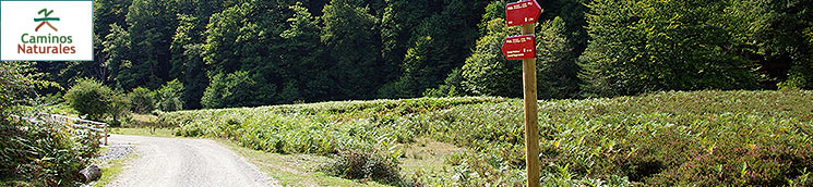
The “Senda del Pastoreo” or the Grazing Path Nature Trail is a circular route across the hills that surround the Plains of Alava, a plain of fluvial origin that is crossed by the River Zadorra on which the city of Vitoria-Gasteiz is situated. It is enclosed between two mountain systems that run in an east-westerly direction, giving the area its biogeographical uniqueness.
In this way, it is isolated from the impact of the coast due to the presence to the north of the mountain ridge (interior Sierras) of the Sierras of Aralar, Aizkorri-Aratz, Urkiola and Gorbea, among others; and to the South, separated from the depression of the Ebro valley and its continental climate by the mountain ridge (exterior Sierras) formed of Montes Obarenes, Montes de Vitoria, Urbasa and Andía.
Select a stage:

 Stage 1: Arantzazu - Arlaban
 Stage 2: Arlaban - Urkiola
 Stage 3: Urkiola - Arraba
 Stage 4: Arraba - Izarra
 Stage 5: Izarra - Villalba de Losa
 Stage 6: Villalba de Losa - Bóveda
 Stage 7: Bóveda - San Millán de San Zadornil
The route is circular, beginning and ending at Arantzazu, and covers a distance of 485 km (including branches). It is divided into 19 sections that run through territories that border the provinces of Araba/Álava, Gipuzkoa, Bizkaia, Navarra and Burgos, joining together some of the main mountain passes and pastures with a long cattle-breeding tradition.
The trail links some of the main mountain pastures which, located in high areas of the mountain ranges, have stayed the same for over 3,000 years, thanks to their pastoral activity. For example, over 50,000 livestock animals currently graze in Urbasa and Andía. Some of these passes form part of a single administrative figure –La Parzonería –, which originates in the Middle Ages and has continued to date. Here, control of the territory is shared among several municipalities, although they do not form part of any of them (Parzonería de Encia, Parzonería de Gipuzkoa and Araba/Álava, etc).
The mountain rangelands are made up of summer pastures, which feed the flocks in the summer and autumn months, a period when the mountain passes are green, while the pastures at lower heights have already been ploughed. A large part of the livestock that grazes in the passes covered by the trail comprises sheep, particularly of the “lachas” type, which is an autochthonous milk-giving breed adapted to mountain pastures mainly used for the production of Idiazabal cheese.
Along the route, you can see many farming-associated elements, such as cabins, shacks, huts and animal pens, where shepherds and their families used to live in the months they stayed in the mountain pass. You can also see drinking troughs, enclosures –traditionally made of limestone slabs— and hoses for disinfecting and collecting the livestock.
The trail mainly runs through mountain pine, at an altitudinal range of between 600 and 1,000 m, sporadically climbing to 1,250 m. Two different biogeographical areas are covered:
Eurosiberian, the stage that crosses the northern Plains of Alava, and Mediterranean, to the south. Nevertheless, given their borderline location, they correspond to states of transition between both, resulting in great biological diversity owing to the joint existence of species proper to both biogeographical areas.
With respect to the fauna species, it is mainly worth highlighting those linked to the forest medium, such as ivory-billed woodpeckers (black, spotted), forest birds of prey (goshawks, snake eagles, tawny owls, etc.), passerines (coal tits, bluetits, finches, etc.), amphibians (webbed newts, agile frogs), mammals (foxes, boars, roe deer, badgers, genets, etc.); and those associated with crags and ledges, such as the griffon vulture, the Egyptian vulture, the peregrine falcon, the chough, etc.
Also worthy of note are the bats, of which some are included in the catalogue of endangered species associated with karstic caves, which are plentiful in the vicinity of the route.
As regards geology, except for small streaks of silica lithology, the route is characterised by limestone outcrops that form sharp rocky crests, as well as extensive karstic mountain ranges, strewn with sinkholes and channels, which predominate on the landscape. The trail is a fascinating example of elements of geomorphological interest, mainly linked to karstic and glacial processes.
Furthermore, the archaeological heritage that can be seen along the trail is also noteworthy, especially in the sections that run along the north of the Plains of Alava, featuring countless megalithic remains (dolmen, menhirs and cromlech) which bear witness to the occupation of these lands since ancient times.
Also worthy of note is the architectonic and cultural heritage, featuring many important churches and sanctuaries, which are present in almost all the towns crossed by the path.
Most of the trail runs through an area of Protected Natural Spaces, which evidences the high ecological and scenic value of the route.
The route runs along unmarked plots, forest tracks, trails and lanes that cover mountain ranges and woods, some of which have steep, stony slopes that make progress difficult, and you may even have to use both hands to overcome some occasional passes where the surface is very uneven or the slope is steep.
Given the territorial environment in which the route is deployed, it is demanding for trekkers owing to its steep, stony slopes in some sections which, on occasions, are extremely long, and the harsh climate proper to high areas, which require some knowledge of the mountain and its surrounding area; a requirement that is easily offset by exceptional panoramic views.
This route cannot be cycled owing to the existence of numerous sections with steep slopes and uneven ground, which hinders movement to a large extent, and as there are some sections, such as that of the gate of Atxuri –on climbing the Gorbea mountain- in the third stage, which you cannot pass even if you get off your bicycle.centradaInteresting links
Interesting links:
- Parque Natural de Urkiola
- Santuario de Arantzazu
- Caserío Gomiztegi y la Escuela de Pastores
- Diputación Foral de Bizkaia
- Asociación Nekazalturimoa. Agroturismo y Casas Rurales de Euskadi
- CEDER Las Merindades
- Turismo de Castilla y León
- Turismo de Álava
- Patronato de Turismo de Burgos
- Diputación Foral de Álava
- Parque Natural de Ubasa-Andía
- Turismo de Navarra
- Turismo de Álava
- Consorcio Turístico Sierra de Estella
- Artzai Eguna (Día del Pastor)
- Santuario de San Miguel de Aralar
- Turismo del País Vasco
- Tursimo Comarca Alto Deba
- Turismo Ataun
Multimedia


