- Home
- Rural Development
- Nature Trails
- Nature Trails
- Northeast Sector
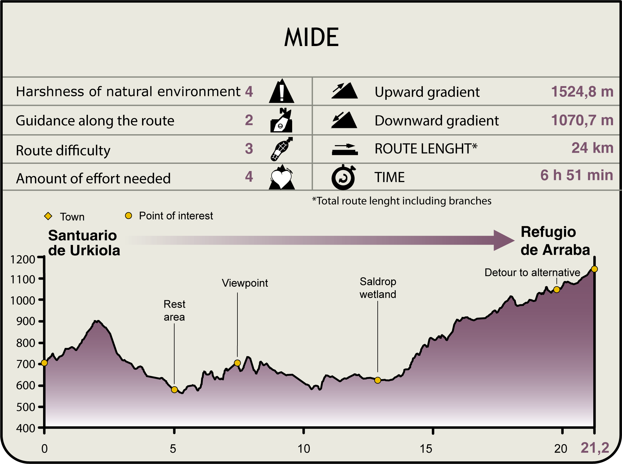
Stage 3: Urkiola - Arraba
Description
From Urkiola to Gorbea, via Barazar
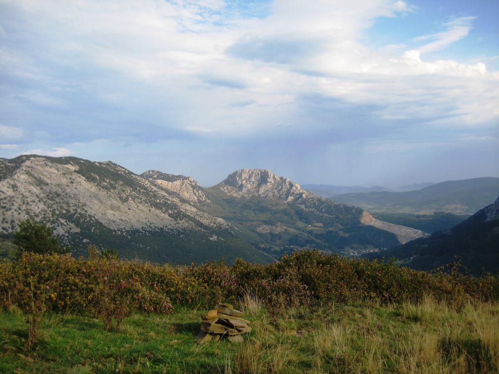
This stage connects the geological landscapes of the Urkiola Natural Park, with its impressive aligned limestone outcrops in the Sierra of Aramotz, to the magnificent Gorbea mountain range. The latter is formed of a combination of karstic elements, such as the Itxina Mountains, with vertical faces and surface limestone pavement formations, and other siliceous elements, such as Mount Gorbea, with its rounded shapes.
The route begins after crossing the road that links Bilbao to Vitoria, and continues straight ahead along a westerly trail. Passing between the buildings that make up the centre of Urkiola, after some 400 m, the trail heads towards the Urkiola -Toki Alai Natural Park information centre, which is well worth a visit. The path continues by taking a right-hand turning located some ten metres before the information centre, along a concrete track that climbs for some two kilometres with a 200 m incline. The route runs along a watershed, among Scots pines (Pinus sylvestris) and copper beech trees (Fagus sylvatica), until it reaches an area of mountain pastures, at the top of Mount Saibi. During your climb, you can gaze at the magnificent views to the north of the Mañaria Valley, the Aitz Txiki peak to the right and the Kanpantorreta peak to the left, and the Sierra of Aramotz and the Mugarra peak in the background.
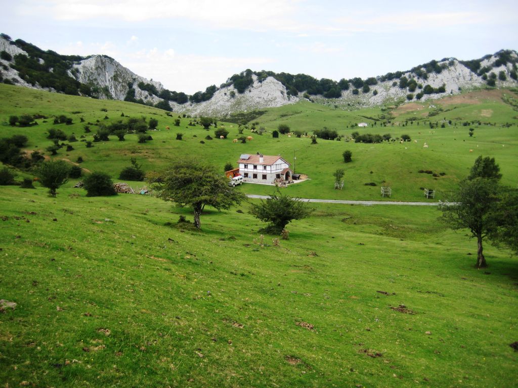
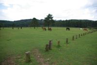
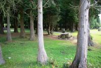
From the top of Mount Saibi, you can see, in the background, the Gorbea mountain range, this sections’ destination. From this point onwards, the trail descends abruptly, with a steep incline, as far as the Dima pass, located at a walking distance of some three kilometres. The route departs towards the left at a sharp bend on the trail, along a path between pastures, crossing a Scots pine grove further down. You then take a forest track on your left that crosses a small beech grove called Dantzaleku, as it is the place where the mythological beings in the area danced their spiritual dances, as legend tells. The route continues along forest tracks among conifer plantations until you reach the Dima pass. In this last stage, you will pass by a farmhouse and its “seles”. In the Dima pass, there is a rest area outfitted with tables and barbecues, where you can regain your strength next to extensive pasture plains.
In order to continue the route, you have to cross the BI-2543 highway, taking a gravel track that begins with a slight hill, and carry on along it for 4.5 km as far as Barazar. This stage runs along almost level tracks in good condition, crossing a continuous forest of conifer plantations that create a pleasant shady ambience when it is hot. Barazar is a road pass, which contains the services proper to these areas (restaurant, bar, etc.).
The route continues in the direction of the Gorbea mountain range, after crossing the N-240 highway in Barazar along a narrow almost level concrete highway that enters the Gorbea Natural Park, to then reach, after a three kilometre easy walk, the Saldropo wetlands and their interpretation centre. From Barazar as far as Saldropo, the Trail borders an extensive area of geological interest known as the “Plain of Barazar” to the north. The presence of some glacial deposits gives rise to an accumulation of water that causes the peat bog of Saldropo or of Barazar.
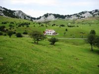
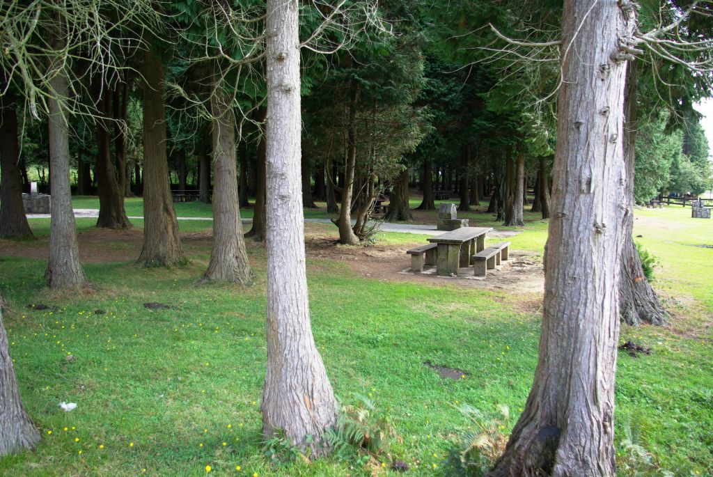
Saldropo is one of the main access points to the Gorbea Natural Park and is outfitted with a car park and rest areas. If you wish, you can visit the wetland interpretation centre, which will help you understand the importance of preserving these ecosystems.
The route continues along a gravel trail, which, after crossing the River Eguna via a wooden walkway, begins its ascent, climbing steeper and steeper, along increasingly narrow tracks that worsen as you rise higher among the conifer plantations on the Atxuri hillside. In the last stage, at the foot of the fortified settlements that outline the Atxuri’s ridge, it turns into a very uneven, steep path that forces you to use your hands in order to make headway. Once you reach the top, after an ascent of two kilometres and a 300 m incline, you can see the Gorbea much closer, separated by the Valley of the River Undebe. The Atxuri hill range shapes a karstic development—Arralde Karst— that is considered to be of geological interest.
The route levels out again northwestwards for 1.8 km, via a path that runs along the crest of the Atxuri, among pastures and limestone outcrops that form limestone pavements, and with magnificent views of the valley. On reaching an area of roads used by shepherds in Altamiñaque, the path turns to the left and begins climbing among periglacial deposits of geological interest.
In this area, there are two species of European yews (Taxus baccata) declared to be unique: the “Aginarte Yew” and the “Aguinaldo Yew”, which deserve a well-earned rest.
From this point onwards, there only remain 3.5 km of moderate ascent, which you should tackle calmly. After crossing between some shacks, the route climbs across the slopes of the Gorbea, which is on your left-hand side, and the foothills of the limestone outcrops of the Aldamin peak.
After a narrow sheer passageway, you come to a small flat pasture area strewn with shepherds’ huts. At this point, you can take a path southwards to reach Aldamin’s shelter, which is located 300 m away, to then return to the same point and continue the route, which has two alternatives here. On the one hand, you can continue along the main route in a north-westerly direction, which ends in Arraba (a kilometre away), or you can carry on via the Arraba turnoff, descending westwards between the karstic mountain ranges of Itxina and Aldamin, which links up again to the main path, after 2.8 km, in stage 4.
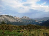
Continuing towards the end of stage 3 in Arraba, you walk along a sheer stretch at the foot of some limestone blocks, from where you can contemplate a magnificent view of the Valley of Arratia and, in the background, the limestone outcrops of Urkiola, the beginning of this stage. You will immediately come to the open space of Arraba, which is surrounded by the rocky outcrops of the Itxina mountain range; both areas are of geological interest as they are linked to karstic processes. In the open space of Arraba, there is a shelter that concludes the stage, which is surrounded by a rest area.
From the beginning of the stage in Urkiola as far as Saldropo, you can easily complete the route by bicycle, taking into account that in some stretches you will need some skill, such as in the descent from Mount Saibi. Nevertheless, the rest of the stage, from Saldropo to Arraba, is not suitable for cycling, since the paths are very uneven and extremely steep, which does not even allow you to carry your bicycle on your shoulder, as in the case of the ascent via Atxuri.
Profile
MIDE (Method for the Information of Excursions)
 Harshness of natural environment
- 1. The environment is not risk-free
- 2. There are more than one risk factors
- 3. There are various risk factors
- 4. There are quite a lot of risk factors
- 5. There are many risk factors
 Guidance along the route
- 1. Well defined trails and crossings
- 2. There is a clearly marked trail and signage
- 3. Requires the identification of geographic features and cardinal points
- 4. Requires off-path navigation
- 5. The trail is interrupted by obstacles that have to be gone around
 Route difficulty
- 1. Walking on a flat surface
- 2. Trails with different types of path
- 3. Walking on stepped paths or irregular terrain
- 4. The use of hands or jumping over the terrain is necessary
- 5. The use of hands is required to progress
 Amount of effort needed
- 1. Up to 1 hour of continuous walking
- 2. Between 1 and 3 hours of continuous walking
- 3. Between 3 and 6 hours of continuous walking
- 4. Between 6 and 10 hours of actual walking
- 5. More than 10 hours of continuous walking
Featured
Further information
Seles
“Seles” are territorial planning mechanisms with regulations and rights passed down from a time when, in the past, they represented a fundamental part of the organisation of Basque territory. Nevertheless, they are not exclusive to this community, as they appear in the whole of the north of the Iberian Peninsula (Galicia, Asturias and Cantabria), and their presence is even documented in Extremadura and Castilla-La Mancha.
As a special feature, their morphology is circular with centrical pillars which have four, eight or sixteen-point stars engraved on them marking the number of existing peripheral pillars.
The “seles” have currently lost the importance they enjoyed in the past. First written references to Guipuzcoan “seles” date back to the 12th century, whereas in Áraba there are references to the year 1025.
Their sizes vary depending on not only whether they are summer or winter “seles”, but also on the province or region they are located in. In this way, a summer “sel” had to have half the radius of a winter one. The radius in the vicinity of the Alto Deba region was some 151 m for winter “seles”. In Araba/Álava, the radius increased to 154 m.
These forms are directly related to livestock breeding and, in general, shelter herds of cattle, and, to a lesser extent, pigs. It is estimated that in the 15th century, each “sel” provided shelter for between one and two dozen cows. In the 15th century, peasants, who were obligated to live there by their masters, rotated the “seles” on a regular basis in order to grow millet, corn, vegetables, etc. and alleviate food shortages at the time.
Gorbeia Natural Park and SCI
These protected natural spaces (the Gorbeia Natural Park and the Gorbeia Site of Community Importance) are the largest in the Autonomous Community of the Basque Country measuring 20.016 ha, which are spread across Bizkaia and Araba/Álava.
Their landscape is the result of a combination of beech and oak trees, rocky limestone outcrops, similar to those of Aldamin, and high meadow and brushwood areas (heaths, thickets, gorse, etc.).
The fauna in these areas includes the European Common Frog (Rana temporaria), the Alpine newt (Mesotriton alpestris), the common wall lizard (Podarcis muralis), the rosalia longicorn (Rosalia alpina), the wildcat (Felis silvestris), the red deer (Cervus elaphus), the great spotted woodpecker (Dendrocopos major), the Egyptian eagle (Neophron percnopterus), the common rock thrush (Monticola saxatilis), etc.
The Park and the SCI’s services include outfitted recreational areas, car parks and information and interpretation centres, such as the one in the town of Areatza (Bizkaia).
Multimedia