- Home
- Rural Development
- Nature Trails
- Nature Trails
- Northeast Sector
Stage 2: Arlaban - Urkiola
Description
In the Urkiola National Park
This stage covers the territories of Gipuzkoa, Araba/Álava and Bizkaia, through the regions of El Alto Deba, Zuia and Duranguesado. Walking along easy forest tracks, among multi-coloured beech and pine trees, the landscapes bordering the vicinity of the Albina reservoir join the sheer rocky outcrops that are characteristic of the Urkiola Natural Park.
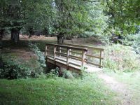
This stage begins in the car park located in the Arlaban pass. In order to set off on the trail, you need to cross the GI-627 highway, follow the road that heads towards Leintz-Gatzaga and immediately turn left along an asphalted lane that leads to a rural accommodation facility. On taking the first intersection to the left, you will come to a gently climbing forest track along which, after crossing beech groves and conifer plantations (radiata pine —Pinus radiata— and Lawson false cyprus—Chamaecyparis lawsoniana —) and following the signposts and passing under power lines, you will come to Mount Maroto, at kilometre point 3.5.
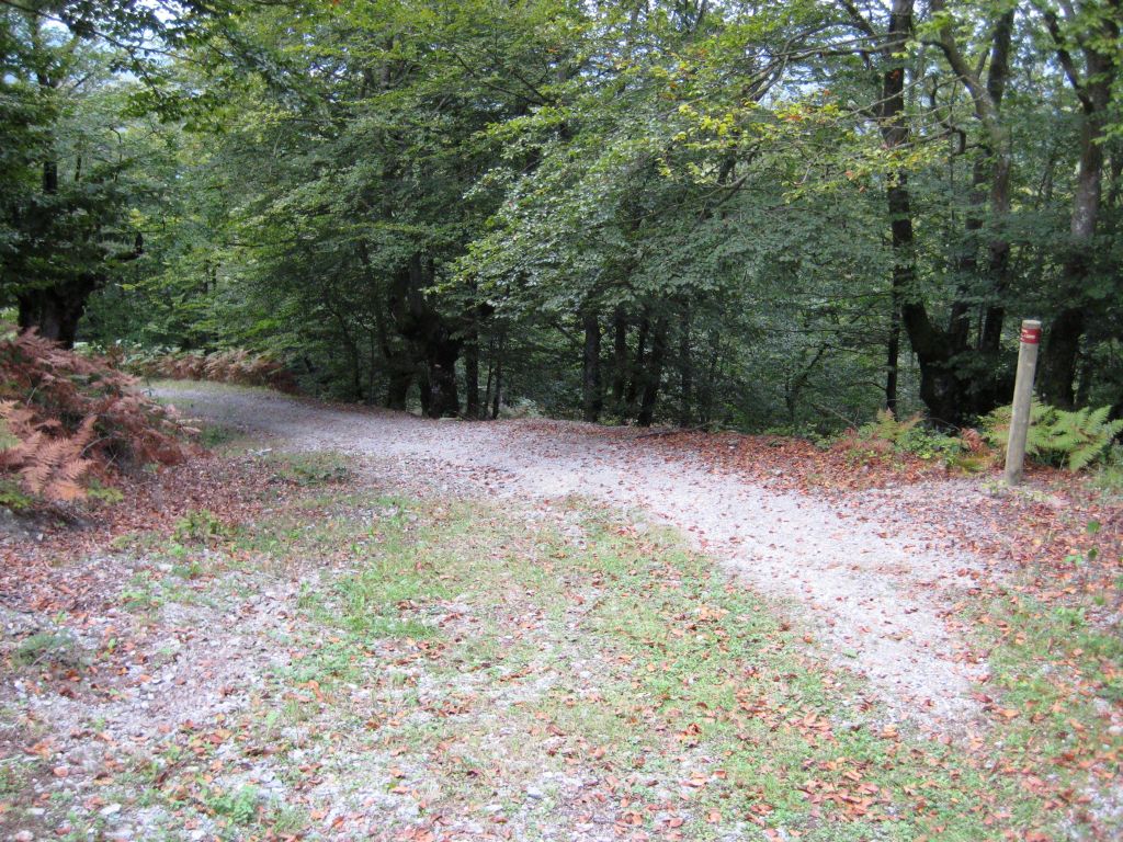
From this point onwards, you continue along a gravel and dirt forest track, first crossing a small beech grove, and then continuing among conifer plantations, covering some two kilometres across the mountain range’s high area. On reaching a fork in the trail, turn left, descending towards a beech grove and leaving Mount Jacinto to your right. Ahead of them, excursionists will see the region of Zuia, which belongs to the province of Araba/Álava.

For 2.5 km, the trail zigzags down a slight slope, crossing pasture areas and wooded meadows containing beech trees and thickets. On the descent, you can contemplate, at the bottom, Mount Gorbea, which the Trail heads towards in a successive stage. On reaching an area of pine trees, you have to take a very pronounced turning along a forest track that crosses the Pagola stream and continues gently downwards for two kilometres, crossing beech and oak forests and bordering the Albina reservoir to the south.
On following this route, immediately after crossing the Albina stream, which originates in the eponymous reservoir, you come to a crossroads.
To your left, some 500 m away, there lies the town of Legutiano on the banks of the Urrunaga reservoir. To your right, the “Senda del Pastoreo” continues; firstly climbing a small hill and then running along forest tracks that cross conifer plantations, mainly Scots pine (Pinus sylvestris), and bordering the Albina reservoir, which is often very nearby.
Following the path’s marks and signs, the trail crosses the A-2620 highway at one point, and continues, now at a distance from the reservoir, along dirt and gravel forest tracks for some 5.5 km until it comes to the town of Ortola. This route crosses an extensive forest area, mainly covered with beech trees and some pine stands, the latter in the vicinity of Ortola.
Here, you take the BI-2511 highway, which crosses the town and leads to the next one known as Olaeta. Both towns, with their surrounding meadowlands, are situated on an element considered to be of geological interest called the “Lomas del Arroyo de Ortola” or the “Hills of Ortola Stream”.
From Olaeta, the Trail runs parallel to the “Escarpes de Arangio” or the Escarpments of Arangio, which can be seen on the right, forming part of the Urkiola Natural Park. On passing through this town, you continue along the same road northwards, for some two kilometres, among meadows and farmhouses scattered on either side. Behind the forest house, you have to take a diversion to the left.

From the forest house turning, the Trail continues its easy 3.5 km ascent to Mounts Ollargain and Marsasu, along forest tracks among beech and pine trees. At this point, you enter the Urkiola Natural Park and the Site of Community Importance, to then descend at the same pace among beech and pine trees and pastures across the sides of the Urkiolaguirre peak as far as the Urkiola Pass, the end of the stage.
When you reach Urkiola, you can already see some of the limestone outcrops that led it to its declaration as a Natural Park, shaping an extremely beautiful landscape. Some of these limestone outcrops are considered to be of geological interest, for example, the “Cresterías del Anboto”, which lie to the right (northwards) of the path, housing peaks such as the Anboto (1.331 m), which lends it its name, and the Aitlluitz (1.034 m), among others. Also worthy of mention is the geological interest of the Valley of Mendiola, located at the foot of these outcrops.
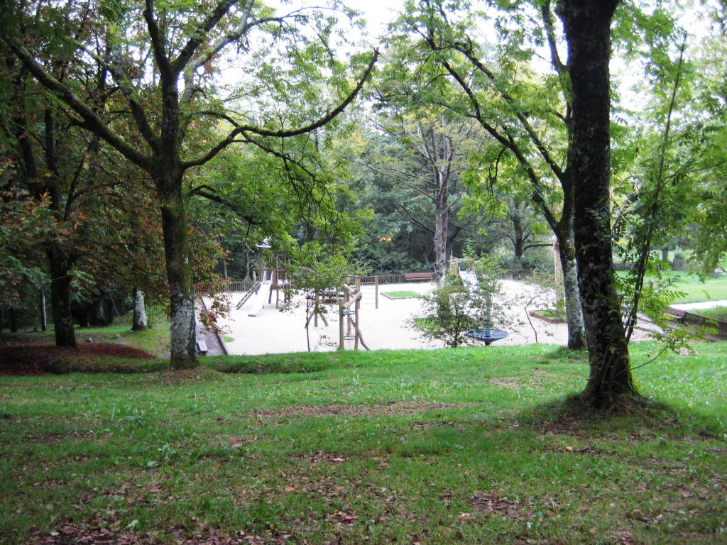
On reaching Urkiola, you cross a park, which is outfitted with a rest area, children’s games, car park, etc., and is immediately followed by the Urkiola Sanctuary. This is an unfinished neo-mediaeval style building, consecrated in 1933, where mothers offered up their children of under a year old to San Antonio after spending a night in the sanctuary.
On following the road, you come to the town of Urkiola, located at the foot of the road to the Urkiola pass, which links Vitoria–Gasteiz to Bizkaia, through Durango. The second stage ends at this point.
EThis stage is suitable for cyclists as it runs entirely along tracks, without any steep slopes, although occasionally, depending on the time of year, you may have to walk in order to cross muddy areas.
Profile
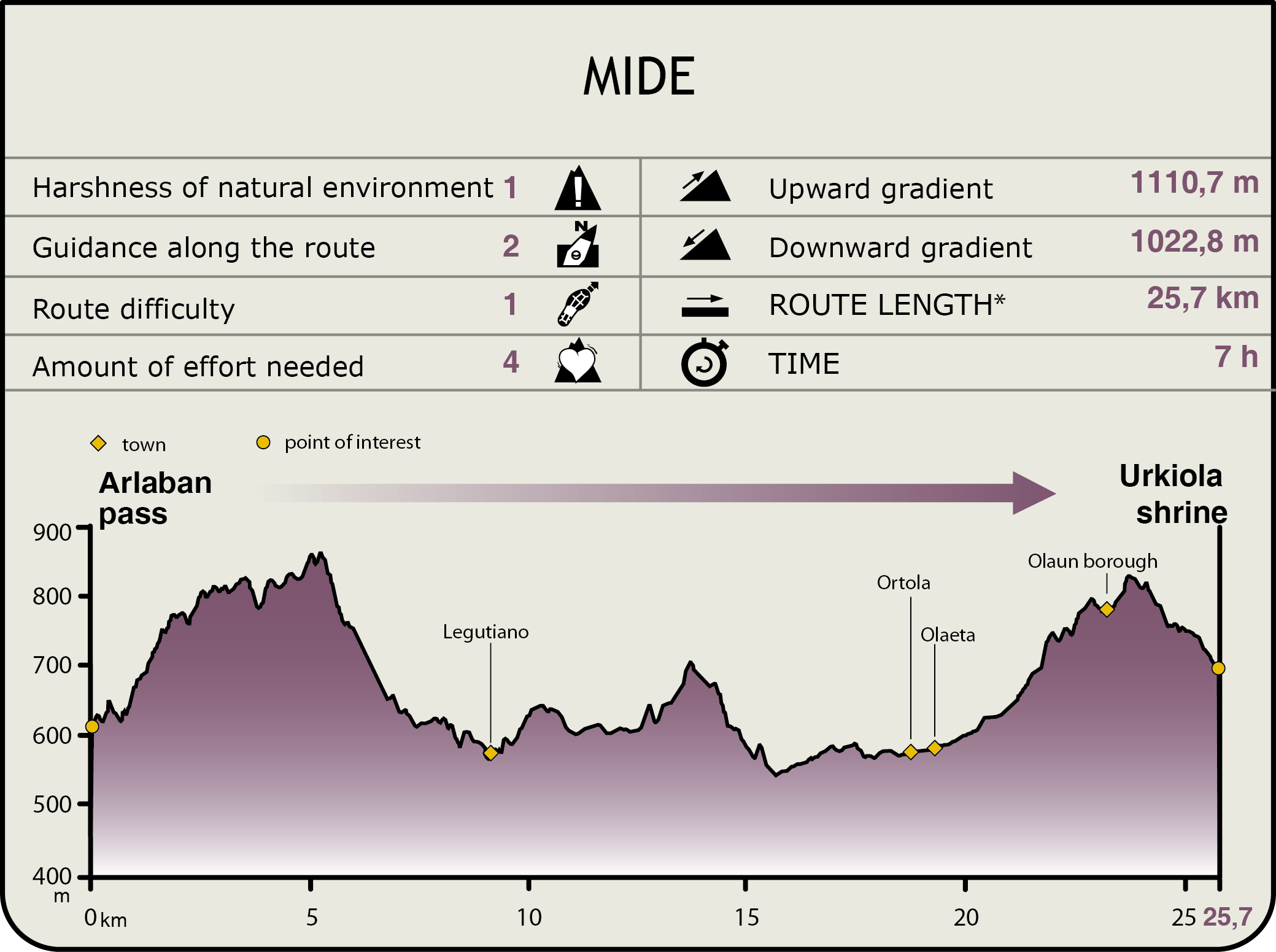
MIDE (Method for the Information of Excursions)
 Harshness of natural environment
- 1. The environment is not risk-free
- 2. There are more than one risk factors
- 3. There are various risk factors
- 4. There are quite a lot of risk factors
- 5. There are many risk factors
 Guidance along the route
- 1. Well defined trails and crossings
- 2. There is a clearly marked trail and signage
- 3. Requires the identification of geographic features and cardinal points
- 4. Requires off-path navigation
- 5. The trail is interrupted by obstacles that have to be gone around
 Route difficulty
- 1. Walking on a flat surface
- 2. Trails with different types of path
- 3. Walking on stepped paths or irregular terrain
- 4. The use of hands or jumping over the terrain is necessary
- 5. The use of hands is required to progress
 Amount of effort needed
- 1. Up to 1 hour of continuous walking
- 2. Between 1 and 3 hours of continuous walking
- 3. Between 3 and 6 hours of continuous walking
- 4. Between 6 and 10 hours of actual walking
- 5. More than 10 hours of continuous walking
Featured
Further information
Urkiola National Park and SCI
The Urkiola Natural Park and the Urkiola Site of Community Importance encompass the highest terrains of the Sierra of Aramotz, creating an enormous limestone barrier between the regions of Arratia, Durangesado and the Valley of Aramaio, and also separating the basins of the Cantabrian and Mediterranean rivers.
These areas are the nesting places for 80% of the birds of prey in the Basque Country, including the Egyptian vulture (Neophron percnopterus), the Eurasian griffon (Gyps fulvus) and the Peregrine falcon (Falco peregrinus). In addition to the bird life, the Natural Park and the Site of Community Importance house populations of autochthonous crabs (Austrapotamobius pallipes), Alpine newts (Mesotriton alpestris), wildcats (Felis silvestris), European polecats (Mustela putorius), Mediterranean horseshoe bats (Rhinolophus euryale), greater horseshoe bats (Rhinolophus ferrumequinum), etc.
Urkiola is home to emblematic caves that are open to visitors, such as the caves of Mari, Bolinkoba, Gentilkoba and Baltzola and the bridge of Los Gentiles, etc. All the information on these caves, as well as other aspects of the Park, can be obtained at Toki Alai, the Parketxe or the Information Centre.
As regards the public use of these protected natural spaces, they are outfitted with picnic areas, two shelters in the sanctuary, which means you can spend the night in the Park, since free camping is forbidden, and countless agrotourism houses in the area surrounding the natural spaces.
Urkiola Sanctuary
The Urkiola or Santos Antonios Sanctuary is located in the municipality of Abadino, inside the Urkiola Natural Park. The sanctuary is located in the geographical centre of the Basque Country and is the point that separates Gipuzkoa, Bizkaia and Araba/Álava.
The creation of the sanctuary is linked to the propagation of Christianity in the Basque Country between the 9th and 11th centuries, which used the Roman roads as its vehicle of conveyance, one of which crossed Urkiola. This was a place of pagan worship, considered to be the house of the genie Mari, a protagonist of Basque mythology, a fact that benefitted the installation of the sanctuary, as many churches and chapels were built on places with a mythological tradition.
Another factor that led to the building of the sanctuary in this enclave is the fact that it was one of the main shepherding centres and a passing place for pilgrims. In this way, a whole series of chapels and facilities used by the pilgrims were built in the vicinity, such as a hospital that was burnt down. It is known as the Sanctuary of the Santos Antonios because San Antonio Abad, the patron saint of animals and fields, was the first venerated saint, but, according to tradition, San Antonio de Padua spent the night and celebrated the Eucharist at the sanctuary; hence, they both became its patron saints.
The current sanctuary dates back to the late 19th century and its style is neo-romantic. The previous church was knocked down in 1870, although its tower is still standing.
Inside the sanctuary, worthy of note is the 16th-century carving of San Antón, the Baroque-style Christ being crucified and a modern carving of San Antonio. Outside, we can see the chapels of Santo Cristo, dedicated to the Vera Cruz, and of Santa Apolina, also known as Santutxu. A recently restored road runs between both.
Multimedia