- Home
- Rural Development
- Nature Trails
- Nature Trails
- Northeast Sector
Stage 15: Artaza - Lizarraga
Description
Among the Beech Groves of Urbasa
This stage runs through the Navarra Media Occidental region. It borders the eastern flank of the Urbasa plateau and progressively crosses considerable beech grove stands and pasture flatlands strewn with rocky outcrops and juniper brushwood, which form unique ground-covering circles. The stage ends in the pass of Lizarraga, a transit point between the Valley of Estella and the corridor of the River Araquil, where the Sierra of Urbasa gives way to the Sierra of Andía.
The entire stage runs across areas declared the Urbasa and Andía Natural Park, SCI and SAC, which are of enormous interest and importance in terms of their landscape and their biodiversity.
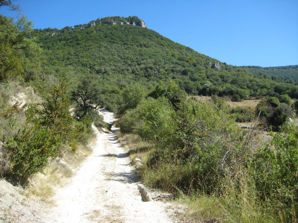
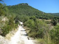
This stage begins in Artaza along a track that leaves northwards. After crossing the NA-7186 highway, it enters a tree stand that covers the slope of the plateau of Urbasa. The route gradually progresses along a steep climb with a difference in altitude of some 450 m, until it reaches the high plateau of Urbasa, in the pass of Urra, after hiking some 3.5 km. This route runs through Isasi and Zizazkun, following a forest track that climbs the foot of the peak of Arripuia. During the ascent, the vegetation changes gradually; at the foot of the mountain there is a predominance of sclerophyllous oak species, which are more resistant to drought and temperature changes, such as the gall-oak (Quercus faginea) and the Holm oak (Quercus ilex), accompanied by brushwood such as box (Buxus sempervirens), juniper (Juniperus sp.), etc.; in the high area of the hillside, close to the summit, single-species beech tree woods (Fagus sylvatica), accompanied by undergrowth species such as dogwood (Cornus sanguinea), maple (Acer sp.), and hawthorn (Crataegus monogyna), prevail.
In the area surrounding the path, you can contemplate old lime furnaces or “limekilns”, where the inhabitants of these territories used to “bake” limestones, by burning firewood from box, furze and other bushes, obtaining, in this way, the lime they used to build their houses. At some points during the ascent, you can contemplate good views of the Palace of Urra, which lies at the foot of the hillside.
On reaching the top of the plateau of Urbasa, in the pass of Urra, you reach a small clearing in the beech grove, where you join a gravel track. However, you leave it straight away by taking a turn-off on the right, eastwards, which enters an extensive beech tree stand once again. From this point, you continue along a slightly uneven path for 45 km, following the eastern edge of the high plateau and crossing a continuous forest, until you reach a small treeless hillock next to a stonewall. From here onwards, taking a detour of barely one hundred metres from the route in an easterly direction, you come to a geodesic milestone on the peak of Dulantz (1.243 m), which offers magnificent views of the nearby valleys.
The route continues northwards, following the eastern flank of the platform of Urbasa, along a path parallel to a stonewall that covers an area of treeless mountains. The landscape is formed of pastures, limestone pavements and thorny brushwood, mainly common juniper (Juniperus communis) and holly (Ilex aquifolium), with some long-suffering beech trunks. On this route, you leave on the right, at the edge of the high plateau, a small peak known as the “Alto de la Nevera”.
The wall that the trail borders in this part is the boundary of a “Facería”, to be specific number 104. A “Facería” is a property figure characteristic of Navarre, similar to the “Parzonería”, which consists of the shared enjoyment of this territory by several municipalities, normally for pasture and wood use. Its name stems from the fact that they were “letters of peace”, “partnerships” or “facerías”. There were even “facerías” whose use was international, where French farmers could take their cattle.
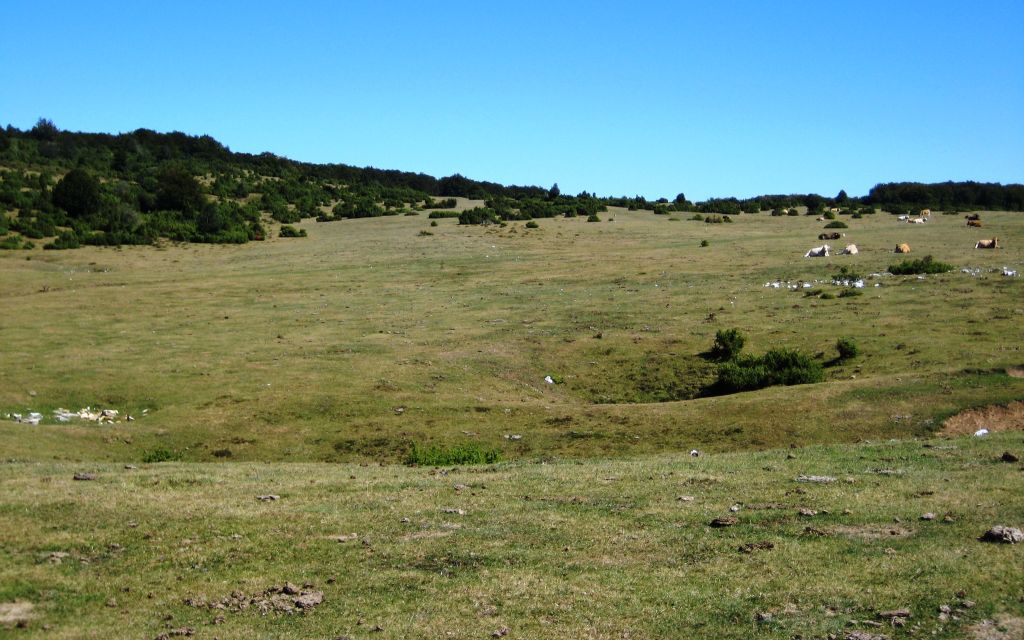
The trail then enters the high plateau, crossing a beech grove patch and reaching a stony flatland with many sinkholes. The flatland gives way to the majadas or grazing areas of Arroniz, a light riverbed with deep soils and rich pastures, surrounded by woodland, where cattle usually gathers. Here, you can see a stone enclosure that delimits a chasm to prevent the cattle from falling into it. Following the route along the majada, in an easterly direction, you once again reach the edge of the high plateau, having hiked, up until this point, 4 km from the peak of Dulantz. The route begins to descend down the slope of the Fuente de la Cañada, as you enter the beech grove via an uneven three kilometre-long path with a steep gradient and an incline of 400 m, which ends on the plains of Zabilde.
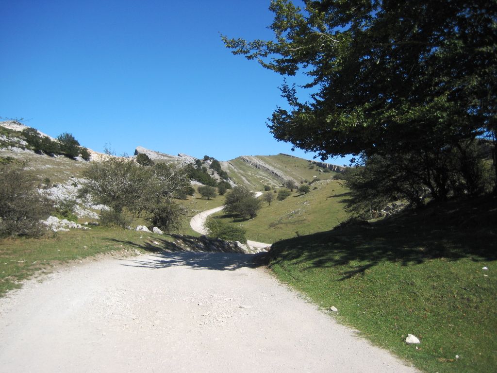
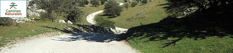
Following along the flatlands in a northerly direction, the trail once again climbs the slopes of Urbasa, for two kilometres, with an incline of 250 m, until it reaches a forest track in Arrangarte, close to the top, and immediately after passing by a stone enclosure that conceals a chasm and a small part of a Roman road that is still preserved. Following the track rightwards, you intersect another that covers the rocky cliffs that delimit the Sierra of Urbasa to the north.

Leaving the route to one side for a moment, you can following the track leftwards until you come to the chapel of San Adrián some 500 m away, which is perched at the top of a rocky cliff.
On resuming your route, you should continue along the track in the opposite direction to the chapel, eastwards, following the lines marked by the outcrops of limestone strata, which have strips of pasture and beech groves lying between them. These strips seem to guide the trail along a final pleasant three-kilometre walk through Ollide, as far as the pass of Lizarraga, this section’s final destination. Lizarraga is located at an altitude of some 1.030 m. This is the intersection of the NA-120 highway, which links the Valley of Estella to the corridor of the River Araquil (Vitoria-Pamplona) and separates the Sierra of Urbasa from the Sierra of Andía, which is the area in the next stage. There are several buildings in the pass of Lizarraga, including mountain accommodation.
The areas with steep slopes, especially the climb from the beginning of the stage as far as the pass of Urra, and the descent from the majada of Arroniz towards Zabilde, as well as its subsequent climb, once again, up to the high plateau and the dirt or rocky surface in some parts of the path make this stage very tough if you want to cycle.
Profile
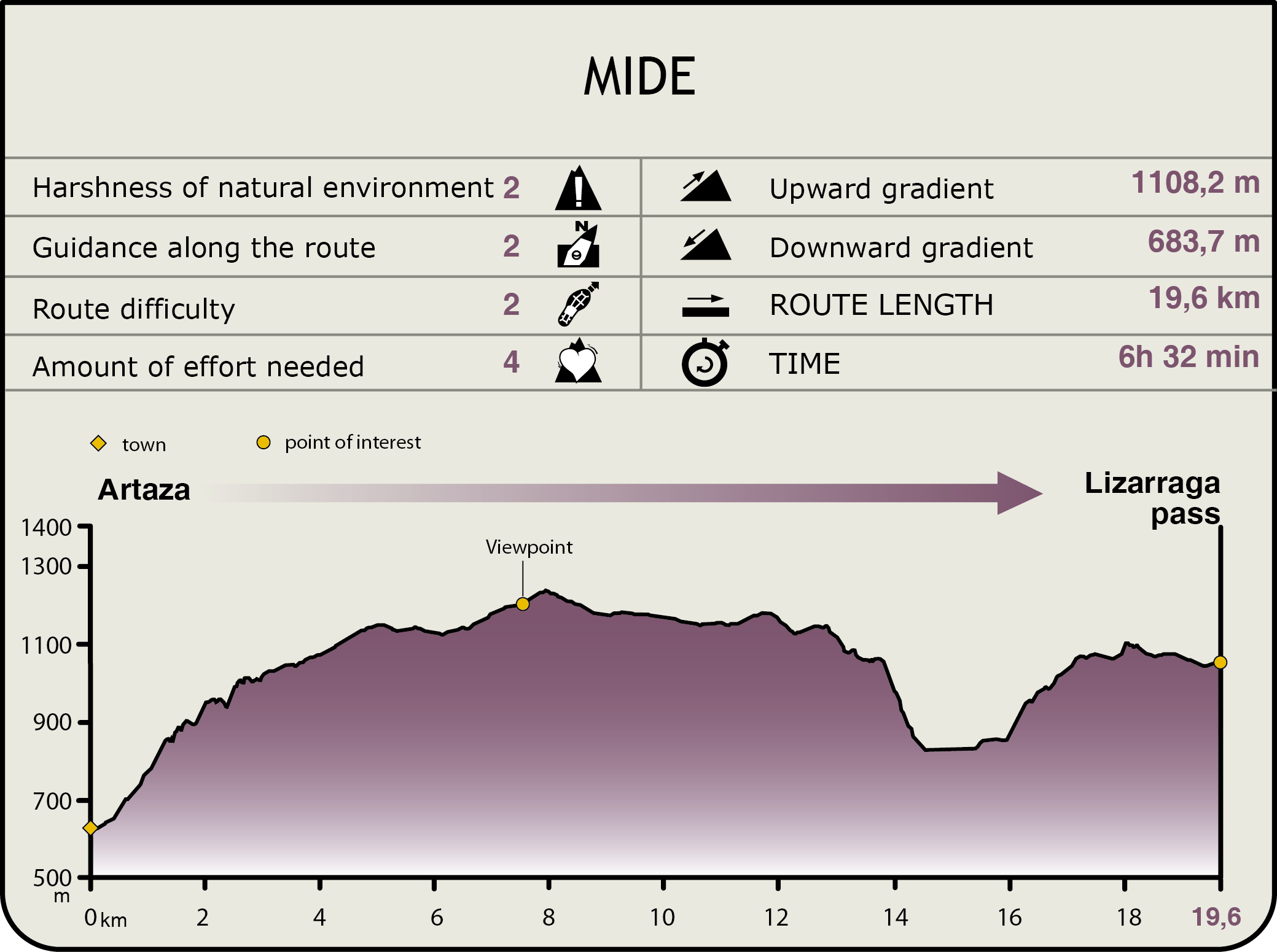
MIDE (Method for the Information of Excursions)
 Harshness of natural environment
- 1. The environment is not risk-free
- 2. There are more than one risk factors
- 3. There are various risk factors
- 4. There are quite a lot of risk factors
- 5. There are many risk factors
 Guidance along the route
- 1. Well defined trails and crossings
- 2. There is a clearly marked trail and signage
- 3. Requires the identification of geographic features and cardinal points
- 4. Requires off-path navigation
- 5. The trail is interrupted by obstacles that have to be gone around
 Route difficulty
- 1. Walking on a flat surface
- 2. Trails with different types of path
- 3. Walking on stepped paths or irregular terrain
- 4. The use of hands or jumping over the terrain is necessary
- 5. The use of hands is required to progress
 Amount of effort needed
- 1. Up to 1 hour of continuous walking
- 2. Between 1 and 3 hours of continuous walking
- 3. Between 3 and 6 hours of continuous walking
- 4. Between 6 and 10 hours of actual walking
- 5. More than 10 hours of continuous walking
Featured
Further information
"Artzai Eguna"
The corridor of the River Araquil, also known as Barranca-Burunda, houses areas where cattle played a primordial role in their inhabitants’ lives. In the past, cattle farming was extensive and was supported by the villages’ private municipal mountains, the “facerías” (mountains belonging jointly to different administrative entities) and the Spanish Government Mountain Department. Cattle farming continues to this very day although it has changed and is less important. In spite of the fact that the size of the herds has decreased in recent years, they are still basically formed of autochthonous sheep, “latxas”, which produce the famous Idiazabal cheese.
In the past, the herds of cattle were very large and varied and depended, for their food, almost exclusively, on the mountains’ grazing resources; hence, they had to be organised very precisely and the herds were progressively moved around different pastures according to the season of the year and the species in question —transhumant or short-distance transhumant—.
A large part of the shelters for shepherds and flocks —huts and shacks, respectively— are still in use.
The Sierras of Urbasa and Andía were the centre of pastoral life as the flocks spent most of the year in these mountains. The shepherds took their sheep to the mountains and there they formed collective flocks that were cared for by one single shepherd. The farmers in the corridor of the River Araquil used to share the pastures of Urbasa–Andía with those of the “Parzonerías” of Gipuzkoa and Araba/Álava, while those of Las Améscoas alternated with those of the Sierra of Lóquiz.
Multimedia