- Home
- Rural Development
- Nature Trails
- Nature Trails
- Northeast Sector
Stage 10: Nanclares de la Oca - Okina
Description
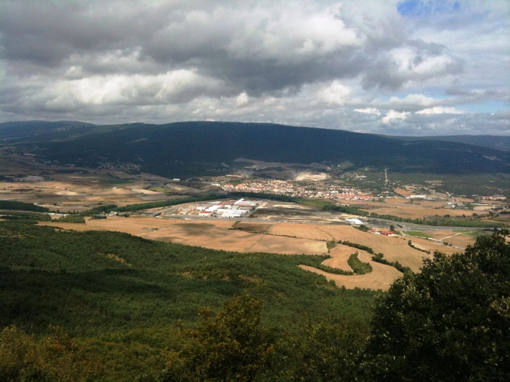
The Montes de Vitoria
This stage covers a large part of the “Montes de Vitoria” mountain ridge, which constitutes the geographical and administrative boundary between the Álava Plain and the Valley of Treviño, both formed of extensive meadows that offer magnificent views from the top of the Montes de Vitoria. Coupled with its diverse array of forest environments, ranging from deciduous beech woods to long-suffering evergreen Holm oak patches, including sclerophyllous and marcescent gall-oak forests and mixed formations of both, this stage offers travellers an excellent example of the natural wealth that has made this territory worthy of its proposition as a Natural Park.
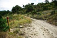
The stage begins in Nanclares de la Oca following the A-2622 highway, which crosses the town in an easterly direction until it reaches a bridge over the River Zadorra, declared a Site of Community Importance (see additional information), and whose meadowland includes the region of the Álava Plain, on which the city of Vitoria-Gasteiz stands. After crossing the River Zadorra, you take a turn-off to the right along a track that runs next to some poplar groves that flank the course of the river, passing through a tunnel under the train lines and following a track that enters an industrial estate. You have to walk along one of its roads for some metres, in an easterly direction, until you come to a signpost that marks a turn-off to a subway under the A-I highway. After crossing the highway, you continue southwards along a gravel farm track that crosses arable land until it reaches the town of Subijana de Álava, located at the foot of the mountains of Vitoria.
After crossing Subijana, you follow a forest track that heads southwards and immediately take a fork on the right. This is the starting-point of a five-kilometre climb, with a 400 m incline, up the northern face of the mountains of Vitoria, until you reach the first telecommunications antenna that has been installed on Peña Mayor. The ascent begins along a forest track with a rather steep slope, which, as you gain height, becomes narrower and steeper. During the ascent, you cross different plant formations. You initially pass through Mediterranean hillside replacement brushwood that is proper to limestone substratum, such as junipers (Juniperus sp.), broom (Genista sp.), heather (Erica sp.), huckleberry (Arctostaphylos uva-ursi), etc.
The path then enters some common pine stands (Pinus sylvestris) and finally passes through a thick mass of gall and Holm oaks, where the former lose their predominance over the latter as you climb up to the summit and enter the sunny side. The effect of the orientation of the mountain range, with a predominance of gall oaks (Quercus faginea), is very obvious on the shady slopes –the Álava side- where there are even some beech stands in stream beds and at the foot of the crests; whereas on the southern slope –the Burgos side- undemanding Holm oaks (Quercus ilex) predominate.
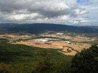
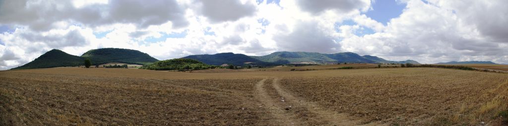
Once at the top, the path continues along the ridge of the Montes de Vitoria as far as the end of the stage in Okina, although you encounter some differences in altitude on your way across this range of hills. From Peña Mayor, a path continues which, after crossing the pastures of the pass of Barrate along the watershed, reaches Peña Busto, where there is another telecommunications installation. From here, continuing through the pass of El Silo, you come to the third and last antenna, on Peña Zaldiarán (964 m). Any of these spots are an exceptional natural vantage point, offering privileged views both of the Llanada Alavesa, where you can see the River Zadorra’s extensive meadow along with the Sierras of Gorbea, Amboto, Aitzkorri and Aratz in the background, and of the Valley of Treviño, to the south of the mountains.
From Peña Zaldiarán, the route descends along an asphalted road, which you leave immediately to take a path that encircles a firewall and crosses a pine grove until it intersects the A-3102 highway at the Zaldiarán pass.
After crossing the road, you take a path that climbs through a beech grove for some 2.5 km, with a difference in level of 250 m, until it reaches the Cuervo peak (1.000 m), from whose treeless summit you have magnificent views of the surrounding area, especially of the Valley of Treviño.
From this point, the route descends 300 m along forest paths for some 3.5 km, leaving on one side small peaks, such as Peña Hueca and Ariaza, until you come to an old asphalted road which, continuing leftwards, leads to the pass of Vitoria-Gasteiz, where it intersects the A-2124 highway, a communication route between Vitoria-Gasteiz and Logroño.

You continue along a track that rises gradually for some nine kilometres, with an accumulated incline of 400 m, as far as the peak of Palogán (1.029 m) and the peak of San Cristóbal (1.045 m), the highest point in the stage.
This part mainly runs through gall-oak forests that transform into beech groves as you gain altitude, as well as some thin patches of pastures at the summit, which constitute important grazing areas, such as “El Bustar”, “La Llana”, “Bustiturri”, etc.
As at other points of the “Senda del Pastoreo”, in this area you can see metallic structures located in the thickness of the forest, which serve as elevated posts for hunting wood pigeons that pass by on their migratory journeys to their winter quarters in the south of the Iberian Peninsula.
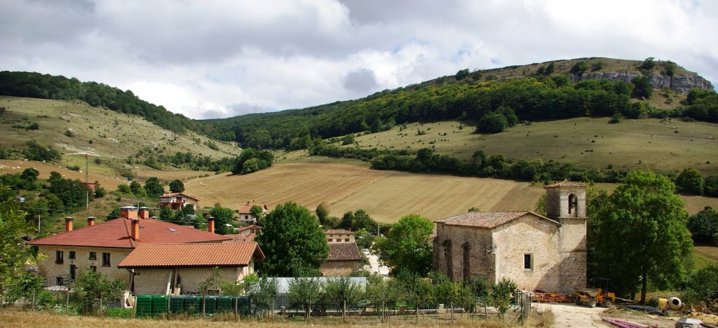
After continuing for a few more metres along the watershed, you soon leave the summit and begin to descend northwards via a steep path that emerges on the left, crossing a beech grove and linking up to a track that leads to Okina, the end of the stage. Okina is a small town in Ávila, located on the banks of the River Ayuda, at the entrance to a terraced gorge, which it has forged on account of its alternating materials with different consistencies (conglomerates and marls).
This stage is difficult to cycle as it has extremely steep and stony parts, in particular, the second half of the ascent as far as the first antenna on Peña Mayor; the descent via the firewall from the peak of Busto (an alternative descent is along a parallel road), as well as some parts through beech groves, such as the descent from the peak of San Cristóbal to Okina.
Profile
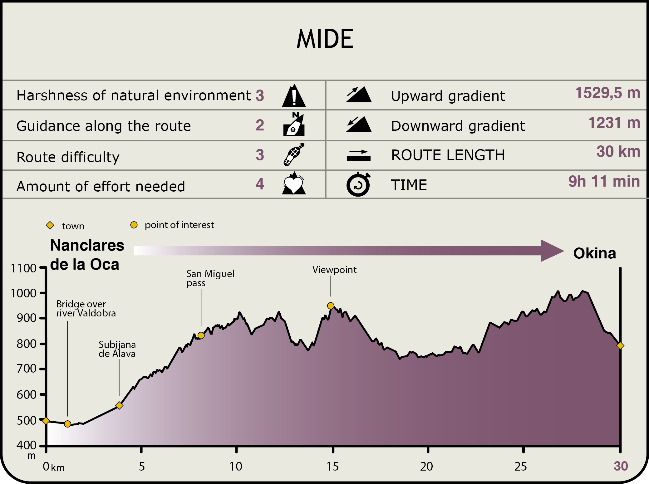
MIDE (Method for the Information of Excursions)
 Harshness of natural environment
- 1. The environment is not risk-free
- 2. There are more than one risk factors
- 3. There are various risk factors
- 4. There are quite a lot of risk factors
- 5. There are many risk factors
 Guidance along the route
- 1. Well defined trails and crossings
- 2. There is a clearly marked trail and signage
- 3. Requires the identification of geographic features and cardinal points
- 4. Requires off-path navigation
- 5. The trail is interrupted by obstacles that have to be gone around
 Route difficulty
- 1. Walking on a flat surface
- 2. Trails with different types of path
- 3. Walking on stepped paths or irregular terrain
- 4. The use of hands or jumping over the terrain is necessary
- 5. The use of hands is required to progress
 Amount of effort needed
- 1. Up to 1 hour of continuous walking
- 2. Between 1 and 3 hours of continuous walking
- 3. Between 3 and 6 hours of continuous walking
- 4. Between 6 and 10 hours of actual walking
- 5. More than 10 hours of continuous walking
Featured
Further information
River Zadorra SCI
This Site of Community Importance —River Zadorra SCI— has a surface area of 327 ha and includes the gallery forest of the river itself, containing transition alder, poplar, ash and willow groves, which have been replaced in several areas by black poplar plantations (Populus nigra). The River Zadorra is the Ebro’s main tributary as it passes through the Basque Country and, among the species that live on the riverbed and on its banks, you can find the European mink (Mustela lutreola), the otter (Lutra lutra) and the roach (Rutilus arcasii).
Montes Altos de Vitoria SCI
This mountain chain, extending 1.852,22 ha, is located in the eastern region of the Montes de Vitoria, to the south of the city of Vitoria-Gasteiz (Araba/Álava). It forms the southern border of the region of the Llanada Alavesa or the Álava Plain. It has rounded summits and average altitudes (610-1,028 m) and small valleys and head ravines, with moderate and steep slopes, which run into three valleys (La Dehesa, Santo Tomás and Uragona) and are filled with water from the Zadorra river basin. The landscape is dominated by forest stands of autochthonous trees with some pasture and brushwood areas.
The Montes de Vitoria, the next Natural Park
This stage runs lengthwise along almost all the Montes de Vitoria, which flank the capital of Álava on the south and serve to curb the damp winds from the north. They also act as a natural border between an Atlantic and a Mediterranean landscape. These mountains evidence a clear distinction between windward and leeward vegetation. While on the northern side there are beeches and gall-oaks, to the south Holm oaks predominate. The chain’s maximum altitude is the 1.177 m of Mount Kapildui, and rivers such as the Batán and Zarpadiel drain its hillsides.
The northern side of the Montes de Vitoria, which corresponds to its Álava part, has been proposed for its declaration as a Natural Park, which is currently in progress. And the fact is that this privileged environment has received and has had to face many threats, including the countless wind farms planned in its vicinity as well as a high voltage network that was scheduled to cross the mountains that are home to species such as goshawks, eagles, woodpeckers, owls, hoofed animals and European minks, to name but a few.
Multimedia