- Home
- Rural Development
- Nature Trails
- Nature Trails
- Northeast Sector
Stage 14: Urbasa - Artaza
Description
Through the Natural Park of Urbasa-Andía
A large part of this stage runs through the Natural Park of Urbasa-Andía. It covers the extensive forests and flatlands of the high plateau along a path that is practically even, save in the final kilometres, when the trail descends abruptly along the canal of the River Urederra.
The high plateau of Urbasa is a substantial limestone mountain range that rests on cretaceous marls, where there is evidence of the karstic processes that have produced sinkholes, poljes, limestone pavements, etc. and important underground units that are irrigated by most of the surface water that subsequently filters through via emergences, such as that of the River Urederra. This explains the scarcity of surface watercourses, as they filter and flow underground.
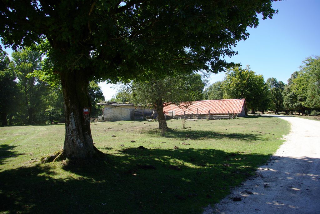
The stage begins at the Bioitza campsite, following the NA-718 highway southwards for some one hundred metres. You should take a turn-off on the right along a rutted path that heads westwards, bordering a campsite, and emerges at a forest garden centre that supplies the afforestation of the Natural Park. After passing the garden centre, you should turn left along a dirt path that climbs a small hillock, entering the beech grove of Siasmuno.
The route runs through quite mature beech stands that not only feature frequent clearings but also areas with a pastured structure containing sparse large trees and pasture-covered ground, the result of mixed cattle and forest use. All of the above gives rise to an unevenly dense mass that favours the ecosystem’s biodiversity. This becomes apparent in Kataliturri, where the path reaches a gravel track in the vicinity of a farming shack. You should follow the track rightwards and immediately take the first turn-off, once again on the right, along a similar track that passes next to the shacks of Lazarugi.
The open structure of the trees, a consequence of a greater intensity of grazing owing to the proximity of the shacks, is obvious in this area. Worthy of note is the presence of sizable specimens of field maples (Acer campestre), which, in some parts, even form small mixed stands with beech trees (Fagus sylvatica), especially in the clearer areas. Other leafy species also make an appearance such as ashes (Fraxinus sp.), lindens (Tilia sp.), holly trees (Ilex aquifolium), etc., which accompany beeches and maples.

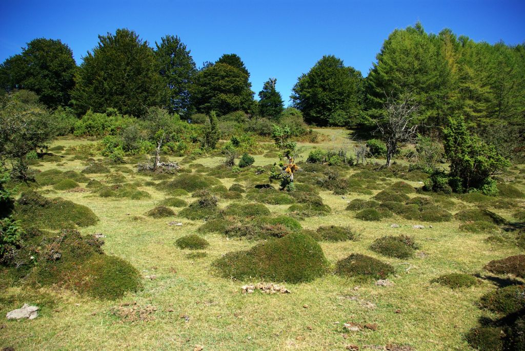
Barely one hundred metres after the shacks of Lazarugi, you take a turn-off leftwards, crossing a small clearing in the forest and then entering a dense beech stand. After covering a short distance through the beech grove, the trail crosses a gravel track that emerges onto the flatland of Lezamen. The flatland consists of a wide expanse of pastures where cattle keep at bay the heather brushwood (Erica sp.) and thorn bushes that manage to proliferate on the wooded edges. Small depressions in the land —sinkholes—, which are the result of the dissolution processes of the limestone layer, also draw your attention. The flatlands are extensive areas with a slightly concave topography that act as rainwater drains. The rainwater filters through, feeding underground aquifers and subsequently springing forth in river sources such as the River Urederra. They are, therefore, areas with soils that are deep, humid and rich in nutrients, which are of enormous value for cattle.
Midway through the flatland of Lezamen, you take a turn-off on the left, along a rutted path that climbs a small brushwood-covered hillside. You once again enter a beech grove along a path that runs next to a cattle enclosure and reach an area, which, although it is treeless, has countless juniper (Juniperus sp.) and thorn bushes. Your attention will be drawn to the cushioned shapes of the heathers owing to the effect of the cattle’s teeth. Following along the signposted route, you pass by a stand of Japanese larch (Larix kaempferi), one of the few conifer species with deciduous leaves that can be seen on the Iberian Peninsula, which is a good place for cattle to shelter.
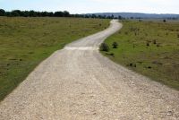
At this point, there are 14 km left until the end of the stage, of which over half border the flatland of Urbasa as far as the Puerto Viejo de Baquedano, from where you descend the canyon of the River Urederra.
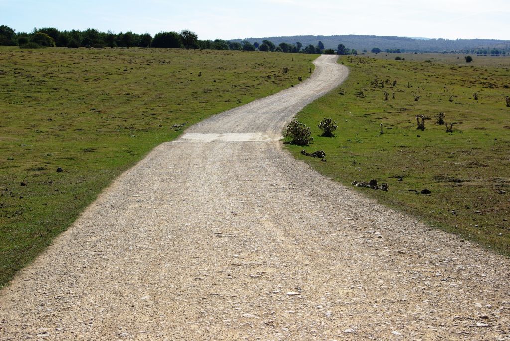
By following this route you will come to an area of shepherds’ shacks. You then take a track that immediately intersects the NA-718 highway and, after crossing it, you follow the path which, for the first two kilometres runs along the head of the flatland of Urbasa, an enormous space with sparse pasture vegetation, brushwood and thorn bushes, where numerous heads of cattle graze. You then enter a beech grove, in the area of Harginaren Soro, while you continue to border the flatland. After a two-kilometre trek under the beech grove, you once again emerge on to an extensive pasture area, in the vicinity of the flatland of Urbasa. You continue through Arratondo in a southerly direction, along a path that avoids some large sinkholes, where, safe from cattle teeth, specimens of maple, elder (Sambucus nigra) and hawthorn (Crataegus monogyna) prosper. These islands of vegetation are of special interest with respect to their fauna.
From this point, you can contemplate the enormous expanse of rich flatland pastures of Urbasa, where you can see numerous flocks of sheep, cows and horses that spend a good part of the year feeding on these mountain rangelands. Some geometrical tree stands, mainly pines (Pinus sp.), which serve as refuge for the cattle in the face of the harshness of the mountain, emerge from the grass cover.
Along this path, you will join a gravel track that provides access to the shacks of Arratondo. You should continue in the opposite direction, rightwards, extending your detour around the flatland of Urbasa. You soon come to a cattle grid, which breaks the continuity of a stonework enclosure, along which the trail enters the Mount of Las Limitaciones. The Mount of Las Limitaciones de Las Améscoas is the name given to a strip of land spanning 5.190 ha, which is delimited by a wall of stones and wired stakes, located over the valleys of Las Améscoas —High and Low—, to the south of the Sierra of Urbasa. It is currently the communal property of both towns and has been since 2 July 1412, when it was granted in a concession by King Charles III, The Noble.
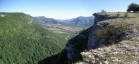
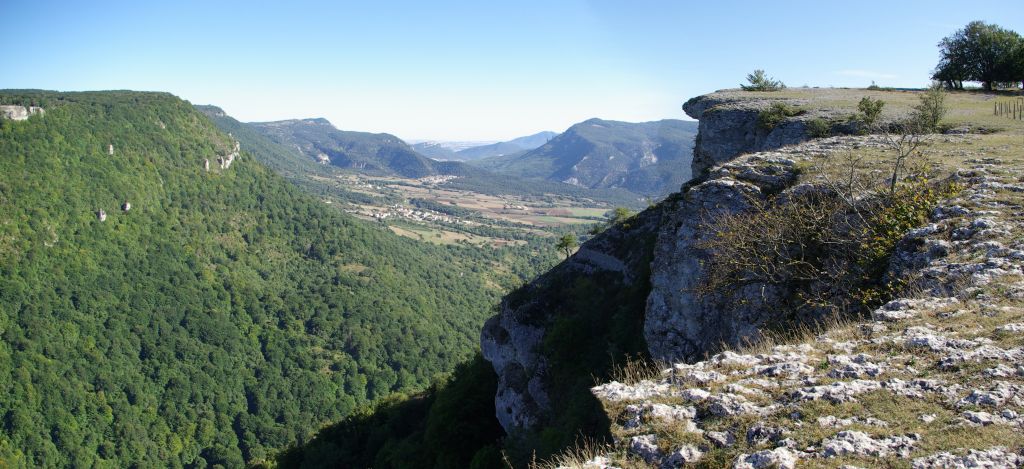
A few metres on, this track merges into another that covers the Mount of Las Limitaciones. You have to take this second path leftwards, passing by Emiliano’s hut, to soon reach the Puerto Viejo de Baquedano. From there, you can see the rocky amphitheatre where the high plateau of Urbasa plummets towards the Valley of La Améscoa Baja. This valley stretches along the bottom of a river canyon sculpted by the River Urederra (from the Basque words “ur” for water and “ederra” for beautiful), through which the waters filtered in the flatlands of Urbasa surface. They do so via a first waterfall with a height of over one hundred metres, which emerges between the rocky cliffs, followed by successive falls and crystal-clear water pools that create unique scenes. It is these elements that have led to its declaration as the Source of the River Urederra Nature Reserve and Site of Community Importance.
From the Puerto Viejo de Baquedano, the route descends down the side of the canyon of the River Urederra via the path of the Puerto Viejo, along a route covering a little over two kilometres with an incline of 300 m, as far as the town of Baquedano, the main point of access to the source of the River Urederra. Even though you cannot see the emergence of the River Urederra from the path, the landscape the route covers is no less impressive. It begins along a stage that is easy to hike, although it is very steep and stony, zigzagging across a sheer area. The route continues along a narrow path that crosses a beech grove stand which, as you go down, gradually changes into a mixed Holm oak (Quercus ilex) and gall-oak (Quercus faginea) wood, with sizable, extremely beautiful specimens. Accompanying bush species such as dogwood (Cornus sanguinea), guelder rose (Viburnum opulus), elder, etc. trim the path.
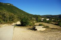
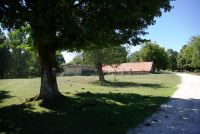
The descent ends at a small rest area, which is crossed by the path that leads to the source of the River Urederra. Continuing along this same track in a southerly direction, you come to the town of Baquedano, where you can visit the church of San Juan Bautista. On crossing the upper part of Baquedano, you come to another rest area from where an asphalted road begins, which leads to the foot of the mountain and borders crop fields to Gollano, a kilometre from Baquedano. In this town, you can visit the parish church of San Bartolomé.
You continue your hike for another kilometre until you come to Artaza, the end of the stage. In this town, important battles were fought in the first Carlist War, known as “Acción de Artaza”. In this town, you can see the church of La Natividad and in the vicinity there is a campsite where you can find accommodation. This stage is suitable for cycling, except for the descent along the canyon of the River Urederra, which can be very dangerous. As an alternative, you can seek other routes that link the Puerto Viejo to Baquedano, by track or by road. The rest of the stage is not difficult with respect to its slopes, although it can be noticeably tougher than its route length indicates, as a good part of it is formed of dirt and grass paths, which are much harder to cycle along.
Profile
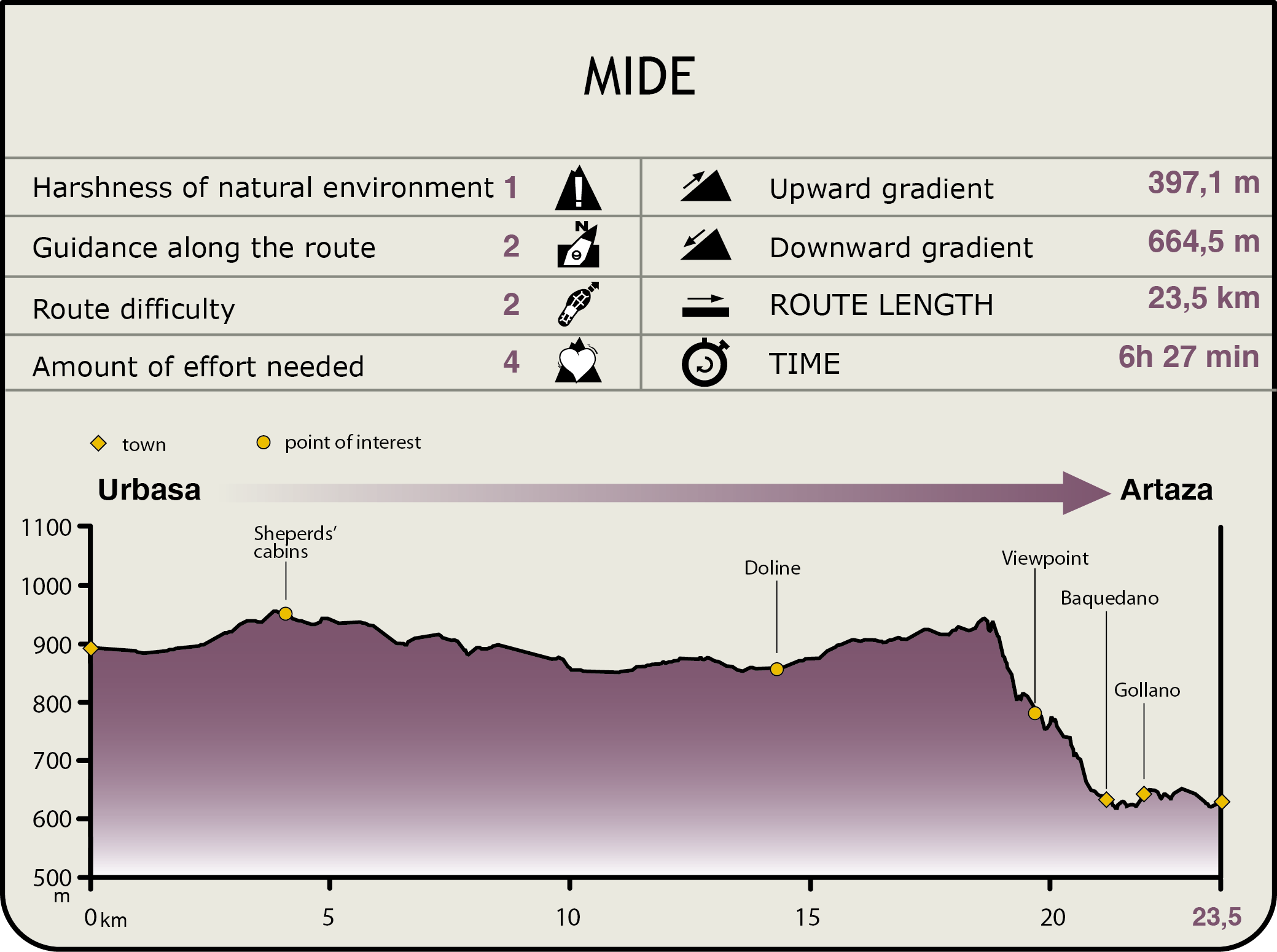
MIDE (Method for the Information of Excursions)
 Harshness of natural environment
- 1. The environment is not risk-free
- 2. There are more than one risk factors
- 3. There are various risk factors
- 4. There are quite a lot of risk factors
- 5. There are many risk factors
 Guidance along the route
- 1. Well defined trails and crossings
- 2. There is a clearly marked trail and signage
- 3. Requires the identification of geographic features and cardinal points
- 4. Requires off-path navigation
- 5. The trail is interrupted by obstacles that have to be gone around
 Route difficulty
- 1. Walking on a flat surface
- 2. Trails with different types of path
- 3. Walking on stepped paths or irregular terrain
- 4. The use of hands or jumping over the terrain is necessary
- 5. The use of hands is required to progress
 Amount of effort needed
- 1. Up to 1 hour of continuous walking
- 2. Between 1 and 3 hours of continuous walking
- 3. Between 3 and 6 hours of continuous walking
- 4. Between 6 and 10 hours of actual walking
- 5. More than 10 hours of continuous walking
Featured
Further information
Urbasa-Andía Natural Park and the Sierra of Urbasa-Andía SCI
The Sierras of Urbasa and Andía are included in the Urbasa and Andía Natural Park and in the Site of Community Importance Urbasa and Andía SCI (20.949,40 ha). They are located to the west of Navarre and are formed by two average-sized mountains that constitute the climatic border between the humid Atlantic area and the arid Mediterranean region.
Three main types of vegetation can be distinguished in these mountain ranges: forests, mainly beech groves, where you can also find maples, lindens, ashes and holly trees; flatlands with thorn bushes and junipers, alternating with pasture areas strewn with heather, hawthorns and gentians, and finally rock-related vegetation featuring highly-specialised species.
Wood from the beech trees was traditionally used to build the shacks of the shepherds who exploited the mountain pastures sustainably, leaving them to rest at certain times of the year so that the grass could become stronger and be renewed.
The Natural Park of Urbasa and Andía has an information centre in the location of Sorosgain, at an altitude of 900 m.
The Source of the River Urederra Nature Reserve and Ega-Urederra SCI
To the south of the Natural Park and of the Urbasa-Andía SCI, you will find the location of the source of the River Urederra, declared a Nature Reserve and a Site of Community Importance. The source, located in the Valley of Améscoa, is the natural outflow of the underground aquifers formed in the karstic mountain range of Urbasa. The first emergence occurs in a cliff on the southern rim of the range, at an altitude of 700 m, creating an exceptionally beautiful fall with a height of over one hundred metres. The River Urederra is a SCI until it flows into the River Ega.
Multimedia