- Home
- Rural Development
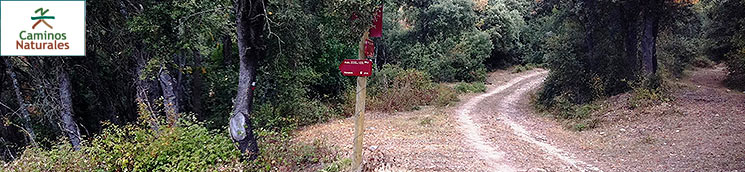
- Nature Trails
- Nature Trails
- Northeast Sector
Stage 9: Espejo - Nanclares de la Oca
Description
The valleys of Álava
This stage covers a large part of the region of Añana, also known as Los Valles Alaveses or the Valleys of Álava, and runs through four of its municipalities: Valdegovía, Kuartango, Ribera Alta and Iruña de Oca.
The stage covers the different landscapes that characterise the region, ranging from the cereal and sunflower crops that carpet the bottoms of the valleys, such as that of Omecillo, at the beginning of the stage, to the rocky areas and cliffs at a height of over 1.100 m, where the harsh climate produces austere vegetation, including extensive forest areas of Holm oak and pine trees that shelter a diverse array of fauna. This diversity and contrast will undoubtedly surprise trekkers.
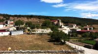
This stage begins at Espejo, along a road that sets off in an easterly direction next to a fronton-tennis court. After leaving the last houses behind you, you should take the first turn-off to the left, along a gravel farm path until you reach Villamaderme, a town located 1.5 km from the beginning of the stage.
Following an asphalted road that crosses Villamaderme in the direction of Bellojín, you take the first turn-off to the left along a forest road that gains a difference of altitude of some 350 m in 3.5 km as far as the top of Sierra Olvedo, passing close to the town of Bellojín and crossing the dense Holm-oak wood mantle that carpets this mountain range’s southern slope. The Holm-oak wood is a formation that is proper to Mediterranean environments where, in addition to Holm oaks (Quercus ilex), the main species, other trees are common such as the strawberry (Arbutus unedo), the common juniper (Juniperus communis), the Phoenician juniper (Juniperus phoenicea), as well as some species of heather (Erica sp.), rockrose (Cistus sp.) and diverse aromatic plants proper to dry ambiences and poor soils. During the climb up to Sierra Olvedo, on looking behind you, you can contemplate a splendid view of the Valley of Valdegovía, where the colour of the crops in the bottom of the valley contrasts with the dark holm oaks that cover the hills.
You should save your strength during the climb so you can tackle the final slope that is very steep and stony, before you reach the top. Once you have completed it, you reach the summit through “El Pasador”, a small mountain pass from where you can see in front of you the Sierra of Arkamo, this section’s next goal. After catching your breath, the trail descends steeply down the northern hillside of Sierra Olvedo, through a pine grove until you reach the town of Guinea, which is located in the bottom of a small valley, which links up to the Valley of Losa. You cross the town and then take a very steep concrete path that heads northwards. After crossing the hillside of the Sierra of Arkamo, which has a difference in altitude of 400 m in three kilometres, the route passes through Holm oak groves and other patches of beech and pine trees in river bed areas, which are more common close to the summit. This is the case of the “Hayal de Guinea”, which is also the location of El Hayal pond that serves as a watering place for the cattle that graze in the Arkamo passes.
There are many water points which, distributed throughout the mountains, are vital for the cattle. Some examples are the wells of El Hayal, Azkorri, Edia, Barzaza and El Menor.
After passing by El Hayal pond and following the track, you can see how, as it climbs, the woodland begins to disappear owing to the effect of the wind and grazing, and now brushwood and mountain pastures predominate, although some scattered trees resist, mainly ashes (Fraxinus sp.) and beeches (Fagus sylvatica) and some Scots pines (Pinus sylvestris), with a flag-like demeanour, misshapen by the buffeting of the wind. Long-suffering Holm oaks also appear at the top in the rockiest areas.
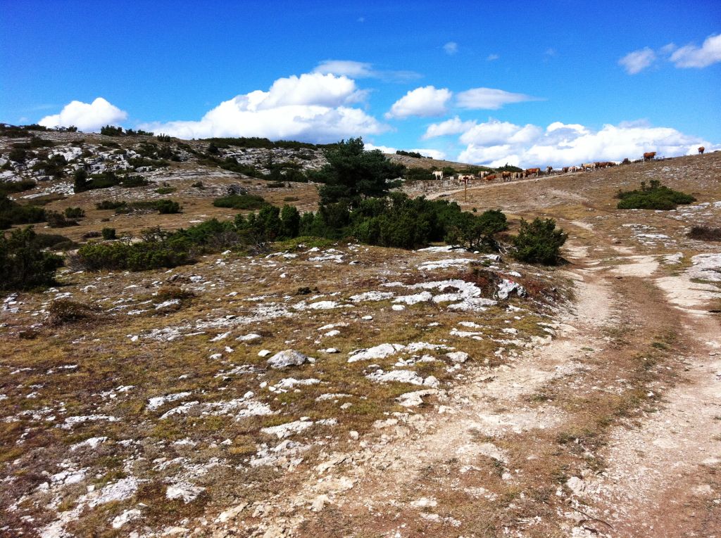
On reaching the top of the Sierra of Arkamo, just before its northern side comes into view, you will have to take a turn-off on the right. This path runs along the mountains lengthwise for over ten kilometres, parallel to the limestone crests that border it on the north. The Sierra of Arkamo is chalky with an average height of between 1.000 and 1.100 m, constituting an important grazing area in the summer months. This range was declared the Arkamo-Gibijo- Arrastaria Site of Community Importance and belongs to the Red Natura 2000.
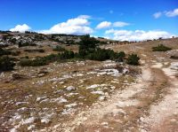
Unless the weather is foggy or windy, which is relatively frequent given the topographic situation of the Arkamo Mountains, trekking across this range of hills is especially rewarding. It is a permanent natural vantage point with splendid views of the Valley of Kuartango, and other mountains in the north, and you can also see the magnificent landscape of the mountain’s plateau itself, characterised by its geomorphological elements of karstic origin, such as the fields of sinkholes and limestone pavements that shape an undulating landscape, carpeted by high rich pastures and brushwood, mainly heather and creeping junipers. The path is easy-going and enjoyable, without any steep slopes, but you should keep an eye on the ground as it can sometimes be uneven.
After some two kilometres moving across the Sierra of Arkamo, you can see, next to the path, the ruins of the wolf trap of Barrón, which is made of two slab walls forming a funnel that leads to a deep pit where the wolf, hounded by hunters, would fall and be killed. This wolf trap evidences that these mountains were used as livestock grazing pastures in ancient times.
The Sierra of Arkamo is intersected by the gorge of the River Bayas or Baia in Basque, which separates the latter from the Sierra Badaia, where, at the present time, you can see some wind turbines. When it reaches the eastern end of the Sierra of Arkamo, the path descends once again across the southern foothills, along a very stony forest track, which is some three kilometres long and has a difference in altitude of 400 m. It crosses a wooded area of Holm oaks that covers the entire southern side of the Sierra of Arkamo, until it reaches the A-3318 highway.
At this point, an ancient path emerges on the left, parallel to the main road, which borders some meadows until it reaches the town of Subijana-Morillas. On walking through its streets, you come to the A-3318 highway and, continuing in an easterly direction, you first cross a subway and then a bridge over the River Bayas, to reach the part of the town established on the left-hand side bank of this river that has been declared a Site of Community Importance.
On entering the streets of Subijana-Morillas, you take a farm track that continues in an easterly direction among arable land. The track comes to an end and the route continues along a forest path for approximately one kilometre, crossing Holm and gall-oak hills until it reaches the town of Montevite.
Along this last part, and from now onwards, the trail runs along the foothills of Sierra Badaia, on the borderline between agricultural areas and tree-covered hills, and parallel to Sierra Tuyo, which is on the right, and joins up with the mountains of Vitoria.
Following the signposts, you cross Montevite in an easterly direction and continue across a slightly uneven gravel track for some 2.5 km, as far as the town of Ollávarre.
You pass through the town in an easterly direction along a similar track for 1.5 km and, after crossing a quarry access road, you come to the end of the stage in Nanclares de la Oca, the last town in the region of the Valleys of Álava or of Añana, on the banks of the River Zadorra.
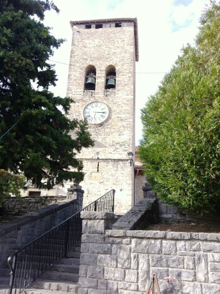
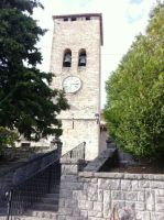
Nanclares de la Oca is a town located a few kilometres from Vitoria-Gasteiz and has more than 2,000 inhabitants. Here, travellers can find all the services they might need. It is a town with enormous historic wealth; its name appears to stem from “Langrares”, a term of pre-Roman origin. Fruit of this origin, in the vicinity of Nanclares de la Oca, there are important Roman remains, such as those of Iruña–Veleia, which are worth visiting, as well as traces of Templar settlements which are the source of the term “Oca”. In the town of Nanclares de la Oca, you can visit three Carlist towers: Almoreta, El Holm oakl and Vayagüen.
This stage is suitable for cycling even though it has some parts that are very steep and stony, especially the last portion that climbs Sierra Olvedo and sporadic sections of the ascent of the Sierra of Arkamo through Guinea, as well as the descent from the Sierra of Arkamo. These parts can only be cycled by expert cyclists. Also worthy of mention is the fact that 1.5 km of the part of the track between the towns of Ollávarre and Nanclares de la Oca is a restricted cycling zone, given that it is an area where residents usually walk, so you will have to cover it on foot.
Profile
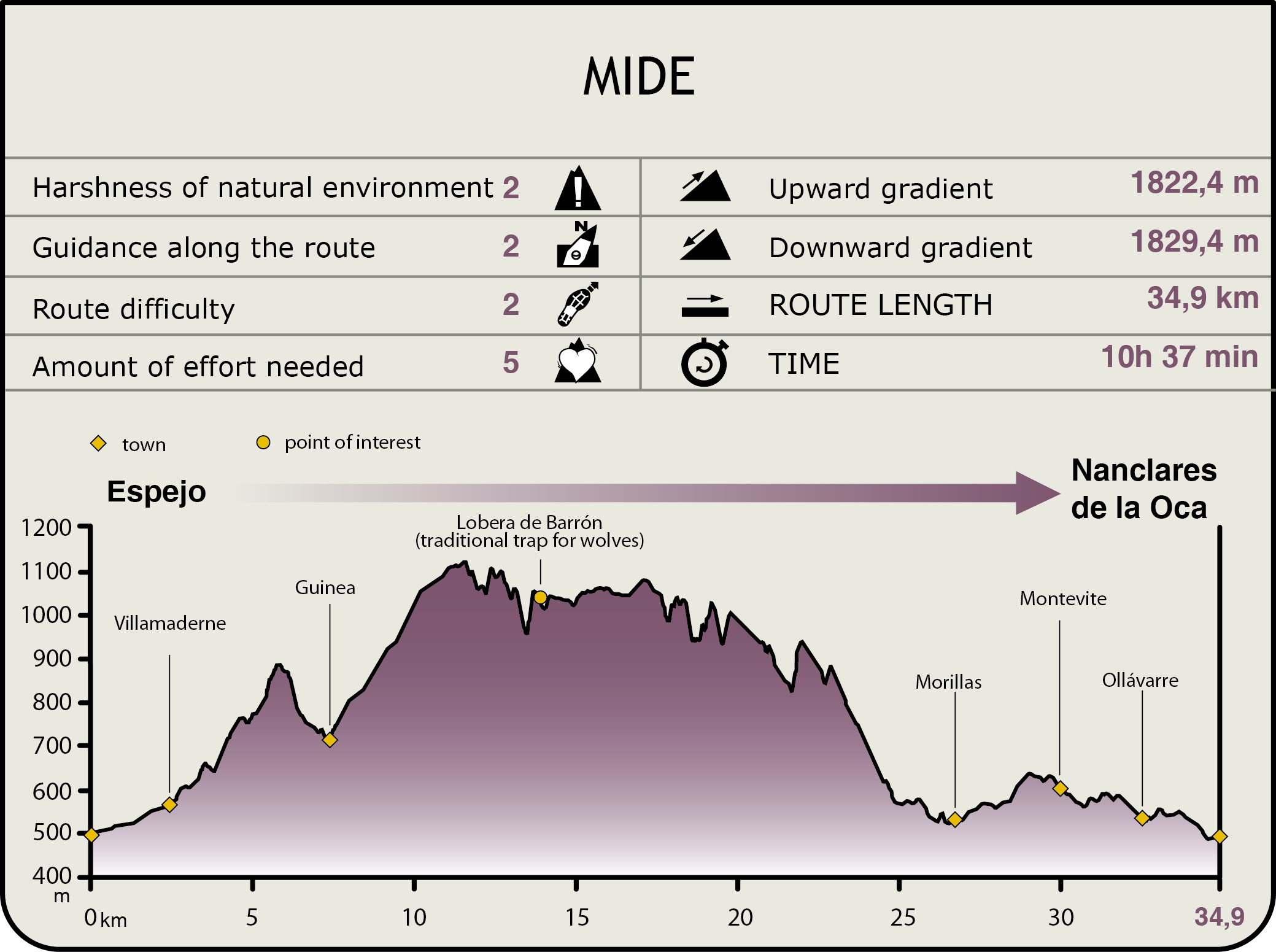
MIDE (Method for the Information of Excursions)
 Harshness of natural environment
- 1. The environment is not risk-free
- 2. There are more than one risk factors
- 3. There are various risk factors
- 4. There are quite a lot of risk factors
- 5. There are many risk factors
 Guidance along the route
- 1. Well defined trails and crossings
- 2. There is a clearly marked trail and signage
- 3. Requires the identification of geographic features and cardinal points
- 4. Requires off-path navigation
- 5. The trail is interrupted by obstacles that have to be gone around
 Route difficulty
- 1. Walking on a flat surface
- 2. Trails with different types of path
- 3. Walking on stepped paths or irregular terrain
- 4. The use of hands or jumping over the terrain is necessary
- 5. The use of hands is required to progress
 Amount of effort needed
- 1. Up to 1 hour of continuous walking
- 2. Between 1 and 3 hours of continuous walking
- 3. Between 3 and 6 hours of continuous walking
- 4. Between 6 and 10 hours of actual walking
- 5. More than 10 hours of continuous walking
Featured
Further information
The pre-roman city. The roman city
The municipality of Iruña de Oca boasts enormous archaeological wealth. Just 1.5 km from Nanclares de la Oca, there lies the Roman city of Iruña–Veleia, which was established in the shelter afforded by the meanders of the River Zadorra.
The surveys and excavations carried out in the area show that, prior to the Roman city of Veleia, there was an indigenous settlement spanning several dozen hectares. This site probably constituted the centre of life in the valley.
The first occupation dates back to the 8th century B.C. The remains recovered in excavations reveal the presence in the city of residents in the area: inhabitants on the plateau, in the Valley of the River Ebro, and even of European peoples. The huts that were erected in the city were either circular —generally built on rock—, or square—strengthened using limestone slabs—. In both cases, the walls were made of stone or sun-dried bricks and the roofs of plants.
The subsequent Roman settlement replaced the aforementioned huts with large Roman houses (domus), which were organised around a central patio, where there was a water fountain. The rooms were arranged around the patio and were usually decorated with beautiful mosaics, generally showing mythological motifs. In Roman times, great splendour existed in the city and paving and sewage disposal infrastructures were built. The city even had a theatre, squares and two thermal baths. Veleia reached an expansion of 80 ha and, even today, preserves part of its outer wall.
At the present time, you can visit the archaeological site there.
River Baia SCI
The area of the Site of Community Importance, SCI River Baia, with a surface area of 424 ha, is formed of a closed valley irrigated by the River Baia as well as the vegetation on its banks. This vegetation is well-preserved and is extremely important as it is a place where Atlantic and Mediterranean characteristics merge, featuring species such as alders (Alnus glutinosa) and ashes (Fraxinus excelsior), next to maples (Acer campestre and Acer monspessulanum), poplars (Populus nigra) and gall-oaks (Quercus faginea). The river crosses the oak wood near to Murguia and its southern area is surrounded by another oak wood close to Guillerna, increasing the floristic and faunistic wealth of its forests, which are of enormous interest for the preservation of the European mink (Mustela lutreola).
Arkamo-Gibijo-Arrasta SCI
The Site of Community importance SCI Arkamo-Gibijo-Arrasta boasts a total surface area of 11,538 ha. It is a mountain chain that runs in an east-westerly direction, between the Valley of the River Bayas and Burgos, whose relief is pronounced and steep and intersected by the existence, in some areas, of karstic plains.
In spite of its location in the Atlantic biogeographical region, this area has enormous Mediterranean influence, as can be verified by the presence of excellent specimens of Oro-Mediterranean kermes oaks and heathers. The shady areas are usually populated by beech and Scots pine groves, with kermes oaks prevailing on the sunny slopes.
Multimedia