- Home
- Rural Development
- Nature Trails
- Nature Trails
- Northeast Sector
Stage 19: Mikeleten Etxea - Arantzazu
Description
Along the historic path of San Adrián
This stage runs across the slopes of the Sierra of Aizkorri, a karstic complex of notable geological and scenic interest. It follows the signs of the historic path of San Adrián, used by the Romans to transport goods between the plateau and Europe.
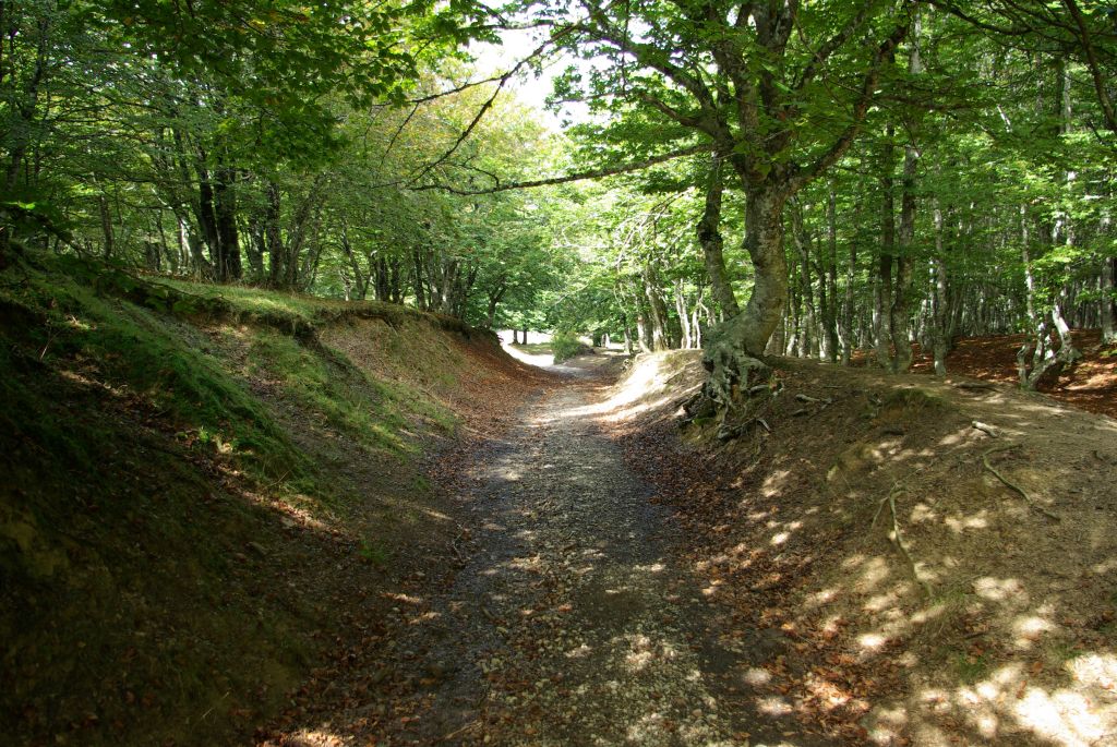
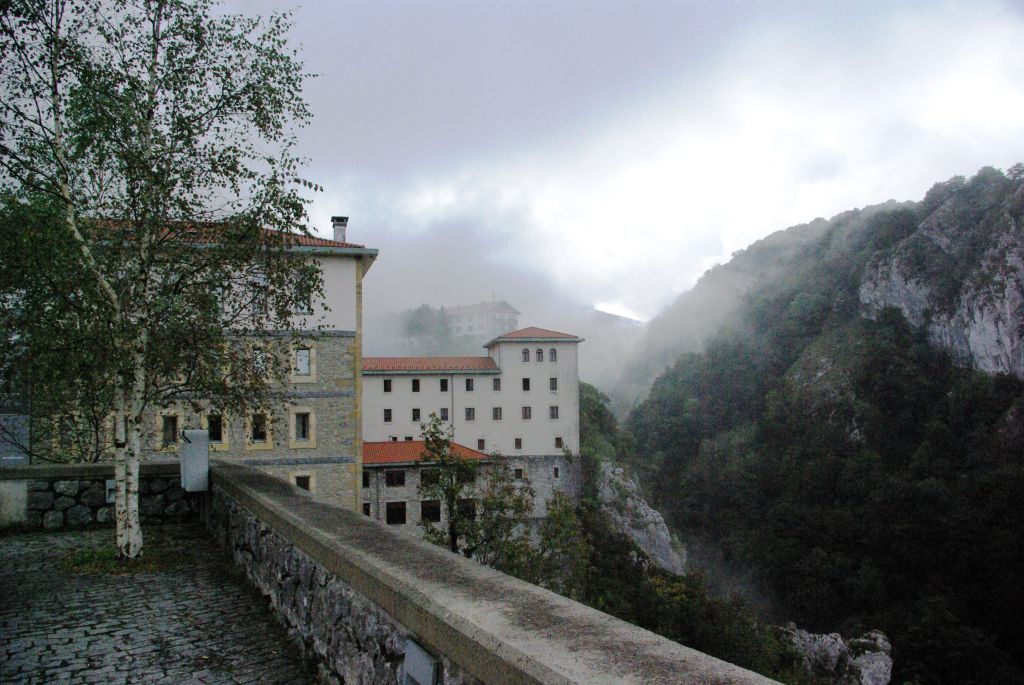
Here, the trail runs through magnificent beech grove stands and crosses the pass of Urbia, an important livestock area. From Urbia, you descend extremely beautiful landscapes as far as Arantzazu, the cradle of cattle grazing, where the Sanctuary of the Virgin of Arantzazu stands, hanging in the canyon of the River Urkullu. Worthy of note are its natural values, as the entire stage runs through the Natural Park of Aizkorri-Aratz and the Aizkorri-Aratz SCI.
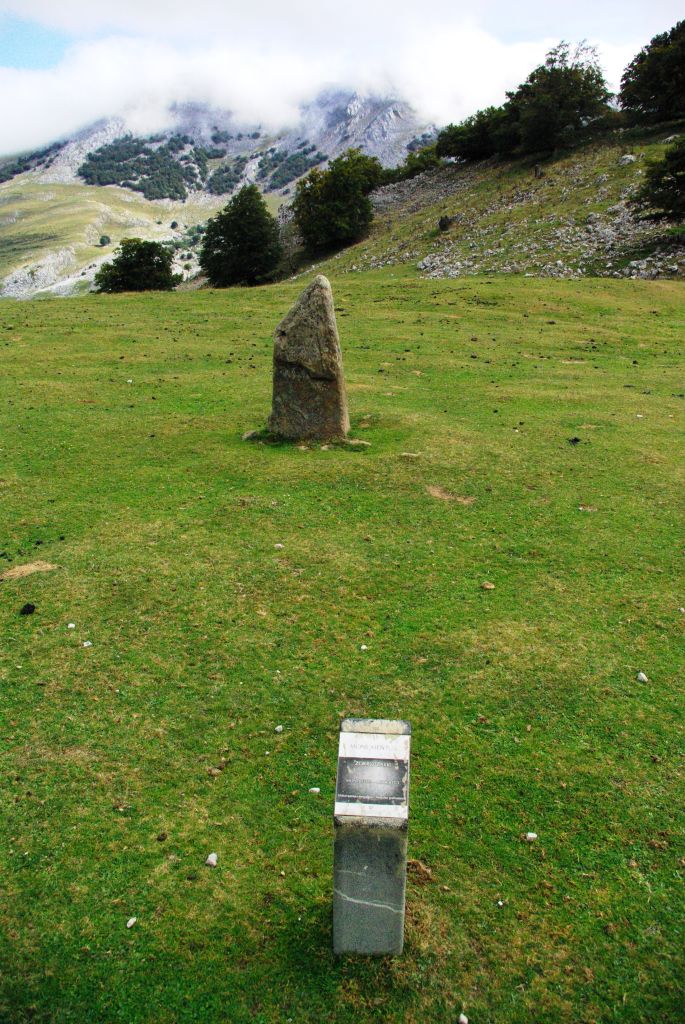
The stage runs through the territory of Gipuzkoa, between the municipality of Zegama and the “Parzonería” of Gipuzkoa and Araba/Álava, covering in some parts the boundary with the region of the Llanada Alavesa, and finally entering the region of the Alto Deba.
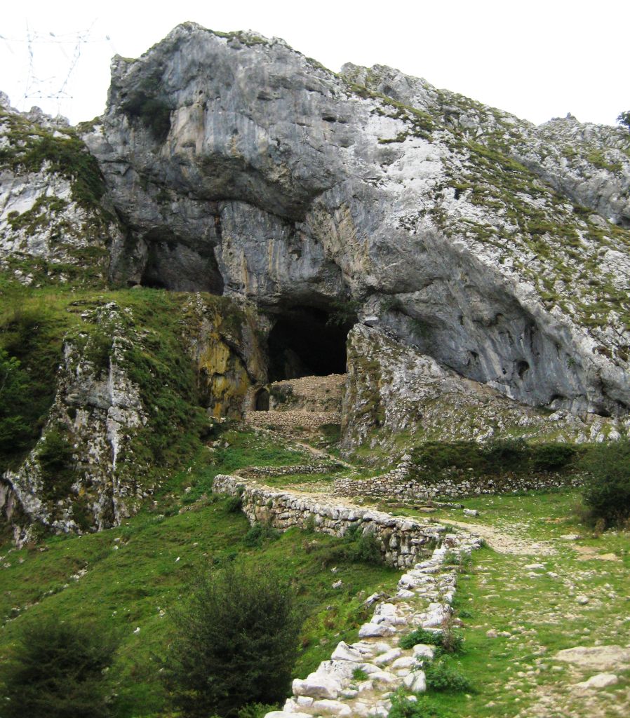
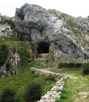
This last stage begins at Mikelete’s shelter, climbing a path in a westerly direction, for one kilometre with a moderate gradient and some steep ramps. You then reach the tunnel of San Adrián, a passing point on the historic path of San Adrián. This path crosses the Sierra of Aizkorri via a natural pass, under a limestone vault, located on a hillock between the mastiffs of Aizkorri and of Aratz. The Romans used the path as a trade route between the squares of Astorga and Burdeos.
At a later date, in the early 12th century, it was a Royal Path of the Crown of Castile, communicating the plateau with Europe. It was also used to take all the wool from Castile to the coast, with customs being established in San Adrián itself. It was also a passing place on the Álava route of The Way of St. James’s, seeking an alternative path in the face of the continuous battles that were fought on the Cantabrian Coast. In 1430, the deeds of the “Parzonerías” of Gipuzkoa and Araba/Álava were signed here. The chapel of San Adrián was built under this rocky vault in the year 1893.
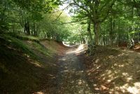
After passing through the tunnel of San Adrián, you can see a prehistoric burial mound next to the route. It continues climbing gently for some two kilometres among beautiful beech groves, until it reaches the pass of Zarra, at the top of the Sierra of Urquilla, close to the Askiola peak. This part of the route follows the Roman road of the path of San Adrián from where you can see some cobbled areas that have been preserved.
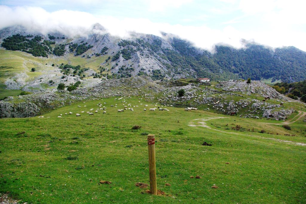
From the pass of Zarra, the Trail descends gently for some three kilometres until it reaches the district of Ollantzu, a group of shepherds’ shacks that are grouped together in the area surrounding the passes of Urbia. This portion initially follows the watershed of the Sierra of Urquilla, the boundary between Gipuzkoa and Araba/Álava, along an old forest path parallel to a recently built track. From this area, there are views of the Llanada Alavesa and the mountains bordering it on the south, which have been covered in previous sections. After crossing this track, the trail then descends a hillside along a gravel path that crosses an extensive, extremely beautiful beech grove, which shelters the path. The track reaches an open space that lets you see the shacks of Ollantzu, which stand on a small hillock among chalky limestone pavements. Next to the path, you can see several remains of megalithic constructions such as the dolmens of Pagarreta, Kalparmuñobarrena and Pagobakoitza.
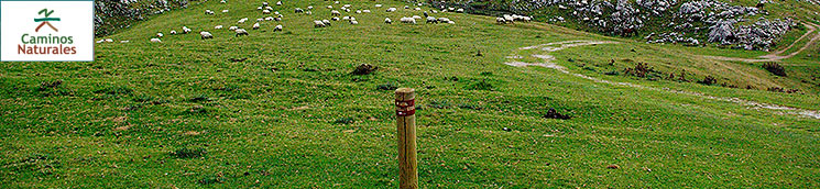
Following the track that crosses the district of Ollantzu, there are views of the whole of the Valley of Urbia, a wide depression of geological interest surrounded by the rocky mountains of the Sierra of Aizkorri. Its pastures constitute one of the main mountain passes in the area where numerous heads of cattle, especially “latxa” sheep, graze.
The trail continues for at least a kilometre along a gravel track that crosses the open space in Urbia through Kalparmuño until you reach the vicinity of the Inn of Urbia. Here, you should leave the track and follow a line of ash trees (Fraxinus sp.) that continue on your right and will take you to the chapel of Andra Mari de Urbia. From here, you can contemplate the magnificent views of the flatland of Urbia and of the Sierra of Aizkorri.

From the chapel, you have to follow the path that climbs gently following another line of ash trees, across the slopes of the Madabideta peak —behind the chapel—, and crossing an area of unique limestone pavements, until you reach the mountain pass of Elorrola. From here, a four-kilometre steep descent begins across the slopes of the Sierra of Aizkorri, as far as Arantzazu, following the Valley of the River Urkullu. The descent begins along a narrow path that becomes increasingly wider as it goes down through Gorostiarán and Otraitz. You will cover almost the entire route under the tops of a thick beech grove, which is only interrupted by some larch (Larix decidua) plantations in its final stage. You also have to cross a stream via a wooden walkway, whose vicinity is the location of the fountain of Erroiti, where legend tells that the Virgin of Arantzazu appeared before a shepherd called Rodrigo de Baltzategi.
The stage and the route of the “Senda del Pastoreo” ends in Arantzazu, nineteen days after it began in the same place. In Arantzazu, there stands the Sanctuary of Arantzazu, a very busy point of religious pilgrimage. Next to the Sanctuary, you can also visit the Information Centre of the Aizkorri-Aratz Natural Park, which this entire stage runs through.
This stage has some tough areas for cycling, which will force cyclists to get off their bikes and walk, due to the steep slope and uneven surface. Worthy of note, in this respect, is the climb up to the San Adrián tunnel and the continuation as far as the pass of Parra, whose areas are very steep and stony and some of which coincide with sections of the Roman road. The first ramps that descend from the mountain pass of Elorrola are also difficult to cycle on.
Profile
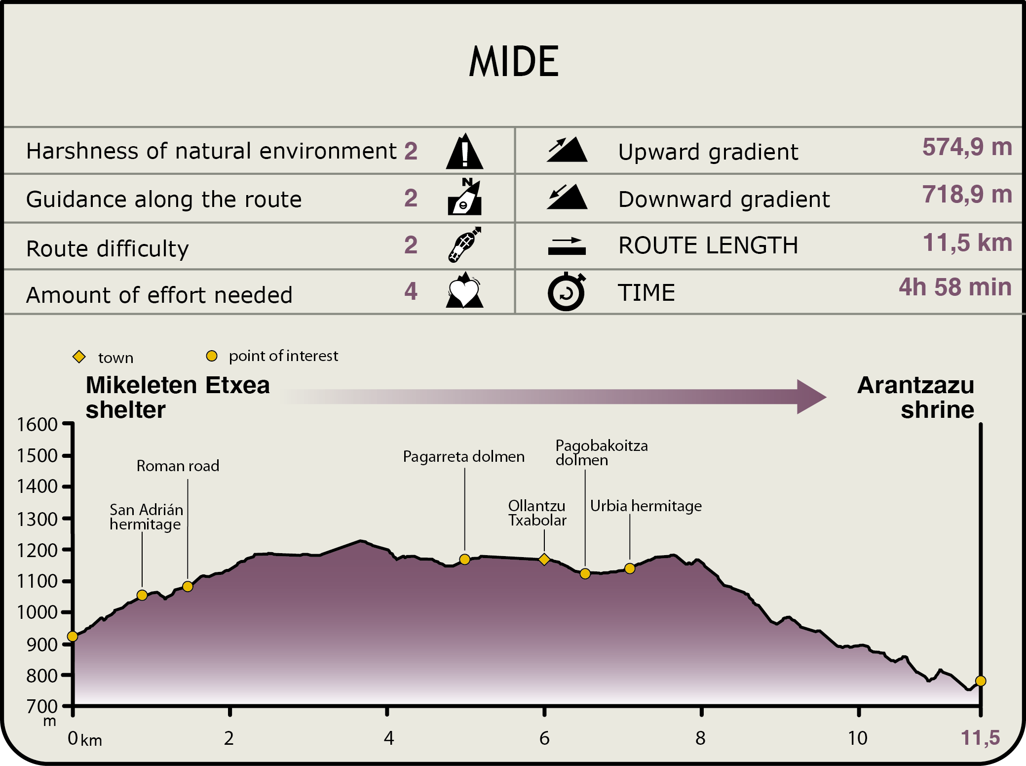
MIDE (Method for the Information of Excursions)
 Harshness of natural environment
- 1. The environment is not risk-free
- 2. There are more than one risk factors
- 3. There are various risk factors
- 4. There are quite a lot of risk factors
- 5. There are many risk factors
 Guidance along the route
- 1. Well defined trails and crossings
- 2. There is a clearly marked trail and signage
- 3. Requires the identification of geographic features and cardinal points
- 4. Requires off-path navigation
- 5. The trail is interrupted by obstacles that have to be gone around
 Route difficulty
- 1. Walking on a flat surface
- 2. Trails with different types of path
- 3. Walking on stepped paths or irregular terrain
- 4. The use of hands or jumping over the terrain is necessary
- 5. The use of hands is required to progress
 Amount of effort needed
- 1. Up to 1 hour of continuous walking
- 2. Between 1 and 3 hours of continuous walking
- 3. Between 3 and 6 hours of continuous walking
- 4. Between 6 and 10 hours of actual walking
- 5. More than 10 hours of continuous walking
Featured
Further information
The Sanctuary of Nuestra Señora de Arantzazu
The “Senda del Pastoreo” or the Grazing Trail ends in the heart of Gipuzkoa, allowing you to enjoy the best religious building in the 20th century, the Sanctuary of Arantzazu.
The Sanctuary was transformed into a site of pilgrimage and devotion in the Middle Ages when, as legend tells, the Virgin appeared before a shepherd on a thorn bush and he asked her “You on a thorn bush?” (in Basque “Arantzan zu?”). It is, therefore, a point with a secular and religious tradition that also served as a space for the preservation of the Basque language during the Franco dictatorship and a symbol of the Basque culture.
The monastery had to be rebuilt on three occasions due to fires; in 1553, 1622 and 1834. In 1950, the building of a new basilica began over the church rebuilt in the 19th century; nevertheless, the project was brought to a standstill for 15 years on account of its ground-breaking design and only the ideas introduced by the Second Vatican Council allowed it to be finished. It was opened for public worship in 1955, even though religious events had not stopped while it was being built, and it was finally consecrated in 1969.
Three Príncipe de Asturias Award winners: the architect Francisco Javier Saénz de Oiza and the sculptors Jorge Oteiza and Eduardo Chillida participated in its design, among others.
Worthy of note in the Sanctuary are six towers that have a diamond tip; the bell tower is the main one and reaches a height of 44 m. Some arcades run along the side of the church over the remains of the previous church. The apse, designed by Lucio Muñoz and inspired by the region’s landscape, stands over a cliff. It occupies 600 m² and is known by many as the 20th-century Sistine Chapel as it houses noteworthy paintings and a small box that harbours the Virgin.
The Way of St. James and the Path of San Adrián
Different sections of the “Senda del Pastoreo” intersect with the journeys of pilgrims who arrive from everywhere in Europe on their way to Santiago de Compostela.
At the town hall of Zegama, The Way of St. James’s continues in its north-south direction, forming part of the inland Basque route – an alternative to the coastal path -, until it intersects the “Senda del Pastoreo” for the first time. This alternative, also known as the Bayona Route, was at its most splendid between the 10th and 13th centuries when the Normans besieged the Peninsula to the north and the Arabs to the south. This path was the safest. There is a diversion from the current Way that crosses the hillsides of the neighbouring mountains as far as the meadowland of the River Oria.
The Path of San Adrián was a transit route before The Way of St. James’s entered these lands; the proximity of Roman remains indicates that it was possibly used by the latter for their movements. It was also important in the 12th-century struggles between Castile and Navarre and, in order to avoid Navarre lands, the Path of San Adrián became a Royal Route so that Alfonso VIII could visit the lands of his wife Leonor of England, Señora de Gascuña.
The San Adrián tunnel, which is 57 m long, houses a chapel inside that is dedicated to San Adrián (rebuilt in 1894) and which served as a shelter for numerous pilgrims and shepherds, as well as for their flocks. In this case, spirituality and grazing went hand in hand.
Multimedia