- Home
- Rural Development
- Nature Trails
- Nature Trails
- Northeast Sector
Stage 16: Lizarraga - Uharte Arakil
Description
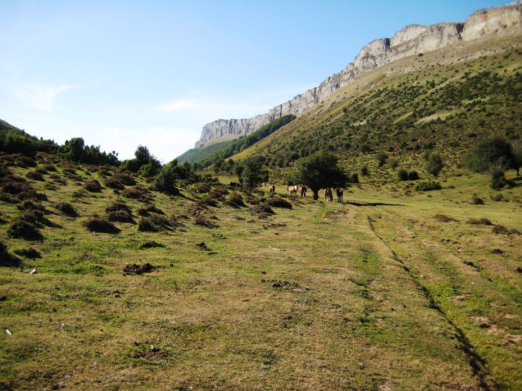
Andía: “Monte Grande”
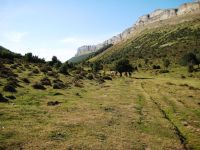
The path levels out across the highest area of the Sierra of Andía (“large mountain” in Basque), inside the Natural Park of Urbasa-Andía, crossing areas of mountain pasture where numerous heads of sheep, cows and horses are present. The pastures share this space with brushwood and alternate with limestone outcrops, containing a considerable number of sinkholes that form a “lunar” landscape. The altitude of the mountains also offers trekkers excellent views. Leaving behind the region of Navarra Media Occidental, you enter the region of Navarra Húmeda del Noroeste, which features Atlantic oak groves and a predominance of hay meadows that replace the croplands. Now, outside the Natural Park, the trail descends the hillside through the Valley of Ergoiena, across the slopes of the Sierra of San Donato. The stage crosses an oak patch and beech grove that stretches as far as the end of this stage descending to the Valley of Araquil.
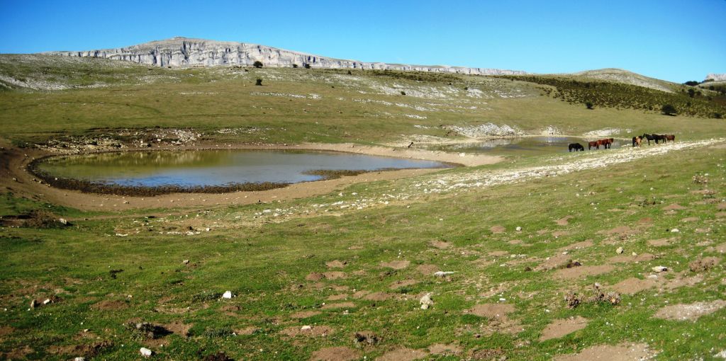
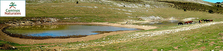
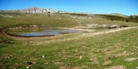
The stage begins in the pass of Lizarraga, crossing the NA-120 highway next to the hostel. You should take the gravel track in an easterly direction, along a small ledge that ends in the pass of Usaide, next to the “Reservoir of Txiki”. The track continues to level out through the pass, parallel to the cliffs that border the Sierra of Andía to the north, until you come to another water reservoir, the Reservoir of Sarasa.
Ironically, in spite of the high rainfall, water is scarce in these mountains as, owing to their karstic nature, it filters very quickly into the ground, resulting in very few surface water bodies. This is a considerable obstacle for the cattle that need livestock watering points. The scarce water reservoirs in existence form impermeable areas of clayey substrate and are carefully maintained by the farmers. They are also very important for the variety of fauna, especially for amphibian species that complete most of their life cycle in them.
Half a kilometre after the reservoir of Sarasa, you should take a turn-off to the right, leaving the gravel track. A rutted path gently climbs a pasture and brushwood area, until you reach the height of a small rocky mastiff that lies on the left: the peak of Peñablanca.
In this last part, there is a predominance of heathers, brushwood formations of great ecological interest, many of which have been declared Habitats of Community Interest in the Natura 2000 Network. They are fire-resistant communities and usually co-exist in conjunction with the mountain pastures to a greater or lesser extent depending on the intensity of the grazing they are subjected to. In particular, the heathers that can be seen across the Sierra are mostly dry. There is a predominance of Cornish Heath (Erica vagans), one of the commonest in areas of limestone substrate, as all heathers are typically proper to acidic areas. They also constitute high interest environments for different species of insects, reptiles, amphibians and birds. In this area, you can also see an abundance of sinkholes, which are very common in the whole of the Urbasa and Andía karstic mastiff.
The path begins to descend gently, bordering the peak of Peñablanca and leaving on the right peaks such as the Tregua and Altos Goñi. As you go around the peak of Peñablanca, the view opens up to the Valley of Ergoiena and the limestone faces of the Sierra of San Donato. You pass by the reservoir of Zuloa and then that of Fuentefría, and go as far as Leziza, the head of the eponymous river, which flows parallel to the Sierra of San Donato and forms the Valley of Ergoiena.
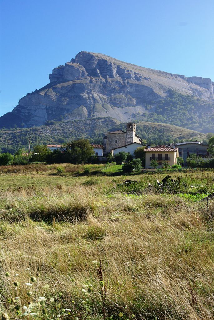
The Sierra of San Donato is a limestone “breakwater” that begins in the Sierra of Andía and goes as far as the corridor of the River Araquil. Its highest point is the peak of Beriain or San Donato (1.493 m), where the chapel of Santos Donato and Cayetano is preserved and which dates, at least, from the year 1797 and currently serves as a shelter for mountaineers. Also worthy of note is the mountain’s “keel” which ends on the peak of Ihurbain.
From Leziza, the trail enters a forest stand, belonging to the municipality of Ergoiena, which you descend through for some seven kilometres across the sides of the Sierra of San Donato, as far as the village of Unanu. This forest mass is formed of an initial beech grove strip that covers the top part of the hillside, at the foot of the rocky faces, and an oak grove area at its bottom. Unanu is a small village located at the foot of Mount Ihurbain, at the end of the Sierra of San Donato, and surrounded by hay meadows. Here, you can visit the church of San Pedro Apóstol.
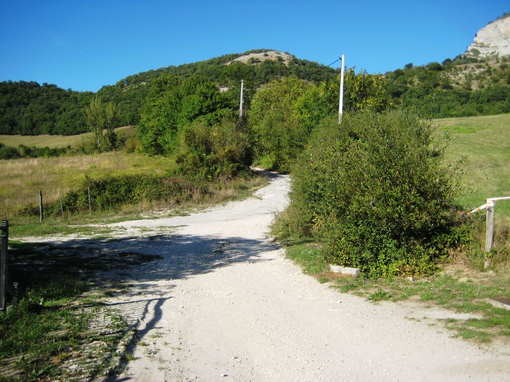
You leave Unanu in a northerly direction along a track that crosses between hay meadows and links up to the “Camino de Unanu”. You should continue bordering the slopes of the peak of Ihurbain, climbing gently for some three kilometres, when you will cross a small wooded beech (Fagus sylvatica) and oak (Quercus sp.) tree stand. You then pass through a treeless area next to an old gravel pit. After crossing the clearing, the track enters a rocky area until it forks. You should take the turn-off on the right in the vicinity of this point, along a forest path that enters an oak grove mass. Here, the route leaves the municipality of Ergoiena and enters that of Uharte-Arakil.
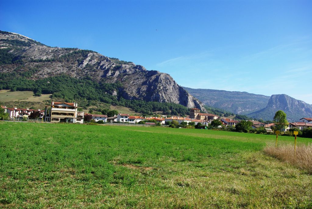
After a short climb, this path then descends for two kilometres through an oak grove that covers the northern slope of the Sierra of San Donato. It then emerges on to a hay meadow area and finally links up to a gravel track that leads trekkers to the first houses of Uharte-Arakil. A hundred metres further on, you come to an underpass, which crosses below the highway that links Vitoria-Gasteiz to Pamplona (the A-10), which leads to the historic centre of Uharte-Arakil, the end of the stage.
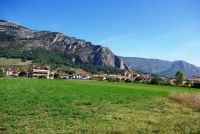
Uharte-Arakil is a town of 800 inhabitants where you can find accommodation and other services for trekkers. It is strategically located on a meander of the River Araquil, between the Sierras of Andía and of Aralar. The word “Uharte” comes from the Basque “ur arte”, meaning between waters, and makes reference to its location. Araquil refers to its location in the eponymous valley. In Uharte-Arakil, you can visit the church of San Juan Evangelista, and tour its streets that are overflowing with very well-preserved typical buildings.
This stage is suitable for cyclists as almost the entire route covers tracks fit for cycling. The only difficulty can be found in the descent through the oak grove in the last part of the stage, although it is not insurmountable.
Profile
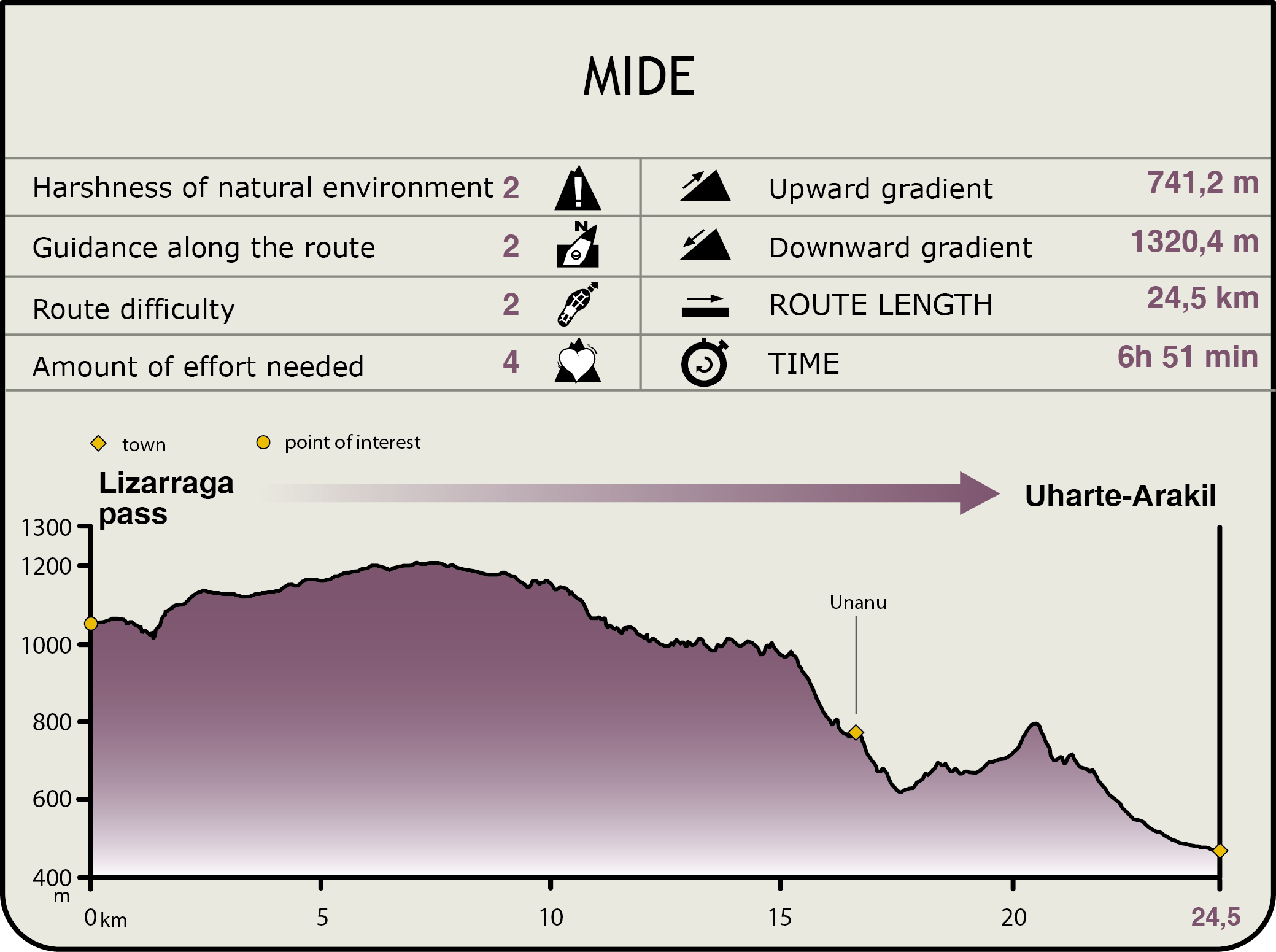
MIDE (Method for the Information of Excursions)
 Harshness of natural environment
- 1. The environment is not risk-free
- 2. There are more than one risk factors
- 3. There are various risk factors
- 4. There are quite a lot of risk factors
- 5. There are many risk factors
 Guidance along the route
- 1. Well defined trails and crossings
- 2. There is a clearly marked trail and signage
- 3. Requires the identification of geographic features and cardinal points
- 4. Requires off-path navigation
- 5. The trail is interrupted by obstacles that have to be gone around
 Route difficulty
- 1. Walking on a flat surface
- 2. Trails with different types of path
- 3. Walking on stepped paths or irregular terrain
- 4. The use of hands or jumping over the terrain is necessary
- 5. The use of hands is required to progress
 Amount of effort needed
- 1. Up to 1 hour of continuous walking
- 2. Between 1 and 3 hours of continuous walking
- 3. Between 3 and 6 hours of continuous walking
- 4. Between 6 and 10 hours of actual walking
- 5. More than 10 hours of continuous walking
Featured
Further information
"Artzai Eguna"/ Day of the Shepherd
The town of Uharte-Arakil is well known because every year, since 1969, it has played host to the staging of Navarre’s Day of the Shepherd on the last Sunday of August.
The fiesta is mainly directed at “latxa” sheep —an autochthonous breed adapted to the climatic conditions and to the relief of the place—. It is an unmixed race due to the century-old prohibition of importing sheep of other breeds. In general terms, these sheep are medium in size and have very long, oily, rough fleeces —their name stems from these adjectives in Spanish—. They are highly regarded especially on account of the quality of their milk, from which the famous Idiazabal cheese is produced.
The fiesta comprises a variety of activities: sheepdog herding contests, livestock shearing and the tasting and sale of sheep by-products. The day is lively and filled with music, bertsolarismo (Basque improvised poetry on a specific theme) and aurreskus, a ceremonial dance meant to show recognition of one or several people.
While the celebration is on, it is common to see a diverse array of characters, such as the joaldunak, people in fancy dress wearing horses’ manes and making cowbells ring (this character also appears in carnivals and whose purpose is to chase away evil spirits and possible plagues before springtime). Other characters are txalapartaris, whose name stems from txalaparta, an instrument of secular communication that is played during the celebration.
Multimedia