- Home
- Rural Development
- Nature Trails
- Nature Trails
- Northeast Sector
Stage 11: Okina - Antoñana
Description
The forests of Izki
The initial kilometres of this stage are accompanied by the Rivers Ayuda and Molino, through extremely beautiful gorges where waterfalls are combined with cliffs and aquatic and rocky vegetation intermingle. The path is detained by the immense expanse of Pyrenean oak copses that offer trekkers all possible forest images, making the route much lighter.
The eleventh stage begins in Okina, through the gorge of the River Ayuda. It sets off in the vicinity of the river and ends, after a five-kilometre hike, in Sáseta; the first town trekkers will come across. This part runs almost entirely through the territory of Burgos, to be specific, the area belonging to the County of Treviño. The trail leaves Okina in a southerly direction along a concrete track that runs parallel to the River Ayuda, on its left bank, reaching, after a short walk, the old mill of Okina, where the gully of the Arangachi stream, a tributary of the Ayuda, also merges. At this point, the track ends and the route continues along an easy-going path that runs across the bottom of the gorge, from where you can see the river’s spectacular shapes, with a succession of extremely beautiful cascades, pools and waterfalls.
On your walk, you can also contemplate the diverse array of riverside vegetation growing on the banks of the River Ayuda and in the ravines that merge with one bank or the other.
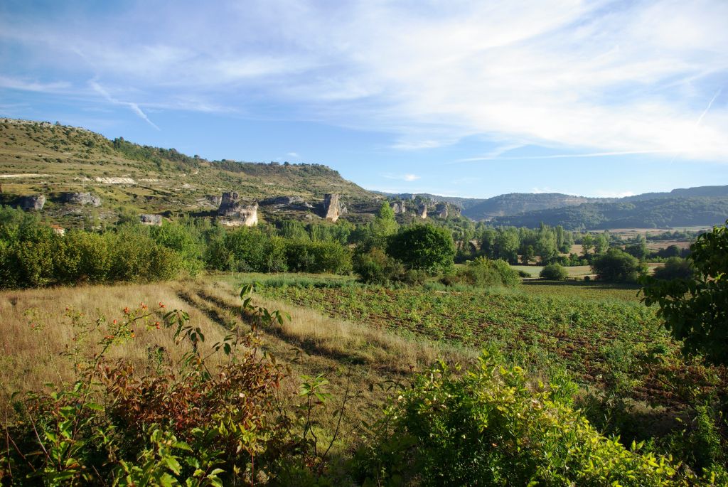
Formed of willows (Salix sp.), ash trees (Fraxinus sp.), maples (Acer sp.), poplars (Populus sp.) and hazel trees (Corylus avellana), and even a few beech stands timidly climbing up the hillside, it is the gall-oaks (Quercus faginea) and the Holm oaks (Quercus ilex) that prevail in the vegetation on the sides of the gorge, characterised by a terraced morphology, which is the result of the river’s different degrees of erosion owing to alternating hard (conglomerates) and soft (marls) blocks, a fact that makes it rather interesting in geological terms. Also worthy of note are the travertine flows that are formed by rainfall in some of the River Ayuda’s tributary ravines. The River Ayuda was declared a Site of Community Importance on account of its natural values.

Just before you reach Sáseta, you will come to an old mill, a must-see, which stands next to a several metre-high waterfall. On reaching Sáseta, you have to take a track that emerges from the bottom part of the village in a westerly direction and crosses the River Ayuda a few metres on, following a turn-off on the left immediately after passing over the river along a farm track that leads to some arable land.
After passing through some crops, you have to turn right along a narrow path that climbs through a brushwood-covered area on the side of a small hill on your right —Peña Barlas— and enter Araba/Álava province territory once again.
Further on, the path continues across arable land until it links up with a farm track, and later on with an asphalted road which, following the River Ayuda, goes as far as Urarte. This is a small town in Álava, belonging to the region of the Montaña Alavesa, which is located on a small hill on the meadow of the River Ayuda. On strolling through its streets, you can contemplate old stone houses and its gothic-style church of La Asunción, with its tower and Baroque portico.
Following Urarte’s main street, you come to the A-3134 highway, which you have to cross and then continue along a gravel track that begins next to an industrial warehouse. Walk down the track as far as the bottom of a narrow valley, the point where two of the River Ayuda’s tributaries, the stream of La Lucía and the River Molino, merge at the foot of a rocky cliff. The trail continues to the left along a path that gradually climbs the right bank of the River Molino canyon, between crops and poplar groves situated on its narrow meadowland, which is regarded as an element of geological interest owing to its flat bottom morphology developed on sands and chalky limestone. The banks of the River Molino are populated with rich riverside vegetation formed of poplars, ashes, willows, maples, etc.
After hiking for some 2.5 km, following the course of the River Molino upstream, you come to Marquínez, a village located at the bottom of this river’s canyon, and flanked by its limestone escarpments. At this point, worthy of note is the presence of the hills of Izki, with evidence of human occupation since at least the Bronze Age. Some of these remains are of great interest, such as Peña Rasgada, where elements of cave art are preserved in the form of slender human figures.
It was in the Middle Ages, with the establishment of towns, when this area took on great importance, marking the border between the kingdoms of Castile and Navarre. During this period, the towns of Antoñana, Bernedo, Corres, etc. were founded as were the Artificial Caves of Marquínez, which were built by the residents as dwelling places although their use subsequently changed with the passing of time. After being lived in by hermits, from the 12th century onwards, they were used as dwellings, cellars and farmyards. Worthy of mention is the cave of Santa Leocadia, where a low relief of Celtic origin, representing Epona (the Goddess of Horses), is sculptured.
Other interesting elements in Marquínez are the parish church of Santa Eulalia, located at the foot of the canyon hills, and the chapel of San Juan de Marquínez, situated on the outskirts of the town and declared a Site of Cultural Interest. The chapel of San Juan is rich in ornamental details, including an archivolt-strutted arch decorated with plant motifs situated on its façade.
On resuming this stage from Marquínez, you take a track that is in good condition and begins next to the parish church of Santa Eulalia in an easterly direction. It borders the flood plain and then takes a detour through the Valley of the stream of La Tejera, a tributary of the River Molino. It gently climbs the valley until it reaches the top of the Sierra of Izki, in a small clearing in the forest. This is where the track ends and the Trail enters the Valley of Izki, coinciding with the eponymous Natural Park. Unlike the areas in the vicinity and most of the route the “Senda del Pastoreo” or the Grazing Trail runs through, the lithology of this valley is acidic (siliceous), which affects the vegetation that can be seen here. The Pyrenean oak (Quercus pyrenaica), a tree that is typical of these soils, clearly prevails, unlike the gall-oak or the Holm oak, which prefer basic soils (limestone), and that is why they are the predominant species in the environs of the Izki valley basin.
From this point onwards and for the next 13 km, the route crosses the extensive forest patch of Pyrenean oaks that covers the Valley of the River Izki, constituting one of the largest areas of autochthonous forest in the Basque Country. In this way, from the Sierra of Izki, you descend next to a small, unnamed stream, hidden by lush riverside vegetation formed of willows, alders and holly trees, which have made inroads into the thickness of the Pyrenean oaks. You come to a track that you should follow to the right, according to this section’s directions, bordering the valley and crossing some tributary streams until the track comes to an end close to the course of the River Izki.
The route continues along a narrow path that forges its way among thick Pyrenean oak vegetation, parallel to this river, crossing it on several occasions via wooden walkways built for this purpose. After following a path for some 1.5 km, you leave the forest mass and join a track that runs parallel to the River Izki and borders croplands that extend along its banks. You then come to a turn-off where you take an old path that crosses the River Izki once again and continues alongside it. After crossing the A-4124 highway, it merges into a gravel track that you have to take on your left to then cross the River Izki once again before it enters the Corres canyon. At this point, there is a rest area where you can stop before continuing the route and climbing a steep slope leading to the village of Corres.
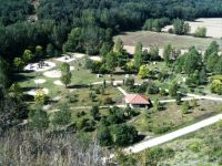
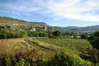
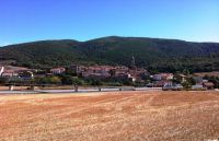
Corres is the only village that is included in the Natural Park. It dates back to the 13th century and it still preserves elements from its mediaeval origin (part of the walls and of the castle, the natural moat that was formed by the River and the entrance bridge). You can still see the remains of the typical allotments of mediaeval walled cities, containing perfectly aligned, very deep houses, with narrow, high facades forming constricted walkways. Worthy of mention is the 16th-century parish church of San Esteban, and the chapel of Virgin of La Peña, which is located at the foot of Mount Mantxibio, outside the town. Because of this, and its privileged location over the Corres gorge, it was declared a Cultural Site in the Heritage Monument category. In this municipality, you can also visit the Izki Natural Park information centre, which is extremely interesting.
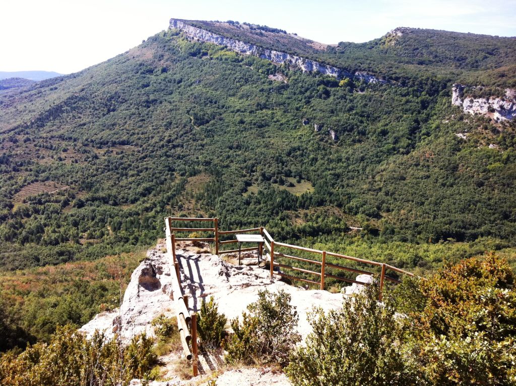
From Corres, you continue along a track that departs next to the church of San Esteban, passing through the cemetery. It then climbs along the upper part of the rocky flanks of the gorge of Corres, which is irrigated by the River Izki, until it reaches the top along a narrow path, between the castle crag and the peak of Soíla, 1.5 km from Corres. Once again, the trail runs over limestone lands, leaving behind, in the bottom of the valley, the siliceous materials that the Pyrenean Oak is associated with. Gall and Holm oaks, therefore, become more prominent, with some beech stands appearing in the last stage of the climb. Nevertheless, what will probably attract your attention most is the abundance of boxwood (Buxus sempervirens), which forms continuous undergrowth under the canopy of the beech grove. A short distance after beginning your descent, there is a viewpoint on your right, from where you can contemplate the castle crag, the Valley of the River Ega, the cliffs of the peak of La Muela and, in the background, the Sierra of Codés.
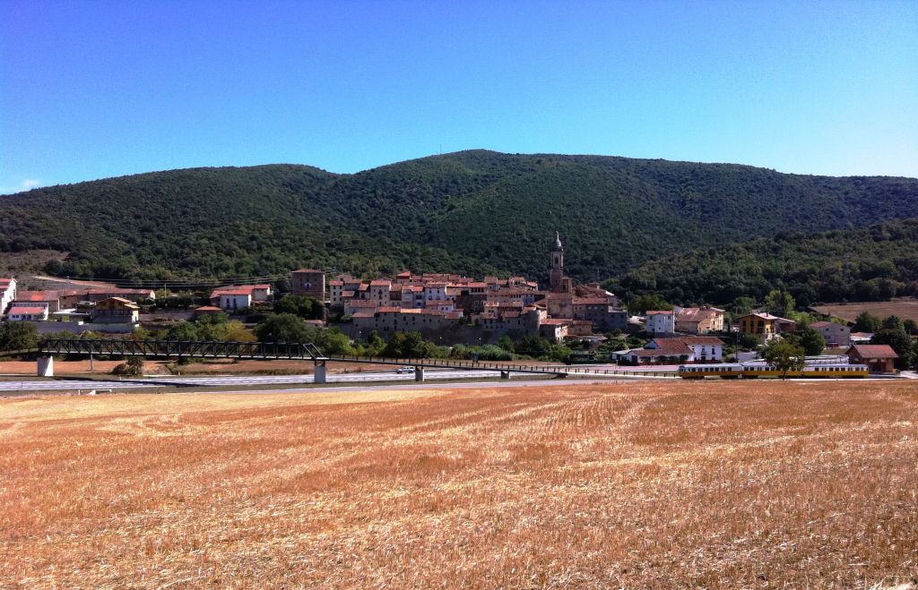
On resuming the route, there are only 2.5 km of steep descent left until the end of the stage in Antoñana. You complete the first downward stage along a very narrow path although it soon links up to a forest track that enables you to descend more easily, crossing a continuous forest of gall-oaks, beeches (Fagus sylvatica) and pines (Pinus sp.), which carpet the slopes of the Soíla. You can also see some notable chestnut tree specimens, as well as two unique trees, a yew (Taxus baccata) —Agin in Basque— and a linden (Tilia platyphyllos), but you have to take a detour from your route to visit them. Once you have completed the descent and after crossing the road, you come to an old railway station, which has been refurbished as the Green Track Visitors Centre of the Basque-Navarre Railway, which follows the old railway lines. After crossing another road, the A-3136, you immediately pass over the River Ega-Berrón, declared a Site of Community Importance, which runs along the foot of Antoñana, the end of the stage.
Antoñana was founded in 1182 by King Sancho, The Wise. On passing through its streets, you can see traits of its mediaeval origins: narrow streets connected via districts, alleys, passageways, stone houses and wooden frameworks, etc. It was a defensive fortress, which still preserves remains of the walls that protected it – declared a Listed Cultural Site -, the tower house to the north, and the old fortress-temple, which is the church of San Vicente Mártir. Another religious monument is the Romanesque chapel of Nuestra Señora del Campo (13th century), situated on the outskirts of the town.
This stage is suitable for cycling. The only difficult parts are those between Sáseta and Urarte, which run along uneven ground; a small stage on its way through the Pyrenean oak grove of Izki, which has a lot of thick vegetation; and the ascent from Corres to Antoñana, which is quite steep and thickly covered. Nevertheless, cyclists who have had a bit of practice can complete them easily.
Profile
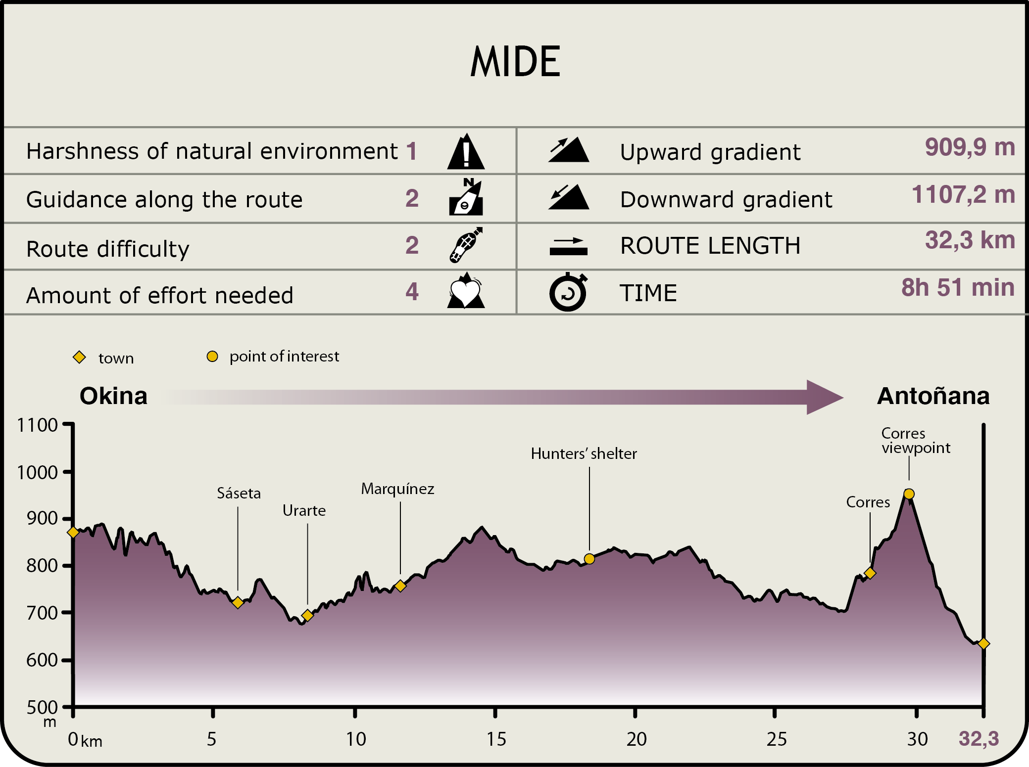
MIDE (Method for the Information of Excursions)
 Harshness of natural environment
- 1. The environment is not risk-free
- 2. There are more than one risk factors
- 3. There are various risk factors
- 4. There are quite a lot of risk factors
- 5. There are many risk factors
 Guidance along the route
- 1. Well defined trails and crossings
- 2. There is a clearly marked trail and signage
- 3. Requires the identification of geographic features and cardinal points
- 4. Requires off-path navigation
- 5. The trail is interrupted by obstacles that have to be gone around
 Route difficulty
- 1. Walking on a flat surface
- 2. Trails with different types of path
- 3. Walking on stepped paths or irregular terrain
- 4. The use of hands or jumping over the terrain is necessary
- 5. The use of hands is required to progress
 Amount of effort needed
- 1. Up to 1 hour of continuous walking
- 2. Between 1 and 3 hours of continuous walking
- 3. Between 3 and 6 hours of continuous walking
- 4. Between 6 and 10 hours of actual walking
- 5. More than 10 hours of continuous walking
Featured
Further information
The River Ayuda SCI
The Site of Community Importance, SCI ES2110012 River Ayuda, has a surface area of 66 ha and is framed within a narrow gorge flanked by limestone escarpments, and marked by grasslands and hedgerows and, occasionally, by beech groves that give way to gall and kermes oaks.
The River Ayuda flows into the River Zadorra, a tributary of the River Ebro, and on its banks the presence of the European mink (Mustela lutreola) and the otter (Lutra lutra) stands out.
The River Ega-Berrón SCI
The River Ega-Berron Site of Community Importance is located in the southwest of Álava, encompassing most of the region of the Montaña Alavesa, and has a surface area of 226 ha. It includes the basin of the River Ega and two of its tributaries, the Berrón and the Izki.
In the River Ega stage, upstream from Angostina, the riverbed was channelled years ago and the tree and bush covering of the banks was removed. In the other sections, the stretch of riparian vegetation is well developed and is formed of alders and willows. Maples (Acer campestre and Acer monspessulanum), poplars (Populus tremula), black poplars (Populus nigra) and other tree species also grow there.
The most valuable natural element in this space is the presence of the European mink (Mustela lutreola).
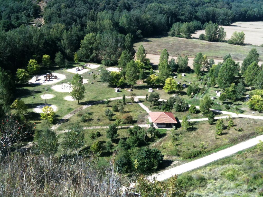
Izki Natural Park, SCI and SPA for Birds, and Montes de Izki IBA
The territorial boundaries of the Izki Natural Park, the Izki Site of Community Importance, the Izki Special Protection Area for Birds and the Montes de Izki Important Bird Area all coincide. They have a surface area of 9.055 ha in the region of the Montaña Alavesa, to the east of the historic territory of Álava.
SIt is an important, very extensive mountainous forest area with small differences in altitude, an undulating relief and not very steep inclines. Most of this natural space’s territory is located in the drainage area of the River Izki, with stream beds and small hills, and forming, as a whole, a basin set between limestone mountains with large rocky faces.
Worthy of note on the sandy lands that make up the River Izki’s basin is the presence of one of the most extensive Pyrenean Oak (Quercus pyrenaica) forests in Europe. In the chalky hills that delimit this valley, the Pyrenean Oak is replaced by gall-oaks and Holm oaks on the sunny sides, and beech groves in the high shady areas. Finally, the pedunculate oak (Quercus robur) makes an appearance forming small forests inside the Pyrenean Oak groves while conifer plantations strew the stand from time to time. There are also enclaves featuring different ecological ambiences, such as alder and willow groves, fens and wetlands, crest flora, etc., which are extremely important owing to their uniqueness and scarce presence.
The Izki divides into two river basins: the River Ega and the River Ayuda (the latter is also a tributary of the River Zadorra), which both belong to the River Ebro basin. They are characterised by being relatively broad river valleys, with seasonal flows and a marked low water level in the summer. The River Izki, a tributary of the River Ega, forms the main hydrological axis of the area as it covers almost 60% of its surface. There is also an abundance of aquifers encompassed within the Urbasa-Montes hydrogeological unit of Vitoria, which basically flows into the River Ebro. In the area of Izki and its vicinity, there are small springs and fountains, whose waters produce peat formations that feature the most unusual and unique flora in the Basque Region.
In the Izki enclave, there is a predominance of forest uses, extensive cattle farming and, to a lesser extent, agricultural crops. The extensive cattle farming focuses, above all, on horse breeding and beef cattle, which graze in the mountains most of the year, in the Park’s highest area. Sheep and goat flocks are much less frequent. Meadow pastures are continuous between the summits of San Cristóbal and San Justo.
The Park’s Information Point is located in the village of Corres, the only population hub in the Park.
Multimedia