- Home
- Rural Development
- Nature Trails
- Nature Trails
- East Sector
Ojos Negros Greenway
Description
From Puerto Escandón to Algimia de Alfara, simulating the route of the mining railway.
Following the trail of the train that carried iron ore from Ojos Negros to the plants of Sagunto. From Puerto Escandón, located at more than 1,200 m above sea level, the pleasant, predominantly descending trail traverses numerous towns and areas of Teruel and the Valencian Community and ends in the municipality of Algimia de Alfara.
Long stretch over 112 km long which traverses the provinces of Teruel and Castellón, finally entering the province of Valencia. This journey starts at the interpretation panel which marks the end of the Ojos Negros Nature Trail. From this point, the trail will be referred to as the Ojos Negros Greenway, since the signage that can be found will correspond to Greenways, continuing the numbering in the kilometre points.
Shortly after starting the trail, between juniper forests and cropland, highway A-23 is crossed via an underground passage to reach the surroundings of the operational Puerto Escandón station and the scarce remains of the old station of the mining railway which always moved in parallel.
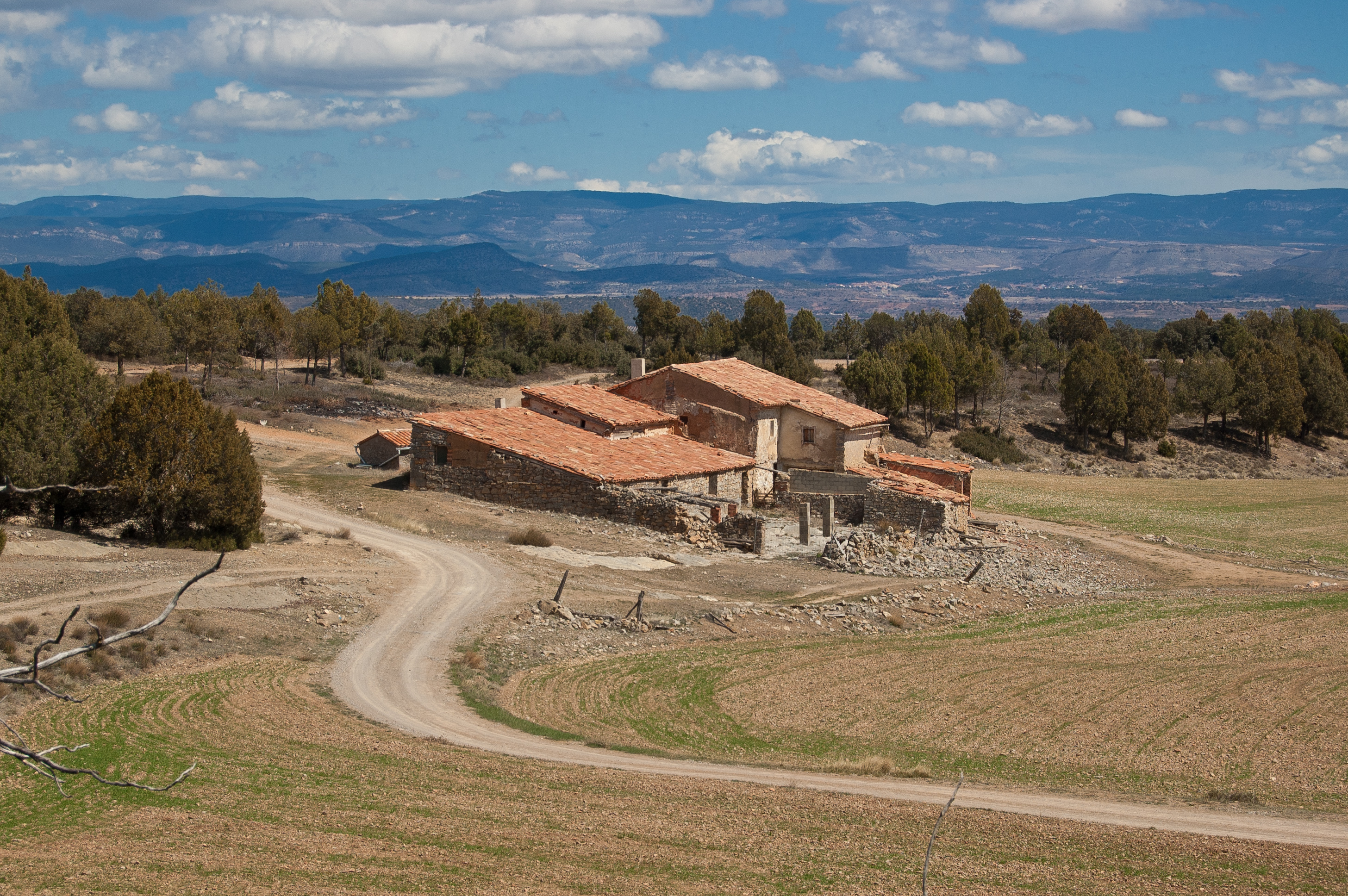
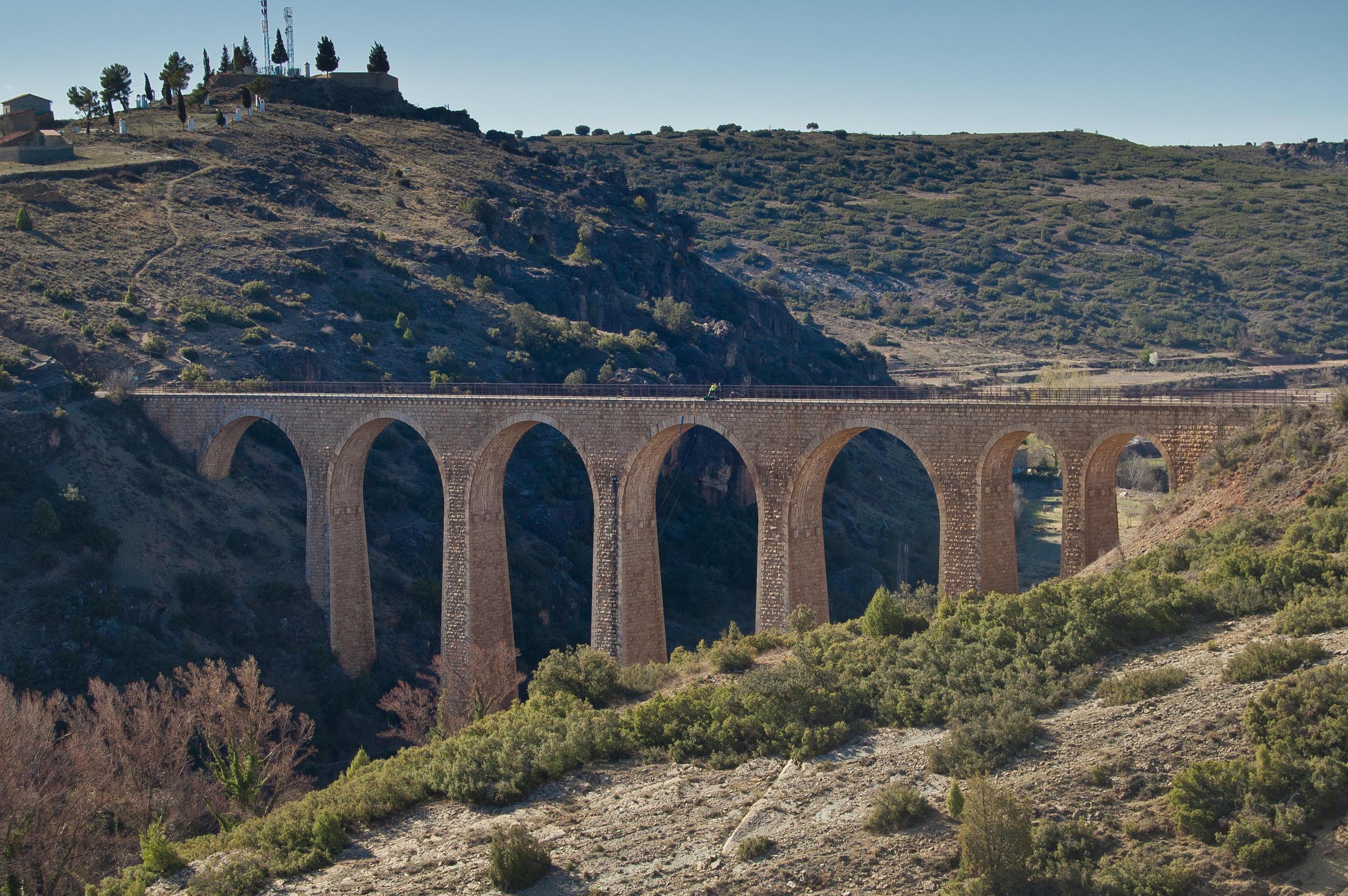
The trail continues between dryland and old farmhouses, dotted by small almond trees. After crossing road A-2520 with utmost care, kilometre point 83 and the old station of La Puebla de Valverde are reached; it is the perfect spot to relax thanks to its rest area. Two kilometres later, the trail crosses the viaduct over the Rambla de Peñaflor, whose four arches are a good example of railway architecture. Holm oaks (Quercus ilex) become the protagonists both in wild formations and in plantations dedicated to black truffle (Tuber melanosporum) production.

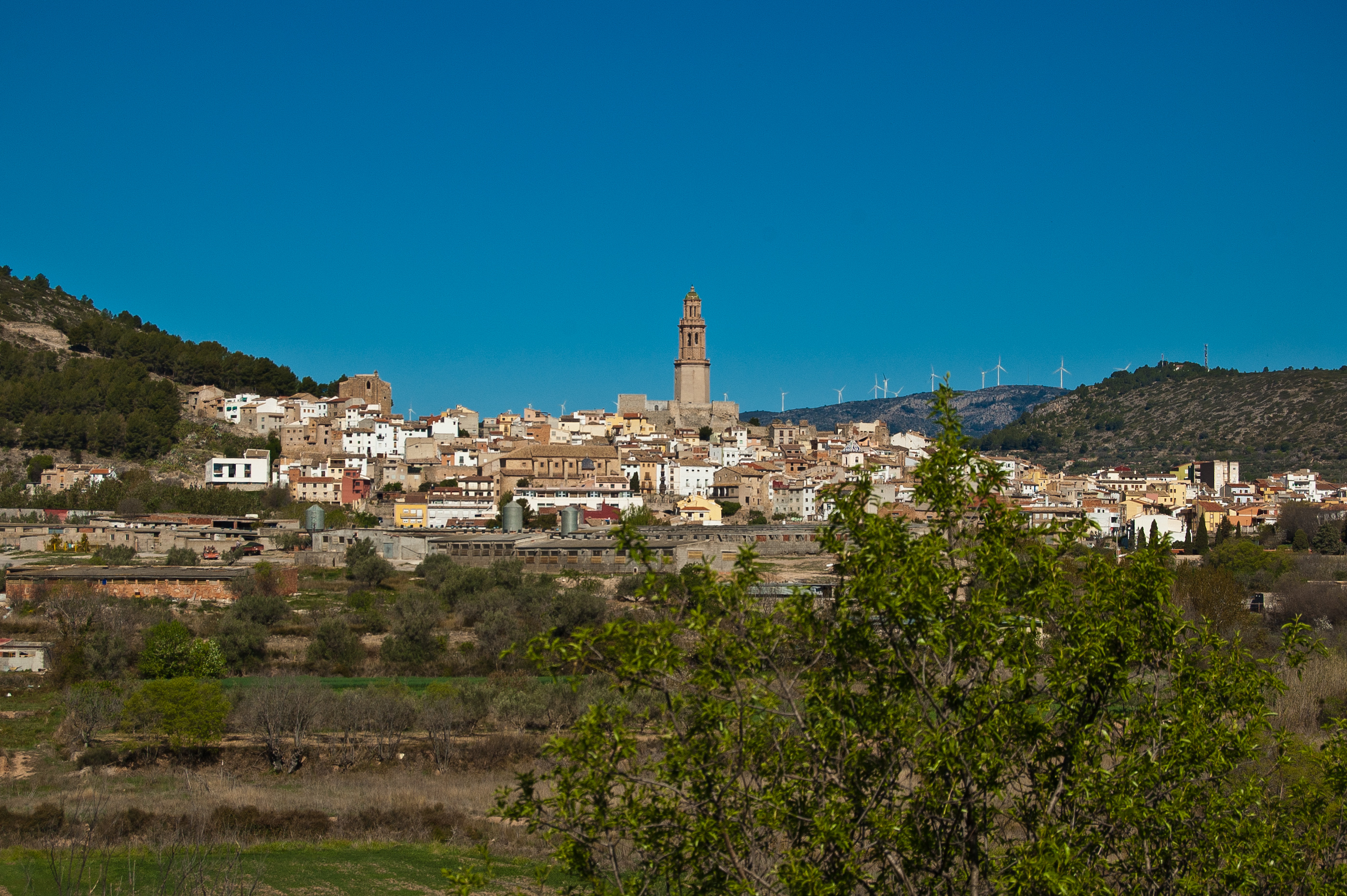
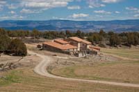
The old station of Sarrión is located next to kilometre point 97; the traveller can see this nice municipality in the background, with the tower of the San Pedro church standing out above all. The viaduct of the Barranco de los Judíos is reached at kilometre point 99 and the trail continues through a tunnel equipped with electric, automatic light. After kilometre point 104, the traveller will encounter a new tunnel and subsequently the large viaduct of Albentosa, which, together with the urban centre of the village, form a beautiful landscape.
Mediterranean scrub areas stand out for their greenness, with specimens of gall oaks (Quercus faginea), juniper trees (Juniperus thurifera) and holm oaks (Quercus ilex), among many other species. The TE-V-6005 road intersection precedes kilometre point 108 and the passing of the trail by Venta del Aire, from where the old building of the Rubielos de Mora station, whose railway line is currently operational, can be seen.
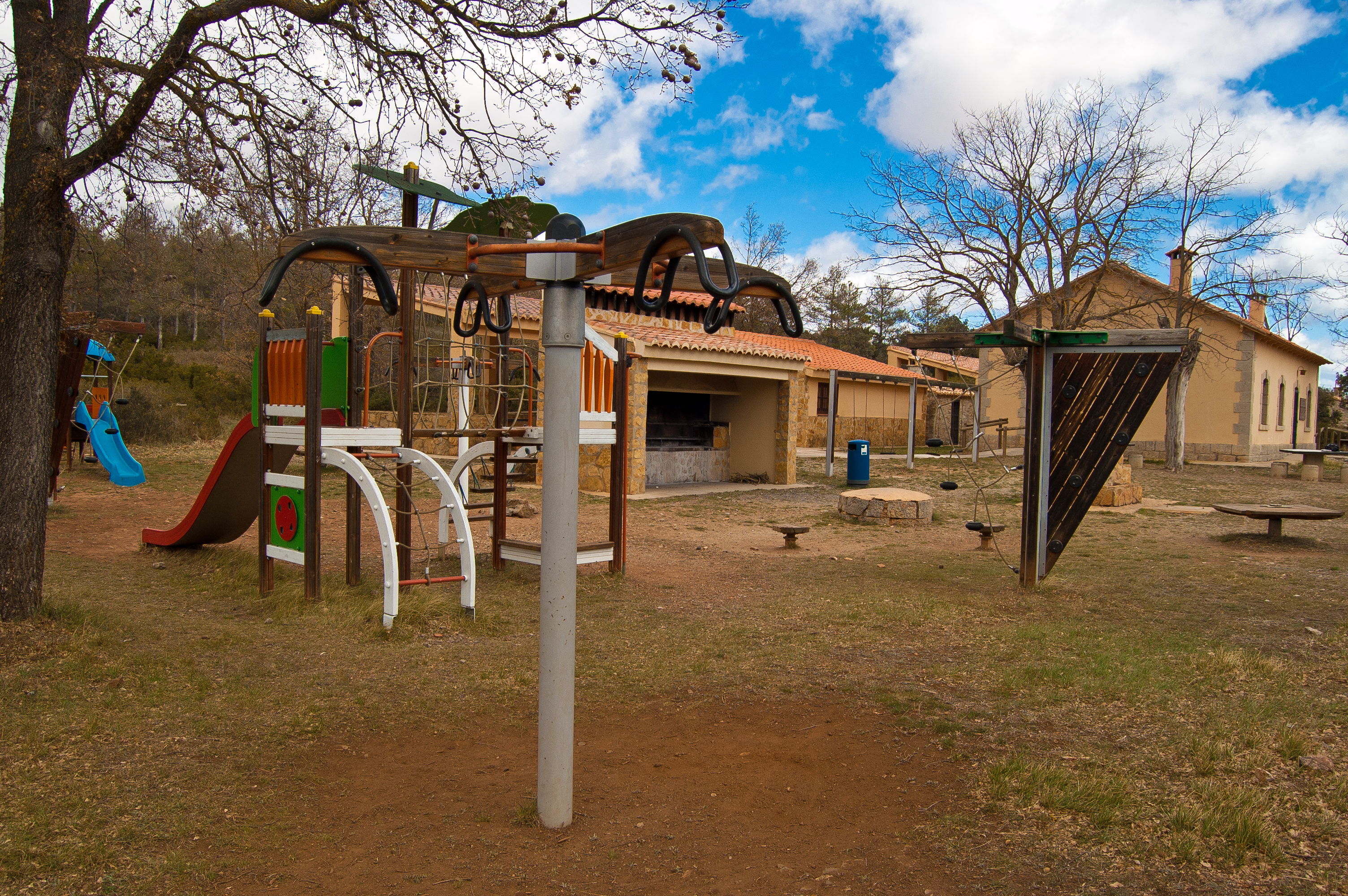
Some meters before kilometre point 117, the trail leaves the Autonomous Community of Aragon and continues the journey through the Valencian Community. At the same time, the traveller ventures into the Site of Community Importance (SCI) Alt Palància. After kilometre point 119, the trail reaches the old station of Barranca, which was restored and is currently known as the Estación del Palancar camp/forest refuge, equipped with barbecues, picnic areas and a children's play area. A gall oak forest follows the pine forest of Palancar de Abajo, and the municipality of Barrancas welcomes the traveller shortly after kilometre point 122. After passing by this village, a dry-stone wall protected the railway line from bad weather; the poplar of the Llano de Barracas rest area, located one kilometre away, is an ideal spot to rest.

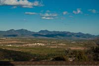
The Aleppo pine forests (Pinus halepensis) alternate with almond trees (Prunus dulcis) along the path that leads to the Ragudo viewpoint, which offers a stunning view of the Sierra Espardà Natural Park. The traveller will pass through three tunnels equipped with electric, automatic light along the trail before reaching the Masadas Blancas rest area. The viaduct of La Fuensanta, with its stunning eight arches, precedes the old station of Caudiel, and shortly before arriving to this municipality there is a tunnel with electric light which ends in the urban centre of Caudiel.
The village is left behind through the old railway route, in a new stretch coinciding with the Camino del Cid and GR-160. After the Novales rest area, the viaduct of Cascajar precedes three almost consecutive tunnels which end at a rest area, plunging the traveller, shortly afterwards, into the urban centre of the monumental town of Jérica. The municipality is left behind through its municipal cemetery, taking the bicycle line which runs parallel to road CV-2330 and crosses it before reaching the Wastewater Treatment Plant and going back to the original railway route at the old Santa Bárbara level crossing booth.
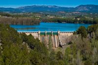
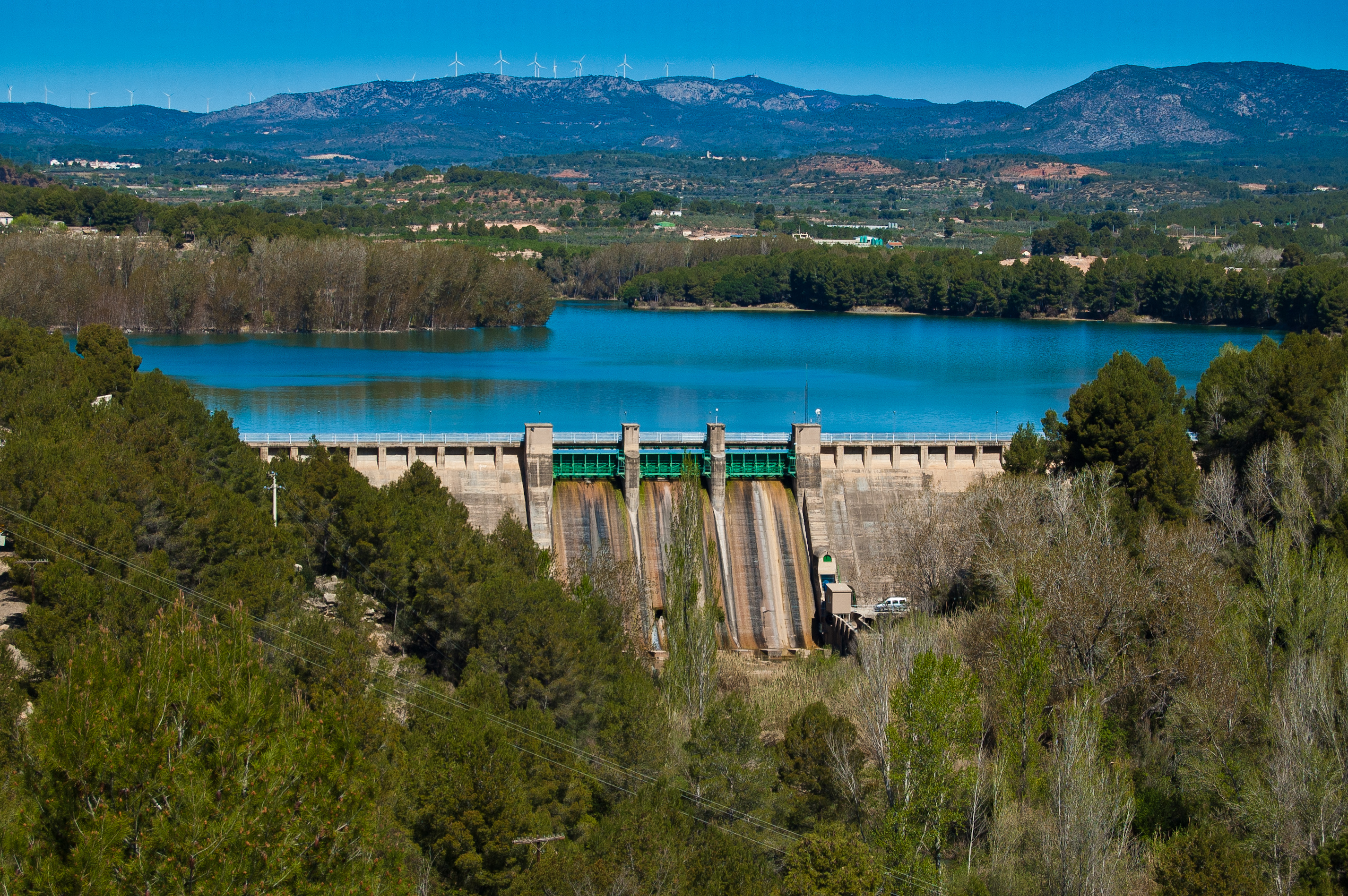
After passing the viaduct of the river Palancia, the traveller reaches the old station of Jérica. Shortly after, the trail continues underneath highway A-23 and crosses the bridge of Mataburros along the old railway route. After kilometre point 158 there is a tunnel which is especially enjoyable by bike; after one kilometre, the traveller will reach the Regajo viewpoint, which is the perfect spot to rest and enjoy the view of the reservoir.
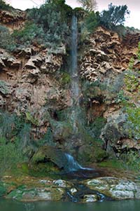
A new tunnel precedes the Cantera de Navajas rest area, where the remains of the old loading platforms can be seen. The village of Navajas, with a camping next to the trail, welcomes the traveller, who must cross road CV-2016 to access the municipality. After two newly constructed underground passages crossing roads CV-216 and A-23, the trail reaches a bifurcation; the traveller must choose between continuing along the old railway route or along an alternative trail. Once this point is left behind, the traveller will reach Altura, whose urban centre is on the left side of the trail.
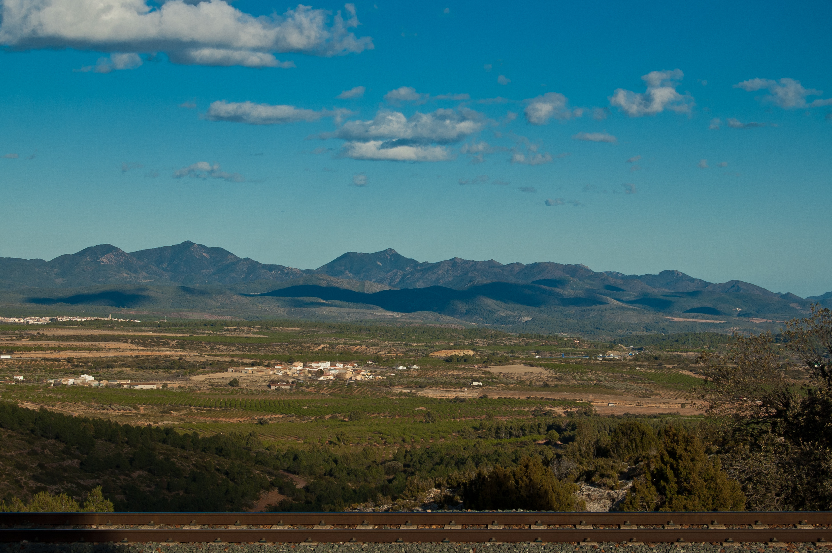
After passing by the Rambla Monteros, kilometre point 166 is reached. On the left side, the traveller will sight the monumental town of Segorbe. The trail reaches the old station of Segorbe escorted by fruit trees. The Rambla Rovira precedes a new scrubland, where the trail continues uphill parallel to highway A-23 (with the town of Soneja on the left side). After a brief descent, an area of quarries in different stages of exploitation and restoration precedes the Sot de Ferrer viewpoint, where the traveller can enjoy the views over this beautiful municipality.
One kilometre after passing by the Barranco Juncar, a new underground passage crossing highway A-23 makes the traveller abandon the original railway route to continue along a dirt path between the roads that access the highway. The trail continues on a paved road among orange trees and mandarin-orange trees, and the viaduct of Arguinas is reached after a new deviation in the original railway route.
The municipality of Algimia must be kept on the left of the trail, and shortly after passing its urban centre the traveller will reach a sign that reads "End of the Greenway" and kilometre point 184.557, where this trail which familiarizes the traveller with the coastal regions of Castellón finally ends.
Sites of interest
Map
Puntos de Interés
Geología
Infraestructura
- Antigua Estación de Jérica
- Antigua estación de La Puebla de Valverde
- Túnel
- Túnel
- Viaducto de Albentosa
- Antigua Estación de Barracas
- Antigua Estación de Caudiel
- Viaducto del Río Palancia
- Rambla Rovira
- Túnel
- Viaducto
- Parque Eólico Alto Palancia II
- Antigua Estación de Torás
- Túnel
- Muro Cortanieves
- Antigua Estación de Segorbe
- Túnel
- Viaducto de Arguinas
- Túnel
- Rambla Monteros
- Viaducto Rambla de Peñaflor
- Viaducto de La Fuensanta
- Estación Puerto Escandón
- Túnel
- Viaducto del Barranco de los Judíos
- Puente de Mataburros
- Túnel
- Cargadero
- Antigua estación de Sarrión
- Túnel
- Viaducto
- Túnel
- Estación de La Puebla de Valverde
- Viaducto del Cascajar
- Puente donde se cayó la burra y no se mato
Profile
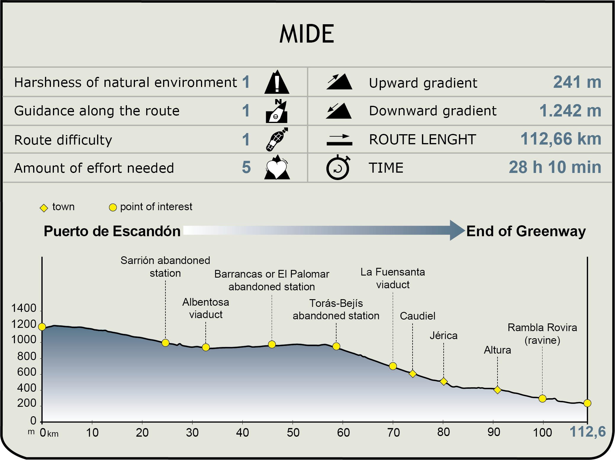
MIDE (Method for the Information of Excursions)
 Harshness of natural environment
- 1. The environment is not risk-free
- 2. There are more than one risk factors
- 3. There are various risk factors
- 4. There are quite a lot of risk factors
- 5. There are many risk factors
 Guidance along the route
- 1. Well defined trails and crossings
- 2. There is a clearly marked trail and signage
- 3. Requires the identification of geographic features and cardinal points
- 4. Requires off-path navigation
- 5. The trail is interrupted by obstacles that have to be gone around
 Route difficulty
- 1. Walking on a flat surface
- 2. Trails with different types of path
- 3. Walking on stepped paths or irregular terrain
- 4. The use of hands or jumping over the terrain is necessary
- 5. The use of hands is required to progress
 Amount of effort needed
- 1. Up to 1 hour of continuous walking
- 2. Between 1 and 3 hours of continuous walking
- 3. Between 3 and 6 hours of continuous walking
- 4. Between 6 and 10 hours of actual walking
- 5. More than 10 hours of continuous walking
Featured
Further information
A difficult choice
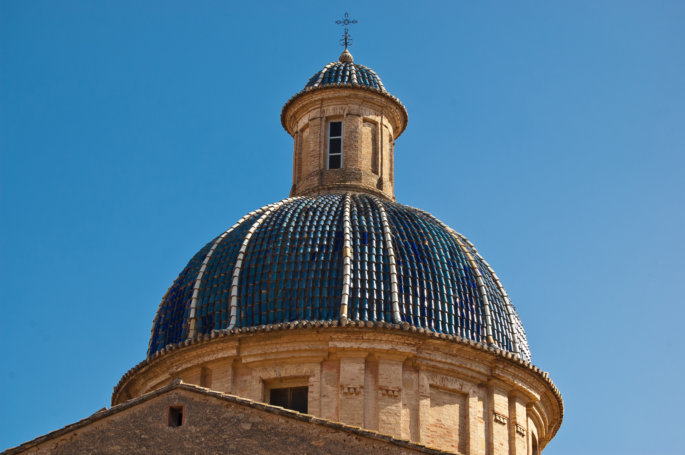
This trip, which is over 112 km long, traverses numerous landscapes of great environmental value, such as: SCI Sabinares del Puerto Escandón, SCI Sierra de Javalambre II, SCI Alt Palància and SCI Curs mitjà del riu Palància. The countless municipalities and their beauty make it impossible to choose. The monumental complex of Segorbe; Sarrión and its San Pedro church; Albentosa, with its stunning viaduct; La Puebla de Valverde; Barracas, a traditional visit; Viver Caudiel, Jérica; Navajas, where the beauty of the Salto de la Novia will fascinate the traveller; Altura, Soneja, Algimia de Alfara and the impressive village of Sot de Ferrer, with its palace, church and shrine. They are all worth a visit!/p>
Multimedia