- Home
- Rural Development
- Nature Trails
- Nature Trails
- South Sector
La Sierra Greenway Nature Trail
Description
In territory of the otter
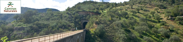
This route passes through a total of 29 tunnels carved out of the heart of the mountains for the railway line that sought to join Jerez and Almargen. The longest tunnel, which is nearly 500 metres in length, is located at the end of the route. Despite this massive endeavour, the Civil War doomed the completion of the project.
The route starts at Olvera station. This town, with Arab influences, was designated a Historic-Artistic Site, and is part of the Route of White Villages. The former railway stop has been restored and transformed into a small hotel with a restaurant, next to which is a sports park.
The initial section of this Trail runs between olive groves typical to this area. The name of the town, Olvera, is etymologically derived from "Olivera". A large variety of birds can be seen, including blackbirds (Turdus merula), robins (Erithacus rubecula), great tit (Parus major), starlings (Sturnus unicolor), goldfinches (Carduelis carduelis), and even some common house martins (Delichon urbica) that have built their mud nests on the rocks outside the tunnels.
The route continues to Navalagrulla station, the only one yet to be restored. There is a rest area and car park available for those who wish to start their journey here. Somewhat past the station, the route traverses through an extensive farm with fighting bulls, who will no doubt greet the travellers from the other side of the fence. From here to the end of the route at Puerto Serrano, the Trail winds through Mediterranean scrubland dotted with large wild olive trees (Olea europaea var. sylvestris), mastic trees (Pistacia lentiscus) and carobs (Ceratonia siliqua).
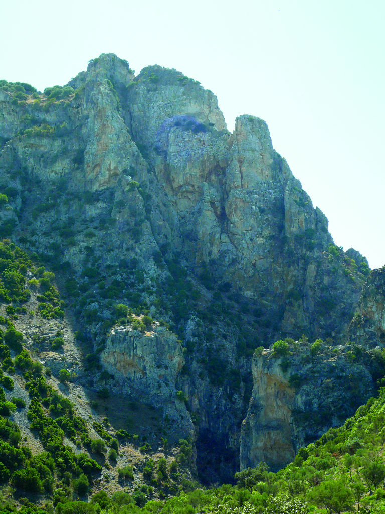
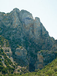
Almost halfway through the Trail, the route continues across a rugged landscape, wedged between small mountains and limestone walls carved by rivers, to Peñón de Zaframagón Nature Reserve. At its foot flows the River Guadalporcún, meeting point for griffon vultures (Gyps fulvus) and, with a little luck, even an Egyptian vulture (Neophron percnopterus) or Bonelli's eagle (Hieraaetus fasciatus), which also nest in the reserve.
A few metres ahead are the Peñón de Zaframagón Reception Centre and Vulture Observatory, open year-round. It contains a small interpretative exhibit on the Nature Reserve and its biodiversity, with particular reference to this Nature Trail and the towns through which it passes. Of particular interest is the live broadcast of vultures nesting in the Peñón that is shown on the first floor.
The route continues to a junction with another path that leads to La Alberquilla's fountain and megalithic site. The fountain is built over a Roman irrigation ditch that can still be seen today, near the megalithic site where a dolmen still stands. Soon after, the Trail reaches Coripe Station, also restored and turned into a hotel with a restaurant. The rest area with car park and an information point provides the visitor a chance to rest.
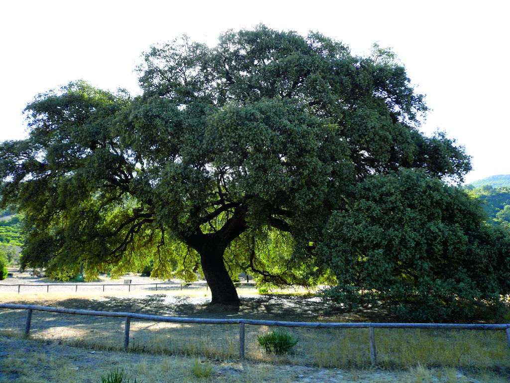
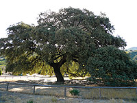
Before crossing the Coripe Viaduct, a path leads to El Chaparro de la Vega Natural Monument, where an ancient oak, standing over 14 metres high, with a crown measuring 30 metres in diameter, can be found about 500 metres from the road. This is the traditional meeting place and venue the countless festive events that bring together Coripe's inhabitants, including the pilgrimage in honour of Nuestra Señora de Fátima, which takes place on the second Sunday of May.
The route continues onwards from Coripe across the Cordel de Morón, an old cattle trail leading to La Toleta recreation area, where travellers can camp with prior permission from Coripe town council. The point at which the rivers Guadalporcún and Guadalete meet is one of the most important places in the province of Cadiz.
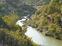
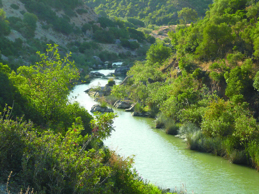
From here, the route runs parallel to the River Guadalete for several kilometres, first through stands of poplars(Populus sp.), and later oleanders (Nerium oleander), tamarisks (Tamarix sp.) and other riparian shrubs. It traverses a landscape in which the impressive Gillette and Los Azares viaducts stand out. Birds typical to riparian forests populate this area, including orioles (Oriolus oriolus), wagtails (Motacilla sp.) and, even, the kingfisher (Alcedo atthis).
After crossing both viaducts, the landscape changes to farmland with olive groves and small vegetable gardens. Further on, the beautiful town of Puerto Serrano appears in the distance. The route first approaches the Nature Trail Interpretation Centre and, soon after, the former local station turned into a rural hotel and a restaurant. A new rest area and car park mark the end of the route.
There are few other routes near La Sierra Nature Trail, except for a few footpaths that start from the towns through which it passes. However, the area is worth visiting for the Trail itself and the services available.
Map
Puntos de Interés
Geología
Hidrografía
Infraestructura
- Túnel de la Reyerta
- Túnel del Indiano
- Viaducto de los Azares
- Túnel del Yaja
- Túnel de los Azares
- Túnel del Descanso
- Viaducto del Gillete
- Túnel de Olvera
- Túnel del Testarudo
- Túnel del Afeitado
- Túnel de Faloir
- Túnel del Navazo
- Túnel de la Higuerilla
- Túnel del Champiñón
- Túnel de Zamarra
- Túnel del Mulo
- Túnel de Bastian
- Túnel del Atajo
- Túnel de Navalagrulla
- Túnel del Esqueleto
- Túnel de la Francesa
- Túnel del Salado
- Viaducto de Zaframagón
- Túnel del Castellar
- Túnel del Galletón
- Túnel de la Alberquilla
- Túnel de Coripe
- Túnel de la Dehesa Nueva
- Túnel de Zaframagón
- Viaducto de Coripe
- Túnel de La Chopera
- Túnel de La Colada
- Túnel del Castillo
- Túnel de la Avioneta
Municipio
Orografía
Profile
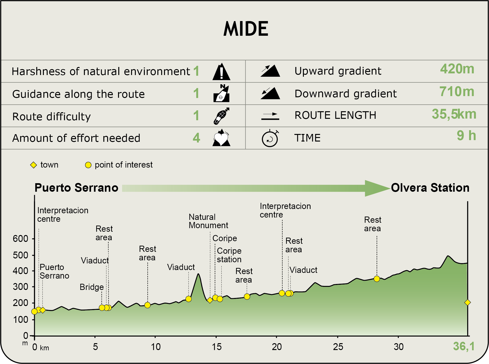
MIDE (Method for the Information of Excursions)
 Harshness of natural environment
- 1. The environment is not risk-free
- 2. There are more than one risk factors
- 3. There are various risk factors
- 4. There are quite a lot of risk factors
- 5. There are many risk factors
 Guidance along the route
- 1. Well defined trails and crossings
- 2. There is a clearly marked trail and signage
- 3. Requires the identification of geographic features and cardinal points
- 4. Requires off-path navigation
- 5. The trail is interrupted by obstacles that have to be gone around
 Route difficulty
- 1. Walking on a flat surface
- 2. Trails with different types of path
- 3. Walking on stepped paths or irregular terrain
- 4. The use of hands or jumping over the terrain is necessary
- 5. The use of hands is required to progress
 Amount of effort needed
- 1. Up to 1 hour of continuous walking
- 2. Between 1 and 3 hours of continuous walking
- 3. Between 3 and 6 hours of continuous walking
- 4. Between 6 and 10 hours of actual walking
- 5. More than 10 hours of continuous walking
Featured
Further information
Guadal: Rivers in the south of the Iberian Peninsula
Throughout much of its itinerary, the La Sierra Nature Trail runs along two rivers: Guadalporcún and Guadalete, both in perfectly preserved. Their common denominator with other rivers in the south of the Iberian Peninsula is that their names start with Guadal. It appears that these names derive from the Arabic word “Wadi” meaning river or stream.
The rivers of the Mediterranean Iberian Peninsula, in particular those whose names begin with “Guadal”, are highly seasonal, with a stable water level throughout the year except in summer when they are almost completely dry. The remaining water is trapped in small ponds which maintain riparian biodiversity in the dry season. However, this does not affect the number of species that inhabit these waters, including endangered species like the otter (Lutra lutra) which finds shelter here.
Multimedia