
- Home
- Rural Development
- Nature Trails
- Nature Trails
- Central Sector
- Valle del Lozoya
Lozoya Valley Nature Trail
Description
A walk through the mountains of Madrid
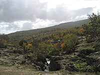
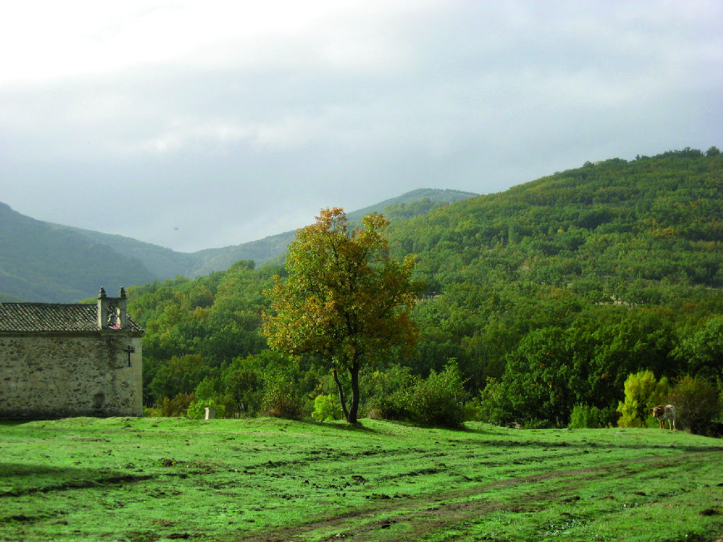
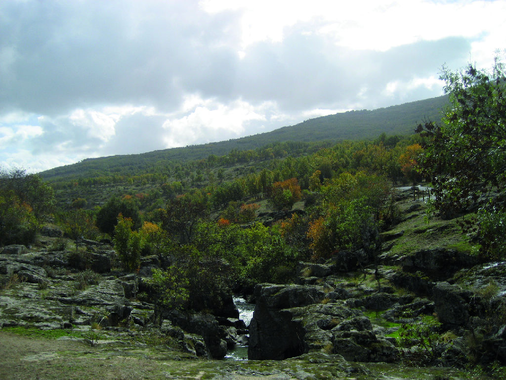
This Trail consists of a main route, and six additional itineraries, which provide the opportunity to discover the southern slopes of Sierra de Guadarrama, in the northwest of the Community of Madrid. It traverses through a valley dotted with shrines hidden in centennial pine forests, accompanied throughout by the River Lozoya. Its rich biodiversity includes endangered species like the imperial eagle (Aquila adalberti) or Graellsia, a moth unique in the world.
- - - - - - - -
IMPORTANT WARNING: DUE TO RESASONS BEYOND THE CONTROL OF THE NATURE TRAILS PROGRAMME, THE CONSERVATION CONDITIONS OF THIS TRAIL ARE BELOW THE REQUIRED STANDARDS, AND MAY NOT BE ALWAYS PASSABLE IN SOME SECTIONS!
- - - - - - - -
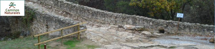
The Trail begins near KM 27.6 of M-604, at Puente del Perdón, built in the eighteenth century. Here also begins the first itinerary (Route of the Batanes). This itinerary takes its name from the estate through which it passes. It runs past the nearby Monastery of Santa Maria del Paular, a must-see, where you can also visit the Giner de Los Rios arboretum, a miniature botanical garden of exotic tree species that is best enjoyed in the spring and fall. This itinerary runs parallel to M-604, and ends a few hundred meters from the exit to Rascafría, next to a bridge over the river Lozoya, where it meets the main road.
From Puente del Perdón, the main route crosses the river into a poplar grove where one can enjoy the peacefulness of the valley. At the ruins of an old school, the route passes through a gate and continues to Rascafría through agricultural farms and grazing lands, the molino de las Briscas bridge crossing over River Lozoya.
After crossing Artiñuelo Brook, the route enters the village and winds down Cascajales Avenue, which runs parallel to the brook. After a short tour of the village, the route reaches a roundabout with a lamppost in the centre and crosses the road from Puerto de la Morcuera (M-611), passing next to Rascafría's cemetery. It then continues along a livestock trail through "Los Grifos" housing development, a pleasant walk through ash (Fraxinus sp.) and hazel trees (Corylus avellana) towards Oteruelo Valley. After crossing the town through the Real street and then Río street, the Nature Trail forks, providing an opportunity to continue along the main route to Alameda del Valle, or take the second itinerary to the shrine of Santa Ana.
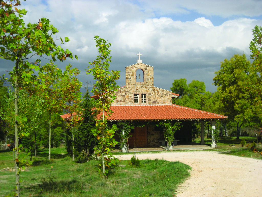
The route to the shrine of Santa Ana starts at the end of Real de Oteruelo del Valle Street, traverses a rest area, crosses the river Lozoya and continues until a livestock enclosure, from where it heads towards a small bridge with a cattle grid that leads to a beautiful Pyrenean oak grove. A few kilometres further on, the Trail narrows into a winding path that crosses over Santa Ana Brook, and reaches an esplanade where the shrine sits. Not only can the shrine be visited, but the mountain landscape is also worth enjoying. The route returns to a wide road marked by a cross to honour the shepherds, and continues towards Alameda del Valle, passing next to a helipad and, after having crossed River Lozoya, a park. This alternative joins the main route in Pinilla del Valle.
Back on the main route, the road leaves Oteruelo folowwing Cascajares road, passing by de cemetery and folowwing a path that, among ash trees, reaches Alameda del valle. The route passes to the south of this town, leaving it along Cercas street, which passes by a cemetery and is headed to Pinilla dle Valle. The trail enters Pinilla along Embalse Street, whence the first views of the nearby reservoir can be seen. Nearby is one of three Pleistocene deposits that exist in the municipality. The route moves on to the town council, where the Church of San Miguel Arcángel is worth a visit.
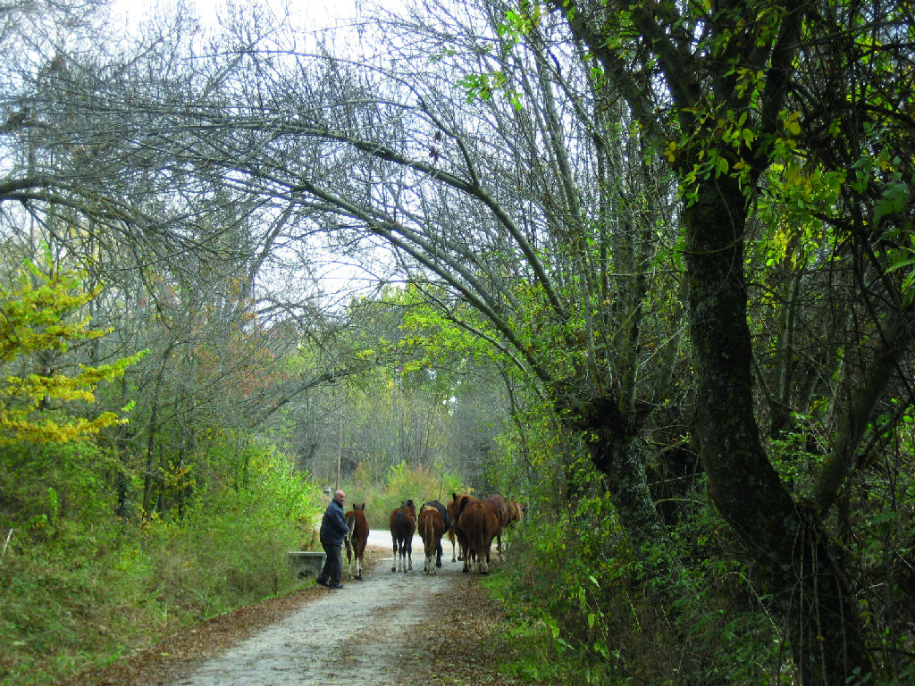
The third itinerary of the Nature Trail (Route of Ermita de la Concepcion) starts at Pinilla del Valle. It climbs towards M-604 road, after a forest with London plane trees, popplars, pines and ashes which has also a picnic area, the trail crosses under the road and arrives at the shrine of La Concepción. To return to the main route, just retrace one’s steps to Pinilla. After leaving the village, the Trail moves away from the river between pollarded ash trees, a clear sign of the importance of livestock farming for the region. The route now turns towards the reservoir, along whose side it runs until Lozoya, traversing through an inviting corridor of centennial Pyrenean oaks (Quercus pyrenaica).
Before reaching Lozoya, it is possible to experience the fourth itinerary, a loop path (Route of Ermita de la Fuensanta). This requires venturing into the village, to the Church of San Salvador, from where a steep street, overshadowed by an electric turret, leads out of Lozoya while enjoying beautiful views of the valley.
The shrine of Fuensanta, built in a hollow sheltered from the cold winds of winter and the harsh summer sun, has a fountain whose crystal mountain waters are the most famous in Madrid.
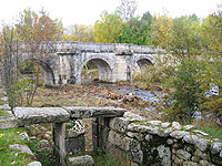
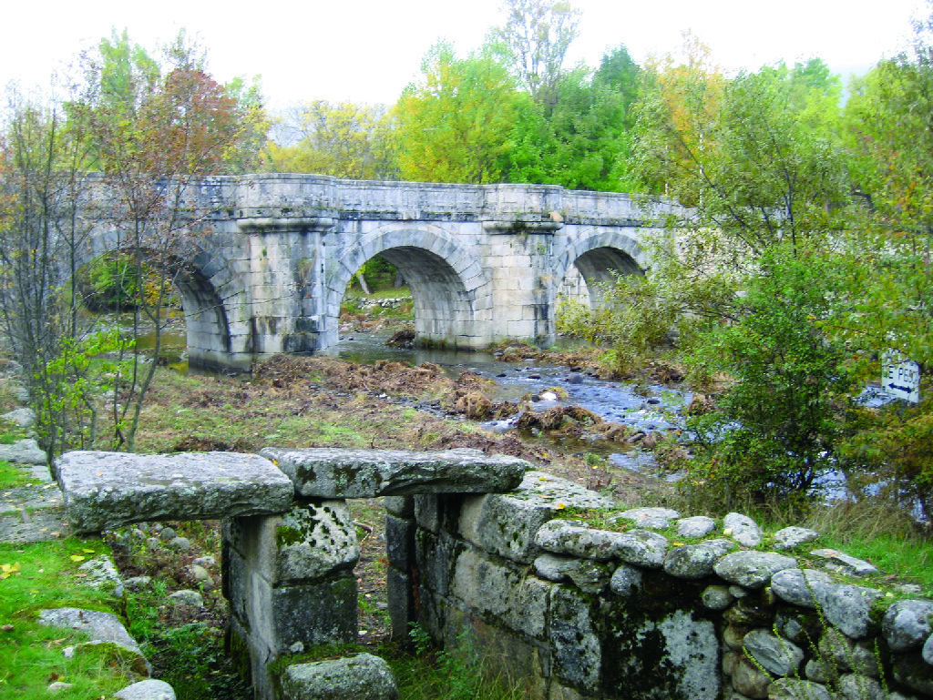
Back on the main route, the Trail continues near the reservoir, skirting the village, and then turns on to a small paved section that gives access to the facilities of the reservoir. Here the Trail heads towards the medieval bridge of Canto or Congosto. This medieval bridge crosses the River Lozoya at a point where the waters run fast and deep, in particular when the reservoir gates are opened.
As the Trail advances, the slopes became steeper, though not insurmountable. It borders Lozoya at mid-slope, and continues to the old Matafrailes Bridge, from where the fifth itinerary (Canencia Route), which leads south to the town of Canencia, can be accessed.
Back on the main route, the Trail cross the M-629 to Canencia Mountain Pass, and continues along a stretch with less vegetation due to grazing livestock. In this section, before Garganta de los Montes, the rising terrain provides views of the Riosequillo Reservoir.
Before reaching Garganta de los Montes, the sixth and last itinerary of this Nature Trail heads directly to El Cuadrón, or to the shrine of Los Prados.
This branch, called the Route of La Ermita de los Prados, continues climbing south until a cattle grid, where it turns onto a fenced path that leads to the shrine, and a rest area with tables. This itinerary ends climbing down to the edge of Garganta de los Montes, where it joins the main route.
The main route doesn't reaches Garganta de los Montes, skirting it by the south. Leaving the town behind along Valdemanco road, the Nature Trail heads to El Cuadrón Tourism Office, the endpoint of this Trail. This stretch is steeper with fewer trees, a landscape with abundant shrubs typical of the highlands.
Map
Puntos de Interés
Cultura
- Puente del Perdón
- Ermita de Santa Ana
- Ermita de Nuestra Señora de la Concepción
- Puente de Entretérminos
- Ermita del Santo Cristo
- Puente del Canto
- Puente de Matafrailes
- Zona de recreo
- Monasterio de Santa María de El Paular
- Puente del Congosto
- Ermita de Nuestra Señora de los Prados
- Ermita de Nuestra Señora de la Fuensanta
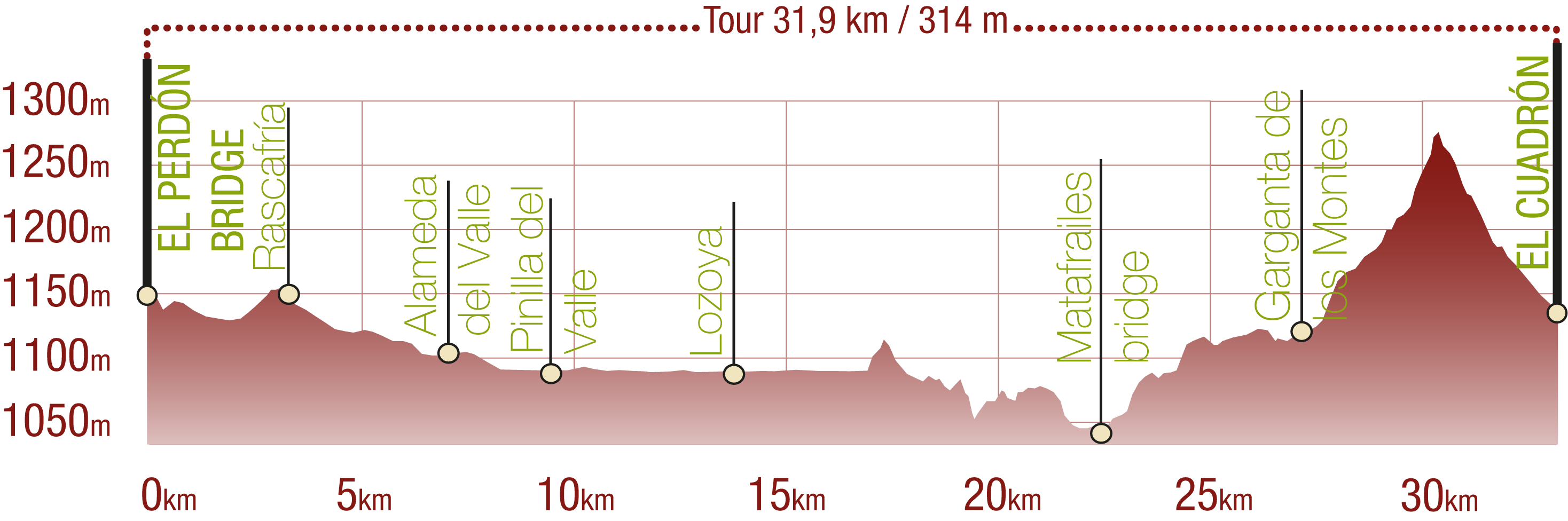
Profile
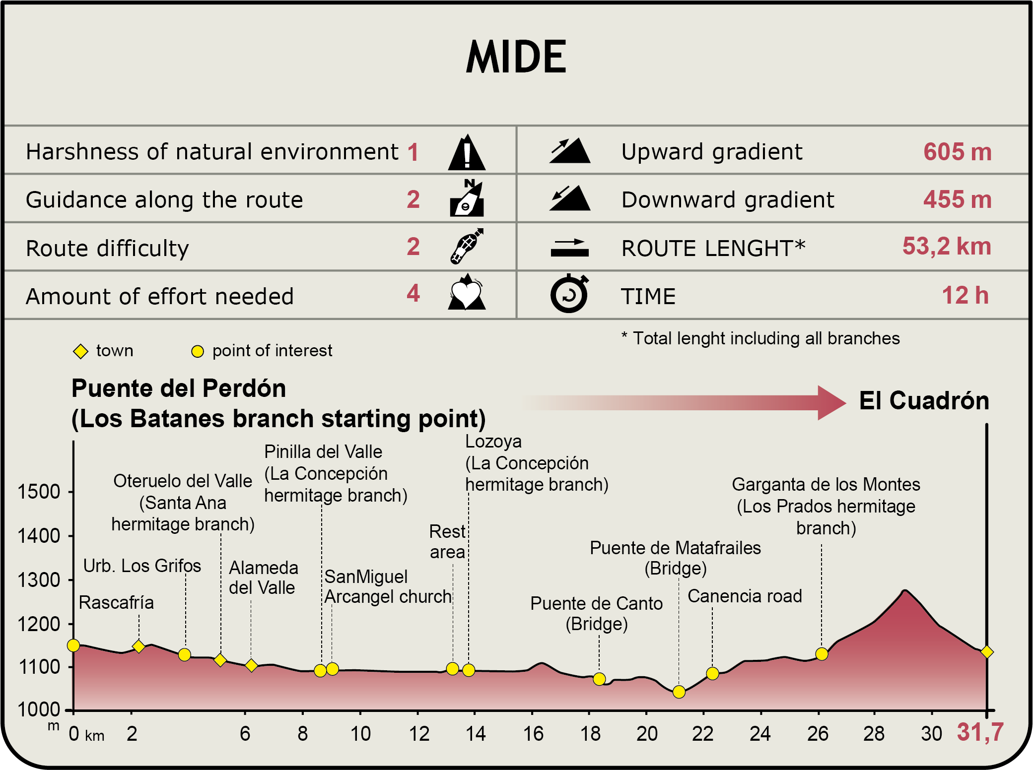
MIDE (Method for the Information of Excursions)
 Harshness of natural environment
- 1. The environment is not risk-free
- 2. There are more than one risk factors
- 3. There are various risk factors
- 4. There are quite a lot of risk factors
- 5. There are many risk factors
 Guidance along the route
- 1. Well defined trails and crossings
- 2. There is a clearly marked trail and signage
- 3. Requires the identification of geographic features and cardinal points
- 4. Requires off-path navigation
- 5. The trail is interrupted by obstacles that have to be gone around
 Route difficulty
- 1. Walking on a flat surface
- 2. Trails with different types of path
- 3. Walking on stepped paths or irregular terrain
- 4. The use of hands or jumping over the terrain is necessary
- 5. The use of hands is required to progress
 Amount of effort needed
- 1. Up to 1 hour of continuous walking
- 2. Between 1 and 3 hours of continuous walking
- 3. Between 3 and 6 hours of continuous walking
- 4. Between 6 and 10 hours of actual walking
- 5. More than 10 hours of continuous walking
Featured
Further information
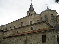
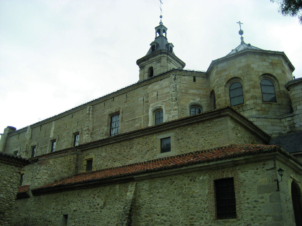
Monastery of Santa Maria de El Paular
The Monastery of Santa Maria de El Paular, located in Lozoya Valley, was declared a National Monument in 1876, due to its beautiful architecture, a combination of Gothic and baroque elements.
The Monastery dates back to 1390, when King John I of Castile ordered its construction, a few days before his death, by order of his father Henry II. The first dwellers were Cartesian monks, who arrived the following year, and remained in the monastery until its confiscation in 1835. This monastery was one of the most important in Spain of the Cartesian Order.
Since 1954, the Monastery has been inhabited by a small Benedictine community that take care of the building and cater to the visitors.
Visiting and mass hours can be found on the website www.monasterioelpaular.com y en el teléfono 91.8 69.14.25..
Multimedia
Downloads
GPS downloads
Brochure and maps
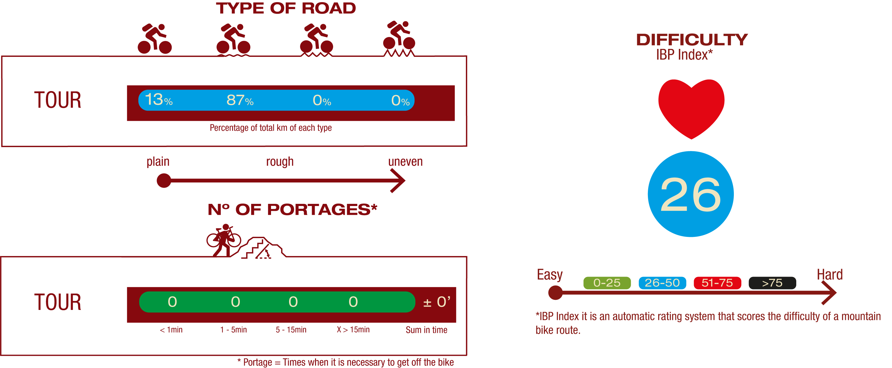
Cyclability
PROFILE
TYPE OF ROAD, PORTAGES & DIFFICULTY
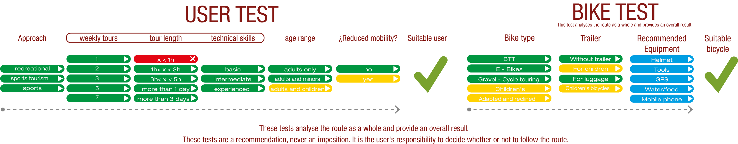
TEST
SAFETY RECOMMENDATIONS
- Sections shared with hikers.
- Transit through the centre of some population centres.
GENERAL RECOMMENDATIONS
- Find out about the technical aspects of the route and the weather on the day.
- Take care of the environment. Take care not to disturb animals or damage vegetation. Respect private areas.
- You must give priority to pedestrians and comply with general traffic rules.
- The environment in which you will be riding is open, free to move around and an area where many activities are carried out (sporting, forestry, livestock and agricultural activities). Always have an understanding, prudent, responsible and respectful attitude.