- Home
- Rural Development
- Nature Trails
- Nature Trails
- South Sector
- Valle del Almanzora
- Tramo ElHijate-Olula
Almanzora Valley Greenway. El Hijate - Olula del Río
Description
Iron mineral has given way to a history-filled cycletouring route.
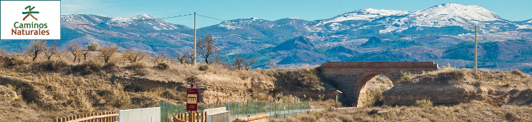
Ride along the spectacular Almanzora River Valley, surrounded by the Sierra de Baza and Sierra de Filabres mountains where tonnes of iron mineral were moved for decades. Villages loaded with history, especially during the Reconquest, line the route. Many of them are set into the mountainside, making them even more breath-taking. Stations, loading areas and many bridges take travellers on a unique railway experience between Hijate and Olula del Río.
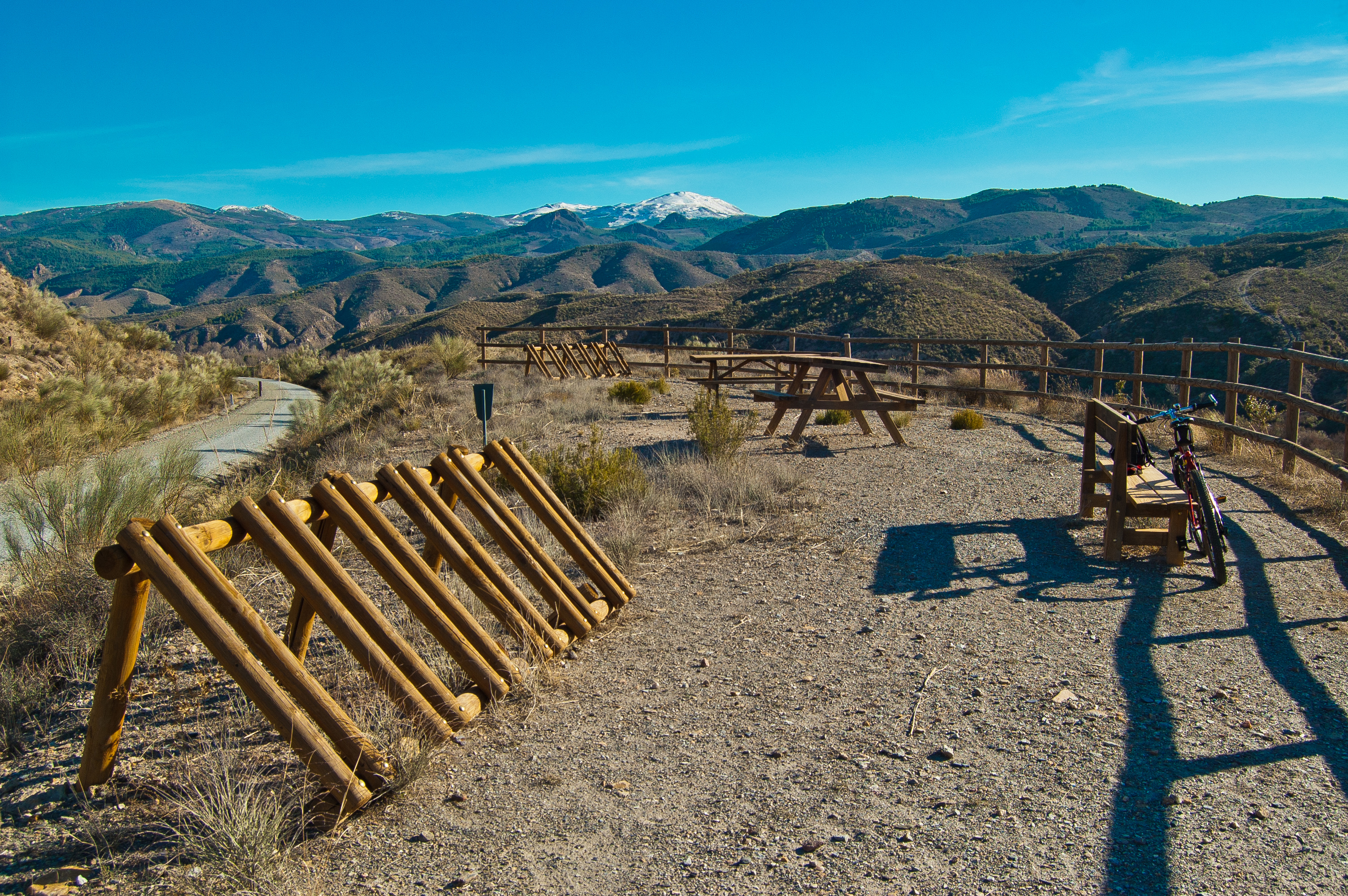
The Almanzora Valley Greenway Nature Trail winds through the province of Almería, starting out at 400 m in altitude at the old Hijate station on the other side of road A-334 bordering the province of Granada. The route is ideal for bike riding and suitable for less-experienced cycletouring enthusiasts as most of the nearly 36 km is descending.
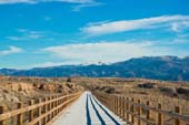
The pleasure of the route can already be felt upon setting out as cycletourists are rewarded with spectacular views of the Filabres mountains, the summits of which are covered in snow in the winter. Just after the first kilometre, you pass by the Pinotada gully and, a short time later, you go under a bridge used by road AL-6403. Both of them could easily go unnoticed as the old railway route continues on with a predominant descending slope.
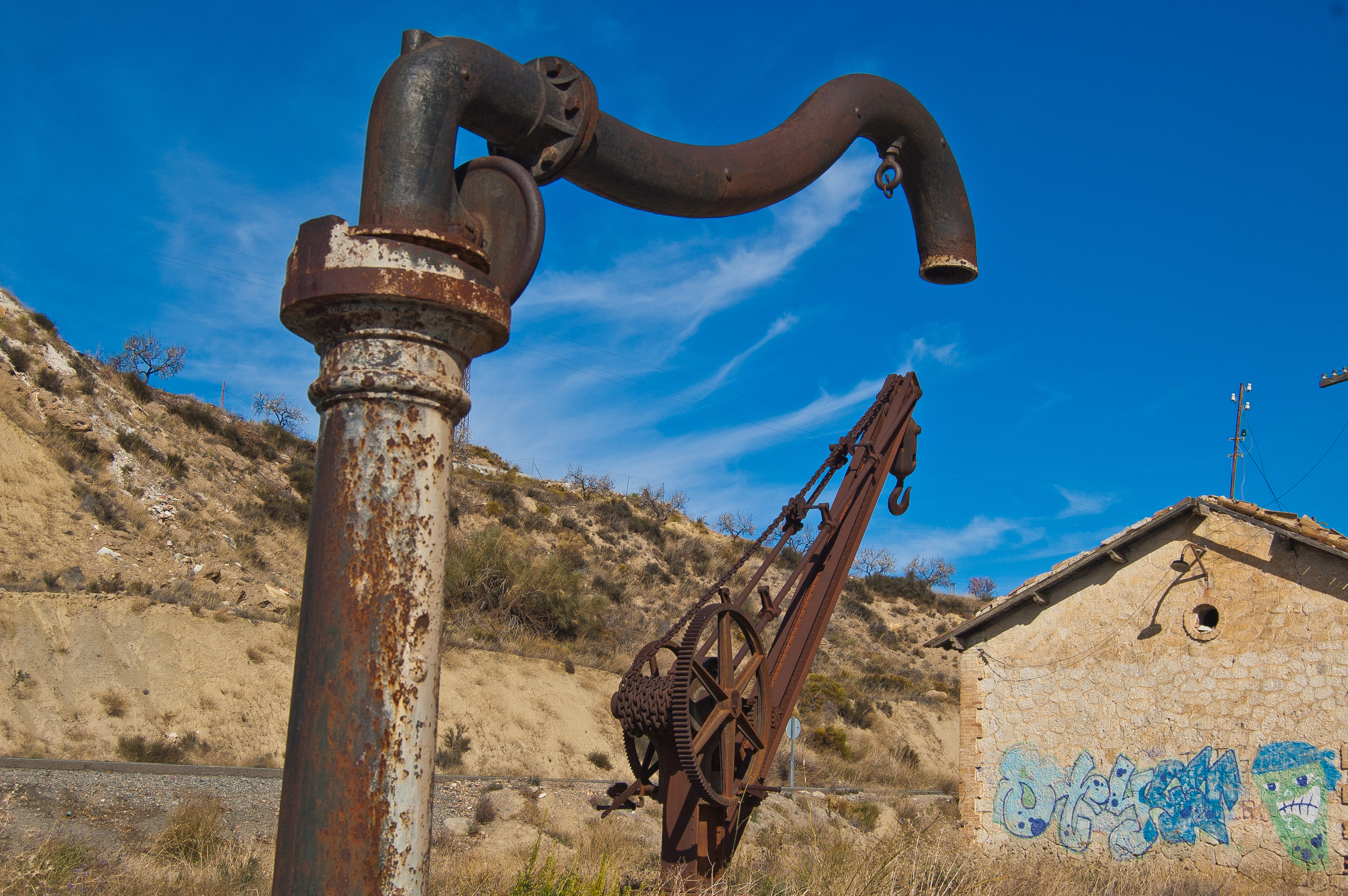
The sight of a wind power station to the left of the trail precedes the Hijate ravine and, once past that, there’s a visitor’s sign describing what is known as the “Iron Stretch”. After going well past kilometre point 5 and right after a curve to the left, you get to the Tesorero loading area - a stone structure where the more than 15 km of cable carrying the iron mineral-loaded cars from the Tesorero mines in the municipality of Baza ended. Finally, they were loaded onto trains and taken to the Murcian town of Águilas.
Next, the El Mirador rest area lives up to its name, offering unbeatable views of the Almanzora River Valley and the Sierra de Filabres mountains. Metres before reaching kilometre point 8, you’ll reach the crossroads leading to Fuencaliente, a little area of Serón that owes its name to a thermal spring near the urban area known as El Aljibe.
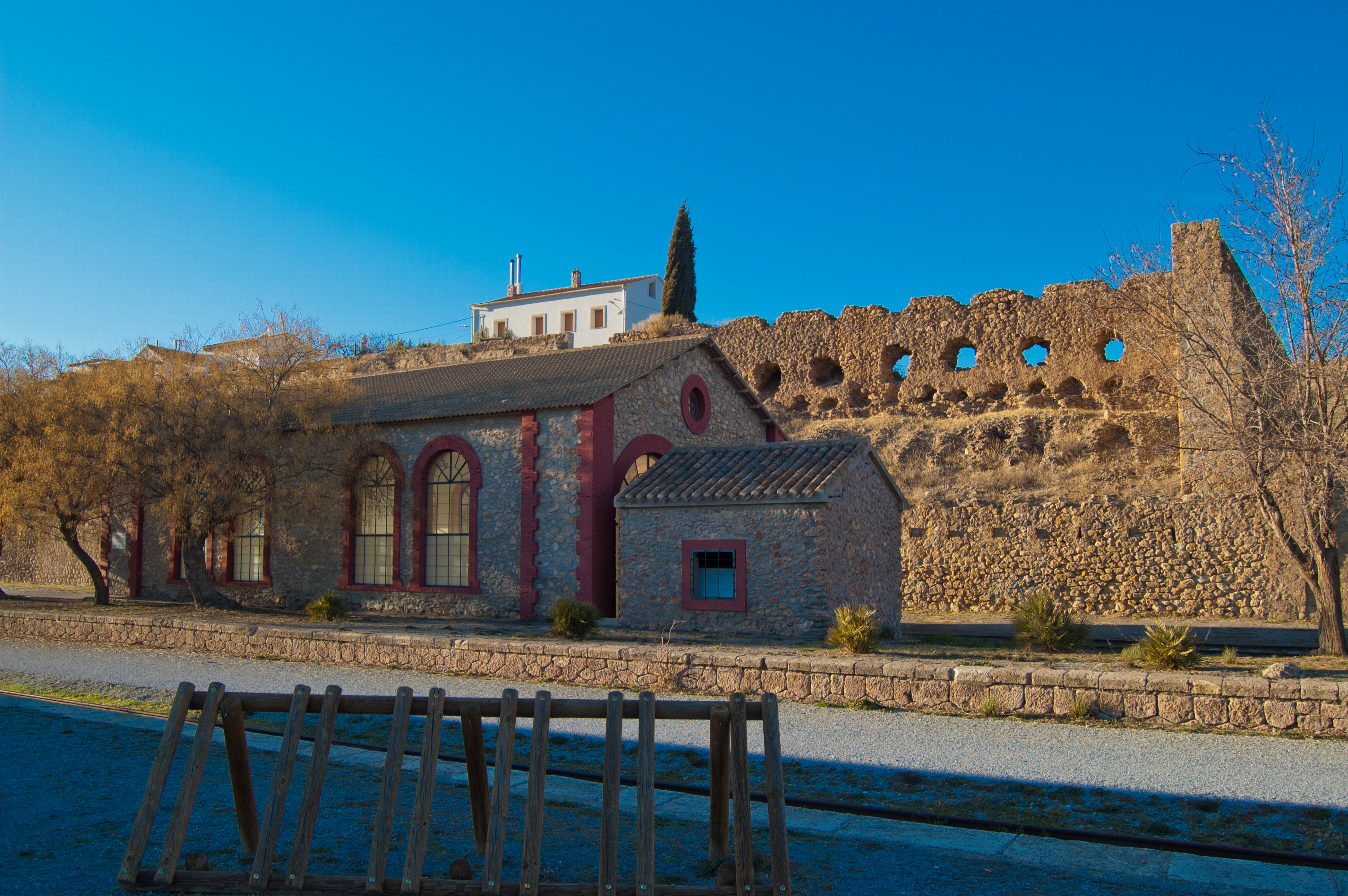
Several small areas and remote villages along the Serón line the way. The trail runs parallel to the Almanzora River bed with more and more olive groves in sight. After passing kilometre point 11, you reach the little watchman’s house that immerses travellers into the Serón station neighbourhood.
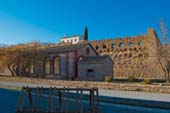
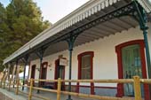
This station was very important to the railway line and iron mineral transport. Two aerial cables known as Manzano and Cortijuelo meet at the loading area. It once featured a warehouse, station, toilets, garages and loading area. The buildings have been renovated and are currently in use with the old warehouse now considered a fairytale station and the actual station housing a bar/restaurant. And a new structure is also found there> the Almanzora Valley Welcome Centre dedicated to the Air.
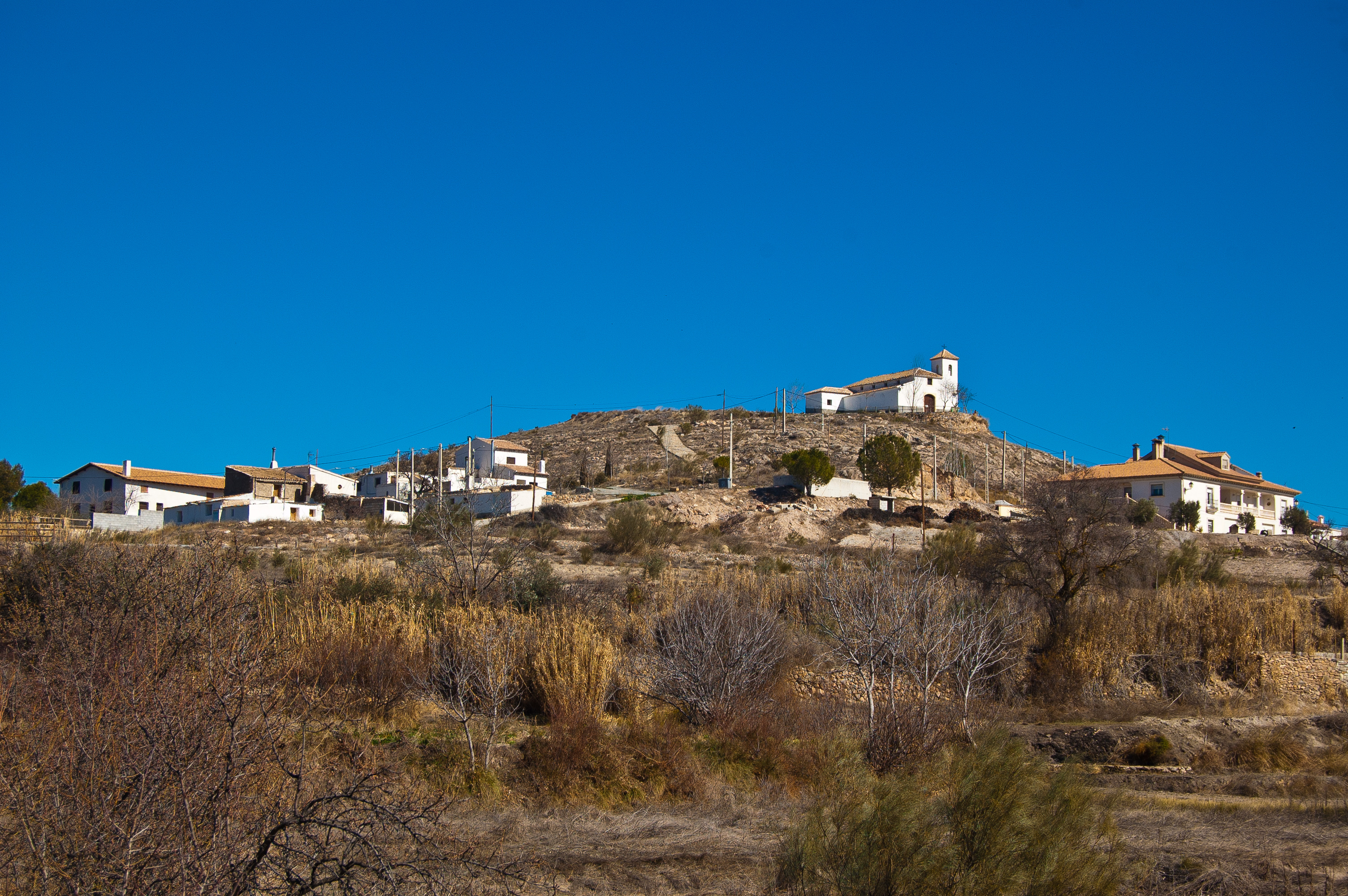
You cross the AL-6404 overpass and then head past the Los Zoilos area. From that time on, you can see the beautiful panoramic views of the Serón urban area with the Nazarí Castle and Asunción Church standing out from among all the buildings.
A newly-built underground passage runs under road A-334 and a short time later you reach kilometre point 15 and the Los Canos loading area with a capacity for 30,000 tn, which received the mineral from the Cabarga San Miguel double-rail cable carry the railway cars with the force of gravity.
You begin to see farmland with small plots of almond trees dotting the landscape with their flowers. Leaving behind kilometre point 18, you go past the triple-arch stone bridge over the Canales ravine.
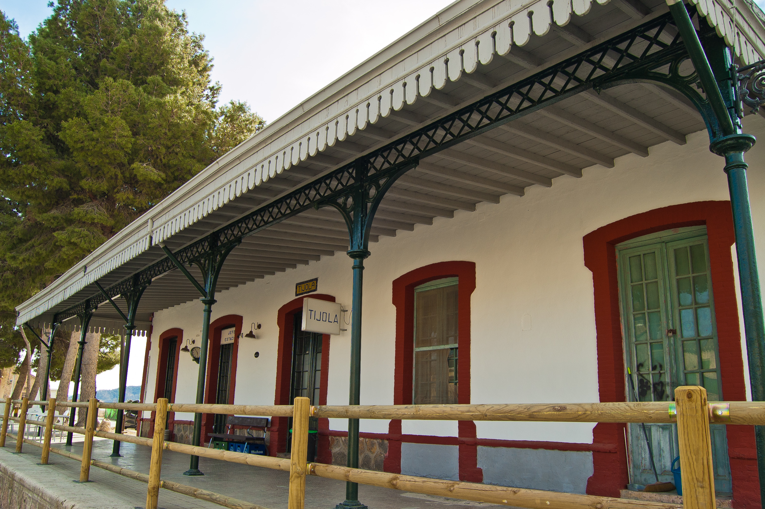
The Virgen del Carmen chapel precedes the Guanila ravine and the tank that welcomes travellers to the Tíjola station. The station building is now a bar/restaurant opposite a children’s play area. After carefully crossing road AL-6100 and right at kilometre point 20, the old RENFE 11339 locomotive welcomes travellers leaving this Tíjola station with the old warehouse reconverted into a shop school.
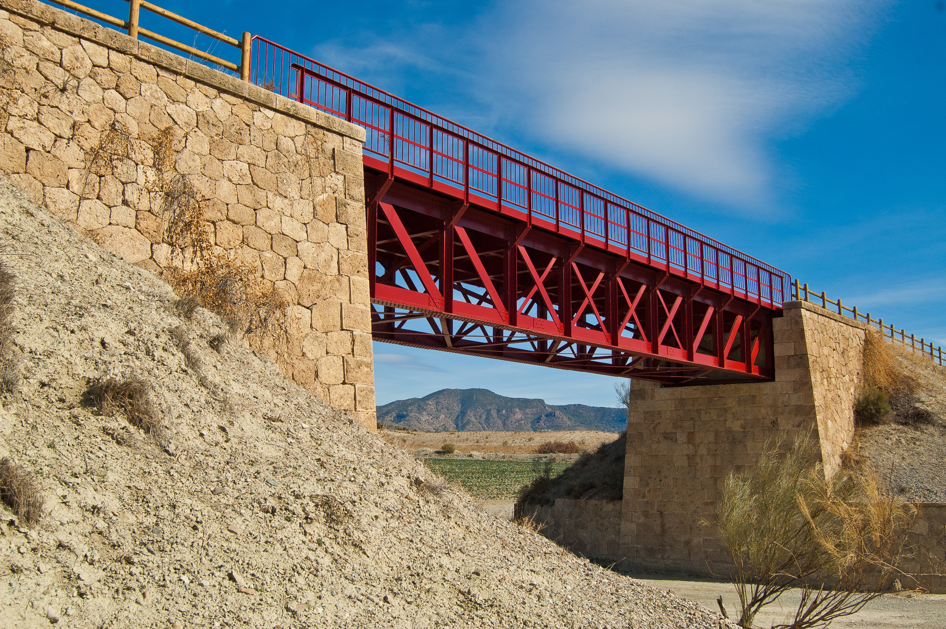
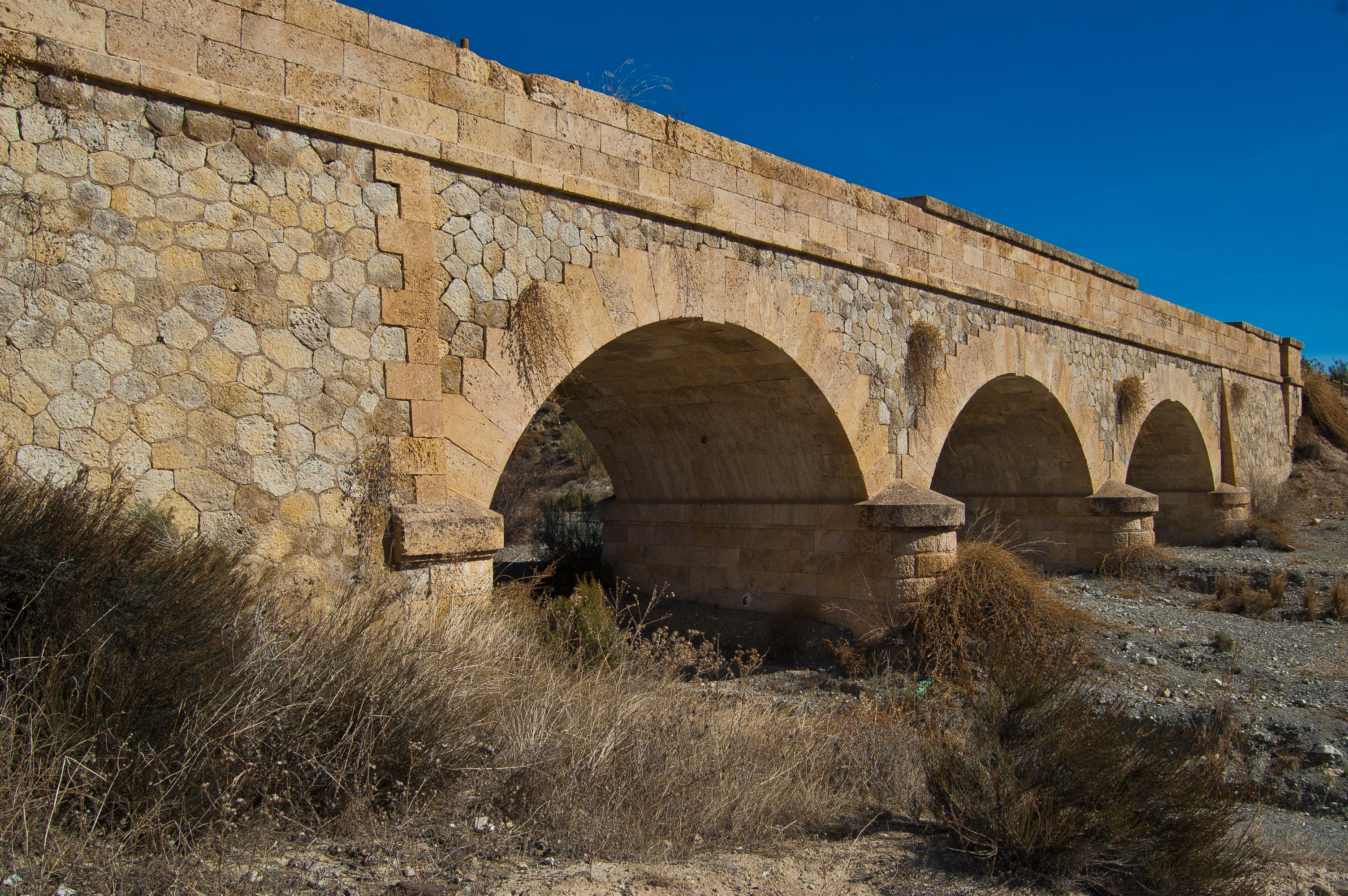
Continuing on, you reach a shared 80 m stretch which gives access to holiday homes and then, about a kilometre later, you go over the Cela ravine across its spectacular triple-arch bridge at kilometre point 22 on the trail. The Enmedio ravine is located just a few metres away as well as the Lúcar ravine, with metal bridges crossing over both.
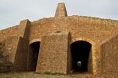
The traveller reaches the 83 m long Cañadicas Tunnel after passing kilometre point 26. Using a torch to get through this short tunnel is recommended. A triple-arch stone bridge goes over the Somontín ravine and then travellers are rewarded with panoramic views of the village of Purchena, heading parallel to road A-334.
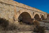
Another double-arch stone bridge goes over the Salada ravine with a 370 m shared stretch beginning a short time afterwards. After passing kilometre point 30, you reach the Purchena station which has been converted into a bar/restaurant and a little while later you begin to see all the aggregate and marble industrial sites the area is famous for.
After passing kilometre 32, a stone bridge goes over the old railway and immediately afterwards you go through a newly-built underpass below road A-334. The Huitar ravine, which you cross via metal bridge, precedes kilometre point 33 parallel to road A-334, which you leave to the left of the trail.
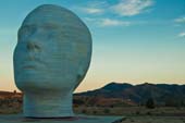
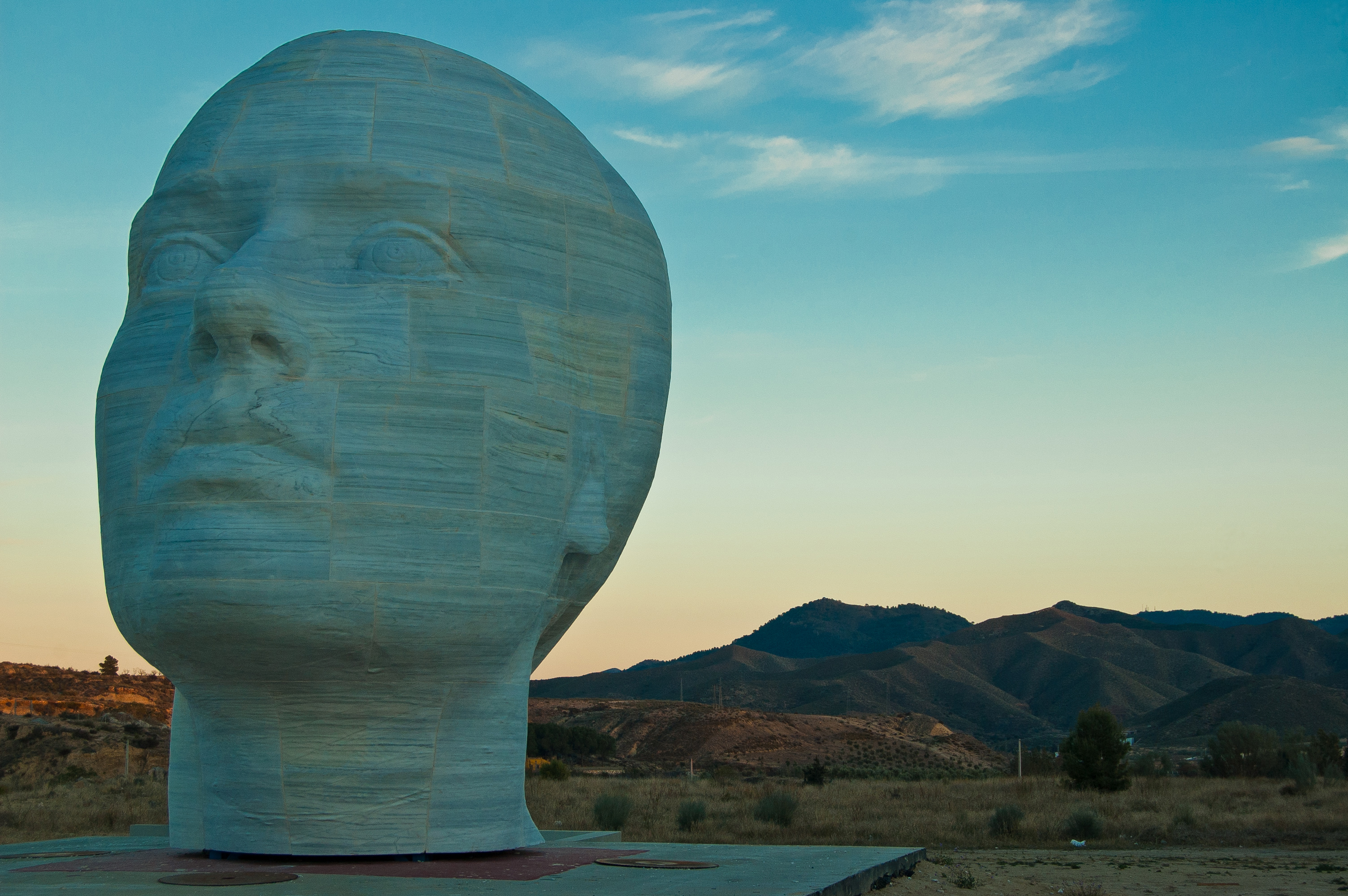
The majestic sculpture La mujer del Almanzora (The Woman of Almanzora) at the entrance to the Casa Ibáñez museum stands out on the other side of the road. At this point, you reach kilometre 34 and begin descending with a pedestrian path to the left of the trail, now passing through Olula del Río.
Upon finishing the descent, you arrive at the Almanzora Valley Historic Railroad Nature Trail welcome sign and a few metres later, the spectacular new-built gateway that passes over road A-349, ending the journey near the old Fines-Olula station.
Sites of interest
Profile
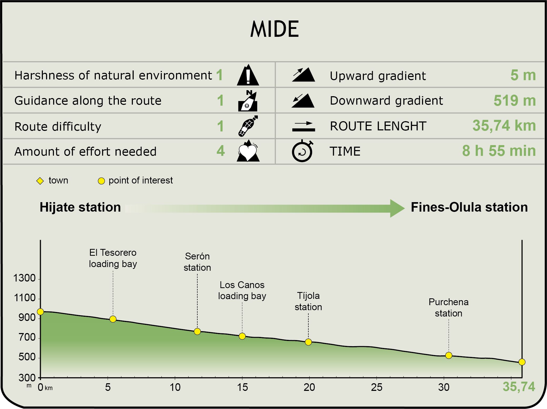
MIDE (Method for the Information of Excursions)
 Harshness of natural environment
- 1. The environment is not risk-free
- 2. There are more than one risk factors
- 3. There are various risk factors
- 4. There are quite a lot of risk factors
- 5. There are many risk factors
 Guidance along the route
- 1. Well defined trails and crossings
- 2. There is a clearly marked trail and signage
- 3. Requires the identification of geographic features and cardinal points
- 4. Requires off-path navigation
- 5. The trail is interrupted by obstacles that have to be gone around
 Route difficulty
- 1. Walking on a flat surface
- 2. Trails with different types of path
- 3. Walking on stepped paths or irregular terrain
- 4. The use of hands or jumping over the terrain is necessary
- 5. The use of hands is required to progress
 Amount of effort needed
- 1. Up to 1 hour of continuous walking
- 2. Between 1 and 3 hours of continuous walking
- 3. Between 3 and 6 hours of continuous walking
- 4. Between 6 and 10 hours of actual walking
- 5. More than 10 hours of continuous walking
Featured
Further information
Murcia-Granada Railway Line
This railway connected the Andalusian city of Granada to the Murcian town of Águilas. The idea began to arise during the 1864 Engineers Commission and most of the newly-built stretches were inaugurated in the last decade of the 19th century; however, the last one between Baza and Guadix, which completed the connection, did not begin operating until 1907. Since then, its main purpose was to transport iron mineral extracted from the Bacares mines in the Filabres mountains in cars via aerial cables to the Serón, Los Canos and Tesorero loading areas. The loads then travelled by railway to the pier in Águilas, Murcia. The Granada-Moreda-Guadix and Águilas-Almendricos-Murcia railway stretches continue to operate, but the Guadix-Almendricos central stretch was closed in 1985.
Almanzora River Valley, Sierra de Baza and Sierra de los Filabres
The Almanzora River runs through the province of Almería from its source in Alcóntar to its mouth in the Mediterranean Sea at the Almanzora Caves. A traditional entrance to Andalusia from remote times, it is markedly seasonal with the major floods in the area quite famous and particularly destructive. The Sierra de Filabres and Sierra de Baza create a single mountain chain with different names it is divided between the provinces of Almeria and Granada, respectively. The Sierra de Baza was declared a Natural Park and both mountain areas are part of the Natura 2000 Network..
Multimedia