
- Home
- Rural Development
- Nature Trails
- Nature Trails
- Northwest Sector
- La Sierra de la Demanda
Sierra de la Demanda Greenway Nature Trail
Description
In a land of oaks and wolves
This area is exceptionally humid owing to its proximity to the Cantabrian mountain range. The landscape, dominated by large oak and beech forests, is populated by many native animal species, including the Iberian wolf, whose howl can be occasionally heard in the valleys and peaks.
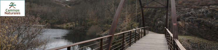
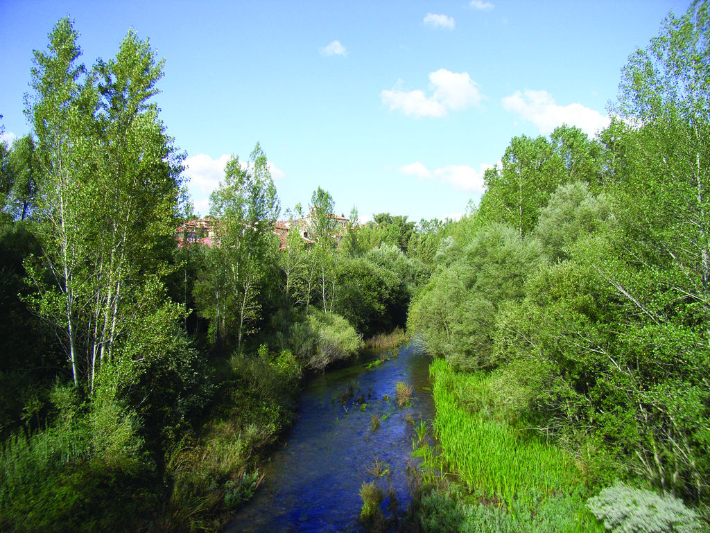
The Nature Trail, which follows an old mining railway line, starts at Arlanzón's sports centre and continues east on a gravel road 2.5 to 3 metres wide. It crosses the bridge over the River Arlanzón, and heads towards a water treatment plant, past a flat oak (Quercus sp.) forest.
After passing through another oak forest with centenary trees and pasture lands, the route crosses a firebreak and ventures into a reforestation Scots pine (Pinus sylvestris) forest studded with a few oaks.
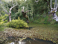
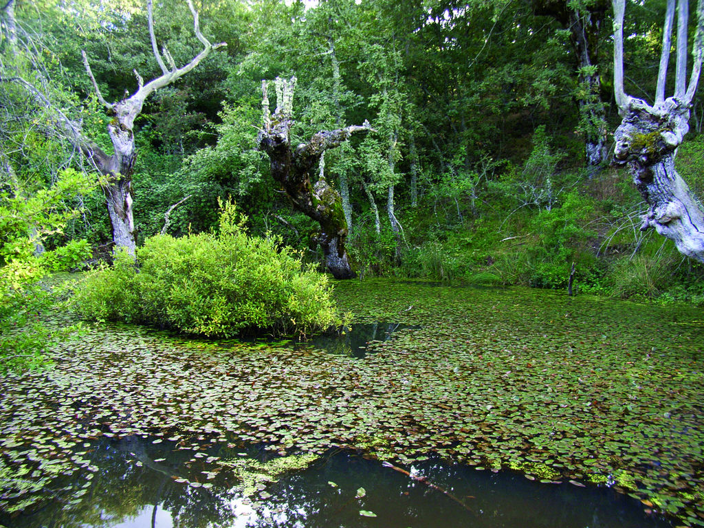
As the Trail winds through flat terrain, the mixed forest gives way to pastures. After crossing the road to Urrez, the route ventures again into a dense oak forest. Before reaching a signposted intersection, there is a small pond carpeted with water lilies (Nymphaea sp.) and a few debarked oak logs. The route continues straight ahead, and passes next to a larger lagoon where the oak groves are dotted with beeches (Fagus sylvatica).
In the next stretch, the Trail drifts away from the railway line, and winds up a steep slope to an intersection. Here, the route continues to the left towards another crossroads, where it again takes the left fork. The Nature Trail is now on flat terrain and follows again the old railway line.
The route descends through the forest, crosses a stream, and climbs again through a pine forest with two firebreaks. It reaches the edge of the reservoir and skirts along the left side at half-slope, through pine and oak groves.
It then crosses an iron and wooden bridge over a stream that flows into this reservoir, and continues along the edge to the tail end. From here, the route continues uphill through meadows, until Pineda de la Sierra ski resort, from where Picos de la Demanda is visible.
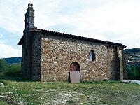
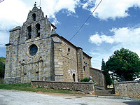
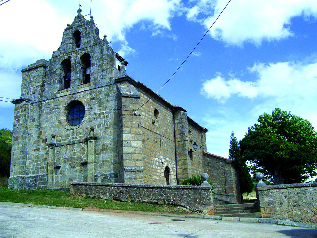
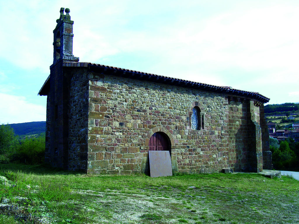
Heading straight ahead at the next two intersections, the Trail reaches a chapel situated at a crossing, opposite Pineda de la Sierra. The route continues between the town states until it reaches Bu-820 road, that is crossed.
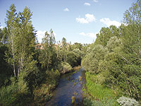
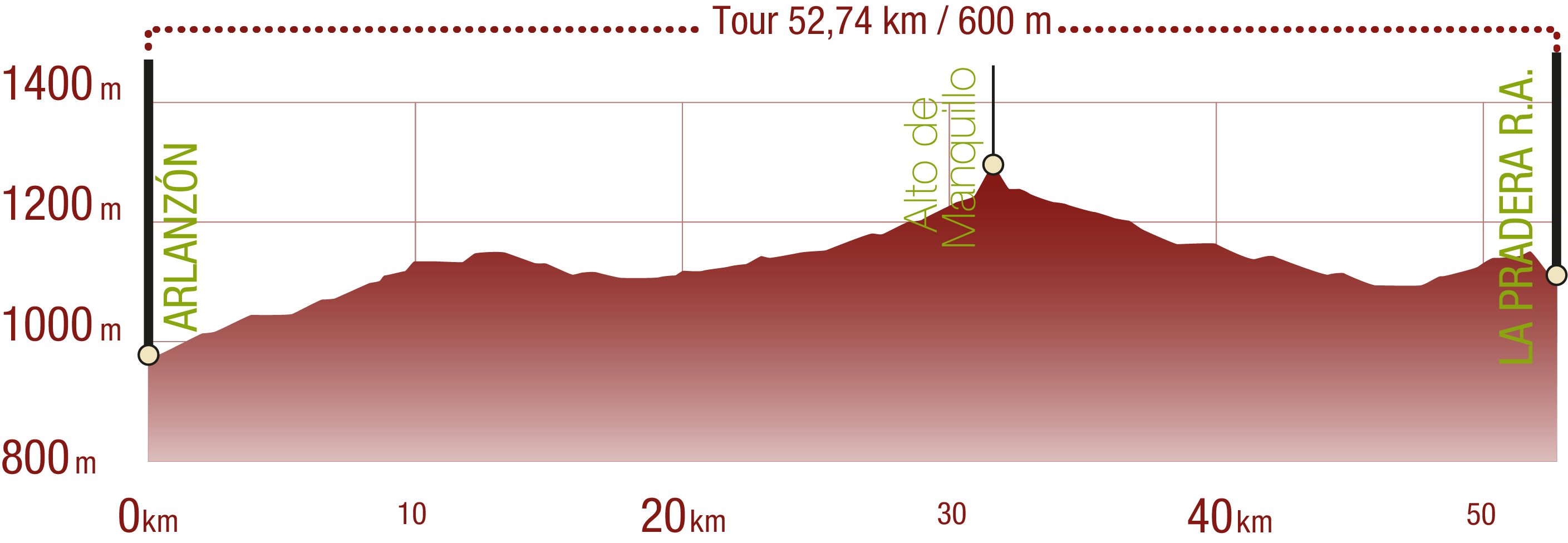
From here, the Nature Trail runs along the river through a riparian birch (Betula sp.) and beech forest. After crossing the river several times by small bridges, it passes an oak grove and continues through heathland studded with beech groves, until it reaches an intersection where the route climbs a steep slope, leaving the tunnel of the old railway line to the left. Once at Manquillo mountain pass (1,400 m), the route descends to Barbadillo de Herreros, after a brief stop to enjoy the best scenic views of the valley on this route.
The next stretch runs up a steep slope to the southeast, towards the tunnel exit, and continues across flat terrain with thick oak groves and a few beeches in the shadier areas. It follows the route of the old railway line until it intersects the road that comes from the mountain pass.
After a few kilometres, the town of Riocavado de la Sierra can be seen through the clearings in the forest. The houses of Barbadillo de Herreros appear further on. The road then passes through a lighted tunnel and crosses the road again to continue through an oak grove towards Bezares. After passing a small pond, the route opens onto vast meadows.
The Trail continues through several intersections to finally reach the small town of Bezares. It winds through meadows and crosses a small road, before heading into Las Aceras forest, populated with large tree species typical of Atlantic forests, including beeches and oaks, pines, maples (Acer sp.) and hollies (Ilex aquifolium).
After climbing down a steep slope, the Nature Trail ends at La Pradera recreation area, a beautiful place near the village of Monterrubio de la Demanda, with a fountain, a small cottage and several tables under centenary oak trees, which invite a rest.
Map
Puntos de Interés
Cultura
- Ermita de los Mártires
- Molino de San Andrés
- Centro de Acceso Yacimientos Sierra de Atapuerca
- Ermita de Costana
- Ermita de San Pedro
- Yacimientos de la Sierra de Atapuerca
- Horno de la ferrería en río Pedroso
- Antiguas minas de plata
- Minas de Cerracín
- Granja Escuela Arlanzón
- Ermita de Ntra. Sra. de Vega
- Bezares
- Ermita del Santisimo Cristo
- Altar a la Virgen de la Peña
- Molino harinero hidráulico
Vegetación
Profile
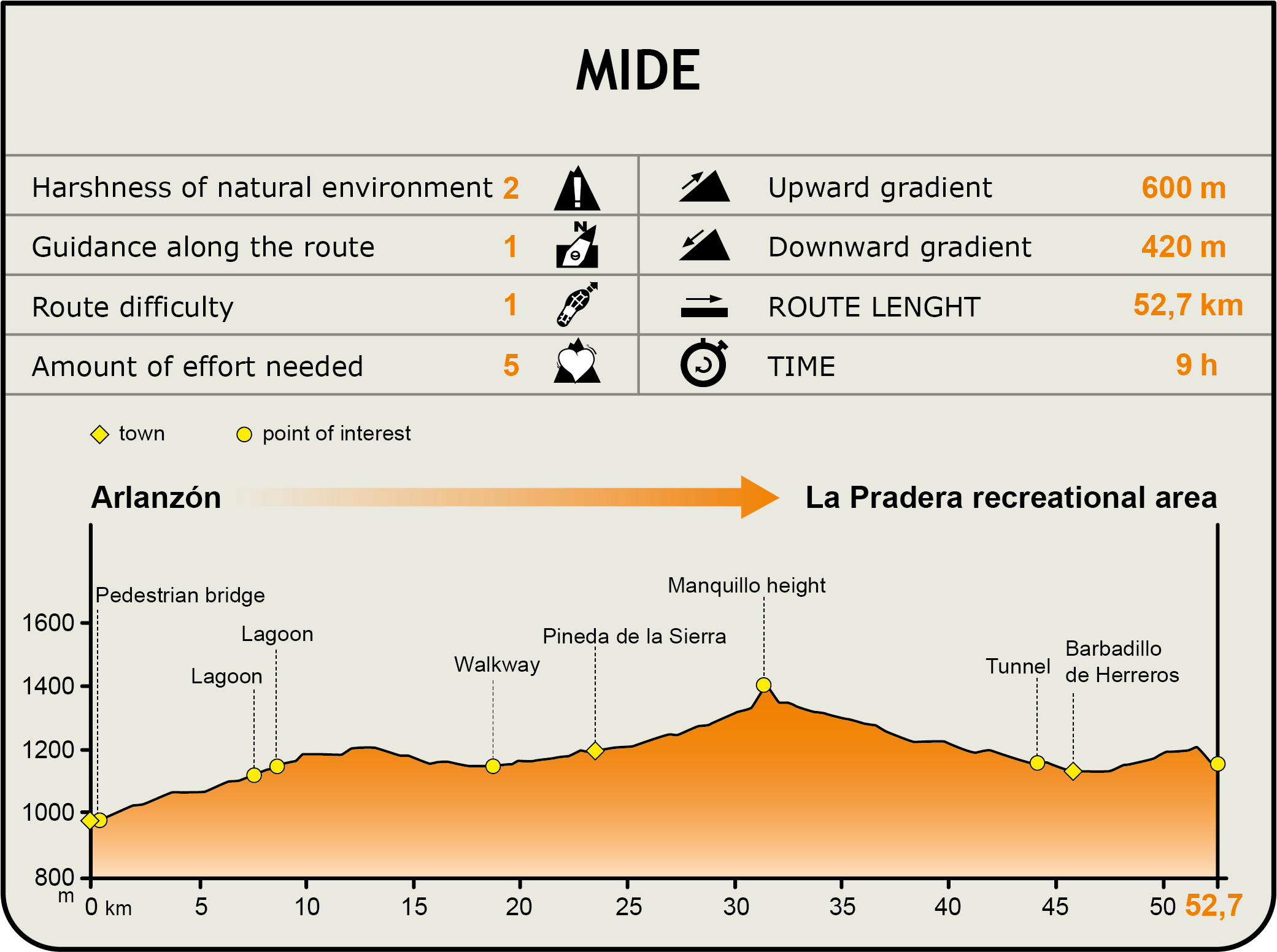
MIDE (Method for the Information of Excursions)
 Harshness of natural environment
- 1. The environment is not risk-free
- 2. There are more than one risk factors
- 3. There are various risk factors
- 4. There are quite a lot of risk factors
- 5. There are many risk factors
 Guidance along the route
- 1. Well defined trails and crossings
- 2. There is a clearly marked trail and signage
- 3. Requires the identification of geographic features and cardinal points
- 4. Requires off-path navigation
- 5. The trail is interrupted by obstacles that have to be gone around
 Route difficulty
- 1. Walking on a flat surface
- 2. Trails with different types of path
- 3. Walking on stepped paths or irregular terrain
- 4. The use of hands or jumping over the terrain is necessary
- 5. The use of hands is required to progress
 Amount of effort needed
- 1. Up to 1 hour of continuous walking
- 2. Between 1 and 3 hours of continuous walking
- 3. Between 3 and 6 hours of continuous walking
- 4. Between 6 and 10 hours of actual walking
- 5. More than 10 hours of continuous walking
Featured
Información adicional de la ruta
Yacimiento de Atapuerca
Este yacimiento, declarado Patrimonio de la Humanidad por la UNESCO, contiene numerosos vestigios fósiles de los primeros seres humanos que se asentaron en Europa, que han aportado elementos básicos para comprender la evolución de nuestra especie. Esos vestigios constituyen una fuente excepcional de datos, cuyo estudio científico proporciona información inestimable sobre el aspecto y el modo de vida de nuestros antepasados remotos.
Cabe destacar el hallazgo en 2007 del Homo antecessor, el primer humano europeo del que derivarían el Homo heidelbergensis (y de éste el neanderthalensis) y el Homo sapiens sapiens.
Multimedia
Downloads
GPS Downloads
Brochure and Maps
Cyclability
PROFILE
ROAD TYPE, PORTAGES & DIFFICULTY
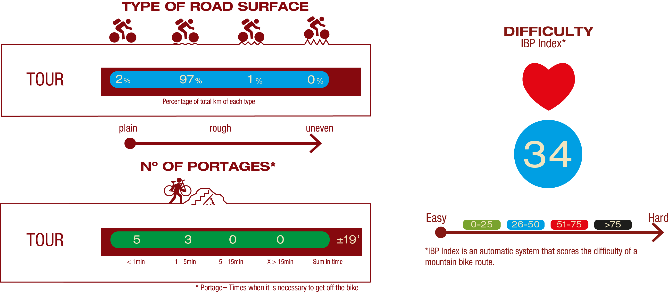
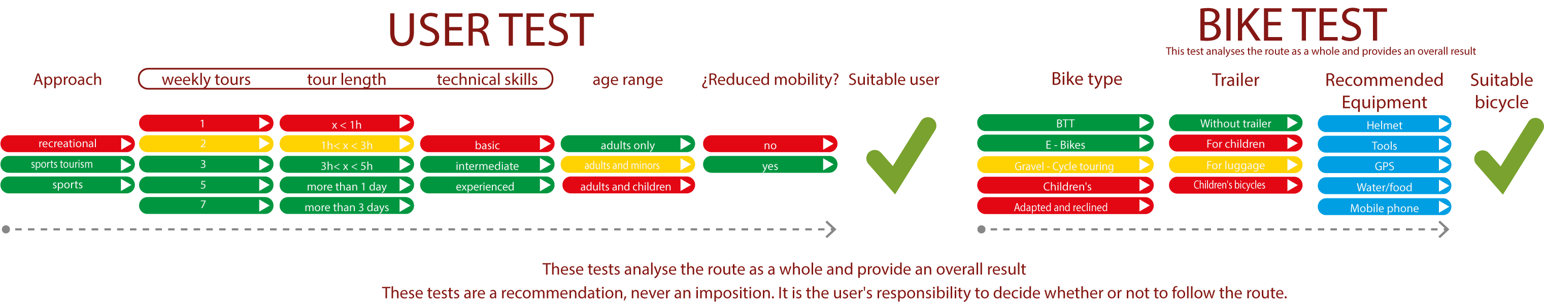
TEST
SAFETY RECOMMENDATIONS
-There are two small uphill sections with steep slopes and three small downhill sections with steep slopes where extreme caution must be taken.
-There are a total of twelve Canadian crossings where you must cross in a straight line to prevent the wheel from entering them.
-Caution should also be taken at the numerous crossroads and, to a greater extent, at road junctions and on paved tracks.
-Finally, there are two footbridges, a small one over the Arlanzón reservoir and a larger one over the Valdorcas river, as well as a tunnel with artificial lighting.
GENERAL RECOMMENDATIONS
-Find out about the technical aspects of the route and the weather on the day.
-Take care of the environment. Take care not to disturb animals or damage vegetation. Respect private areas.
-You must give priority to pedestrians and comply with general traffic rules.
-The environment in which you will be riding is open, free to move around and an area where many activities are carried out (sporting, forestry, livestock and agricultural activities). Always have an understanding, prudent, responsible and respectful attitude.