- Home
- Rural Development
- Nature Trails
- Nature Trails
- Northwest Sector
- Senda del Oso
Senda del Oso Nature Trail. Valdemurio Reservoir- Santa Marina Section
Description
A walk through the heart of the forest
This pedestrian and cyclist Nature Trail through County Quirós (Asturias) runs along the old mining railway line that linked Trubia and Santa Marina with a branch that went to Entrago mine. The area, blessed with landscapes of exceptional beauty, is home to a variety of threatened Asturian wildlife species, including the bear, otter and golden eagle. The traveller can experience a rich cultural heritage through its architecture, traditions and unparalleled cuisine.
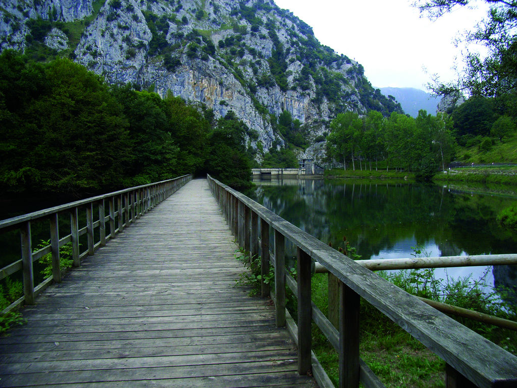
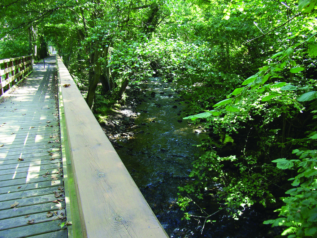
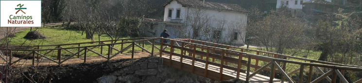
The Nature Trail begins near Valdemurio Reservoir and continues along its edge during a short distance, until it reaches a recreation area next to a jetty. Here, the route crosses a wooden walkway over the reservoir.

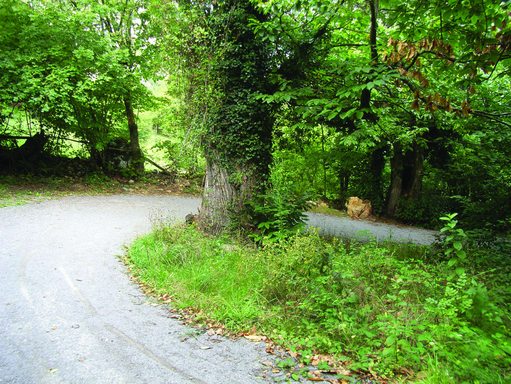
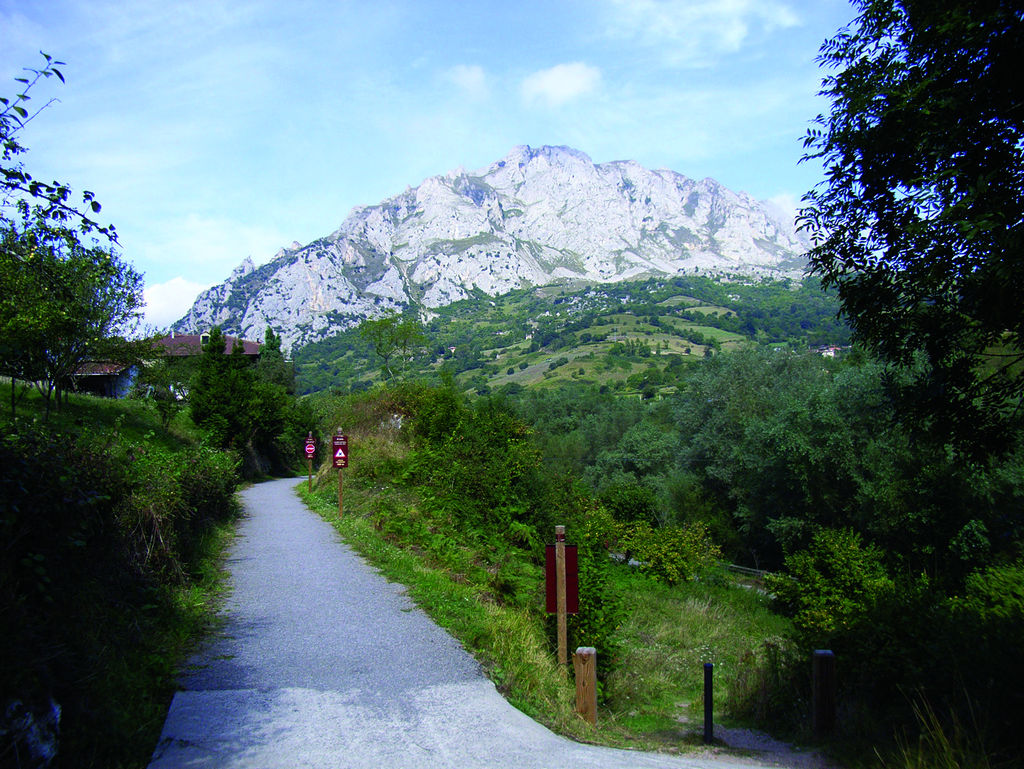
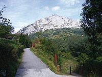
Once on the opposite side, the route begins a short but steep climb between chestnut trees (Castanea sativa). Past a few bends, it reaches a flat area of meadows, whence it begins to descend again along the reservoir, through willows (Salix sp.), ashes (Fraxinus sp.) and other riparian species. This section of the Trail offers stunning views of the eastern slope of Valle de Quirós, including the town of Las Agüeras, Aciera and Tene.
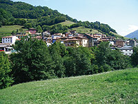
The trail traverses a more or less flat area of meadows, until it crosses the road up to the village of Villaorille, with views of the impressive Sierra del Aramo, in particular the Pico La Gamonal and Barriscal to the northeast, and the silhouette of Cueto Mar to the northwest. The Nature Trail continues through a chestnut and hazel forest (Corylus avellana) and reaches a path leading to a pleasant rest area next to a water channel.
As the route approaches the River Quirós, the chestnut forest gives way to a landscape covered by alders (Alnus glutinosa), willows and ashes, and populated by riparian bird species, such as the dipper (Cinclus cinclus), wagtail (Motacilla cinerea) and kingfisher (Alcedo atthis).
The route traverses the riparian forest towards the small village of La Vega, located five kilometres from the start of the Nature Trail, and, after crossing the road up to Toriezo, follows the riverbank until it meets the road to Pola de Lena.
After a short stretch along the riverbank, and past the road to Faedo and Fresnedo, the route veers onto a paved road at San Salvador that passes through a small reforestation pine forest, and heads through a chestnut forest to a cemetery.

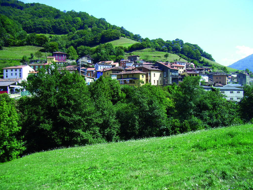
From here, the road runs over flat terrain, between chestnut and oak (Quercus robur) trees, to a wooden bridge over a stream, and continues through an area of meadows with views of the village of Bárzana, capital of County Quirós, to the left.
The path reaches the road up to the towns of Coañana and Villamarcel, then continues down and takes an offshoot road to ascend by a concrete path to a trough with unsafe water.
The route continues over a flat area shaded by a dense chestnut forest towards several meadows by a brook. After crossing a small wooden bridge, it traverses a black poplar grove peppered with hazel trees, until it reaches Santa Marina and crosses the road to Pola de Lena through a lighted tunnel.
At the end of the tunnel, the route crosses over the river at Lindes by another wooden bridge, and reaches a recreation area near the road that gives access to the picturesque towns of Cortes and Lindes. Further on along this road is a car park next to an old ore loading station, where the Nature Trail ends.
Map
Puntos de Interés
Hidrografía
Municipio
Profile
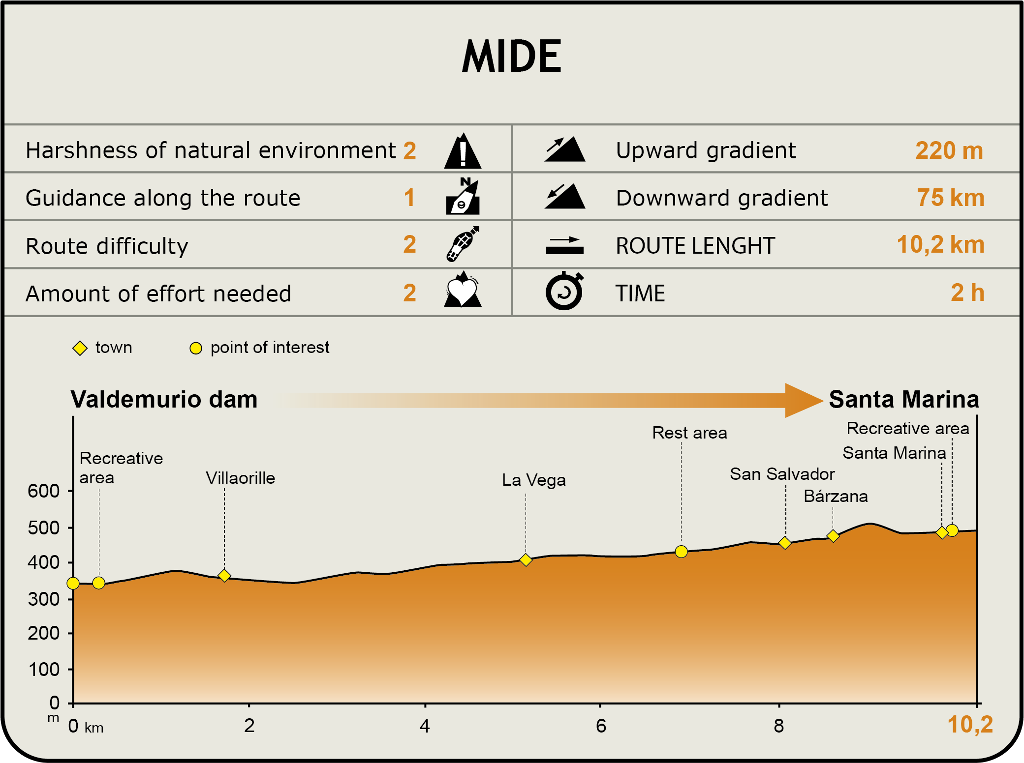
MIDE (Method for the Information of Excursions)
 Harshness of natural environment
- 1. The environment is not risk-free
- 2. There are more than one risk factors
- 3. There are various risk factors
- 4. There are quite a lot of risk factors
- 5. There are many risk factors
 Guidance along the route
- 1. Well defined trails and crossings
- 2. There is a clearly marked trail and signage
- 3. Requires the identification of geographic features and cardinal points
- 4. Requires off-path navigation
- 5. The trail is interrupted by obstacles that have to be gone around
 Route difficulty
- 1. Walking on a flat surface
- 2. Trails with different types of path
- 3. Walking on stepped paths or irregular terrain
- 4. The use of hands or jumping over the terrain is necessary
- 5. The use of hands is required to progress
 Amount of effort needed
- 1. Up to 1 hour of continuous walking
- 2. Between 1 and 3 hours of continuous walking
- 3. Between 3 and 6 hours of continuous walking
- 4. Between 6 and 10 hours of actual walking
- 5. More than 10 hours of continuous walking
Featured
Further information
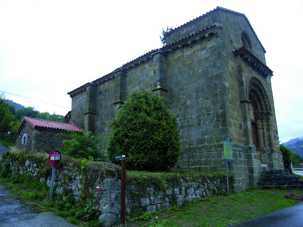
Romanesque Church of San Pedro Arrojo
This small temple, recently renovated, is built only with ashlars cut in right angles. It is the most interesting architectural building in County Quirós.
Although it was likely built in the first third of the 13th century, a sacristy was later added to the original floor plan, and the existing wooden roof was added to the building after the end of the Spanish Civil War.
The floor plan is unorthodox for an Asturian church. The wide nave, topped with a semicircular apse with remains of frescoes, probably from the 15th century, is divided into four sections by pilasters corresponding to external buttresses.
Worthy of note is a medieval statue of Christ on the Cross over the chancel, next to the triumphal arch and a small rosette above it.
EEight openings between the pilaster, supposedly intended to hold the Quirós family tombs, are also notable. According to tradition, Don Gutierre, first Marquis of Camposagrado, is buried in one of them.
The only doorway to the temple, framed by a ledge on the wall, has three archivolts decorated with plant motifs in zigzag patterns. The supporting columns have carved capitals on the left side only. Above the eaves that protect this doorway is a pointed window decorated with geometric openwork.
Bermiego Yew
The yew (Taxus baccata), a tree sacred to the Celts and the first inhabitants of these lands, signaled the places where ceremonial rites, prayers and burials took place. The tree produces a poisonous substance called taxine that is present in the leaves, seeds and bark, but not the red fruit body. Legends and traditions hold that the Asturs used this toxin to poison the arrows used to fight against the Roman troops of Augustus during his conquest of the northern territories of Hispania.
The veneration in which it was held gradually declined with the arrival of the first Christians in the area, who built shrines and chapels in these magical places.
One of the most notable specimens in Asturias is the so-called “Texu de Bermiego”, listed as Tree of Special Interest. It was declared a Natural Monument of Asturias in 1995.
Almost 13 m high, the perimeter of the trunk of this millenarian specimen is 6.82 m, and the canopy is 15 m in diameter. Popularly known as "Teixu l´Iglesia", it is situated on a privileged promontory outside the village, near the church of Santa María.
Multimedia