- Home
- Rural Development
- Nature Trails
- Nature Trails
- Northwest Sector
- Río Barbantiño
River Barbantiño Nature Trail
Description
The culture of water
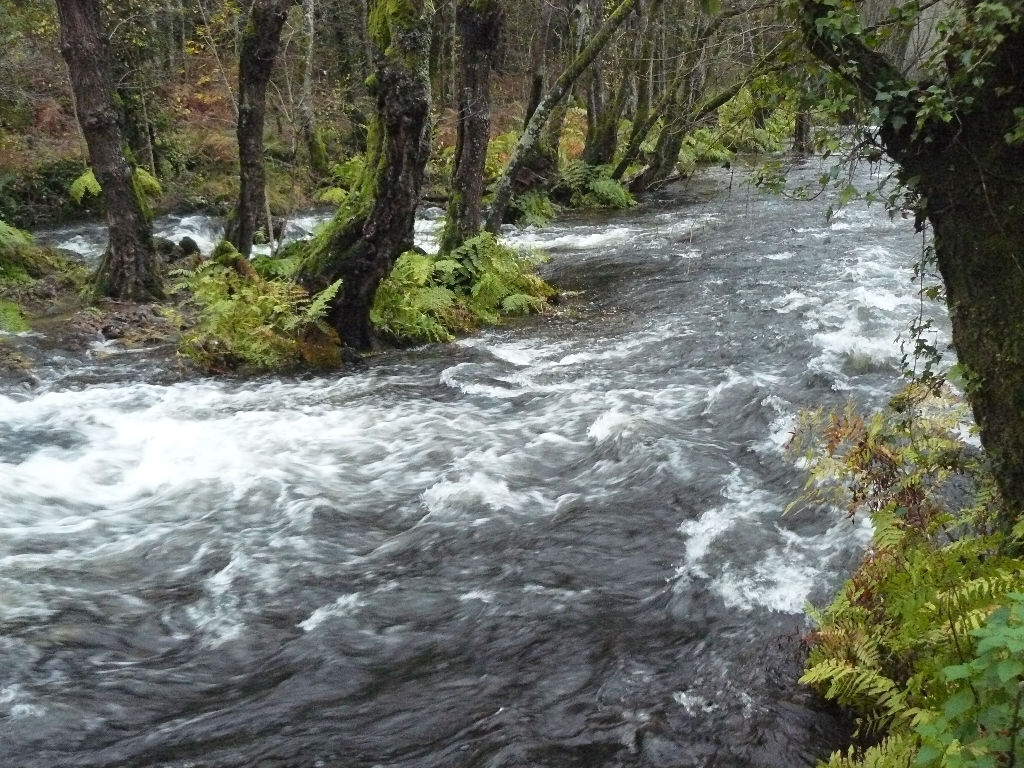
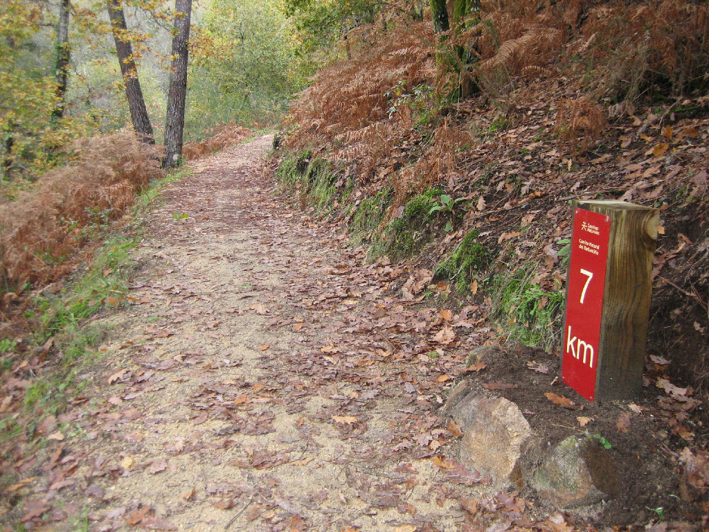
The River Barbantiño, in northern Ourense province, is the main watercourse of this 10-kilometre river circuit through a beautiful natural environment, studded with small bridges and walkways. The old water mills that dot its course evidence the importance of Galician rivers to the local economy.
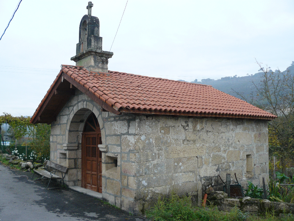
Barbantiño Nature Trail runs through the municipalities of Maside, Amoeiro and Punxín, where the route begins. Leaving Ourense via N-120 in the direction of Vigo, the route turns onto N-541 at Barbante in the direction of Carballiño, until it reaches the town of A Forxa (Punxín). Opposite the "Casa do Concello", is a track leading to the chapel of San Roque, where a concrete path runs down to the river. On the right bank of the river is a bathing area, O Banino as it is known, an upwelling of warm, sulphurous water (23° C) with medicinal and mineral properties. Here starts the route.
The Trail crosses several small streams over wooden bridges and walkways, while the restored mills are well-placed to enjoy a rest. A small recreation area and a fountain of thermal water can be found at the trail head. From here, the route gradually climbs to the river basin, through agricultural landscapes and riparian forests of alders (Alnus glutinosa), poplars (Populus sp.) and willows (Salix sp.), until it reaches the bridge over OU-409.
The walk along the river bank is graced by granite rocks worn smooth by water and a canopy of common oaks (Quercus robur) and Pyrenean oaks (Quercus pyrenaica), as well as royal ferns (Osmunda regalis); a fern species widely found in Galicia basins. Before reaching the bridge, the route climbs to the village of O Viñao, and then returns to the road by the bridge.
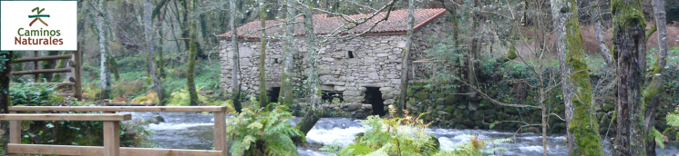
From here, the route descends again to the river, and continues through a valley that gradually narrows. The greenery of this riverside forest remains vibrant through winter due to the presence of bay trees. This mysterious stretch, which evokes memories of the bandit Fendetestas from the film "The Living Forest", also amazes with small “caneiros” or artisan stone dams, which once served to pond and channel water for hydraulic use.
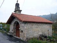
Further on, the route arrives at another path leading to a recreation and rest area, whence it continues along the edge of a canal until San Fiz, a small town with few inhabitants, home to the church of San Pedro, well-worth a visit.
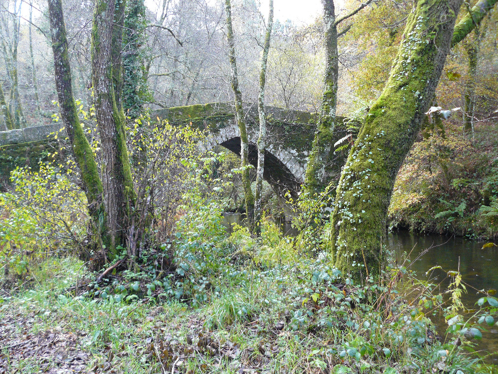
From here, the Trail continues down to the medieval bridge of San Fiz, at the foot of the town of Santa Baia. This bridge, which has a pointed arch, is on the former “Camino Real” that linked Ourense and Santiago de Compostela.
After crossing the bridge, the route retraces its steps back along the left bank of the river, through a tunnel under the railway. When the route emerges from the tunnel, the landscape is of a backwater at the edge of a small reservoir, the Barbantiño.
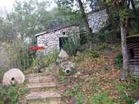
The winding route passes under the AVE bridge, through pine and gorse forests, meandering down the mountain towards several mills, the so-called “Muiños das Penas”, which underlines the importance of water in the Galician culture.
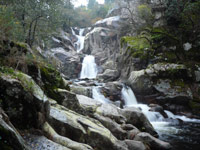
A metal walkway leads to the beautiful natural area of “Fervenza do Barbantiño” or “Catarata del Cachón”, famous for its 15-metre waterfall and crystal clear pools.
Back at the mills, a flight of stairs lead down to a small recreation area by the waterfall. A metal bridge allows a close-up view of the waterfall in all its splendour. It is possible to take a break here before completing the final stretch back to the trail head. From the rest area, a path winds downstream along the left bank.
The climb down on the way back is easier than at the beginning of the journey. Until it reaches a mini hydroelectric power plant, much of the route runs about 10 m above the river below along easy paths with spectacular views of Barbantiño. Once back at the OU-409 bridge, the route continues along the path that leads back to the river, following its course to the concrete bridge that links Parada and Punxín, and the trail head.
Sites of interest
Map
Puntos de Interés
Hidrografía
Vegetación
Profile

* The distance shown in MIDE does not include branches.
MIDE (Method for the Information of Excursions)
 Harshness of natural environment
- 1. The environment is not risk-free
- 2. There are more than one risk factors
- 3. There are various risk factors
- 4. There are quite a lot of risk factors
- 5. There are many risk factors
 Guidance along the route
- 1. Well defined trails and crossings
- 2. There is a clearly marked trail and signage
- 3. Requires the identification of geographic features and cardinal points
- 4. Requires off-path navigation
- 5. The trail is interrupted by obstacles that have to be gone around
 Route difficulty
- 1. Walking on a flat surface
- 2. Trails with different types of path
- 3. Walking on stepped paths or irregular terrain
- 4. The use of hands or jumping over the terrain is necessary
- 5. The use of hands is required to progress
 Amount of effort needed
- 1. Up to 1 hour of continuous walking
- 2. Between 1 and 3 hours of continuous walking
- 3. Between 3 and 6 hours of continuous walking
- 4. Between 6 and 10 hours of actual walking
- 5. More than 10 hours of continuous walking
Featured
Further information
Abundance of water resources
County O Carballiño is rich in water resources, both surface and underground. In addition to a dense network of waterways, this area abounds with mineral and medicinal hot springs that have made it a major health tourism centre in Galicia.
Countless streams rise in Serras de Mantiñan de Suido and Montes de Testeiro, whence they flow south to join the rivers Barbantiño and Arenteiro that shape the typical “socalcos” or terraces where the Ribeiro vineyards are located.
While the River Barbantiño forms a natural boundary with the region of Ourense to the east, and its waters flow into the River Miño, the rivers Arenteiro and Viñao stretch throughout the county to meet the River Avia, whose waters also flow into the Miño.
The Romanesque footprint
The towns of Punxín, Maside and Treboedo are home, respectively, to the following Romanesque churches, all with a single rectangular nave and apse: San Xoan de Ourantes (12th century), the church of Santo Tome de Maside Vello, rural Romanesque, and the church of Santa Comba de Treboedo.
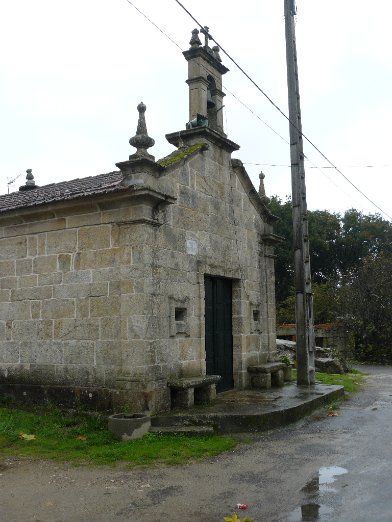
The tomb of San Wintila, a hermit who lived in the time of King Alphonse III, can be found in the church of Santa Maria in Punxín. It is a popular tradition to gather soil from around the tomb to cure ailments.
Multimedia