
- Home
- Rural Development
- Nature Trails
- Nature Trails
- Northwest Sector
- La Mirada Circular: Ancares Leoneses de Guimará a Balboa
La Mirada Circular Nature Trail: Ancares leoneses from Guímara to Balboa
Description
Through the land of bears and "pallozas"
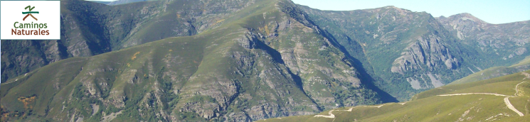
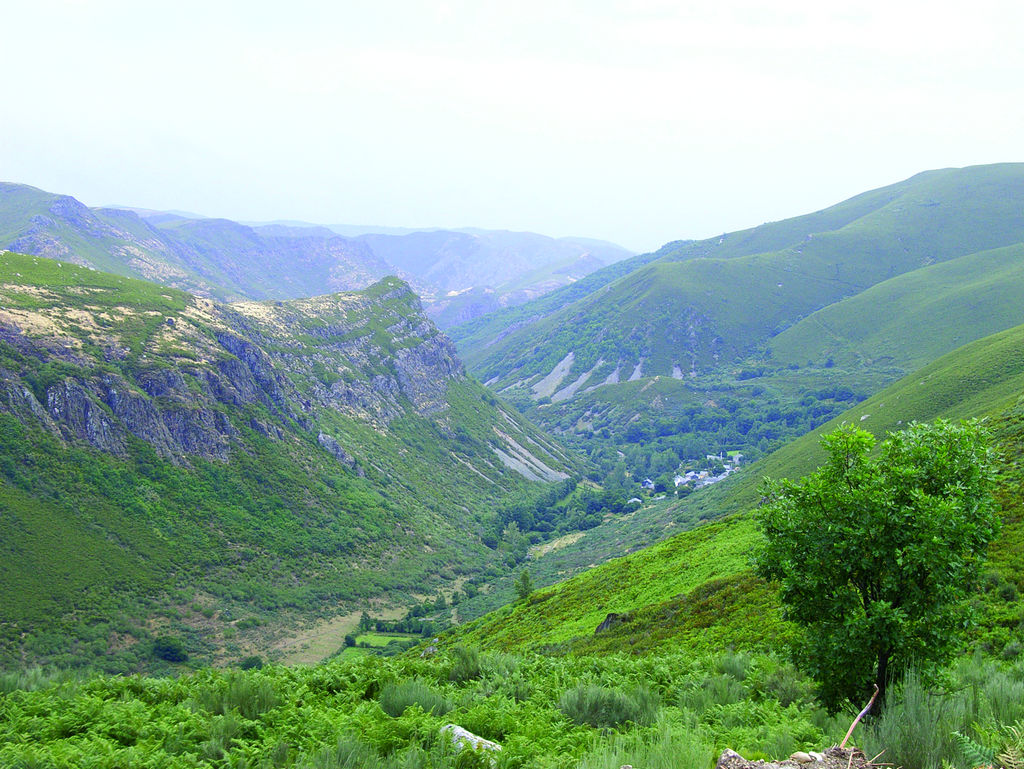
Sierra de Ancares, located in northwest León, borders with the province of Lugo and the Principality of Asturias. An exceptional natural site situated in County Bierzo, it is a UNESCO World Heritage Site and Biosphere Reserve. Its valleys, carpeted with oak and chestnut trees, are home to abundant and varied fauna, including the last grouses in the area and an occasional brown bear.
Guímara - Pereda de Ancares Section
This route starts in the municipality of Guímara, in northern Ancares, at the border with the Principality of Asturias, and ends in Balboa, southeast Ancares, near the border with Lugo province.
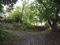
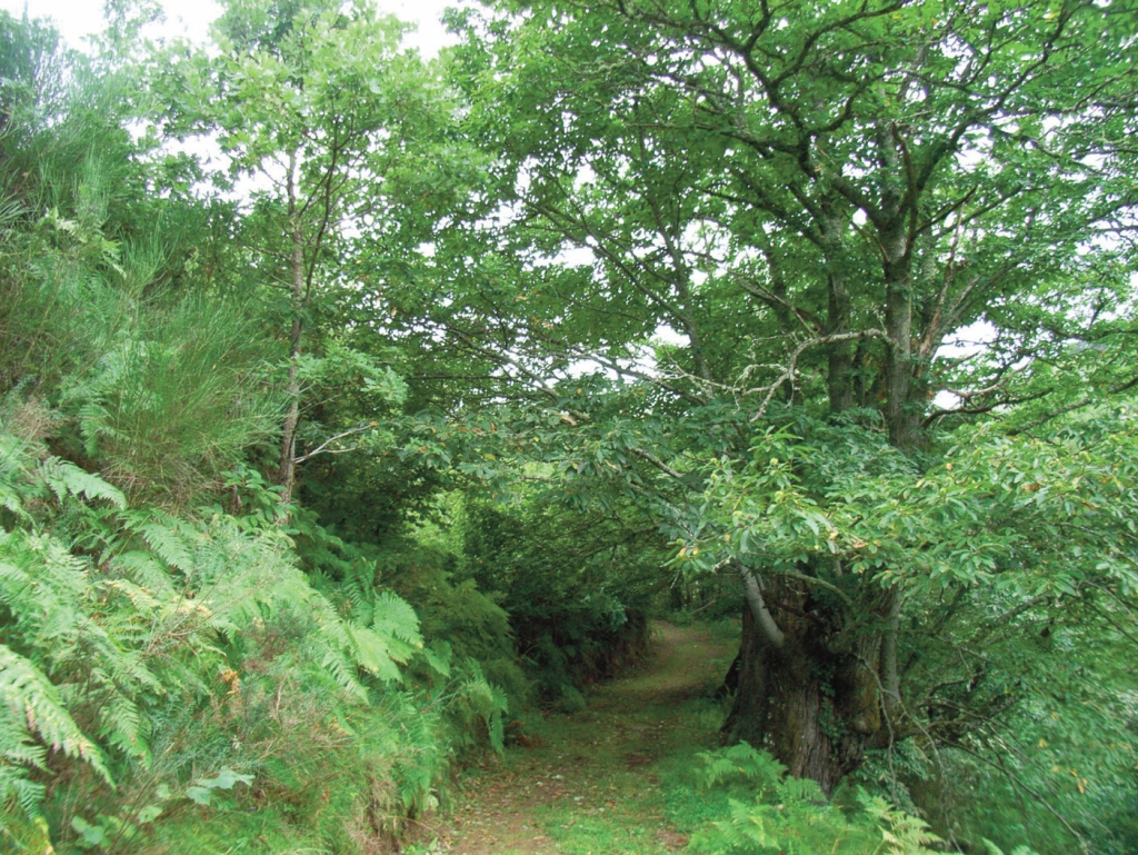
The route runs along a track located at the edge of Guímara, whence it begins to climb a slope where heath and shrubs alternate with deciduous woods dominated by oak (Quercus sp.) and birch (Betula sp.). It also contains holly (Ilex aquifolium) and rowan (Sorbus sp.), especially in autumn, which adds colour to the landscape.
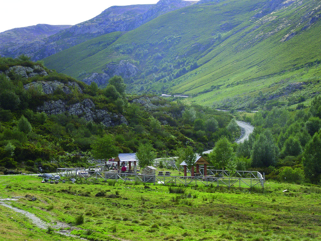
The track continues up the valley, with tall grasslands used to graze livestock, until Braña del Cuadro, where a small cabin and a recreation area to rest and recover is located. The route continues uphill to a fork where the right branch leads to Ibias Valley, in southwest Asturias, and the left heads to the high meadow where the Refugio de la Pesca y Suertes can be found next to the River Cúa.
The route continues towards Alto del Boquín (1,753 m), a siliceous promontory that stands out in the heath landscape, with views over Suertes Valley.
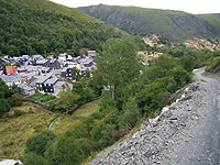
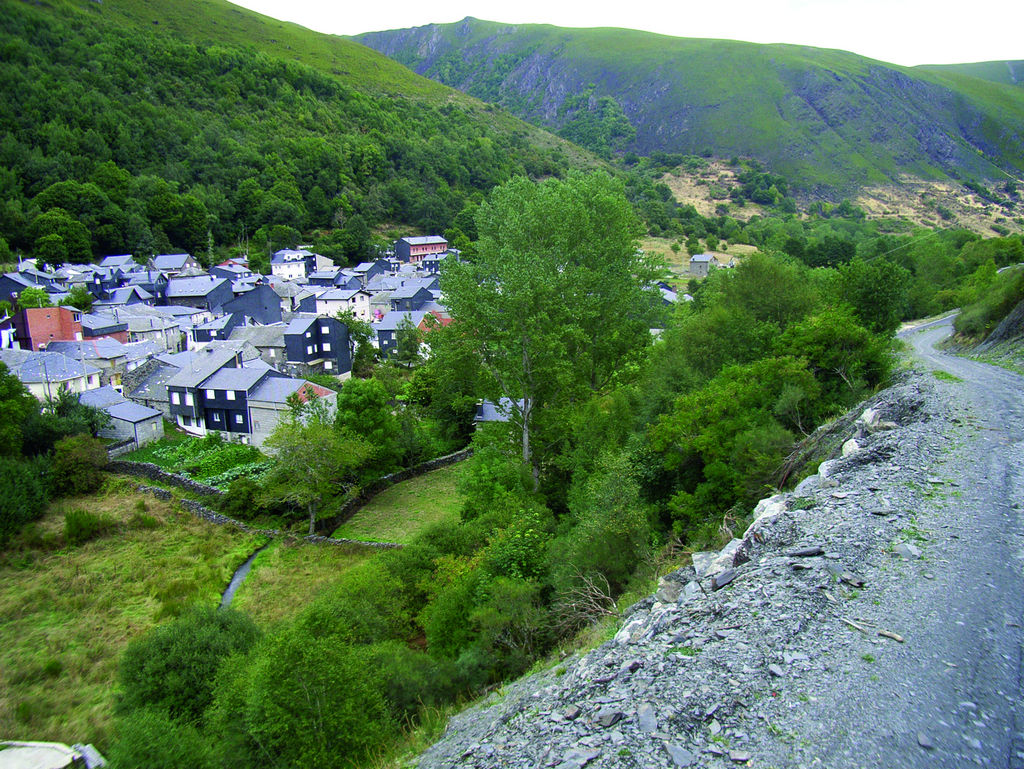
From here, the path begins a steep descent towards the village of Suertes. The steepness diminishes when the path reaches the river. The Nature Trail continues parallel to the river, through meadows and oak forests, until it reaches and traverses Suertes along Calle Real.
The route continues down the road, past the offshoot road to Espinareda de Ancares. It then begins to turn south, veering right onto a dirt road towards Pereda de Ancares. The first stretch of this section runs through meadows, then through an oak and chestnut (Castanea sativa) forest. Further on, the Trail reaches and crosses the bridge over the river, and continues down the road until another crossroads, where it heads straight ahead to Pereda.
Pereda de Ancares Pereda - Burbia Section
Past the church, the route winds up through the town to an intersection where the Tourism Office is located. Further on, the route leaves Pereda along a dirt track towards another intersection, leaving the offshoot road to Braña de Pereda to the right.
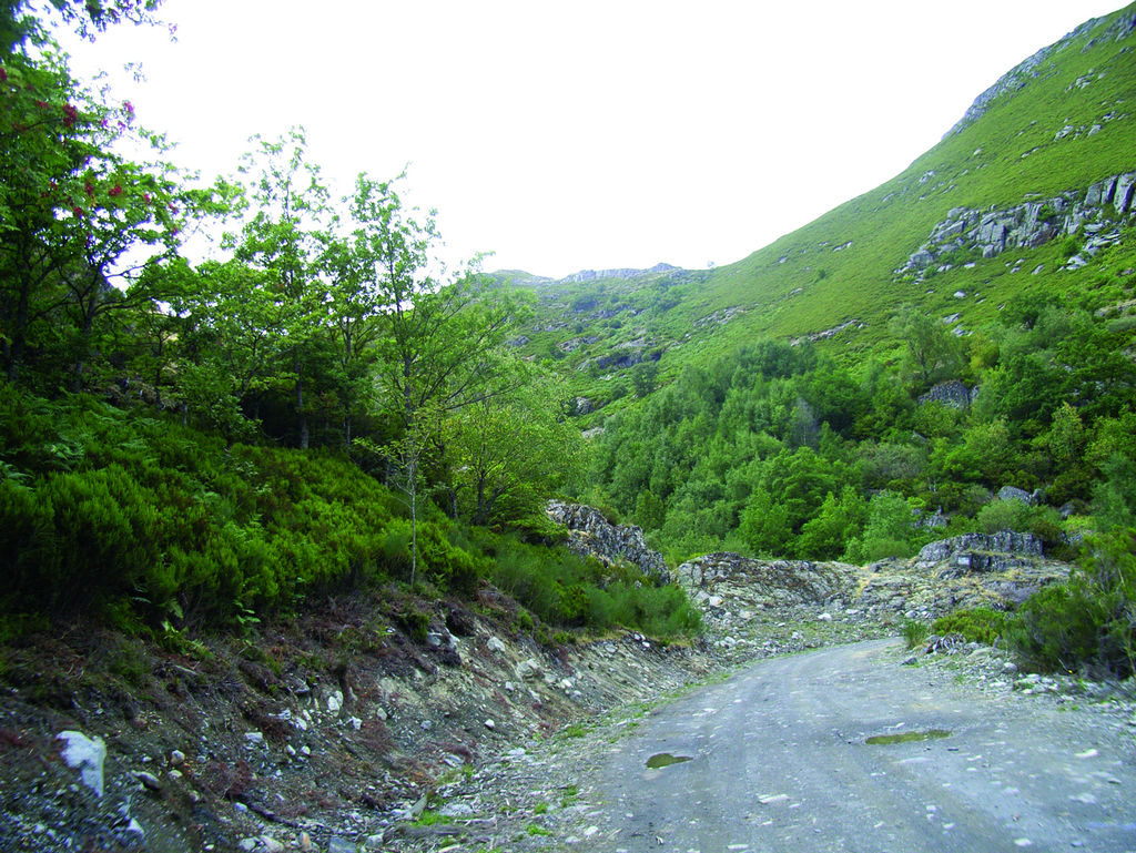
Taking the track to the left, the Trail, now lined with large chestnut trees, begins to climb a steep slope towards a sharp bend where the terrain levels. Further on, the route starts to climb again amidst heath, broom, oak and birch, and crosses two intersections. It then reaches a more level terrain populated with reforestation Scots pine (Pinus sylvestris).
The Nature Trail heads south, past a cottage and a water tank. Past an oak grove, the route crosses a track leading to Candín, and heads uphill to the right towards Alto del Mirandelo (1,414 m).
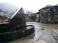
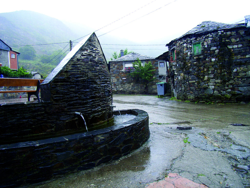
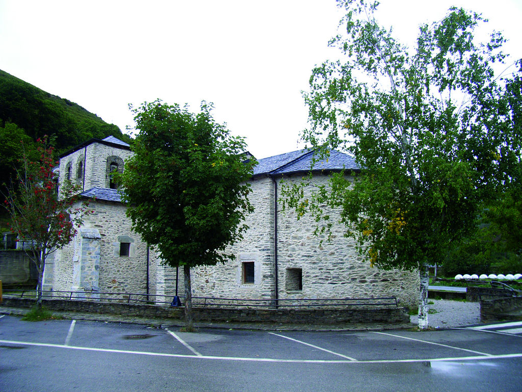
From here, the path runs along level terrain to a junction where it winds down a steep track to Burbia. The track passes through a chestnut wood peppered with a few constructions, crosses two junctions and, once in Burbia, continues straight ahead along a cobbled street to the town square with a playground and a fountain.
Burbia - Campo del Agua Section
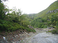
The route crosses the road and heads along a dirt track through a riparian forest to a stone bridge over the river. From here, it traverses through meadows and oak woods towards Campo del Agua.
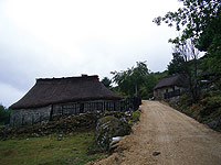
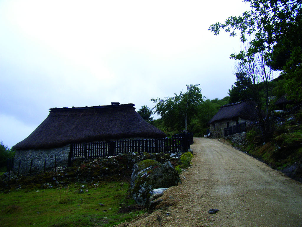
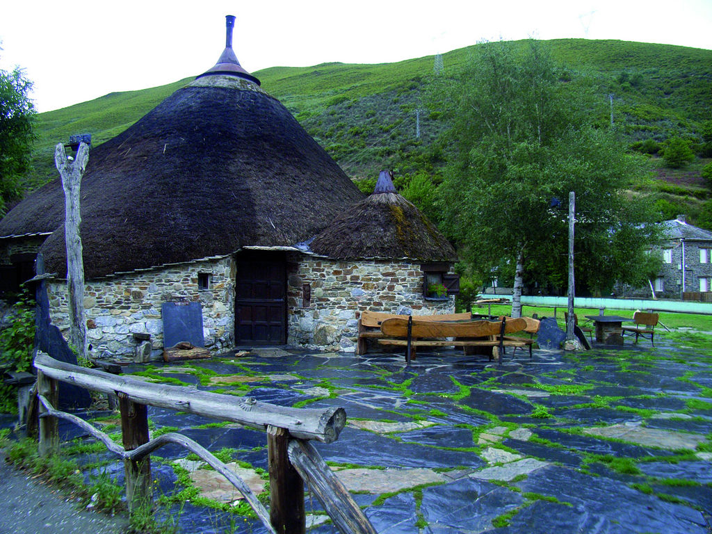
The Nature Trail continues upstream, through gorse and hazel trees (Corylus avellana), then crosses a junction. Further on, the track crosses to the opposite slope and beings to climb, through an oak forest, towards a flat area, from where Braña de las Agüerias and its cottages can be seen. The path descends, crosses a brook, and begins to climb uphill again. After turning right, it is possible to view Campo del Agua. Several well-preserved "pallozas" (thatched houses) and slate cabins, typical of this region, can be found in the neighbourhood of El Regueiral.
Campo del Agua - Balboa Section
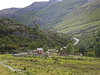
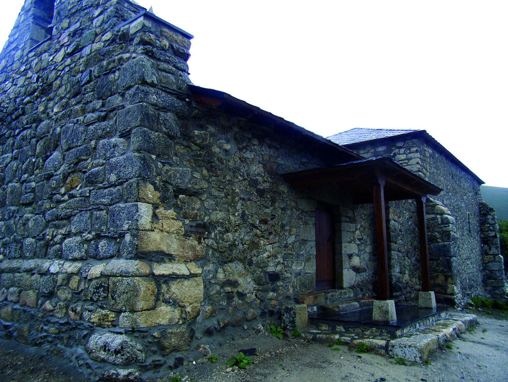
The Trail reaches the church and, further on, the town houses.
The track climbs up a hill covered in lush oak trees, then downhill to cross a brook that meanders through oaks and holly. Past a junction, the track starts to climb again through a dense oak and birch forest dotted with holly and rowan.
Further on, the track drifts away from the forest. Past a recreation area, the village of Porcarizas can be seen on the valley floor.
The Nature Trail traverses two hills and a water tank, and continues to the top of the hill that leads down into Tejeira Valley. The route heads down the valley to a junction, from where the access to Pedra Caballar shelter can be seen up the hill. It continues uphill to the left, through a forest populated with many yews (Taxus baccata) and holly. The route reaches the top of another hill, leaving behind Tejeira Valley. Soon after, it crosses a stream and climbs a hill overlooking Ponferrada thermal plant, and reaches a junction with a farm road to the right. The route now heads along the left branch.
It climbs to a meadow and heads down a side-track leading to a cabin, and descends to Cantejeira, with views of the towns of Pumarín and Chan de Villar.
On entering the town of Cantejeira, the route veers to the left along a concrete path, past several intersections, until it reaches the square, and heads towards Balboa.
Before reaching the junction with the road to Pumarín, the route turns right onto a grass path, then takes the fork to the left.
The path, with two junctions, narrows as it heads towards the village of Castañoso. Past a few meadows, it traverses a swamped area with hazel trees. It crosses a small brook, and continues on flat terrain, until it reaches a gorse-covered hill, where it veers right onto a path that runs through an oak forest to a meadow. At the lower end, the path veers right. It crosses a bridge over a brook, and starts to climb towards the road. Past another small bridge, the route begins to descend through chestnut trees towards Balboa. From here, the Nature Trail continues straight ahead, crosses the road and traverses through Cantejeira to the intersection with the road.
Heading towards Castañoso and Villarinos, the route once again crosses the river over a bridge near several "pallozas" and finally reaches the church and the municipal shelter, where the route ends.
Sites of interest
Profile
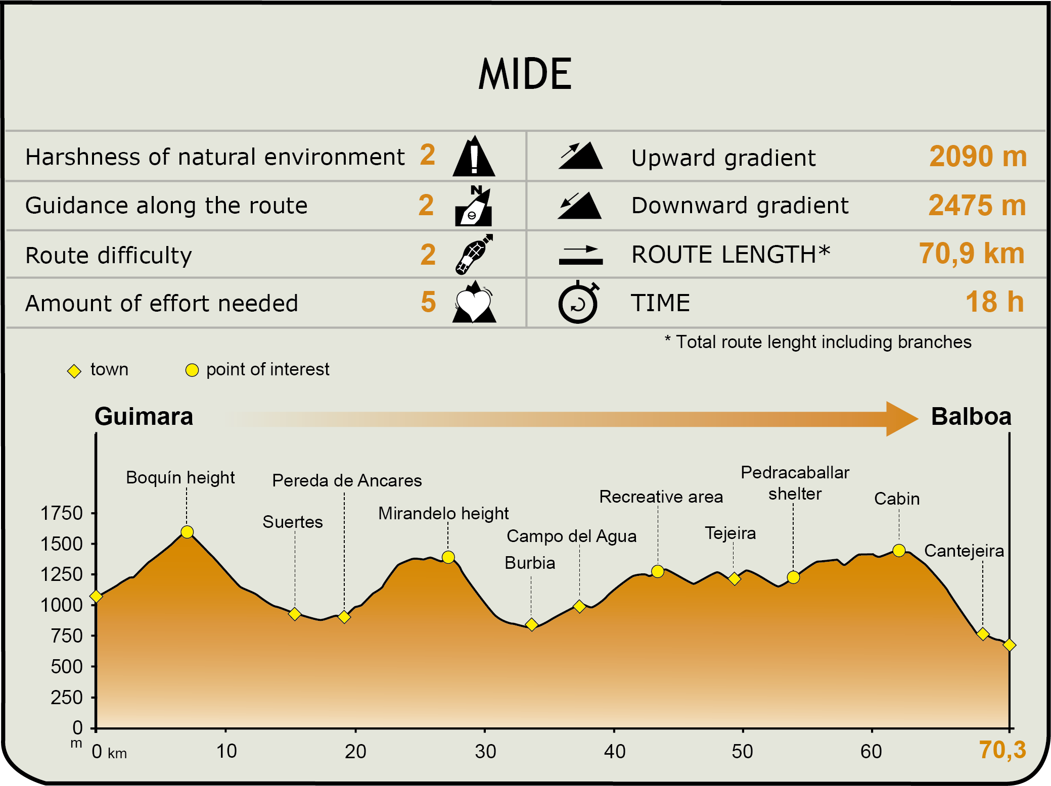
MIDE (Method for the Information of Excursions)
 Harshness of natural environment
- 1. The environment is not risk-free
- 2. There are more than one risk factors
- 3. There are various risk factors
- 4. There are quite a lot of risk factors
- 5. There are many risk factors
 Guidance along the route
- 1. Well defined trails and crossings
- 2. There is a clearly marked trail and signage
- 3. Requires the identification of geographic features and cardinal points
- 4. Requires off-path navigation
- 5. The trail is interrupted by obstacles that have to be gone around
 Route difficulty
- 1. Walking on a flat surface
- 2. Trails with different types of path
- 3. Walking on stepped paths or irregular terrain
- 4. The use of hands or jumping over the terrain is necessary
- 5. The use of hands is required to progress
 Amount of effort needed
- 1. Up to 1 hour of continuous walking
- 2. Between 1 and 3 hours of continuous walking
- 3. Between 3 and 6 hours of continuous walking
- 4. Between 6 and 10 hours of actual walking
- 5. More than 10 hours of continuous walking
Featured
Further information
Castro de Chano
This ensemble of buildings, typical to the Castro culture in Northwest Spain, is situated in Fornella Valley, within Ancares Nature Park.
This archaeological site, dated between the late 1st century and the first half of the 2nd century, was excavated between 1989 and 1993. It consists of 16 well-preserved, circular buildings, with slate walls 4 m high and 60 cm wide.
The "castro", which is divided into several rooms, has at its centre an ashlar on which the post supporting the vegetation cover rests.
Multimedia
Downloads
GPS Downloads
Brochure and Maps
Cyclability

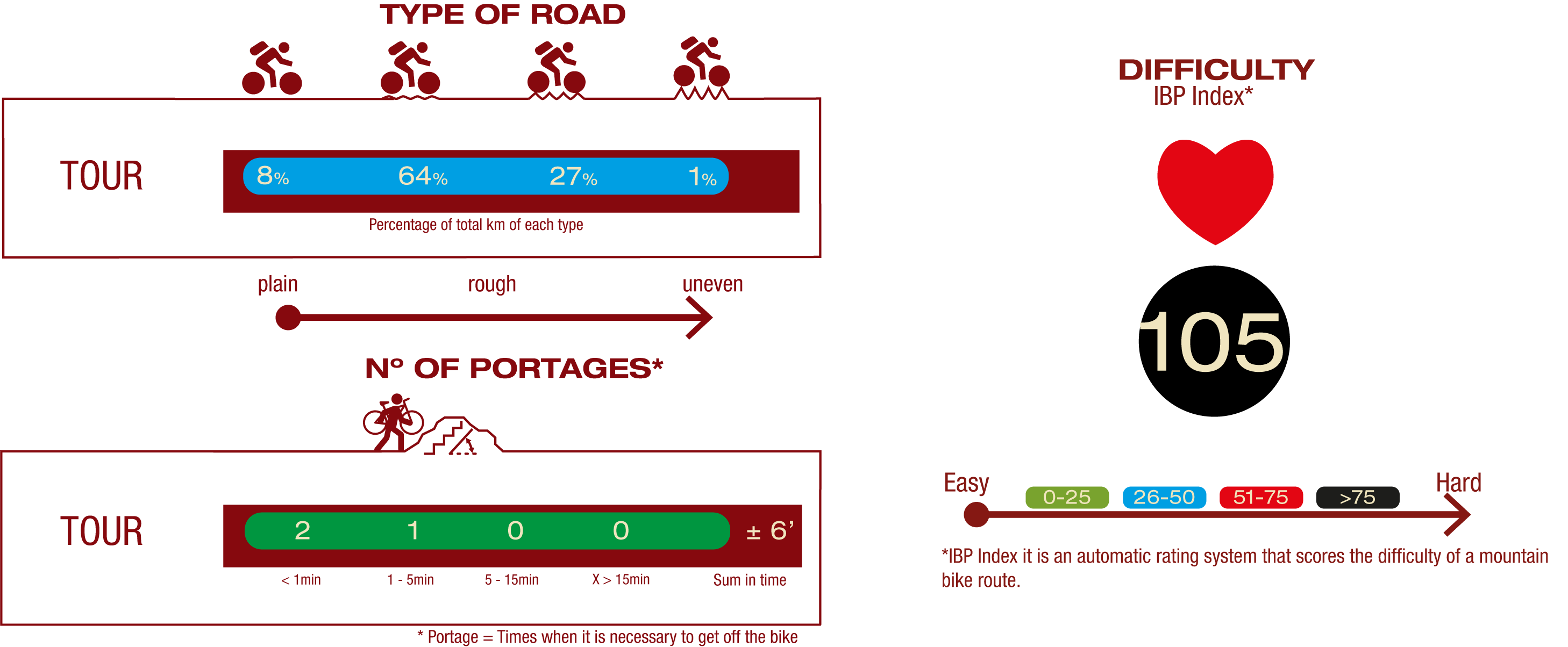
CYCLOSTAGE 1
PROFILE
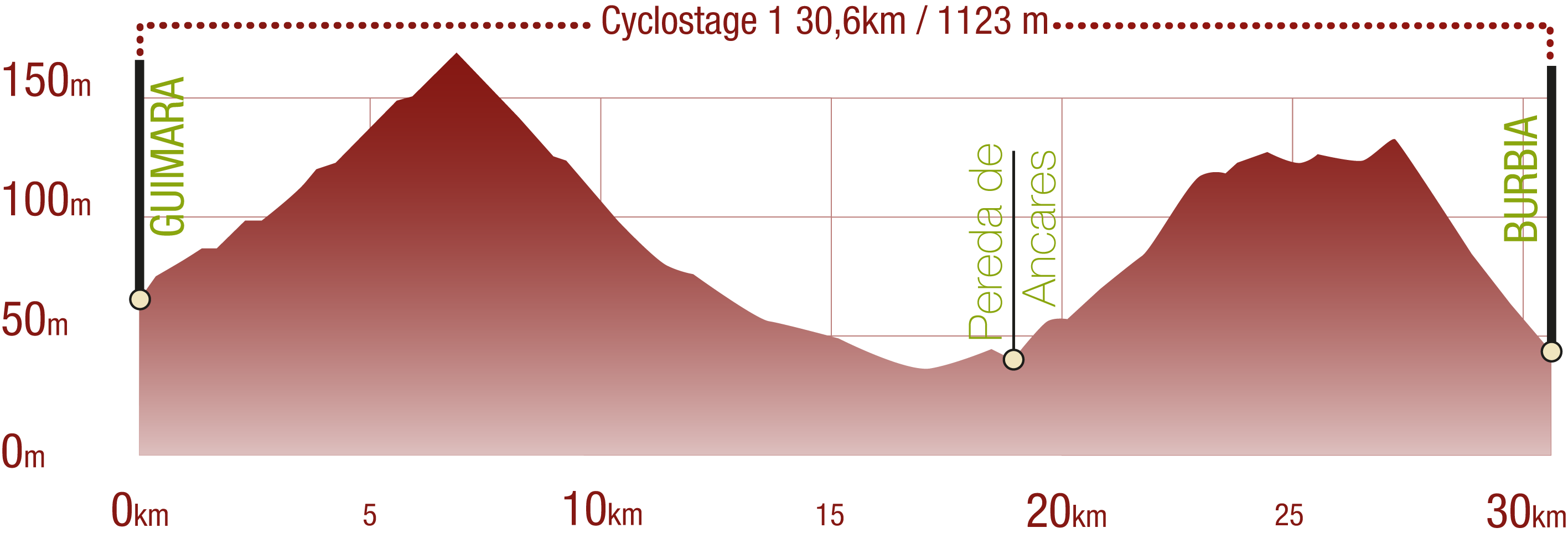
TYPE OF ROAD, PORTAGES & DIFFICULTY
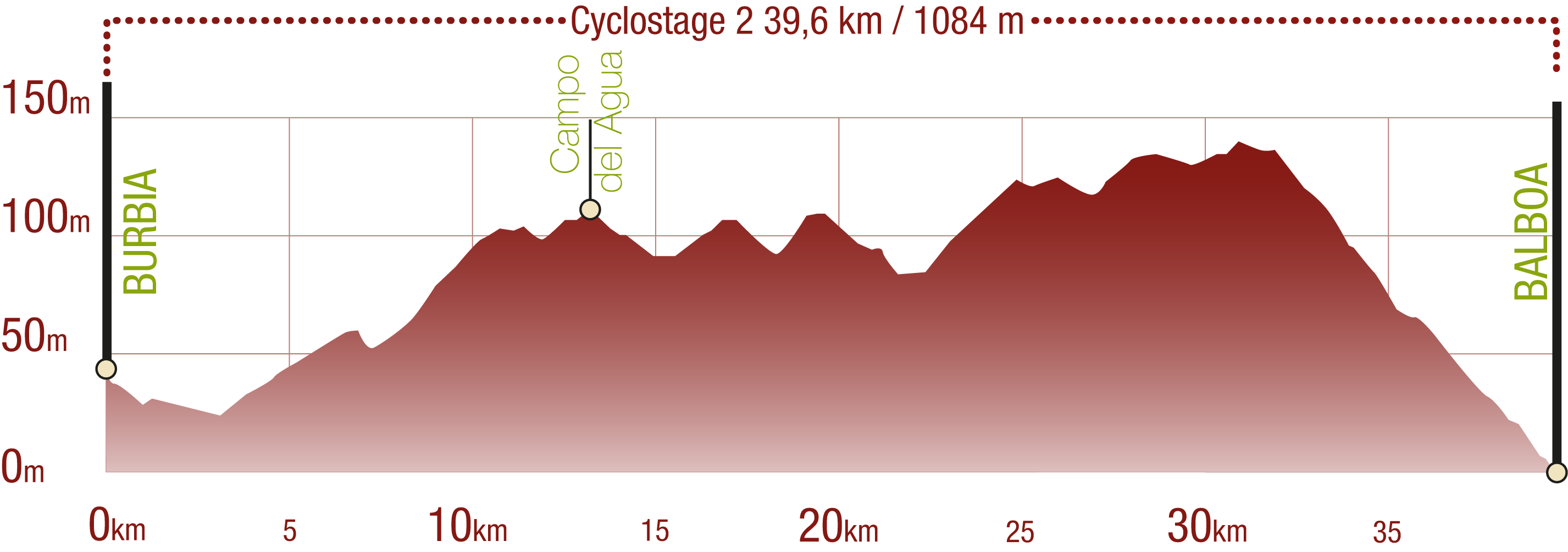
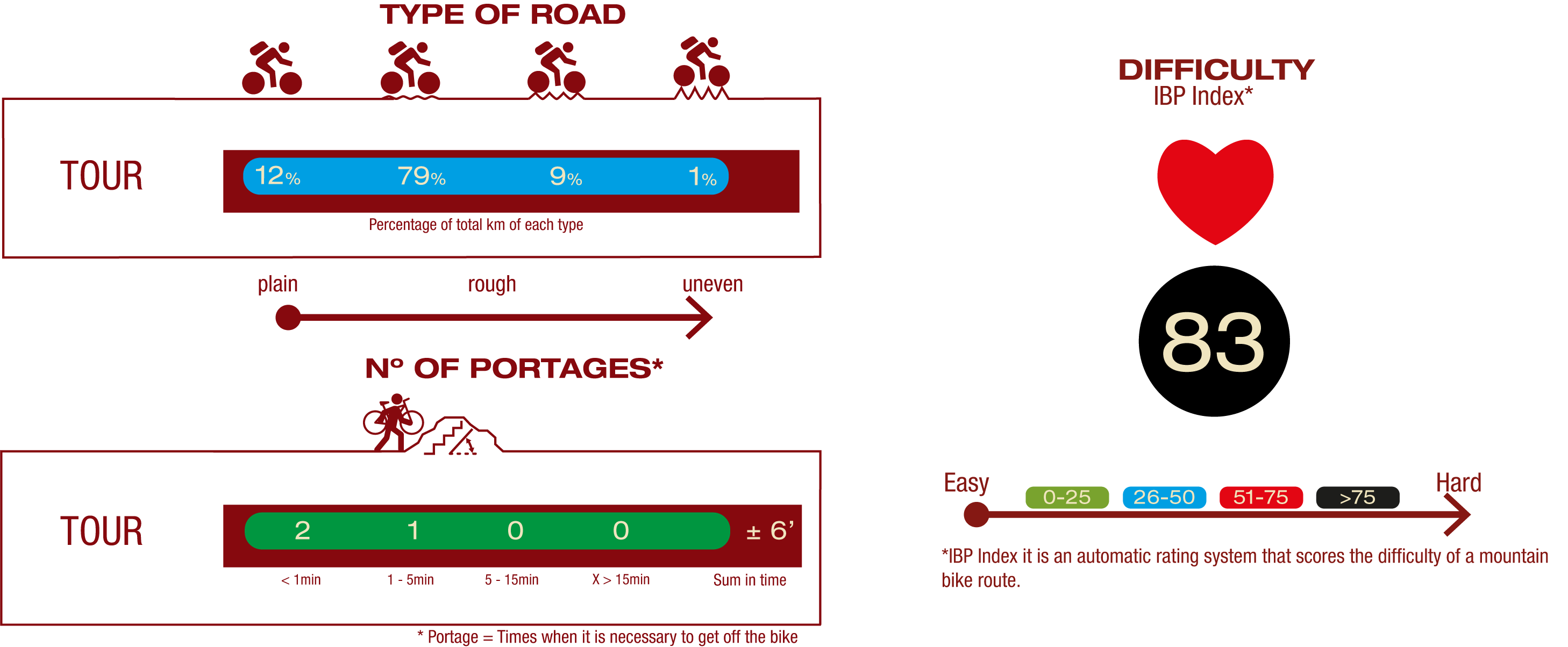
CYCLOSTAGE 2
PROFILE
TYPE OF ROAD, PORTAGES & DIFFICULTY
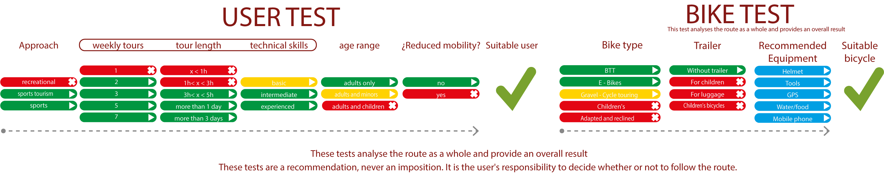
TEST (Both cyclostages)
SAFETY RECOMMENDATIONS (Both cyclostages)
- Prolonged downhill sections with uneven road surface.
- Transit through the centre of some population centres.
- Few options to replenish water.
GENERAL RECOMMENDATIONS (Both cyclostages)
- Find out about the technical aspects of the route and the weather on the day.
- Take care of the environment. Take care not to disturb animals or damage vegetation. Respect private areas.
- You must give priority to pedestrians and comply with general traffic rules.
- The environment in which you will be riding is open, free to move around and an area where many activities are carried out (sporting, forestry, livestock and agricultural activities). Always have an understanding, prudent, responsible and respectful attitude.