
- Home
- Rural Development
- Nature Trails
- Nature Trails
- Northwest Sector
- Conquista de Bembibre
Ruta de la Conquista Nature Trail
Description
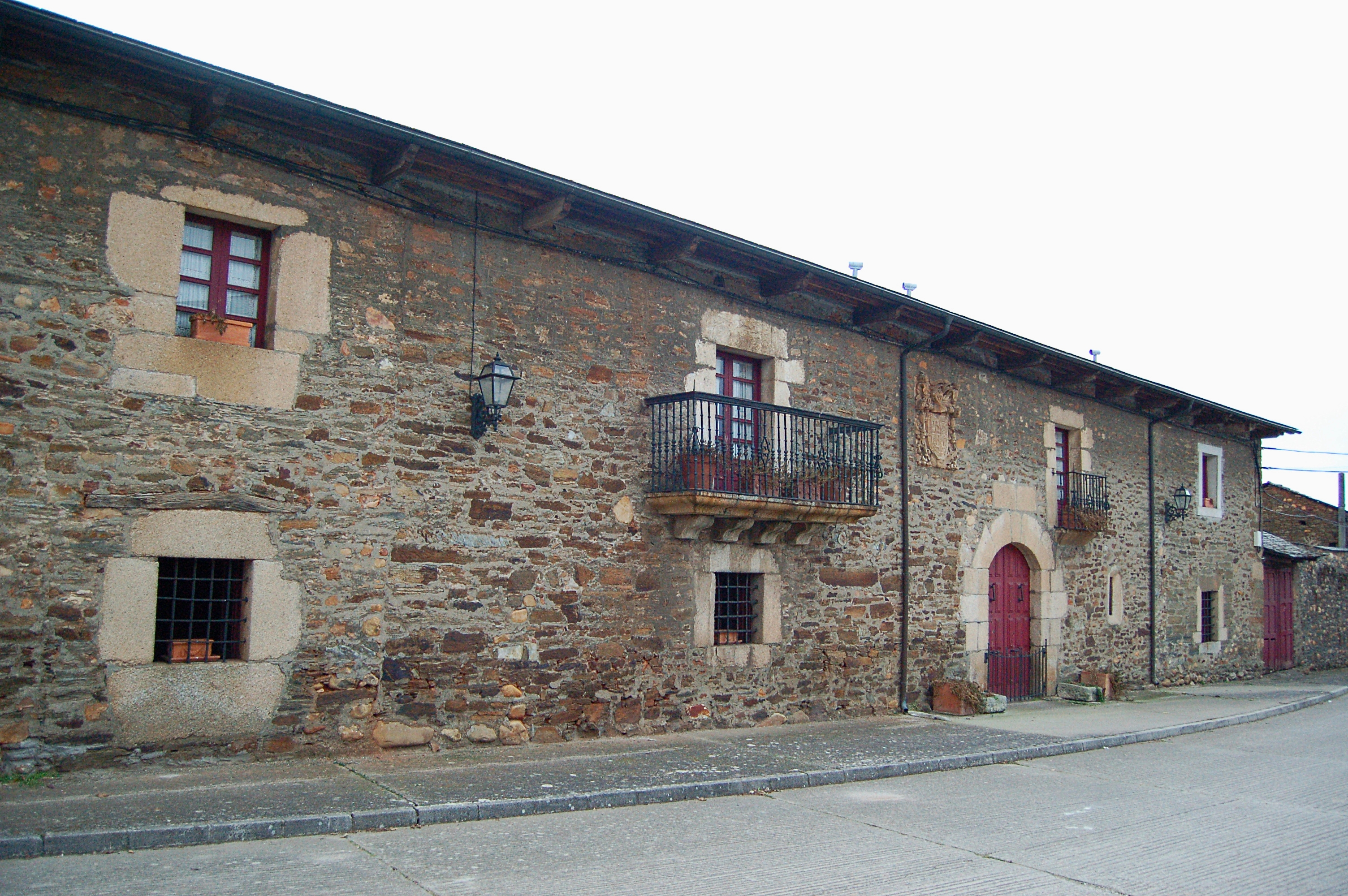
Villages of stone and slate dot the woods of cork oaks and Pyrenean oaks
Labaniego marks the start of the Conquerors' Route Nature Trail. After crossing a beautiful forest of Pyrenean oaks, San Esteban del Toral may be visited. Grape crops have been cultivated here since ancient times, giving the village of Viñales its name. After enjoying a visit to Rodanillo, cork oaks and strawberry trees adorn the path, and become more dense after passing Cobrana, lining the tracing of the Zofreral Route. The Shrine of Nuestra Señora de la Peña offers and spectacular panoramic view over Congosto, which is the end of this Conquerors' Route Nature Trail.
The Conquerors' Route Nature Trail crosses the shire of El Bierzo, in León. Its starting point is the village of Labaniego. An interpretation panel marks the start of the trip, which begins crossing the village from West to East along the El Cristo Street, where the traveller may visit the Santiago Apóstol Church, dedicated to St. James the Apostle, and the Santo Cristo Shrine. In the car park, before leaving the village, there is a detour to the left which allows to visit the ruins of the San Fructuoso Monastery.
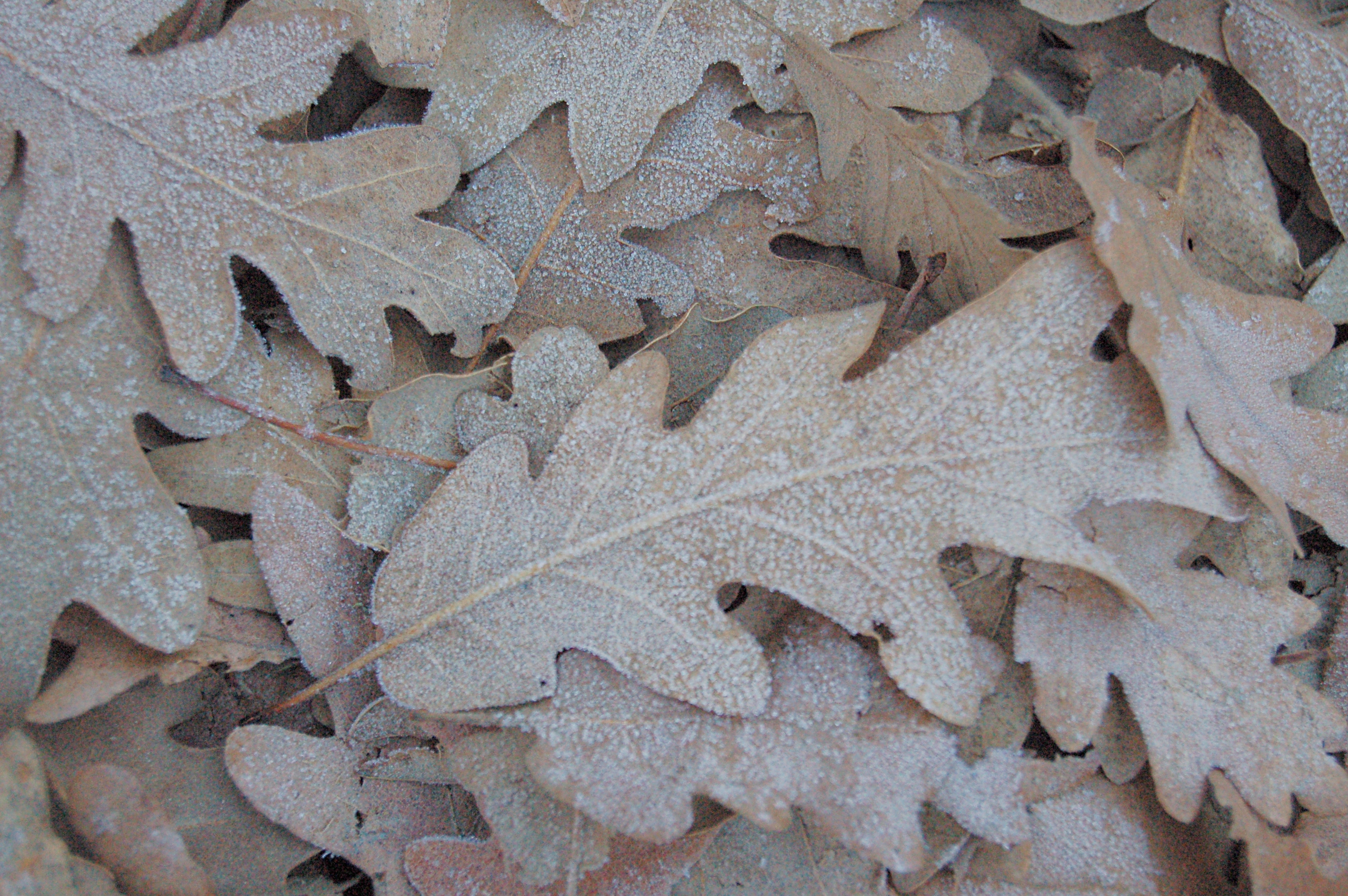
The trail continues along a dirt path, first straight and then along a descending slope, until reaching, after a few metres, a recreational area with stone benches and tables. The user then enters a wood of Pyrenean oaks (Quercus pirenaica) which, in autumn, presents stunning golden hues due to its leaves marcescence: this characteristic prevents dead leaves to fall to the floor, and they stay attached to the branches for a long time.
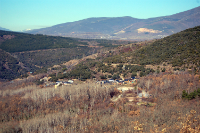
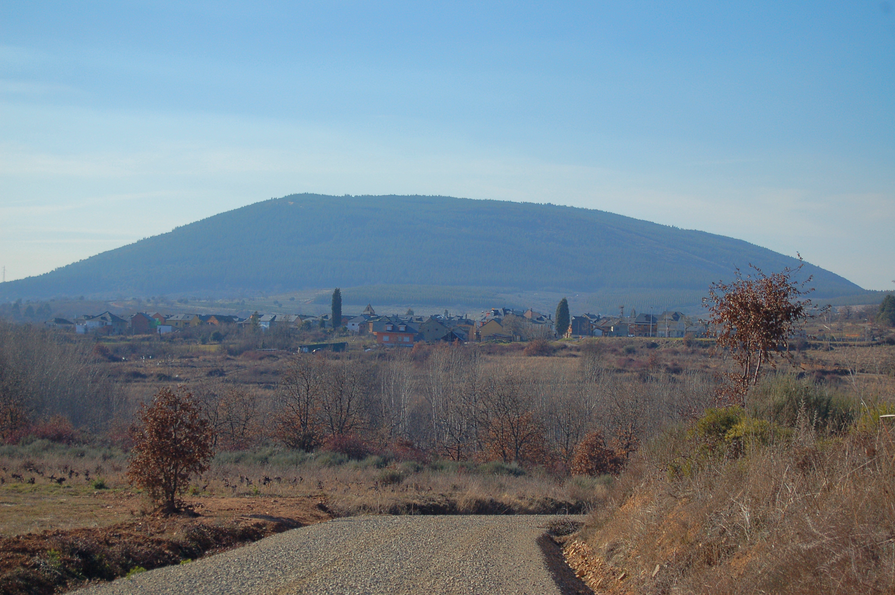
Shortly before the trail turns left, it starts and ascension that ends well after kilometre point 1. This section goes through the aforementioned wood of Pyrenean oaks. The trial turns right and becomes less steep and the first pine masses appear to the left of the road. At kilometre point 2, the trail begins to descend and, a little further, a viewpoint offers spectacular views over Labaniego, the hills and the nearby villages.
The descending trail heads south, by a steeper slope that runs between oaks, shrubs and masses of reforested pines. The trail runs close to the Creek Reguera del Goyo and heads to San Esteban del Toral. Kilometre point 4 is located in the entrance of this village, and a little further the traveller shall find an interpretation panel informing them of the beauty hidden in this village.
The trail continues though the main street, and then it takes the Las Llamas and La Laguna streets. It is possible to take a short detour, not even 200 m, to visit the beautiful church of San Esteban del Toral. Back to the trail, it leaves the village by turning right on a dirt path.
The grape fields to the left indicate the traveller that they are approaching Viñales. The trail runs down a slope to kilometre point 5 and crosses old chestnut trees and newly reforested areas before reaching this village. Again by an asphalt road, the trail turns left crossing the main square of the Barrio de Arriba and the Venancio Álvarez street, to the Coal Mining Memorial. At this point, the trail turns right, and an information panel listing the village highlights may be found.
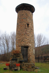
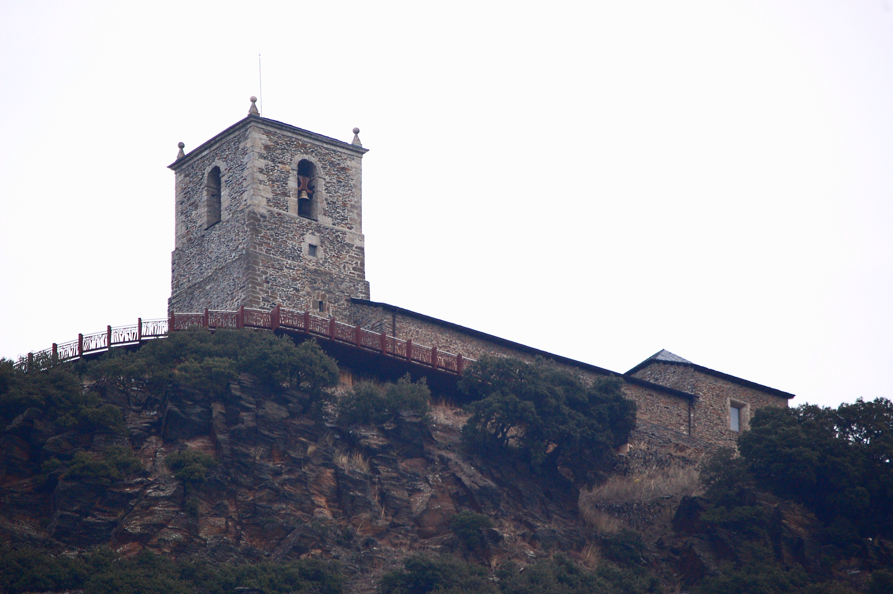
Next, the trail reaches the tower of the old parish church of Viñales, which is currently known as lookout tower The Viñales Sentinel. Walking along the road, the traveller reaches kilometre point 6 and crosses the road by the next zebra crossing, and leaves the village by taking a dirt path to the left.
For approximately 500 m, the trail runs along a steep slope which reaches a 10% gradient. After a curve, the slope becomes less steep and the traveller is rewarded with spectacular views over Viñales. The climb is ended at the following crossroads. The descend begins, and allows to see the village of Rodanillo just in front. The trail reaches kilometre point 7 among grape crops, small reforested areas and scrubland. The slope ends when it reaches the Creek Valdemolín and its riverside woodland formed by poplars and ash trees, among other species. This woods protects the basin and allows the traveller to take a brief shelter in the shadow.
Next, the village of Rodanillo welcomes the traveller, who walks down the streets of Los Majuelos, Las Eras, and Camino Losada, where the local church is located. Then, the trail leaves the village by the La Cárvaca street, where an information panel may be found. Shortly afterwards, the trail crosses the LE-463 road by the appropriate pedestrian crossing and, once in the dirt path, reaches kilometre point 9 in an area of scarce trees where the Pyrenean oaks is once again the protagonist.

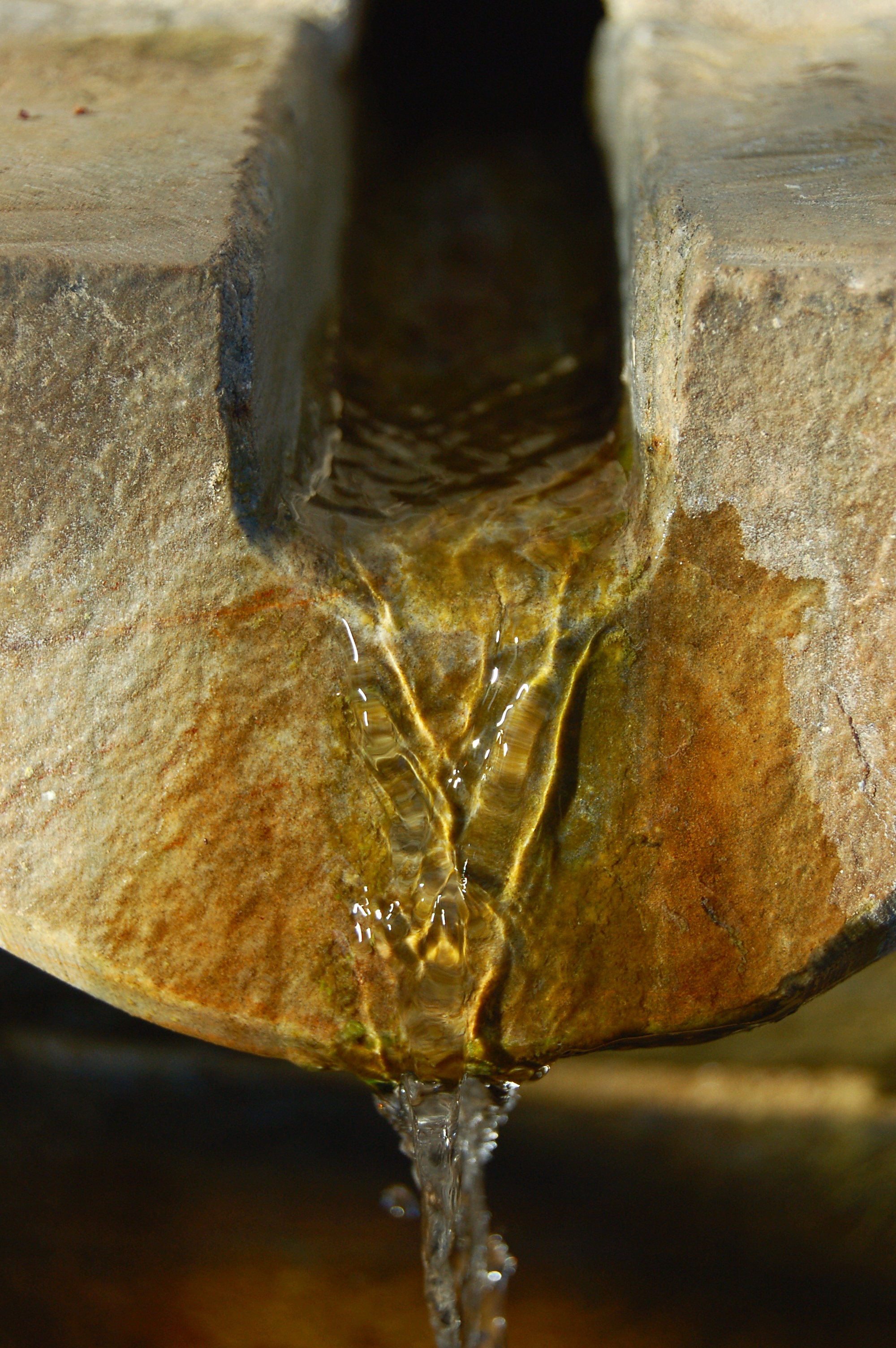
The trail crosses the Andrés Canal and after going up and down several hills, vegetation becomes denser and more varied. A sign of this is that the first cork oaks (Quercus suber) and strawberry trees (Arbutus unedo) may be found. The traveller may comfortably rest in a recreational area provided with a fountain and stone tables, and guarded by old chestnut trees.
Shortly after kilometre point 12 the Nature Trail crosses the local route known as El Zofreral. The trail shall cross and recross, and even run along, this route several times. Cork oaks from whose bark cork is obtained, become more and more abundant, and the traveller is surrounded by an oasis of biodiversity of significant botanical value for such a northern area. .
The route zigzags across the El Zofreral route, guarded by old chestnut trees which witnessed ancient times, before reaching a new recreational area located deep in the cork oak woods.
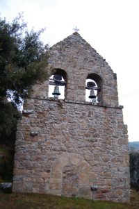
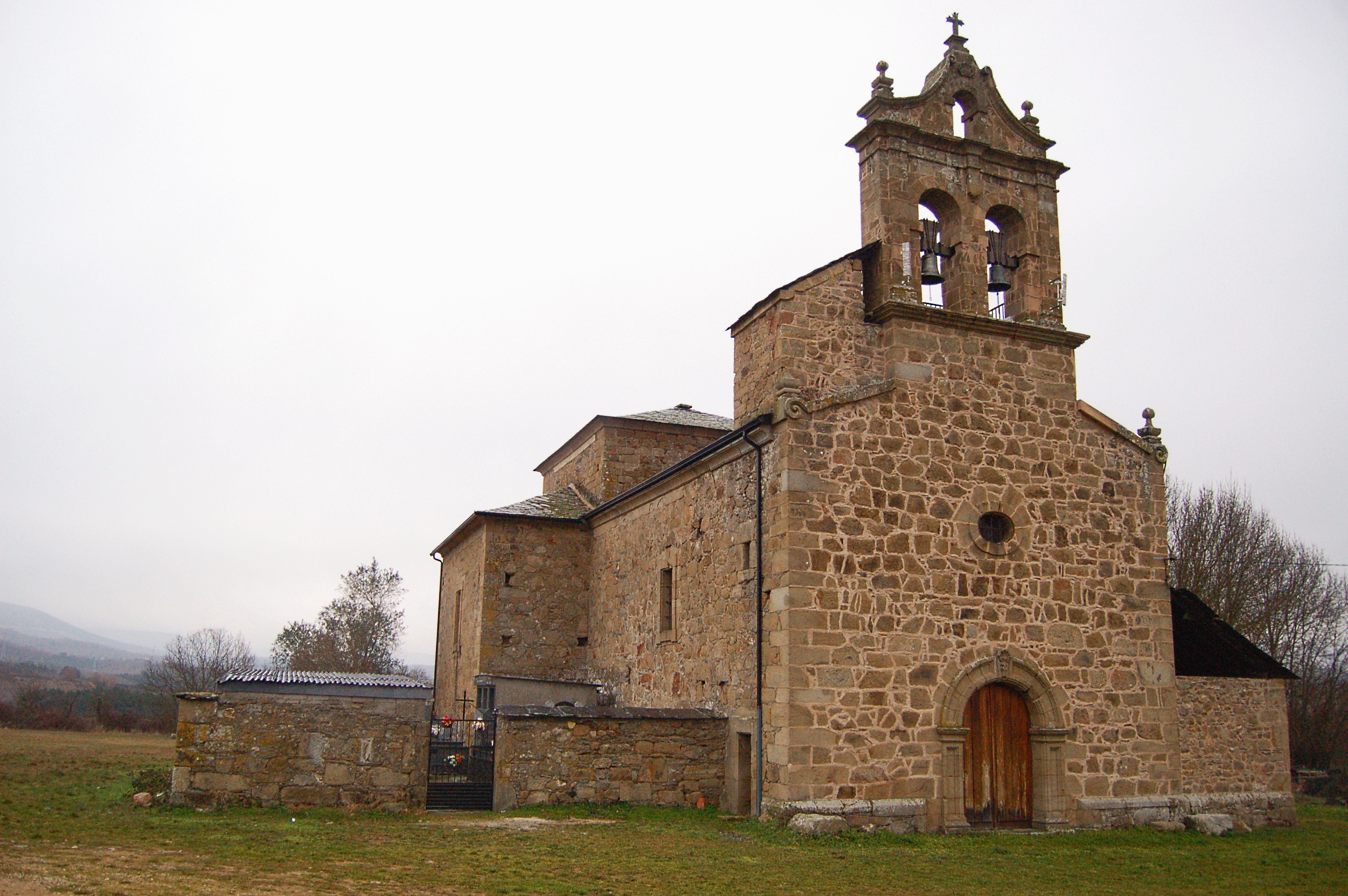
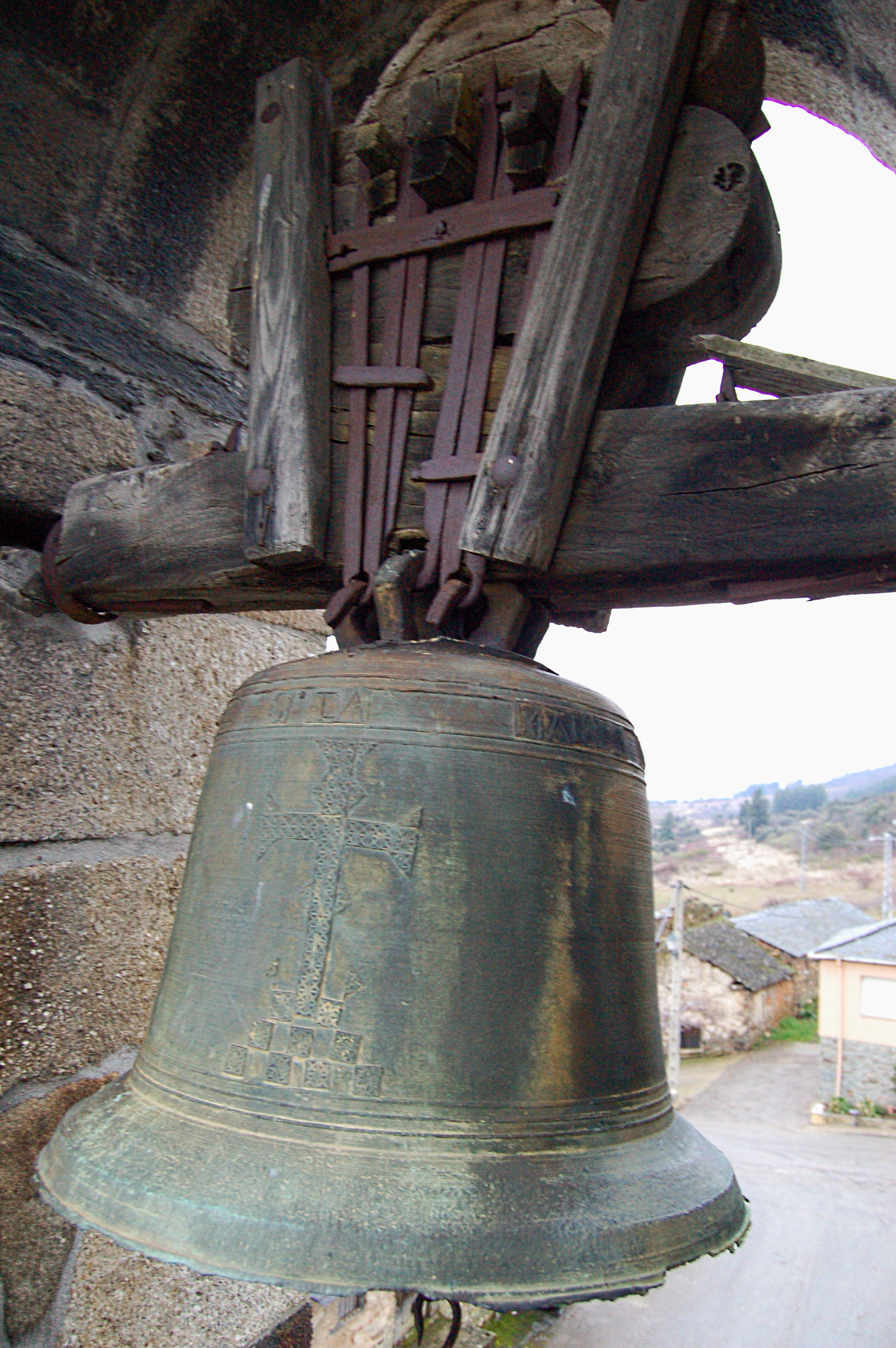
Once the traveller has regained their strength, they continue until reaching the Santo Cristo de Cobrana Shrine and afterwards the Nature Trail interpretation panel, which stands in the village streets next to the panels describing the two El Zofreral routes. The trail ascends along the Las Nogales Street and turns right by Las Moreras street and along the El Ciprés Street, leaving to the left the pretty church of Santa Maria Magdalena, whose bell tower is a perfect example of traditional architecture. After crossing the Constitución square, the trail turns left, and ascends leaving the village behind.
Shortly before kilometre point 15, the trail becomes a wide dirt road which ascends through the hills. After reaching kilometre point 16, and still ascending, the trail follows the layout of the El Zofreral route and becomes a narrow forest path. For this reason, as indicated by the appropriate signal, it is recommended to climb down of the bike. This path winds up the hill leading the traveller to a magnificent wood of cork oak (Quercus suber), whose beauty is enhanced by the strawberry trees (Arbutus unedo) that dot the woods.
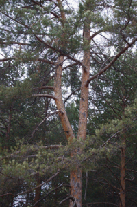
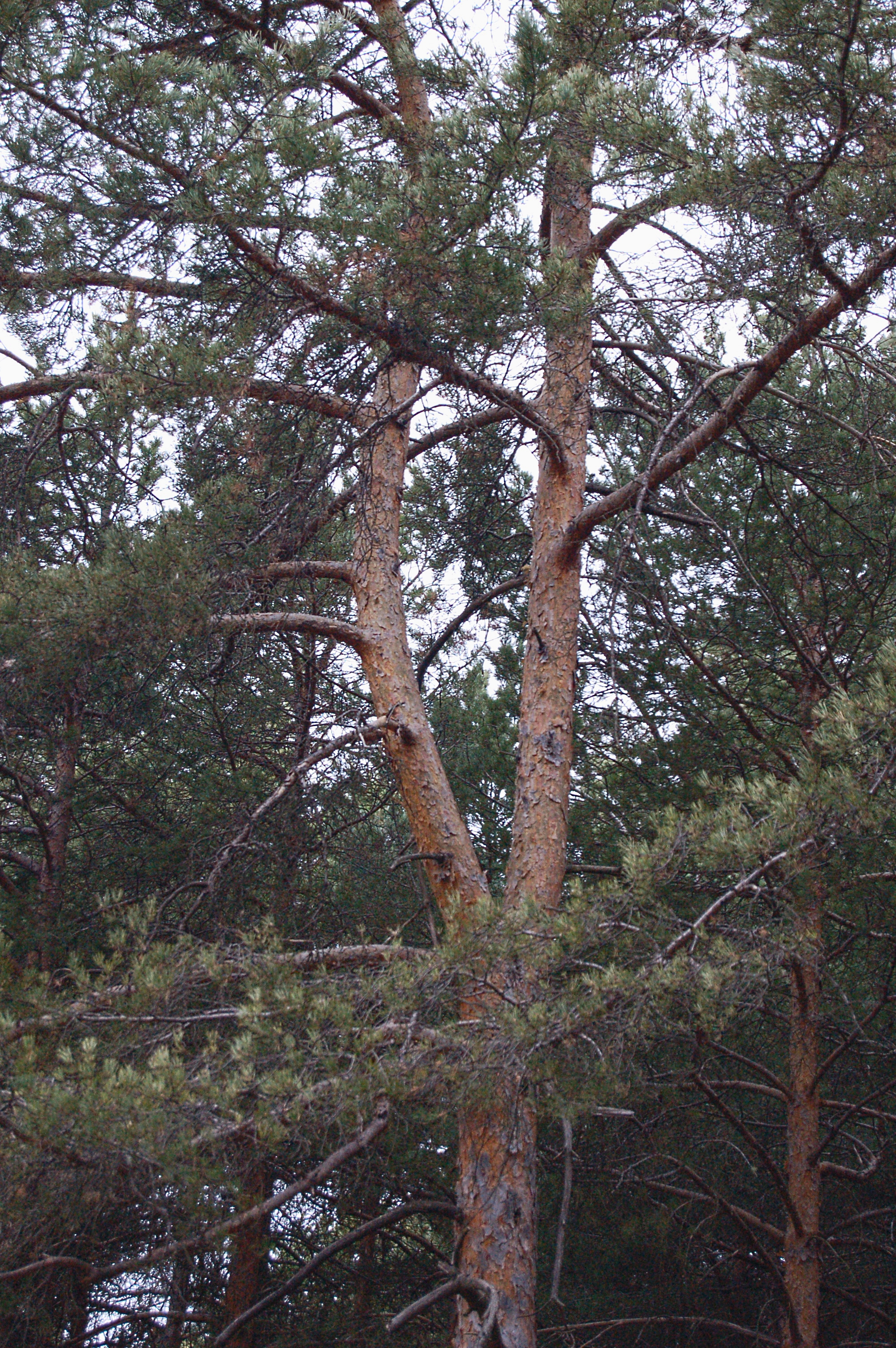
The trail ends in the Cobrana viewpoint which allows the traveller to take a rest while enjoying the panoramic views from this privileged spot. The path becomes wider before reaching kilometre point 17, and shortly after the trail is crossed by a chain that prevents motor vehicles from passing. From this moment, the reforested pine dominates the vegetation, and, after kilometre point 18, the traveller may enjoy crossing a patch of wild pine trees (Pinus sylvestris) with their characteristic salmon-hued paper-like bark.
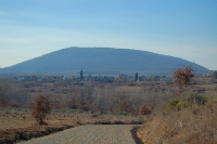
A small oak tree (Quercus ilex) patch, after kilometre point 19, guards the Shrine of Virgen de la Peña, which well deserves a detour to enjoy its architectural beauty and the landscapes surrounding its location atop Mount Turcia.
The trail runs along a dirt path, first parallel to the road that leads to the shrine and then across it, so please be extremely cautious. Then, the trail becomes narrower and descends down the hill, where it becomes wider again. After passing kilometre point 20, the path zigzags down the hill. The traveller may observe the marks that a fire left on the woods. The village of Congosto may be seen at all times..
A few metres before kilometre point 21, a short section along the road starts. The trail passes the Santa Olaya fountain and enters the village of Congosto. Once in the village, the trail turns left by the Real Street to the Shrine of Santo Cristo de las Maravillas and right to the Ayuntamiento Street, and finally turning again right by the Era street, where a recreational area and a porticoed market, and an information panel stand where the threshing floor used to stand. This is the end of the Conquerors' Route Nature Trail.
Sites of interest
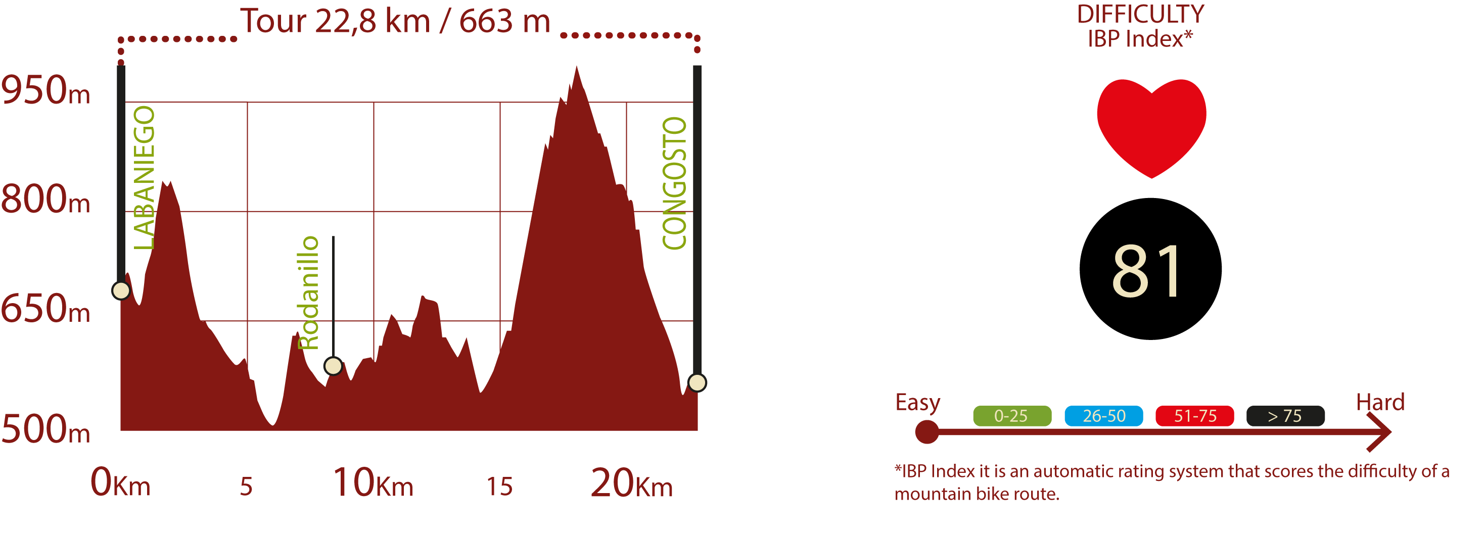
Profile
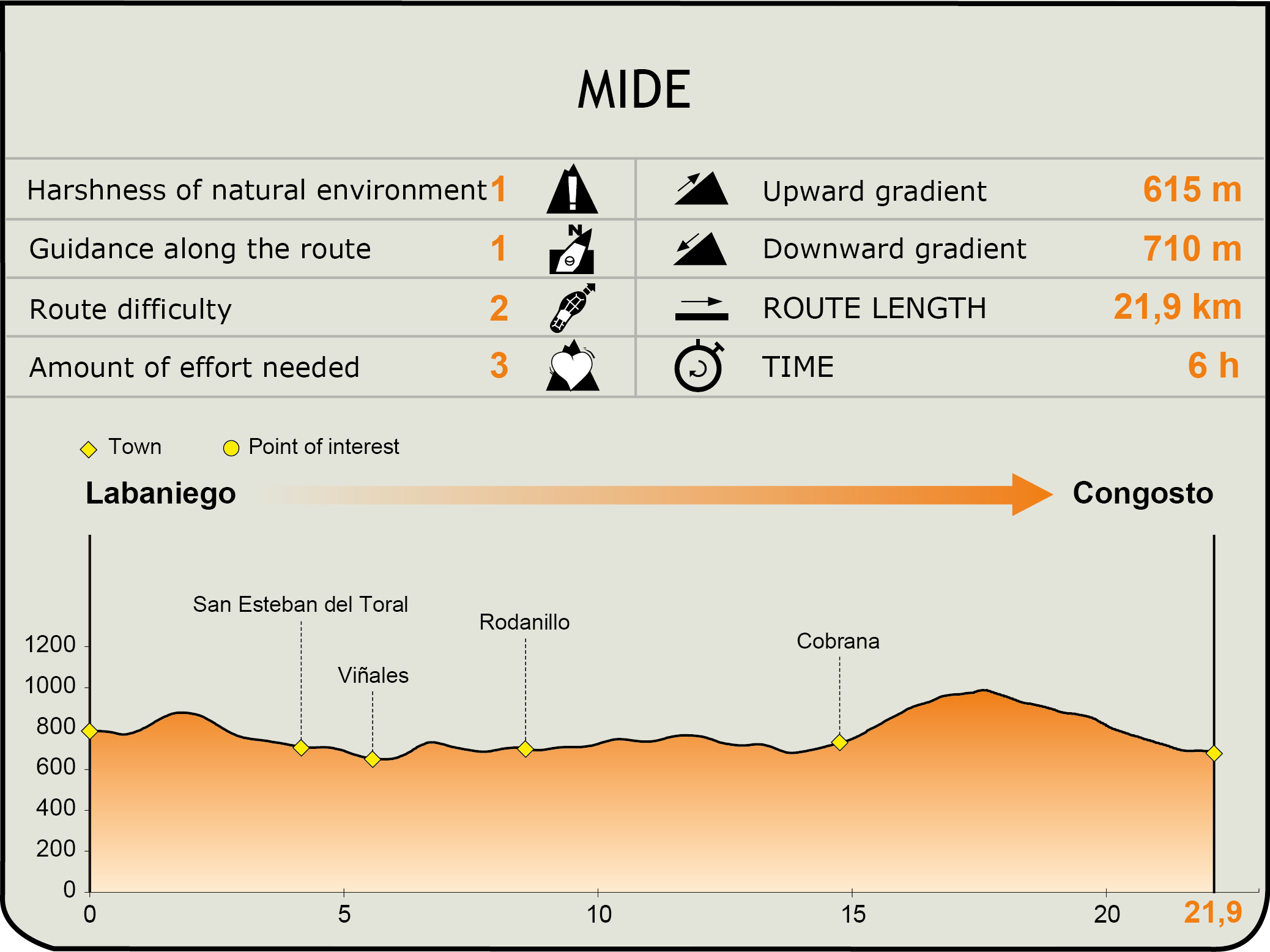
MIDE (Method for the Information of Excursions)
 Harshness of natural environment
- 1. The environment is not risk-free
- 2. There are more than one risk factors
- 3. There are various risk factors
- 4. There are quite a lot of risk factors
- 5. There are many risk factors
 Guidance along the route
- 1. Well defined trails and crossings
- 2. There is a clearly marked trail and signage
- 3. Requires the identification of geographic features and cardinal points
- 4. Requires off-path navigation
- 5. The trail is interrupted by obstacles that have to be gone around
 Route difficulty
- 1. Walking on a flat surface
- 2. Trails with different types of path
- 3. Walking on stepped paths or irregular terrain
- 4. The use of hands or jumping over the terrain is necessary
- 5. The use of hands is required to progress
 Amount of effort needed
- 1. Up to 1 hour of continuous walking
- 2. Between 1 and 3 hours of continuous walking
- 3. Between 3 and 6 hours of continuous walking
- 4. Between 6 and 10 hours of actual walking
- 5. More than 10 hours of continuous walking
Featured
Further information
El Zofreral
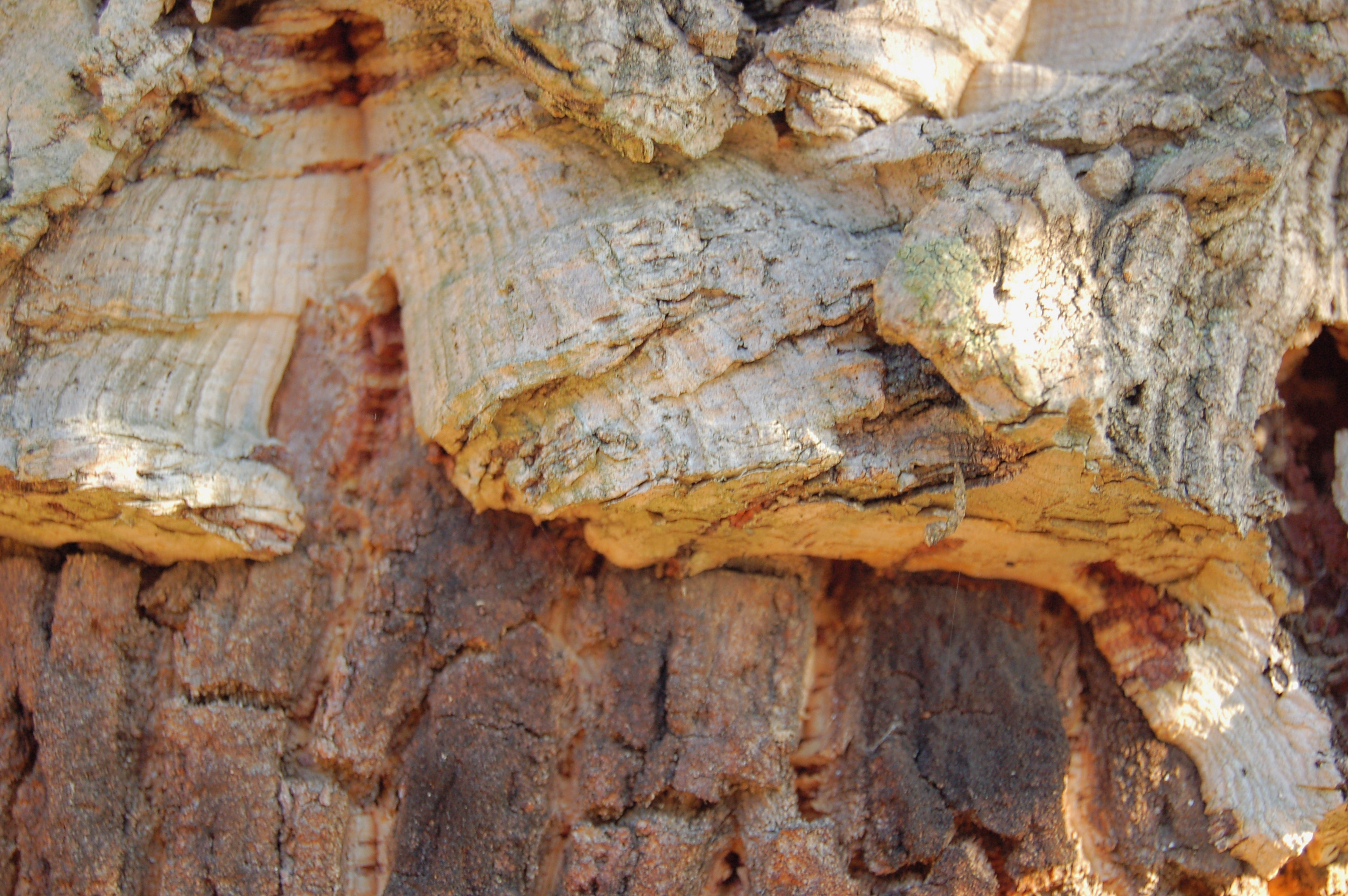
El Zofreral is the name given by the Cobrana natives to the woods of cork oak. It is a wood formed by cork oaks, or zofreros, as they are known locally, which cover around 180 ha mid-slope (approximately 600 m high) on the south-facing side- These Mediterranean woods, usually characteristic of more southern area, thrive here due to the particular topography and environmental conditions of the area.
Cork oaks are trees from the Fagaceae family. Their main value lies in its bark, from where cork is obtained. The first natural cork extracted by from cork oak bark presents irregularly distributed cracks. Once this natural cork has been obtained, subsequent cork layers produced by the same cork oak have a more regular texture. Bark is extracted in the form of large rectangular panels. Panels from the first layer of barks are mainly used as decoration (for example, for nativity scenes) and from the second and subsequent layers are mainly used as bottle stoppers for the wine industry.
Multimedia


Downloads
GPS Download
Brochure and Maps
Cyclability
PROFILE & DIFFICULTY
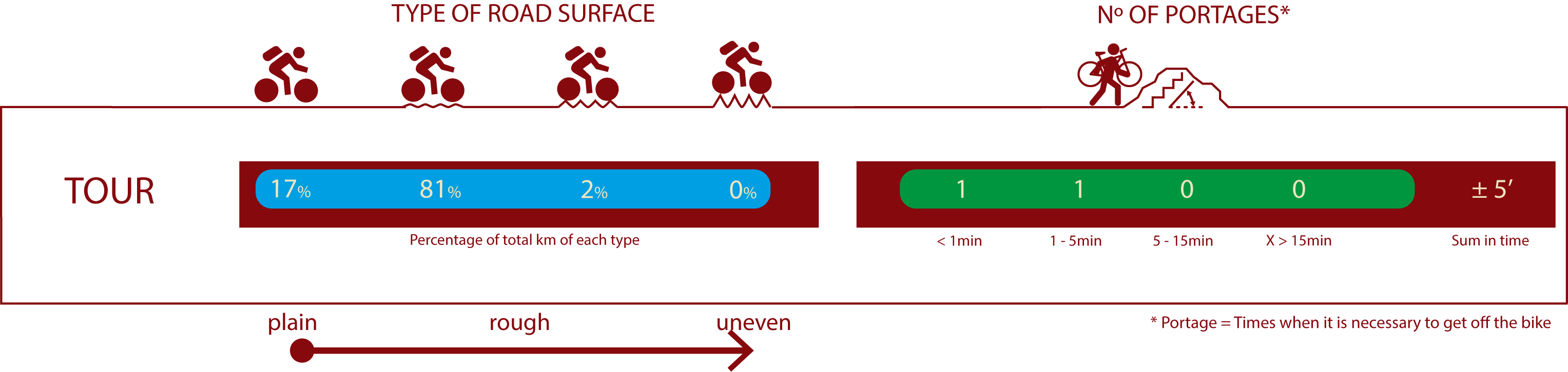
ROAD TYPE & PORTAGES
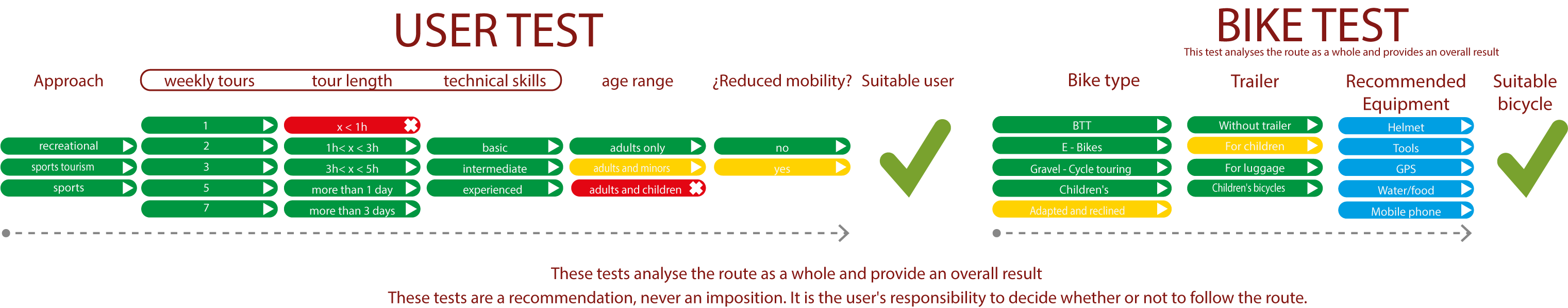
TEST
SAFETY RECOMMENDATIONS
-Sections shared with hikers and agricultural vehicles.
-Transit through the centre of some population centres.
GENERAL RECOMMENDATIONS
-Find out about the technical aspects of the route and the weather on the day.
-Take care of the environment. Take care not to disturb animals or damage vegetation. Respect private areas.
-You must give priority to pedestrians and comply with general traffic rules.
-The environment in which you will be riding is open, free to move around and an area where many activities are carried out (sporting, forestry, livestock and agricultural activities). Always have an understanding, prudent, responsible and respectful attitude.