- Home
- Rural Development
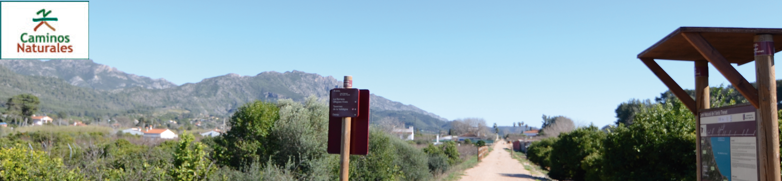
- Nature Trails
- Nature Trails
- East Sector
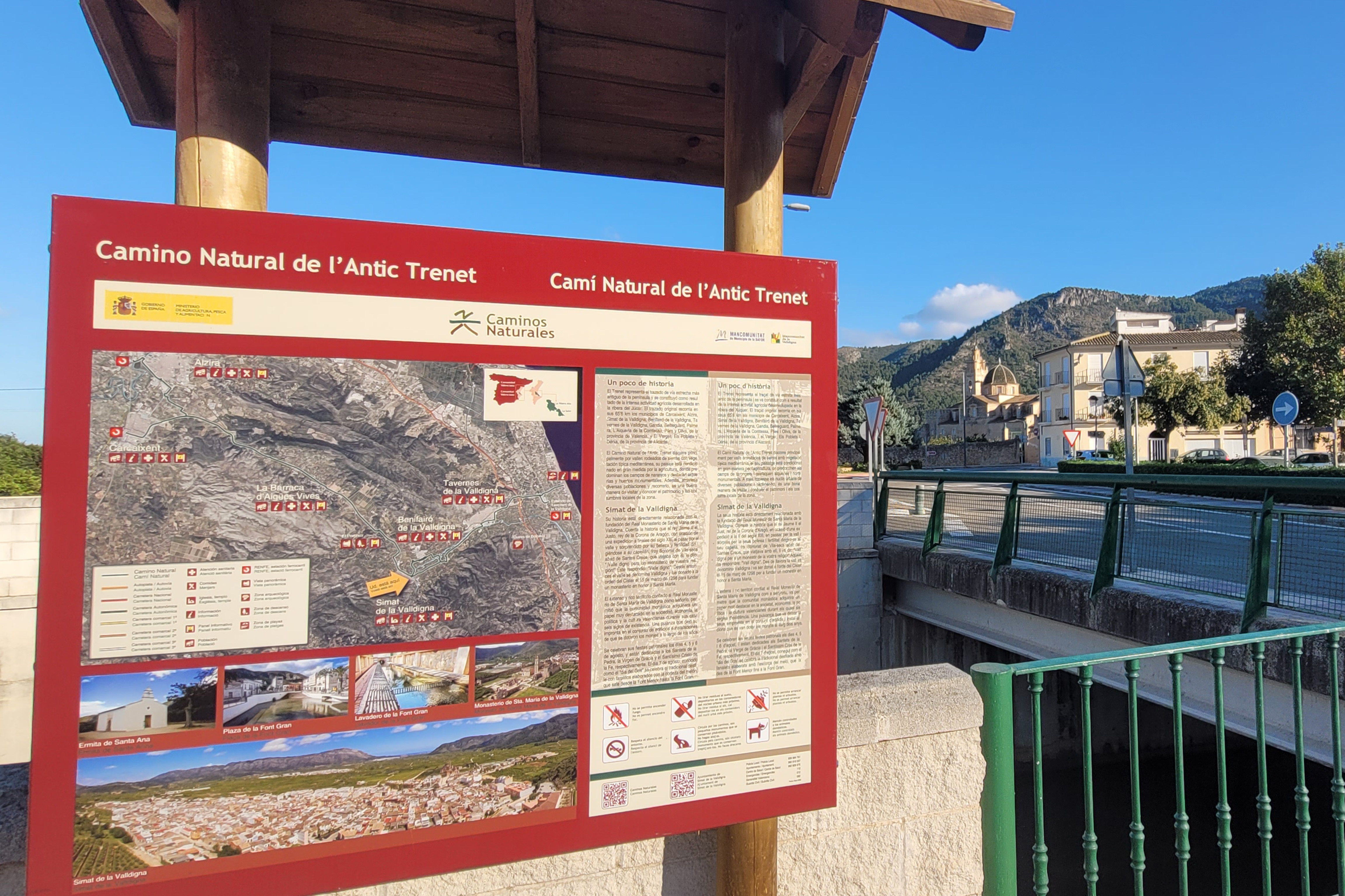
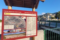
L'Antic Trenet Nature Trail
Description
Following the path of the Trenet (“little train”) from Carcaixent to Denia, a pioneer among the peninsular narrow gauge railroads
This Nature Trail reclaims for recreational use part of the Carcaixent to Denia railroad’s layout. It takes the traveller from the town of Ribera Alta to the region of La Safor, all the while sheltered between the Les Agulles and La Murta mountain ranges.
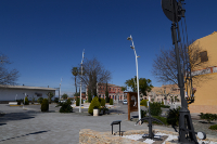
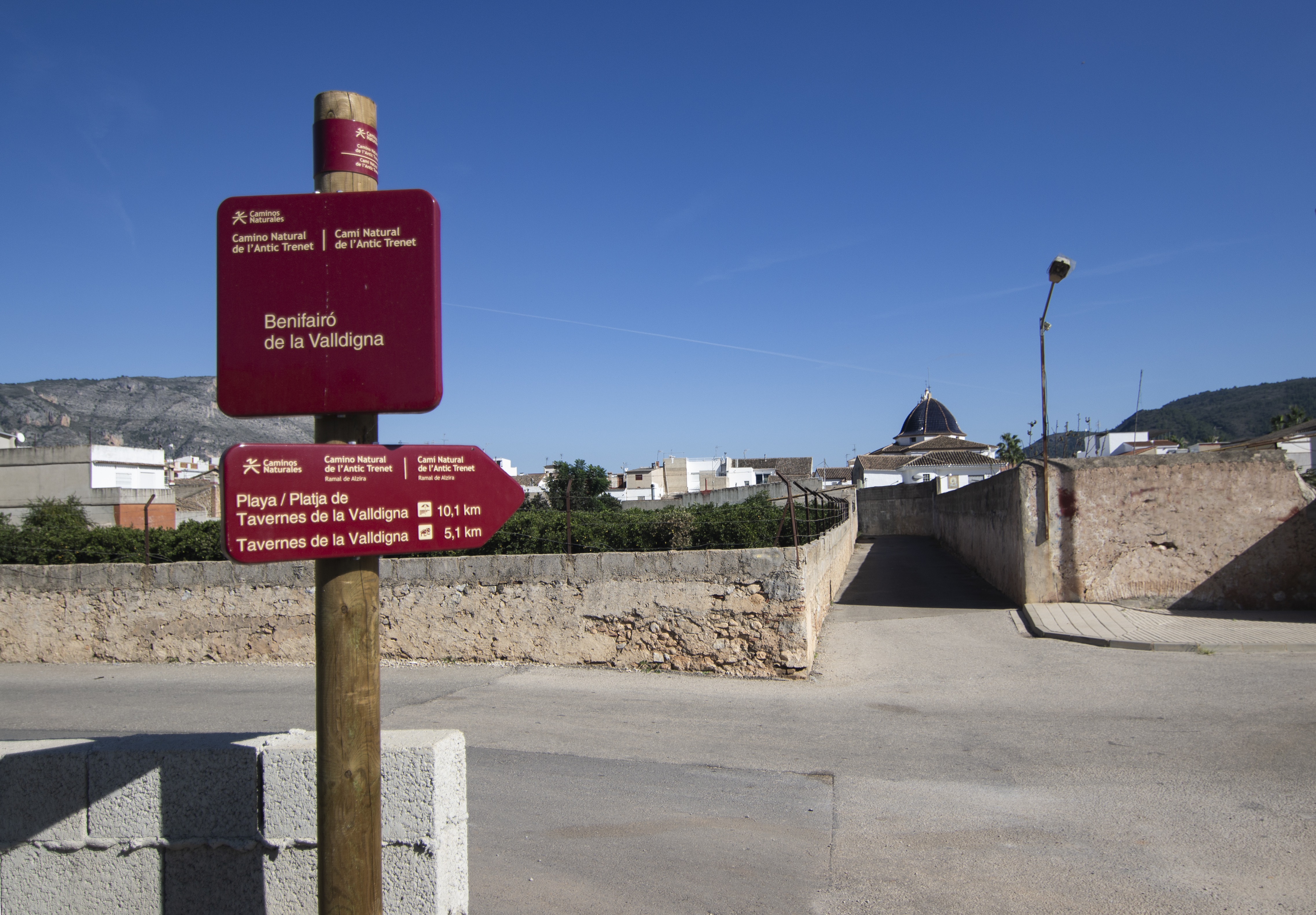
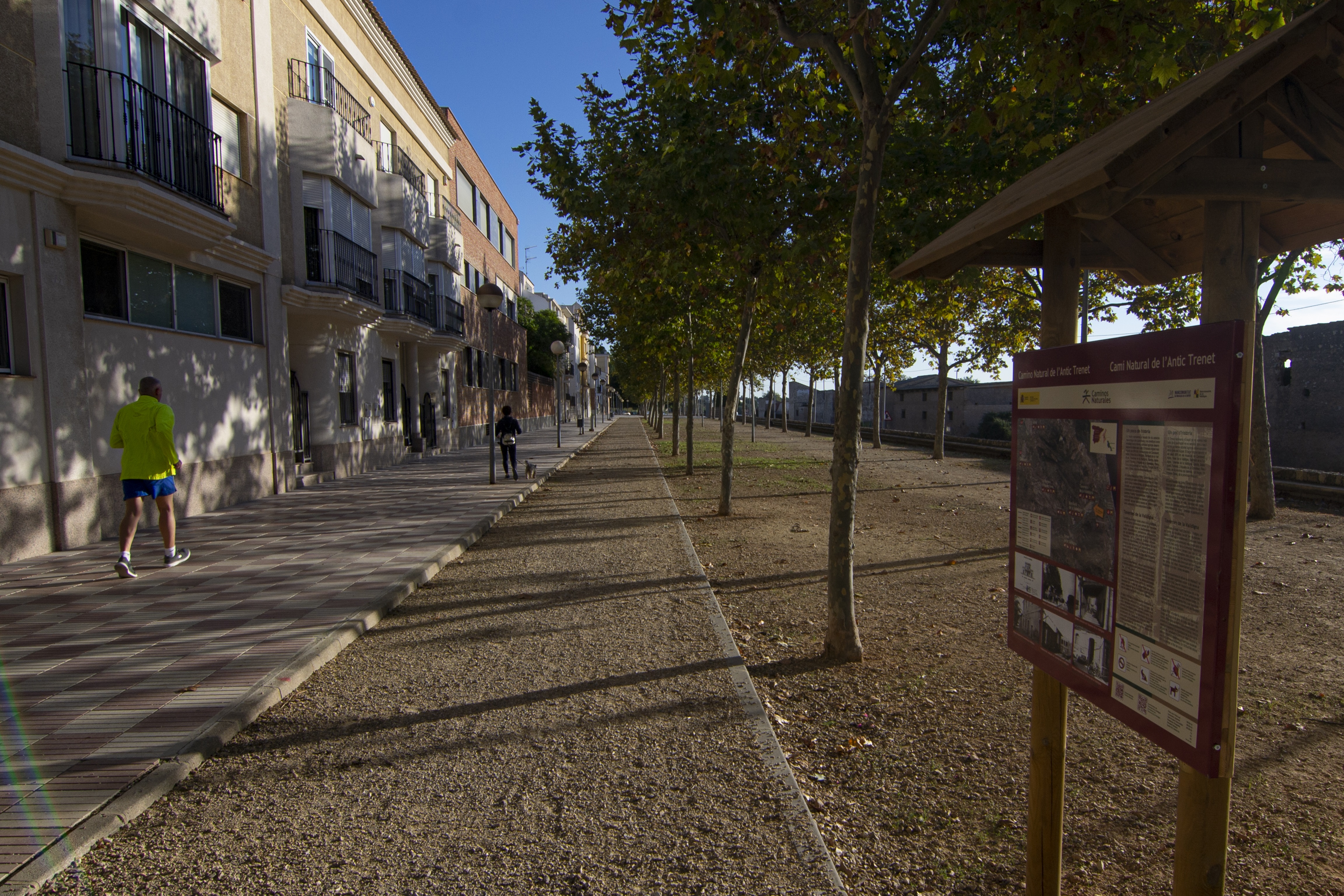
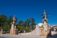
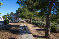
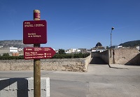
The trail starts in front of the Carcaixent train station, next to its parking lot. Before you leave, though, we recommend you visit the Magatzem de Ribera (Ribera's warehouse), a quaint modernist building inaugurated in the early twentieth century as a warehouse for orange trade.
The first section of this trail runs through the town center, so it is advisable to exercise extreme caution at street crossings and, if you are cycling, always keep in mind that you will be sharing the trail with motor vehicles. The trail continues along Carrer de les Corts Valencianes, next to the municipal sports center. After a roundabout, the street changes its name to Avinguda de les Germanies, and continues next to the Navarro Darás municipal park.
At the next roundabout, turn left onto Carrer Sebastian Hernandez, which later becomes Avinguda de la Vieta (named after the Trenet). Further down this street we reach the end of the urban section, where we find new remnants of the old train route – railway signs located at the entrance to a roundabout, next to Carrer de Gandia.
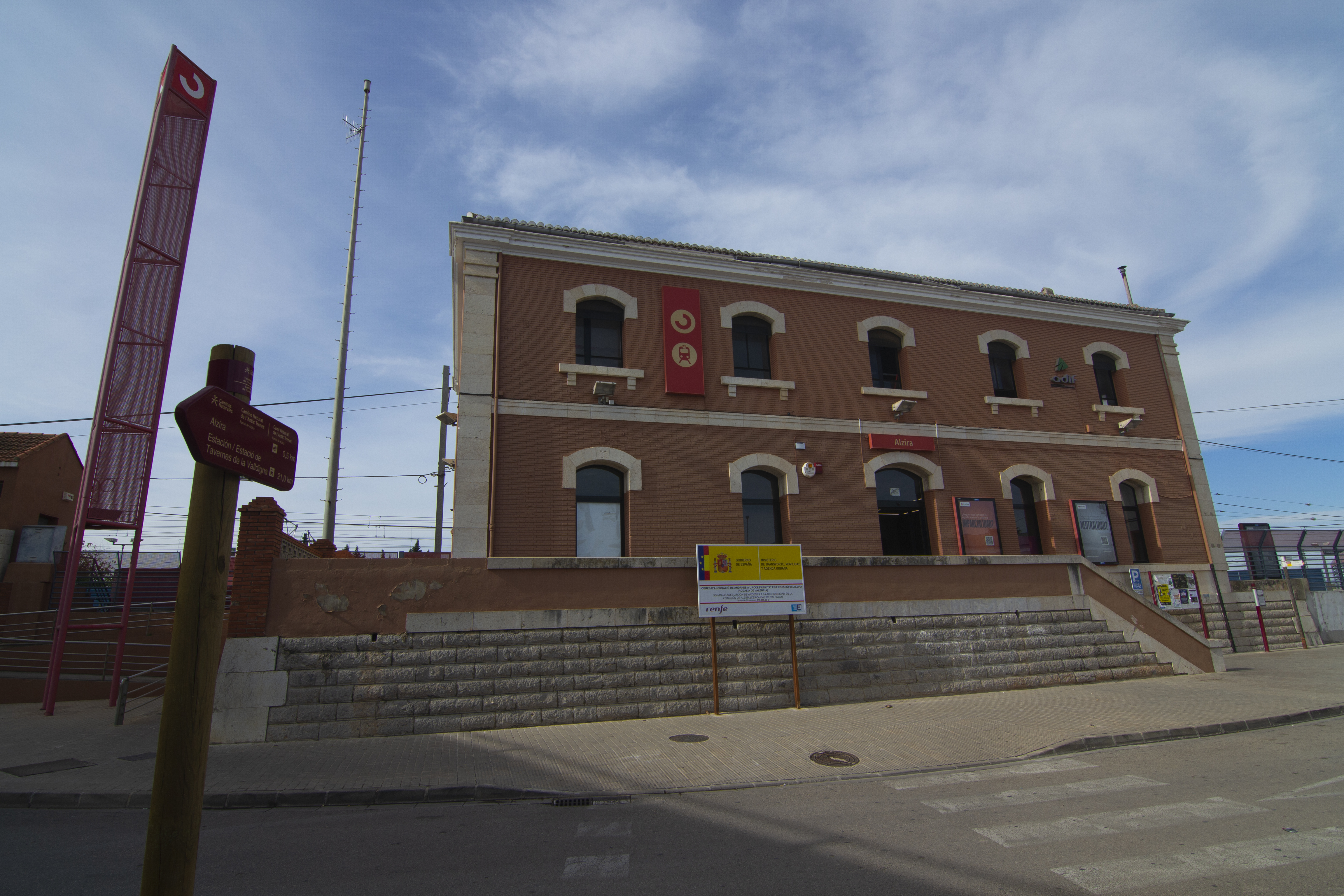
The Nature Trail is momentarily interrupted by the CV-570 road, and resurfaces 1 kilometer later, to the right of the aforementioned road. Before continuing along the old railway platform, an alternative branch that starts on the left-hand side allows you to reach Alzira and its train station.
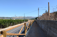
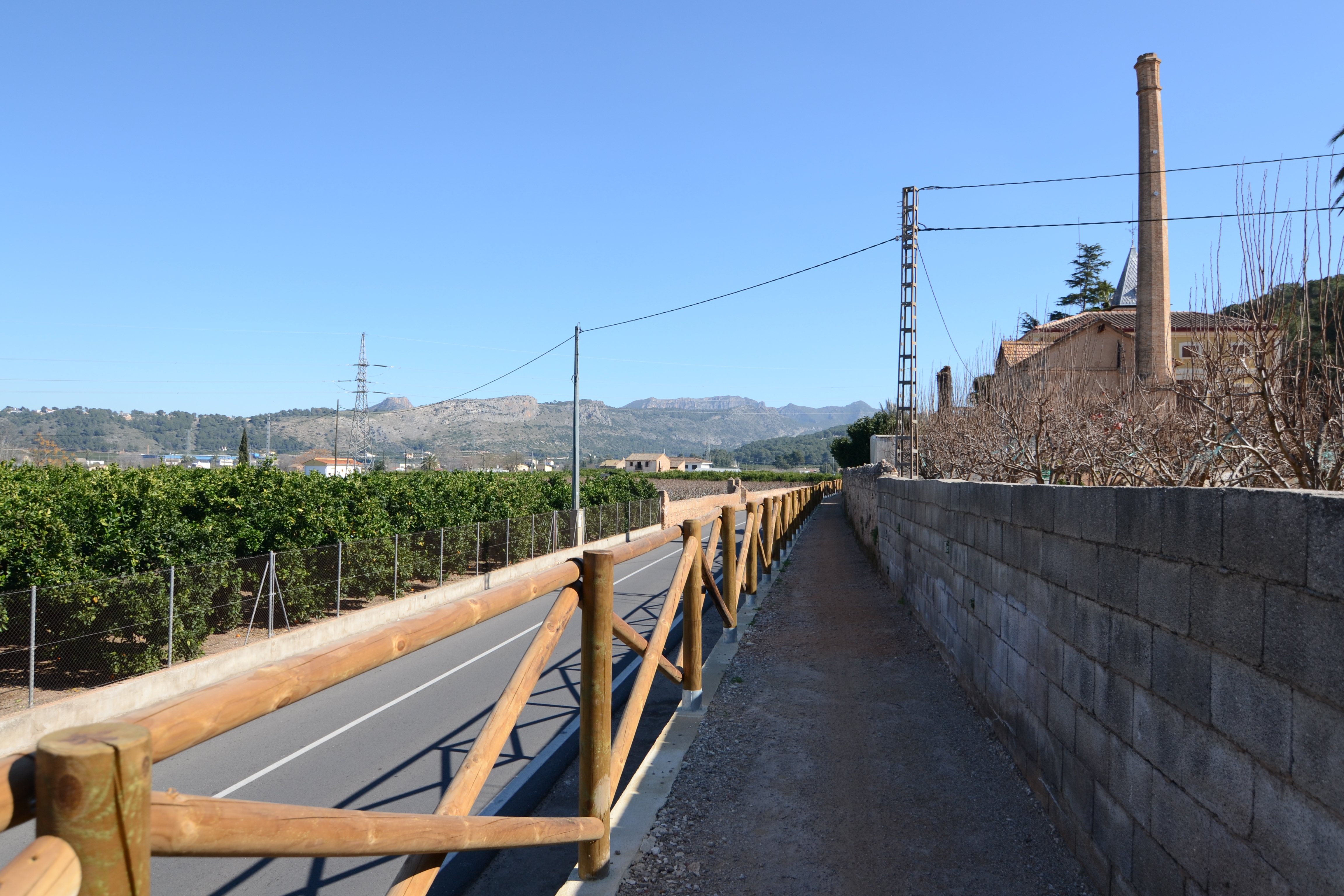
For the next 400 m, you will walk parallel to the road, between the walls of a farm and the wooden fences protecting the path (if you are cycling, you should get off the bike and carry it). Here the trail climbs higher than the road, which allows you to look over the crops on the left, or even the town of Alzira further away in the north. A couple of highlights of this unique panoramic view are the hill on which the Royal Sanctuary of Santa Maria del Lluch stands and, of course, the Serra de La Murta to the northeast.
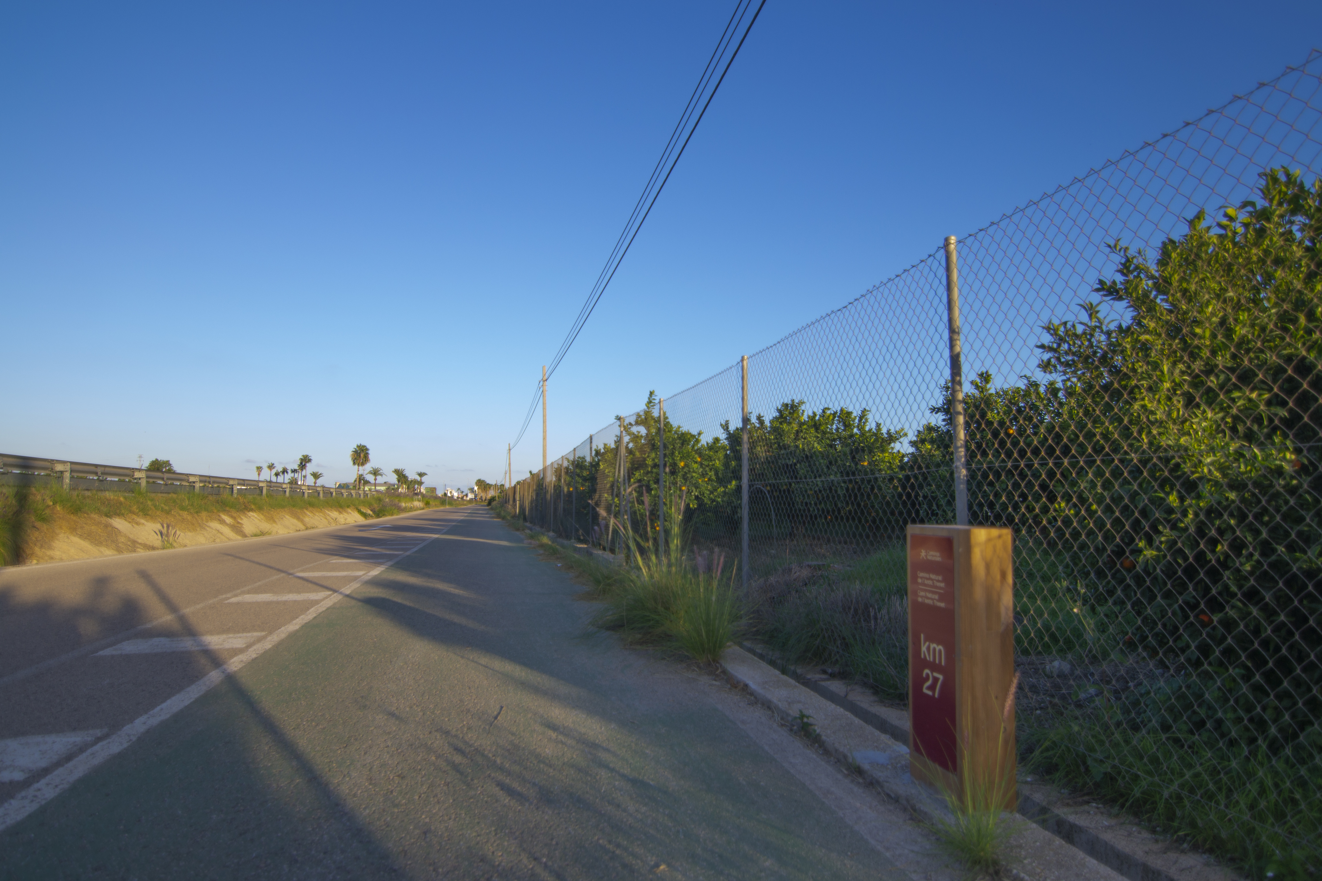
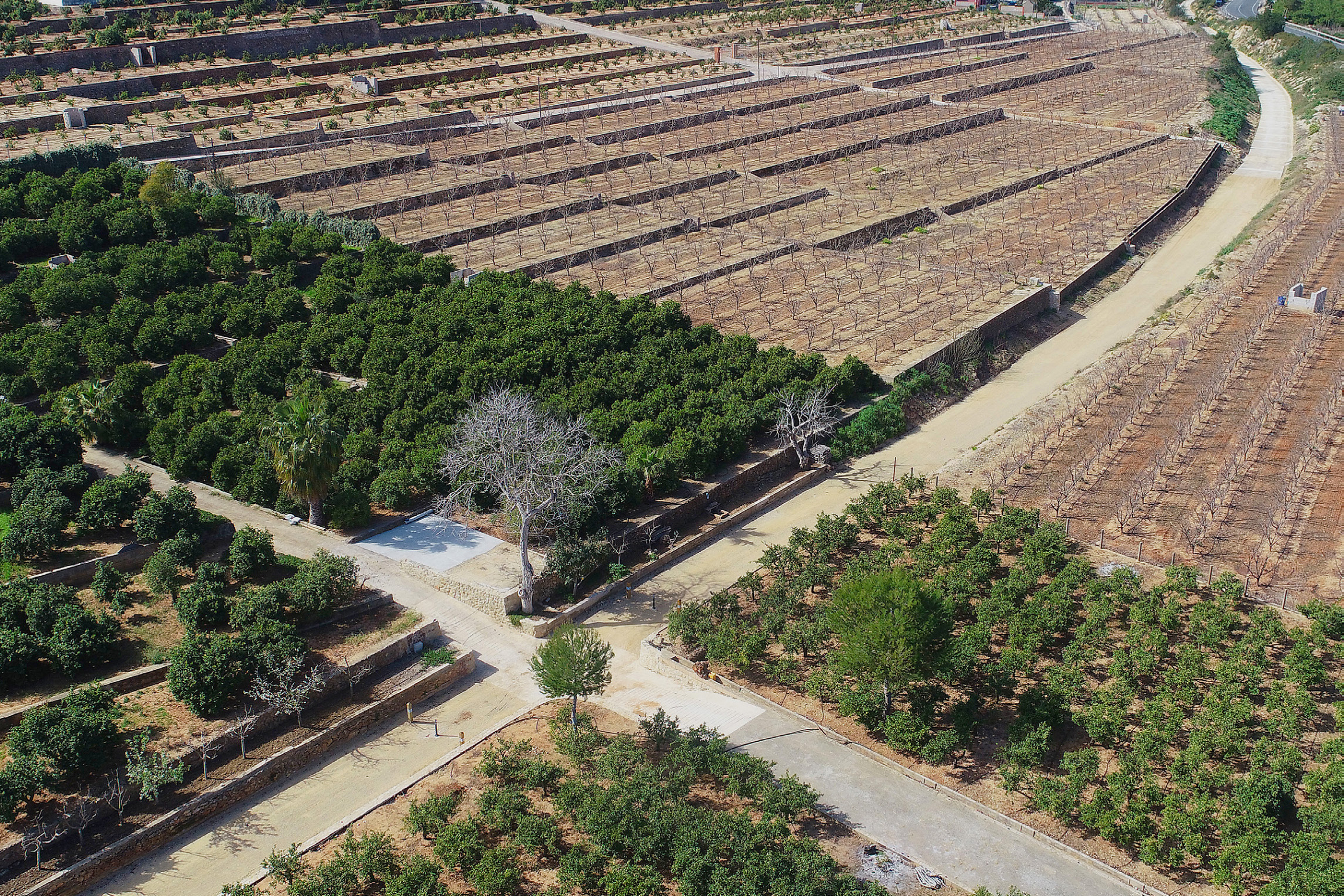
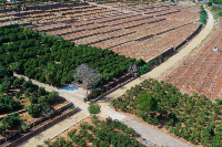
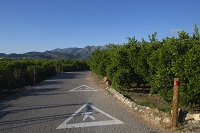
After this stretch, the Nature Trail continues on a track between orange groves and some orchards, wide enough to walk easily. Citrus cultivation will be a constant for the next 3 km, except for a few occasions when the orange trees have not yet gained ground over the pine forest that covers the mountain range south of the road. Another constant along much of the trail is the Barranc de l'Estret, which runs to the left parallel to the road. The name (ravine of the choke point) is a reference to the area it leads to, where the mountains of Carcaixent and Alzira get closer.
The trail is interrupted again by the presence of the CV-50 and reappears after 1.5 km on the left side of the road, next to one of the old gatehouses. These simple structures were used as shelter by the flagmen, who operated the level crossings’ gates. Shortly after, the landscape opens up to a wide plain still dominated by orange groves, along with some houses; La Barraca d'Aigües Vives, a minor local entity or EATIM subject to the city of Alzira, is nearby.
A continuación, tras cruzar el barranco de la Falsía junto a un almacén de cítricos, el Camino pasa a ser de uso compartido con vehículos de motor, discurriendo por el carrer de l’Estació, que como su nombre indica, llega hasta la antigua estación de La Barraca d’Aigües Vives. Por este motivo se recomienda al usuario extremar las precauciones. Los alrededores de esta estación se han convertido en un parque, y el único edificio existente funciona ahora como centro sociocultural.
After leaving the station through a landscape similar to the one you left behind, between detached houses and orange trees, you reach the edge of the CV-50 road. A few meters before you do, the remains of the Trenet tracks and another gatehouse can be seen. The trail crosses the Barranc de l'Estret ravine around a small patch of pine trees to later cross it again, returning once more to the CV-50 road, where the Nature Trail is interrupted again.
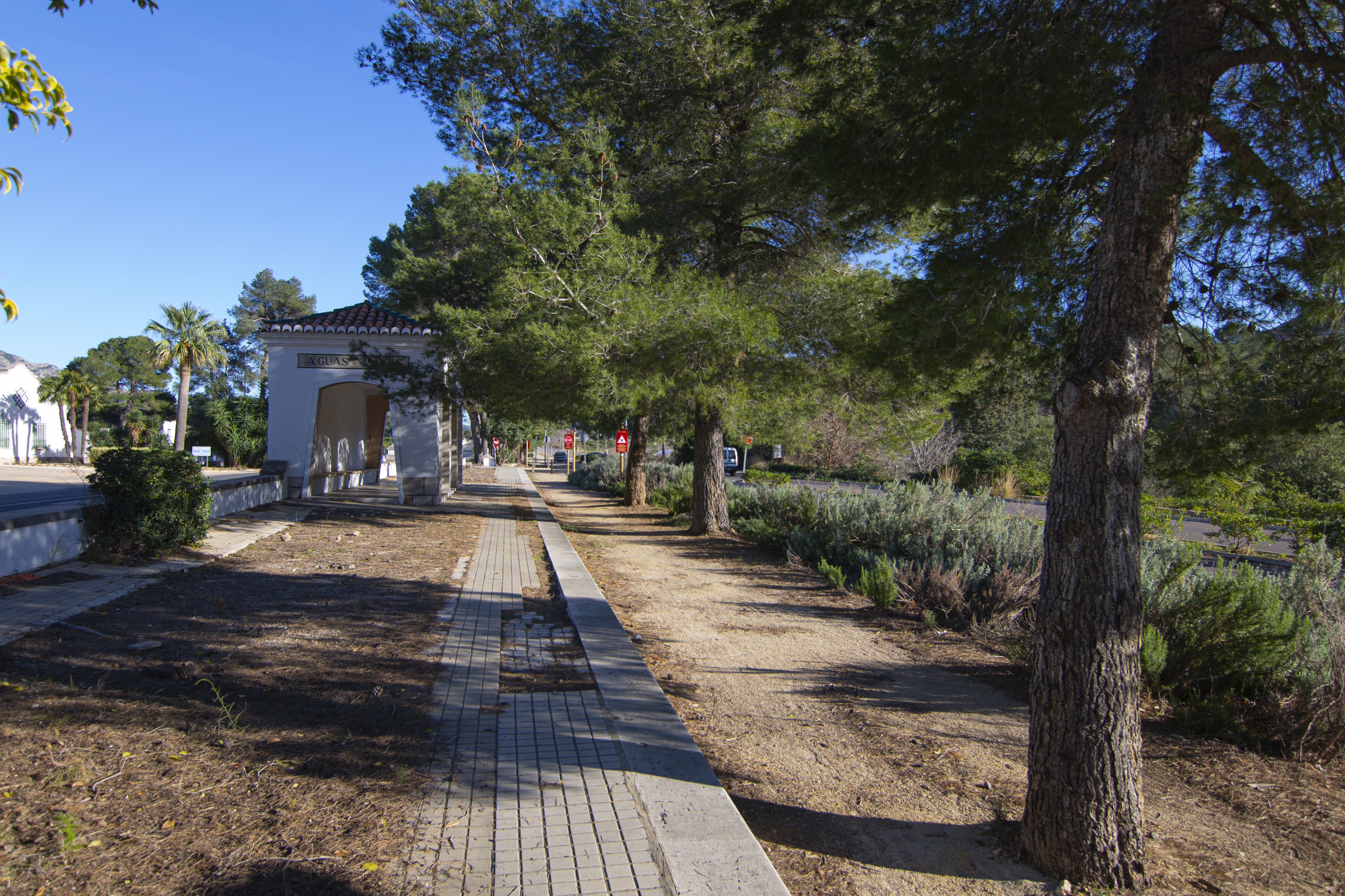
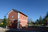
The trail resurfaces again on the other side of the road, nearby the Aguas Vivas railway stop. This simple building was built to provide transportation for the Colonia Infantil Nuestra Señora de Aguas Vivas, a mid-20th century tuberculosis sanatorium.
The trail continues parallel to the road between pine trees; be very careful at the first crossing after the railway stop, as it is the access to a hospital and traffic there is heavy. You’ll see on the right a detour which takes you to the Royal Monastery of Santa María de Aguas Vivas, a 14th century former Augustinian monastery, privately owned since the ecclesiastical confiscations of Mendizábal.
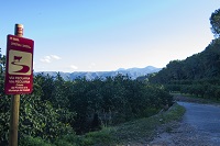
It’s worth mentioning that, after the station of La Barraca d'Aigües Vives, the Nature Trail runs parallel to another route of cultural relevance in the Valencian Community: the GR-236 or Route of the Monasteries. Inaugurated in 2008, it was given its name because it links five historic monasteries in the inland regions of the Valencia province, including the aforementioned Aigües Vives and Santa María de la Valldigna, which will be discussed below.
Leave behind an access road leading to the housing developments in the area and you’ll get back to the old railway, which runs for a few meters through a trench dug below ground level. For the next 2 km, the trail again weaves among fruit trees, although the orange trees are now replaced by persimmons. In this segment, the traveller will cross different wooden footbridges over ravines (Cremenser and Los Muertos) leaving behind an abandoned industrial warehouse.
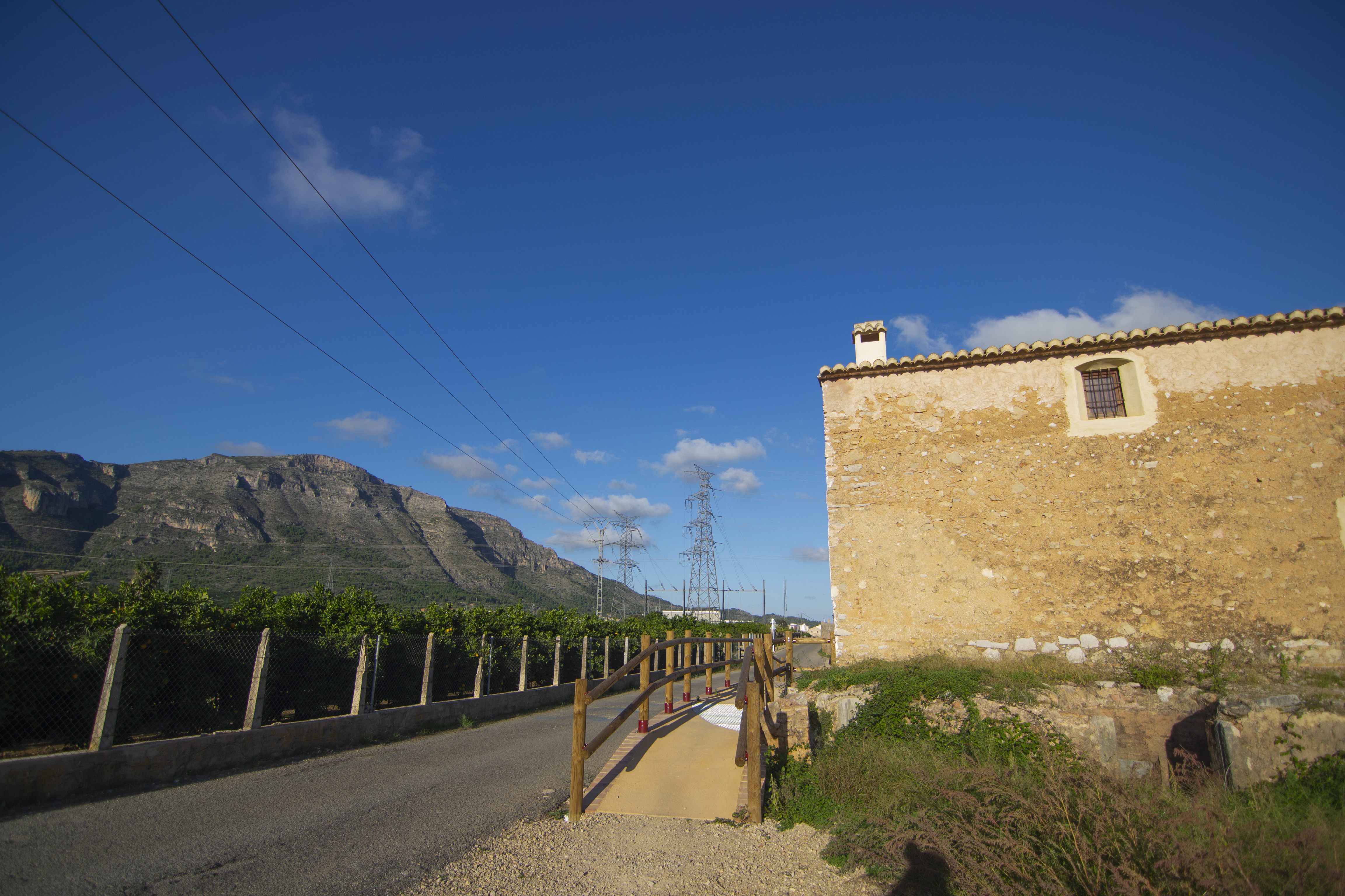
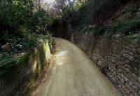
The next 500 m provide a new change of scenery; the trail continues through a trench with high walls and enters a dense pine forest in the area known as Portitxol, a natural pass where the Ribera Alta meets La Valldigna. A highlight of this boxed-in section of the trail are some peculiar structures that served as shelter for the track maintenance crew whenever a wagon train passed whilst they were on the railway platform.
Leaving the trench behind, and now in the region of La Safor, you can stop for a break at a rest area near a ruined building, where animals were kept back in the beginning of the tram service, when the tram was pulled by horses. From this point on, the dismantled railway line is definitively left behind as you continue along cattle tracks and paved rural roads. Please be careful, since most of the walk will be on roads shared with motor vehicles, between walls and farm fences, and with several low visibility turns.
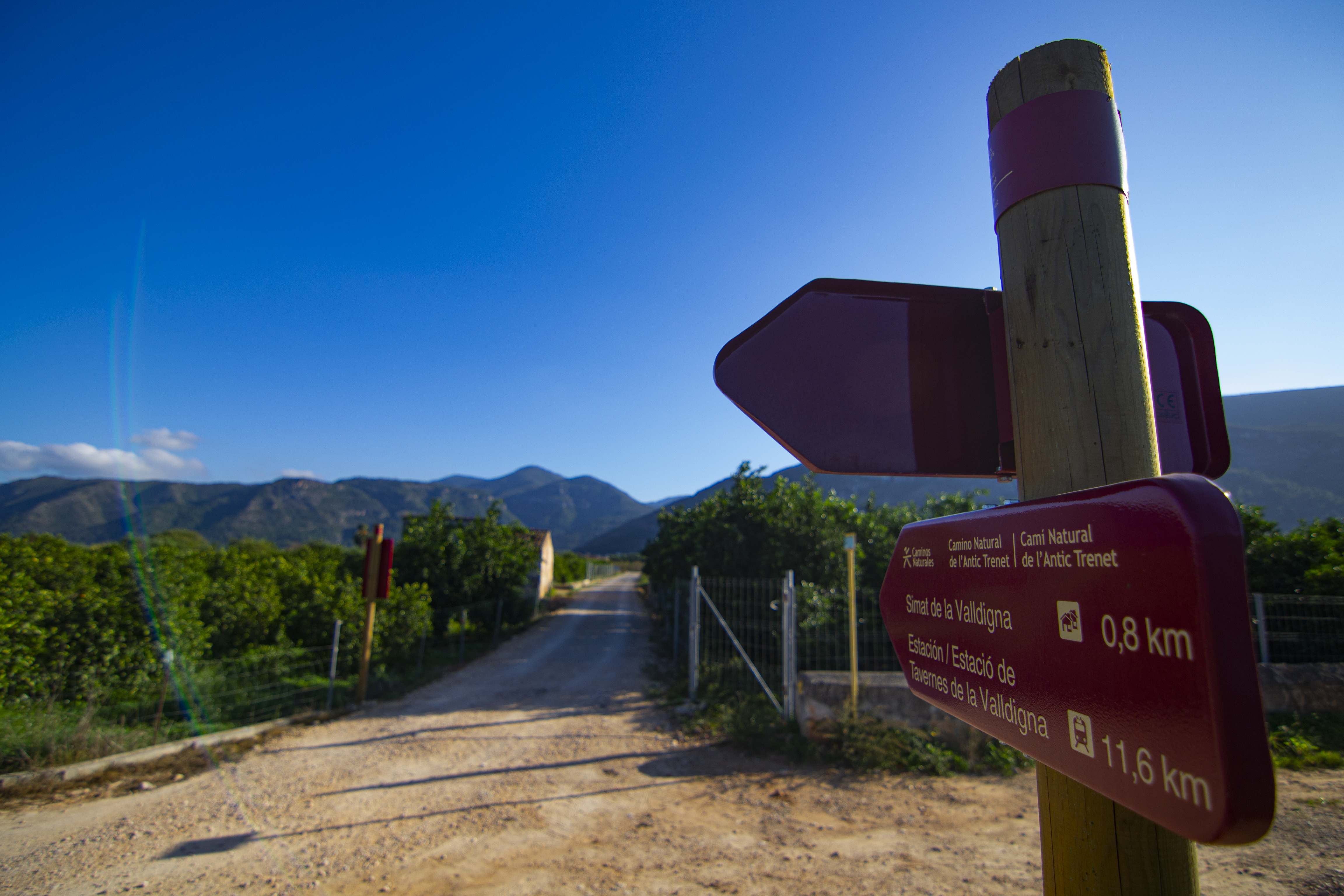
After climbing down, the trail joins the Colada (path) del Portixol to the Muntanya del Castell; take a right and follow it. Continue along this cattle track until you cross the Cremenser ravine (like other ravines in the area, in times of flooding this ford can become impassable), then along the Colada del Pla to the castle of Benifairó de la Valldigna, which we will leave behind on the left after just 360 meters. This diversion allows us to see the first houses of Simat de la Valldigna in the distance.
This town, like the others through which we pass (Benifairó and Tavernes), is closely related to the founding of the monastery of Santa María de la Valldigna. The area was populated by Muslims until it was conquered by James I of Aragon in the mid-13th century. At the end of the century, the valley was donated to the Cistercian monks, who founded the monastery. Christians and Moors continued to coexist in La Valldigna, subjects to the abbot of the monastery, until the “Expulsion of the Moriscos” at the beginning of the 17th century. With the ecclesiastical confiscations of Mendizábal (1835), the monastery was abandoned and left in private hands, so it suffered deterioration and plundering until the Generalitat Valenciana (the government of the autonomous region of Valencia) purchased it in 1991.
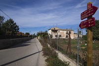
The trail leads shortly after to Avinguda Font Menor de Simat, which must be crossed (cyclists must cross on foot or continue along the street on the right until a roundabout where you can change direction). Continue along a lane shared by pedestrians and cyclists that runs along the Avinguda de la Valldigna until you reach a roundabout. At this point you can take an alternative route that, after passing through Benifairó de la Valldigna, reconnects with the main trail a couple of kilometers ahead of here.
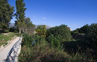
After crossing the bridge over the Vaca river (a watercourse that flows alongside the Nature Trail for much of the remaining part of the route, and is one of the most characteristic elements of the valley), you will reach another roundabout. Although the itinerary continues taking the third exit, the monastery of Santa María de la Valldigna is just 200 m away, and it is a recommended visit to learn about the history of La Safor area (for more information and schedules, visit https://monestirvalldigna.gva.es/es/).
Back to the landscape of citrus groves on both sides of the road (which is shared with motor vehicles), continue straight ahead, ignoring all the detours to the right and left, until you cross another ford which might be impassable during floods, just after the point where the Benifairó alternative route connects with the main trail.

It is time to cross the ravine, after which we continue a few hundred meters along the same path, with views of the castle of Marinyén (an ancient Muslim fortress) in front, perched on the top of a steep peak. Turn left at the first detour, leaving behind the path that leads to the beginning of the climb up to the castle, to continue along a path that, after crossing the Castell ravine, turns to the left and then to the right, parallel to the Vaca river.
After a crossroads next to some farm buildings, the Nature Trail diverges from the shared traffic road, continuing on a gravel path that runs along its right side and is separated by wooden posts. Although these posts offer some protection, care must be taken at crossings or farm entrances. After half a kilometer, the path approaches an old mill, at which point the trail changes sides and continues to the left. The differentiated path vanishes for a few meters after the Tavernes de la Valldigna electrical substation.

Pass by the first access to Tavernes on the left, a concrete ford and, after about 350 m, turn left between some industrial buildings, crossing a bridge over the river Vaca. After the bridge, turn left again to take a bike path that goes around Tavernes, between the river and Avinguda Corts Valencianes. The trail then turns north, where we part company with the Vaca River for the rest of the route, and now follows Carrer Marjaletes until reaching a roundabout. Once there, take the exit to the CV-50 road and cross it to continue along a path shared by pedestrians and cyclists that runs through an urban park and passes by the monument to Mayor Vicente Gómez Marí.
The park ends at Carrer Dula, but the pedestrian path continues parallel to it until it reaches a roundabout next to an industrial park. Crossing Carrer Dula, continue north (once again, the road is shared with motor vehicles), go around the industrial estate and you’ll find yourself walking through citrus groves again.

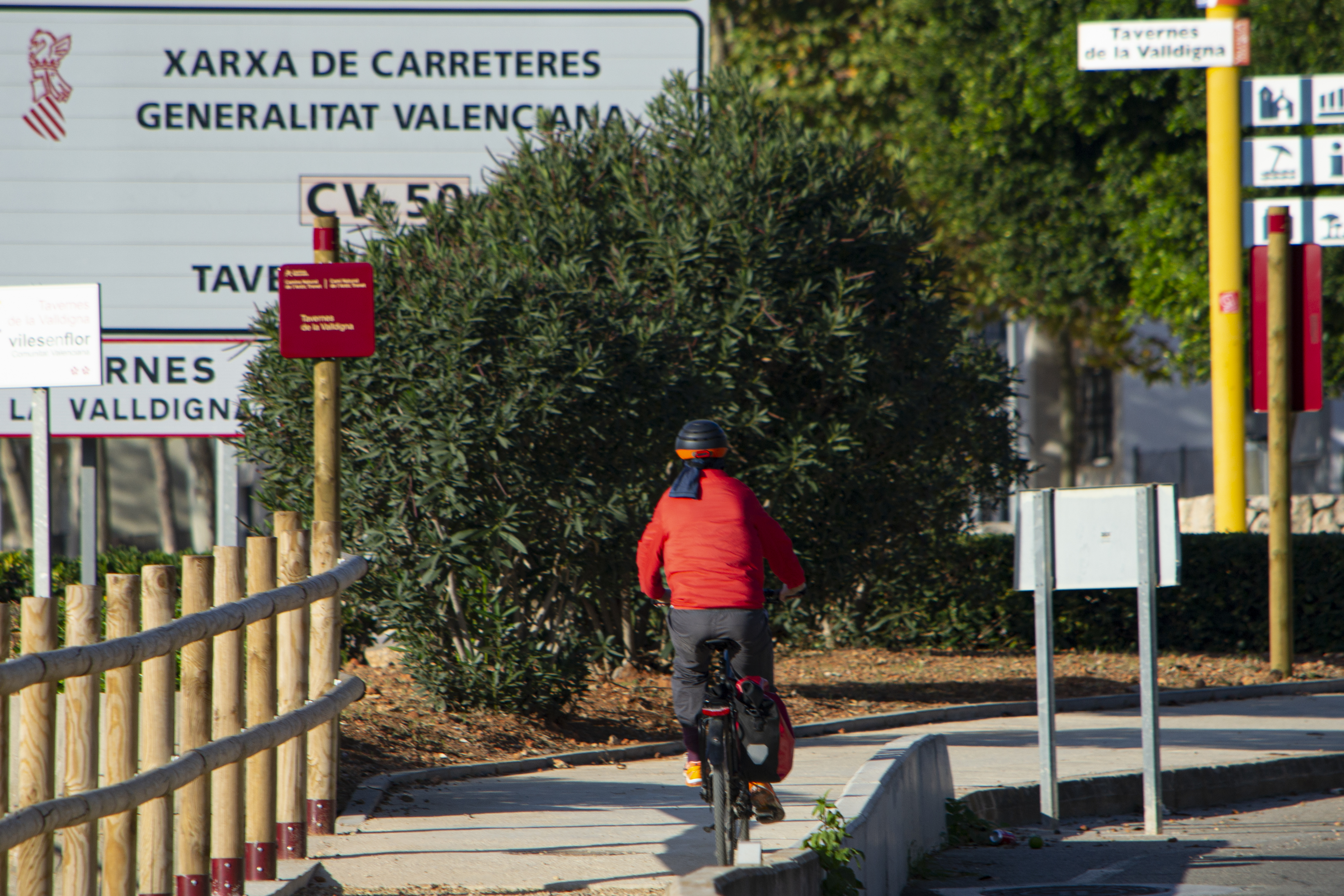
About 200 m after passing under the AP-7, pass under the N-322 and you’ll reach another roundabout. A pedestrian and cyclist path was built to facilitate transit along the itinerary; follow it to cross the CV-50 road (remember that cyclists have to cross dismounted) and you will reach the entrance to Ullal Gran. “Ullals” are coastal wetlands formed by groundwater upwelling. These enclaves usually serve as habitats for certain species of birds, fish, invertebrates and vegetation, forming the so-called marshes.
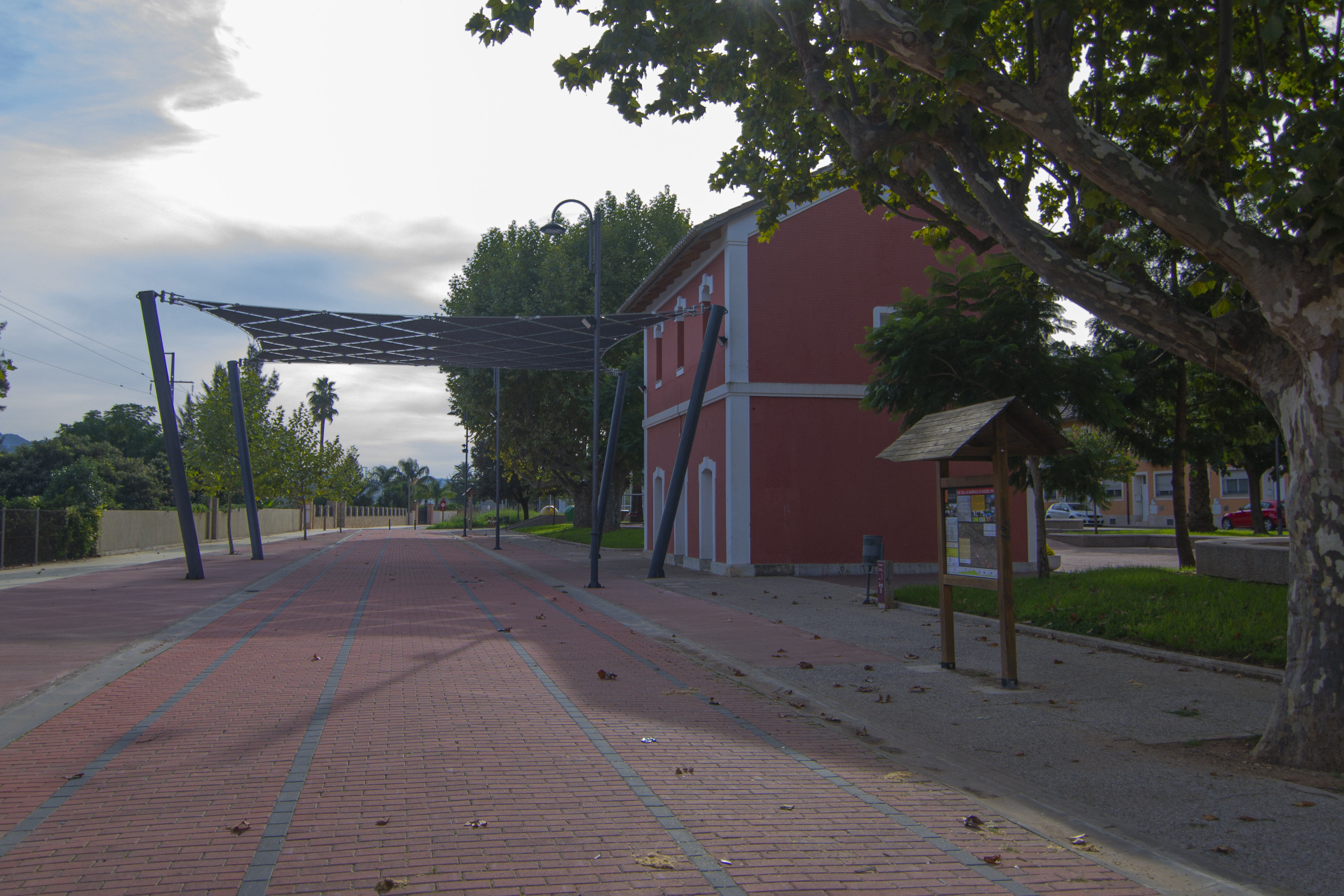
Following the bike path the route reaches the detour to the Tavernes de la Valldigna station, starting point of a branch that leads to the beach of Tavernes de la Valldigna. The Nature Trail ends at the gates of the station, after entering the industrial area growing around it – pedestrians can use the sidewalks, but cyclists must be careful with the crossings, because traffic may be heavy. This is a functional station and is part of the Cercanías Valencia network.
Branch to Alzira

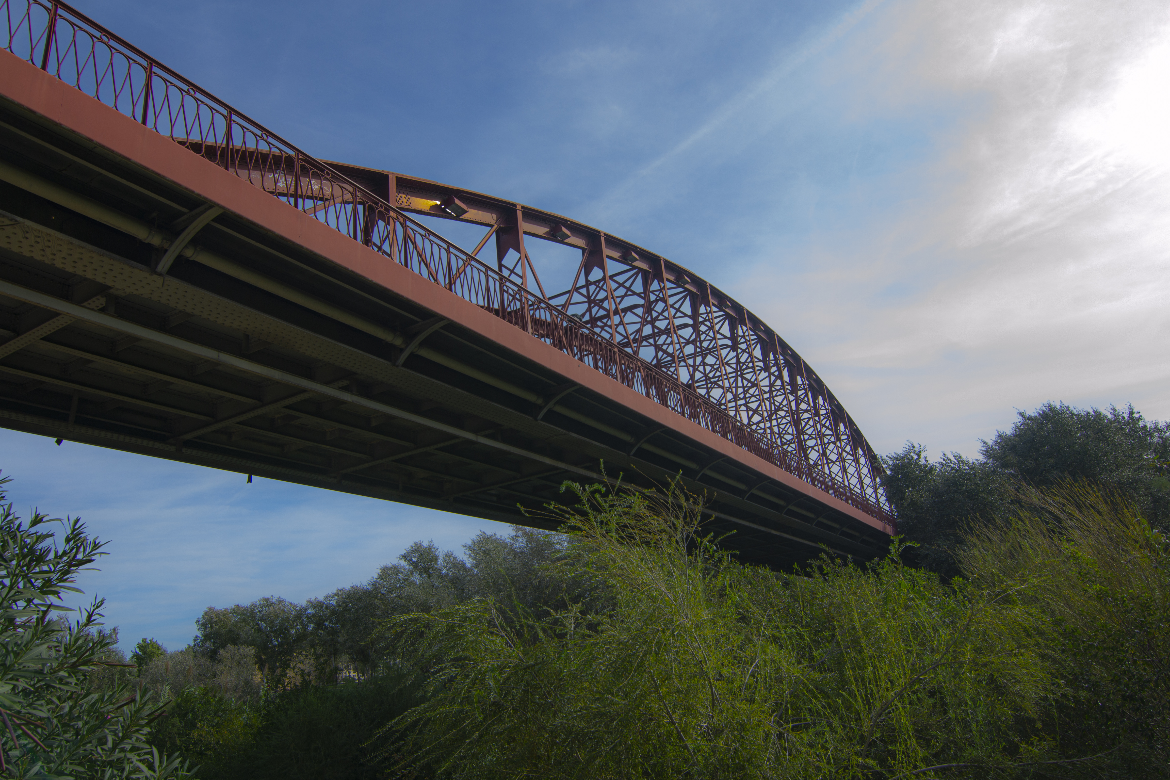
This branch starts next to the Cercanías Valencia station that provides service to the town of Alzira. Take the pedestrian an cyclist path that runs next to the Júcar river and you will consecutively walk under the CV-550 and CV-50 roads, in parallel to the river until you cross it over the iron bridge of Alzira, built at the beginning of the 20th century.
Continue on the street Ronda d’Algemesí and, just before passing under the CV-50 again, take the Camí del Malecó street. After half a kilometer you’ll reach the Mirador del Júcar viewpoint, a rest area where the river meets the Casella ravine. There you’ll enjoy a beautiful view of the Júcar valley as it crosses through this area of Valencia.
The trail then runs parallel to the Casella ravine until you get to a service road parallel to the CV-572 road, where you take a pedestrian and cyclist path that goes around a roundabout from which the Camí de la Cova Marvelles street starts. Continue due south east on a boxed-in paved path that runs between the walls of agricultural states on both sides and reaches the CV-570 road. This is where you join the main route of the Nature Trail after a diversion of 1 km from the Carcaixent exit.
Due to the direction of traffic, if cyclists want to take the branch in the opposite direction, you won’t be able to follow the same path you took to arrive, but instead you must follow another path 350 metres before the one described above, which will take you through the Camí del Transformador street until you reach the Cami de la Cova Marvelles street.
Branch to Benifairó de la Valldigna
This branch begins in Simat de la Valldigna, after crossing the CV-675 road, and continues along a small, paved path that runs parallel to the river and passes through a couple of recreational areas. This trail leads to a wider concrete path next to the Simat water treatment plant. From this point on, roads are shared with motor vehicles.
Continue 700 m north in the now familiar company of orange trees, and then take the path that goes off to the right. Almost immediately after, turn right and continue along a road that is now paved until you reach Benifairó.
Never entering the town center, it continues around the streets Pio XII, Ferrán II, Ràfol and Castell, leaving the town by a road that starts on the right-hand side of the latter. Cyclists will have to take a small detour to reach the same point following the traffic indications.
Once outside the town, between fruit orchards, take the first detour on the right, which leads to a concrete ford over the Vaca river (which may be flooded). After crossing the river, you’ll pass by the La Valldigna recycling center and reach a crossroads where you reconnect with the main route.
Branch to the beach of Tavernes de la Valldigna
Starting from the detour to the Tavernes station, instead of going towards the building, continue straight on until you reach a roundabout on the CV-603 road. Continue east along the road (use extreme caution) and, after crossing over the railway and passing another roundabout, continue along a cycle path that leads to the entrance of the beach district of Tavernes de la Valldigna, 1 km away. Before enjoying the Mediterranean Sea, it is worth visiting the Torre de La Vall, one of the towers erected between the 16th and 17th centuries as part of a surveillance network against pirate incursions.
Sites of interest
- Mancomunitat de la Ribera Alta
- Mancomunitat de La Safor
- Alzira Town Council
- Carcaixent Town Council
- La Barraca d’Aigües Vives Town Council
- Tavernes de la Valldigna Town Council
- Benifairó de la Valldigna Town Council
- Simat de la Valldigna Town Council
- Paraje Natural Municipal de ‘La Murta i la Casella’
- La Ribera de Xúquer tourism site
Map
Puntos de Interés
Profile
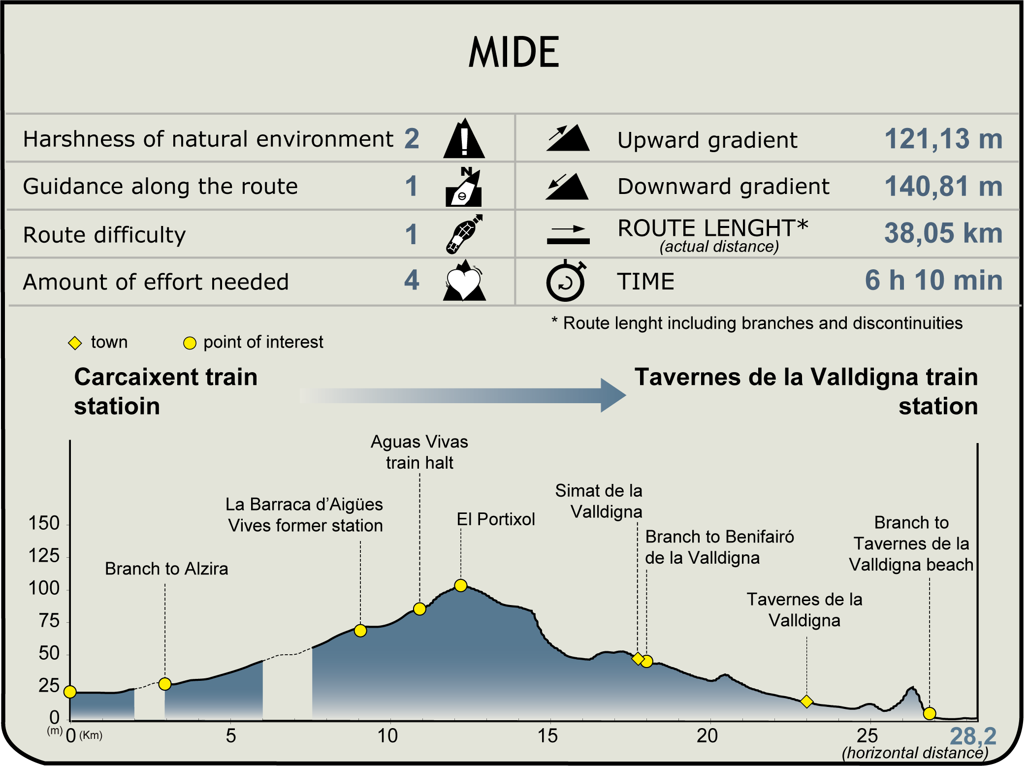
MIDE (Method for the Information of Excursions)
 Harshness of natural environment
- 1. The environment is not risk-free
- 2. There are more than one risk factors
- 3. There are various risk factors
- 4. There are quite a lot of risk factors
- 5. There are many risk factors
 Guidance along the route
- 1. Well defined trails and crossings
- 2. There is a clearly marked trail and signage
- 3. Requires the identification of geographic features and cardinal points
- 4. Requires off-path navigation
- 5. The trail is interrupted by obstacles that have to be gone around
 Route difficulty
- 1. Walking on a flat surface
- 2. Trails with different types of path
- 3. Walking on stepped paths or irregular terrain
- 4. The use of hands or jumping over the terrain is necessary
- 5. The use of hands is required to progress
 Amount of effort needed
- 1. Up to 1 hour of continuous walking
- 2. Between 1 and 3 hours of continuous walking
- 3. Between 3 and 6 hours of continuous walking
- 4. Between 6 and 10 hours of actual walking
- 5. More than 10 hours of continuous walking
Featured
Further information
The Carcaixent-Dénia Railway
The Carcaixent-Dénia Railway is the oldest narrow gauge railway route in the Iberian Peninsula. Announced in 1861, it was opened in 1864 by the Public Limited Company "Tram-way de Carcagente a Gandía", which was in charge of its operation throughout its 37.5 km. Its original purpose was to communicate the interior regions with the coast in order to make agricultural product trade easier.
It started out as animal-drawn, with up to 30 horses pulling carriages. In fact, there were stables distributed along the route to help draft animals rest. In 1880 the route from Gandía was extended to Dénia (additional 19 km), and a year later, the carriages became steam-propelled, enabling the transport of passengers.
After changing hands a few times, in the middle of the 20th century, the railway became a state property, joining EFE (Operation of State Railways) in 1942, which would later be known as FEVE (Spanish Narrow Gauge Railways), being used until 1964.
Due to the lack of investments, the use of the Trenet was abandoned in favour of road transport, which led to the closure of the railway line. In 1969, the journey between Carcaixent and Gandía ended and, 5 years later, between Gandia and Dénia.
Municipal Natural Site of La Murta i la Casella
It is located in the municipality of Alzira and has an area of 765.64 ha, within the Serra de Corbera SCI, between the Cavall Bernat and Agulles mountains. It was declared as a Municipal Natural Site in 2004 due to its rich natural and cultural heritage.
In addition to its natural value, its location and geography provides it with a microclimate with mild temperatures and a high degree of humidity, very favourable for great plant formations, with the presence of ashes, holm oaks, strawberry trees, hawthorns, laurels and myrtle trees (murta in Valencian language). It also has a great landscape value, with fertile valleys surrounded by steep limestone mountains full of caves and chasms, which contrast with the coastal landscape or the crops of the Júcar River plain.
Within its cultural heritage, it is worth mentioning the ruins of the Jerónimo monastery of Nuestra Señora de la Murta, declared a Site of Cultural Interest. In its surroundings you can also find the remains of two shrines, the Santa Marta Fountain and its aqueduct, ponds and a cistern, lime kilns, a stately home with a romantic garden or the historical path of Pas del Pobre.
The Municipal Natural Site of La Murta i la Casella is crossed by the GR-236 route or the Route of the Monasteries, so called because it links the La Murta monastery with four other historical monasteries in the interior regions of the province of Valencia.
Multimedia