
Las Villuercas Nature Trail
Description
From the plains of the Guadiana to Jara amidst deep valleys and rugged mountains
The region of Las Villuercas takes its name from the surrounding mountains. Located between the valleys of the Tagus and Guadiana, this region is famous for its unique geology with distinctive hydrological and botanical features.
This Nature Trail, which connects Vegas del Guadiana Greenway Nature Trail and La Jara Greenway, features the interesting heritage of Las Villuercas, both natural (La Lorera de la Trucha, “Rio Guadalupejo” Green and Biodiversity Corridor or Sierra de Las Villuercas SPA) and historic-artistic (Guadalupe Monastery, a World Heritage Site, or the largest concentration of rock paintings in Extremadura).
The Trail, divided into six sections (five between Logrosán and Santa Quiteria stations and one to Guadalupe), is 70 kilometres in length. The Trail is clearly signposted throughout. Caution should be exercised, since much of the route is also used by motor vehicles. Furthermore, water fountains are few and sparse in between, it is therefore important to stock up water at the towns through which it passes.
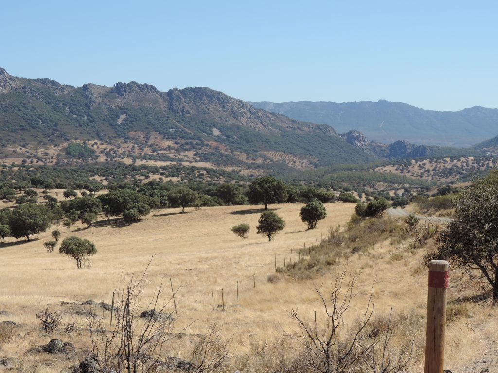
From Logrosán to Cañamero
The route starts at the abandoned station of Logrosán, witness to the never completed Talavera de la Reina-Villanueva de la Serena railway line. To better understand this ambitious project, it would be necessary to take the Vegas del Guadiana Greenway Nature Trail, which runs over the railway line to Villanueva station.
The nearby town of Logrosán has been associated with mining since ancient times. The town is located at the foot of Cerro San Cristóbal where cassiterite was mined, and on whose summit the site of ancient human settlements can be found. The remains of mining infrastructures and even the Costanaza Mine have been restored and opened to visitors.
Leaving behind the station, the route continues along gravel roads also used by motor vehicles. It crosses several intersections with other rural tracks and the Logrosán-Berzocana road, accompanied throughout by rockrose (Cistus ladanifer), brambles (Rubus ulmifolius), broom (Retama sphaerocarpa) and an occasional Pyrenean oak (Quercus pyrenaica), as well as walls and fences that demarcate vegetable gardens, olive groves (Olea europaea) and holm oak “dehesas” (Quercus ilex). From time to time, the railroad reappears, be it because the Trail runs over the tracks, or alongside an embankment.
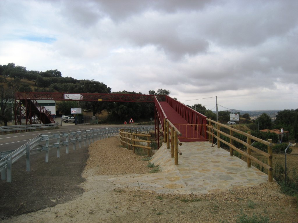
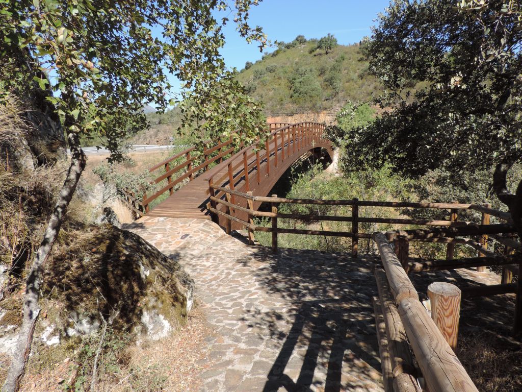
The route reaches the edge of the road, and where a sign indicates a side-track to the left of a cement plant that leads to Cañamero stop. After crossing another road next to which is a small rest area, the route crosses over EX-102 via a metal walkway.
Here, the Trail narrows as it begins to steep climb. The shrine of Santa Ana, with a nearby fountain, and close to Cañamero, can be reached using the roads that give access to the surrounding farms.
This section ends at the opposite edge of Cañamero, a town with a rich historical heritage, described in the next section. The road continues always uphill, passing next to the town hall and the church of Santo Domingo de Guzman. Spectacular views of Sierra del Pimpollar, on which the town sits, can be seen from this point.
From Cañamero to Collado de Gaitanejos

Slightly further on, there is a path up to Alchanat Castle, located on a rock overlooking the town. Little more remains than the foundations of this ancient Arab fortress (Al-Chanat). After a gentle descent along a dirt road (shared with vehicles) through pines (Pinus pinea) and eucalyptus (Eucalyptus globulus), the route reaches a rest area on Escarihuela Hill. From here, the Trail continues downhill. However, another side-track, leading to “El Mirador” archaeological site, open to visitors, enables a better understanding of Cañamero's history. Here stands a Chalcolithic dolmen, known as “La Brujera” (witches' Sabbath), owing to the longstanding white witch tradition in Las Villuercas, evidenced by other place names in the area. One can also go to Risco de las Osas, a ridge with interesting rock art.
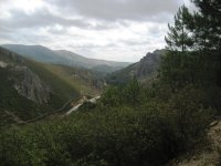
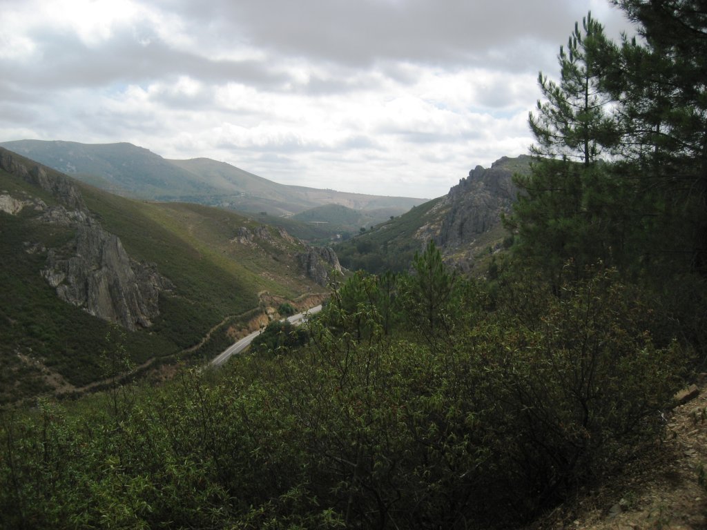
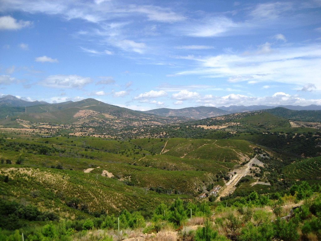
The Trail winds down the somewhat steeper slope of Sierra del Pimpollar, bound throughout by a wooden rail fence to protect the traveller. There is in one of the bends a bench where it is possible to rest and enjoy wonderful views of Las Villuercas gorge, carved by the River Ruecas, which rises near the 1,601 metre peak that gives name to the county. Inside Ruecas Valley, the Trail reaches the shrine of Nuestra Señora de Belén, after crossing the river. The route continues up the valley to Collado de Martín Blasco, from where the route passes under EX-116 and heads on to the rest area of Balcón de Puertollano with stunning views. A side-track leads down to Berzocana station, visible from this viewpoint. The mountain landscape is dominated by rockrose, ferns (Pteridium aquilinum) and reforestation pine, as Las Villuercas suffered a major fire in 2005 that destroyed 9,000 ha. A few kilometres along the summit, the Trail starts its descent to the River Silvadillo, crossed by a wooden footbridge. During the descent, pastures and holm oak "dehesas" begin to appear amidst the reforestation pine landscape.
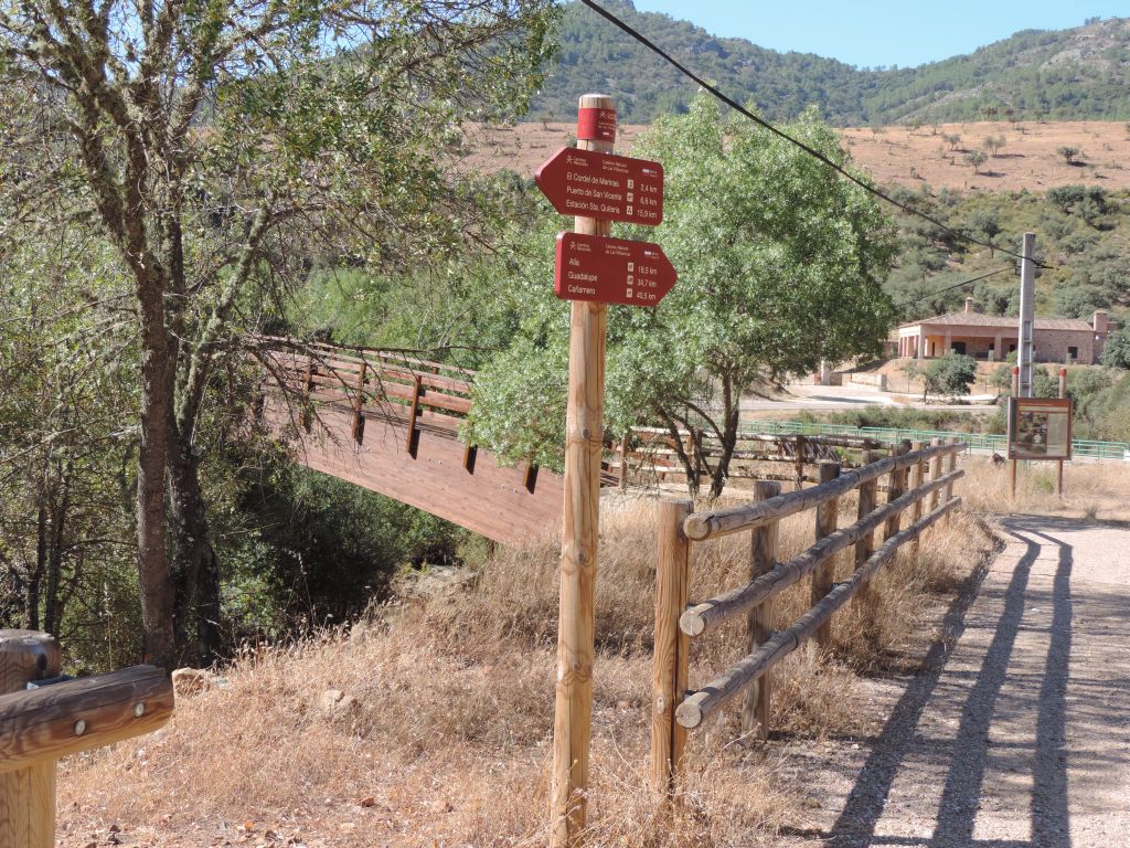
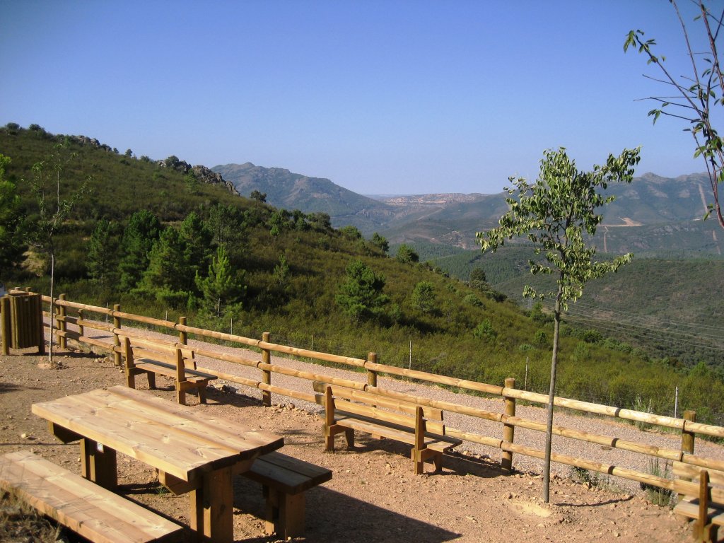
The Trail heads down with few changes in the course or landscape until it reaches Collado de Gaitanejos rest area, the end of this section. From here, the traveller can take the road to Alia or another to Guadalupe.
Collado de Gaitanejos to Guadalupe
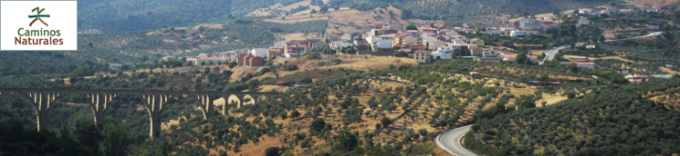
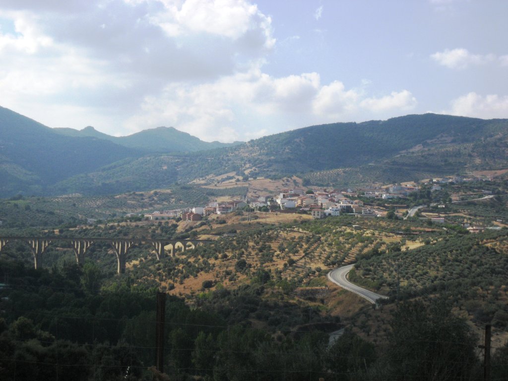
From the rest area, the Trail starts a gentle but continuous climb between holm and cork oak (Quercus suber) "dehesas", with a few chestnuts (Castanea sativa) and strawberry trees (Arbutus unedo). Before heading down the Guadalupejo River Valley, olive groves begin to dot the landscape, and in the distance, the town of Guadalupe appears with its impressive viaduct, built for the unfinished railroad to Villanueva de la Serena. The route descends to the roundabout where the roads EX-380 and EX-102 meet. After crossing the latter, the Trail skirts around the roundabout and crosses the road to Navalmoral to continue between the river and the road to Guadalupe.
On the opposite side of the road is a side-track that gives access to the Ruta de las Ermitas. It crosses again to the opposite side of road, next to the ruins of a mill. Before returning to the opposite side of the road, care should be taken against brambles and nettles that have partially covered the route. The river is lined by a gallery forest, typical of Las Villuercas valleys, teeming with life: elm leaf blackberry, spurge flax (Daphne gnidium), red elderberry (Sambucus racemosa), willow (Salix sp.), wild rowan (Sorbus torminalis), butcher's brooms (Ruscus aculeatus), poplars (Populus sp.), Montpellier maples (Acer monspessulanum), elm (Ulmus minor) and a few common ashes (Fraxinus angustifolia).
After crossing the road again, the Trail runs along the river. If the viaduct looked impressive from afar, passing under it, close to one of its massive piers, is even more impressive. The Arco Viejo rest area appears next. The route crosses the river over an old stone bridge to the opposite side of the road for the last time, up a steep slope to Guadalupe through vegetable gardens and olive groves.
This section ends at the entrance of Guadalupe, a town that grew around the Royal Monastery of Guadalupe, a UNESCO World Heritage Site. roll through the streets of Guadalupe to discover its medieval arches (remains of it ancient walls) or the old Jewish quarter and its typical houses with wooden porches and balconies bursting with flowers.
From Collado de Gaitanejos to Alia
The Trail heads to Alia from the rest area through a landscape dominated by pastures and holm oak "dehesas" dotted with rockrose and broom patches. It arrives at the River Guadalupejo, next to which is a rest area (Molino de Guadalupejo) with an information panel on the importance of the river to the local villages, evidenced by the many mills found along its banks. In fact, after crossing the river by a wooden walkway, a side-track can be taken to enjoy the Route of the Mills, a 15 kilometre loop route that passes next to several mills and the ditches that supply water.
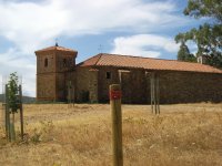
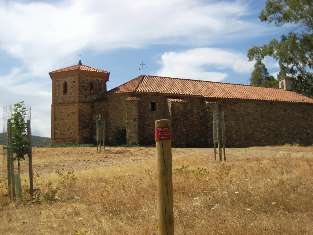
The route heads to Alia, the end of this section, along the same dirt and gravel track with wooden fence that used at the beginning, crossing various rural roads and a few brooks. This section ends in the outskirts of Alia, a town of Arab origin, evidenced by the typical Moorish architecture of its streets and buildings, such as the church of Santa Catalina, near a rest area.
From Alia to Puerto de San Vicente

The longest section of the Nature Trail starts outside Alia. After getting some rest at the small recreation area, the route heads into a more thickly populated “dehesa”. Leaving the town behind along a paved path that soon becomes a gravel track, the Trail reaches a crossroads next to the chapel of La Concepcion, and turns onto a path to the left, until it meets the road to Castilblanco.
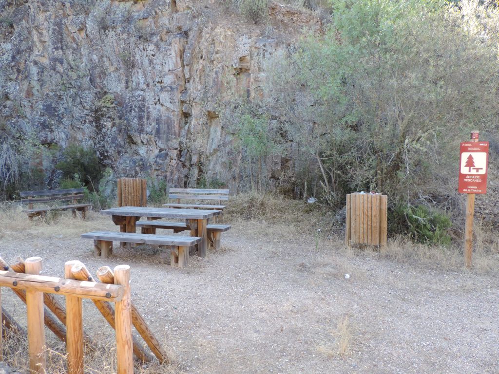
The route traverses several fenced gateways, which must be closed after use, to arrive at an intersection with a dirt and gravel road similar to the one in earlier sections. Leaving behind, for the time being, the holm oak groves, the route climbs up a hill through rockrose thickets and a few fields of crops, only to descend a steep slope towards the Riofrío Reservoir. During the descent, a rest area near Lago de Riofrío rest area provides an opportunity to rest and freshen up in the fountain near Los Terreros (a sign warns that this is untreated water). There is an information panel on local wildlife next to the reservoir.
The route continues to the River Guadarranque, passing through pastures populated with large holm oaks and new young trees. On a lucky day, a group of deer (Cervus elaphus) may appear on the Trail, as they have become accustomed to human presence and are not so skittish. After a rest area, the route crosses over the river by a wooden footbridge, from where the remains of the old bridge over the rivers Guadarranque and Guadarranquejo can be seen. There is an information panel on the opposite side of the footbridge. After crossing another wooden footbridge, a panel informs of a side-track to the protected nature area of Lorera de la Trucha.
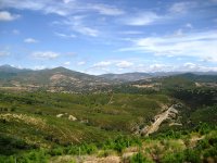
Without straying too far from EX-102, the Trail begins a steady climb, crossing a stream and passing close to Fuente del Cordel de Merinas (a fountain with untreated water) until it crosses the road. After a steep descent, the route starts a challenging climb up Sierra de Altamira to Puerto de San Vicente. The landscape consists of pine and eucalyptus trees, as well as typical Mediterranean shrub species: rockrose, broom, thyme (Thymus communis), Laurustinus (Viburnum tinus), hawthorn (Crataegus monogyna), flax-leaved daphne, dog rose (Rosa canina), white heather (Erica arborea), evergreen privet (Phillyrea angustifolia), etc. It is worth making a stop at Cielo de Altamira rest area with stunning views of the mountains and the valley below.
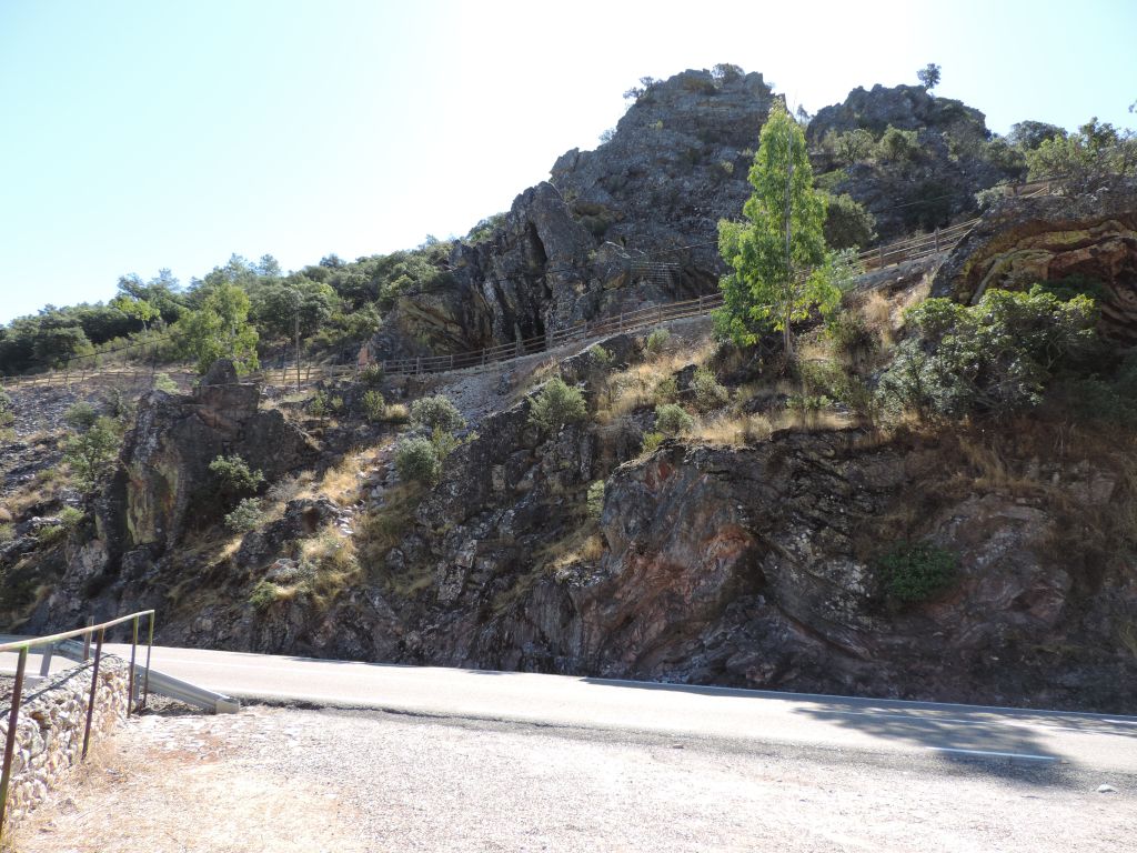
After reaching the mountain pass, the Trail crosses the road by a metal walkway to enter the province of Toledo. This section ends at the edge of the town of Puerto de San Vicente, at a rest area with a fountain.
From Puerto de San Vicente to Santa Quiteria
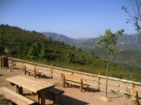
The Trail barely ventures into the town. It passes next to the pool and sports centre and continues along a paved road (shared by motor vehicles going to the country estates) from which several dirt roads branch off. However, there are clear signs indicating the way forward. Oak meadows and thickets dominate the landscape along the road. There is a rest area near Fuente de la Dehesa, with drinking water and tables.
After crossing a few low ridges, the route turns onto a side-track on the right, leaving the railway platform straight ahead. A dirt road leads to Santa Quiteria, the endpoint of this section and the Trail, where there is a car park and a rest area. This station is also part of the never completed Talavera de la Reina-Villanueva de la Serena railway project. The entrance to the tunnel through Sierra de Altamira can be seen from here. La Jara Greenway Nature Trail, which runs along the railway tracks to Calera y Chozas, near Talavera, can also be joined from here.
Profile
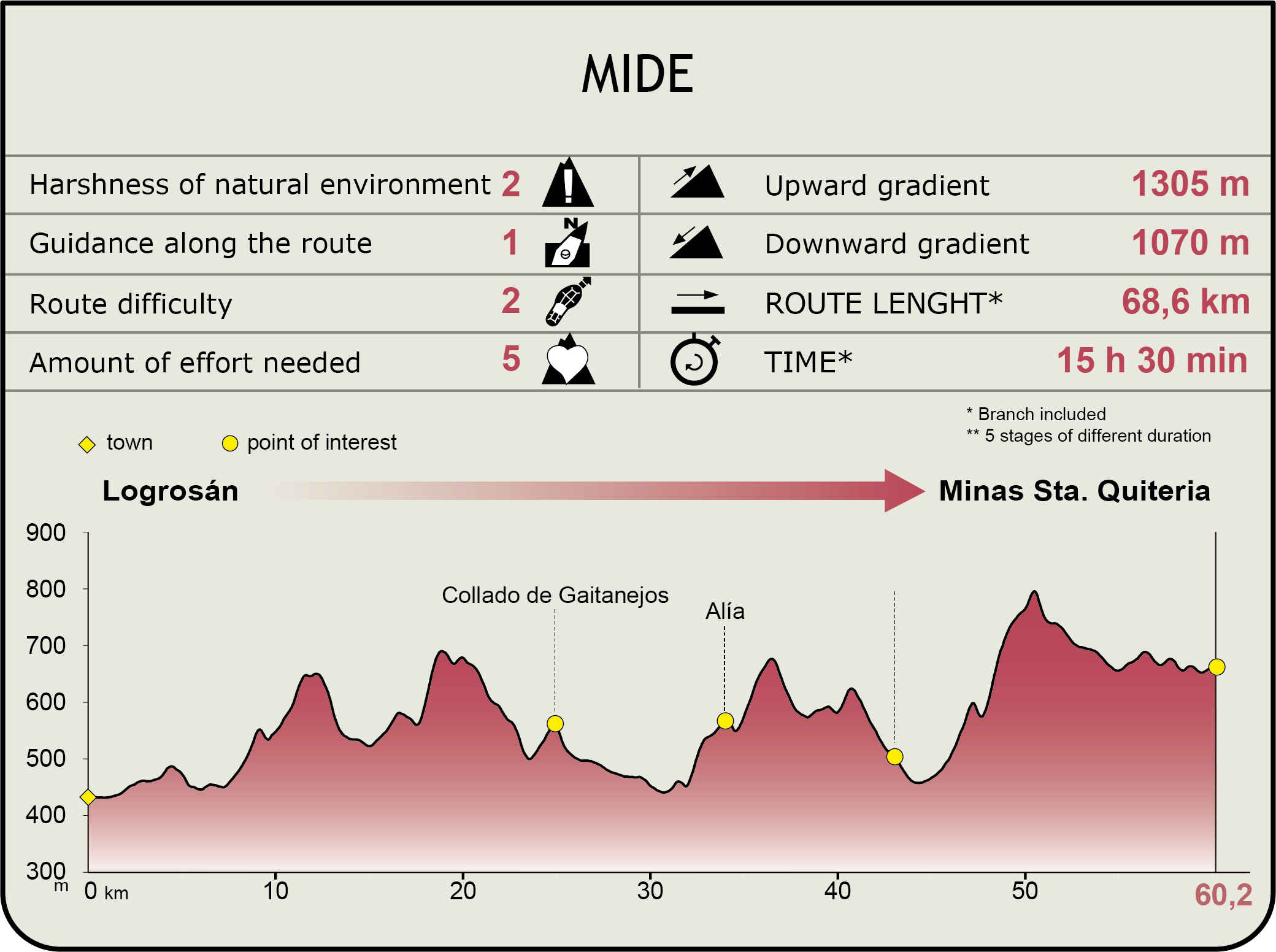
MIDE (Method for the Information of Excursions)
 Harshness of natural environment
- 1. The environment is not risk-free
- 2. There are more than one risk factors
- 3. There are various risk factors
- 4. There are quite a lot of risk factors
- 5. There are many risk factors
 Guidance along the route
- 1. Well defined trails and crossings
- 2. There is a clearly marked trail and signage
- 3. Requires the identification of geographic features and cardinal points
- 4. Requires off-path navigation
- 5. The trail is interrupted by obstacles that have to be gone around
 Route difficulty
- 1. Walking on a flat surface
- 2. Trails with different types of path
- 3. Walking on stepped paths or irregular terrain
- 4. The use of hands or jumping over the terrain is necessary
- 5. The use of hands is required to progress
 Amount of effort needed
- 1. Up to 1 hour of continuous walking
- 2. Between 1 and 3 hours of continuous walking
- 3. Between 3 and 6 hours of continuous walking
- 4. Between 6 and 10 hours of actual walking
- 5. More than 10 hours of continuous walking
Featured
Further information
Guadalupe and its Monastery
La Puebla de GuadalupeThe history of the town of Guadalupe is closely tied to the Monastery. This town of about 2,450 inhabitants grew around the original shrine which later became the monastery. La Puebla de Guadalupe, with houses dating from the fourteenth to sixteenth centuries, was declared a historic-artistic ensemble in 1944. While strolling through its streets, the visitor will discover five medieval arches, the gates of the wall that once surrounded the Monastery, hospices and hospitals with 16th century façades, typical houses with wooden colonnades, lean-tos or gabled roofs, Arab tiles and flower-decked balconies, which evoke the ancient highland traditions of Extremadura.
Royal Monastery of Santa María de GuadalupeThe history of the sanctuary dates back to the thirteenth century. It was originally a shrine, replaced in the late fourteenth century by a so-called “second church”. The village of Puebla was founded in 1337. King Alphonse XI ordered the building of the Monastery in 1340. In 1389, the sanctuary was given to the Order of Saint Hieronymus. The Order remained here during four centuries until the confiscation of 1835, when the Monastery was placed under the Archdiocese of Toledo. The Monastery and Sanctuary have remained under the custody of the Franciscan Order since 1908.
The Monastery of Guadalupe is a monument of significant importance. It was the main monastery of the Order of St. Hieronymus, and an extraordinary blend of different architectural styles, in particular, the Temple, the Mudejar cloister and the shrine - the latter unique in the world. Owing to its relationship with the Catholic Monarchs and the evangelisation and conquest of America, this site is closely associated with the medieval and modern history of Spain. It is or has been a first-rate cultural centre, a research and education centre (school of medicine, pharmacy, scriptorium, etc.), a workshop for different crafts (embroidery, metalwork, illuminated manuscripts), a library with a vast and rich collection of books, a pilgrimage centre and a hotel.
It was given the prefix “Royal” by King Alphonse XI in 1340, and “Pontifical” by Pope Pius XII in 1955. It was designated “National Monument” in 1879 and UNESCO “World Heritage Site” in 1993. Moreover, the image of Nuestra Señora de Guadalupe holds the title of “Queen of Spain or the Hispanic world”, granted by King Alphonse XIII in 1928, and “Patroness of Extremadura” in 1907.
La Lorera de la Trucha
The La Lorera de la Trucha route starts in the section between Alia and Puerto de San Vicente of Las Villuercas Nature Trail. This medium-high difficulty route is 14.5 km long and takes about five hours.
La Garganta de la Trucha, in the municipality of Alia, is located under Bermejo Hill, between Sierra de la Palomera and Sierra de Altamira. La Lorera de la Trucha has the best specimens in Spain of Portugal laurel (Prunus lusitanica subsp. Iusitanica), as well as alder and ash trees that provide shade. Portugal laurel trees already existed in the Tertiary, at a time when the whole peninsula was covered by laurel forests of temperate climates. Even today, they continue to form clusters in gallery forests, in specific areas with a very particular climate and soil conditions. Hence, these areas are of great significance.
The Lorera (Portugal laurel) was declared Singular Tree of Extremadura in 2004.
Multimedia

Downloads
GPS downloads
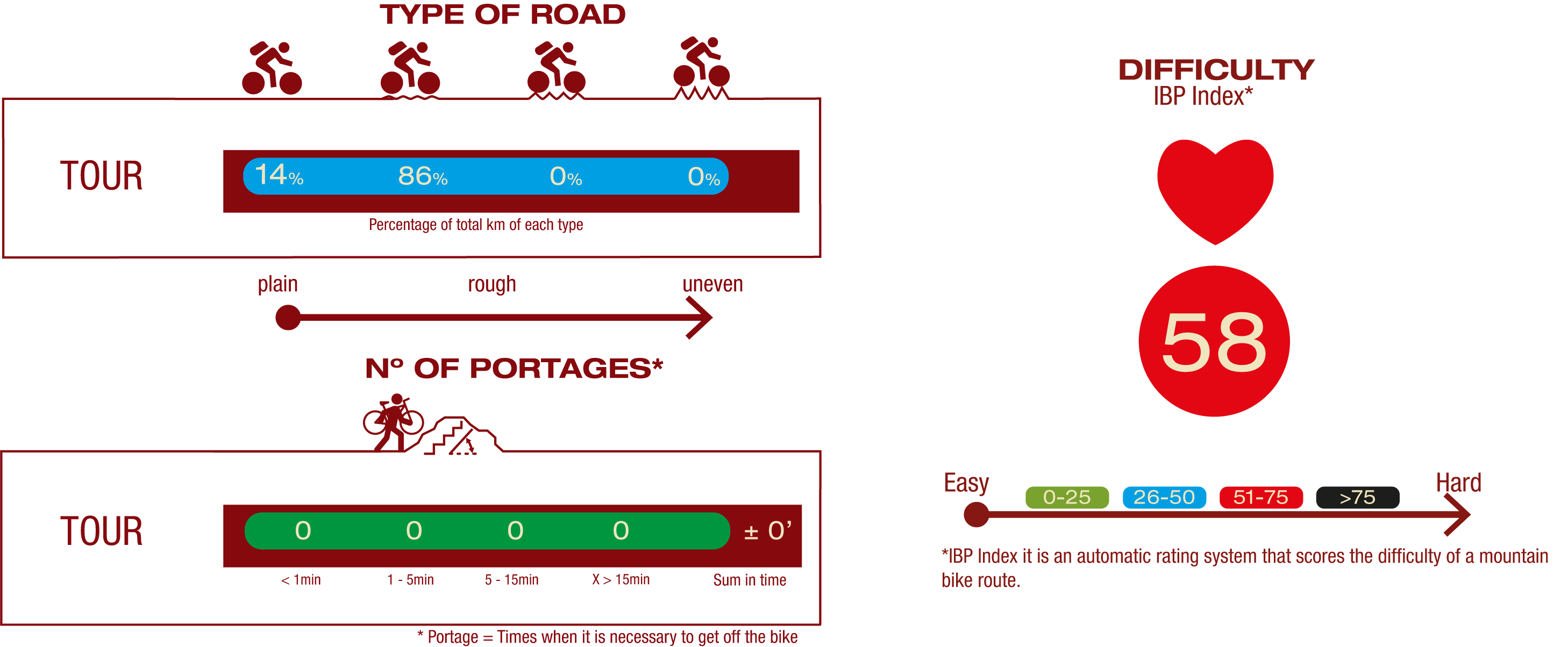
Cyclability

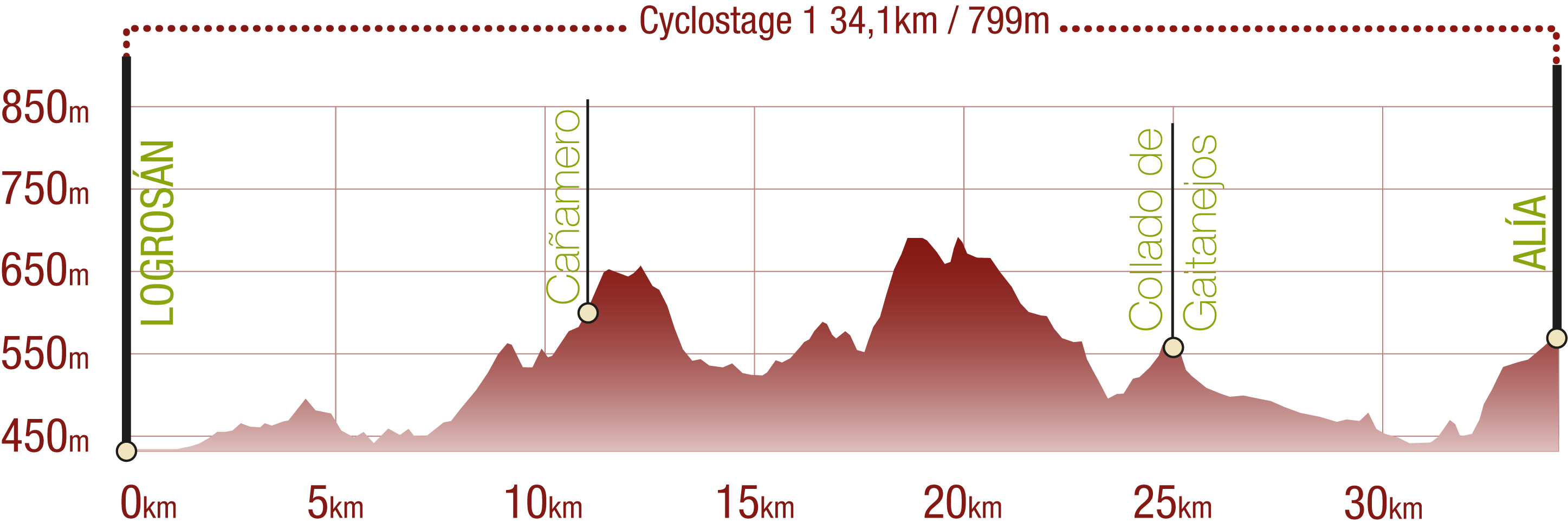
CYCLOSTAGE 1
PROFILE
TYPE OF ROAD, PORTAGES & DIFFICULTY
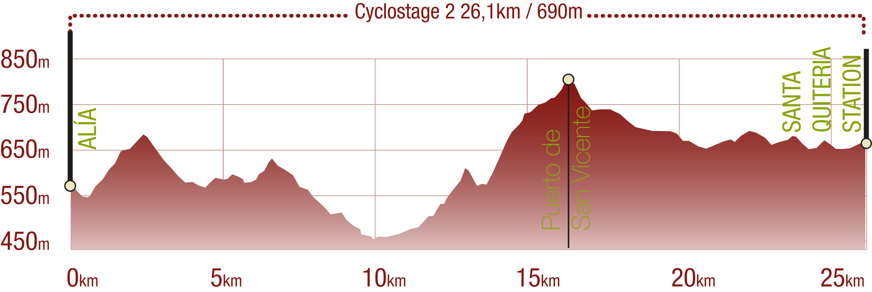
CYCLOSTAGE 2
PERFIL
TYPE OF ROAD, PORTAGES & DIFFICULTY

TEST (both cyclostages)

SAFETY RECOMMENDATIONS (both cyclostages)
- Sections shared with hikers.
- Transit through the centre of some population centres.
GENERAL RECOMMENDATIONS (both cyclostages)
- Find out about the technical aspects of the route and the weather on the day.
- Take care of the environment. Take care not to disturb animals or damage vegetation. Respect private areas.
- You must give priority to pedestrians and comply with general traffic rules.
- The environment in which you will be riding is open, free to move around and an area where many activities are carried out (sporting, forestry, livestock and agricultural activities). Always have an understanding, prudent, responsible and respectful attitude.