Carbajosa de la Sagrada – Alba de Tormes stage
Description
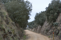
The trail runs through Campo Charro among the remains of the old Plasencia-Astorga railway
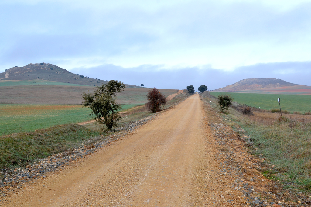
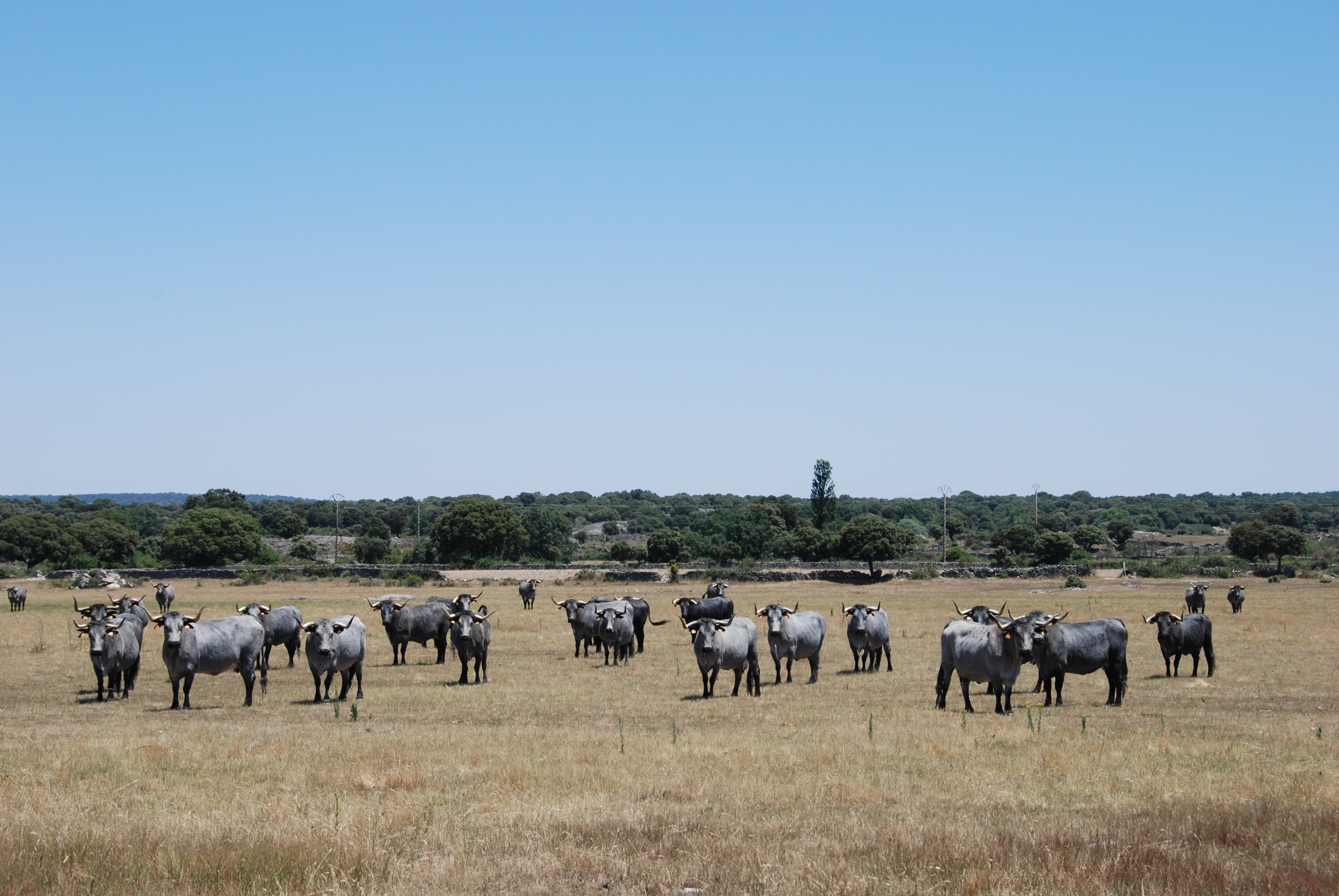
The Vía de la Plata Nature trail uses the old Plasencia-Astorga railway track, which operated for a 100 years until the late 1980s. This first stretch of the trail, from Carbajosa de la Sagrada to Alba de Tormes, goes through pastures and crop fields among two monadnocks (isolated hills in a plain area, remains of a former platform that has been eroded), known as the Arapiles. This, together with the meadows with several specimens of Quercus where wild cattle grazes, is the perfect example of the distinctive landscape of this area of the Salamanca province, referred to as Campo Charro.
Certainly the livestock practices in this section are linked to the pasture ecosystem, with extensive farming and by means of the use of indigenous breeds such as the Lidia cattle breed or the Morucha, Retinta and Avileña-Negra Ibérica breeds, reared due to the high quality of their meat protected by the Logotype 100% Indigenous Breed, and the Iberian pig. On the other hand, in areas where cereals are grown, the most representative livestock breed is the Castellana [Castilian] sheep.

Before the travellers begin this trail, they must know that there is only a fountain along this route and, although there are a lot of intersections leading to nearby towns, it would be advisable to walk this trail well supplied with water. It is also important to remember that this trail goes through a lot of paths leading to private properties and, although these paths are not very busy, the traveller must pay attention at the intersections.
This trail begins at the industrial park of Carbajosa de la Sagrada (specifically at Vertical I Street), just a few kilometres from the capital of the province. There is an information display panel marking the beginning of this stretch, from where the traveller will be able to see how the old railway platform continues towards Salamanca on the left. In this initial stretch, the trail goes under the SA-20 road and then under Salamanca Street, leaving the town’s cemetery aside. During this first stretch, the traveller will be able to access the town centre of Carbajosa from different intersections, before the trail finally leaves the town centre and enters the crop areas.

These crops, fallow lands and pastures will be the main landscape for a long stretch. The landscape will only change when the trail goes through the cuttings made for the railway, different paths to access private properties, or due to the presence of monadnocks (isolated hills in a plain area, remains of an old platform that has been eroded).
Two of these monadnocks are a must-see, taking advantage of the rest area on the right of the route. They are the Arapiles (Arapil Chico on the left and Arapil Grande on the right), a place where the Battle of Salamanca took place during the Peninsular War. An information display panel at this rest area gives the traveller more information on this topic. From this point, the traveller will be able to access Arapil Grande (with a commemorative monument about this battle on its top, and amazing panoramic views over the surrounding lands) or the town of Arapiles, through the DSA-106 road. The railway tracks that crossed this road can still be seen.

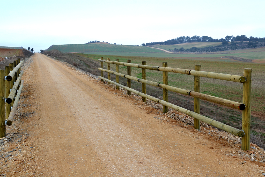
Right after another branch leading to the town of Calvarrasa de Arriba, the landscape on both sides of the trail changes completely when the traveller enters the holm oak forest (Quercus ilex subsp. Ballota), which becomes thicker and thicker as the trail continues. The trail keeps going through numerous intersections with paths leading to private properties, among which there is a brick factory that is no longer used and is located near the Maza de Alba stopping place. Just like the factory, this stopping place is not working today, so it is used as a cattle warehouse.
The trail continues through the holm oak forest, where a rest area allows the traveller to admire the Dehesa Charra landscape, helped by an information display panel. Then, the trail continues through another cutting with bare slopes allowing traveller to see the peculiar colours of the rocks. It then crosses over the concrete bridge leading to the private property of La Maza.
At this point, the trail reaches its highest altitude, and the now scarce holm oaks change into a labiate scrub landscape (Spanish lavender – Lavandula stoechas –, rosemary – Rosmarinus officinalis – and thymus – Thymus zygis) in areas where the land has not been used to grow cereal.
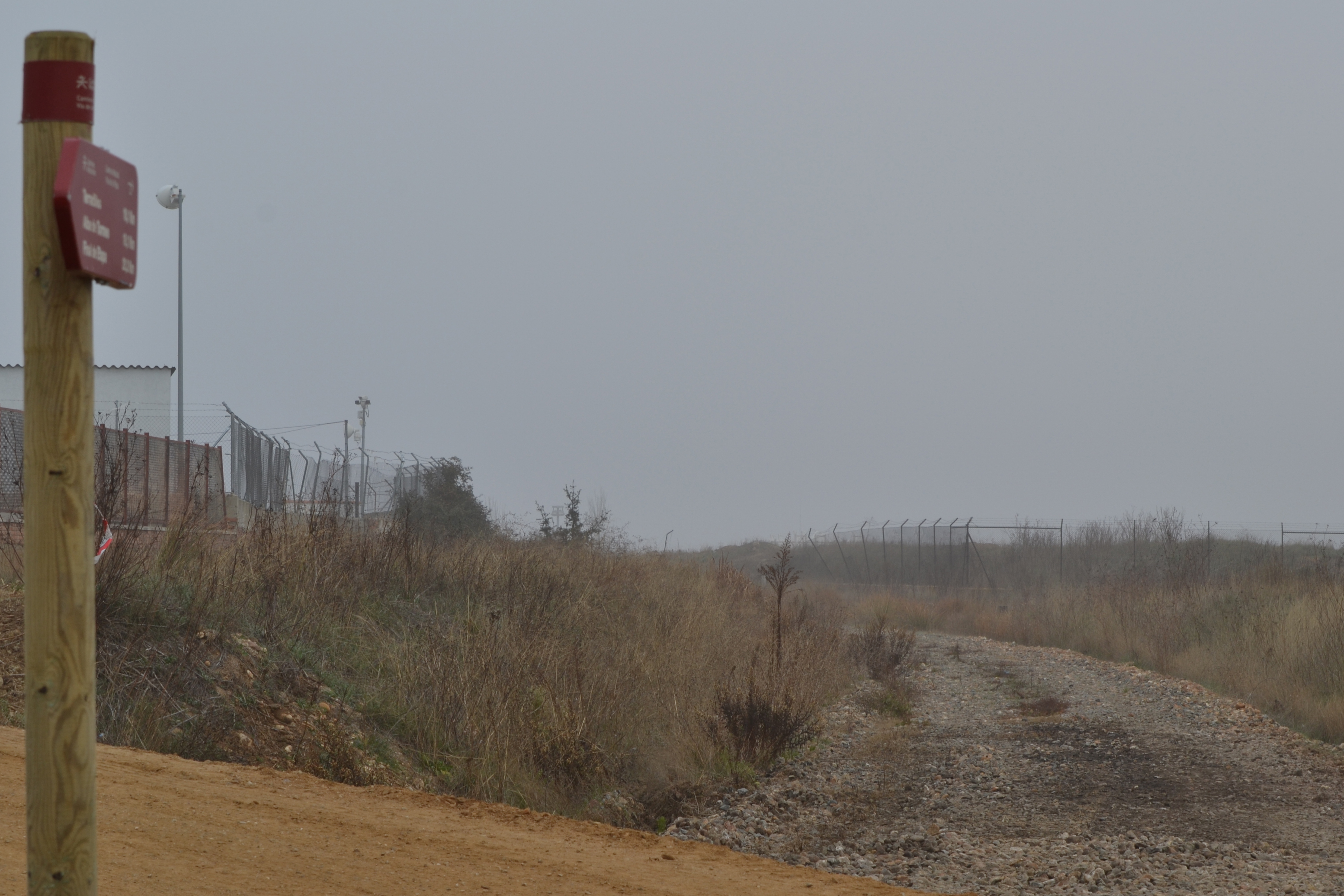
Near the road leading to the town centre of Terradillos, there is the only fountain the traveller will encounter along this nature trail. The route continues among crop fields until, shortly after the bridge over the DSA-106 road leading to Alba de Tormes, the trail is surrounded by scattered holm oaks and cuttings again. This walk among walls is only interrupted by the crossings over some streams, where viewpoints (with their corresponding information display panels) allow the traveller to admire the panoramic views of Alba de Tormes and the namesake river.

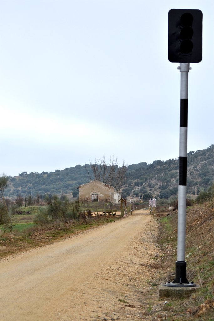
This last cutting coincides with a traffic light used to monitor the train traffic, almost at the end of the trail, which is next to a rest area, a parking and the information display panel about this stretch of the Vía de la Plata Nature Trail.
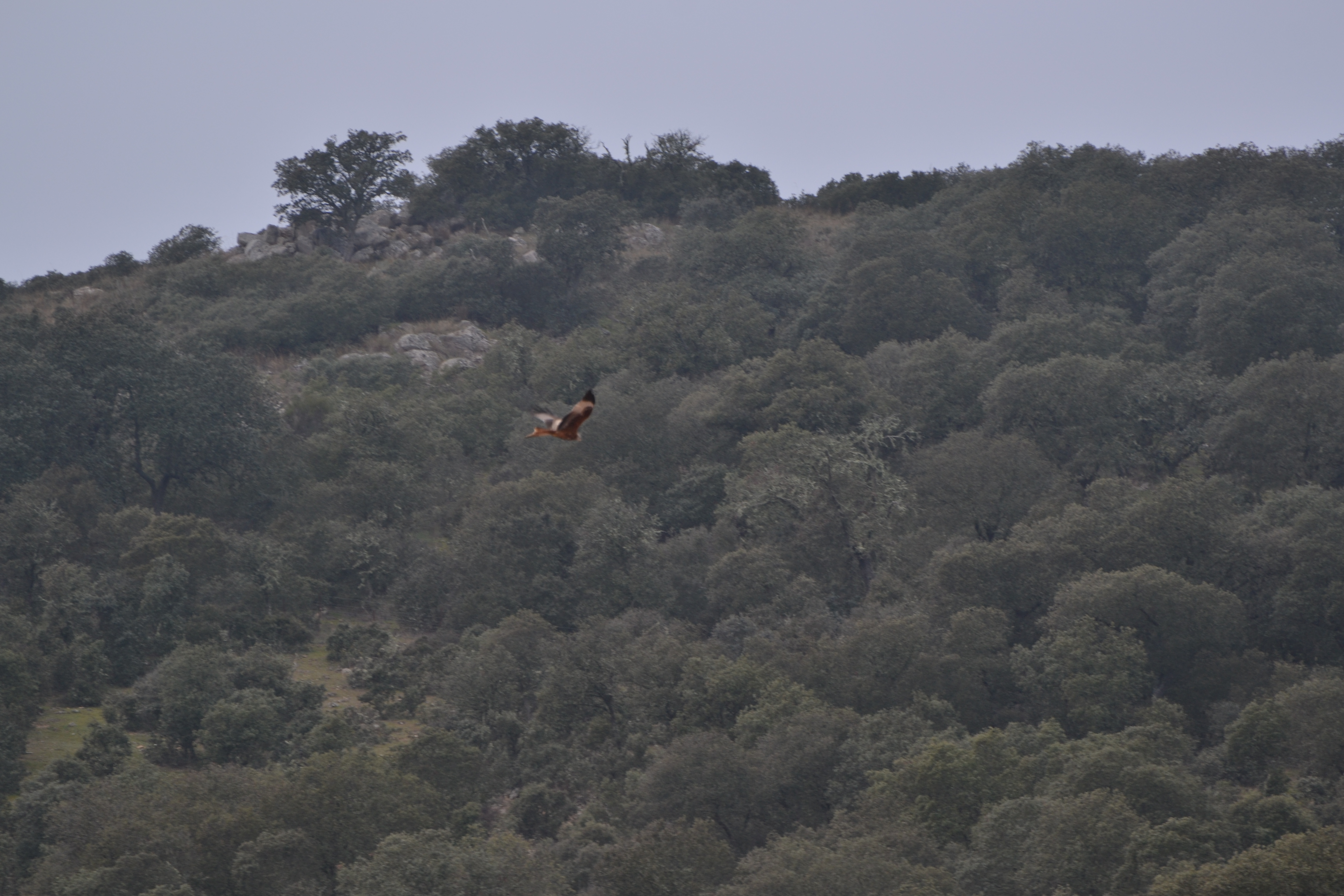
It is not difficult to see the remains of the old Alba de Tormes railway. It is also easy to see red kites (Milvus milvus), short-toed snake eagles (Circaetus gallicus) or common magpies (Pica pica) flying over the station on the traveller’s way to the nearby Tormes river.
In case the travellers want to walk this route the opposite way, they can easily access the parking lot at the end of the trail using the branch located between kilometres 29 and 30 on the right side of the SA-114 road.
Profile
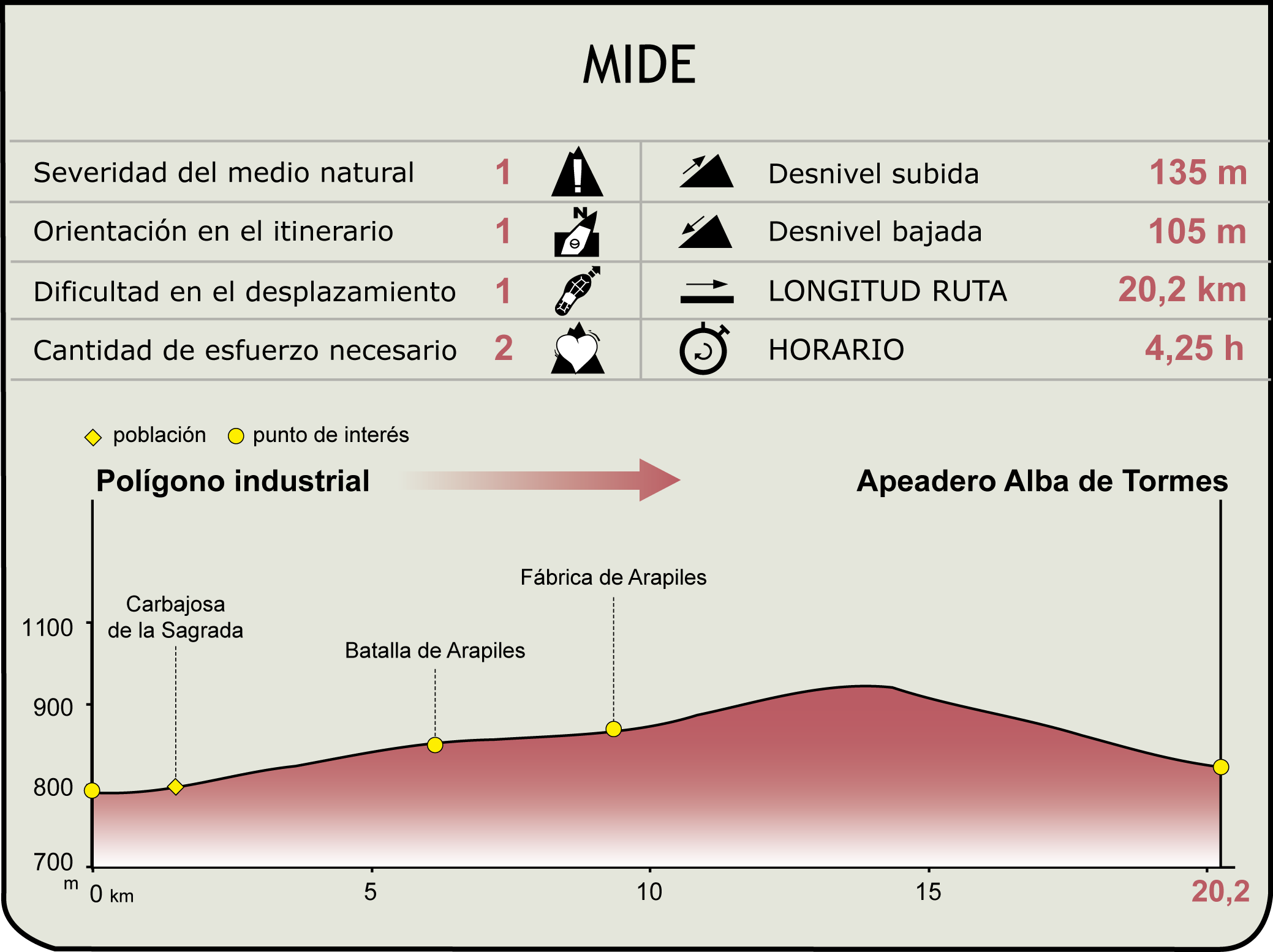
MIDE (Method for the Information of Excursions)
 Harshness of natural environment
- 1. The environment is not risk-free
- 2. There are more than one risk factors
- 3. There are various risk factors
- 4. There are quite a lot of risk factors
- 5. There are many risk factors
 Guidance along the route
- 1. Well defined trails and crossings
- 2. There is a clearly marked trail and signage
- 3. Requires the identification of geographic features and cardinal points
- 4. Requires off-path navigation
- 5. The trail is interrupted by obstacles that have to be gone around
 Route difficulty
- 1. Walking on a flat surface
- 2. Trails with different types of path
- 3. Walking on stepped paths or irregular terrain
- 4. The use of hands or jumping over the terrain is necessary
- 5. The use of hands is required to progress
 Amount of effort needed
- 1. Up to 1 hour of continuous walking
- 2. Between 1 and 3 hours of continuous walking
- 3. Between 3 and 6 hours of continuous walking
- 4. Between 6 and 10 hours of actual walking
- 5. More than 10 hours of continuous walking
Featured
Further information
Carbajosa de la Sagrada
The beginning of the trail is located in this municipality, founded by Alfonso IX of León at the beginning of the 13th century. The name of this municipality refers to the “carbizos” or “carbajos” (probably referring to Quercus pyrenaica). It is located in the outlying area of Salamanca. The recently created Botanical Park it really worth visiting, since it holds distinctive (and unique) species from the province. Its historical buildings, such as the church of Nuestra Señora de la Asunción, are also worth visiting.
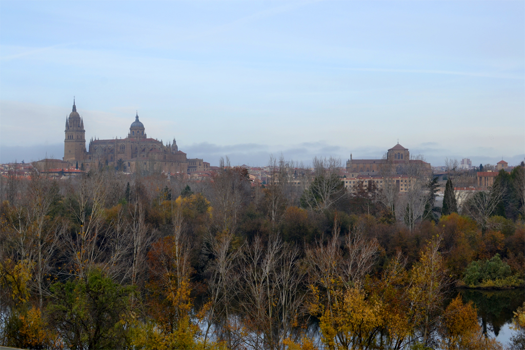
Alba de Tormes
This is a town with a lot of history and whose old town was declared Historic-Artistic Grouping. It is particularly associated to the name of Saint Teresa of Jesus, who visited Alba de Tormes to attend the marriage between her sister Ms. Juana de la Ahumada and Mr. Juan de Ovalle, and to found a monastery of the Carmelo order. Years later, she came back to the town from Medina del Campo. She fell ill and died in her cell of the Monastery of La Anunciación on 4th October 1582. Her (incorrupt) corpse remains in the chapel of La Anunciación, after her remains were moved to Ávila for a period of time.
King. Alfonso XIII and the queen Eugenia also visited Alba de Tormes to attend the Third Centenary of the Saint’s death, as did Saint John of the Cross, Pedro Calderón de la Barca (dramatist who was the secretary of the 6th Duke of Alba), Miguel de Cervantes, Lope de Vega (during his exile from the Court of Madrid) or the Pope John Paul II.
Arapiles Historical Site
The Plasencia-Astorga railway, and therefore this Nature Trail, goes right between two hills that were very important in the Peninsular War, the Arapiles.
The Battle of Salamanca was one of the most important confrontations of the Peninsular War and it was fought in the surroundings of the hills Arapil Chico, where the allies’ artillery batteries were deployed, and the Arapil Grande, where the French ones were deployed. This happened in the municipality of Arapiles, south of the city of Salamanca, on 22th July 1812.
This war resulted in the victory of the allies’ army (Anglo-Hispanic-Portuguese), commanded by general Arthur Wellesley, first duke of Wellington, over the French troops, commanded by marshal Auguste Marmont. After this victory, Wellington continued through the Duero valley and took Madrid, where he was laud as a liberator of the population. Although the campaign was not decisive in the long term, this defeat was the prelude to the end of the European supremacy of Napoleon.
Besides the hills, this battle marked in the history of all the surrounding towns, near the Nature Trail. For example, Arapiles has an Interpretation Centre about the Arapiles Historical Site.
Multimedia