Casas del Monte - Hervás stage
Description
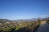
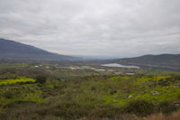
From the plains of the Ambroz valley to the foothills of the Sierra de Béjar
Following the course of the old Plasencia-Astorga railway (which forms part of the route known as the Vía de la Plata), this section of the Vía de la Plata Nature Trail crosses the county of Ambroz Valley from south to north. Over the course of this trail the landscape changes from livestock pastures and dehesas to the deciduous forests (oak, Pyrenean oak and some the most important chestnut groves in Cáceres) on the mountain hillsides.
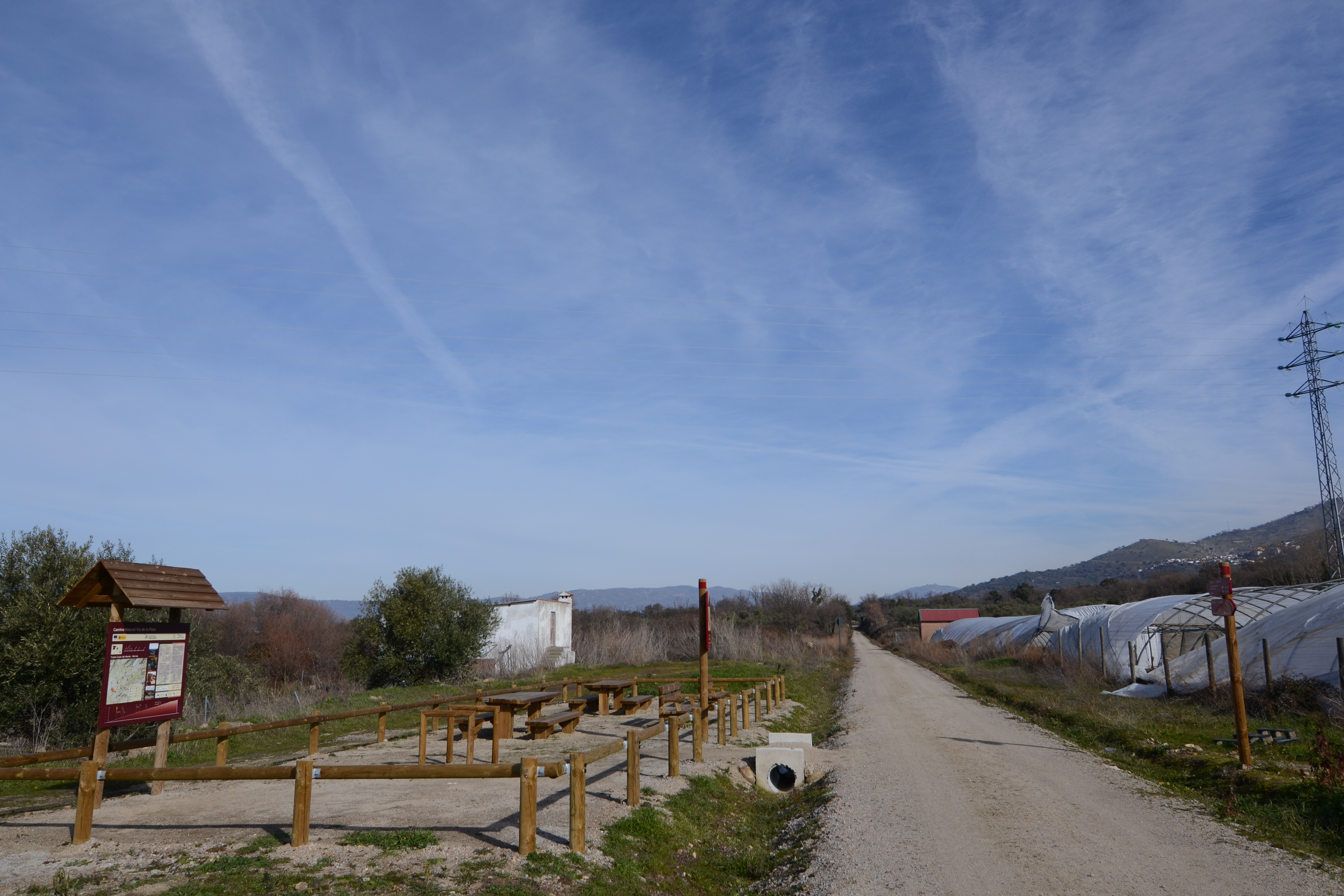
Along the route, the old railway use is evident: old signals, boundary stones with the RENFE symbols, the ruins of old railway workers’ houses and, of course, the station that served the municipalities of the area. The track is compact and wide throughout the route and wooden fences protect the traveller at points where the steep slopes alongside the trail might be dangerous. The three old stations offer rest areas and information panels on the trail and its local environment. Like the rest of the sections of this trail, the route runs along the aforementioned Vía de la Plata, a route used for access to the “French” Camino de Santiago, which it joins at Astorga.
This section begins at the municipal boundary between Jarilla and Casas del Monte and can be accessed along the paved country road that starts at km 447 of the N-630. After 100 metres, take the dirt track on the right as far as the nature trail. The starting point is 300 metres to the south.
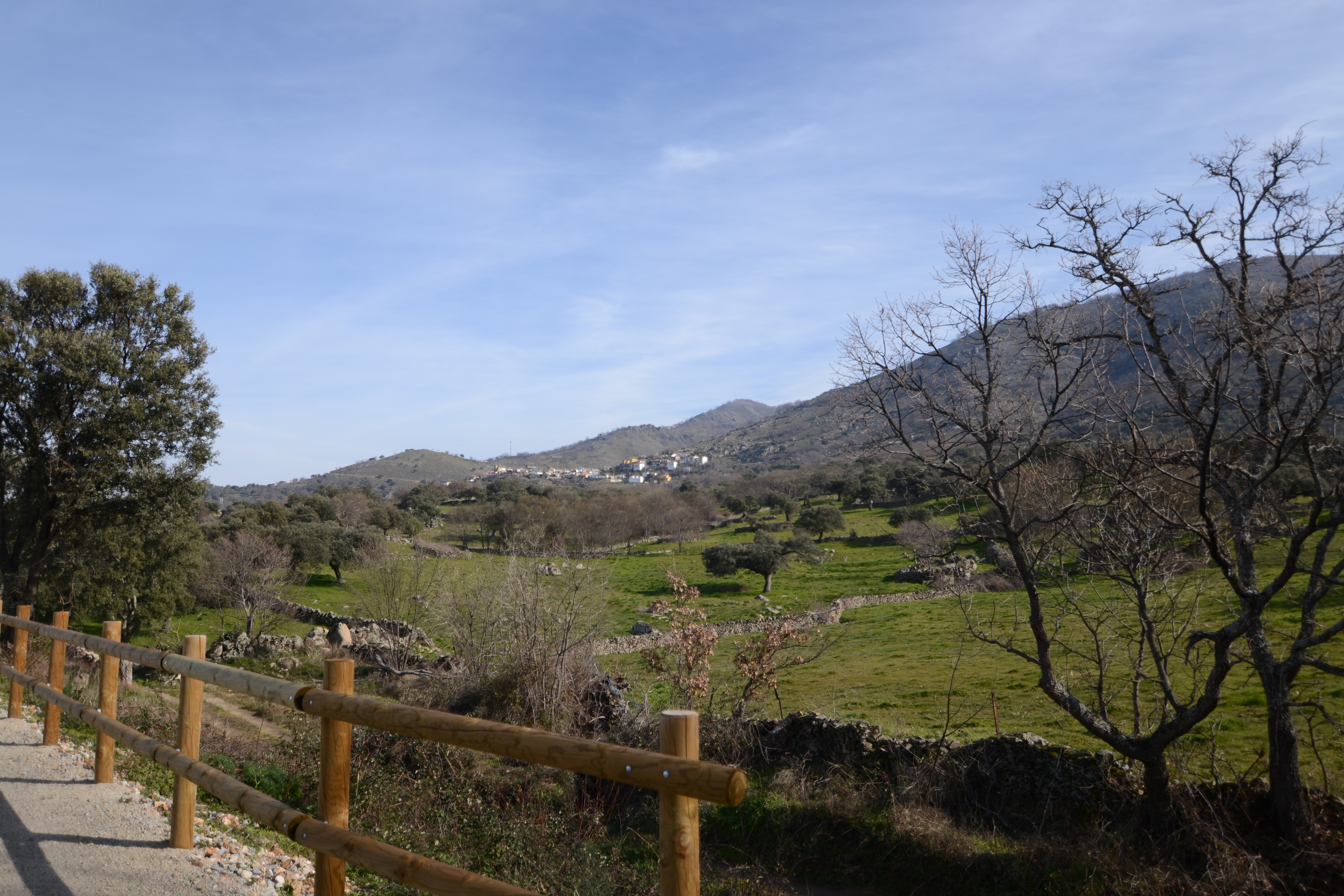
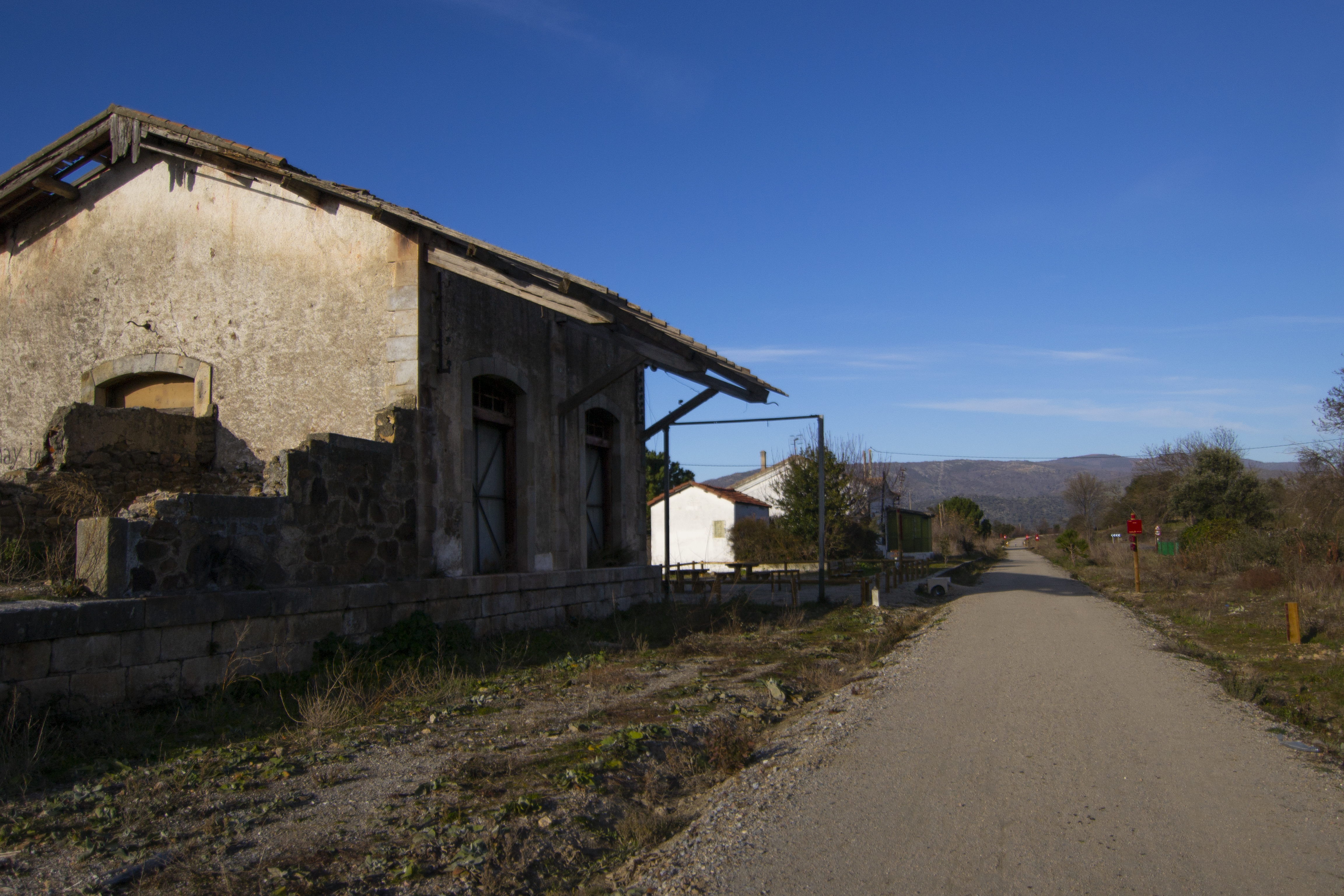
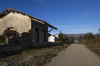
The first few kilometres of the trail run through an essentially agricultural landscape, among olive groves, dehesas and pastures for cows and sheep. In this environment, it is common for the Nature Trail to be crossed frequently by tracks that access farms. After two kilometres, more buildings begin to appear around the trail until after we pass under CC-15.3 (which provides access to Casas del Monte) and arrive at the old station that served that locality. Around the station, a number of mountain houses were built although of the railway infrastructure barely one building in ruins is left.
Leaving the station behind, the trail briefly runs through the trenches excavated for the railway before penetrating an oak grove later becoming a gallery forest (ash, poplar, willow) before reaching the bridge over the Garganta Ancha. Crossing the bridge, two hundred metres later, a country road of decent width on the right takes us up to Casas del Monte. Over the next few kilometres of the Nature Trail, the landscape becomes dominated by dehesas with holm oak and dotted with the odd cork or ash tree. The village of Segura de Tora (which takes its name from a Vetton bull found in the area and currently located in Plaza Mayor) can be seen from afar, on the hillsides of the Cruces Altas mountains. There, the trail reaches the bridge over the Garganta Grande (2km form the last one), flanked by riverbank vegetation.
A little less than a kilometre past the stream, a country road takes us to Segura de Toro. Both this village and Casas del Monte and Gargantilla share similar characteristics, owing to their location at the foothills of the mountain: a haphazard layout with narrow streets and lanes and the presence of natural pools built from the mountain streams, making for an interesting visit any time of year.
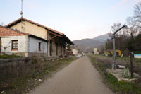
The trail soon returns to the dehesa, occasionally descending again into the trenches, and reaching the old station at Aldeanueva del Camino just after the Montesinos stream. As in the case of the Casas de Montemayor station, a small neighbourhood also sprung up here, and it retains even more vestiges of the railways. More of the buildings remain standing, including the passenger terminal, and some of the old railway tracks can be found at their original location.
Just after exiting the station, the trail crosses the CC-58 road, which links Aldeanueva del Camino with Segura de Toro and, through its CC-68 variant, with Gargantilla. Remember to exercise precautions as this road does have a certain degree of traffic (it is the access road for the A-66 for these villages) and there is poor visibility due to the curvy nature.
The trail makes a turn here and changes direction to the northeast, running parallel with the A-66 for a couple of kilometres. It soon crosses a concrete path that offers access to Gargantilla on the right and Aldeanueva del Camino on the left. Aldeanueva del Camino itself is traversed by the Vía de la Plata.
On the way to Hervás, the route continues to rise gently but constantly, while ascending the slopes of the Cruces Altas mountains. The unevenness of the terrain forces the trail between the banks excavated for the railway more regularly here than in previous section. The vegetation also begins to change, with holm oak and cork trees making way for Pyrenean and common oak.
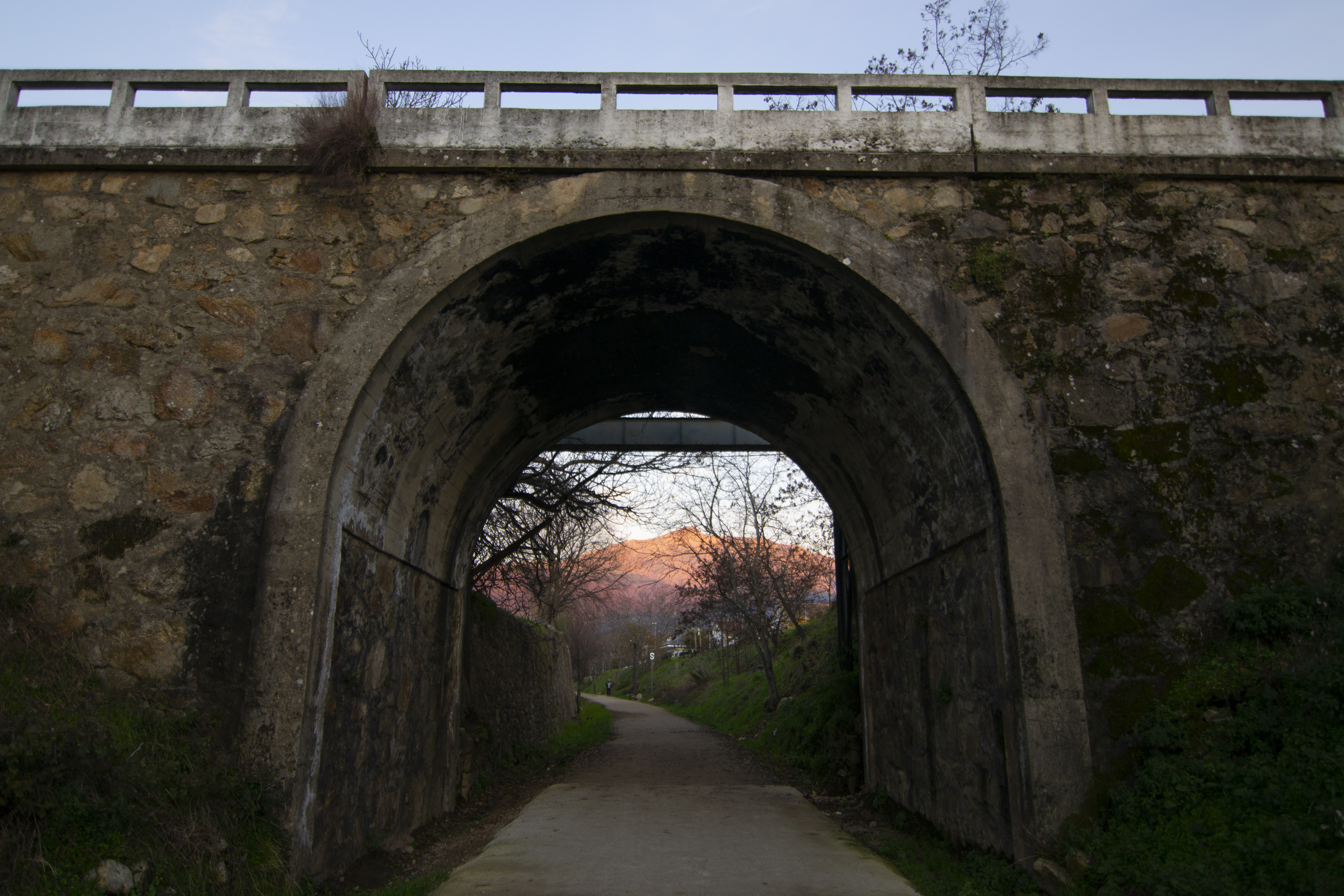
2 km from the exit for Gargantilla, the track passes over the Romanillo stream, entering a dense oak grove. Upon emerging, the traveller can tell they are approaching Hervás as the first country houses appear between the pastures, passing through orchards and finally reaching the first houses of the town itself. It enters the town passing over the river Gallego and later under the CC-102 road, which connects Ambroz Valley with the Jerte Valley through the Puerto de Honduras pass. Before reaching the station at Hervás, travellers must cross the road, caution advised as there can be quite a bit of car traffic despite it being the outskirts of the town.
Unlike the two other stations on the route, Hervás’s station is in quite good condition as the buildings have been refurbished for other uses. The passenger terminal now operates as a youth hostel and the neighbouring buildings house the Extremadura Railway Interpretation Centre and rural accommodation. There are also some tracks in their original location, on display with other elements such as needle exchanges and molehills.
Hervás is the administrative and commercial centre of the region overseen by the Association of Municipalities of Ambroz Valley, and boasts a rich artistic and historical heritage including the Jewish Quarter, the churches of San Juan Bautista and Santa María, the Perez Comendador-Leroux museum and the classic car and motorcycle museum. There are also natural attractions such as La Chorrera waterfall and chestnut forests, so it is certainly worthwhile taking a couple of hours to explore the town before continuing with the route.

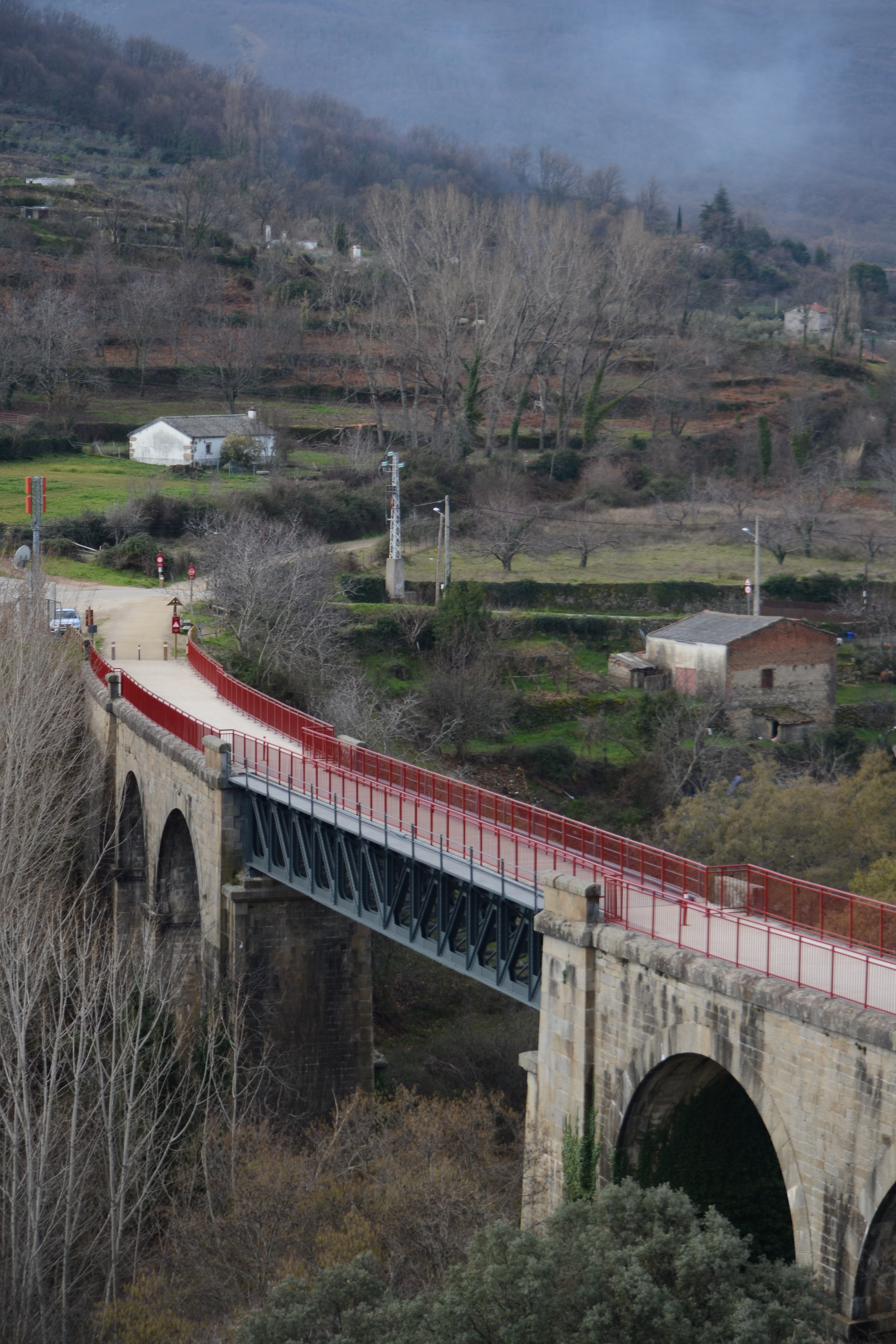
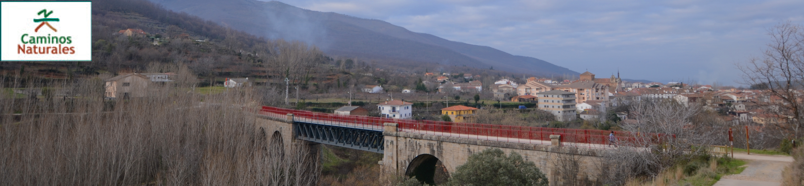
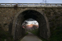
The trail leaves the station behind and once again continues between the banks, passing under a bridge (Calle Paraje de la Estación) and opening up once again after the level crossing at Calle Juan de la Plaza, to one of the landmarks of this section of the Nature Trail: the viaduct over the river Ambroz, also referred to as the “iron bridge”.
It is a bridge with a central metallic span and arches of granite masonry on each side, spanning a total length of 110m over the river Ambroz. Before crossing the bridge, take advantage of the wooden benches to pause and enjoy the impressive views of the Ambroz Valley, with the church of Santa María and Hervás's Jewish Quarter rising in the foreground.
After crossing the bridge and leaving the last of the town's houses behind, the landscape is similar to that on the way into the town, with private orchards and large extensions of pasture for livestock. Some 600m after crossing the River Ambroz, the trail passes under the EX-205 road and, a kilometre later, reaches the River Balozano, a tributary of the Ambroz.
Although the trail has been rising all along, after this point, the gradient becomes a little more pronounced and the final few kilometres of the Nature Trail require some extra physical exertion. All the way along, a wooden fence protects travellers from the dangerous decline on their left. This effort is rewarded with impressive views to the southeast and the Ambroz Valley with the Baños reservoir and the town of Hervás visible in the foreground.
This section of the Vía de la Plata Nature Trail ends at an altitude of over 770m, on the boundary between the municipalities of Hervás and Baños de Montemayor, where the section that crosses Castilla y León reaches Béjar.
By using the old railway platform and tanks to the firm, compacted surface, the trail is bicycle friendly throughout, with one section with higher difficulty due to the gradient of above 7% as it rises after crossing the bridge over the River Balozano.
Map
Puntos de Interés
Hidrografía
Orografía
Profile
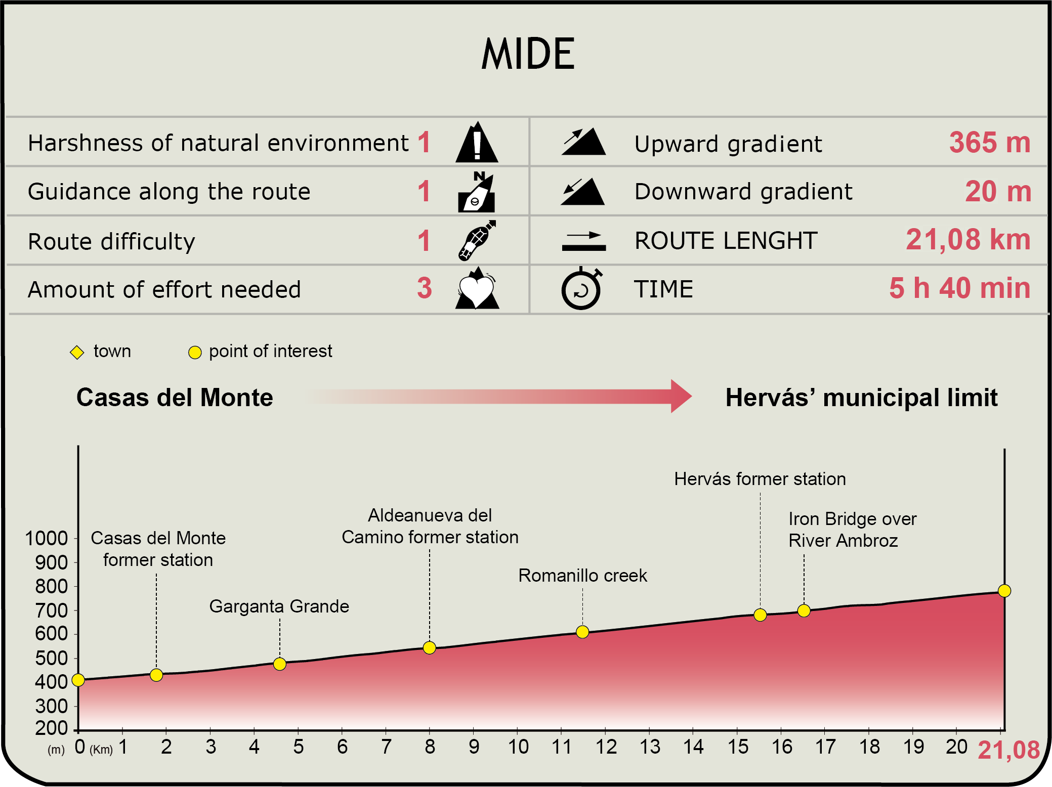
MIDE (Method for the Information of Excursions)
 Harshness of natural environment
- 1. The environment is not risk-free
- 2. There are more than one risk factors
- 3. There are various risk factors
- 4. There are quite a lot of risk factors
- 5. There are many risk factors
 Guidance along the route
- 1. Well defined trails and crossings
- 2. There is a clearly marked trail and signage
- 3. Requires the identification of geographic features and cardinal points
- 4. Requires off-path navigation
- 5. The trail is interrupted by obstacles that have to be gone around
 Route difficulty
- 1. Walking on a flat surface
- 2. Trails with different types of path
- 3. Walking on stepped paths or irregular terrain
- 4. The use of hands or jumping over the terrain is necessary
- 5. The use of hands is required to progress
 Amount of effort needed
- 1. Up to 1 hour of continuous walking
- 2. Between 1 and 3 hours of continuous walking
- 3. Between 3 and 6 hours of continuous walking
- 4. Between 6 and 10 hours of actual walking
- 5. More than 10 hours of continuous walking
Featured
Further information
Ambroz Valley
The Ambroz Valley is located in the north of the province of Cáceres in the autonomous community of Extremadura, bordering the province of Salamanca. With the most western foothills of the Sierra de Gredos to the east, it offers a diversity of landscapes with mountainous elevations (reaching 2,000m) and valley depths (500m) all within a distances of little more than 25km.
Ambroz Valley is both a natural county and an Association of Municipalities, made up of: Abadía, Aldeanueva del Camino, Baños de Montemayor, Casas del Monte, Garganta, Gargantilla, Hervás y Segura de Toro, and Hervás, the administrative and commercial centre of the association’s region.
As the natural crossing point of the Central System to the west, many forms of transport have passed through the Ambroz Valley throughout history: the Roman road from Mérida to Astorga (Iter ab Emerita Asturicam), drover’s roads and cattle tracks like La Real Soriana Occidental and La Vizana, and later the railway, along whose tracks the Camino Natural Vía de la Plata now runs, and, over the last few decades, the N-360 national road and the A-66 motorway.
Throughout history, there have been many cultures that have left their mark in the country: the Vetton Celts (the bull of Segura de Toro) the Romans (La Granjuela, the baths in Baños de Montemayor, the road from Mérida to Astorga, etc.) and the Jews (the Jewish Quarter of Hervás was declared a Historic-Artistic Site in 1969).
Plasencia-Astorga Railway
This Nature Trail recovers, for recreational use, the route of the old Palazuelo-Astorga Railway, which was brought into service along the full route (347.5km) in July 1896, although some sections had been inaugurated previously. It was closed to passenger traffic on 1 January 1985 along the Plasencia-Astorga section (330.8km). Today, only the 16.7km of the section connecting the old Palazuelo station (called Monfragüe since May1990) with the Madrid-Cáceres line at Plasencia is still in service. When it was in operation, this railway saw trains connecting Gijón and Seville (918 km) through Mérida, Cáceres, Plasencia, Salamanca, Zamora, Astorga and León.
Multimedia