Baños de Montemayor - Béjar stage
Description
Crossing from Cáceres to Salamanca along the slopes of the Sierra de Béjar mountain range.
This section of the Vía de la Plata Nature Trail follows the route of the old Astorga-Plasencia railway line, which runs at a mid-slope level along the sides of the western edge of the Béjar mountain range, declared in 2006, alongside its neighbouring mountain range La Sierra de Francia, as a Biosphere Reserve. The Vía de la Plata Route, is a tourist-cultural trail based on the Roman trail between Augusta Emerita (Mérida) and Asturica Augusta (Astorga), which lends it its name, and it runs parallel to the nature trail for a large part of the journey.
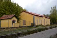
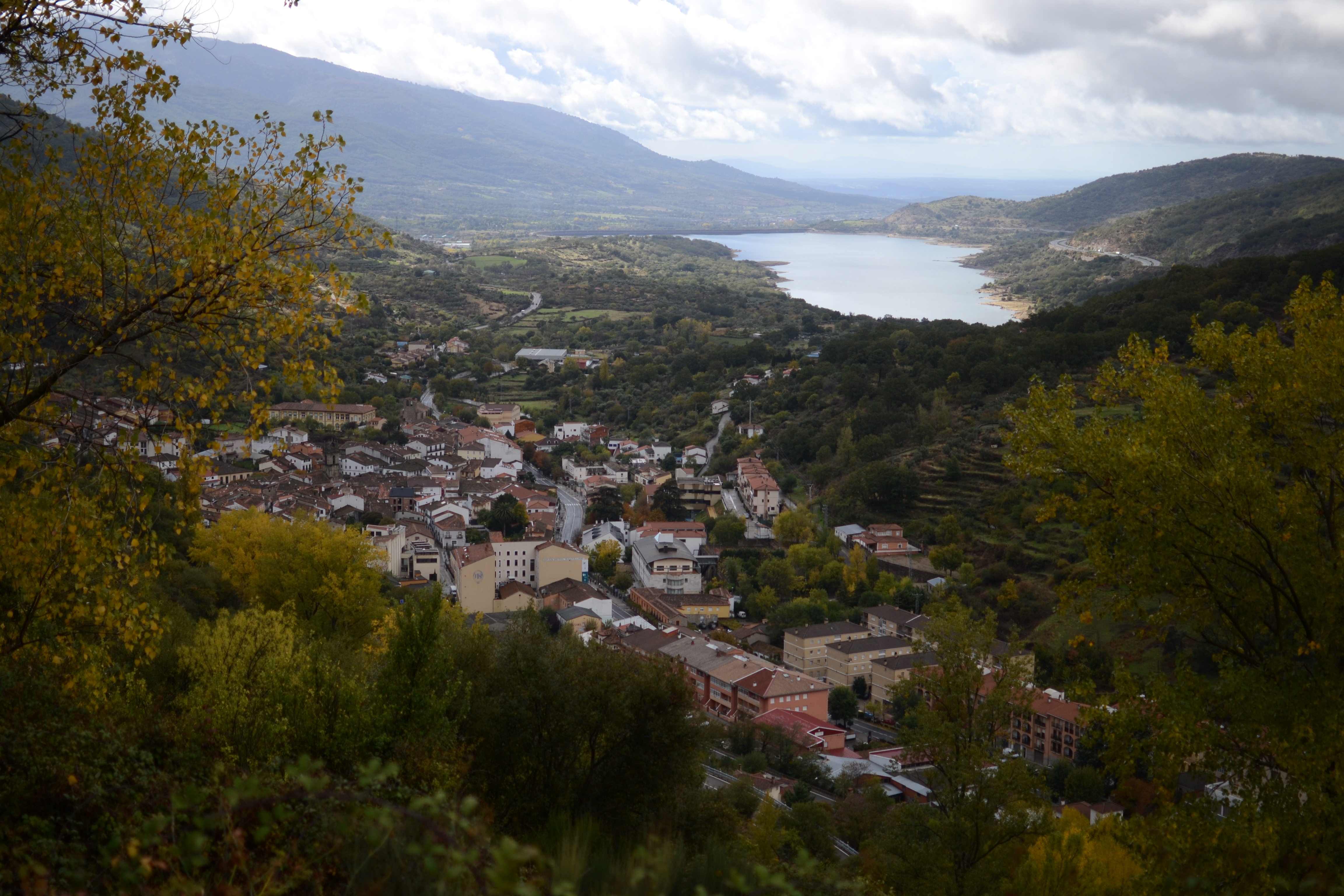
Starting from the municipal boundary between Hervás and Baños de Montemayor, the old station of Baños de Montemayor is reached after some two kilometres. The station’s main building is well conserved, although it is not in use, and around this there is a tree-lined recreational area with tables, children’s games and impressive views of the Ambroz valley, with the Baños reservoir standing out.
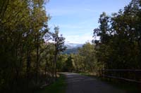
The trail crosses the road from Baños de Montemayor to La Garganta (care must be taken, the road is very winding and thus visibility is not good) to then enter a forest with a mix of deciduous trees that cover the slopes of the mountain range, and this will accompany the trail until it reaches Béjar.
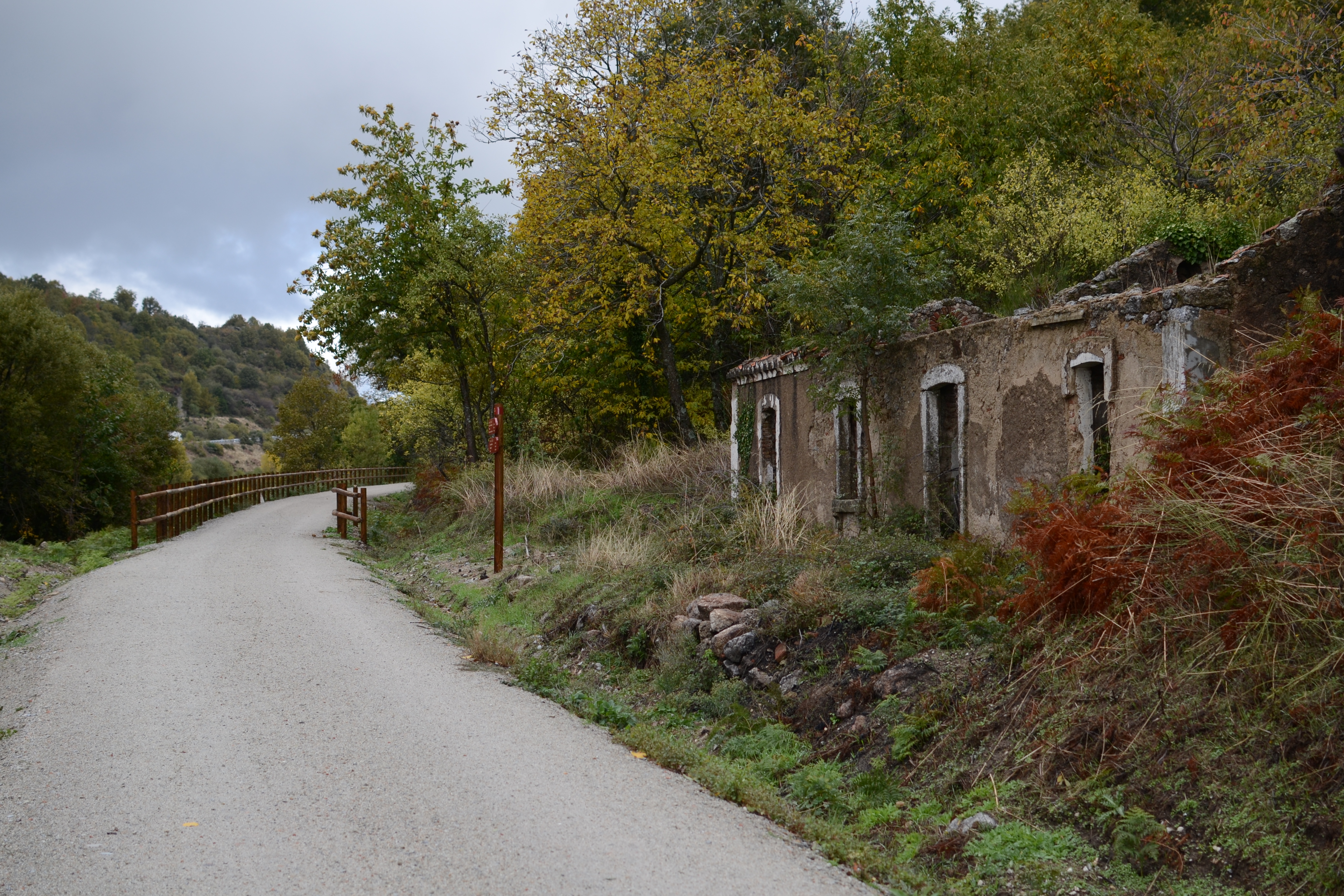
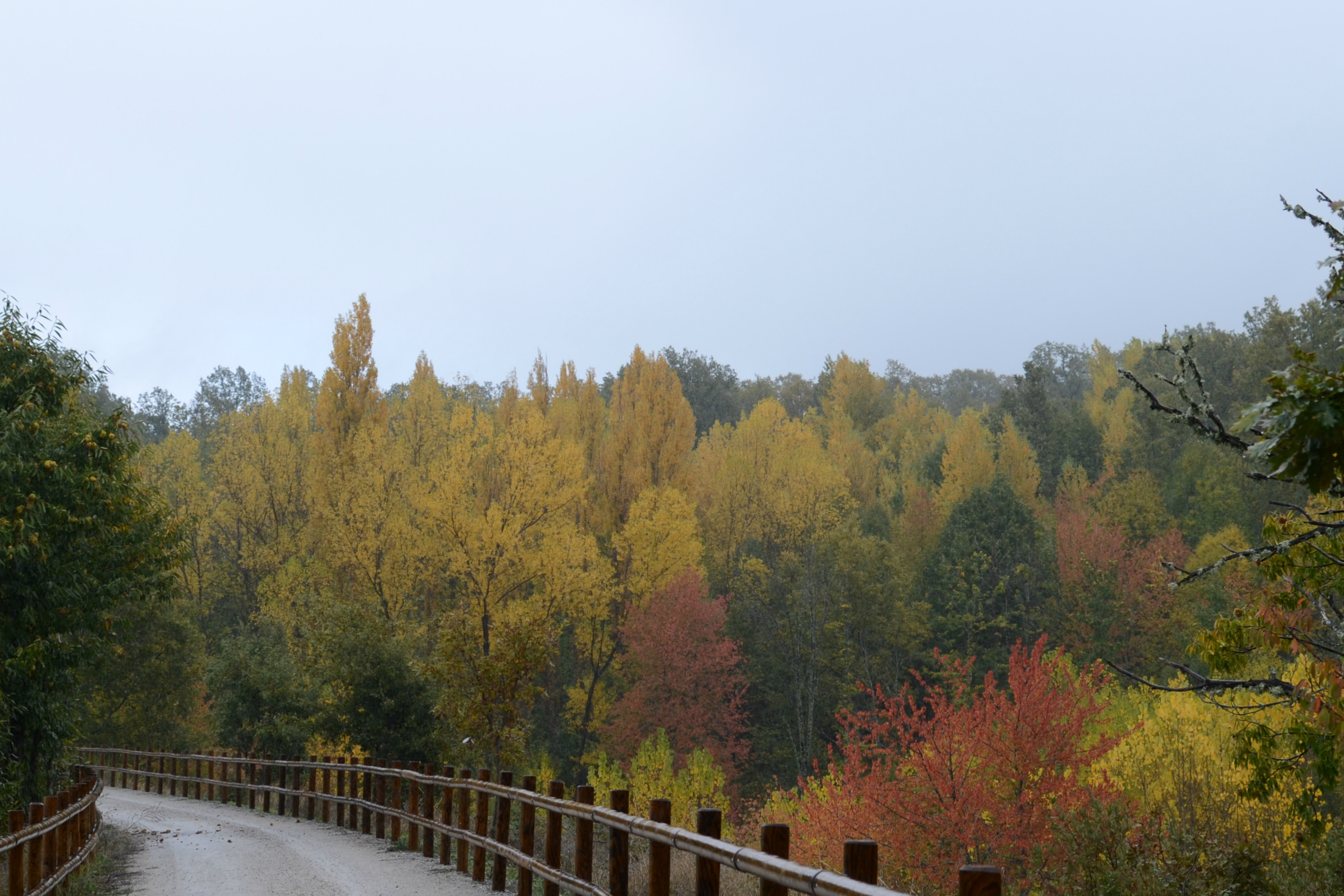
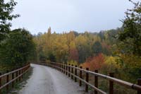
The company of oak, chestnut, maple, ash, rowan and hazel trees, etc. provides the traveller with shade during the trail and, particularly in autumn, a great variety of colours make this journey along the old railway line much more attractive. Throughout the journey it will also be common to see, on both sides of the trail, the remains of constructions associated with the maintenance of the railway line.
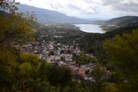
After a kilometre and a half, a walkway over the River Garganta is reached, this is a small water course that was used to turn the mills at Baños de Montemayor, and just a few metres later the first of the route’s tunnels is reached. At more than 200m long, the tunnel is artificially lit (although it is advisable to carry a torch). After the tunnel, the trail takes a wide curve in which the vegetation to the left opens up, allowing for spectacular views of the valley, with the town of Baños in the foreground, and the reservoir once again in the background.
Just under a kilometre after leaving the tunnel the provincial (and autonomous) boundary is crossed between Cáceres and Salamanca, and after kilometre point eight the station of Puerto de Béjar is reached. Around the station, whose main building has been converted, a populous area (Colonia de La Estación) sprung up, which belongs to the town of Puerto de Béjar. Curiously, with regard to the name of this nature trail, in 2001 value was placed on a small section of the Roman trail, with an open air interpretation classroom being opened on this Roman route (Iter ab Emerita Asturicam) under the said road; this can be reached 600 m from the station.
Continuing the route, the N-630a is crossed, now close to Puerto de Béjar, and the town can be reached from some of the paths that lead from the right of the trail. Leaving Puerto de Béjar behind, the trail continues without the landscape changing for 3 km, until the outskirts of Cantagallo are reached, where the forest opens up. Although it is not visible thanks to the vegetation, only around 10 m separate the trail from the A-66 motorway. After passing underneath one of the roads that accesses this town in Salamanca, a rest area is reached where there used to be a stop, although there are no traces left of this. From this point a trail to Cantagallo can be taken.
Cantagallo is left by passing under another road which provides access to the town, leaving the trail boxed in between the motorway on the left and the N-630a road on the right. The trail returns to the company of a broadleaf forest, and crosses below the road. Around kilometre 13.5, a path to the right enables for the “Cedro de la Francesa” to be visited; a beautiful centenary Atlas Cedar, considered as a monumental tree.
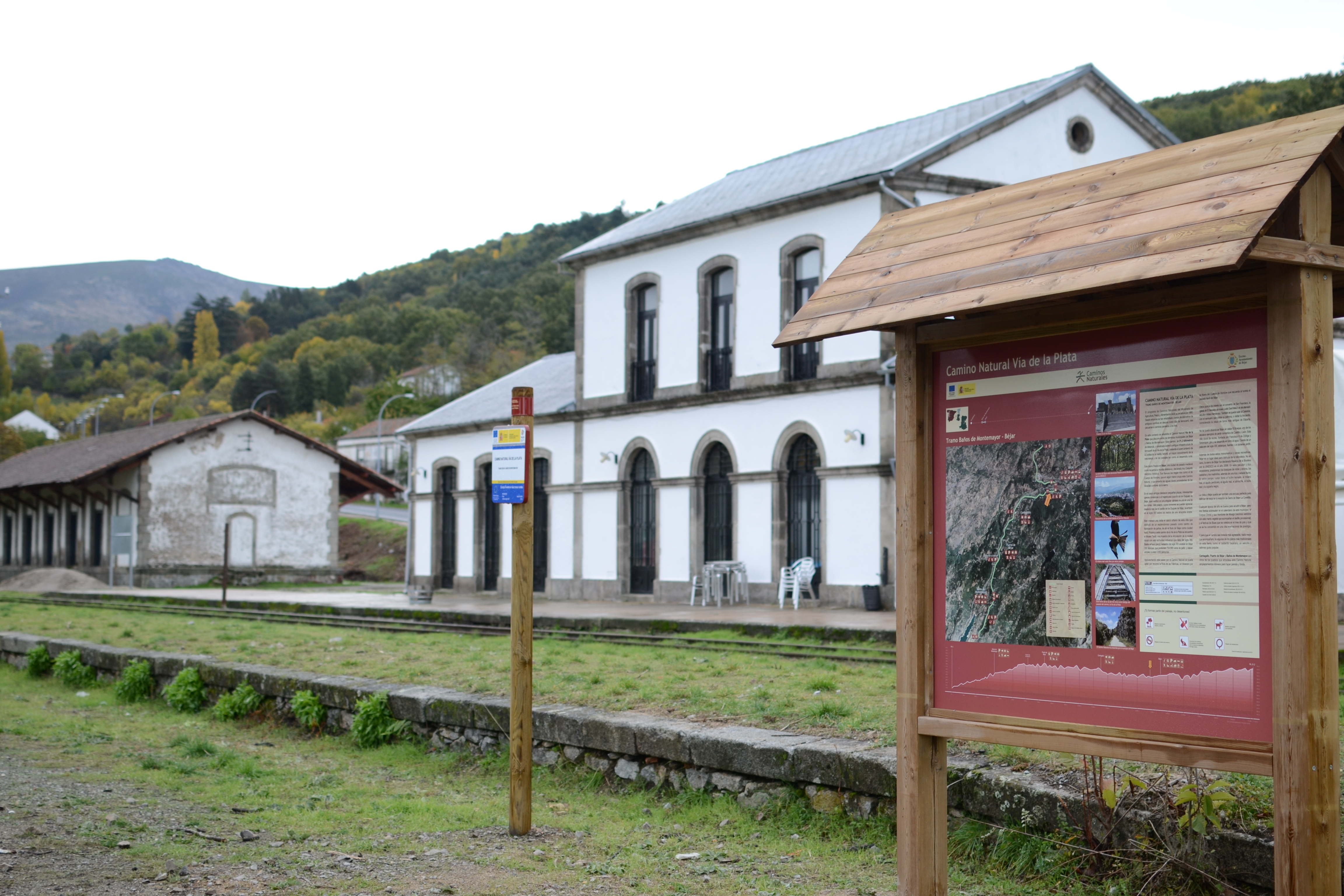
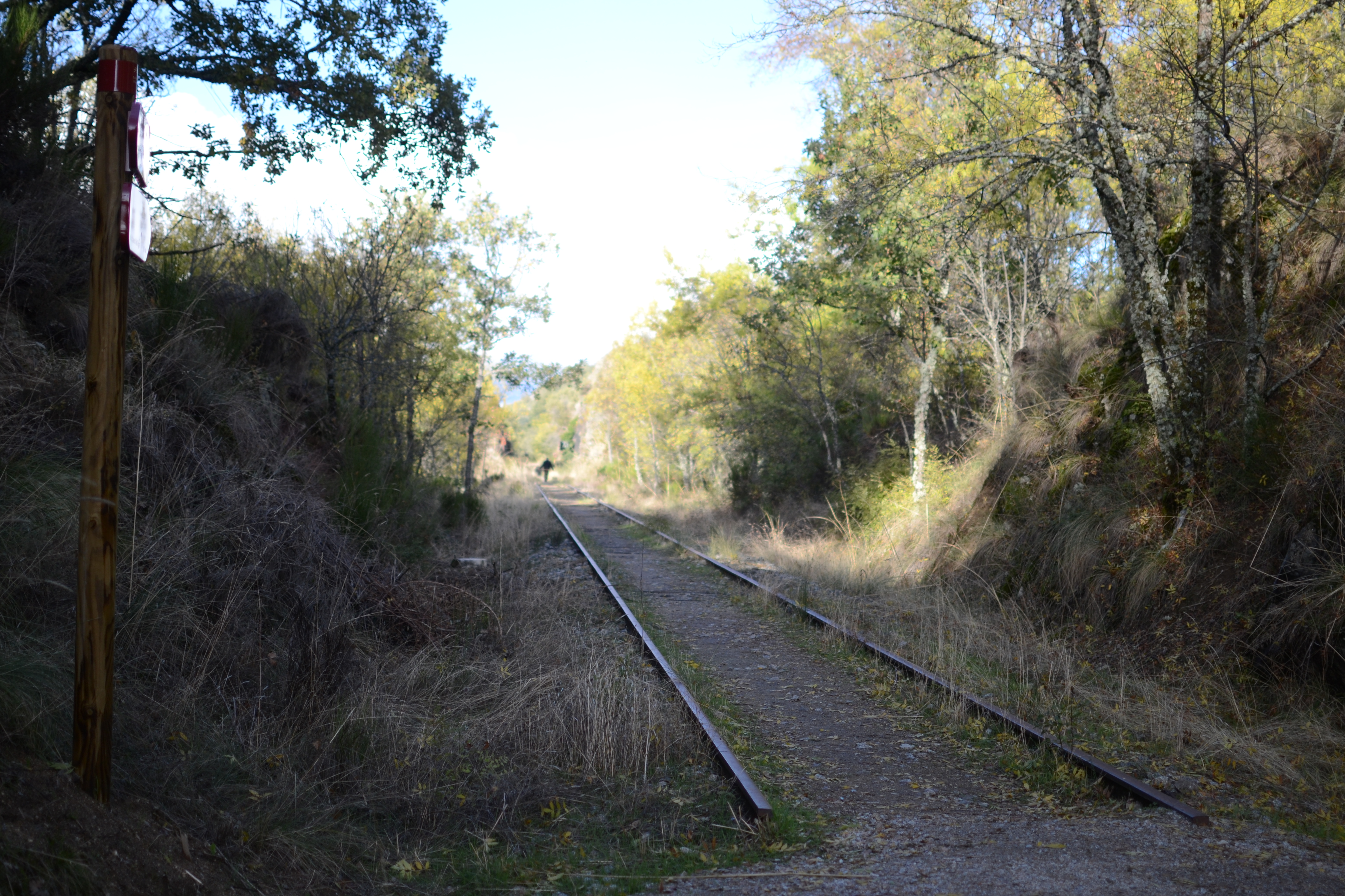
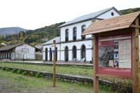
Road N-630a is crossed again, this time over a metallic bridge, and then the Béjar station is reached. The station’s buildings are all in a very good condition, as they have all been restored to be used as a restaurant and hostel. A rest area has also been made, as well as a viewpoint looking towards Béjar walls. Some elements of the time period in which the trains stopped here have been recovered and value has been placed on them, such as section of tracks, traffic lights and the rail road switches.

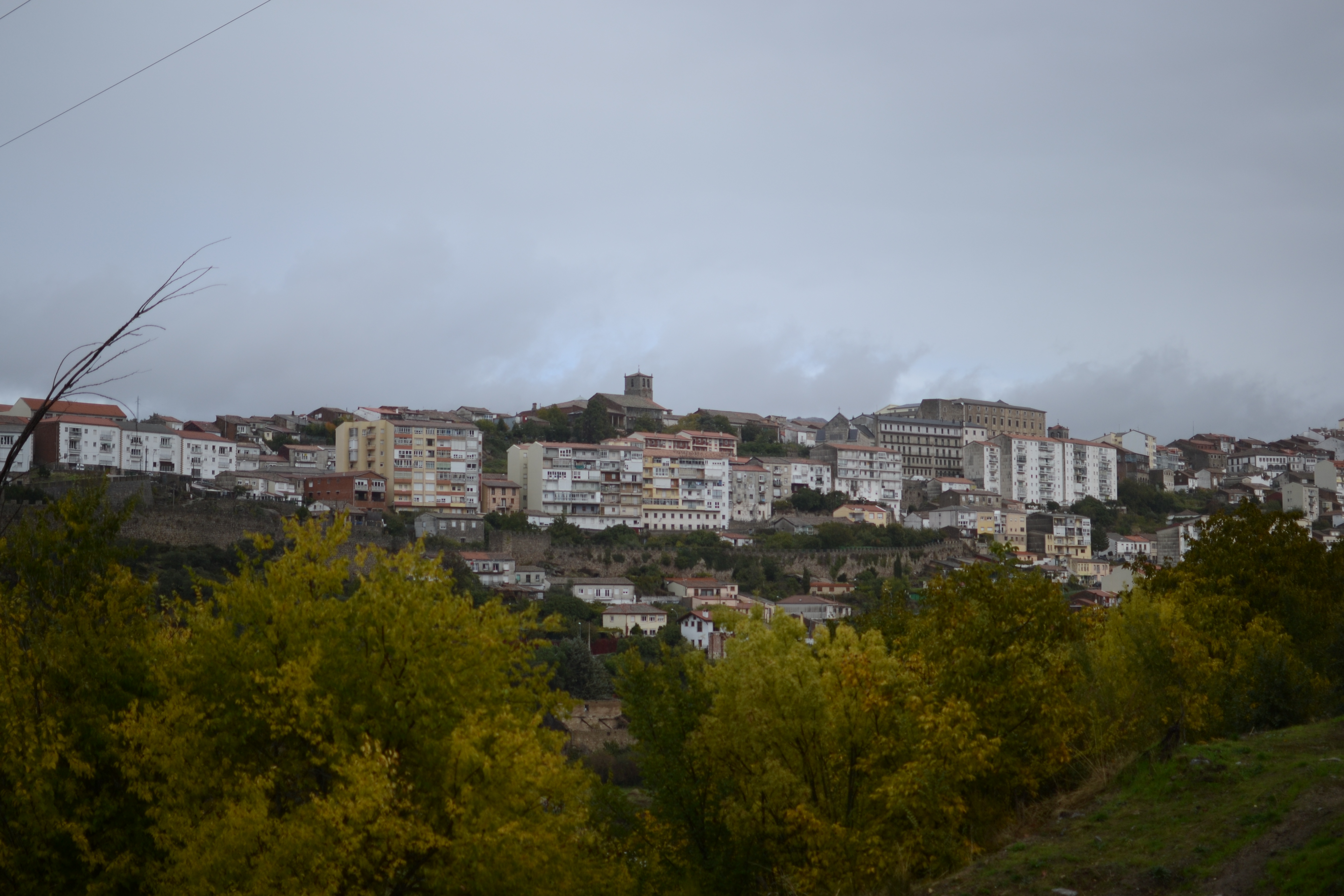
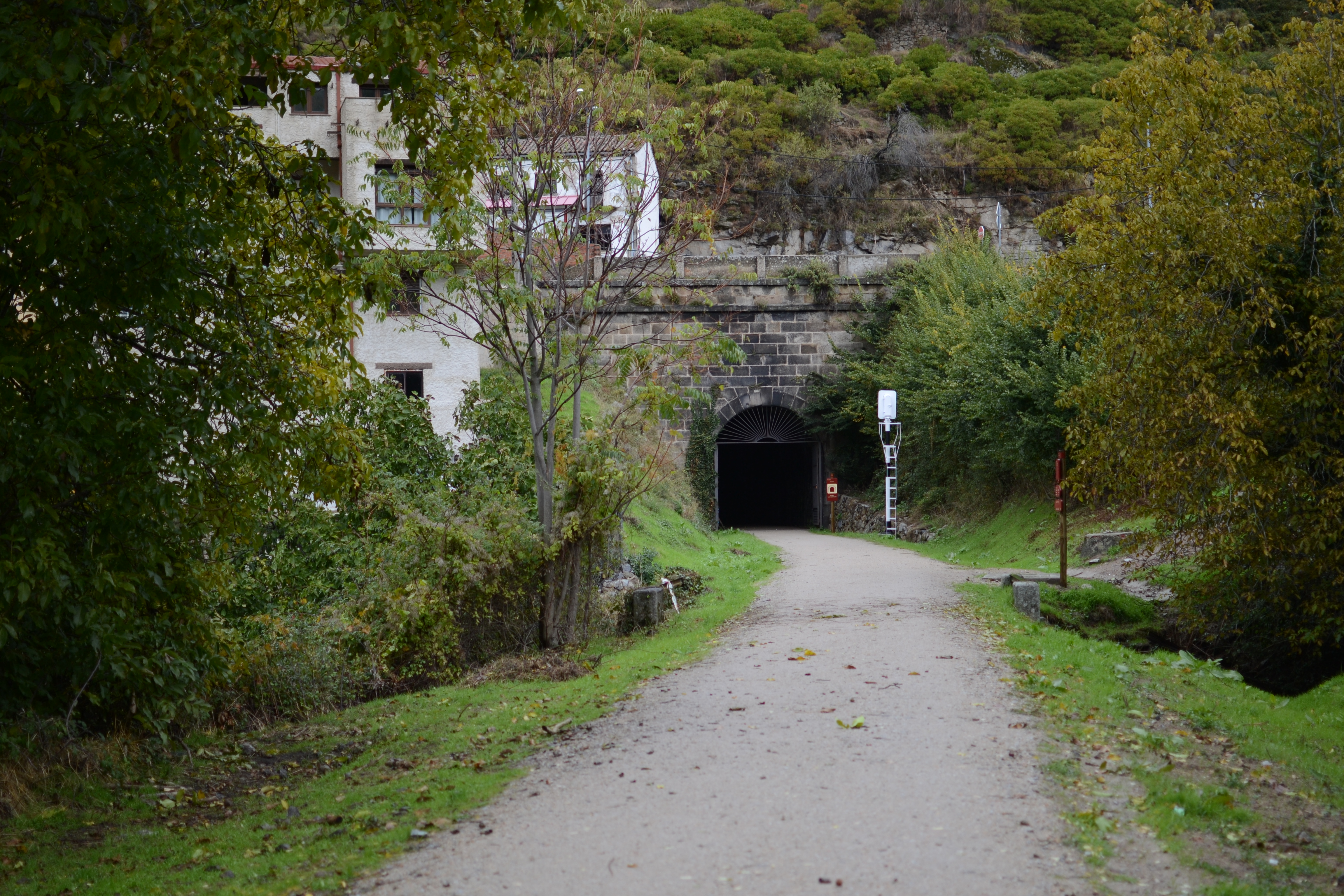
The historical centre of Béjar has a unique location, covering a hill that is almost surrounded by the River Cuerpo de Hombre. When the railway was built, the decision was made to save this geographical feature by means of a tunnel that passes just below the town. It is through this tunnel, which is perfectly converted and lit, that the nature trail now passes. Before entering the tunnel, a path enables for the southern side of Béjar to be reached. This town is a must-see in order to enjoy its historical heritage (medieval walls, Roman churches such as Santa María la Mayor, Santiago and San Juan Bautista, and the Ducal palace), and its art (Mateo Hernández museum and the religious art museum), as well as being the services centre for the region of Sierra de Béjar.
The light of this almost 400 m tunnel enables for its careful upkeep to be observed, especially considering that it was built between 18889 and 1891. Approximately half way through the tunnel, the walker will find themselves 50 m below the Plaza Mayor of Béjar. Upon leaving the tunnel, the River Cuerpo de Hombre is crossed via a bridge, next to one of the many textile factories, which has been turned into a museum on the industry that was so closely linked to Béjar during the 19th and 20th centuries. A route (signalled as the route of the textile factories) takes you along the river banks and enables for the old cloth factories to be admired on the left of the nature trail, just after passing under the road via which Béjar can be accessed.
It does not take long to reach the route’s final tunnel, which is less than 200 m long, after which the last of Béjar’s factories are left behind. After passing below the A-66 motorway and going around an industrial park via a wide curve, the valley of the River Cuerpo de Hombre is also left behind. Until the end of the route the trail changes between being accompanied by dense deciduous forests and Pyrenean oak and ash forests and pastures in which cattle graze. Glancing backwards, the peaks of the Sierra de Béjar mountain range can be observed and in the east, in the background, the silhouette of the Sierra de Francia mountain range can be made out.
After crossing under road SA-220, there is only 1400 m to go before the municipal boundary between Béjar and Navalmoral is reached. Although this section of the Vía de la Plata Nature Trail ends here, Navalmoral de Béjar is less than a kilometre away and the town council has cleared the railway in order to provde acces to te town centre.
Sites of interest
Map
Puntos de Interés
Información
Orografía
Vegetación
Profile
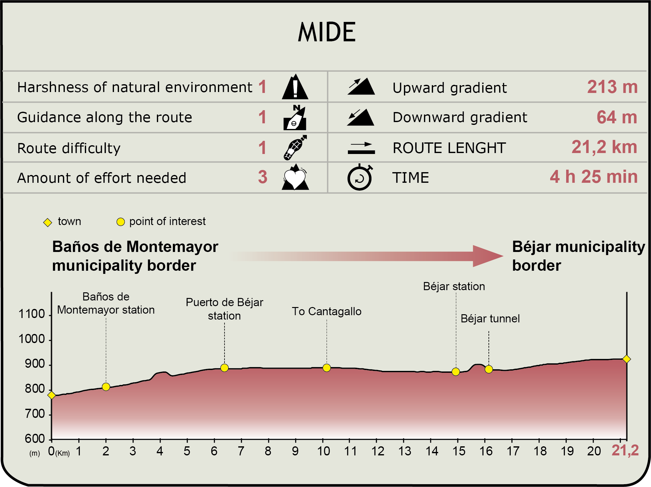
MIDE (Method for the Information of Excursions)
 Harshness of natural environment
- 1. The environment is not risk-free
- 2. There are more than one risk factors
- 3. There are various risk factors
- 4. There are quite a lot of risk factors
- 5. There are many risk factors
 Guidance along the route
- 1. Well defined trails and crossings
- 2. There is a clearly marked trail and signage
- 3. Requires the identification of geographic features and cardinal points
- 4. Requires off-path navigation
- 5. The trail is interrupted by obstacles that have to be gone around
 Route difficulty
- 1. Walking on a flat surface
- 2. Trails with different types of path
- 3. Walking on stepped paths or irregular terrain
- 4. The use of hands or jumping over the terrain is necessary
- 5. The use of hands is required to progress
 Amount of effort needed
- 1. Up to 1 hour of continuous walking
- 2. Between 1 and 3 hours of continuous walking
- 3. Between 3 and 6 hours of continuous walking
- 4. Between 6 and 10 hours of actual walking
- 5. More than 10 hours of continuous walking
Featured
Further information
Las Sierras de Béjar y Francia Biosphere Reserve
The Las Sierras de Béjar y Francia Biosphere Reserve, is located in the south-east of the province of Salamanca, on the border with the provinces of Ávila and Cáceres. Although in biogeographic terms this is located in the Mediterranean region, there are various areas that have a clear Euro-Siberian influence, and consequently this area has great natural richness, with interesting places in which both regions come together.
Its centre coincides with the places of greatest interest within the Natural Spaces with declared protection, both the Natura 2000 Network and the Critical Areas for the black stork and the “El Berreuco” archaeological site (located in the town of El Tejado) for its cultural importance. The buffer zones are found surrounding the centre and there are no towns inside. It is where the main economic activities take place (agriculture and farming) and the majority of forest exploitations and hunting areas. The transition area is where the populations, roads, quarries and reservoirs are located. Here, traditional crops are found close to the towns and there are tourism activities.
The oak and holm oak forests are present throughout the Reserve, and alongside them there are the famous holm oak, oak and ash pastures in the cooler areas. There are also chestnut forests in many places. Next to these representative formations, there are also some remarkable ones, such as the Madroño de Miranda del Castañar forest, the areas of Holly in the Honfría forest in Linares de Riofrío and the Quercus robur forest in San Martín del Castañar.
The large variety of flora (with more than 2,000 species) provides a high diversity of habitats populated by more than 5,000 species of invertebrates and 300 vertebrates. Two endemic species stand out among these for their importance: the ray-finned fish (Cobitis vettonica) and the lizard of the Peña de Francia (Iberolacerta martinezricae), as well as keystone species such as the salamander, the black and griffon vultures, the Bonelli's eagle, and mammals such as hunting species for example boar, deer and the Iberian lynx.
Plasencia-Astorga Railway
The Plasencia-Astorga railway line, also known as the Palazuelo-Astorga line made up part of the part of the ferrocarril del Oeste de España (Spain West’s railway), a transversal line from Sevilla to Gijón.
The railway was opened in 1896, and was fully working until the end of the 20th century. In 1985 it stopped offering passenger services, and in 1996 goods traffic also stopped. Although there are still sections where trains of other lines pass, MAPA’s Nature Trails Programme has rehabilitaded parts of the track for their recreational use.
Multimedia