Barcial del Barco - Maire de Castroponce stage
Description
Between Rivers Esla and Óbrigo valleys
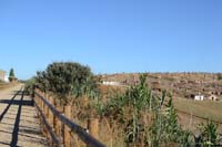
Setting off among crop land (corn, sunflower, vines, etc.) from the platform at the old Plasencia-Astorga railway line, this section of the Vía de la Plata Nature Trail involves the transition between the plains of the River Esla and that of its tributaries, the Órbigo and the passing from Tierra de Campos region to the Benavente y los Valles region, both in the province of Zamora. The name of this nature trail could not be more fitting to its route, as on various occasions it coincides with the Vía de la Plata Route.
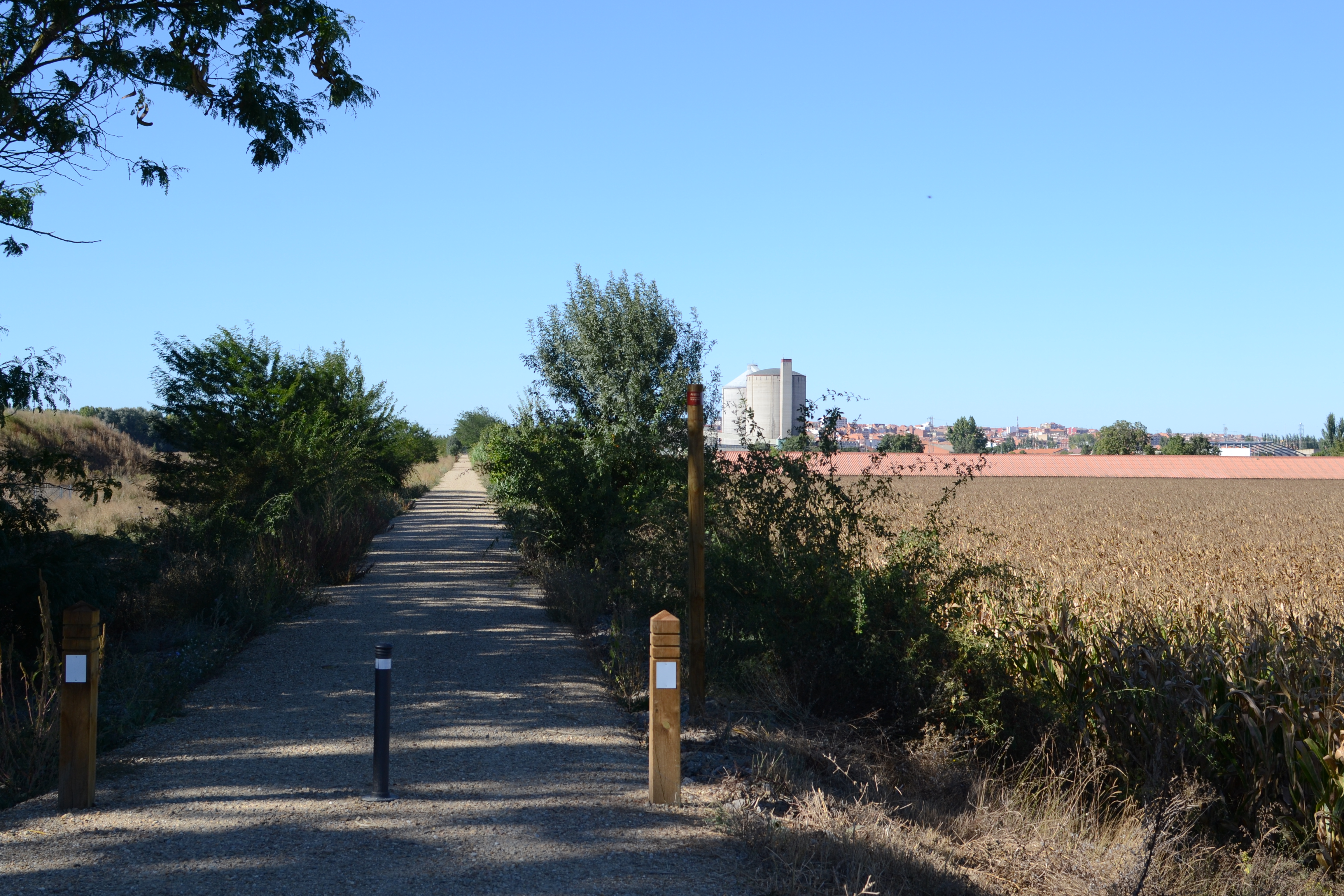
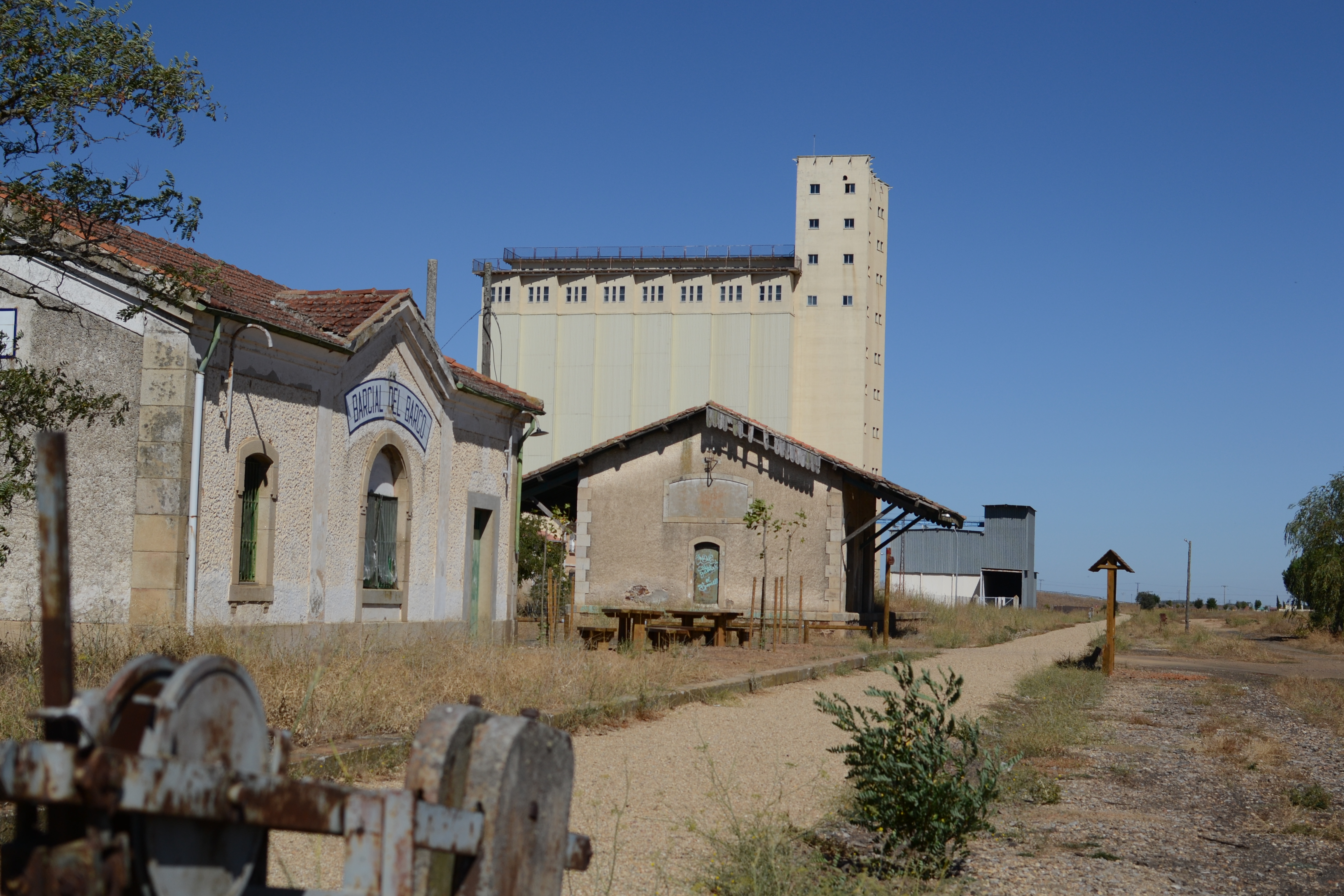
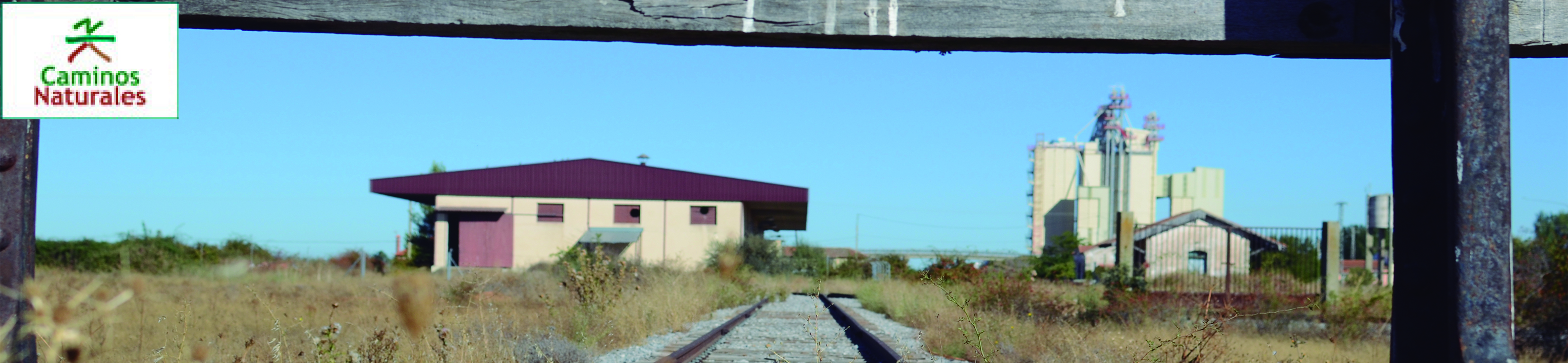
This almost 25 kilometre long section leaves from the Barcial del Barco station, on the outskirts of the town in the province of Zamora. Despite not being used, the station’s buildings are still standing and it has a Rest Area. Before setting off, take note of the Spanish Agricultural Guarantee Fund’s (FEGA) large silo. These modern granaries, that are very common in rural Spain, tend to be located next to means of transportation, such as roads or railway lines.
Leaving the silo behind, it does not take long before the route crosses the Vía de la Plata route. This is a tourism-cultural route marked with signs from the Regional Government of Castilla y León, and with granite boundary stones with a yellow scallop, as it is part of a Camino de Santiago. Shortly afterwards road N-610 is passed underneath, and a kilometre later a meander in the River Esla is reached.
During the first part of the journey towards Benavente, a series of walkways and bridges are passed over which enable the route to pass over rural paths, ravines and streams. The first of all of these is a slightly larger than 50 metre bridge over a ravine that flows into the Esla.
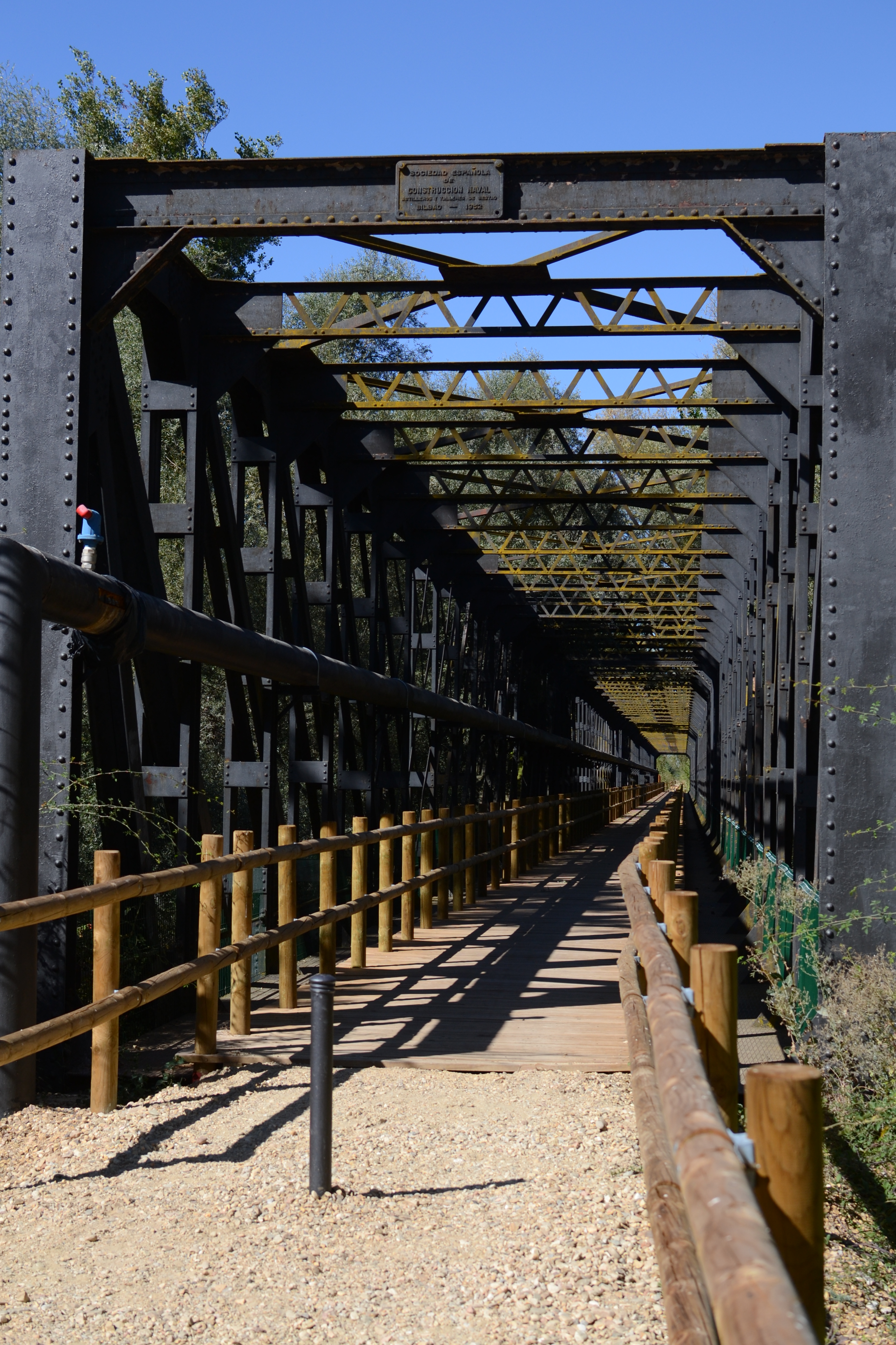
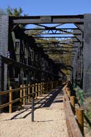
The river and the trail separate for a kilometre and a half, during a journey in which the old railway platform is elevated on a slope, among the crops on the flood plains of the River Esla. Shortly before meeting again, the trail enters a production poplar grove (the manufacturing of wooden panels from this tree is one of the region’s most relevant industries) and later a gallery forest with willows, ashes and hawthorns. The River Esla is crossed by means of an impressive viaduct made of more than 250 m of steel and granite masonry, built in 1932 and reformed in 1949.
On the other side of the river, the landscape of crops and walkways over streams and trails is repeated, passing next to a detour via which Villanueva de Azoague can be reached. This is famous, among other reasons, for its sugar industry, one of this region’s most emblematic industries, and that made use of the railway line for the entrance and exit of products. The two large sugar industry silos are well visible throughout this entire section of the trail, until reaching close to Benavente.
After leaving the sugar industry to one side and the detour that used to enable the trains to access the facilities (the tracks still remain), it is possible to see, also on the right of the trail, the Cistercian monastery of El Salvador. Although the current building is modern (1976), the congregation dates back to the 12th century, when the town of Santa Colomba (some 4 km away) was founded.
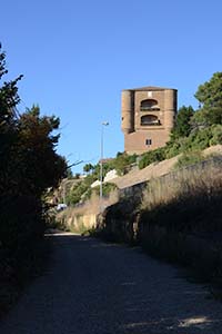
After crossing another bridge, Benavente is entered from the south, after passing below the N-452 viaduct. Until arriving at the station of Benavente, the trail leads along a headland upon which the old town sits on the right, under the watch of the Caracol Tower (which in its day made up part of the castle of La Mota, and is currently part of the Parador de Turismo de Benavente), and the Los Molinos creek, an arm of the River Órbigo which, among others, provides energy to a grain mill close to the station.
The Prado de las Pavas can be found on the other side of the spring, this is a green area which used to form part of the famous garden of the Counts of Benavente, and these days it has been turned into a botanical garden and recreational area for locals. This is where the INTERREG programme’s Los Ríos Interpretation Centre cab also be found, aimed at creating a series of environmental facilities on both sides of the Portuguese-Spanish border.
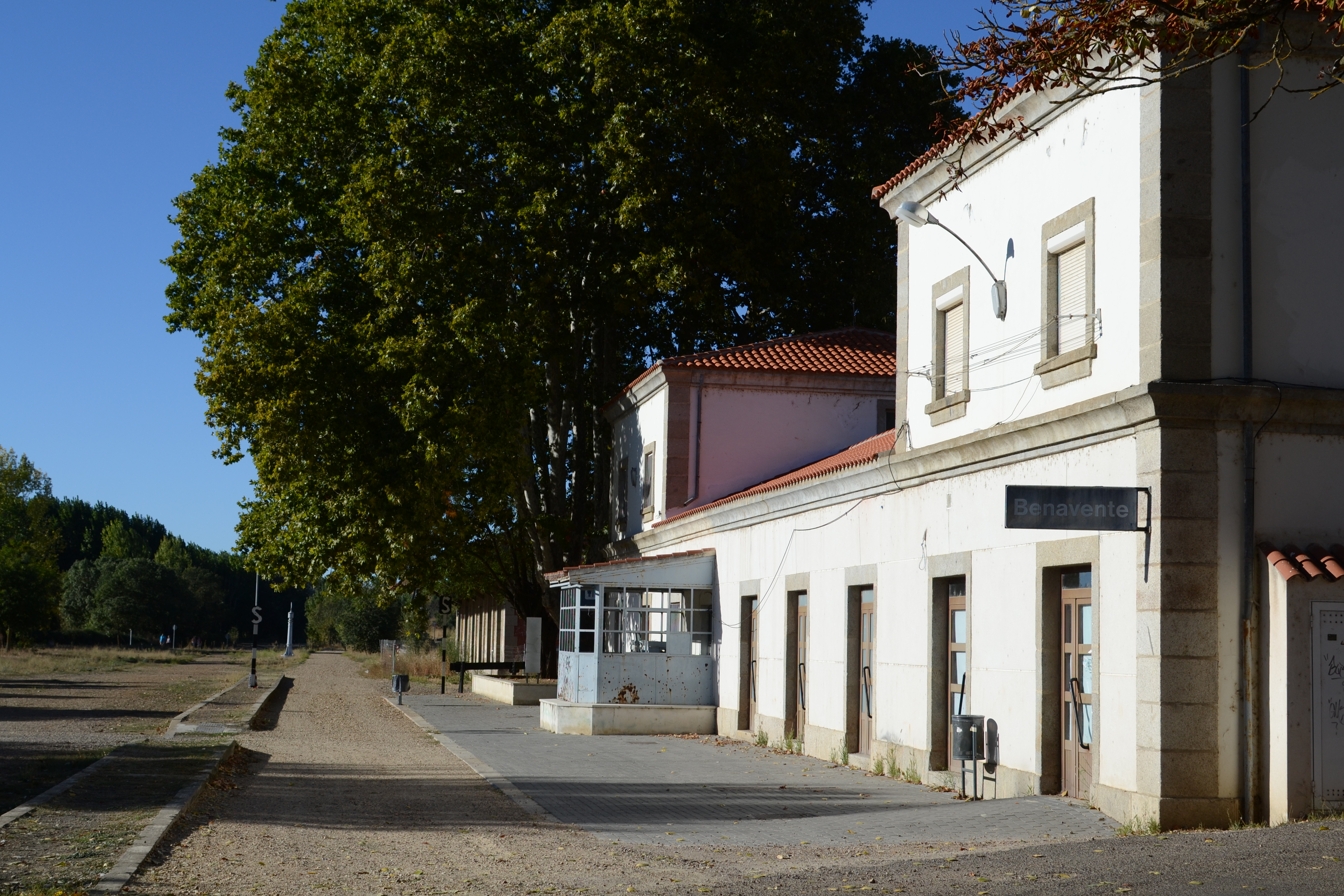
After passing by the previously mentioned grain mill, the station of Benavente is finally reached. In a well conserved stated, the travellers’ building has been restored as a hostel for pilgrims, and the station’s surroundings have been converted into an authentic railway museum, placing value on the cranes, water deposits, buffer stops, rail road switches and even a locomotive, distributed among a large, gardened rest area.

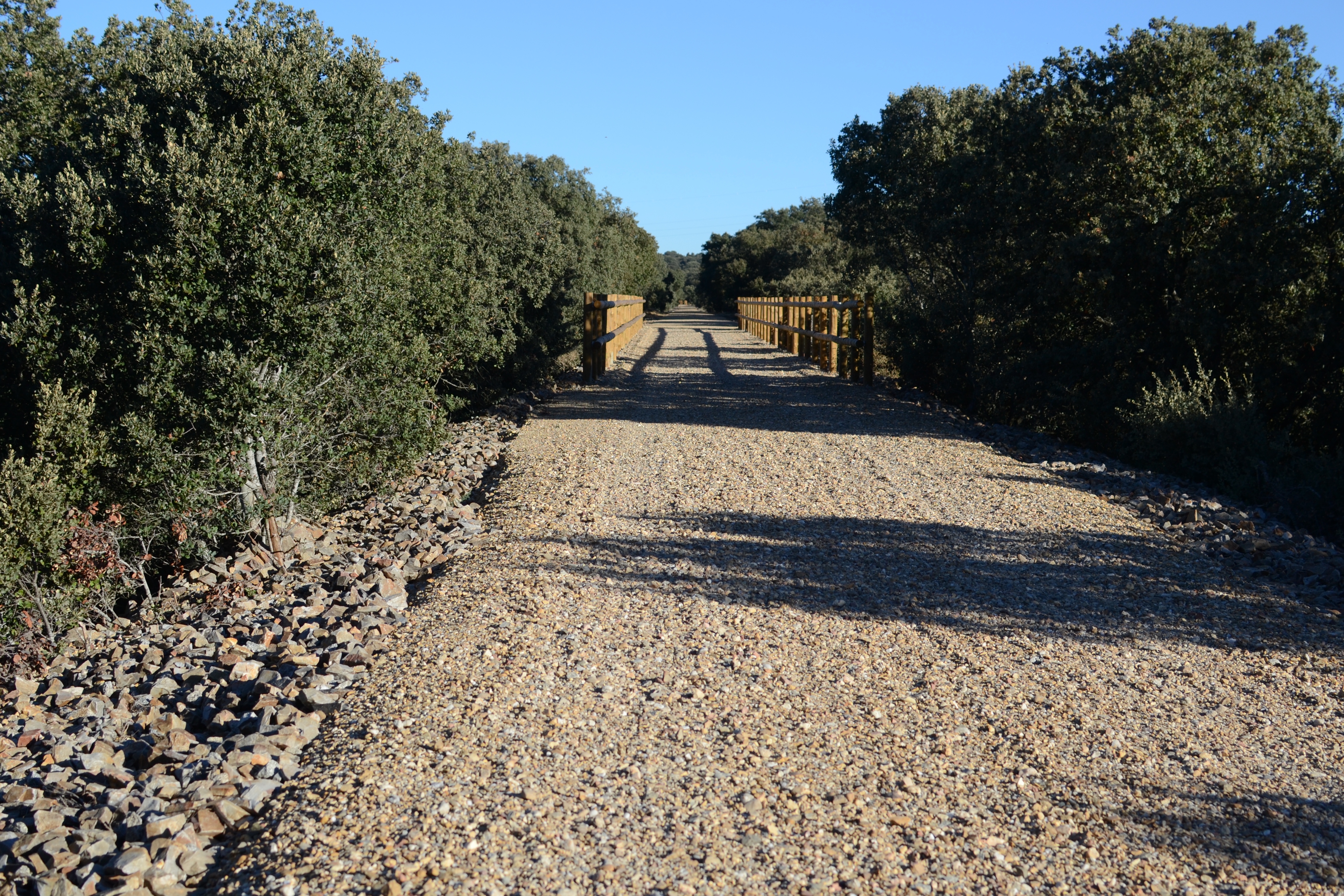
After crossing road ZA-P-15, the route continues along an area of poplars and orchards, in the company of the Los Molinos creek. The last houses in Benavente are hidden behind the embankment on the right of the trail that, after passing over the road via a bridge, enters the Mosteruelo meadow; vast Mediterranean vegetation dominated by evergreen oaks. The contrast between this landscape and the plains previous to this can be seen in the areas in which the oak groves allow for the crops and poplars to be seen next to the Los Molinos creek on the left of the trail. Before passing below road A-52, the nature trail will have passed the Vía de la Plata route on two occasions, with the two routes now definitively becoming further apart.
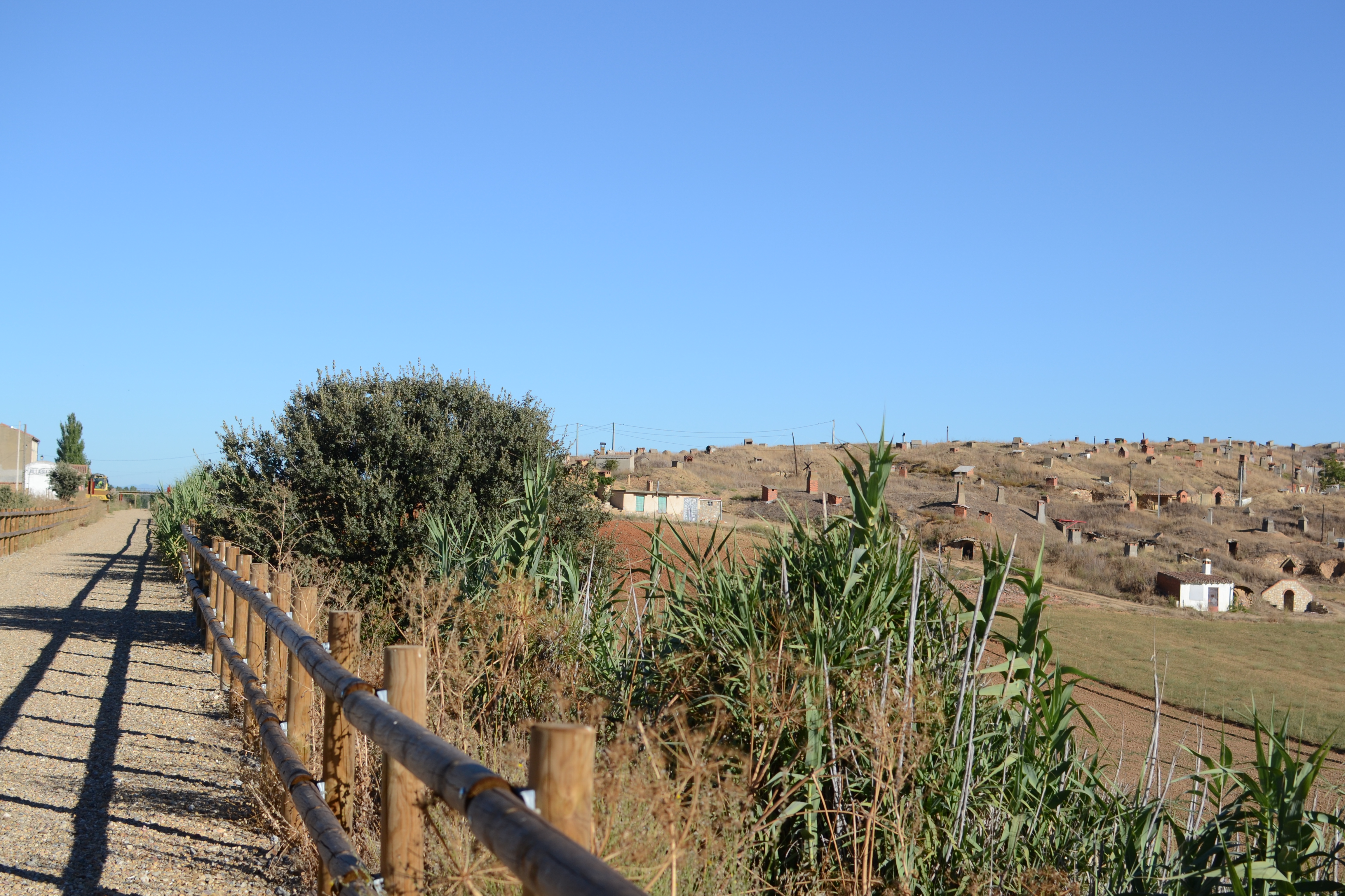
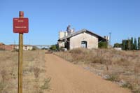
The road also marks the end of the meadow and the town of Villabrázaro is immediately reached. The traditional wine cellars carved into the hills, which are very usual in the towns in this area, really grab the attention upon entering the town. The trail only peripherally touches this town, leaving the old stop on one side, this is barely a roofed refuge with an annexed bathroom, and a rest area has been made next to this.
Once again with the landscapes of crops (above all corn fields and some vineyards), with the occasional presence of wooded areas and brambles, which give welcome shade in the heat, the Reguero creek is crossed, and notably on the right, almost on the horizon, the Nuestra Señora del Valle convent, next to the town of San Román del Valle can be seen. Although it is in ruins (conservation work is being undertaken), it is worth a visit.
The trail continues, passing by various detours towards the area’s towns, first Paladinos del Valle (belonging to the municipality of La Torre del Valle) and then towards La Torre. These towns cannot be seen from the trail, as they are hidden behind a small hilltop, but they are also perfect examples of the area’s traditional architecture.
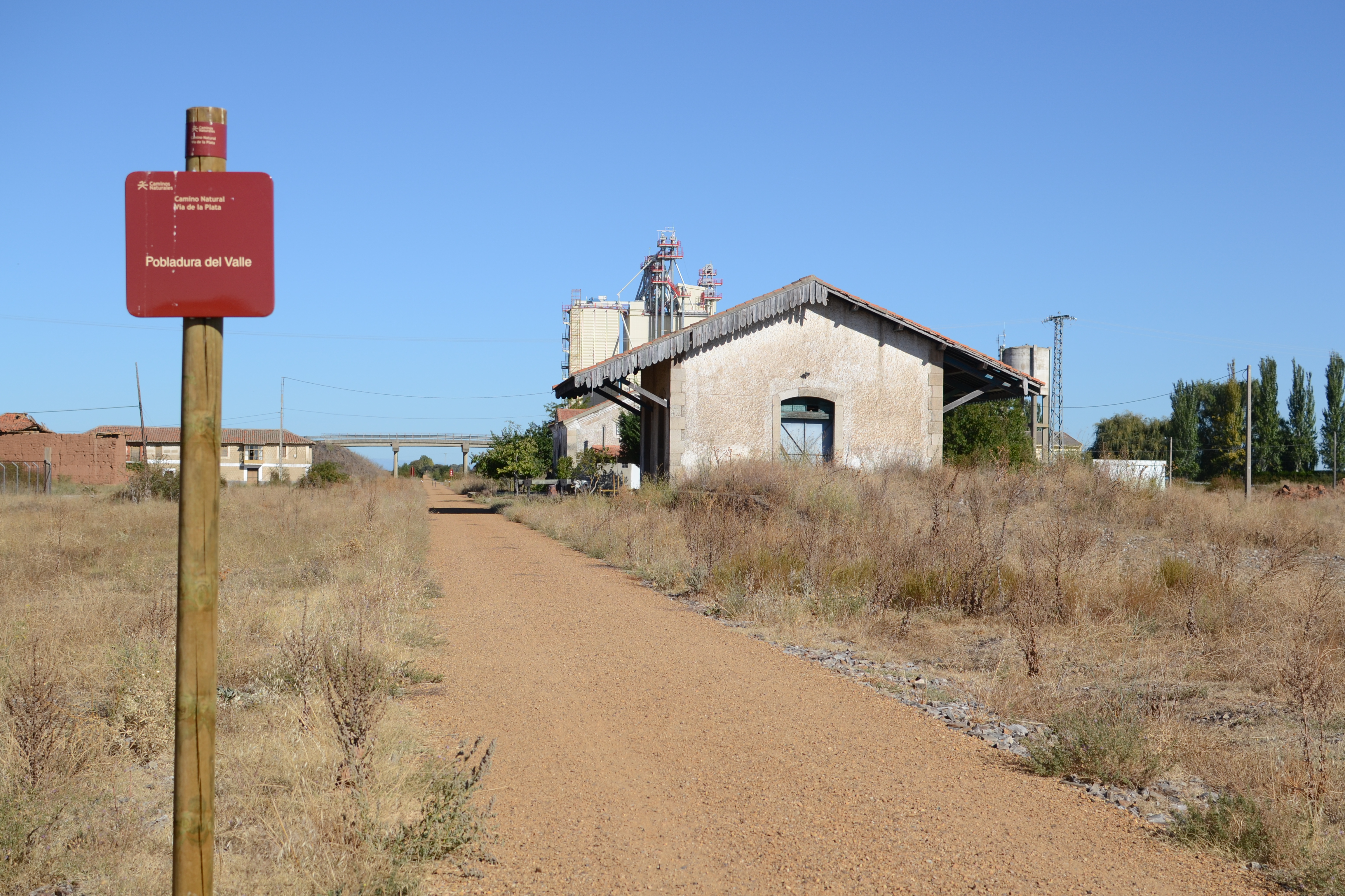
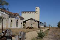
During the past few kilometres the Pobladura del Valle feed factory can be seen on the horizon, on the outskirts of the town and a just a few metres from the station. The station of Pobladura is in a very good condition, with the passengers´ building having been reconverted as rural accommodation. Other vestiges to its old railway use can also been seen, such as the rail road switches, a detour with a section of tracks that are still there, and the structure to turn the wagons next to the rest area between the two main buildings.
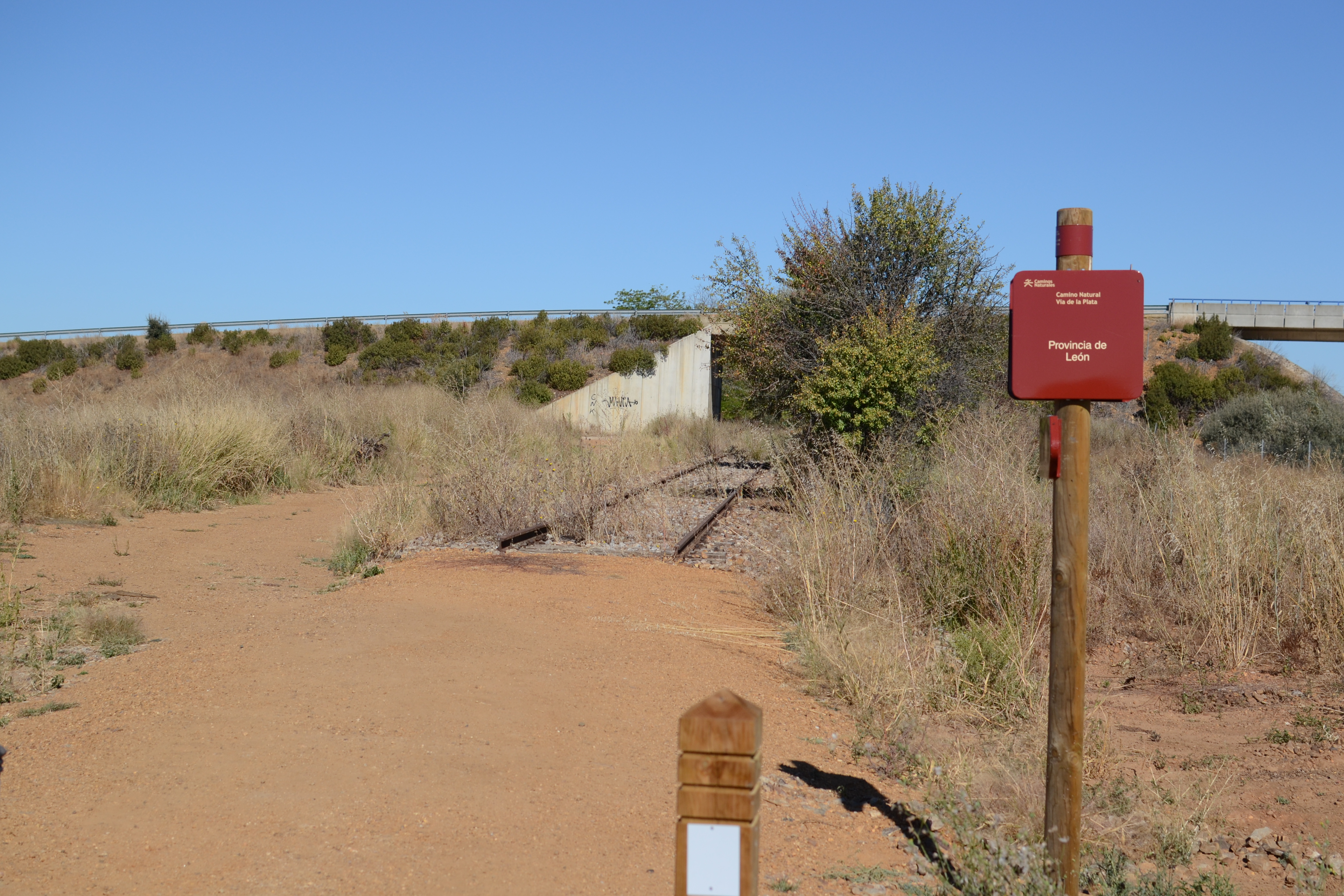
After passing below the road from Pobladura to Morales del Rey, and leaving a detour to the town of Pobladura on the right, there is only 4 kilometres before reaching the end of the trail. These pass once again with the scenery of crops, and the final kilometres have the company of the A-6 on the right, reaching the provincial border between Zamora and León, which marks the end of the section of the Vía de la Plata Nature Trail.
From here, Marie de Castroponce can be reached via rural trails, or by road LE-114, detouring to the south next to the historical bridge of Vizana, a Roman bridge which was destroyed during the Peninsular War and reconstructed at the beginning of the 20th century.
Map
Puntos de Interés
Hidrografía
Información
Vegetación
Profile
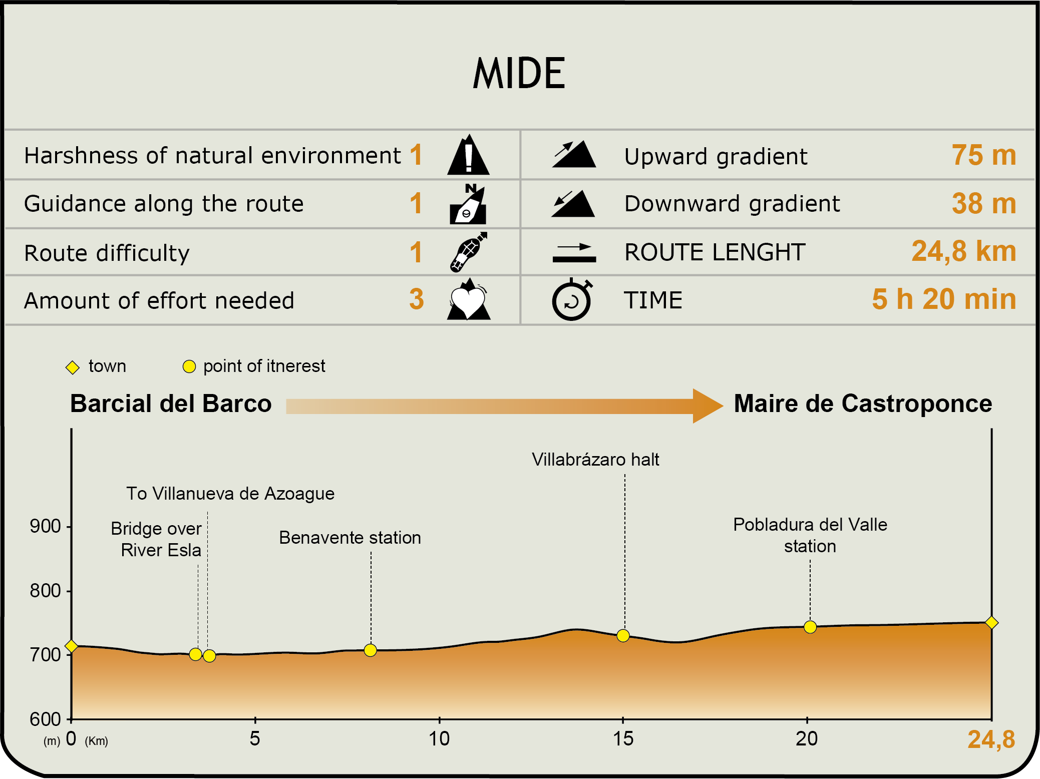
MIDE (Method for the Information of Excursions)
 Harshness of natural environment
- 1. The environment is not risk-free
- 2. There are more than one risk factors
- 3. There are various risk factors
- 4. There are quite a lot of risk factors
- 5. There are many risk factors
 Guidance along the route
- 1. Well defined trails and crossings
- 2. There is a clearly marked trail and signage
- 3. Requires the identification of geographic features and cardinal points
- 4. Requires off-path navigation
- 5. The trail is interrupted by obstacles that have to be gone around
 Route difficulty
- 1. Walking on a flat surface
- 2. Trails with different types of path
- 3. Walking on stepped paths or irregular terrain
- 4. The use of hands or jumping over the terrain is necessary
- 5. The use of hands is required to progress
 Amount of effort needed
- 1. Up to 1 hour of continuous walking
- 2. Between 1 and 3 hours of continuous walking
- 3. Between 3 and 6 hours of continuous walking
- 4. Between 6 and 10 hours of actual walking
- 5. More than 10 hours of continuous walking
Featured
Further information
Benavente
The privileged place upon which the current city of Benavente lies is a headland on a plain in the valleys of the rivers Tera, Órb¡go and Esla, and here, throughout history, many different people settled due to its strategic position at a crossroads. It had the name Brigaecim for the Astures, Ventosa for the Suebis and it was called Malgrat during the 12th century until Ferdinand II gave it its current name.
This city has witnessed important historic events: it is here where the union of the kingdoms of León and Castilla was formed, under the reign of Ferdinand III in the Benavente Concord (1230); it suffered devastation in the Peninsular War, in 1808 there was an important battle here between English and French troops that affected many of its buildings after the city was looted, and Napoleon himself stayed in Benavente for several days.
Out of its rich architectural heritage, the church of Santa María de Azogue and that of San Juan de Mercado (both with a Roman style and started in the 12th century, although they were not finished until sometime after) stand out, as do the Torre del Caracol tower which is the only remains of the Pimental castle-palace (Counts of Benavente) and that is these days part of the Parador de Turismo, the Hospital de la Piedad, founded by the fifth count of Benavente to house the pilgrims, and the neoclassical Town Hall (19th century).
Its patron saint festivities, the Veguilla festivities, are celebrated on the Monday eight days after Easter Sunday in honour of the Virgen de la Vega. It also holds various fairs on hunting and fishing, ceramics, tapas and pepper.
Due to its location, it is one of the transport hubs in the north-east of Spain. At present the city of Benavente, which is capital of the Zamoran region of Benavente y los Valles, has become a very important logistical centre with regard to overland transport.
Multimedia