- Home
- Rural Development
- Nature Trails
- Nature Trails
- Central Sector
La Jayona Greenway Nature Trail
Description
Traces of the importance of mining in the county of Llerena.
This trail, among olive groves and pastures of holm oaks populated by Merino sheep, passes along part of the railway line which transported products extracted from the many mines spread throughout the county of Llerena towards the province of Cordoba. The mine of La Joyona stands out above all, named as a Natural Monument in 1997, it lends its name to this Nature Trail.
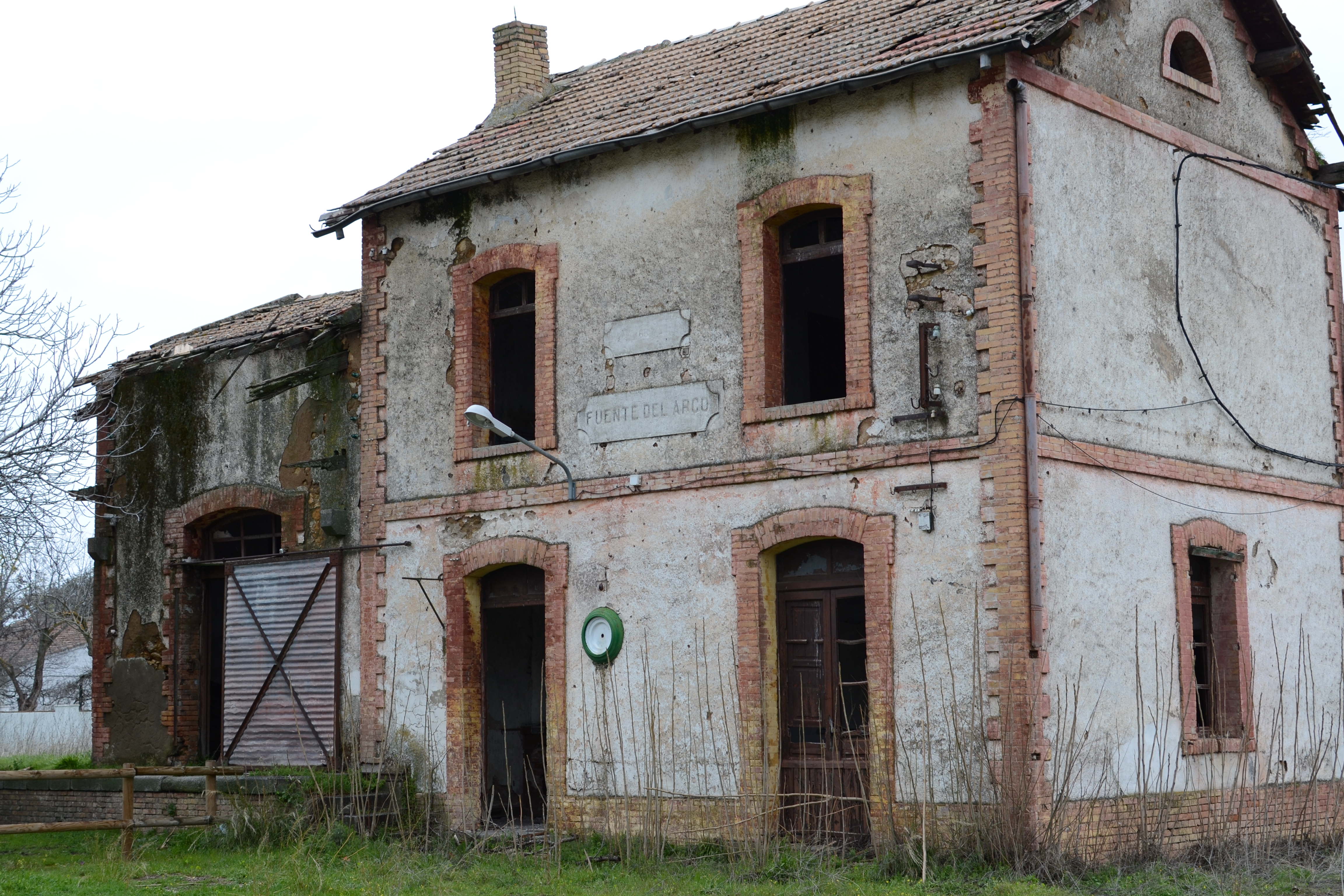
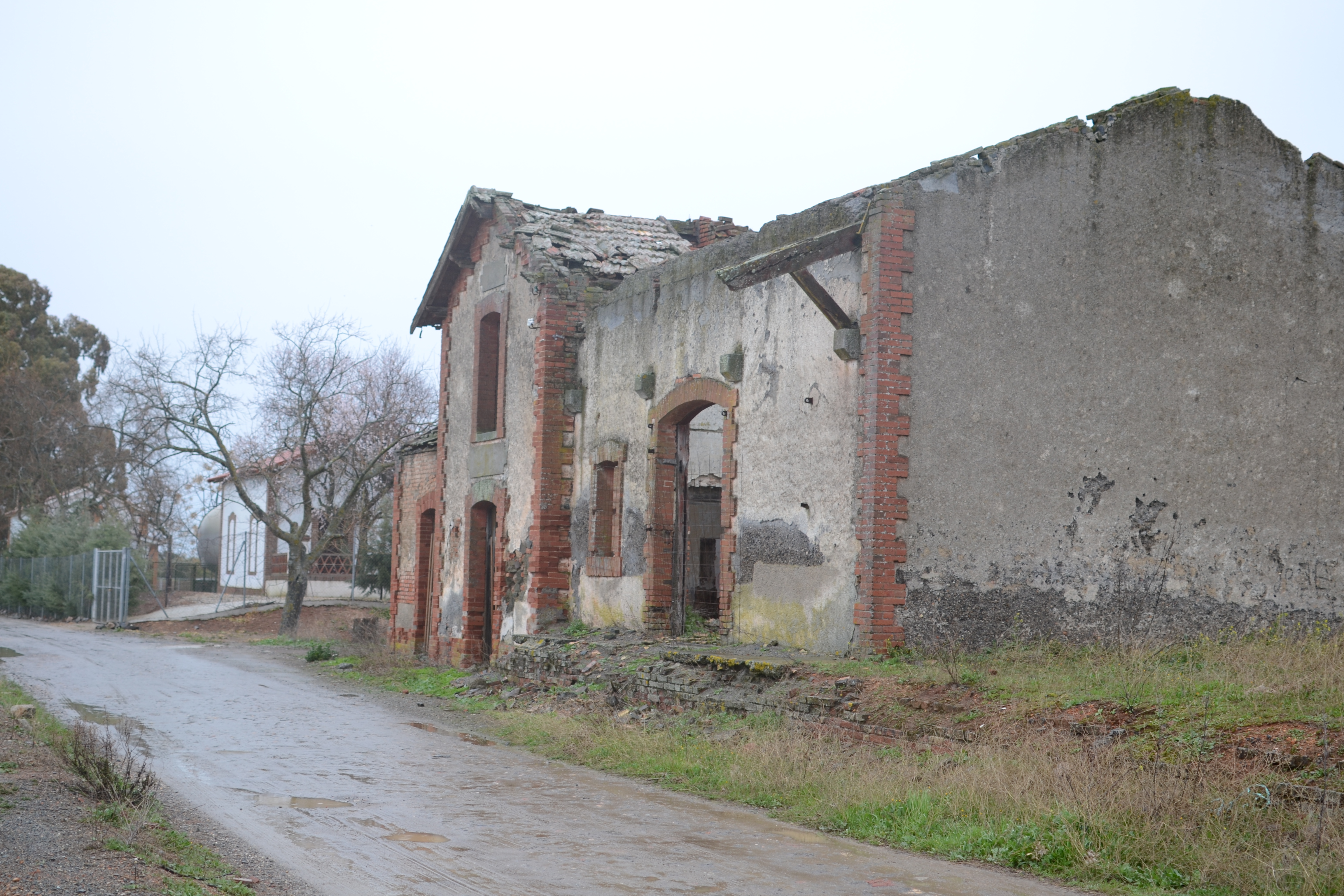
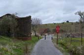
This nature trail, which runs through part of the region of Llerena, starts next to the ruins of the old station of Fuente del Arco, alongside a rest area next to the station and an information panel. This station served the Peñarroya to Puertollano and Fuente del Arco mine railway, built by the Metallurgical Mining Society of Peñarroya (Sociedad Minero Metalúrgica de Peñarroya). A few meters away from this there is a stop with the same name on the Sevilla to Llerena/Cáceres line, which is fully operational.
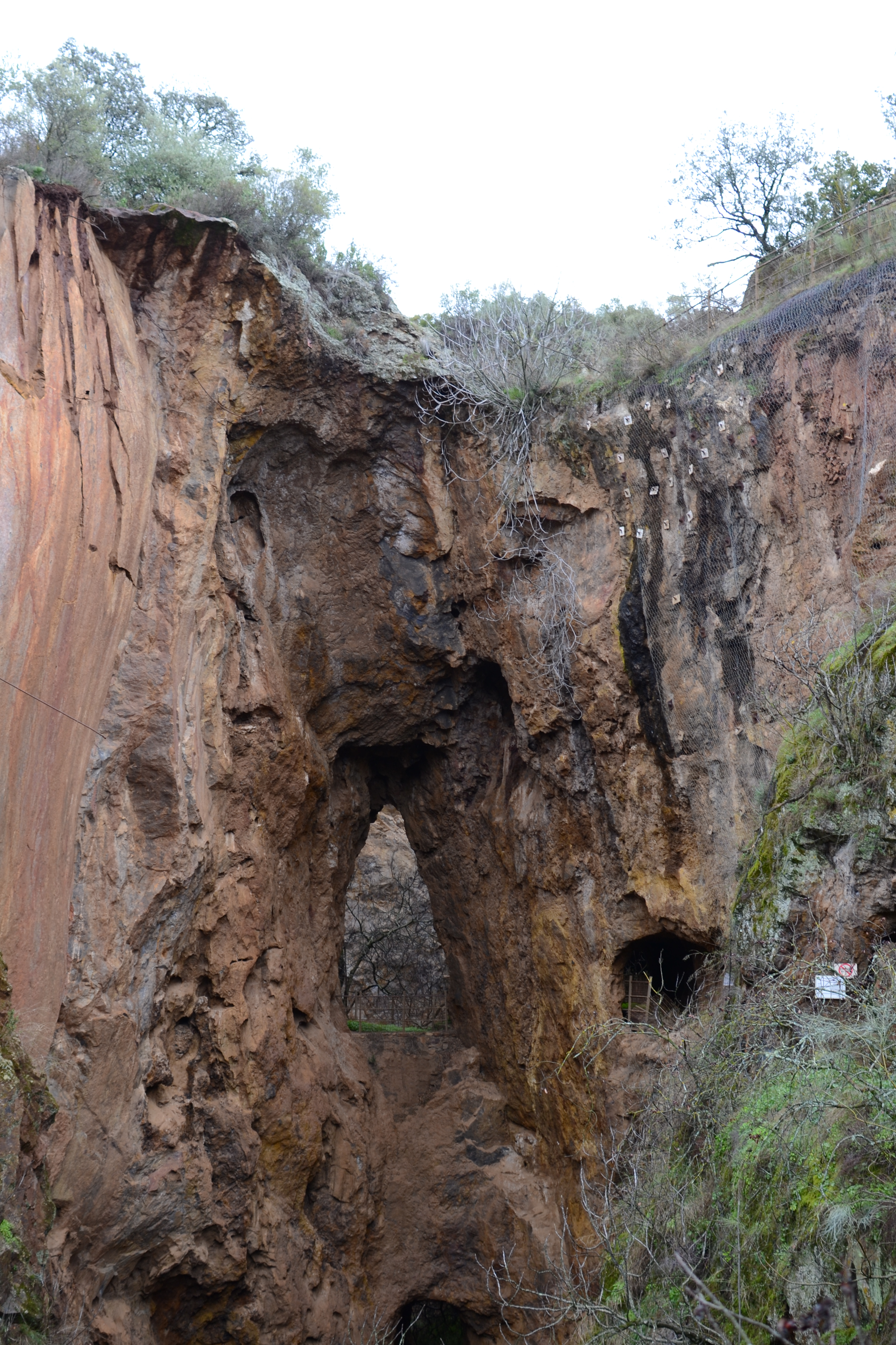
Before starting out on the nature trail, it is advisable to go to the La Jayona Mine, an open-pit mine that you can visit and which was named as a Natural Monument in 1997 and lends its name to this route. To get there, the signs for "Mina La Joyona" must be followed. On the way to the mine, some 10 km from the station, the town of Fuerte del Arco will be passed through and you will pass alongside the Virgen de Ara shrine. This is also a very recommendable visit both for the panoramic views of the mountains and the wall paintings it houses in its main nave.
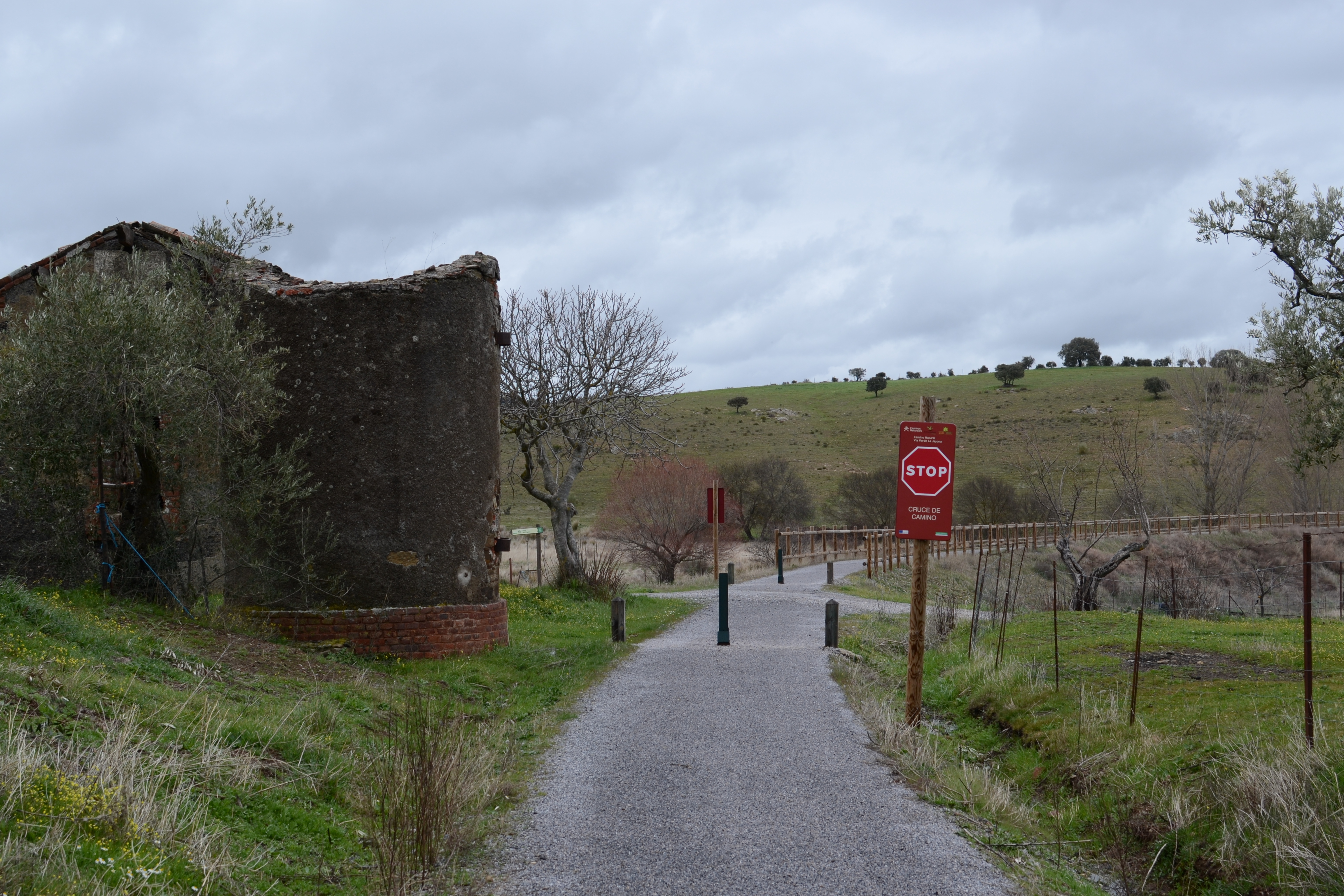
At all times the trail follows the old mining railway line, along a firm asphalt path that only changes at the multiple crossroads with paths with farm estate access. Due to the rolling nature of the hills that the trail passes through, often, when the side slopes are dangerous, wooden-fenced paths protect you from any accidents. On other occasions the trail lies in the trenches that were dug for the railway track.
Another constant element during the itinerary is the continued presence of infrastructure related to the old activity of this route: ruins of stops, mineral loading bay and even two stations that served the nearby towns.
The trail can be divided into four, easily differentiated sections in terms of the surrounding vegetation.
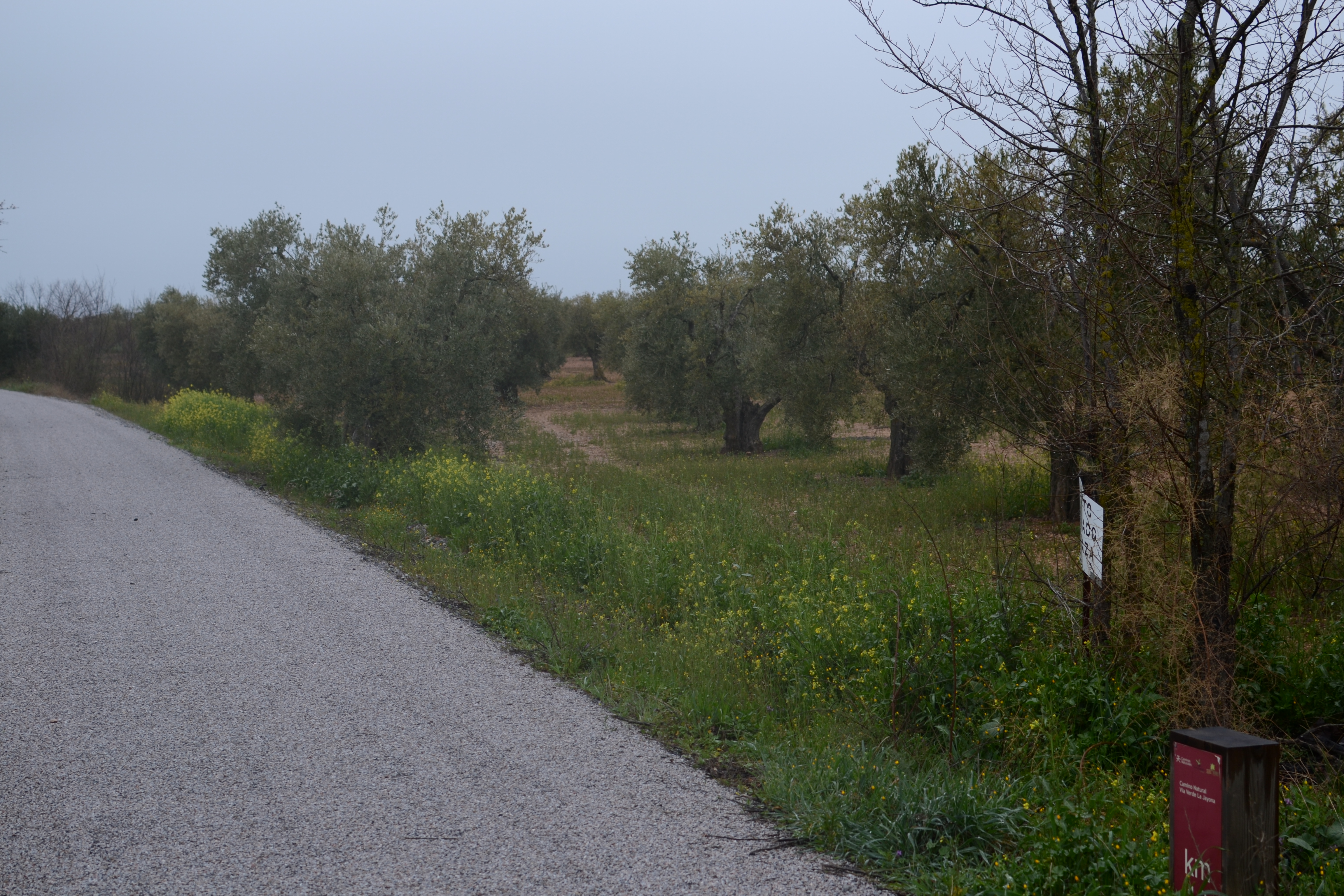
For the first kilometre and a half, practically until crossing over the Galapagar creek, you can still note the presence of the houses that have been being built close to the station, in a landscape in which grassy crops alternate with olive groves and the aforementioned housing.
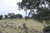
The second section, which is more than 8 km long, enters into pastures of holm oaks of variable densities, with the typical Mediterranean scrubland covering up the slopes next to the trail (thyme, retama, genista and flax-leaved daphne, etc.) In these landscapes the presence of the herds of Merino sheep is continuous, as such it is advisable to take a lot of care, as the estates in many sections are not fenced and it is easy to find these animals in the middle of the trail. During this section, as well as crossing many trails with farm access, cattle grids are also frequent in order to stop the sheep passing into the estates of different owners. A highlight in this journey is the crossing over the Sotillo river, with a rest area just after crossing. Here there is an opening in the oak trees and interesting, panoramic views of the Sierra del Viento mountains in the foothills of the Sierra Morena mountains.
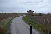
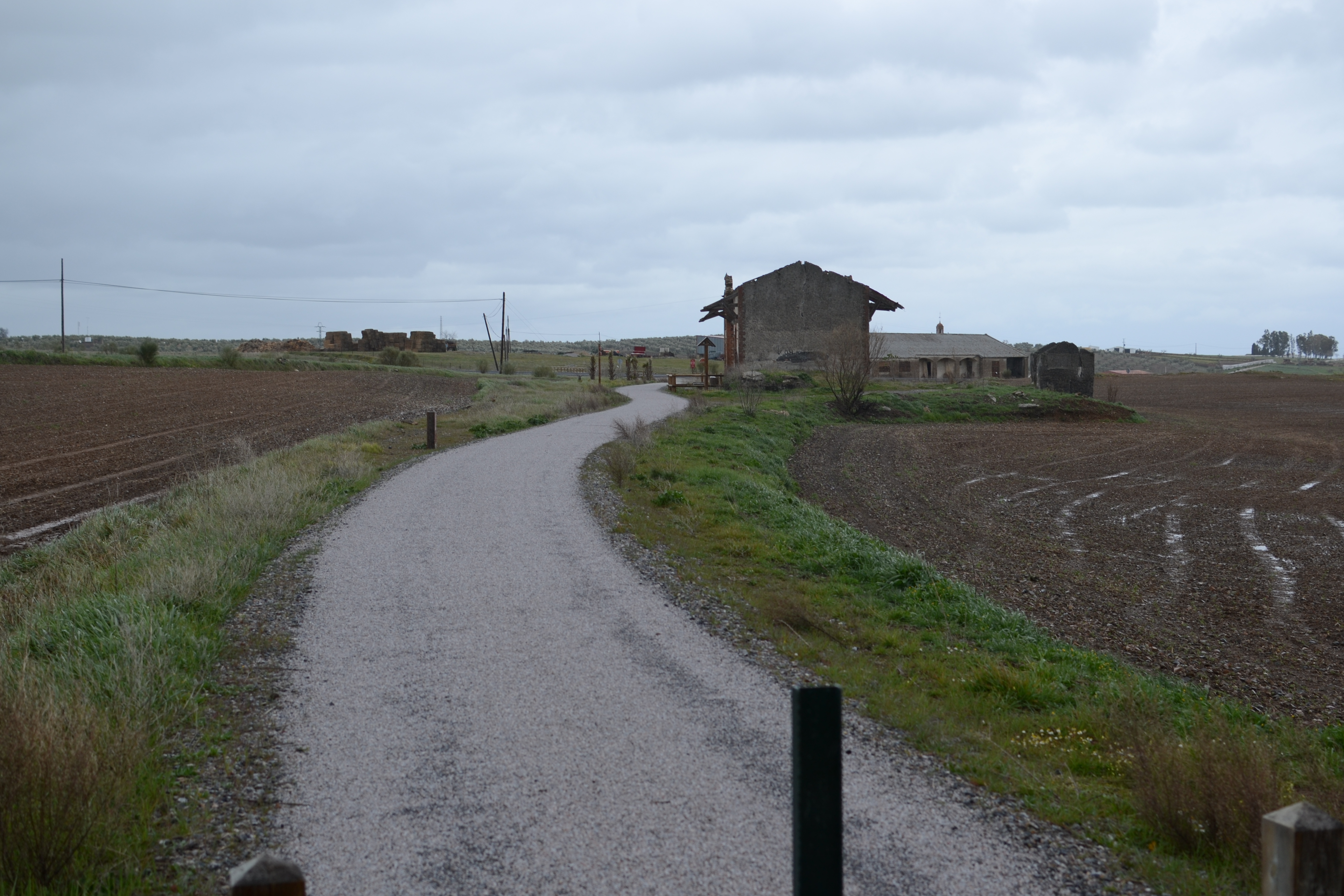
In the next section the landscape changes radically, going from a continued presence of trees, to almost no trees at all. For the next 5.6 km, the trail passes through grassy crops and pastures, crossing through an olive grove in the vicinity of Valverde de Llerena. Sheep are no longer to be seen in this section, but depending on the time of year it is common to see partridges and hares crossing from one side of the trail to the other. The monotony of the crop fields is broken (some 11 km after beginning the trail) by the ruins of the station that served the nearby town of Valverde de Llerena (less than 1 km from where the nature trail crosses the road to Ahillones). Just like the other stations the trail passes by, this has a rest area and an information panel. The town of Valverde was founded in the 13th century, and a highlight of its heritage is the Purísima Concepción church.

What remains of the La Jayona Nature Trail will be completed in the company of olive groves almost until the end, passing next to the Berlanga-San Fernando station (17 km from the start, with its corresponding panel and rest area). Despite the name, the town of Berlanga is actually more than 3 km from here; although it is worth a visit to discover the rich heritage of this town with more than 700 years of history.
Going back to the trail, there are only 2 km until the end, once again in the company of grassy crops, but without completely leaving the olive groves. The trail comes to an end next to the ruins of a stop and a rest area just before reaching the N-432 road, some 5 km from Berlanga and 7 km from Azuaga; the county's most populated town in which, as well as its rich heritage, all types of services can be found.
Map
Puntos de Interés
Geología
Hidrografía
Orografía
Vegetación
Profile
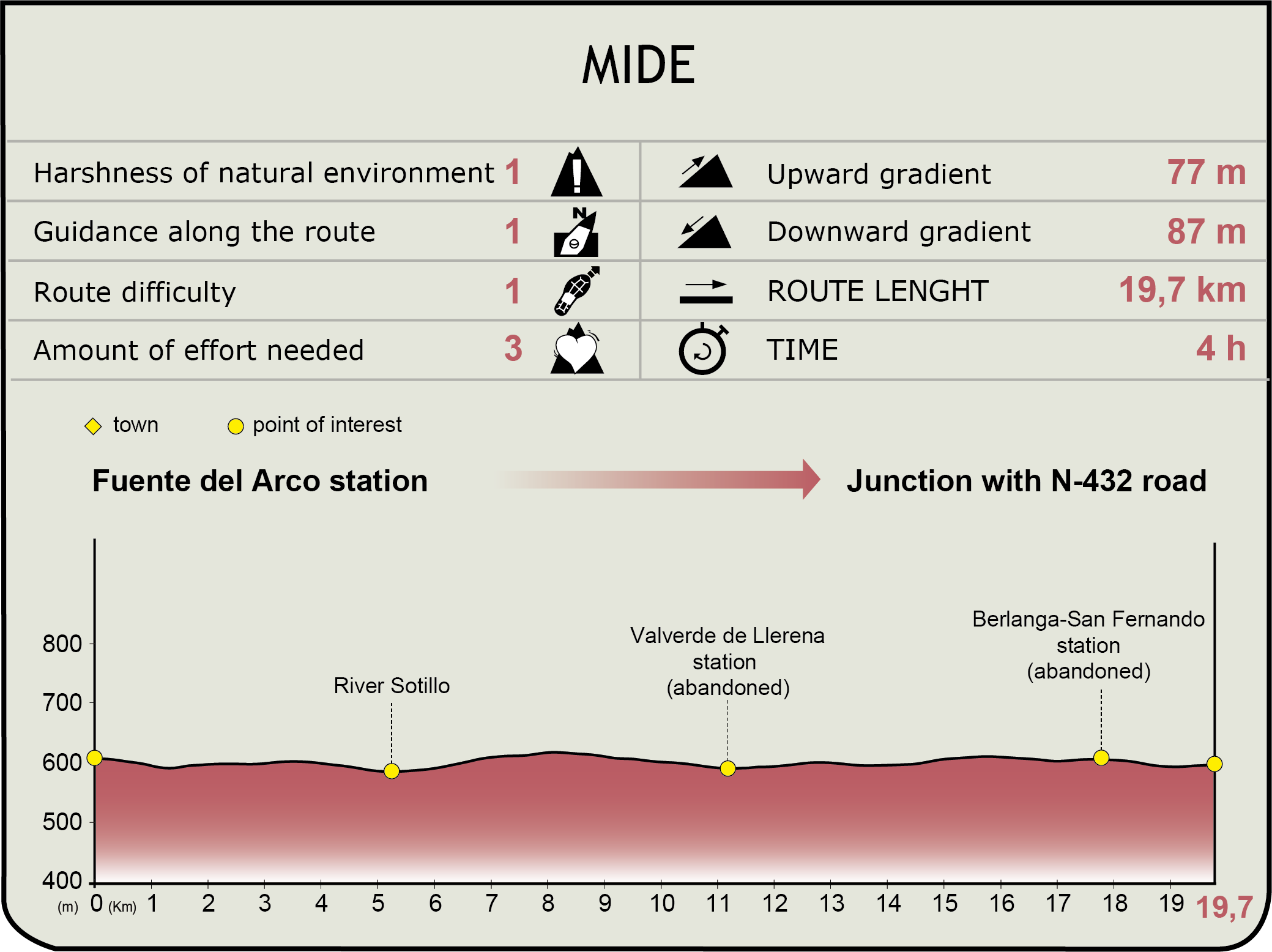
MIDE (Method for the Information of Excursions)
 Harshness of natural environment
- 1. The environment is not risk-free
- 2. There are more than one risk factors
- 3. There are various risk factors
- 4. There are quite a lot of risk factors
- 5. There are many risk factors
 Guidance along the route
- 1. Well defined trails and crossings
- 2. There is a clearly marked trail and signage
- 3. Requires the identification of geographic features and cardinal points
- 4. Requires off-path navigation
- 5. The trail is interrupted by obstacles that have to be gone around
 Route difficulty
- 1. Walking on a flat surface
- 2. Trails with different types of path
- 3. Walking on stepped paths or irregular terrain
- 4. The use of hands or jumping over the terrain is necessary
- 5. The use of hands is required to progress
 Amount of effort needed
- 1. Up to 1 hour of continuous walking
- 2. Between 1 and 3 hours of continuous walking
- 3. Between 3 and 6 hours of continuous walking
- 4. Between 6 and 10 hours of actual walking
- 5. More than 10 hours of continuous walking
Featured
Further information
Multimedia