- Home
- Rural Development
- Nature Trails
- Nature Trails
- Central Sector
- Río Rivera de Acebo
River Rivera de Acebo Nature Trail
Description
Seven paths between two waters
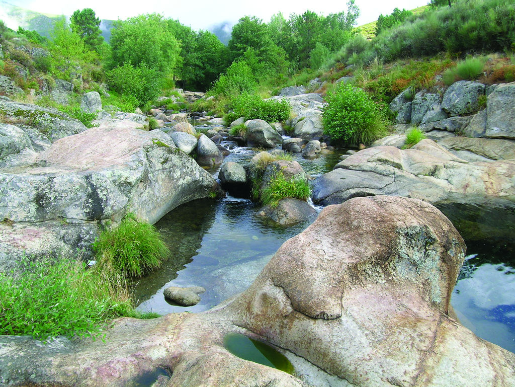
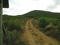
This route through the lands of Cáceres is formed of seven paths that begin in the recreational area known as “El Jevero” or are connected to those that leave from there. This point, located two kilometres from Acebo, offers travellers its natural pools of the River Rivera de Acebo, where they can enjoy a swim at the beginning or at the end of their trek.
The seven paths that make up this Nature Trail are:
Nº 1. El Prado de Las Monjas Reservoir Path
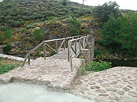
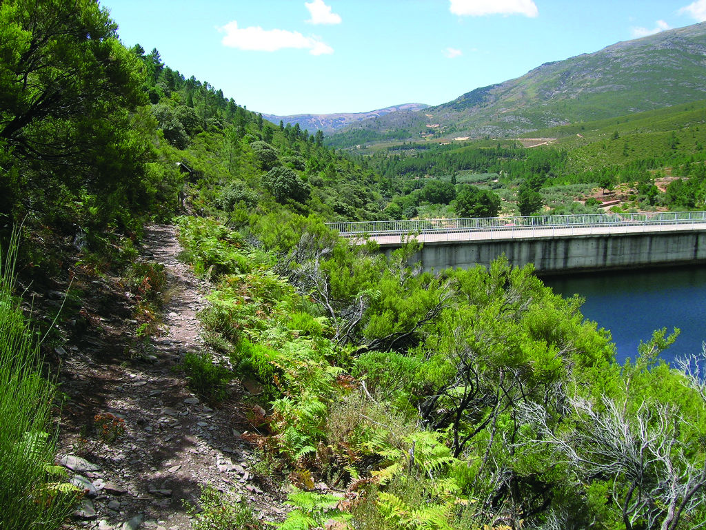
On leaving the “El Jevero” recreational area, the only point containing drinking water fountains, the trail runs northwards across a hillside on the left bank of the River Rivera de Acebo. It is structured into three easily discernible sections: the first and the last go along a path, while the middle one uses the route known as the “Pista del Molino”.
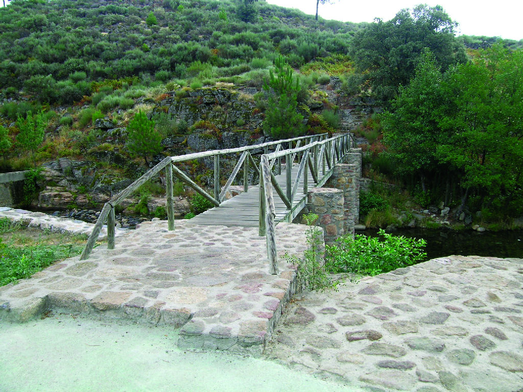
After crossing the river via a walkway located between the two pools, this path ascends on granite rock between white brooms and ferns as far as the “Pista del Molino”, which runs half-way up the hillside along the lower boundary of an area of maritime pine afforestation (Pinus pinaster). You must make sure you do not turn off onto other paths, such as number 2, which emerges halfway along the track.
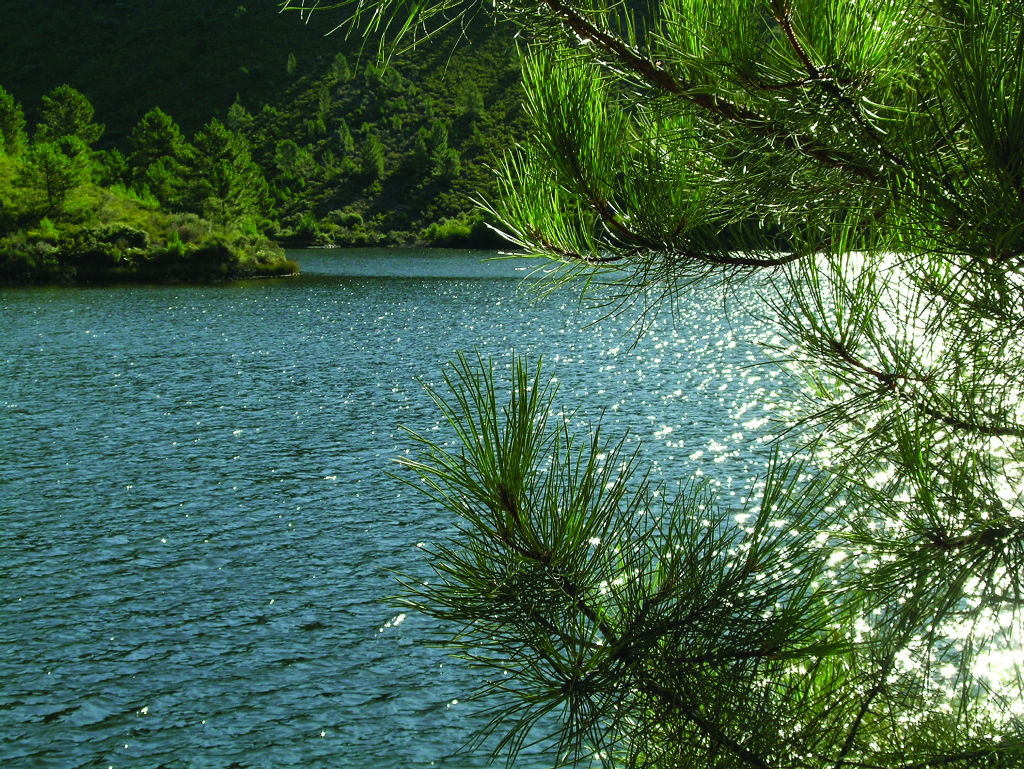
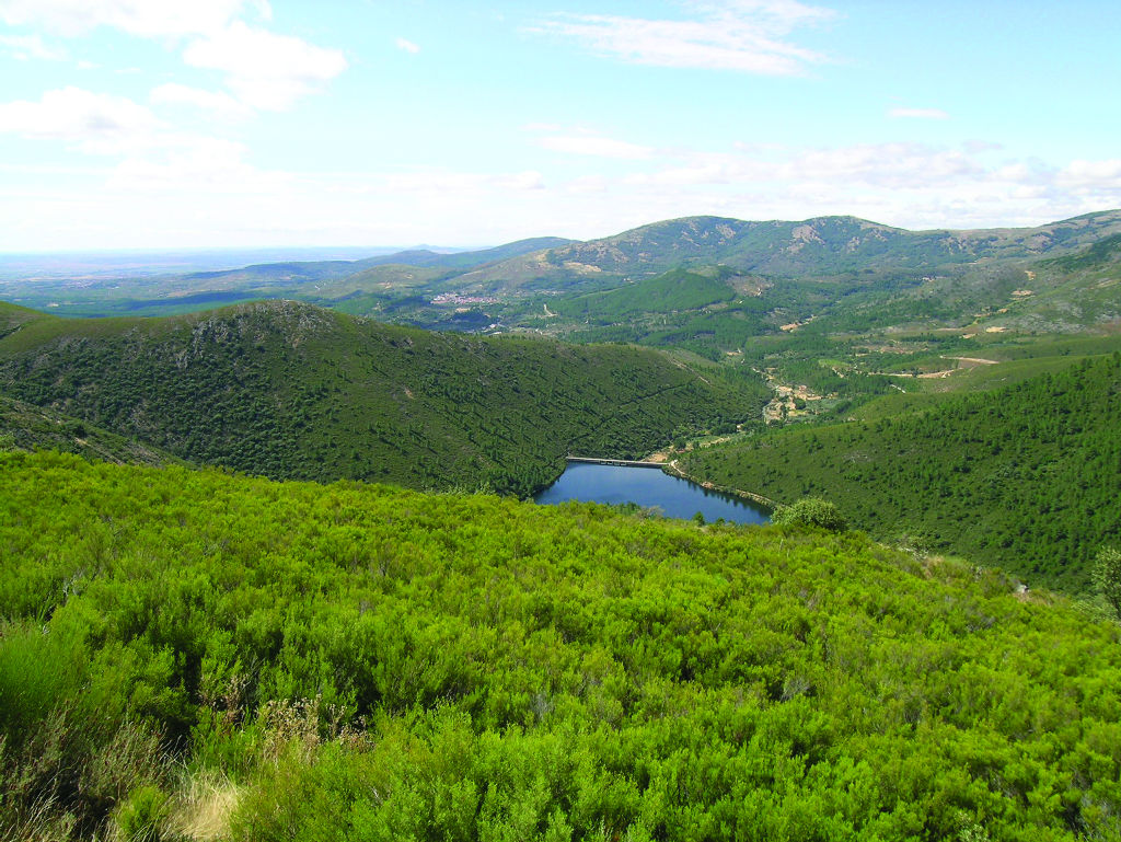
This trail ends at the dam of the Prado de las Monjas reservoir. From here, you can begin paths No. 3 and No. 7.
Nº 2. La Ventosa Viewpoint Path
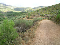
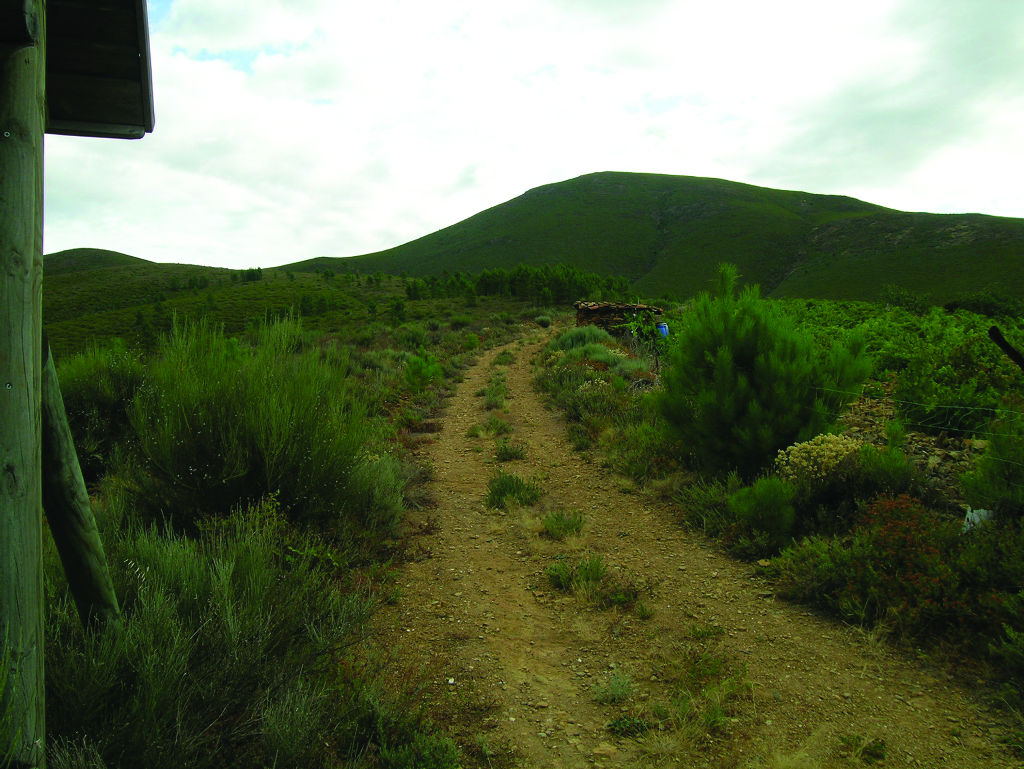
This path’s destination is the 794 m of the summit of El Cerro de La Ventosa, which shares its starting-point with path No. 4, approximately halfway along the already described first route, at a well-signposted fork.
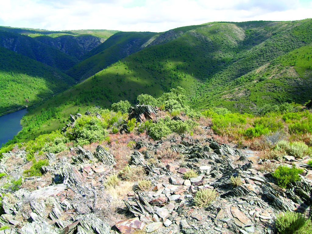
Its route entails climbing among heathers (Ericasp.), white brooms (Cytisussp.) and rockroses (Cistussp.), following a small rope that borders an area of maritime pine afforestation. This perspective allows you to see, on the right, the valley of the stream of Arroguijo, and on the left, that of the River Rivera de Acebo, dominated by the peak of Jálama, which, with its 1,492 m, is the highest summit of the Sierra de Gata.
Nº 3. Los Puentecitos de la Cascada de La Cervigona Path
This path takes its name from the pool of the Bridges or of the Little Bridges, which is one of the streams whose source can be found in the spot known as La Cervigona. The streams flow down to the River Rivera de Acebo forming waterfalls until they pour into the river’s waters.
You leave on the right-hand-side bank of the Prado de las Monjas reservoir and continue parallel to its riverbed. After passing the reservoir, you cross the River Rivera de Acebo and continue along the bottom of the valley heading upstream along the left-hand-side bank. As you make your way up the path, it becomes narrower and narrower and the prevailing heather vegetation of the hillsides is adorned with alder trees (Alnus glutinosa) and other riverside species.
After crossing the river once again, the path turns upstream, this time heading up the Arroyo de los Alisos, which, for a large part of its route, is boxed in between slate slabs that form beautiful waterfalls.
The route ends close to a building that was once a light factory, very close to La Cervigona waterfall, but you cannot reach it as the area is inaccessible.
Nº 4. El Puerto de Castilla Norte Path or La Cervigona Viewpoint Path
This path forms part of the Puerto de Castilla trail, which is several centuries old and was prepared to withstand the passing of carts pulled by beasts of burden as Roman roads were.
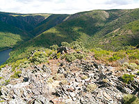
It begins at La Ventosa Viewpoint and runs across the foothills of the Teso de Santa María as far as the firewall located at the top of the route. After leaving here via a well-signposted turn-off to the south, the path ends at the Viewpoint of La Cervigona, from where you can enjoy a panoramic view of the valley of the River Rivera de Acebo and its surrounding area. In the distance, you can see La Cervigona waterfall, with a height of 65 m.
Nº 5. El Puerto de Castilla Sur Path
This path, which also forms part of the old Puerto de Castilla trail, begins at a bridge next to the last pool, from where it starts to climb along a rope in a northerly direction, to end up, after some very steep bends, at La Ventosa hillock, from where you can reach La Ventosa Viewpoint or continue the trail along the path of the Puerto de Castilla Norte.
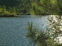
Nº 6. Las Piscinas de Rivera de Acebo Path
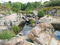
This path covers the three pools of the River Rivera de Acebo, beginning with that of El Molino de Acebo. The other two are situated behind the first next to the recreational area known as “El Jevero”. From here, you can carry on along the path of El Prado de Las Monjas until you come to the route for the Little Bridges of the Waterfall of La Cervigona. It is, therefore, a very short connecting path that is outfitted with rest areas at the beginning and at the end of the route.
Nº 7. El Arroyo de La Jara del Rey Path
This is a very steep path, which, in some sections, has been made accessible via steps. The last section is the most difficult due its steep slope, mud caused by erosion, and the sporadic disappearance of the path by briers and white brooms.
This path climbs from the end of the reservoir dyke across the foothills of the Teso de Santa María towards La Ventosa hillock, where it coincides with path No. 4. You can either continue along it as far as the Viewpoint of La Cervigona or return to “El Jevero” recreational area along paths No. 2 or No. 5.
Profile
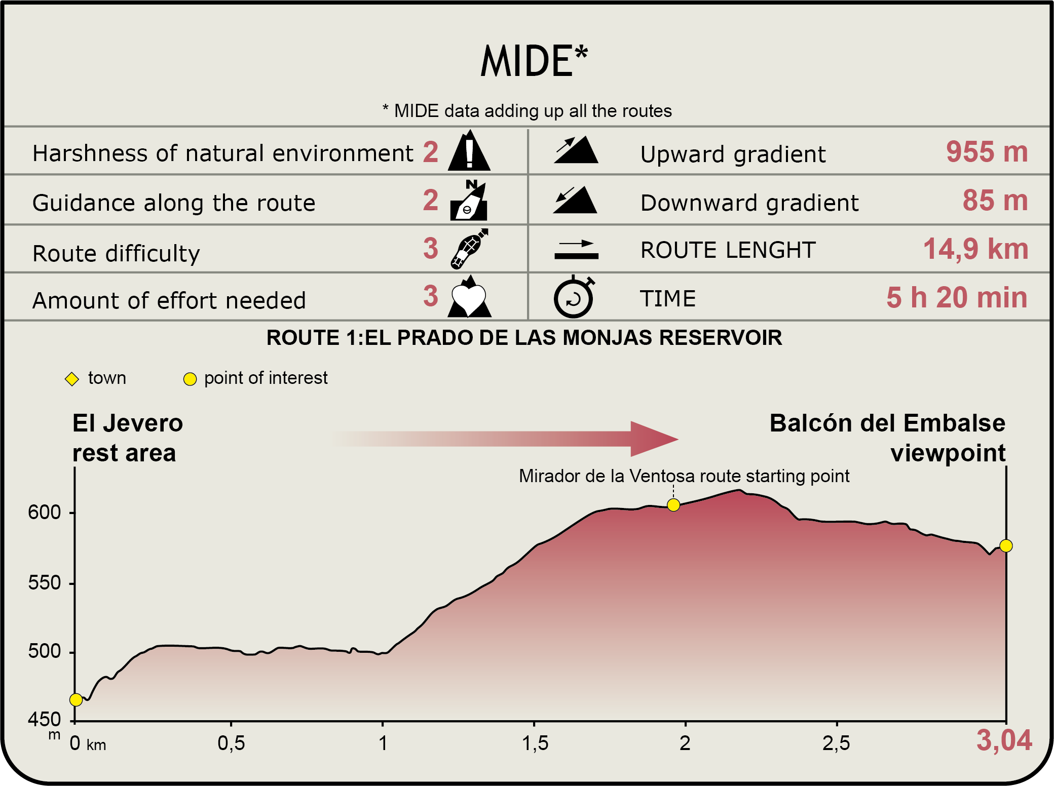
MIDE (Method for the Information of Excursions)
 Harshness of natural environment
- 1. The environment is not risk-free
- 2. There are more than one risk factors
- 3. There are various risk factors
- 4. There are quite a lot of risk factors
- 5. There are many risk factors
 Guidance along the route
- 1. Well defined trails and crossings
- 2. There is a clearly marked trail and signage
- 3. Requires the identification of geographic features and cardinal points
- 4. Requires off-path navigation
- 5. The trail is interrupted by obstacles that have to be gone around
 Route difficulty
- 1. Walking on a flat surface
- 2. Trails with different types of path
- 3. Walking on stepped paths or irregular terrain
- 4. The use of hands or jumping over the terrain is necessary
- 5. The use of hands is required to progress
 Amount of effort needed
- 1. Up to 1 hour of continuous walking
- 2. Between 1 and 3 hours of continuous walking
- 3. Between 3 and 6 hours of continuous walking
- 4. Between 6 and 10 hours of actual walking
- 5. More than 10 hours of continuous walking
Featured
Further information
Multimedia