
- Home
- Rural Development
- Nature Trails
- Nature Trails
- South Sector
Lucainena de las Torres to Agua Amarga Nature Trail
Description
Tonnes of minerals made this singular journey by train, now used by walkers and cycle tourists.
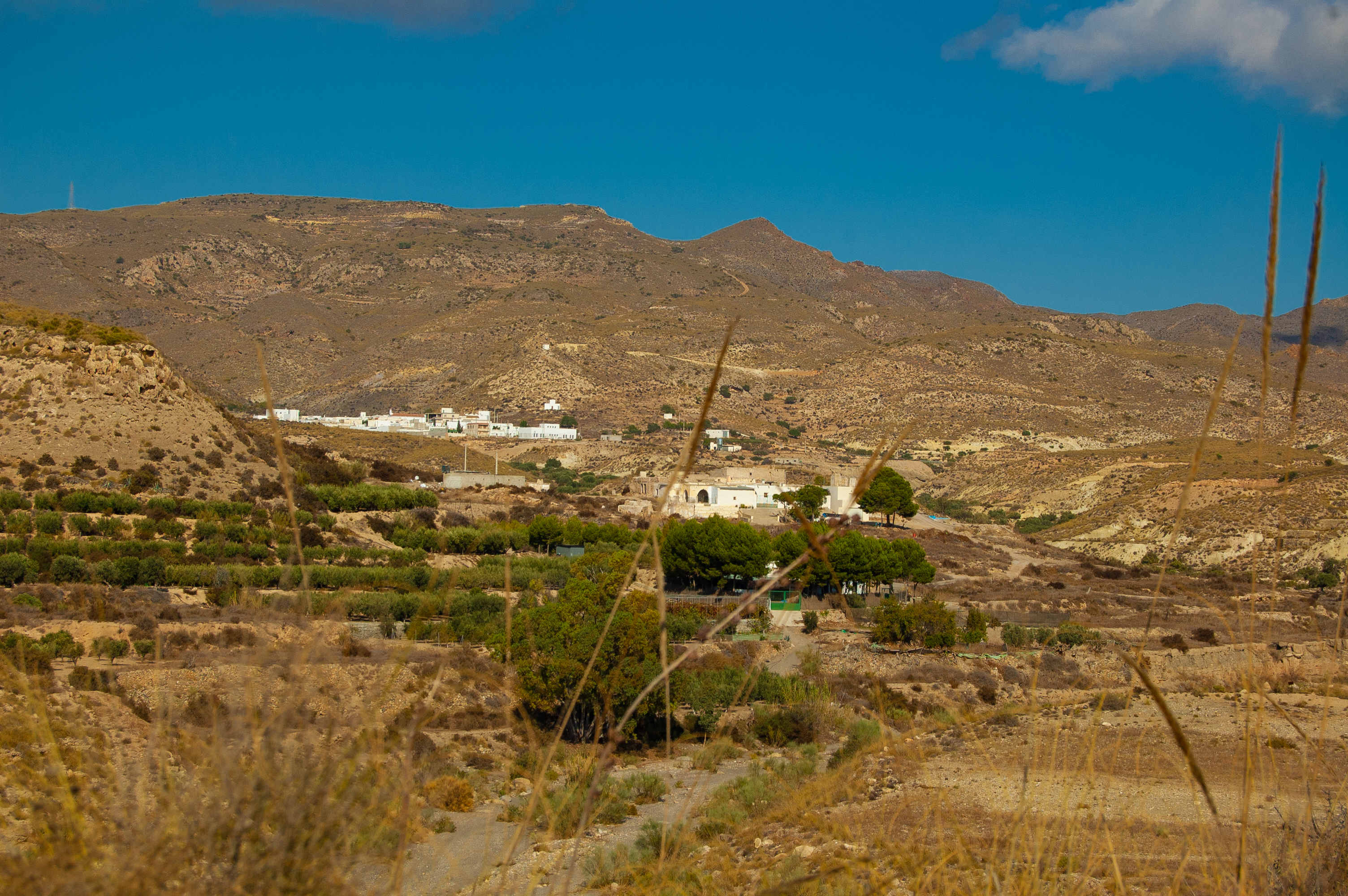
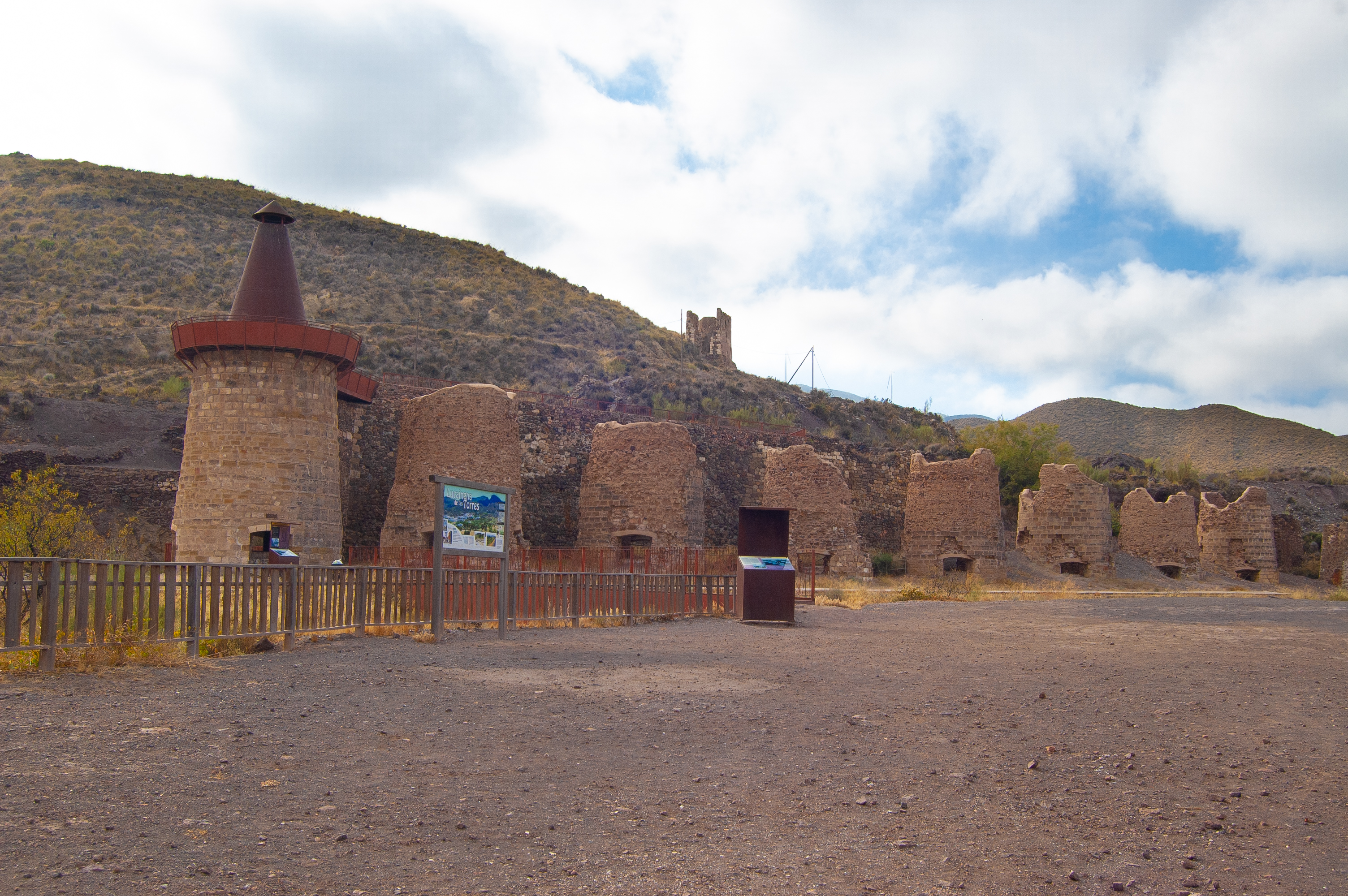
From the iron ore blasting furnaces in Lucainena de las Torres, thousands of tonnes of the mineral were dispatched to the coast at Agua Amarga before continuing their onward journey by boat to the Altos Hornos de Vizcaya company in Bilbao. You can now recreate this journey and enjoy the landscape of the Sierra Alhamilla, accompanied over much of the route by the Rambla de Lucainena dry riverbed and the sight of vegetable greenhouses around Venta del Pobre.
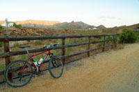
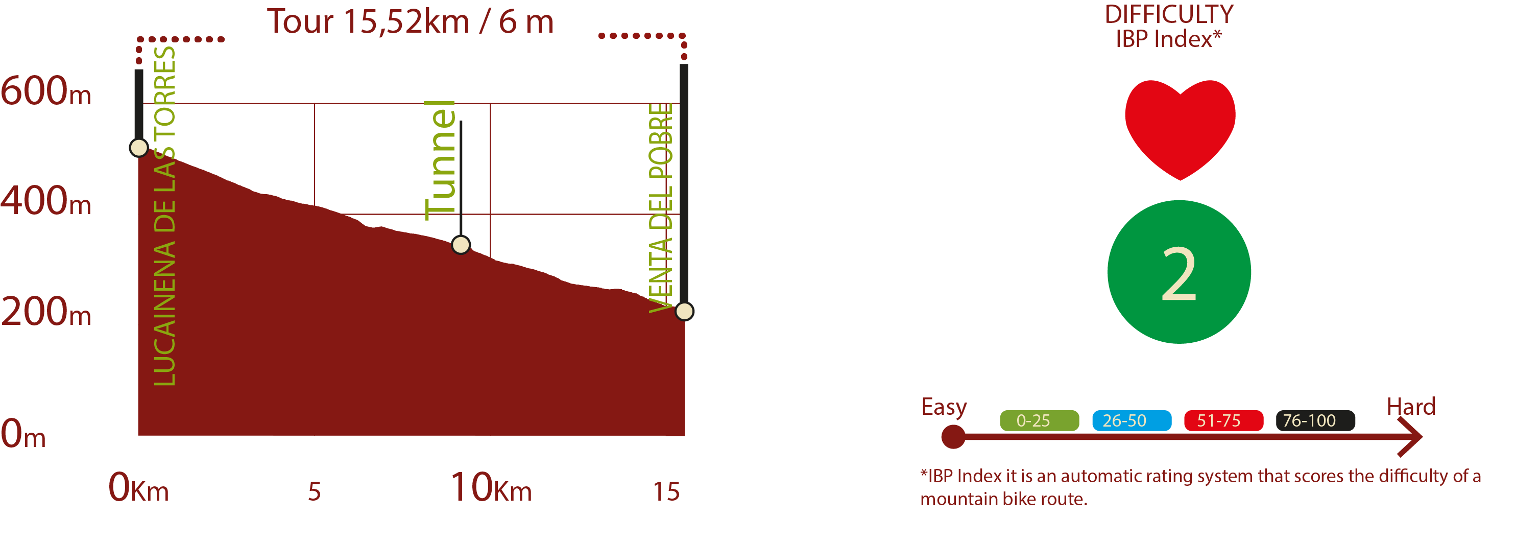
The Lucainena de las Torres to Agua Amarga Nature Trail begins in Lucainena de las Torres and currently stretches as far Venta del Pobre in the municipality of Níjar for a total route of a little over 15 kilometres. The route is clearly divided into three sections of approximately 5 kilometres each, the first running along the Greenway between Lucainena de las Torres and El Saltador, the second a paved section between El Saltador and El Molinillo bridge and the third section coinciding with the Nature Trail between El Molinillo bridge and La Venta del Pobre.
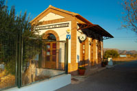
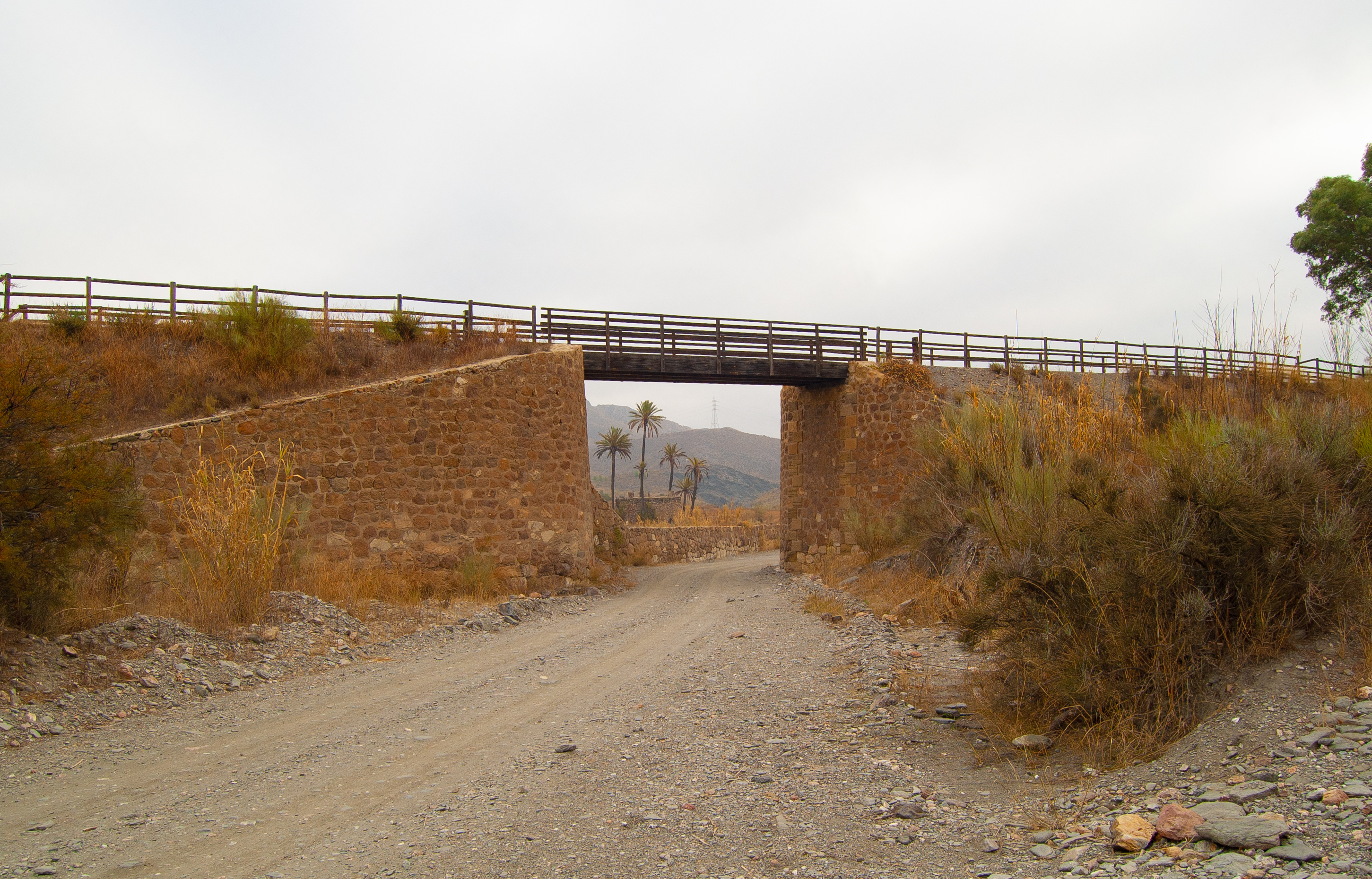
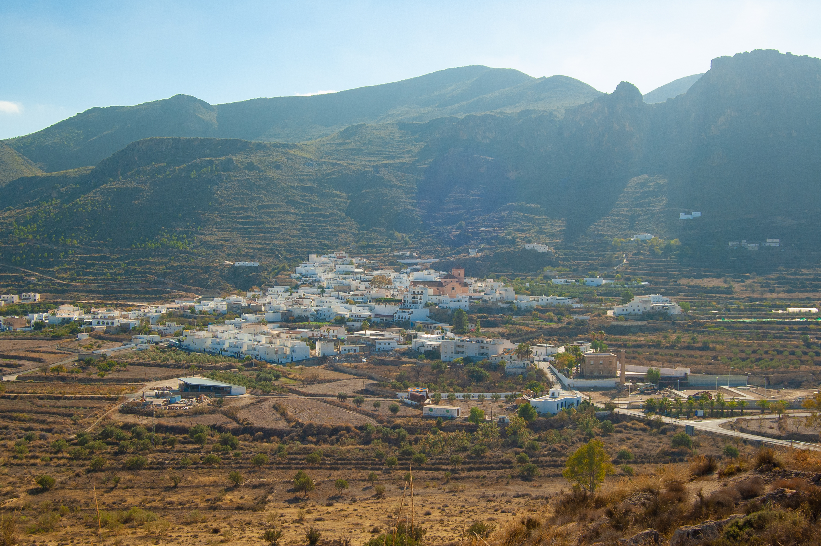
Our itinerary starts in the beautiful village of Lucainena de las Torres, at the crossing of the old railway line with the AL-3107. Upon setting off, the traveller immediately finds the old Lucainena de las Torres station, today converted into a tourist information point celebrating the railway history of the village.
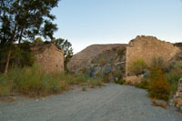
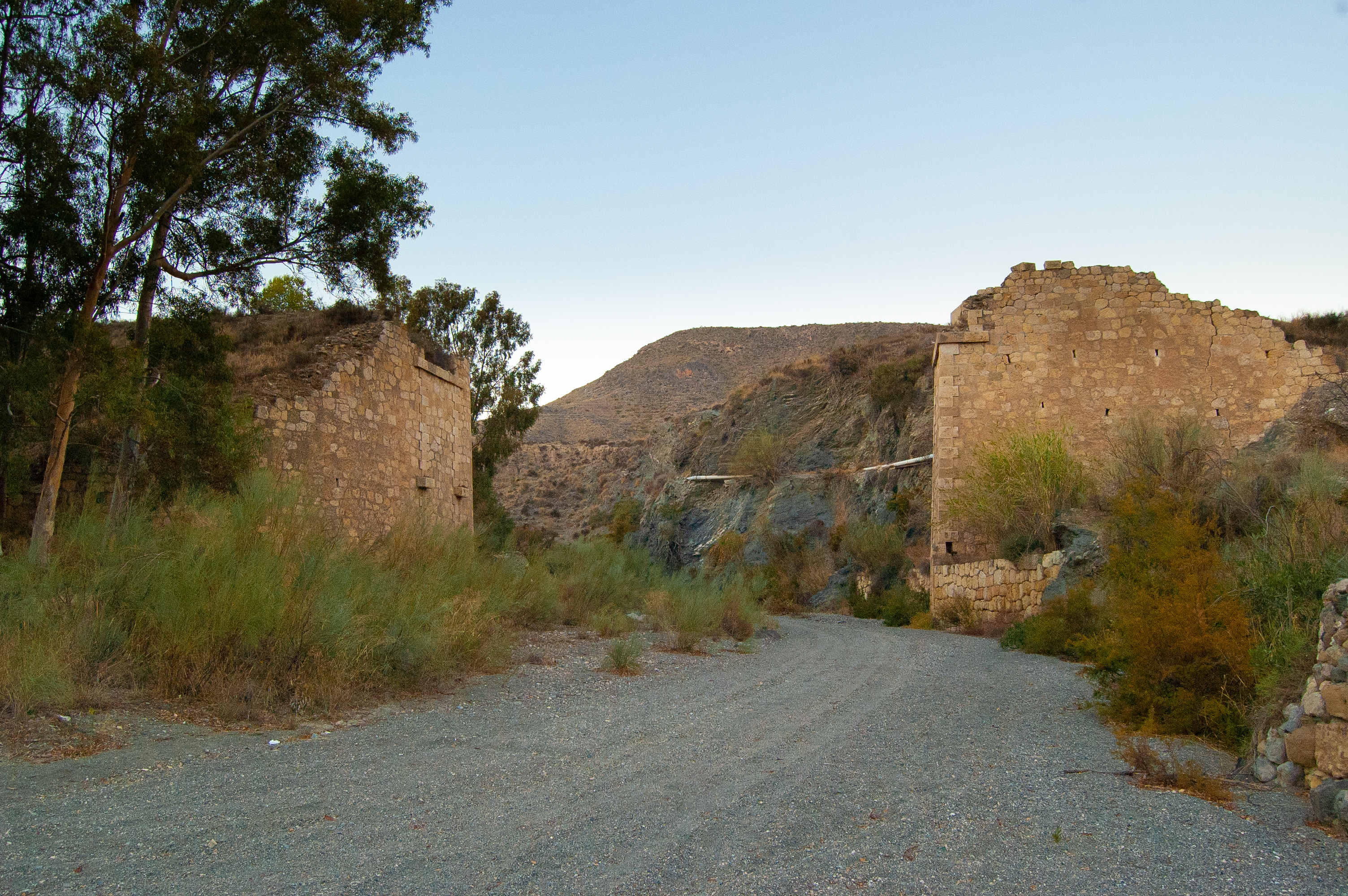
As we leave the village of Lucainena de las Torres behind with its Church of Nuestra Señora de Monte-Sión dominating the skyline, we pass the old El Molinillo watchtower, the only remaining tower where once stood seven, when the village was known as “Lucainena de las Siete Torres”.
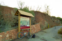
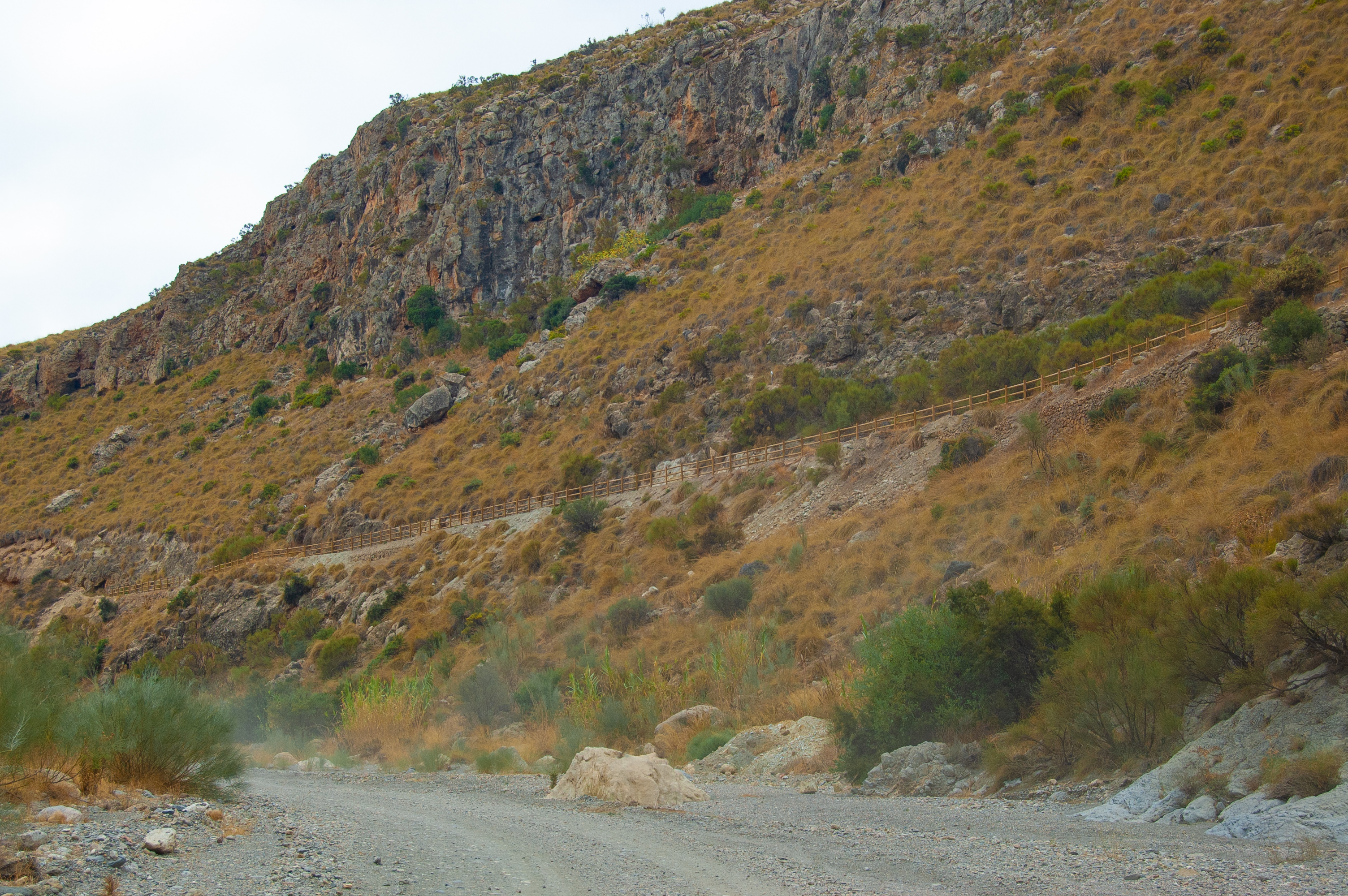
After a number of level crossings we reach the El Algarrobo viewpoint which also has a rest area where walkers can enjoy panoramic views of the Sierra de Cabrera-Bédar, which has been declared a Special Area of Conservation (SAC) due to its environmental value.
Passing the two-kilometre mark, we reach La Cerradilla, a rest area which offers shade, seating and even a water fountain to quench your thirst. The surrounding landscape offers the visitor an incredible haven of peace and quiet before continuing on the gentle decline in parallel with the Rambla de Lucainena where small white farmsteads dot the landscape.
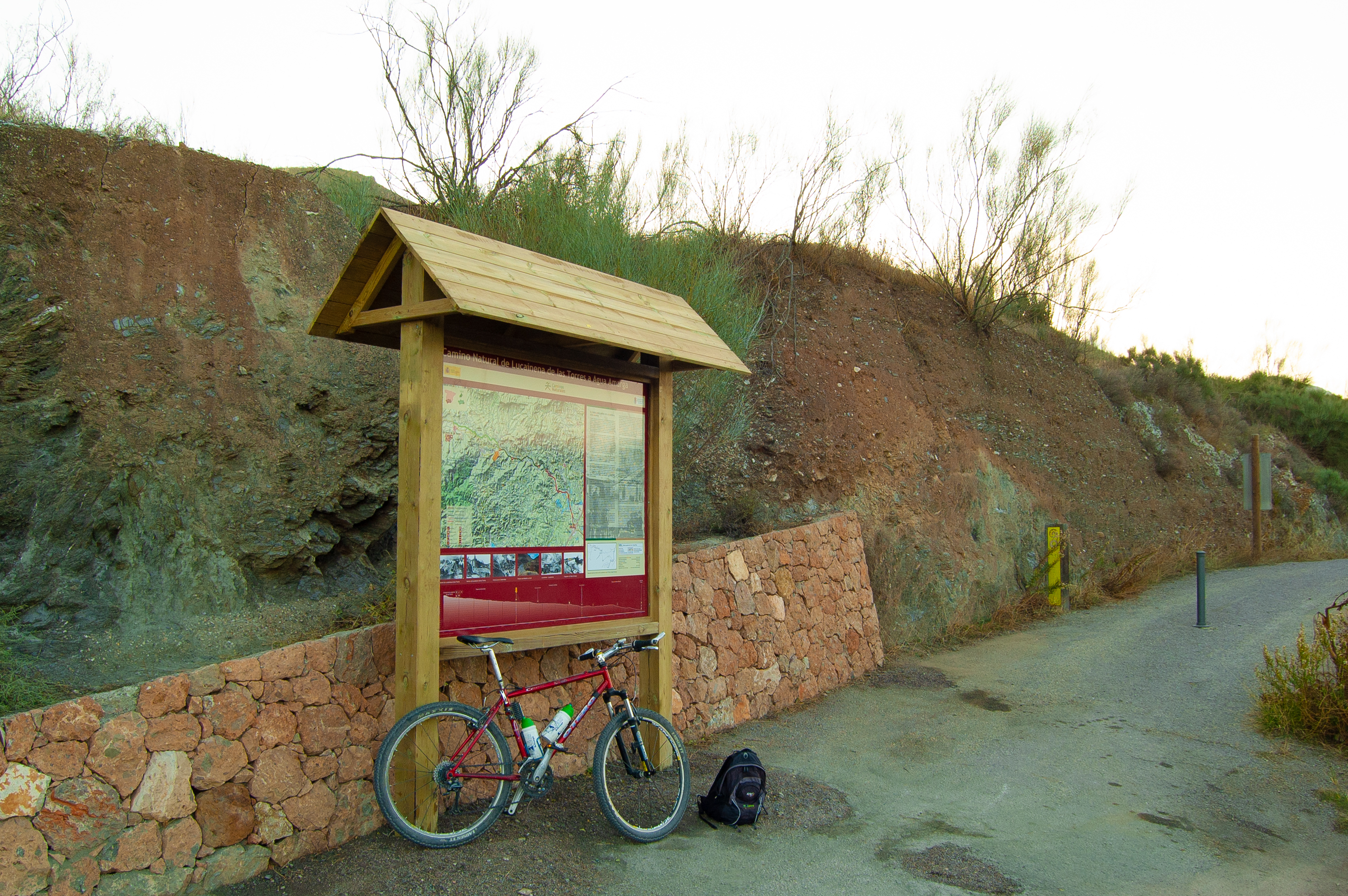
Without too much exertion we’ll soon reach the 5-kilometre point, passing over the Rambla Honda bridge, past the old Cortijo de las Tejas farmstead. The cortijo (rural farm) is best viewed from the “El Saltador” viewpoint, located on the route itself shortly before we reach the end of this first section of the Greenway..
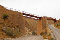
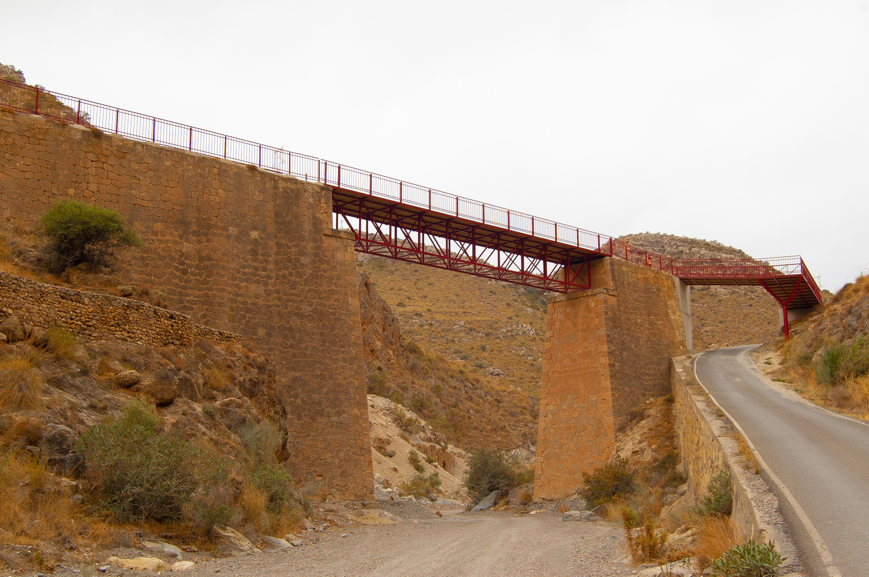
After the Greenway interpretation panel, the paved section begins along the route that once saw trains laden with mineral pass. Just past the 6-kilometre point, due to the ruinous state of the old Rafaela bridge, the route descends to the Rambla de Lucainena before a short, steep ascent to return to the old railway line near the small village of Los Ramos.
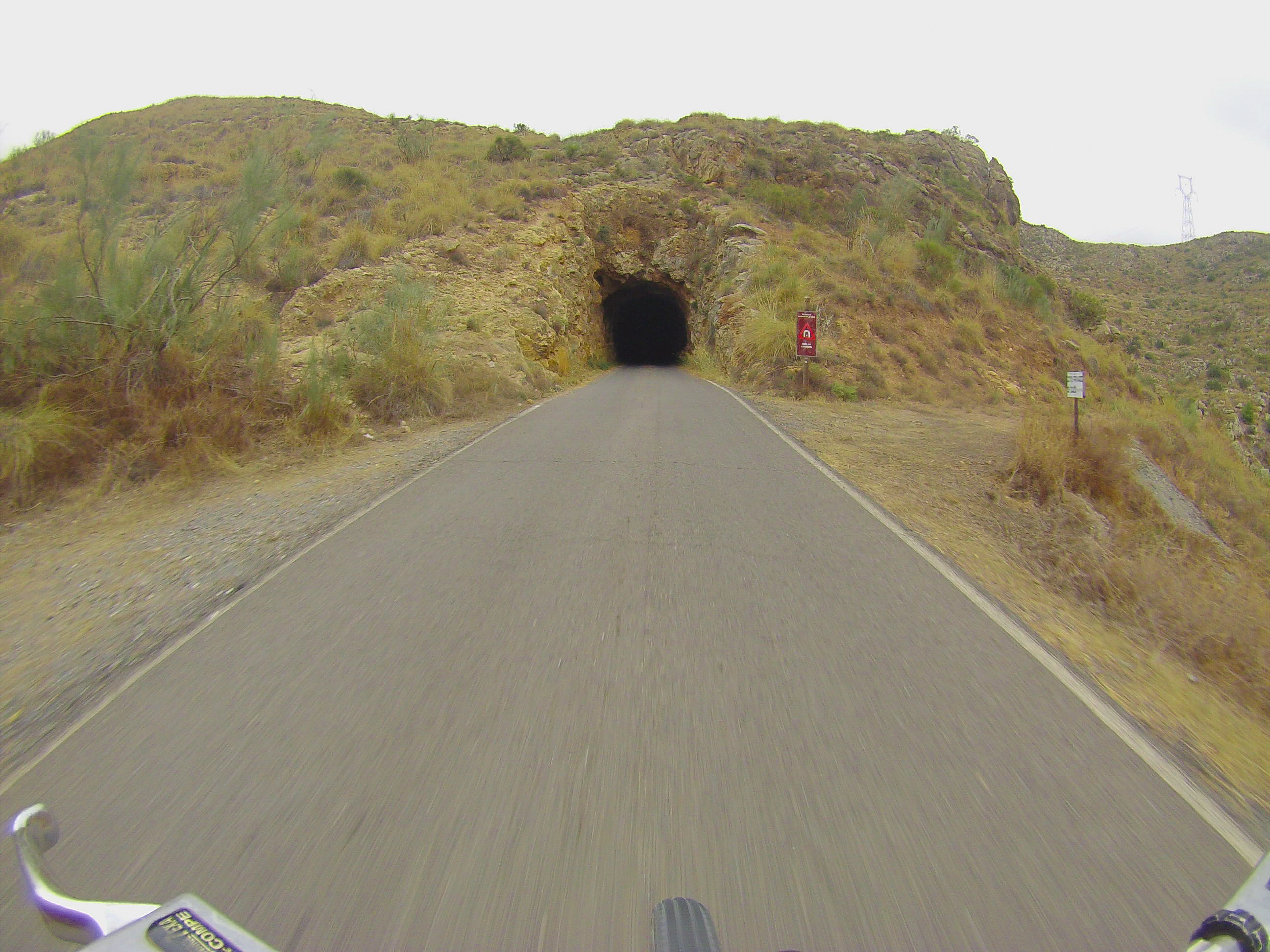
Having overcome this modest challenge, the Nature Trail returns to its natural descent. Passing the 9-kilometre point, we reach the only tunnel on this railway line, cut into the stone with no cladding and which, despite having no artificial lighting, presents no great difficulty, being only 85 metres in length.
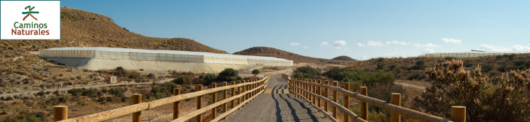
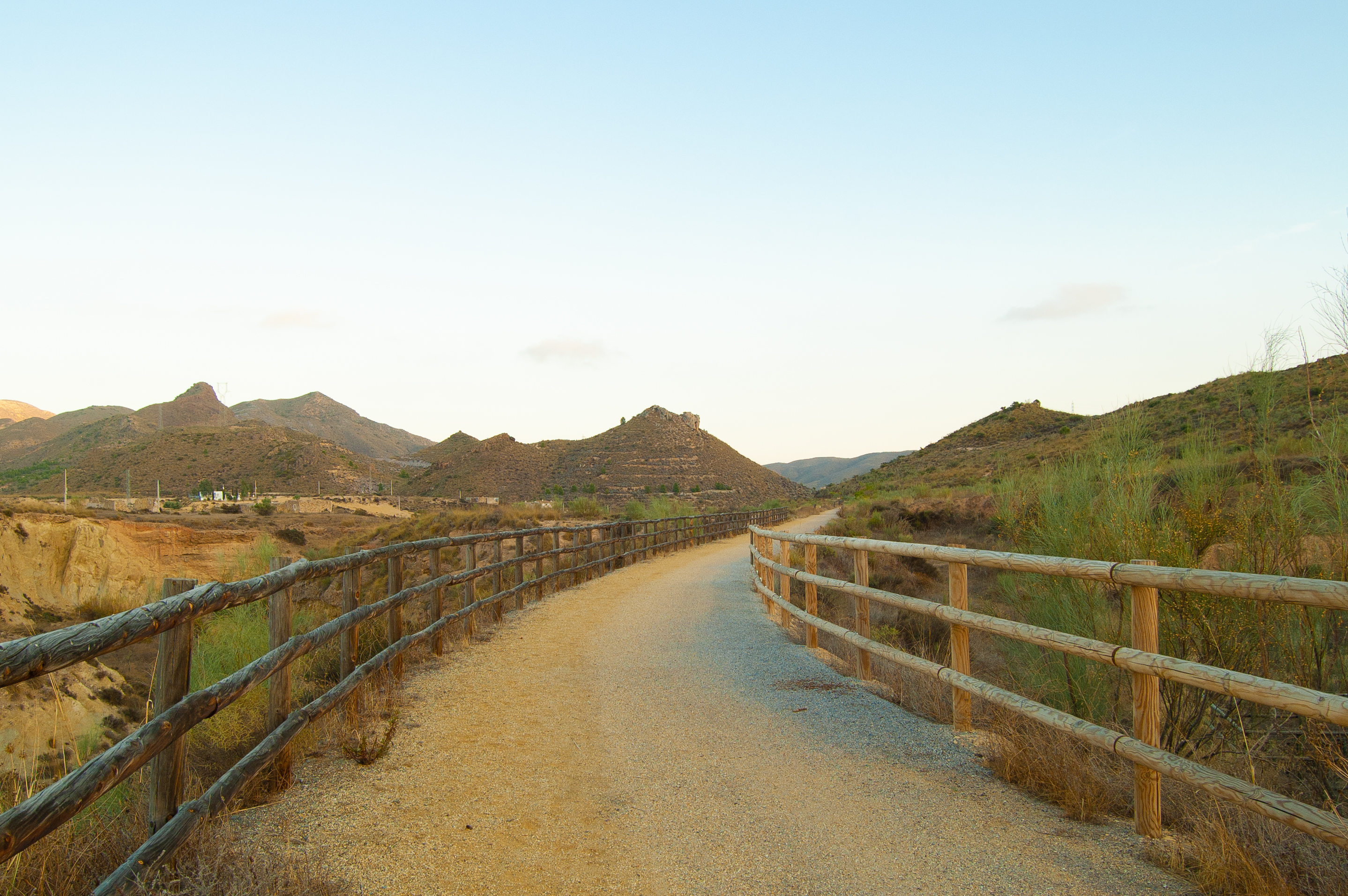
A few metres further on, we reach the 10-kilometre mark and the end of the paved section for the final kilometre of the Nature Trail. This final section begins at El Molinillo bridge which has been reconditioned for walkers and cycle tourists. Crossing the bridge, our faithful companion on this section of the itinerary, the Rambla de Lucainena, comes into view.
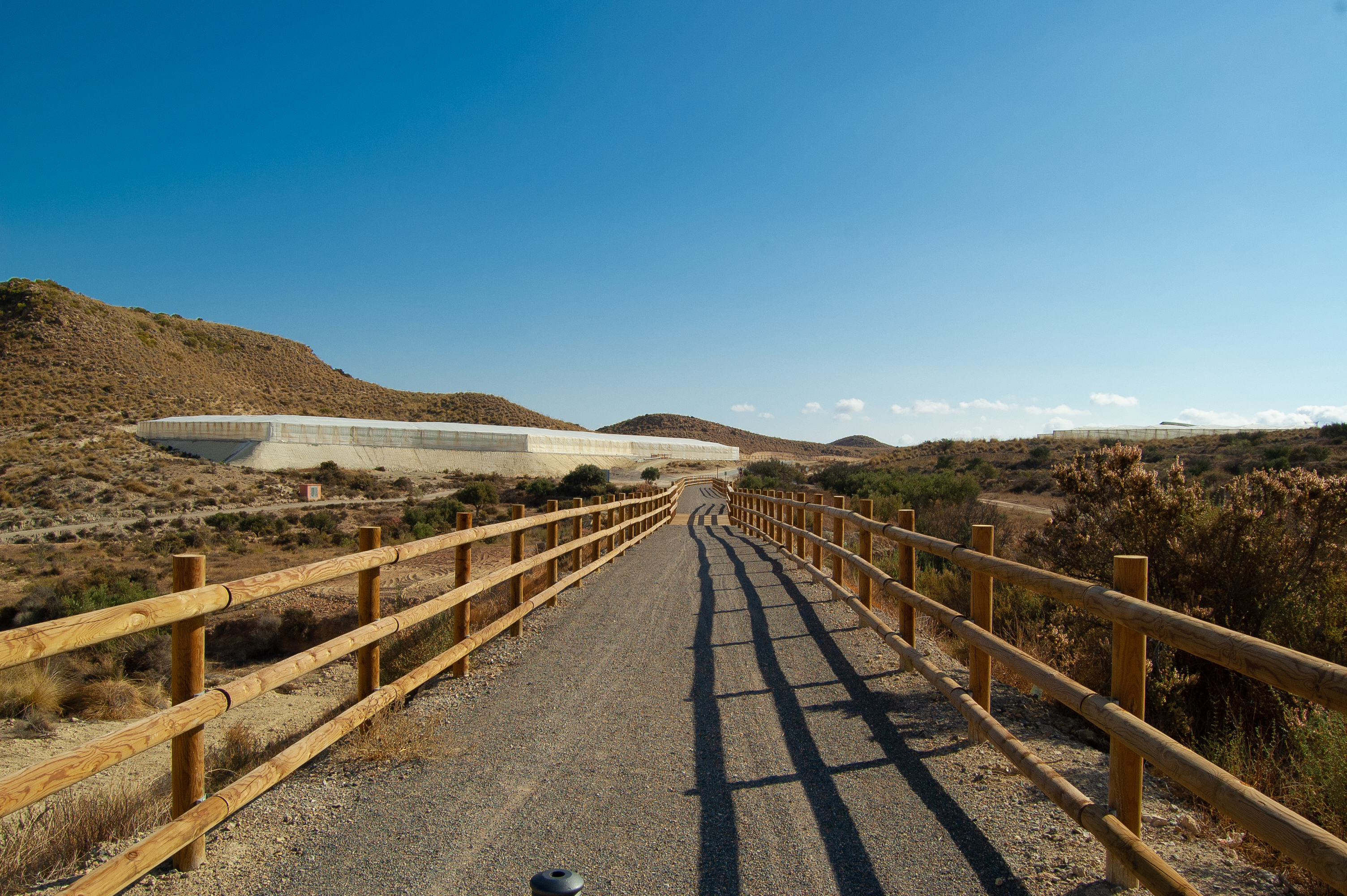
The mountain landscape gradually flattens to one of fields of crops dotted with greenhouses for growing vegetables. Past the 13-kilometre point, on the left of the trail is the Cortijo Polopillos farmstead as the number of greenhouses around us increases.

A kilometre later, a short but steep slope breaks the downhill gradient of the trail so far, but it presents the traveller with no great difficulty. We reach the final section after two level crossings, reaching the Nature Trail interpretation panel and finishing in Venta del Pobre, at junction 494 of the Mediterranean Highway (A-7). This was once home to the old Camarillas railway station, long since disappeared, and today, travellers can find a small service area (restaurant, lodging, petrol station and parking) alongside the handful of houses.
Map
Puntos de Interés
Hidrografía
Vegetación
Profile
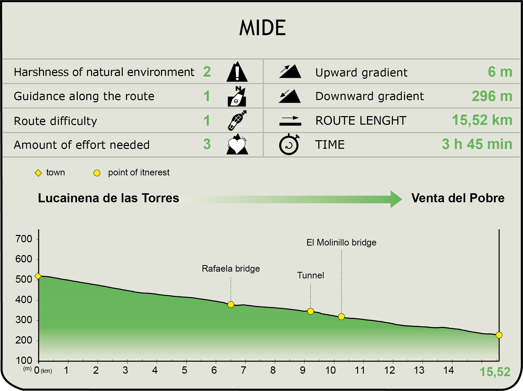
MIDE (Method for the Information of Excursions)
 Harshness of natural environment
- 1. The environment is not risk-free
- 2. There are more than one risk factors
- 3. There are various risk factors
- 4. There are quite a lot of risk factors
- 5. There are many risk factors
 Guidance along the route
- 1. Well defined trails and crossings
- 2. There is a clearly marked trail and signage
- 3. Requires the identification of geographic features and cardinal points
- 4. Requires off-path navigation
- 5. The trail is interrupted by obstacles that have to be gone around
 Route difficulty
- 1. Walking on a flat surface
- 2. Trails with different types of path
- 3. Walking on stepped paths or irregular terrain
- 4. The use of hands or jumping over the terrain is necessary
- 5. The use of hands is required to progress
 Amount of effort needed
- 1. Up to 1 hour of continuous walking
- 2. Between 1 and 3 hours of continuous walking
- 3. Between 3 and 6 hours of continuous walking
- 4. Between 6 and 10 hours of actual walking
- 5. More than 10 hours of continuous walking
Featured
Further information
Lucainena de las Torres
Andalusian village in the province of Almería included in the Most Beautiful Villages in Spain network since January 2013. Remains from the neolithic period have been found, but its origin is believed to date back to Roman times, this being the home of the patrician Lucanius, hence the name. In the Arabic period, the village was protected by a wall and seven towers and was conquered by the Catholic Monarchs in 1488. With the development of mining in the late 19th century, the municipality went through a period of expansion and wealth. The highlights of this wealth of cultural heritage include the 18th century Church of Señora de Monte-Sión and the viewpoint of El Poyo de la Cruz, as well as council building and the square, the old hospital and public wash house and the old iron ore calcination furnaces. The local festivals in honour of San Sebastián and the Virgen de Monte-Sión, are held on the third weekend in January and the third week in September.
The mining railway
This railway was the property of the Compañía Minera de Sierra Alhamilla, and was built between 1894 and 1896. It is a total of 36.2 km in length and transported tonnes of iron ore from Lucainena de las Torres to Agua Amarga. There were 5 stations on the route (Lucainena de las Torres, La Peralejos, Camarillas, La Palmerosa and Agua Amarga), 2 metal bridges over the Lucainena river walk (the Rafaela bridge and the Molinillo bridge) and one unclad tunnel of 85 metres in length.
From when it was first brought into service, 250 tonnes of ore would be transported by locomotive, and the railway performed well over many years. Its service was cut short by the European steel making crisis in the wake of the First World War and activity was suspended on the line in September 1931. During the Spanish Civil War, it was operated by the workers themselves but was barely profitable. In the post-war period, it was returned to its owners, the damage repaired and it was put in operation once again. It never performed as well as before, however, and service on the line ceased definitively in 1942.
Multimedia


Downloads
Descargas de GPS
Brochure and maps
Cyclability
PROFILE & DIFFICULTY
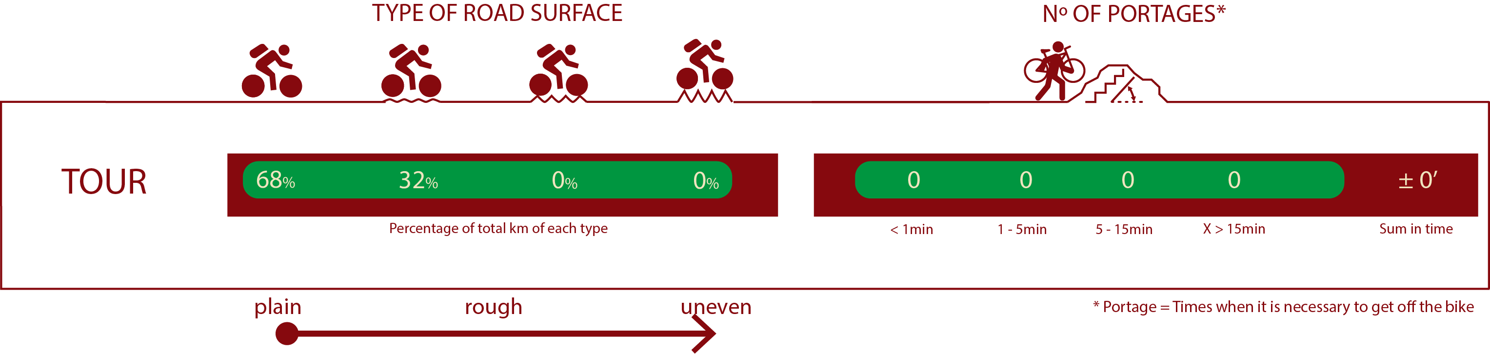
ROAD TYPE & PORTAGES
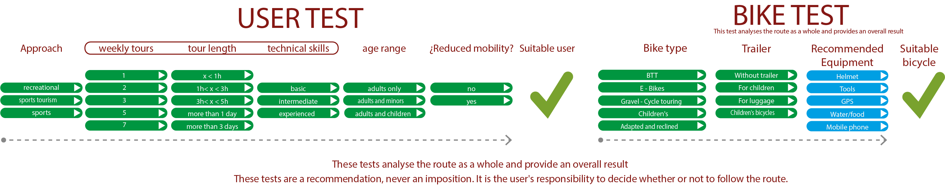
TEST
SAFETY RECOMMENDATIONS
-Caution on small road junctions, on the section open to road traffic and on sections shared with motor vehicles.
GENERAL RECOMMENDATIONS
-Find out about the technical aspects of the route and the weather on the day.
-Take care of the environment. Take care not to disturb animals or damage vegetation. Respect private areas.
-You must give priority to pedestrians and comply with general traffic rules.
-The environment in which you will be riding is open, free to move around and an area where many activities are carried out (sporting, forestry, livestock and agricultural activities). Always have an understanding, prudent, responsible and respectful attitude.