- Home
- Rural Development
- Nature Trails
- Nature Trails
- South Sector
- Guadalimar
Guadalimar Greenway Nature Trail
Description
From the Guadalimar flood plains to the fields at Bejígar
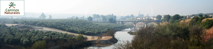
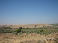
This Trail runs almost entirely through olive groves, with stunning views of the River Guadalimar as it advances north. The route is dotted with many viaducts and tunnels that cross deep ravines and high hills.
The 15-kilometre route, which starts near Linares-Baeza train station, in Arquillos (Linares), and ends in Horcajo (Begíjar), is very easy for both pedestrians and cyclists, owing to the absence of steep slopes.
The Linares-Baeza Station is located a few kilometres southeast of the town of Linares, on the right bank of the River Guadalimar. This small town has always been famous for its railway station; a place where trains pass through, arrive or depart on a daily basis. The town is linked in a unique way to the romantic history of this unparalleled mode of transport, used by thousands of travellers since it was invented.
The Trail alternates between riparian, floodplain and olive grove landscapes. As the route ventures north, one can see in the distance, industrial activity associated with olive farming (mainly oil mills) and a large sugar refinery.
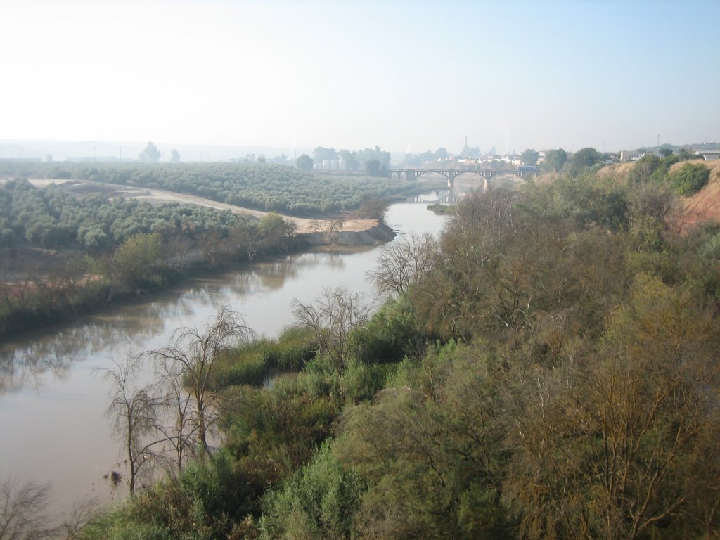
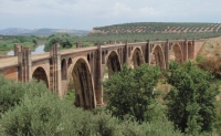
The route starts about one kilometre north of the Linares-Baeza station, near the 235-metre, curved viaduct over the River Guadalimar. An old hydroelectric power station can be seen upstream from this bridge, as well as the dam that diverts water towards it. One can see downstream from the bridge, on the right bank of the river, the Linares-Baeza Station, the bridge over the N-322, and the works of a future motorway.
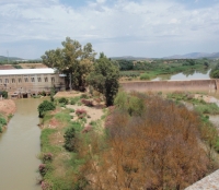
After crossing the viaduct, the Trail runs along the left bank of the river. About 1.3-kilometres further on, after passing under the future motorway, there is an old oil mill with all the accessories, including large tanks and silos, and a variety of equipment.
After passing under the N-322 road, alongside the path stands a large mulberry tree (Morus sp.). From here, the Trail runs between olive groves and vacant fields. The landscape to the west is typical of this area, where the countryside alternates with olive groves and farming facilities.
The route heads towards a footpath over the Pichingo Creek, from where one can see an old siphon before reaching the old N-322a road. After crossing the road with care, there is another footbridge over Pozo Creek, and further on, the route crosses the JV-3043 linking Linares-Baeza Station with Lupión and Begíjar.
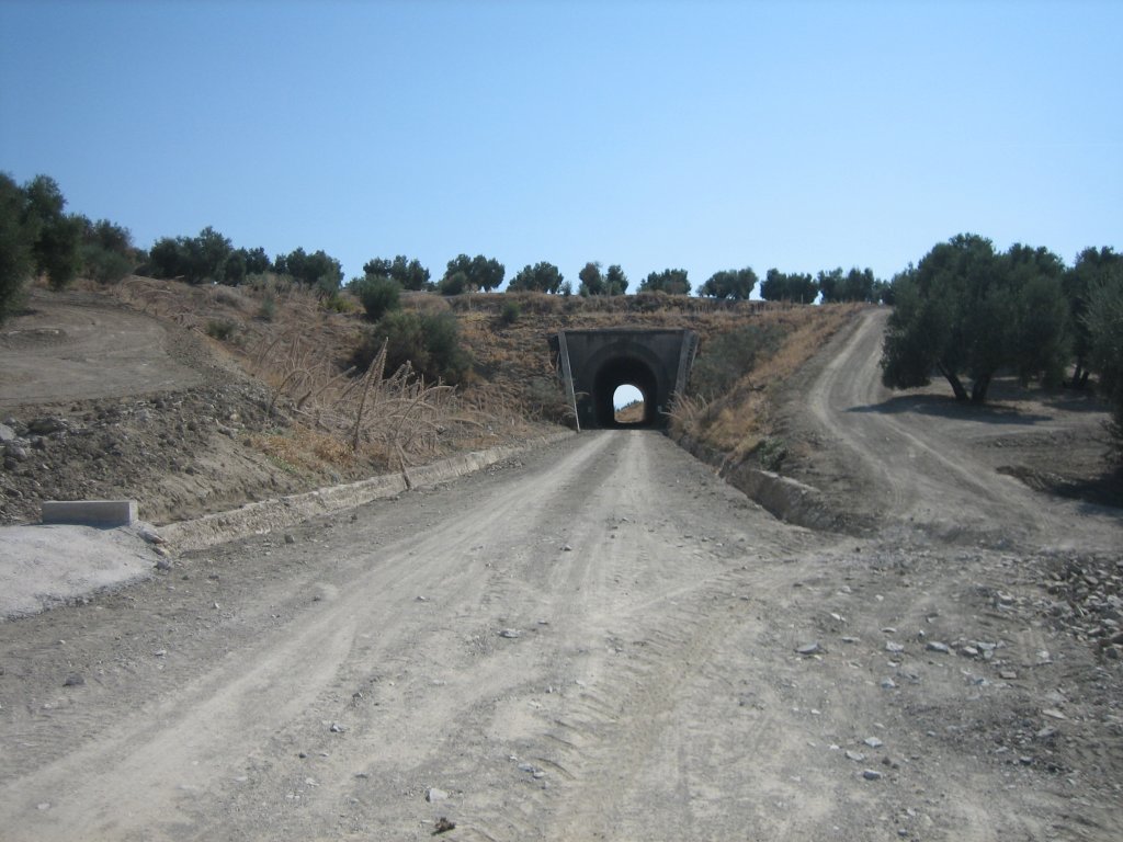
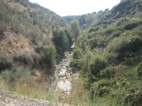
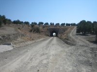
At about 3.5 kilometres from the start, and after crossing the Ibros Creek via a railway viaduct, the route arrives at the first of many tunnels along this path. This tunnel is illuminated.
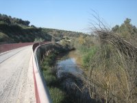
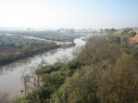
On the opposite side of the tunnel, the Trail gradually approaches the Guadalimar riverbank (included in Red Natura 2000 as the SAC, Special Area of Conservation "Ribera del Guadalimar"), until it runs parallel to the river itself. It is sometimes possible to see, on the opposite side of the river, some Mediterranean Turtles (Mauremys sp.) sunbathing on the sand at the water's edge. The lush vegetation in this area consists of white poplars (Populus alba), field elm (Ulmus minor) and tamarisks (Tamarix sp.).
The route continues parallel to the river until it crosses the railway viaduct over Valdeparra Creek, and reaches a rest area next to the second tunnel (also illuminated). After passing through the tunnel, the path continues parallel to the river, and arrives at a second rest area. One can see to the west, across the river, perched atop the hills in the distance, the ruins of the ancient city of Cástulo and the Torreón de Santa Eufemia.
Rabbit burrows (Oryctolagus cuniculus) become a common sight on the slopes.
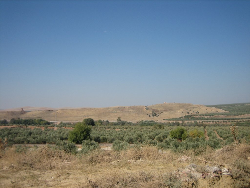
From here, the Trail slowly drifts away from the River Guadalimar, running parallel to the tracks of the new railway to Baeza. It gradually begins to climb from 330 metres in the Guadalimar flood plains to 440 metres, venturing forth through vast fields of olive trees, the mainstay of the local economy. Aside from the olive trees (Olea europaea), there are also many other plant species typical of this environment, including common figs (Ficus carica), yellow broom (Retama sphaerocarpa) and lentisc (Pistacia lentiscus).
An interesting colonising plant species that "shoots" its seeds when shaken can be found along the next stretch of the route. It is commonly known as Squirting cucumber (Ecballium elaterium) because the fruit looks like a small cucumber.
Further on, the route arrives at a third rest area with a viewpoint. It then crosses a bridge on the road from Lupión to Guadalimar. After about eight kilometres, the Trails passes only 200 metres from the village of Guadalimar, separated by the new railway. Several interesting vegetation formations of Ravenna grass (Saccharum ravennae) and tamarisks can be seen on the embankments.
From here, the Trails runs entirely through a homogeneous landscape of olive groves. After crossing a viaduct over the River Lupión, the route arrives at a third tunnel (also illuminated) with a rest area close by.
Immediately after crossing under a bridge, the route is interrupted by the JA-4103 road from Lupión to Torreblascopedro. Caution should be exercised as the path continues along a very dangerous sharp bend with low visibility.
In the next stretch of the Trail, the landscape is still mainly olive trees. After passing the fourth tunnel (also illuminated), there is another rest area.
Past three more unlit (short) tunnels, the route arrives at a rest area located 15.25 kilometres from the starting point, where the Trail ends. The traveller can rest and recover here.
Sites of interest
Profile
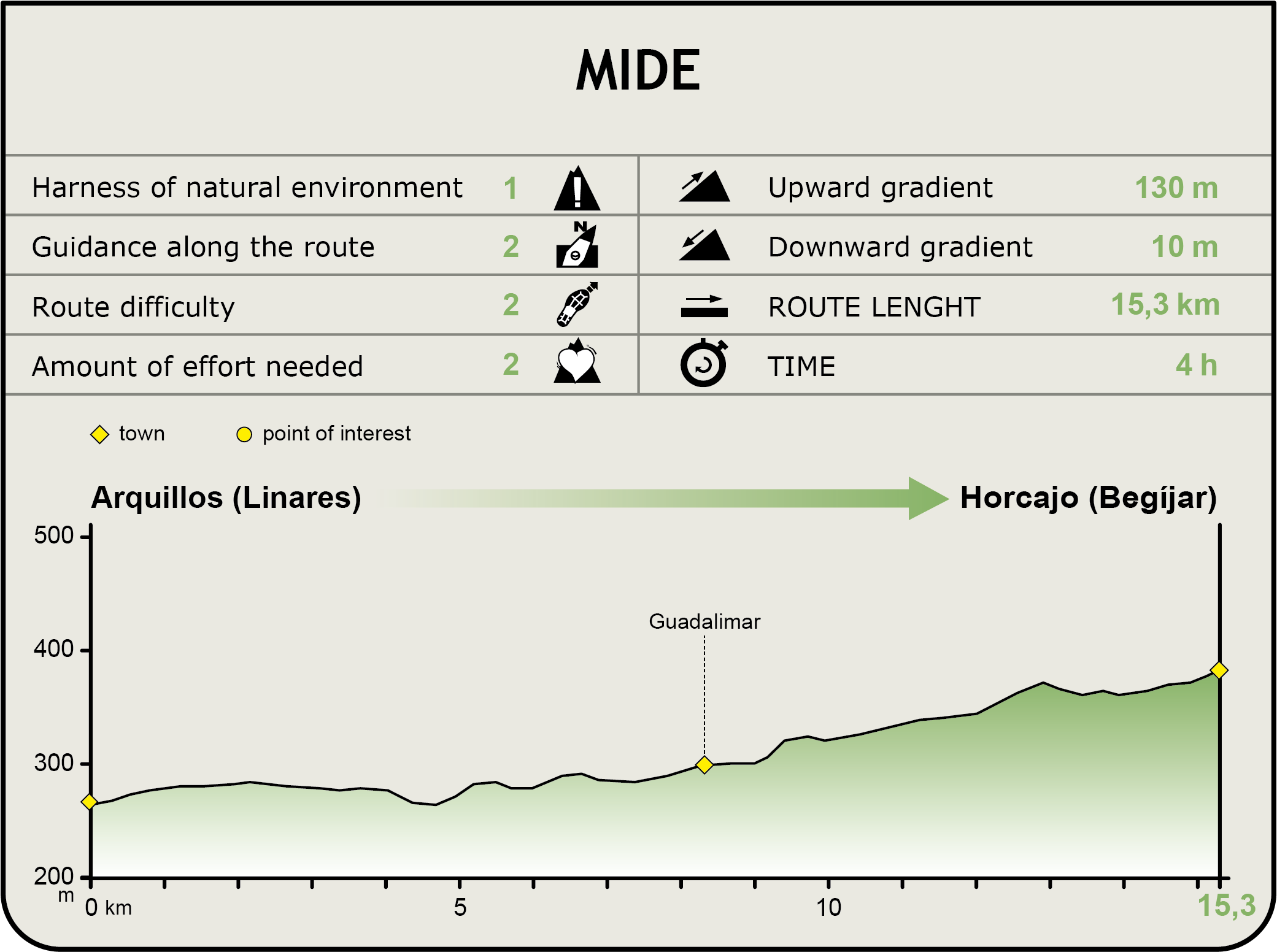
MIDE (Method for the Information of Excursions)
 Harshness of natural environment
- 1. The environment is not risk-free
- 2. There are more than one risk factors
- 3. There are various risk factors
- 4. There are quite a lot of risk factors
- 5. There are many risk factors
 Guidance along the route
- 1. Well defined trails and crossings
- 2. There is a clearly marked trail and signage
- 3. Requires the identification of geographic features and cardinal points
- 4. Requires off-path navigation
- 5. The trail is interrupted by obstacles that have to be gone around
 Route difficulty
- 1. Walking on a flat surface
- 2. Trails with different types of path
- 3. Walking on stepped paths or irregular terrain
- 4. The use of hands or jumping over the terrain is necessary
- 5. The use of hands is required to progress
 Amount of effort needed
- 1. Up to 1 hour of continuous walking
- 2. Between 1 and 3 hours of continuous walking
- 3. Between 3 and 6 hours of continuous walking
- 4. Between 6 and 10 hours of actual walking
- 5. More than 10 hours of continuous walking
Featured
Further information
Guadalimar
The "Province of Jaén Settlement Plan" provided for the establishment of Guadalimar, a hamlet built by the Ministry of Public Works and Agriculture in 1954-1958, in the namesake floodplain in Lupión.
The hamlet, designed by the architect José A. Corrales Gutiérrez, contained 154 dwellings for agricultural workers, a school, a church, several administrative buildings, two houses for teachers, a shop and the shop owner's house. It was inaugurated personally by Franco in 1961, and, until recently, the official name was "Guadalimar del Caudillo". Since then, it has been integrated into Lupión, and repopulated with five hundred inhabitants from Lupión, Begíjar, Baeza, Ibros, Bélmez, Bedmar, Hornos, Pontones and other neighbouring towns.
Linares-Baeza Station
The station has been in decline since 1992, when the AVE Madrid-Seville line was opened. Different trains passed through this station on their way to various Andalusian destinations. Until then, the station saw at least 40 passenger trains per day; now it is down to 18.
The station is still an important freight hub, as plans to build a dry port are still ongoing, despite delays from lack of investment.
The Madrid-Jaén high-speed line under construction, with one section already in service (Iberian gauge), will soon pass through here. Of the many stations that used to service the city of Linares, this is the only one that is still operating. It was formerly called Baeza-Empalme Station.
This station is currently the head station of Renfe's Medium-Distance Line 71 (Granada-Linares-Baeza).
Multimedia