
Section 3. Biobra a Petín
Description
From the Serra da Enciña da Lastra to the river Sil valley
The last stretch of the Vía Nova Nature Trail changes its direction and heads from the Serra da Enciña da Lastra, through which the Vía Nova enters the province of León, to the valleys of the rivers Galir, Cigüeño and Sil, where it reaches the vineyards of the Valdeorras Designation of Origin. The trail runs at mid-slope level, thus allowing the traveller to enjoy the magnificent views of these valleys during most of the journey./strong>
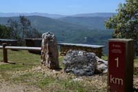
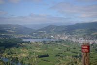
The following stretch of the trail starts in the Serra da Enciña da Lastra Natural Park, at a viewpoint located at the top of the mountain of the same name, with views of the Province of León, on the border with Ourense.
This park is a mountainous range of limestone rock with cutting peaks and deep valleys that divides the regions of El Bierzo and Valdeorras. It is populated with holm oaks, chestnuts and Mediterranean scrubland, with peculiarities such as the presence of wild thyme fields, endemic floral calcareous ground and other anomalies such as more than 25 species of orchids. The fluvial canyons and cliffs are the habitats of raptors and other birds, which make the park an interesting ornithological refuge. Moreover, it has several karst caves called palas (word of Pre-Roman origin meaning cave), which are frequented by amateur speleologists.
One kilometre after the first viewpoint we find another one with views of the Ourense valleys. From this point, the trail starts descending in a gradual but constant way, surrounded by holm oaks and chestnut trees when arriving to the village of Biobra. As we enter this village, which has a visitors centre, we continue descending the hillside of the mountain, which provides views of the Galir valley.
The river Galir, an affluent of the river Sil, can be crossed through a concrete bridge before reaching O Porto. After traversing its streets, the following kilometre of the trail, before deviating next to O Real, continues along the road OU-622 hard shoulder. For this reason, although this stretch goes through village, the traveller should be extremely careful.
Back on the unpaved trail, the track runs along the riverbed between scrublands and crop lands, thus meaning that the traveller does not have to excessively climb the hill that separates O Real from the next village, A Veiga de Cascallá.
In this municipality, the traveller can visit a church with a curious history. It was moved from the village of Alberguería, located 50 km away, and it was rebuilt stone by stone when the works of the Prada reservoir started, which would have otherwise flooded it.
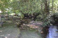
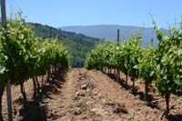
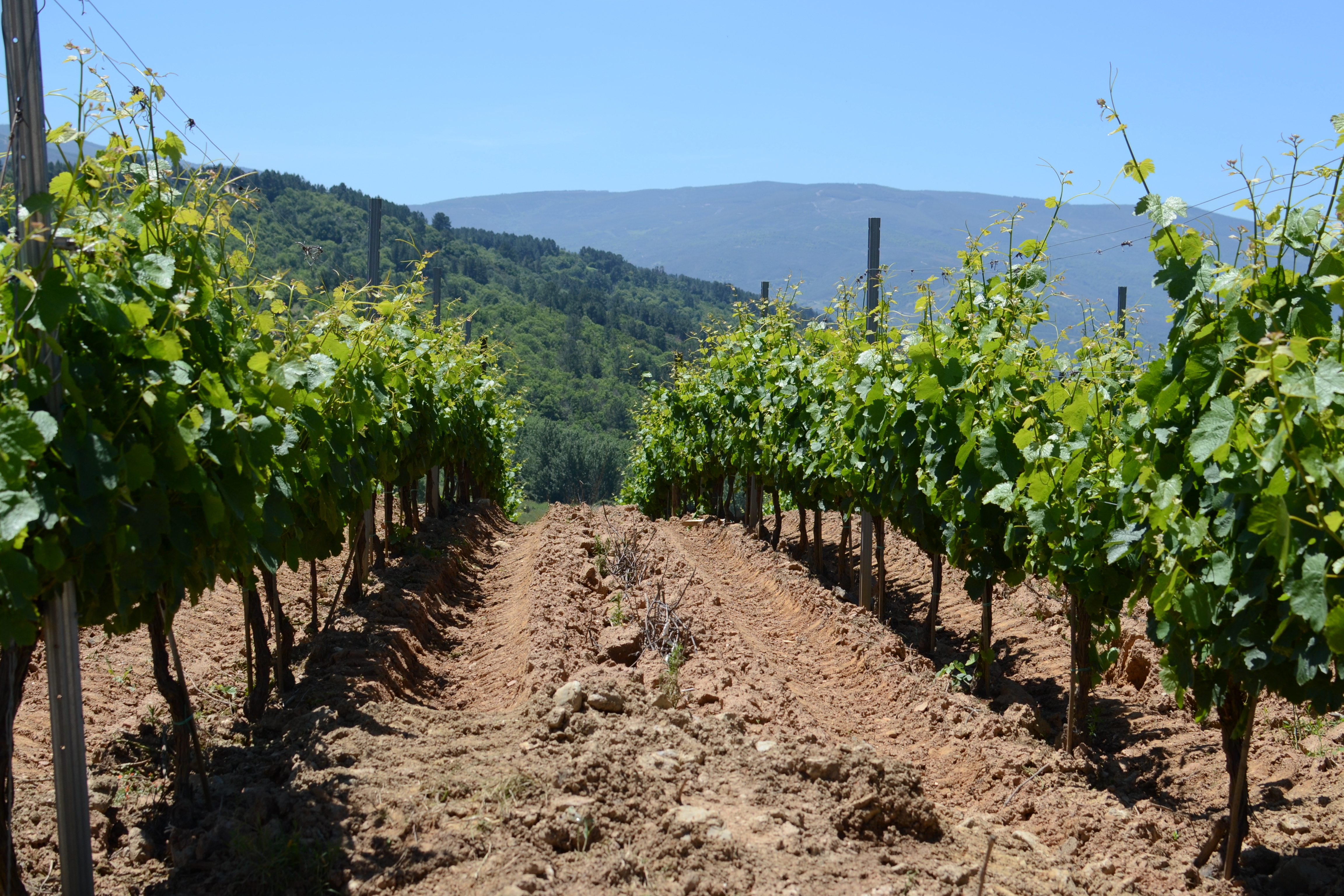
After leaving A Veiga, the trail keeps on ascending the mountain hillside, accompanied by brooms, chestnut trees and isolated pine trees until reaching the divide, where it begins to descend through a chestnut grove. The trail traverses the floodplains of the river Cigüeño, also an affluent of the river Sil, and the landscape completely changes. The forest is replaced with vineyards of the Valdeorras Designation of Origin, and the trail leaves behind the dirt track and runs along the secondary roads that connect the different villages of the area.
The traveller reaches Rubiá, previously known as Rubiana, where an "ara" or stone altar dedicated to Ravveana Bareco, with the inscription Albino Tito Torubo, was found some decades ago. Bareco is a Celtic deity and Ravveana is believed to be a local deity, since she is the one who gives the name to this place, and which is not mentioned anywhere else.
After around 2 km the trail reaches O Val, where it resumes the dirt track for a kilometre and a half; the traveller will walk among chestnut trees, pines and willows, surrounded by creeks, before returning to the semi-paved trail that traverses the nearby villages, Vilanova de Valdeaorras and O Castro. O Castro was built around a medieval tower of the 14th century that suffered destructions and partial reconstructions, probably derived from the Irmandiño revolts; at the end of the 15th century it became the property of the Counts of Rivadavia, and was renovated again in the 18th century to use it as a prison.
In 2010, the excavations carried out in the surroundings enabled the origins of O Castro, which dates back 2000 years, to be discovered. These excavations uncovered remains of the first Pre-Roman shacks made with straws and clay and subsequent constructions made of stone, which correspond to two different phases of the Roman occupation, later covered by medieval constructions and the castle.
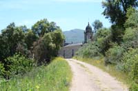
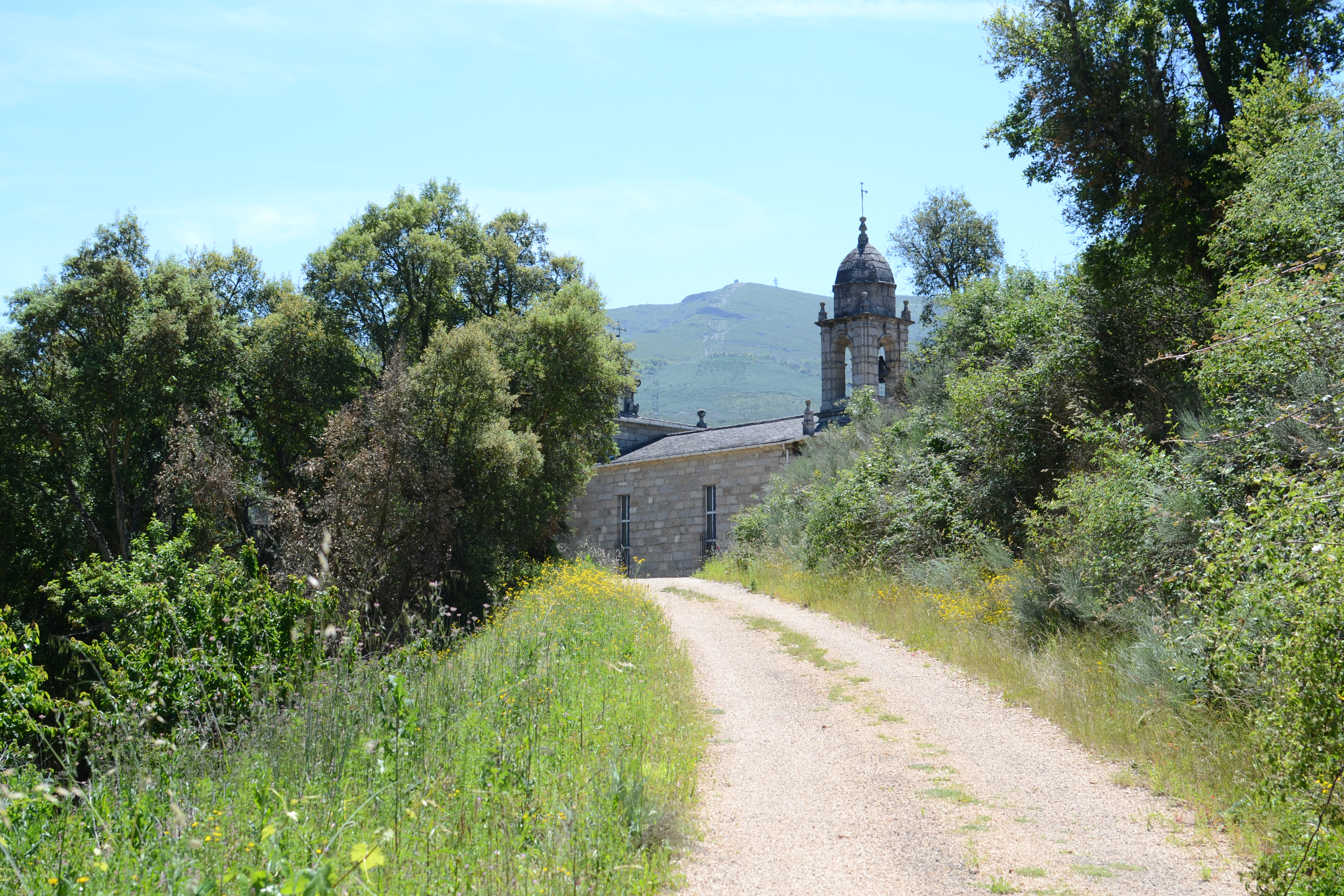
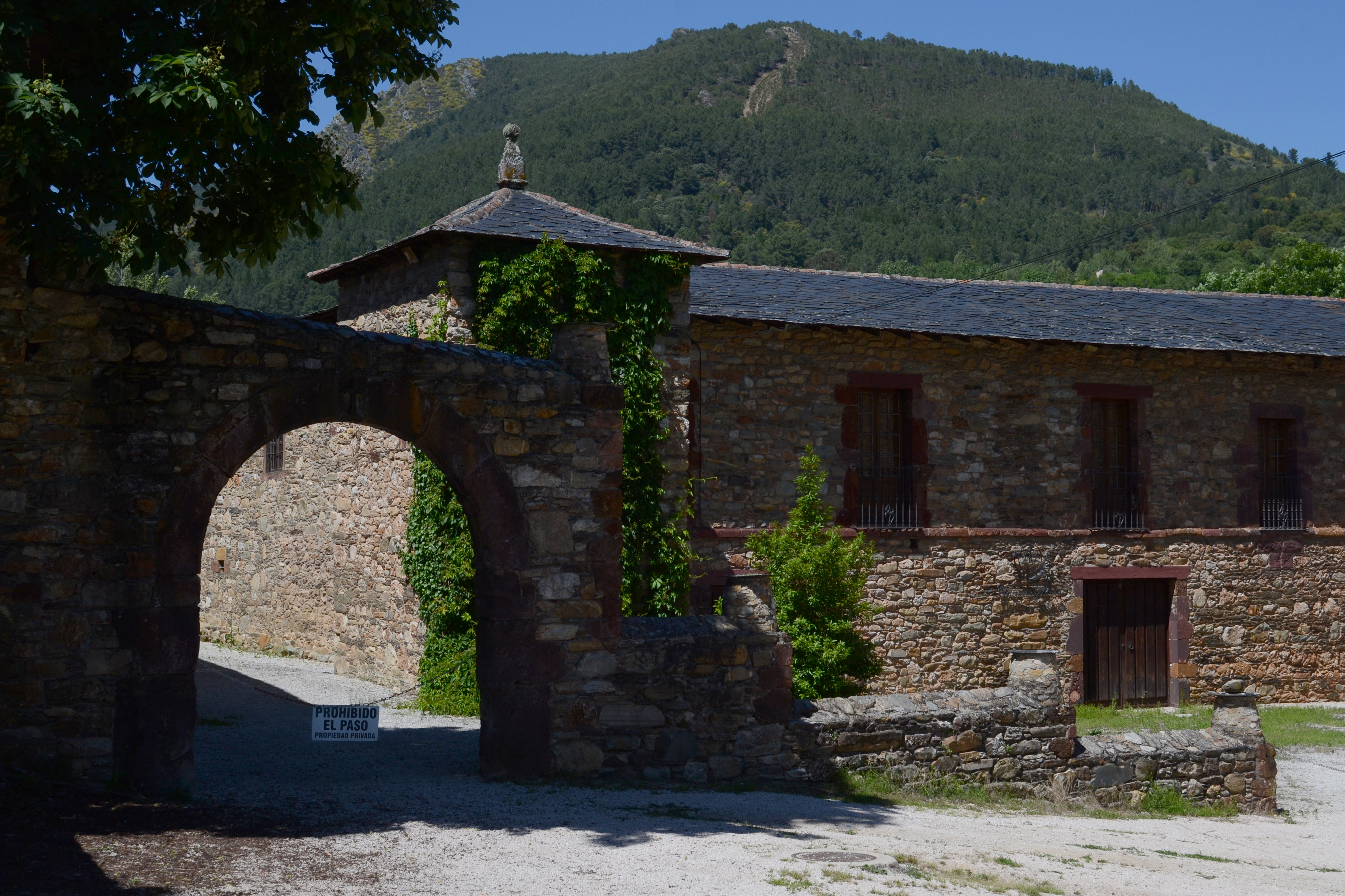
The trail continues descending towards the Mariñán river bed, which is evidenced by the vegetation surrounding the trail, which has been replaced by the typical trees of the gallery forest: black poplars, willows, maples... After crossing the river, the trail reaches the church and the monastery of Xagoaza, which have been transformed into a wine cellar; it continues along the river and then crosses it through a bridge next to a mill in ruins.
From this point onwards, after leaving behind O Barco de Valdeorras, the nature trail shares its route with the Winter Way, an alternative to the Way of Saint James which was traditionally used to enter Galicia through the Sil valley when O Cebreiro was impassable due to the snow.
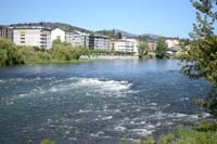
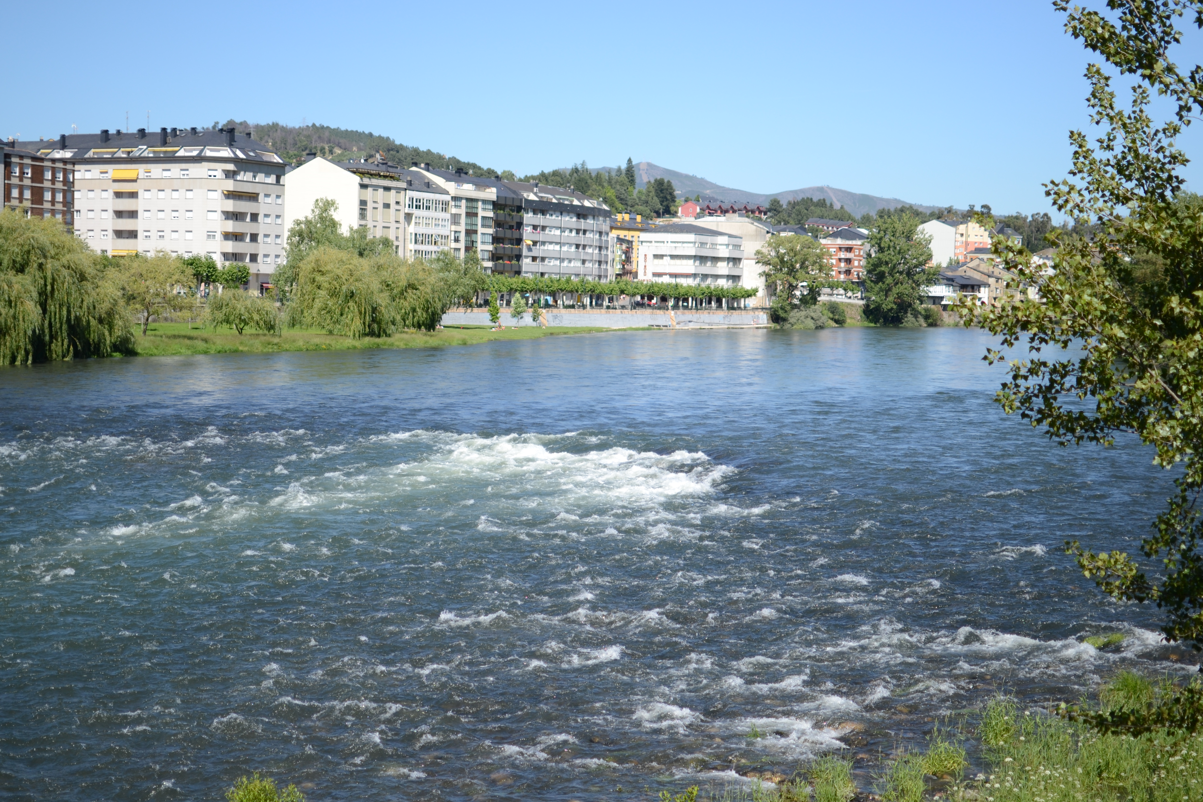
The traveller enters O Barco, the most populated city of the region, and traverses it through the avenue Eulogio Fernández until crossing the river Sil, which is more than 100 m wide in this area. Shortly afterwards, the trail reaches a big recreational area called O Salgueiral. In the valley, the traveller will see the river Sil all along the trail.
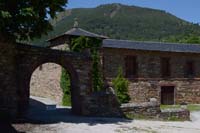
The route goes along with the river, surrounded by the gallery forest on the right side and by new vineyards on the left, passing by the industrial park of O Barco and reaching Arnado. The traveller enters this small village through an arch under the castle of Torre Penela, a palace building built at beginning of the 20th century.
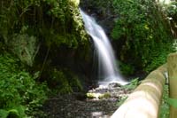
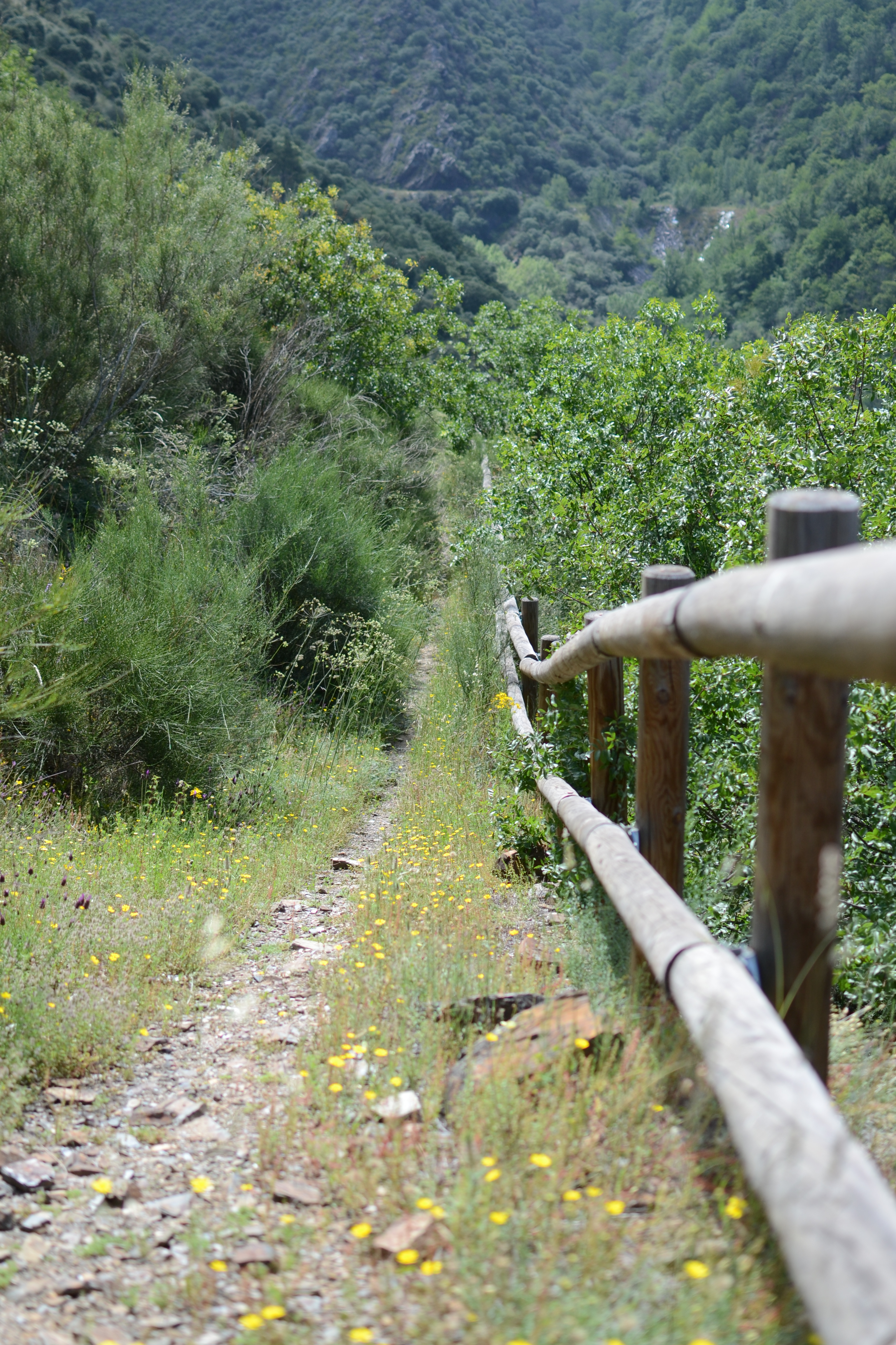
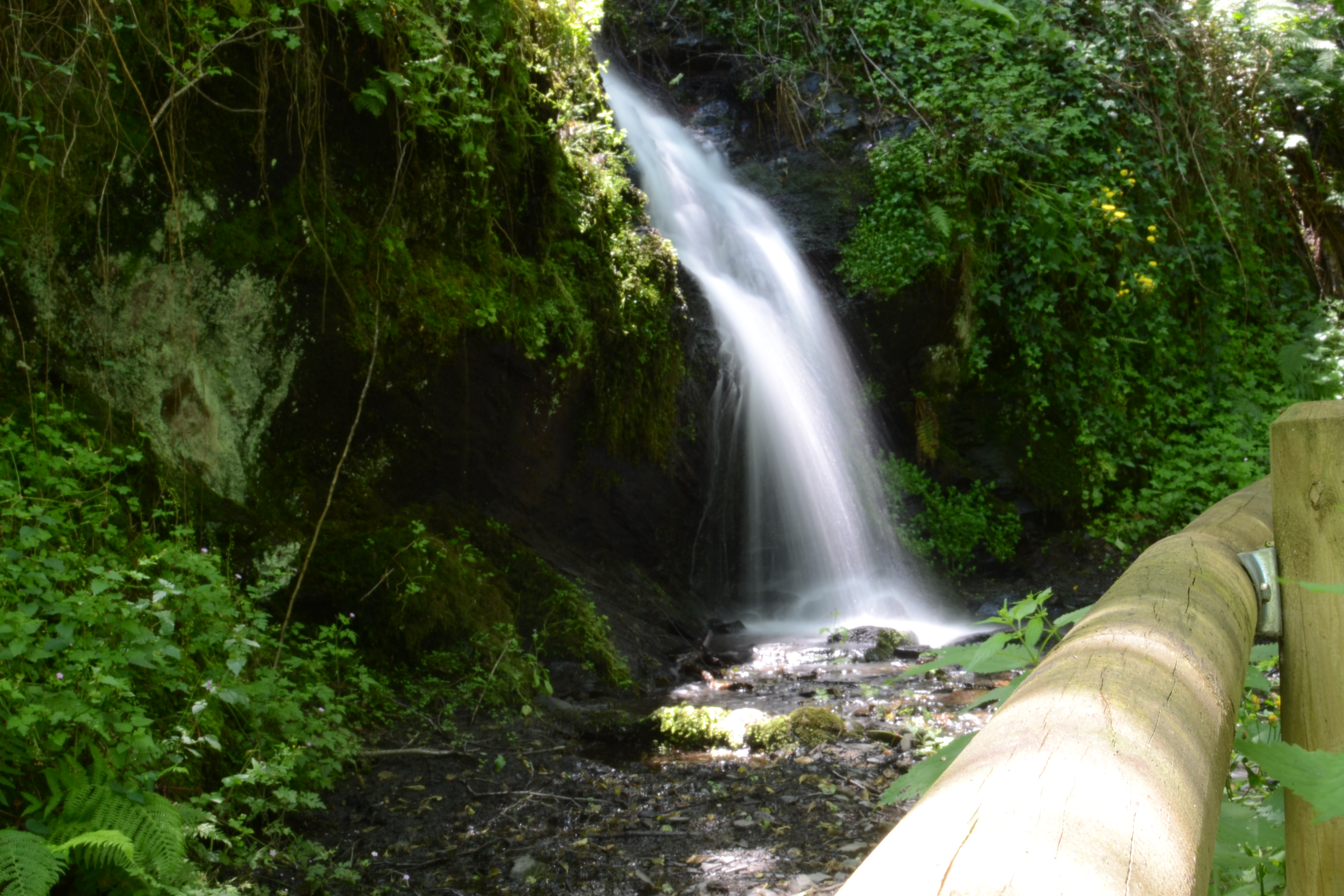
From Arnado onwards, the trail starts climbing the hillside of the mountain, escorted by chestnut trees and brooms. However, the vegetation becomes more varied (maples and willows, ferns, ivy and vines) and much more abundant when the route gets closer to the beds of the creeks, where the traveller can enjoy the picturesque waterfalls depending on the season. Even though there are wooden fences to protect the traveller from falling, crossing these creeks can be dangerous when water levels are high. The views from the trail are impressive: the river Sil, the reservoir of Santiago and the villages perched on the opposite hillside of the valley, such as Vilamartín de Valdeorras.
This will be the landscape for the four kilometres that separate Arnedo and Correxais, passing by some ruined houses before entering this new village. Before leaving Correxais behind, we can visit the ruins of the convent of the Trinitarians, founded in 1727, a place of great historic importance on the region of Valdeorras.
From Correxais onwards, the trail presents a similar aspect to that already described between Arnedo and Correxais, at least until reaching the Olivedo creek cliff. In this stretch, the view opens up to the wide floodplains where A Rúa de Valdeorras is found and to the reservoir of San Martiño; in the background, the river Sil squeezes in between the mountains.
The descent through the walls of the Olivedo cliff is short (barely 500 m) but quite sharp; for this reason, despite the wood balustrade that protects the trail on the right, the traveller must be careful. The last metres before reaching the creek run among holm oaks and chestnut trees, and the trail starts ascending a more comfortable but yet demanding slope on the opposite hillside, surrounded almost exclusively by chestnut trees. After this ascent, the traveller enters a wide track leading to the road that goes up to San Paio. The route continues descending this tortuous road that, when changing directions, offers new views of A Rúa, the river and Petín, the village where this route finishes.
This road leads to the secondary road OUR-195 (heading to Arnado), where the traveller must turn left. Shortly after, the route takes a detour and runs among vineyards, separated from the river Sil by just a few trees, so the traveller can enjoy the views. The trail surrounds an industrial building and returns to the road until reaching the end of the trail next to the first houses of Petín.
The stretch ends at this point after around 50 km. Nevertheless, if the traveller still feels energetic, they should visit the streets of Petín or cross the river Sil through the bridge of la Cigarrosa and visit A Rúa.
Map
Puntos de Interés
Geología
Orografía
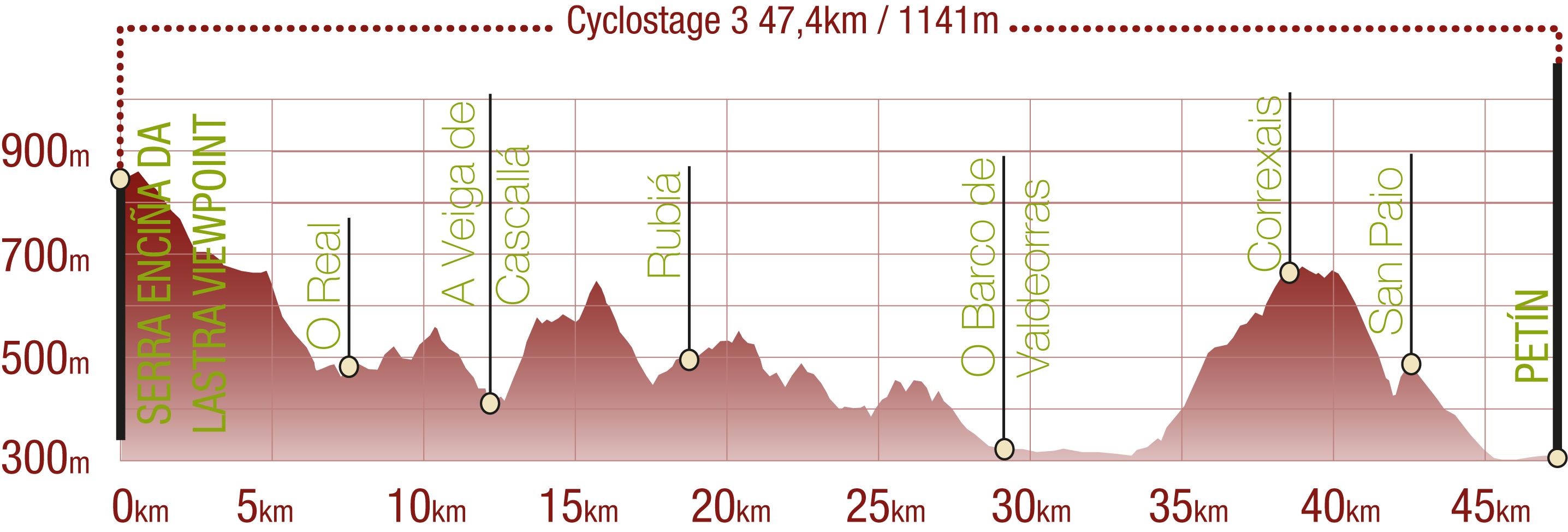
Profile
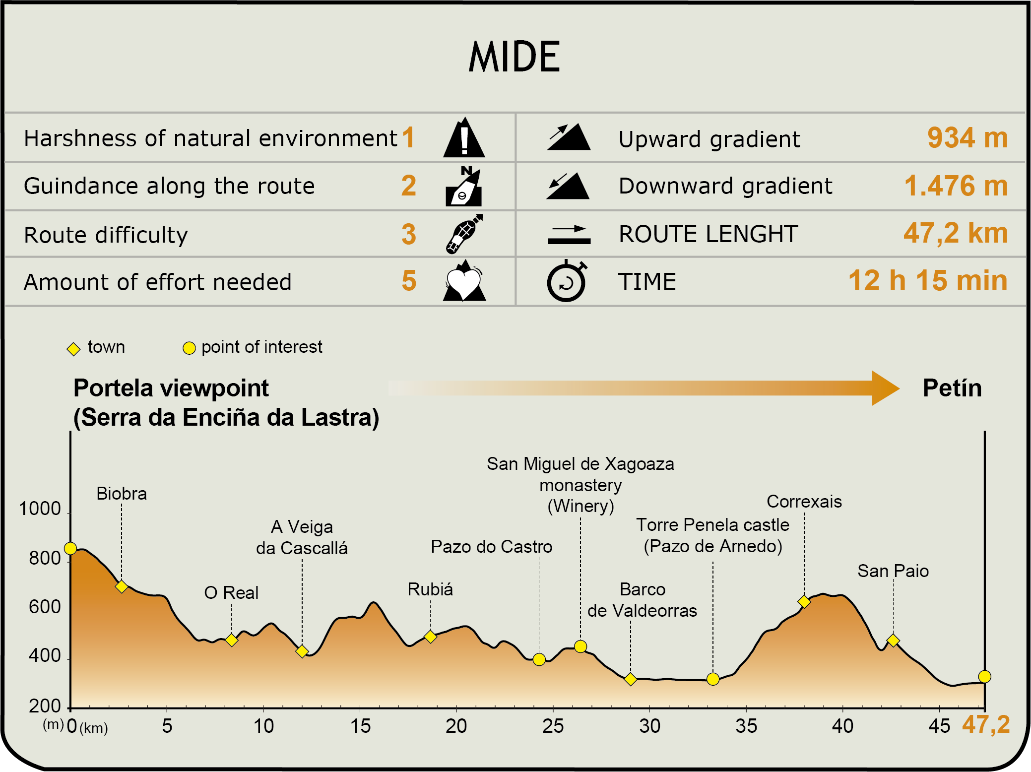
MIDE (Method for the Information of Excursions)
 Harshness of natural environment
- 1. The environment is not risk-free
- 2. There are more than one risk factors
- 3. There are various risk factors
- 4. There are quite a lot of risk factors
- 5. There are many risk factors
 Guidance along the route
- 1. Well defined trails and crossings
- 2. There is a clearly marked trail and signage
- 3. Requires the identification of geographic features and cardinal points
- 4. Requires off-path navigation
- 5. The trail is interrupted by obstacles that have to be gone around
 Route difficulty
- 1. Walking on a flat surface
- 2. Trails with different types of path
- 3. Walking on stepped paths or irregular terrain
- 4. The use of hands or jumping over the terrain is necessary
- 5. The use of hands is required to progress
 Amount of effort needed
- 1. Up to 1 hour of continuous walking
- 2. Between 1 and 3 hours of continuous walking
- 3. Between 3 and 6 hours of continuous walking
- 4. Between 6 and 10 hours of actual walking
- 5. More than 10 hours of continuous walking
Featured
Further information
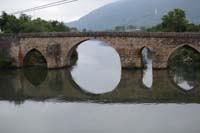
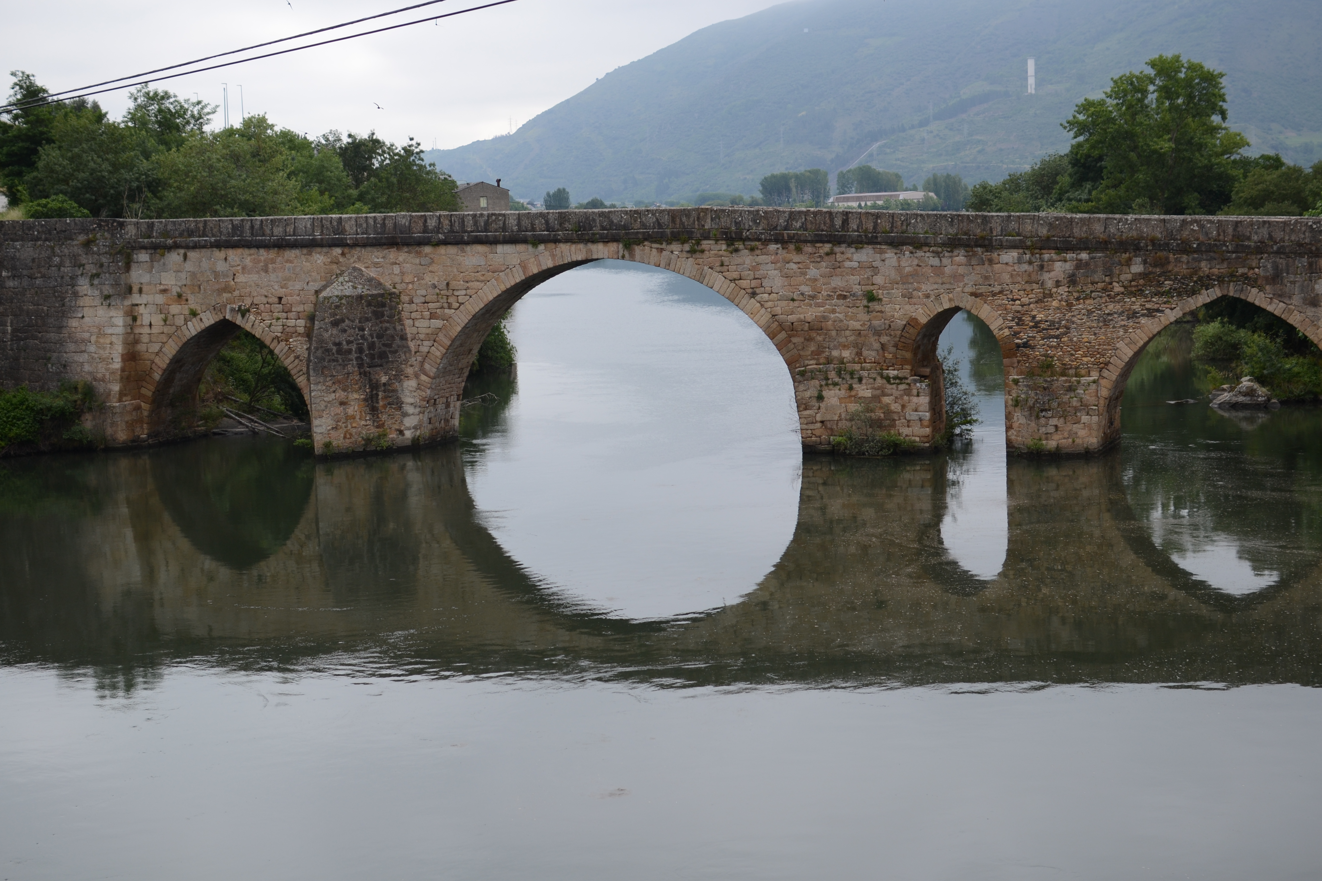
Cigarrosa bridge
Even though the bridge dates back to 1577, it has its origin on the Roman bridge which crossed the Via Nova. Some of the ancient ashlars are still preserved, although nowadays they are covered by the waters of the reservoir of San Martiño. This bridge, which is around 100 m long, is supported by five arches, three of which are ogival arches.
Remains of the Roman occupation in the area have been found in the surroundings of the bridge, such as mosaics or the tombstone of Rúa Vella. The bridge gets its name from the mansio Forum Gigarrorum, the most important population centre of the region and the capital of the Astur gigurros people. Located in the current lands of the council of A Rúa. Valdeorras, the name of the region seems to be the evolution of the name mansio.
Serra da Enciña da Lastra Natural Park
With an area of 3,151.67 ha, Enciña da Lastra is the youngest of the six natural parks of Galicia (declared on 03/05/2002), the fourth largest behind its neighbouring Invernadeiro (5,722 ha), and one hundred times smaller than the Xurés Natural Park (30,000 ha). The three of them are in the province of Ourense.
The hillsides covered by the park are home to the largest holm oak grove in Galicia. We can also find numerous endemic calcareous areas and more than 25 species of orchids; the largest area in the region.
The fauna stands out for having one of the largest communities of nesting birds in the Autonomous Region, due to its wide variety of habitats. More than half the area of the Park has been declared as ZEPA/SPAB (Special Protection Areas for Wild Birds).
Multimedia


Downloads
GPS Downloads
Cyclability
PROFILE
TYPE OF ROAD, PORTAGES & DIFFICULTY
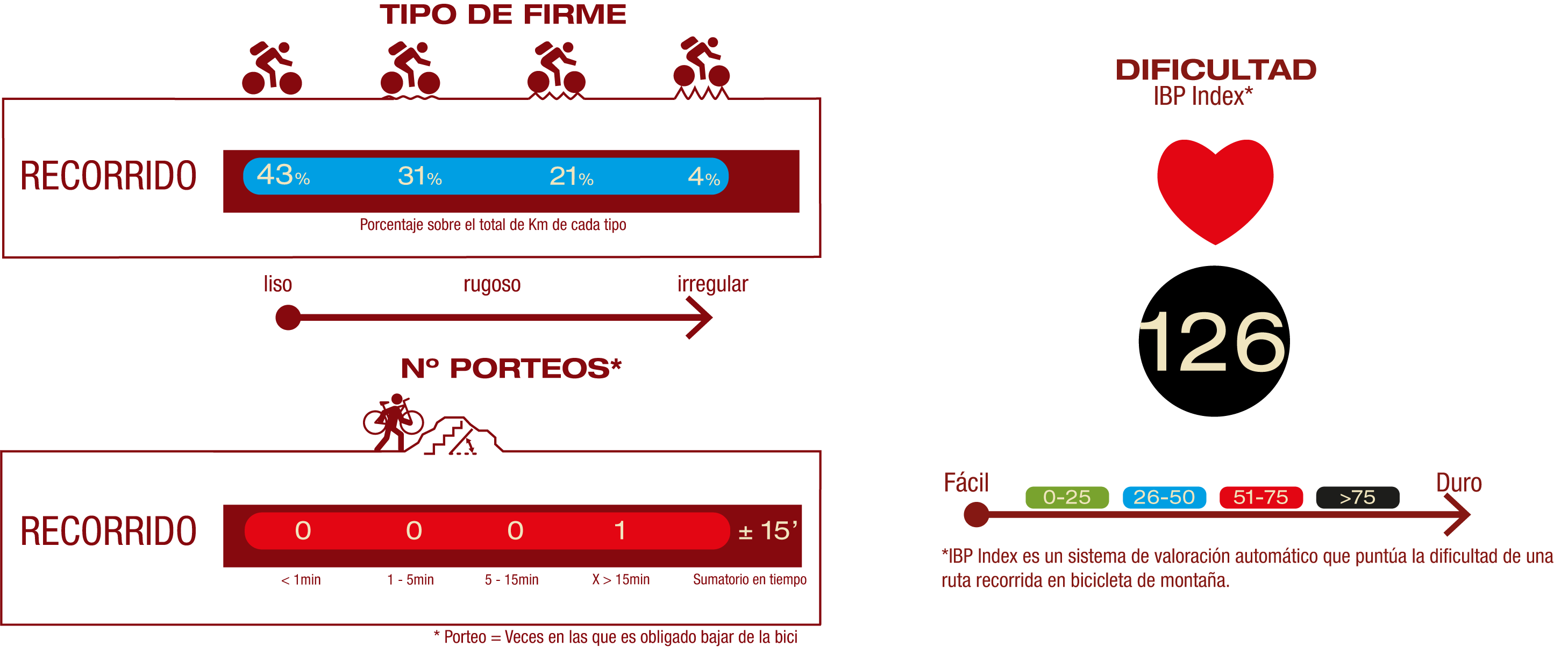
TEST

SAFETY RECOMMENDATIONS
- Sections shared with hikers.
- Transit through the centre of some population centres.
GENERAL RECOMMENDATIONS
- Find out about the technical aspects of the route and the weather on the day.
- Take care of the environment. Take care not to disturb animals or damage vegetation. Respect private areas.
- You must give priority to pedestrians and comply with general traffic rules.
- The environment in which you will be riding is open, free to move around and an area where many activities are carried out (sporting, forestry, livestock and agricultural activities). Always have an understanding, prudent, responsible and respectful attitude.