
Section 1. Portela de Home a Santa Comba de Bande
Description
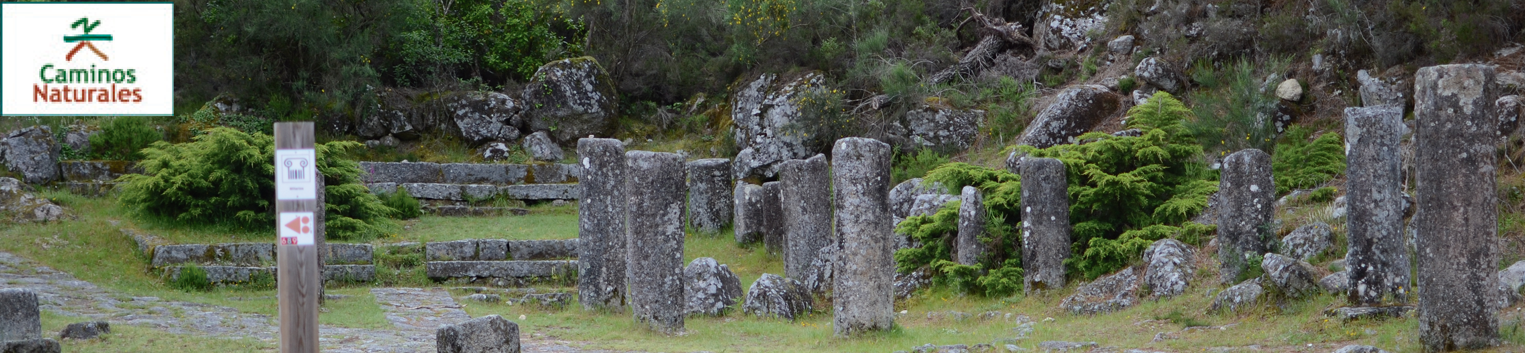
The Via Nova enters Galicia: Walking the Serra do Xurés
The first stretch of the Nature Trail passes in its entirety through the Baixa Limia-Serra do Xurés Natural Park, which is part of the Xurés-Gerês Transboundary Biosphere Reserve and International Park, located between Portugal and Spain.
It runs along the river Caldo and traverses the valley of the river Limia, encountering numerous Roman remains, such as the A Ponte Nova milestones –ancient stone columns which were placed at the roadside of Roman roads to indicate distances– or the remains of the mansio of Aquis Originis –a building that served as a stop for travellers using the Roman road.
The Vía Nova Nature Trail starts at Portela do Home, a border crossing point between Portugal and Spain. Although they are currently out of service, the buildings used for watching the border or as a customs post are still preserved.
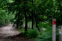
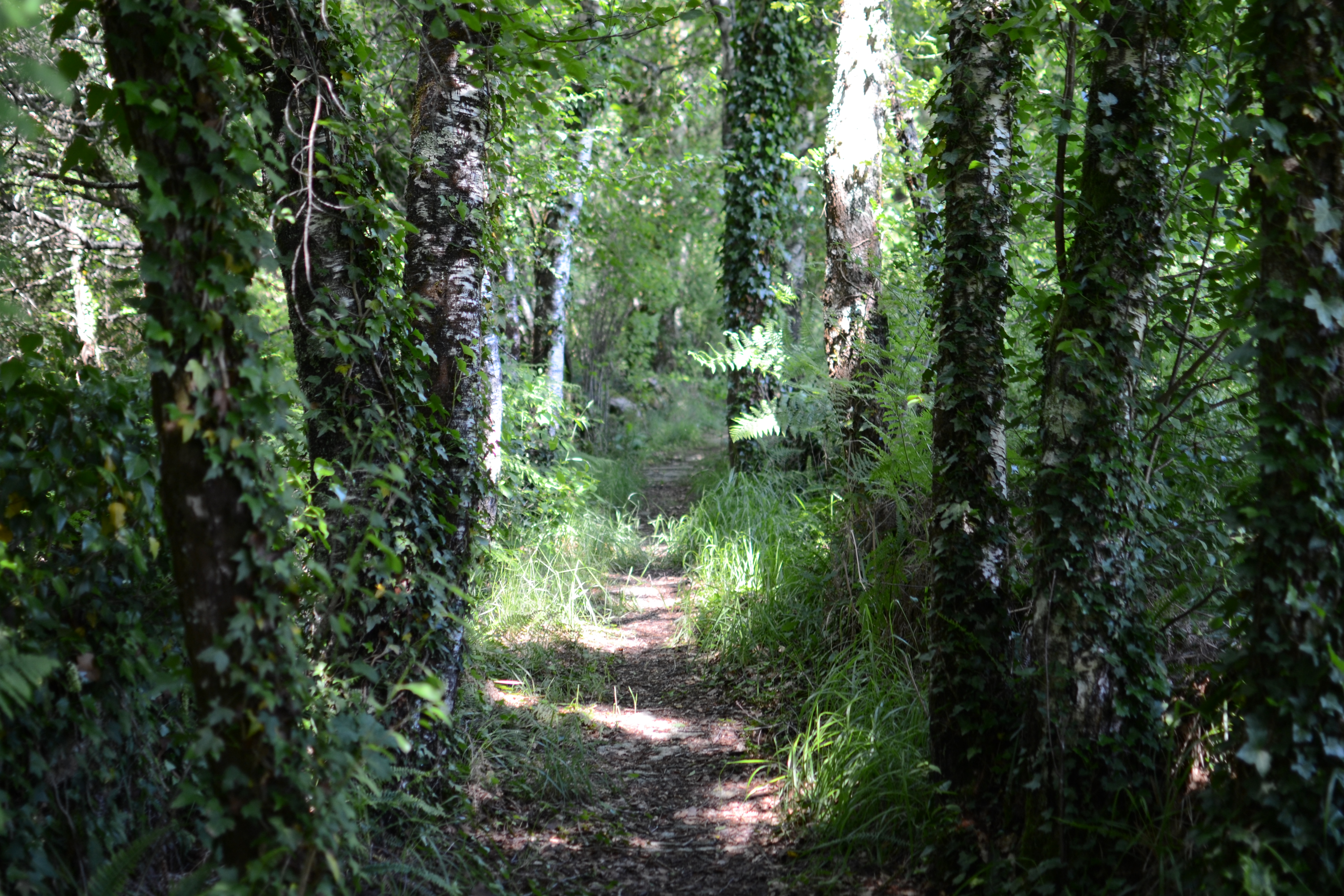
Several information panels located close to a parking lot allow visitors to check information about the trail, the Natural Park and the Roman road. This is the beginning of the trail, which a few meters later leaves the pavement to enter a mixed forest dominated by oaks and a wide variety of other species such as birches, poplars, ashes, maples and some spruces.
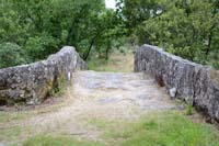
After crossing the river Caldo, the landscapes on the two sides of the trail are quite different. On the right side, the mixed forest turns into a gallery forest surrounding the river; on the left side, the hillside is dominated by a pine forest used for timber production. These species will accompany the traveller until reaching road OU-132, where the trail crosses the river Caldo via the Ponte Nova bridge.
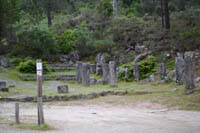
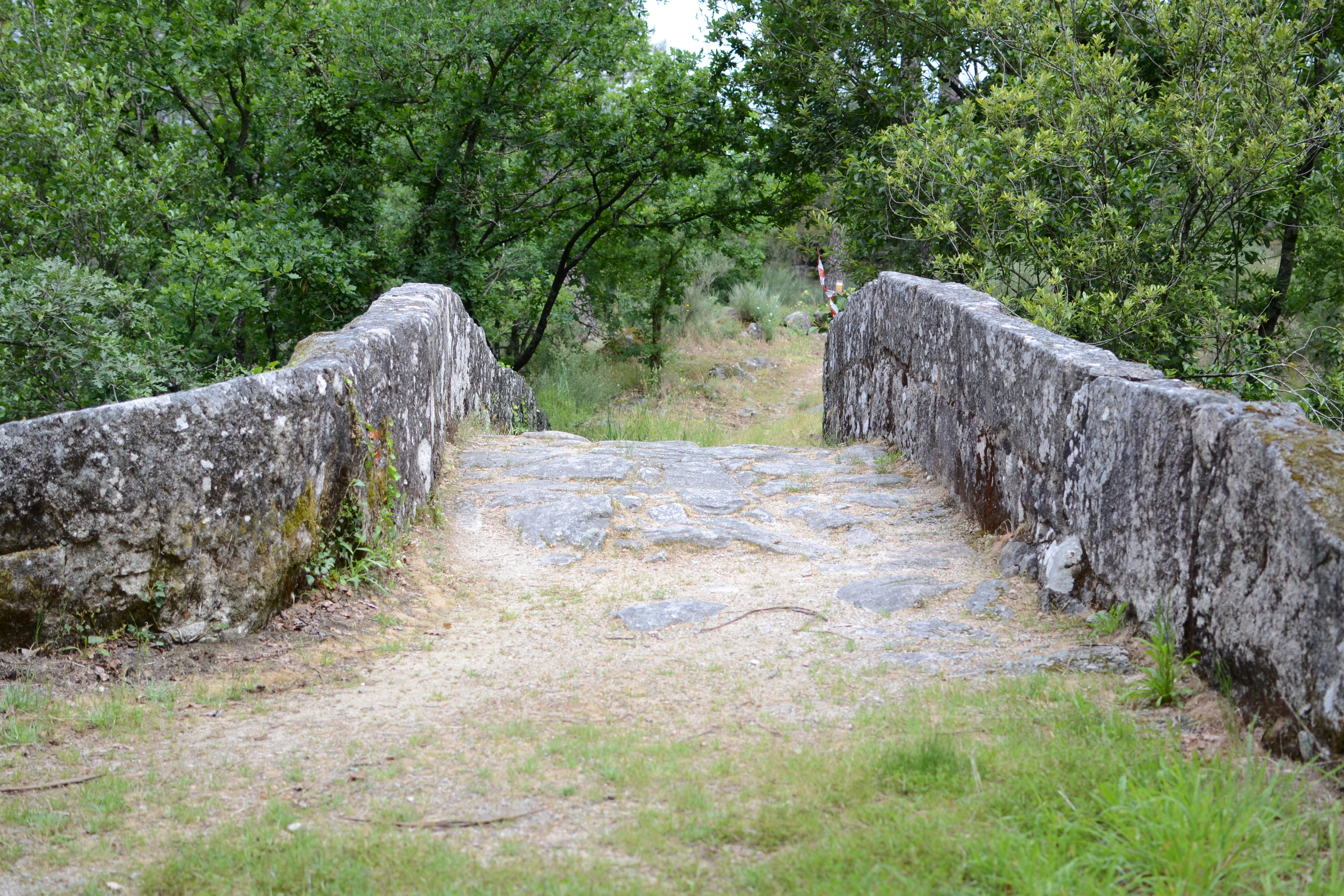
Before leaving the road behind and resuming the trail, it is worth stopping and ploring the Roman remains present in this area. After crossing the bridge, on the right side of the road, some of the milestones of the Roman road found in the surroundings have been placed in an esplanade that serves as a rest area. A few meters further, on the left side of the road, a stretch of the original Roman infrastructure, around one kilometre long, has been rehabilitated. If the traveller wants to keep exploring these archaeological sites, heading south along the Roman road it is possible to see the remains of the bridge that once crossed the Barranco do Castro, which was later replaced by a footbridge.
The trail returns to the forest on the right side of the river, where the traveller will be escorted by leafy trees; the pine trees being left on the other side of the valley. Right after, the trail reaches an intersection that leads to the Corga da Fecha waterfall on the right.
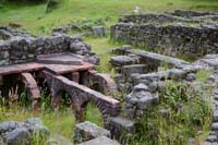
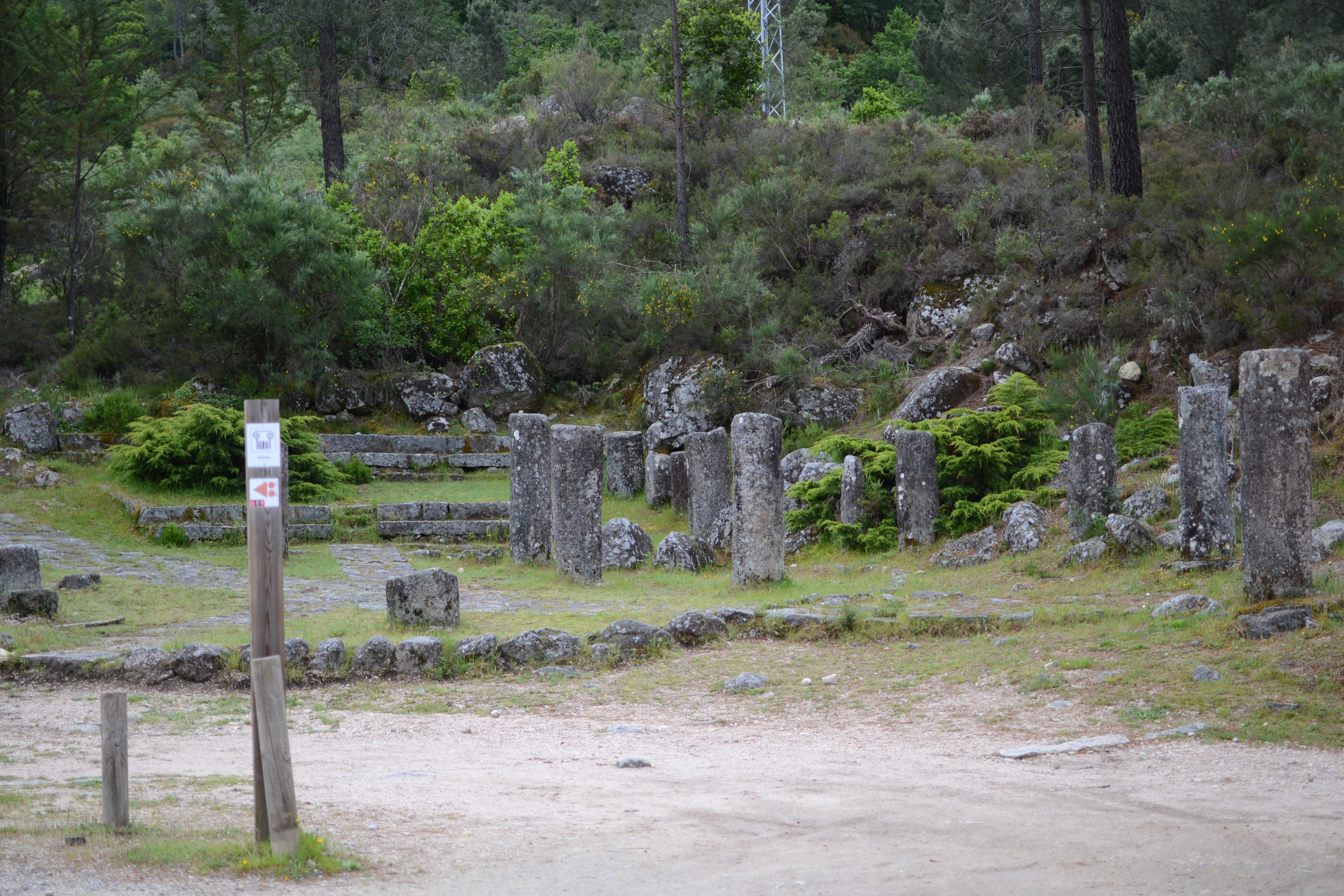
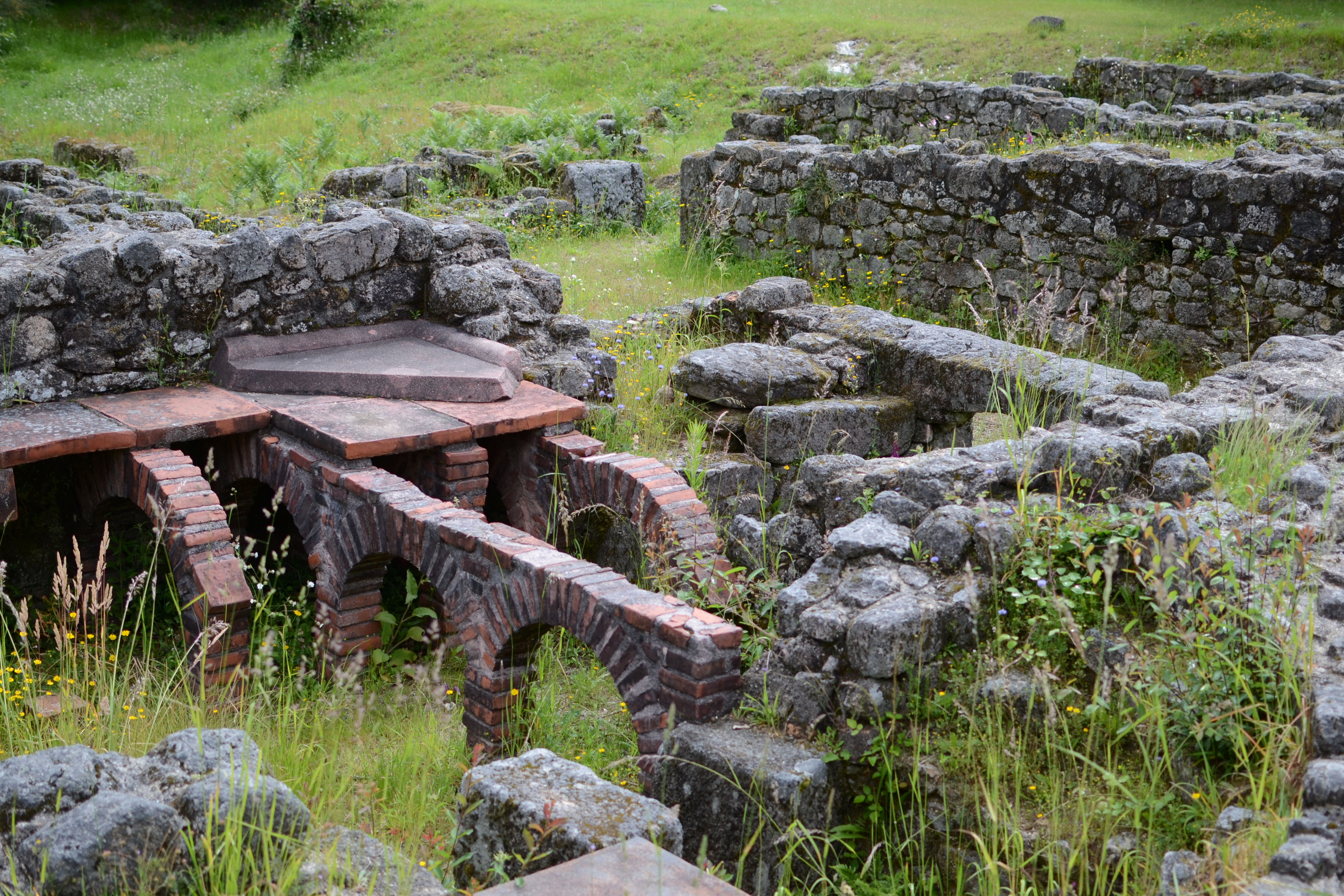
The following remains of the Roman period in this area are the mansio Aquis Originis, located on the left side of the trail. The mansio were a sort of hostels managed by the Roman State where officers and traders used to rest. This is one of the eleven mansio of the Via XVIII, between Braccara Augusta and Asturica Augusta, mentioned in the Antonine Itinerary.
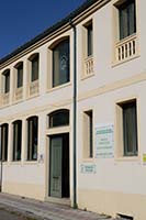
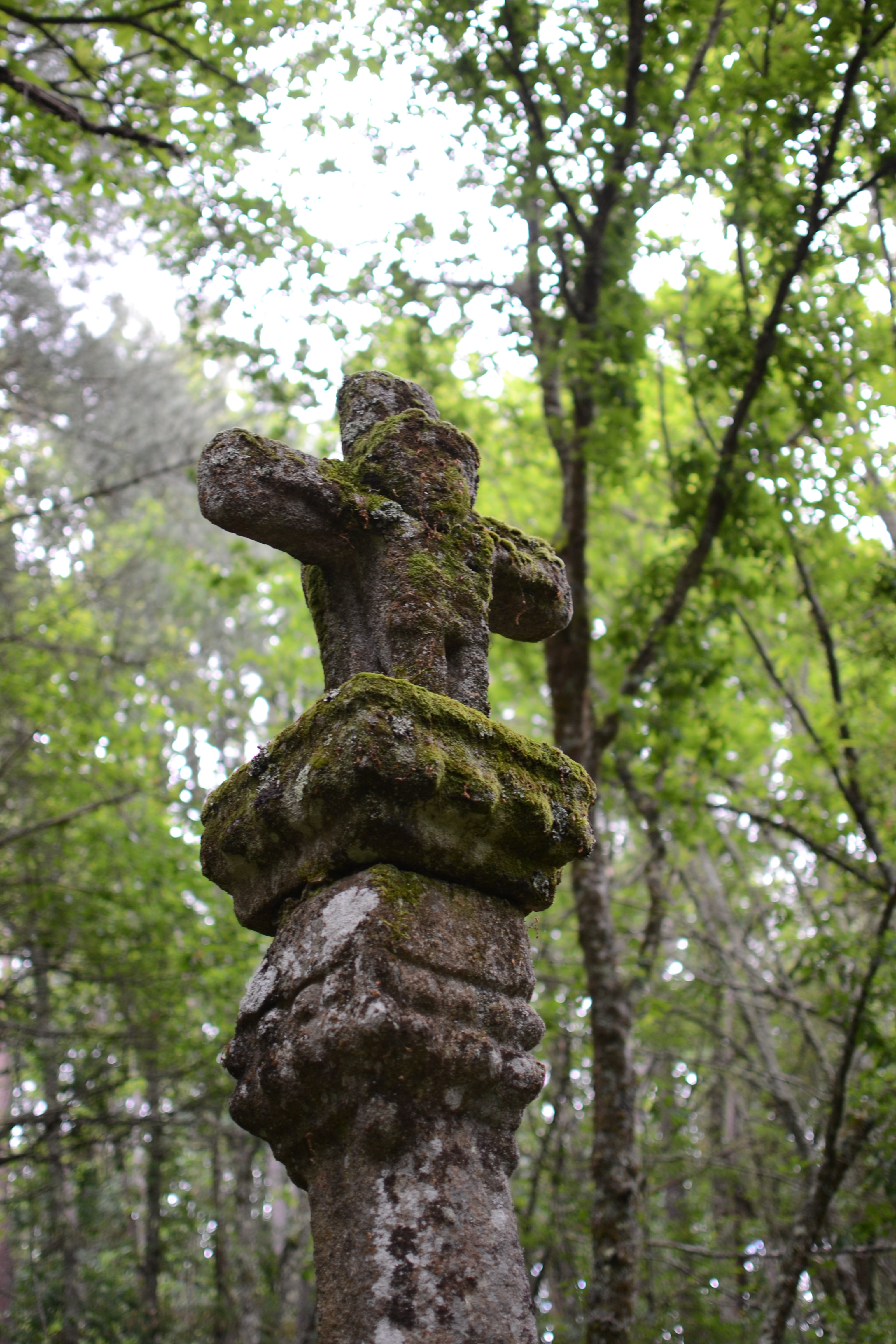
From the parking lot close to these archaeological remains, travellers can access the thermal village of Lobios, where they can visit public thermal baths and an area in the river Caldo suitable for swimming, as well as a hotel and resort (which hosts an exhibition with extensive information about the Via Nova) and different accommodations. After a well-deserved rest in any of these infrastructures, the trail continues through the forest toward Vilameá, within the Council of Lobios. In this stretch, where the trail narrows significantly between stone walls, the traveller will find a beautiful but aged calvary before reaching Vilameá.
Vilameá is the first town visited in this trail; all the municipalities, except for Lobios, have similar features: traditional architecture and narrow, irregular alleys. Vilameá is left behind via the road that leads to the shrine of Nuestra Señora de Xurés, a challenging ascending path which is worth walking up to enjoy the stunning views. However, the trail turns left before reaching the building and shares some meters with the Ruta dos Muiños. This circular path covers different restored mills in the Vilameá riverbed, and our trail accompanies it crossing the bridge of La Devesa (18th century) and passing by one of these restored mills (Muiño da Ponte).
The forest becomes less dense as the trail climbs the hillside to move ahead between brushes for over one kilometre before descending towards road OU-312, which must be crossed by the traveller. On the other side of the road, the trail passes by a calvary and descends slightly between the houses of the town of Lobios before reaching road OU-312, which must be crossed next to a series of hórreos or elevated granaries to continue along the main street of this municipality.
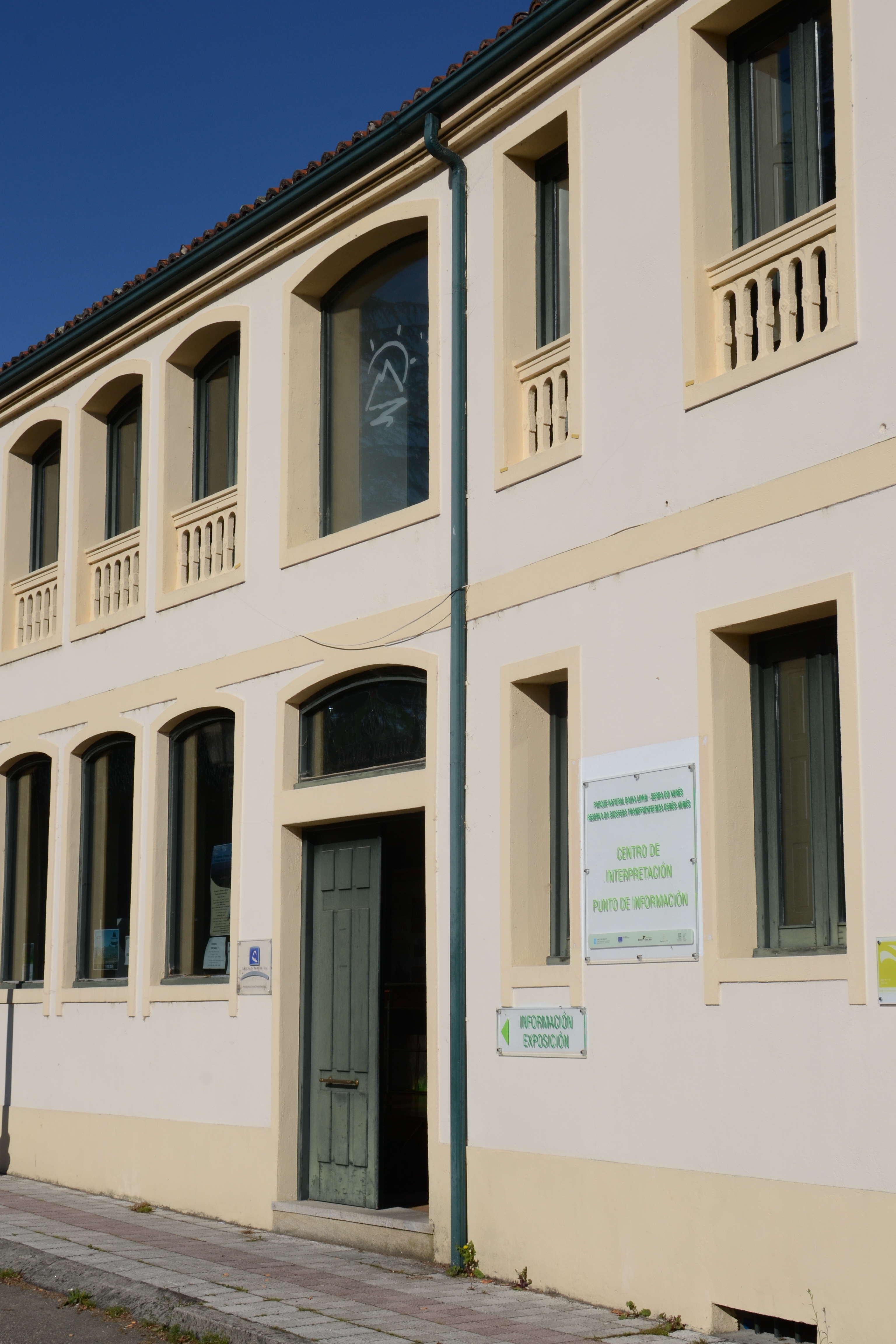
The "porta de Lobios" is an unmissable visit before leaving the town. It is one of the "portas do Xurés": interpretation centres located in the different areas of influence of the Natural Park, each of which is devoted to one special feature of the park; in this case, it explains the local flora. In the second stretch of the trail, the traveller can visit another porta explaining the Roman presence in this area.
From this point, the trail is in the river Limia valley, which will accompany the traveller until the end of the second stretch of this nature trail.
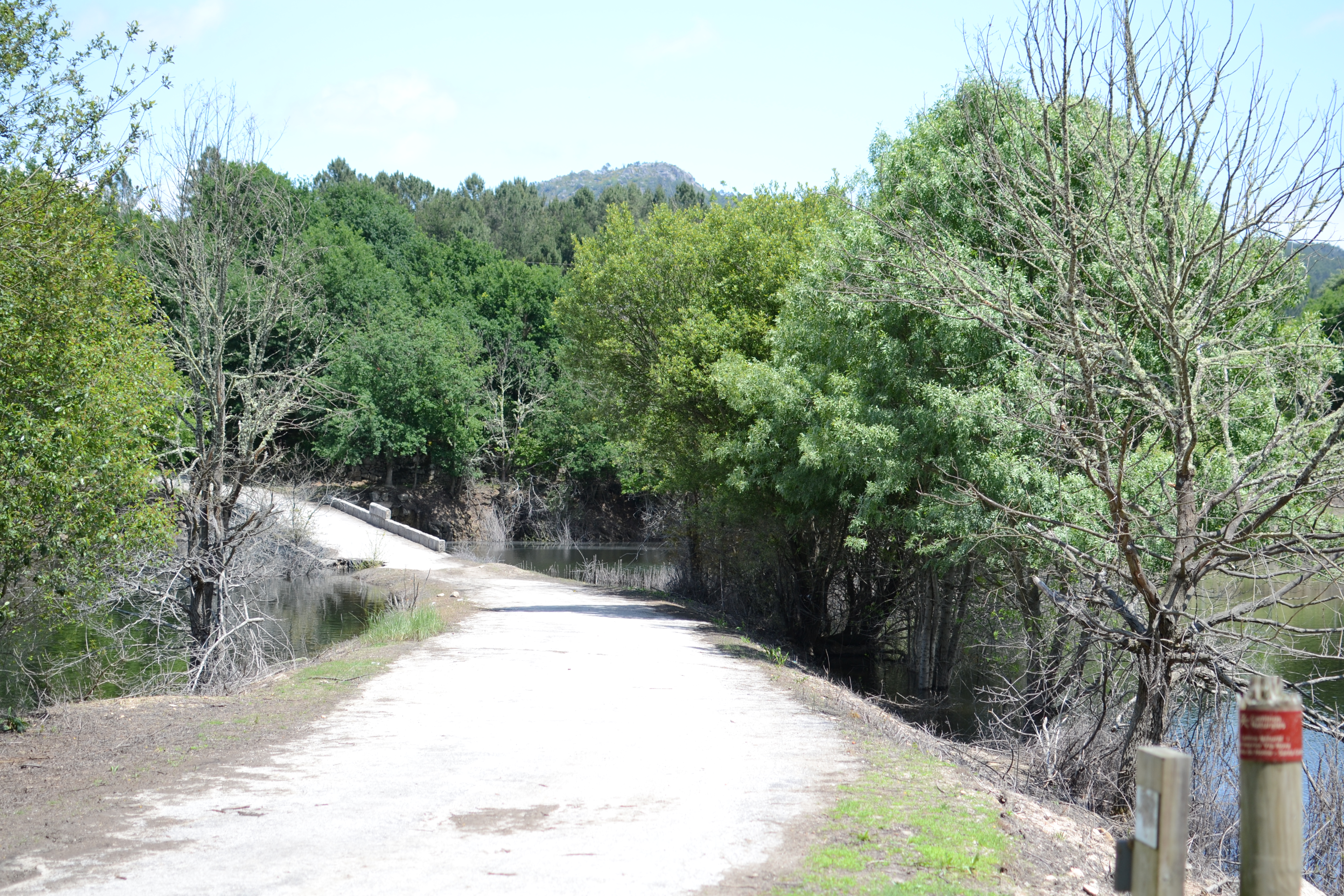
The trail leaves Lobios via the main street and turns right descending towards Ribas de Araúxo, although the town is never really fully entered as the path continues its descent towards the river Cabaleiro. Although the trail crosses a bridge over the river, it can be dangerous when the Lindoso reservoir is full. In that case, passengers can cross the river by continuing along a path that leads to road OU-1202 and crossing a viaduct to return to the trail next to an intersection. If the bridge can be crossed safely, the trail ascends until reaching a calvary next to a series of houses with a special history: the Casa da Feira, which was built in the 19th century in front of the esplanade named after it, where a fair was hosted on the 24th of each month; and the Casa do Aceite, which was built in the same period and had a mill and a wine press. Both buildings were restored between 2007 and 2009 and nowadays they are used for touristic purposes.

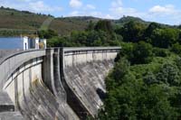
From the aforementioned intersection, the trail continues along road OU-1202 for 800 m, crossing the viaduct over the river Salas (although care must be taken, it is quite safe for pedestrians) and leaving the road behind by turning right towards Ganceiros. After wandering the streets of this town, the trail surrounds the Laxas de Eiroá mount through an area dominated by a pine forest and a granite landscape in the upland areas. The trail reaches Parada de Ventosa, a municipality which can be seen among the pine trees while descending the hillside. After leaving this town belonging to the Council of Muiños, the trail reaches road OU-1202, turns left and passes by a rest area, where the traveller can enjoy the views of the reservoir of Las Conchas. Taking the first house-lined detour on the right, the trail passes over the dam of the reservoir.
On the other side of the dam, the trail crosses road OU-540 and enters a landscape which will be recurrent: narrow paths between stone walls, surrounded by leafy trees that connect different municipalities belonging to the Council of Lobeira. This way, the traveller will pass by Tedós, Ermille, Chaos and Fradalvite and, after walking along a road, they will reach the end of this stretch, located in a parking lot at the entrance of Santa Comba, next to its church and cemetery.
Map
Puntos de Interés
Orografía
Profile
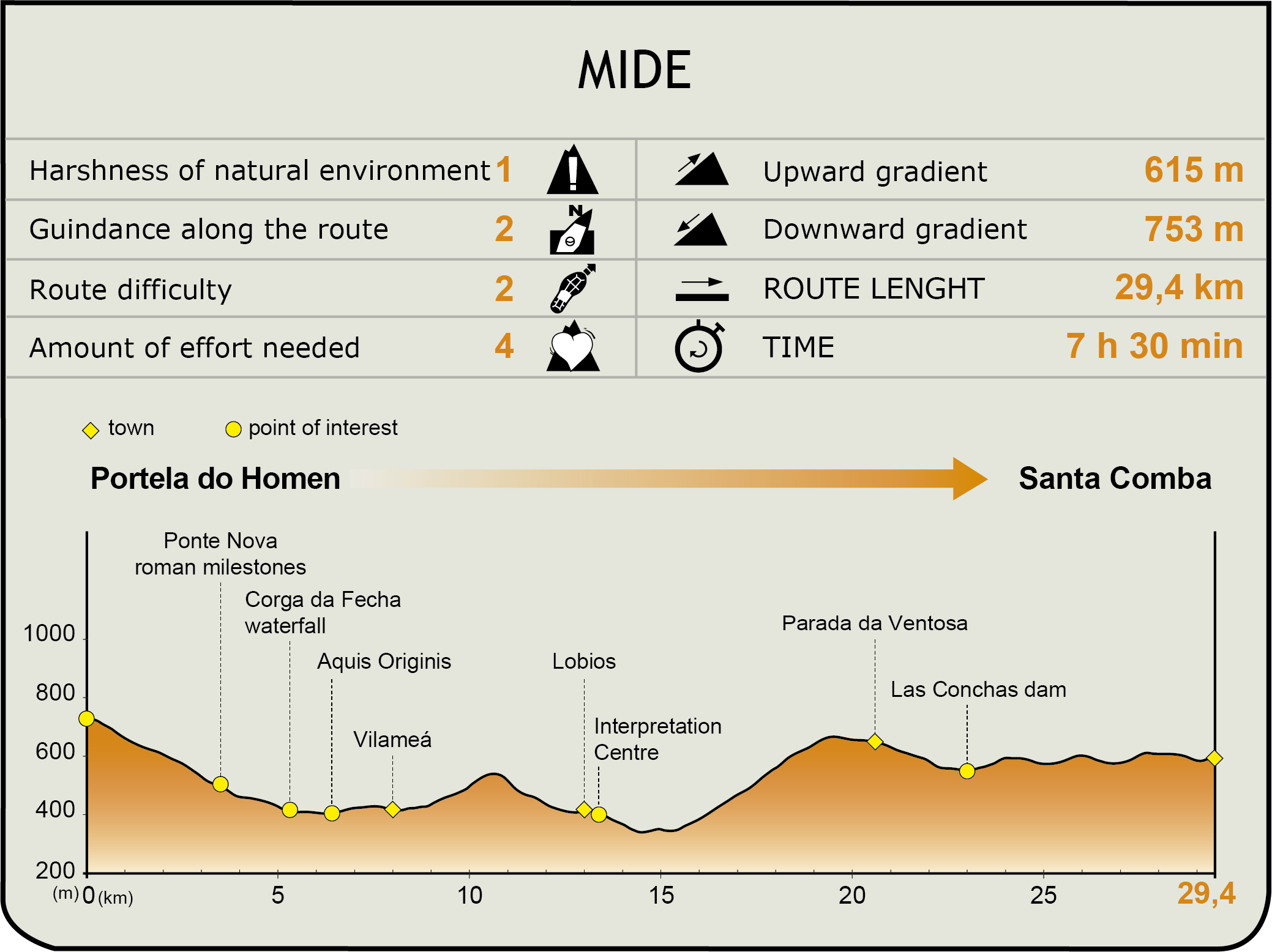
MIDE (Method for the Information of Excursions)
 Harshness of natural environment
- 1. The environment is not risk-free
- 2. There are more than one risk factors
- 3. There are various risk factors
- 4. There are quite a lot of risk factors
- 5. There are many risk factors
 Guidance along the route
- 1. Well defined trails and crossings
- 2. There is a clearly marked trail and signage
- 3. Requires the identification of geographic features and cardinal points
- 4. Requires off-path navigation
- 5. The trail is interrupted by obstacles that have to be gone around
 Route difficulty
- 1. Walking on a flat surface
- 2. Trails with different types of path
- 3. Walking on stepped paths or irregular terrain
- 4. The use of hands or jumping over the terrain is necessary
- 5. The use of hands is required to progress
 Amount of effort needed
- 1. Up to 1 hour of continuous walking
- 2. Between 1 and 3 hours of continuous walking
- 3. Between 3 and 6 hours of continuous walking
- 4. Between 6 and 10 hours of actual walking
- 5. More than 10 hours of continuous walking
Featured
Further information
The Roman Vía Nova
The Vía Nova Nature Trail takes its name from one of the Roman roads of the Iberian Peninsula, in the province of Lusitania, subsequently known as Gallaecia. It is the Via XVIII, which connected the cities of Bracara Augusta and Asturica Augusta, currently known as Braga (Portugal) and Astorga (province of León), respectively.
With a length of 215 miles (around 325 km), it was built during the Flavian dynasty, at the end of the 1st century AD, and it was inaugurated in the year 79 by Caio Calpetano Rantio Quirinial Festo, when Titus was the Emperor and his brother Domition was the Caesar, as reflected in the inscriptions of the milestones located along the trail.
This road had eleven mansio or resting places along its route: Salaniana, Aquis Originis, Aquis Querquennis, Geminas, Salientibus, Praesidium, Nemetobriga, Foro,Gemestario, Bergidum and Interamnium Flavium, some of which (whether authentic Roman remains or their theoretical location) can be visited during the course of this nature trail.
Network of Portas of the Baixa Limia-Serra do Xurés Natural Park
The unique biological and landscape characteristics of the Baixa Limia-Serra do Xurés Natural Park led to the protection of this area in 1993 by virtue of Spanish Law 4/1989 on the conservation of natural habitats and wild fauna and flora.
This 20,920-hectare park stretches from the south of the province of Ourense, along the border with Portugal, parallel to the Portuguese Peneda-Gêres Natural Park. The connection of the values from both parts led to the declaration of the Gerês-Xurés Transboundary Park as a Biosphere Reserve in 2009.
Among the special features of this Natural Park, it is worth mentioning its variety of ecosystems: alluvial valleys, deciduous forests, peatlands, scrubland and hill meadows, among others. The significant number of endemic species present in their habitats is also noteworthy. Apart from its recognised natural and landscape value, this area has an interesting historical, artistic, ethnographic, gastronomic and, in general, human background which increases the value of this region.
The network of Portas of the Baixa Limia-Serra do Xurés Natural Park reflects the value that has been attributed to the region by means of six thematic interpretation centres. The Portas are located in the six municipalities which serve as a gateway to the Natural Park – Bande, Calvos de Randín, Entrimo, Lobios, Lobeira and Muíños.
These centres welcome the visitors, each of them offering specific information about the features of this natural area. The Bande centre addresses the history of the region through archaeology in a space that is also used as a in interpretation centre of the Aquis Querquennis site; in Calvos de Randín, travellers can learn the history of Couto Mixto, a particular territory between Spain and Portugal which was independent from both kingdoms until 1864; the Entrimos centre is responsible for explaining the geology and the processes that have shaped the relief of the Park; Lobeira is the headquarters of the centre dedicated to ethnography, due to the relation between this municipality and the historian and ethnographer Xaquín Lorenzo Fernandez; the porta of Lobios focuses on the interpretation of the flora of the Natural Park; and finally, the Muiños centre explains the close link between the water, the Park and the people from the Baixa Limia region.
Multimedia

Downloads
GPS Downloads
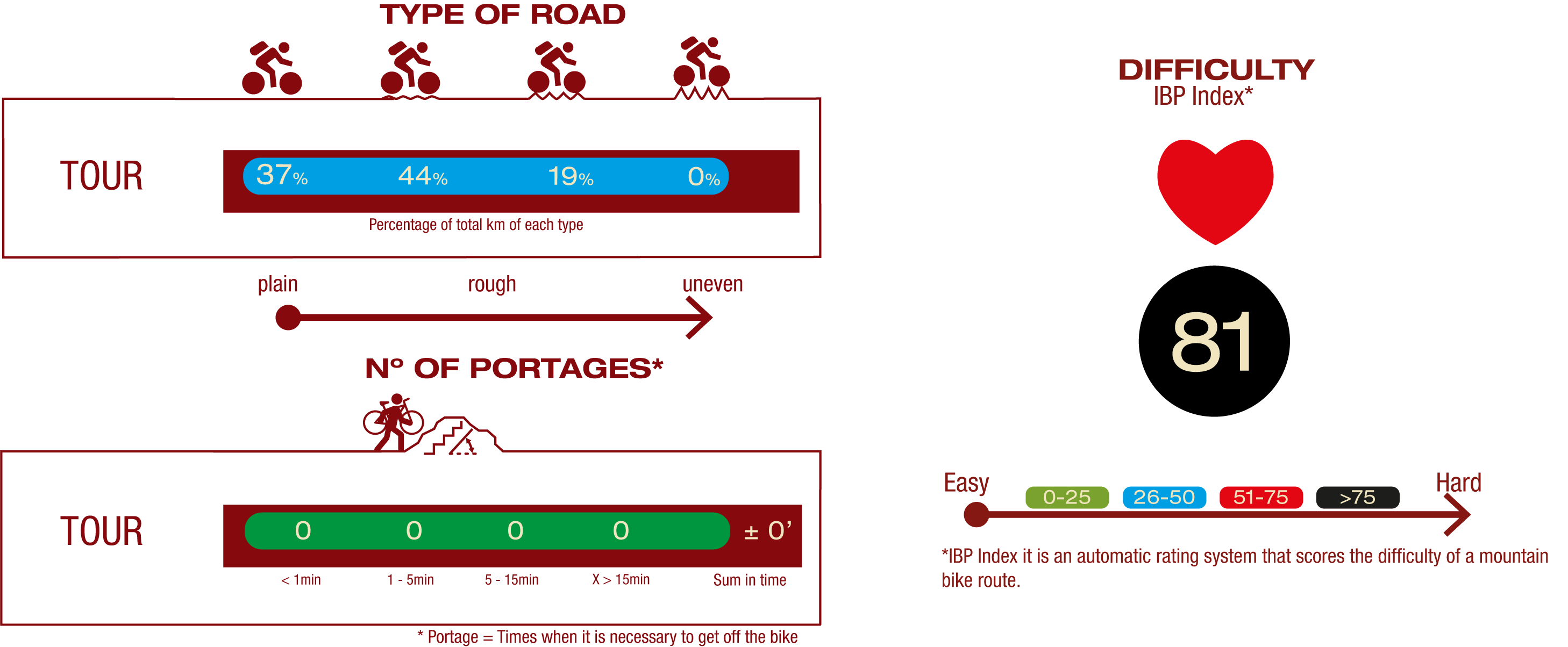
Cyclability
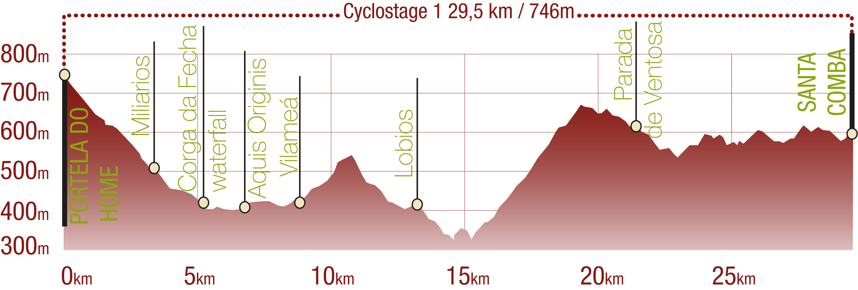
PROFILE
TYPE OF ROAD, PORTAGES & DIFFICULTY
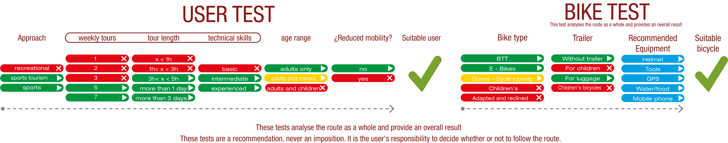
TEST
SAFETY RECOMMENDATIONS
- Sections shared with hikers.
- Transit through the centre of some population centres.
GENERAL RECOMMENDATIONS
- Find out about the technical aspects of the route and the weather on the day.
- Take care of the environment. Take care not to disturb animals or damage vegetation. Respect private areas.
- You must give priority to pedestrians and comply with general traffic rules.
- The environment in which you will be riding is open, free to move around and an area where many activities are carried out (sporting, forestry, livestock and agricultural activities). Always have an understanding, prudent, responsible and respectful attitude.