- Home
- Rural Development
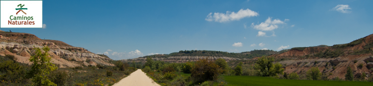
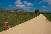
- Nature Trails
- Nature Trails
- Northwest Sector
- Santander-Mediterráneo
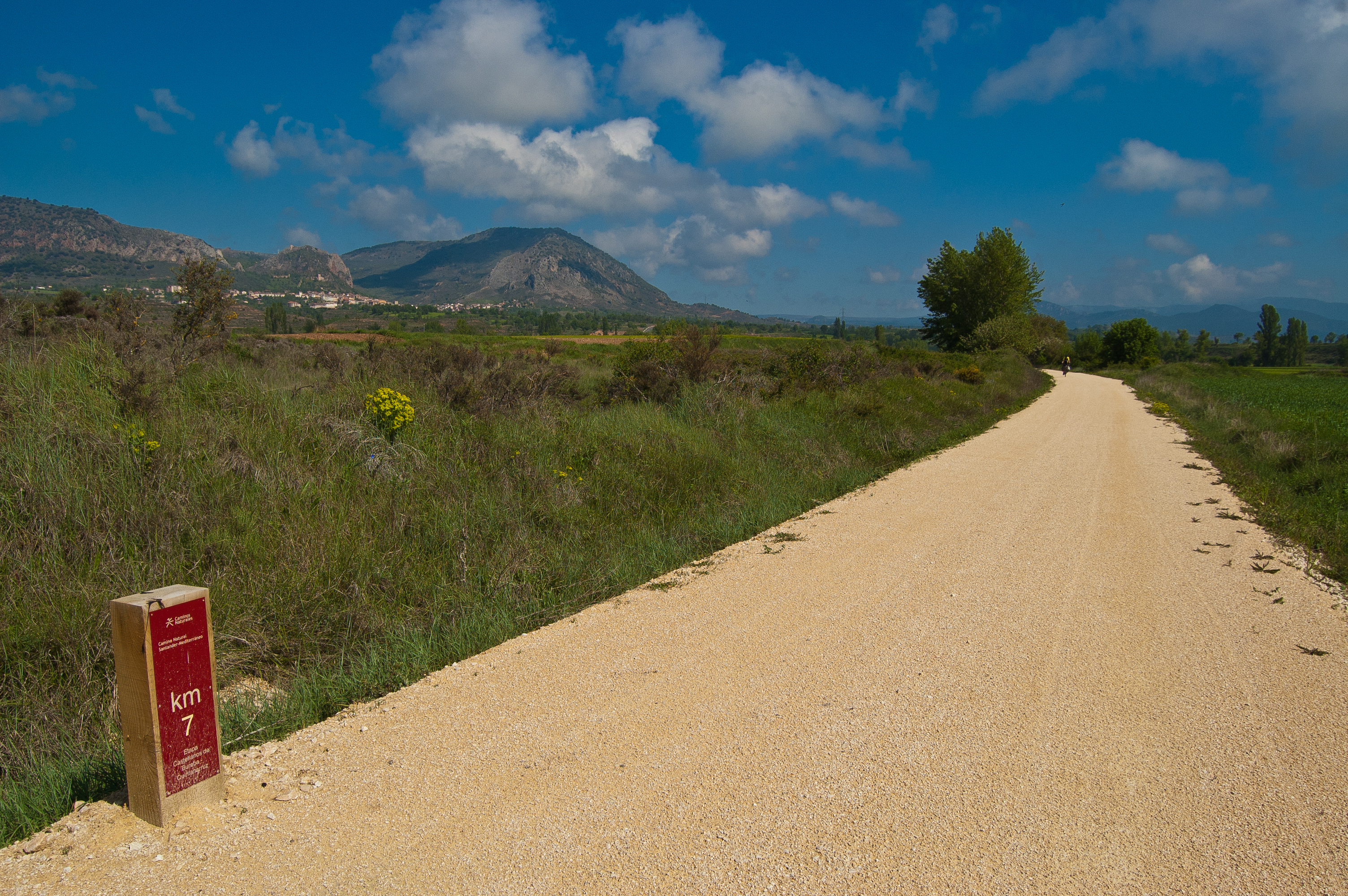
Santander-Mediterráneo Nature Trail. Castellanos de Bureba-Quintanilla Vivar section
Description
This old railway line runs among the valleys of the River Homino and the River Ubierna.
The province of Burgos is home to this double section of the old Santander - Mediterranean Sea railway route. The River Homino is the first travel companion; and by its side the town of the unforgettable naturist Félix Rodriguez de la Fuente is visited. Afterwards, the extraordinary Valle de Las Navas can be enjoyed, and the River Ubierna accompanies the traveller in the land of El Cid.
The itinerary starts 300 m from the town of Castellanos de Bureba (Burgos), where the Santa Lucia church offers unbeatable views, highlighting the cherry fields with the famed culinary value of this fruit. The route advances with the River Homino to the right, which snakes with its characteristic riverside woodland, with Riberas del Río Oca and tributaries being protected in its basin as a Site of Community Importance.
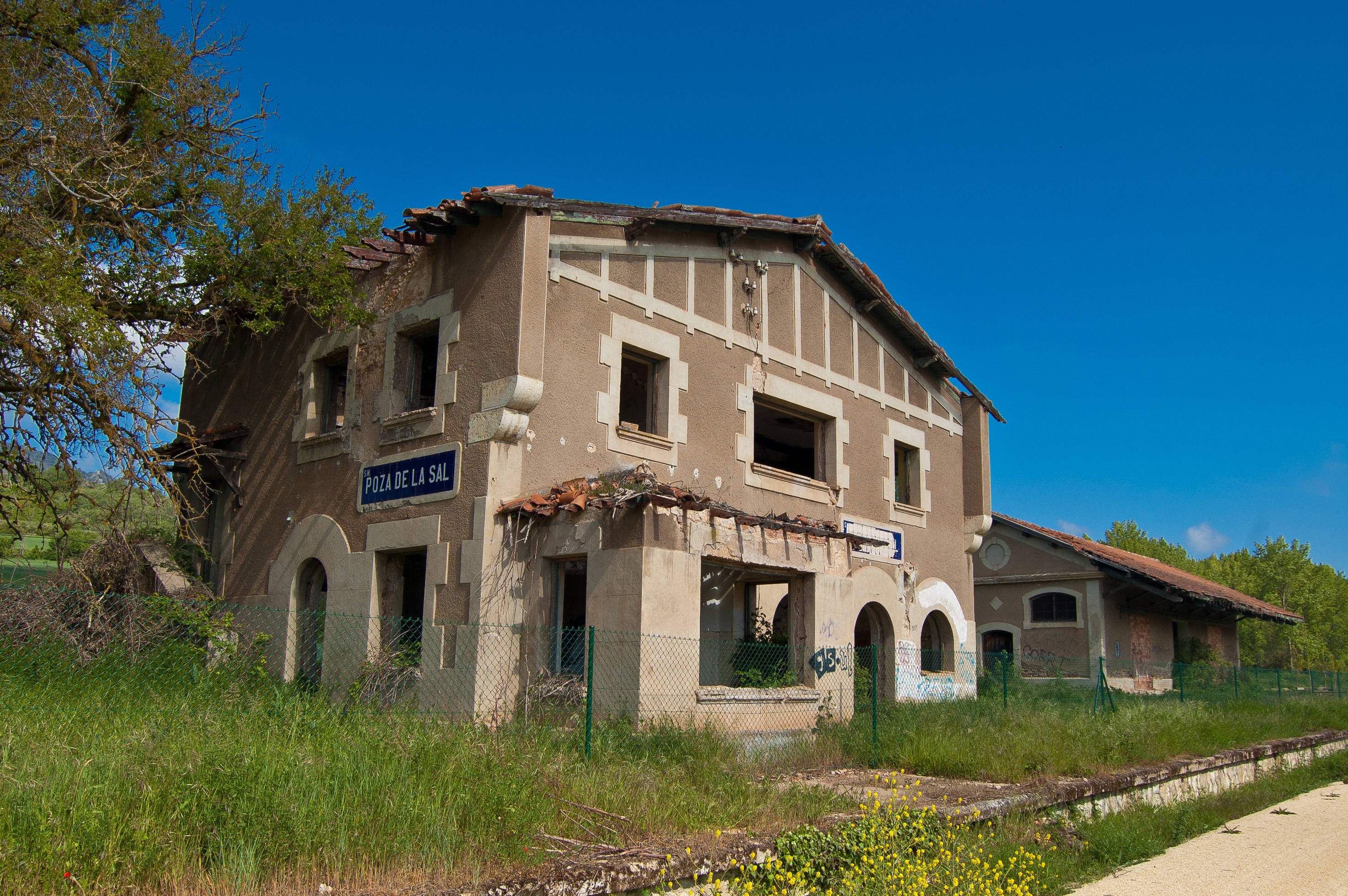
Not long after passing kilometre point two, a crossing is reached through which the town of Salas de Bureba can be reached, and the Rest Area can be found on the other side of this town. Once on the Nature Trail again, it leads south, heading parallel to road BU-P-5028. With said road on the right and the River Homino on the left, the old station of Poza de la Sal is reached, with its Rest Area next to the warehouse.
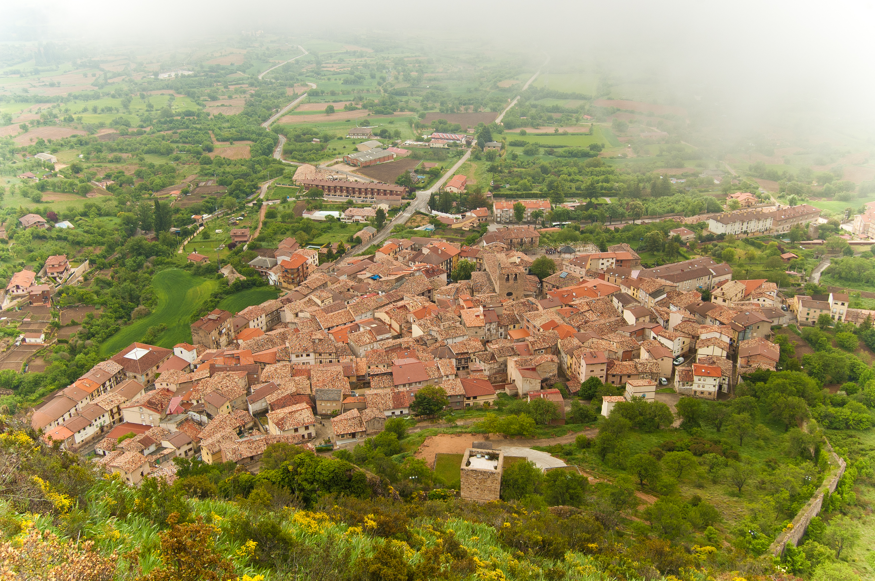
Metres prior to kilometre point 5, care must be paid when crossing road CL-633, to then reach the kilometre point leaving the Nuestra Señor Virgen de Pedrajas sanctuary-hostel on the left. Coinciding with kilometre point 6, road BU-V-5103 is crossed and an interpretation panel portrays the proximity to the beautiful town of Poza de la Sal, birthplace of the unforgettable naturist Félix Rodriguez de la Fuente, less than two kilometres away.
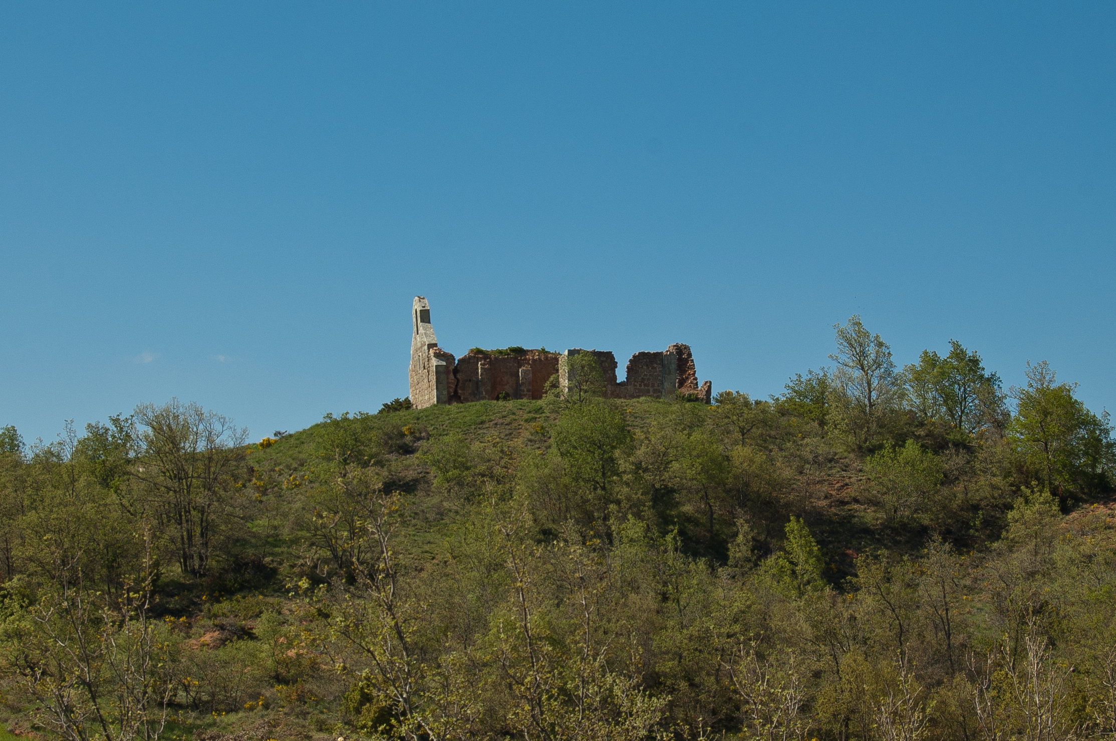
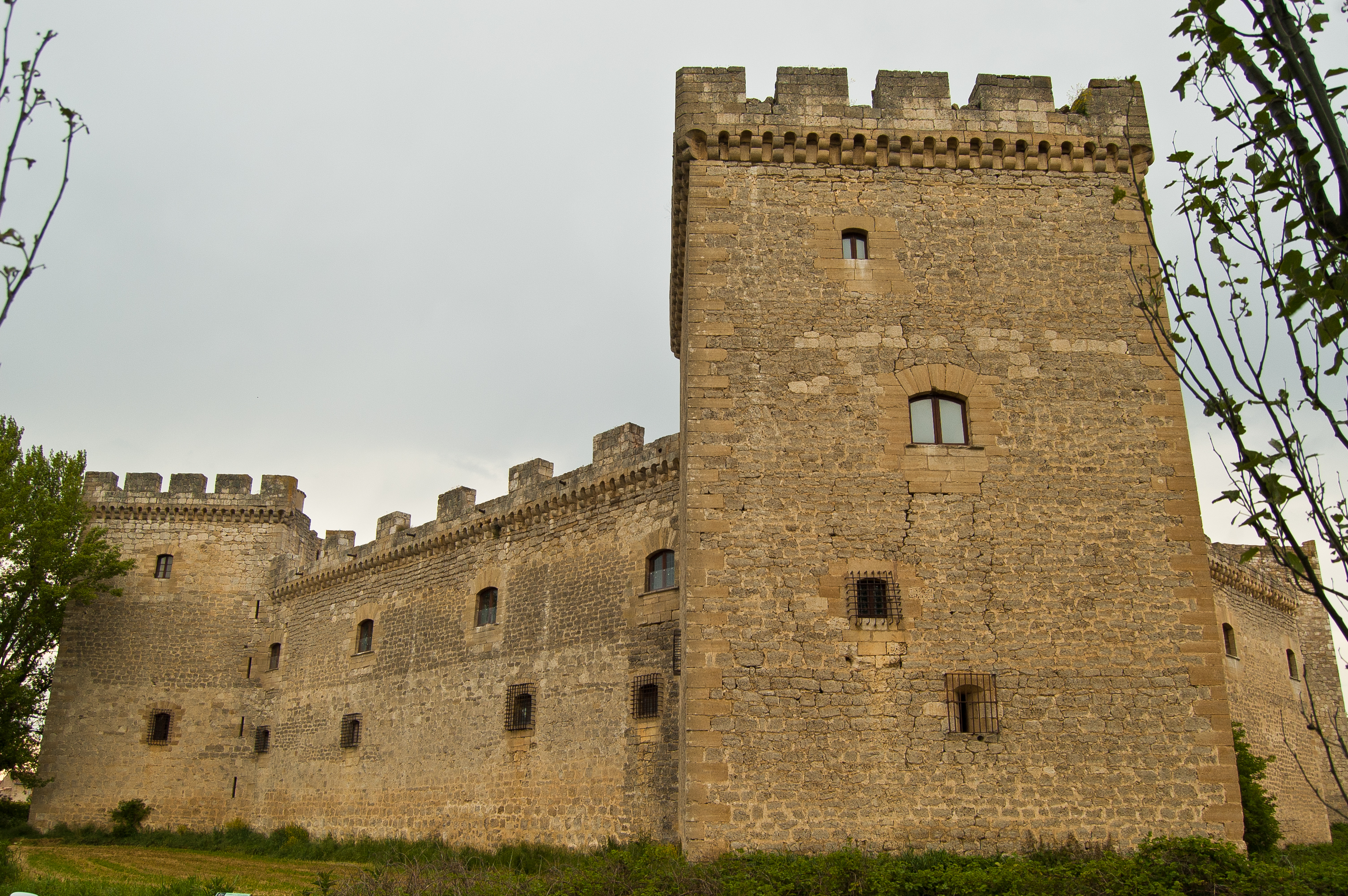
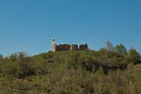
The views of the mountain range with the Castle of Rojas and Poza de la Sal on its slopes provoke the traveller to cast their gaze behind them for various kilometres. After passing kilometre point 9, the old Lences de Bureba stop is reached and soon after road BU-V-5021 is crossed, care must be taken here, and the town of Lences de Bureba is passed on the left. Highlights of said town include its medieval bridge and the church of Santa Eugenia.
Leaving the town behind, the path is lined with cereal crops and the River Homino is ever-present, leading quietly along a remarkable landscape where erosive processes take the limelight.
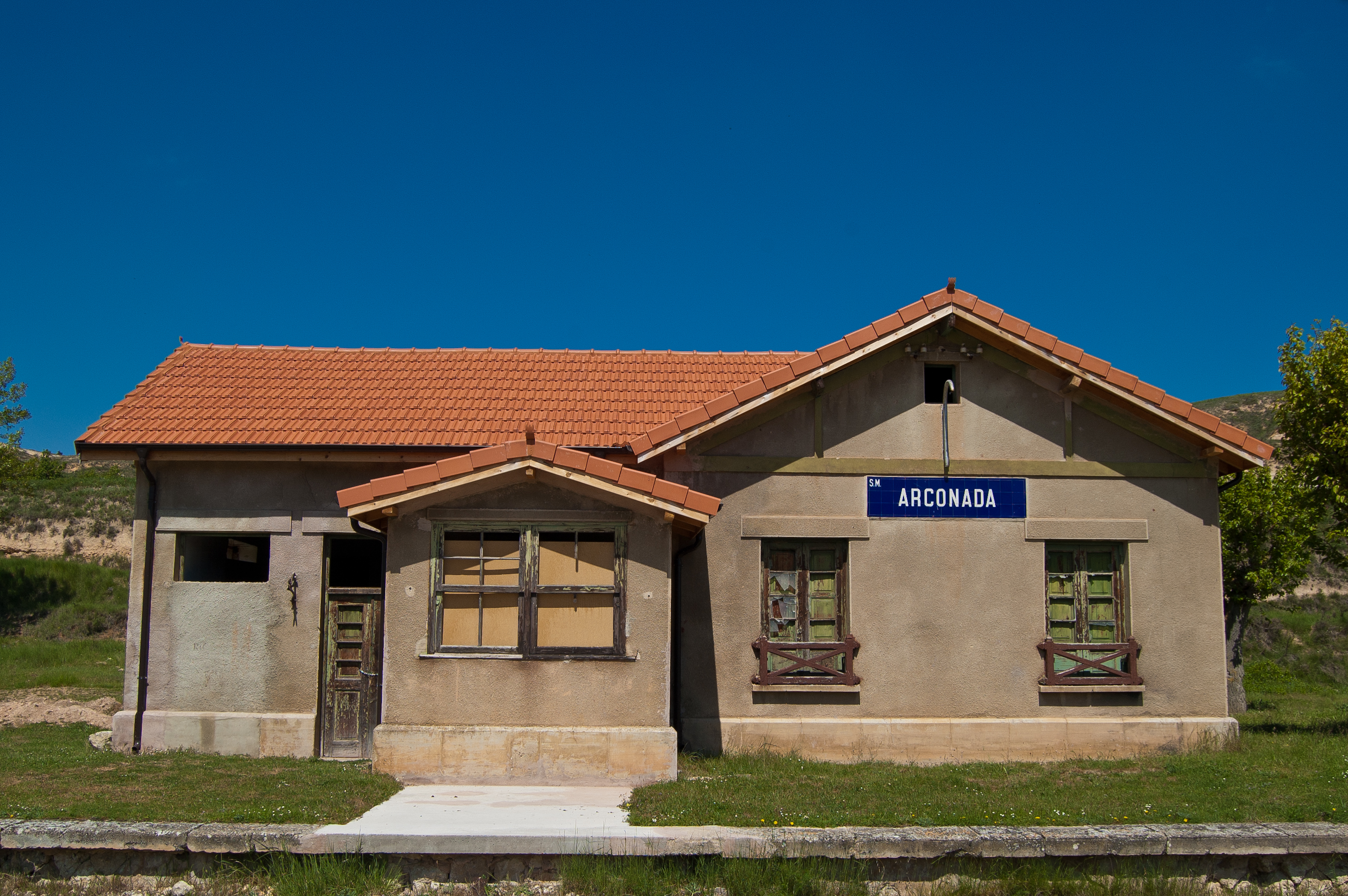
After kilometre point 13, the Rest Area at the Arconada stop allows the traveller to take a break. The building has been reformed and is in a good state of conservation. A few metres later, on the left of the route, the town of Arconada welcomes the traveller with the church of Santa Eulalia dominating the landscape.
The traveller delves fully into Valle de Las Navas, and as the kilometres advance they are able to enjoy the various colours offered by the different layers that have come to light after large erosive processes. The beauty and calm breathed in the valley of the encased River Homino cause the walker to experience a pleasurable feeling of isolation and disconnection from the worldly noise.
The old railway route turns various times to the left and right with a wide and characteristic turn radius, with kilometre point 20 being reached slightly after the town of Lermilla, with the Rest Area of the same name prior to this. After passing the River Homino and crossing the road via which the town is accessed, the old Lermilla-Quitanarruz stop is reached. Shortly afterwards, kilometre point 21 is reached and finally, before entering the town of Quitanarruz the first part of the route from Castellanos de Bureba to Quintanarruz comes to an end.
Continuing from the same point, kilometre point 0 marks the beginning of this second part, fittingly passing through the town of Quintanarruz along the street called La Vía. After leaving the town, the route heads south where the cork oak forests are increasingly more abundant.
On the top of a small headland stand the ruins of what was once the Shrine of Nuestra Señora de los Ángeles, and shortly afterwards a wooden bench enables for the botanical richness of the River La Molina to be enjoyed. After passing kilometre point 4, the town of Cobos Junto a La Molina can be seen, with its church of San Torcuato being the most notable building.
Continuing comfortably the kilometres pass by, until reaching a small Rest Area at La Molina de Ubierna, where a well-deserved break to regain strength can be taken. After passing kilometre point 7, the church of San Román can be seen. This is where various scenes of the Passion of Jesus take place, performed by the residents of La Molina de Ubierna on Good Friday. At the crossroads that provides access to the town, there is an interpretation panel that invites visitors to visit said town.
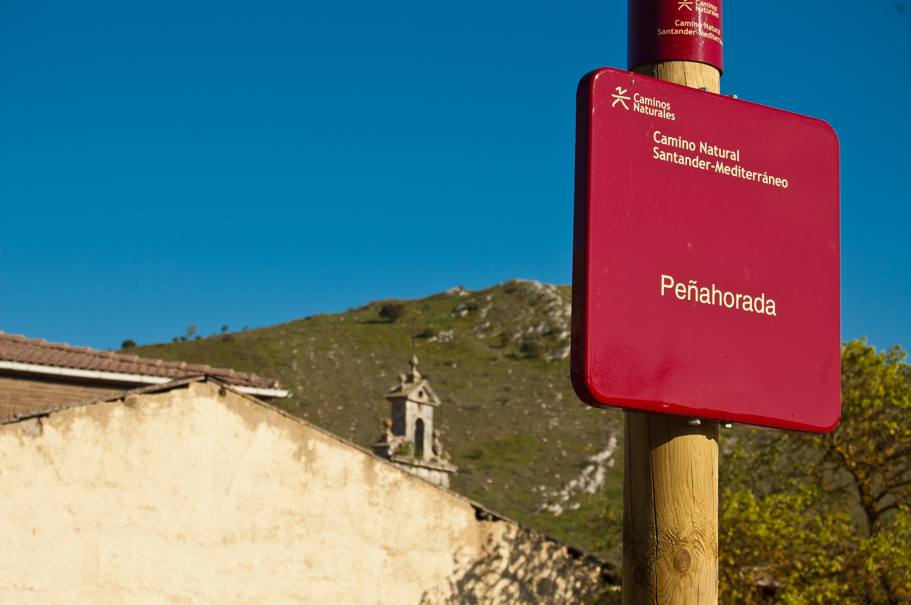
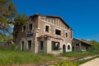
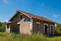
The route continues without large shocks, until the old gatekeeper booth is reached, which has these days been converted into housing, just before the CL-629 road crossing, where care must be taken. Not long afterwards the town of Peñahorada is reached, and there is another Rest Area here. Around kilometre point 11, the traveller reaches the old station of Peñahorada, where the passing of time is noticeable just by observing its current state.
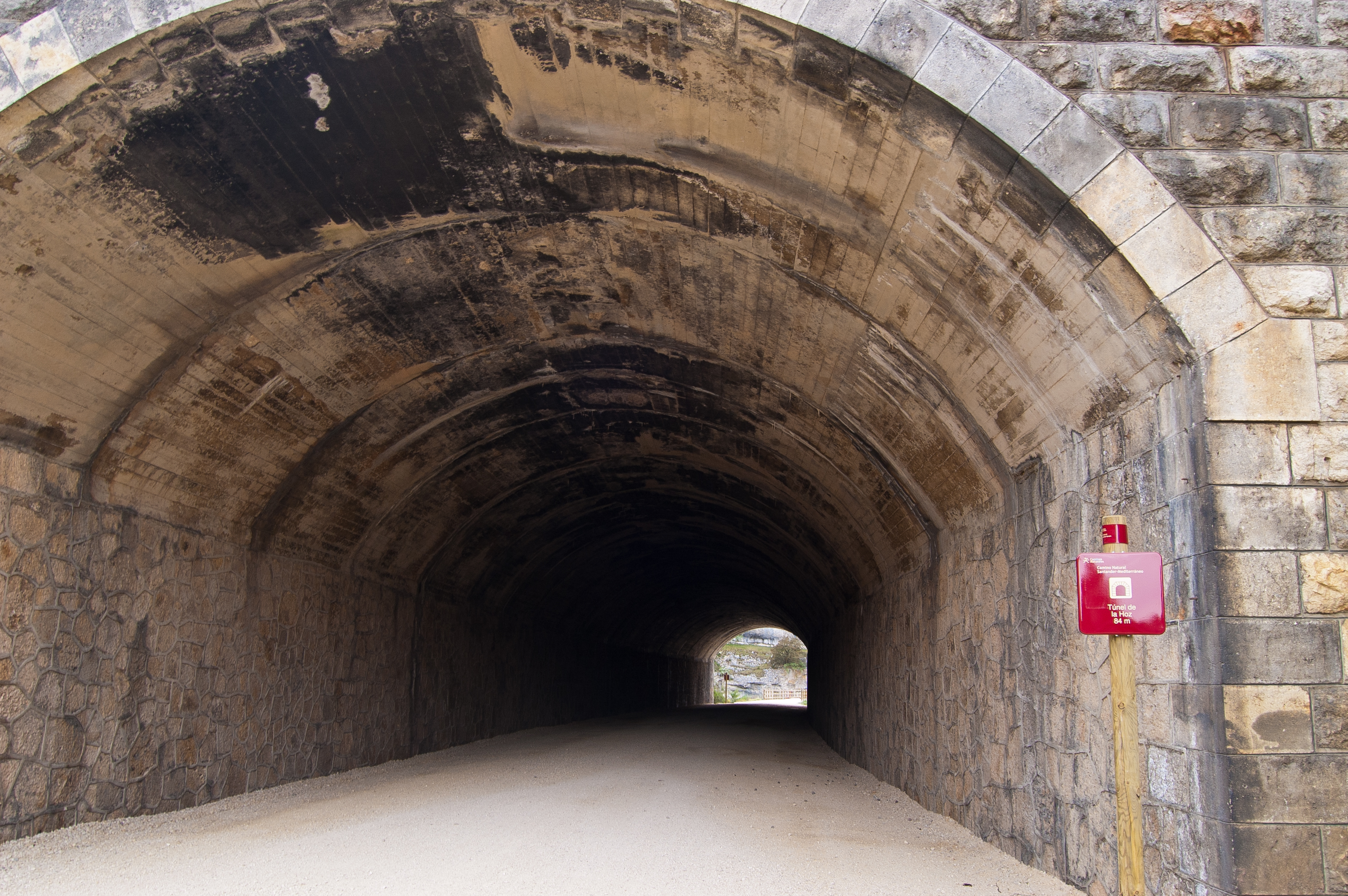
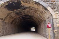
The route continues in parallel to road CL-629, leaving an old mineral loading bay in a good condition on its left. Not long after passing kilometre point 12, the Callejón tunnel (120 m) and the La Hoz tunnel (84 m) are reached. Due to their short lengths, they do not have artificial lighting and thus it is recommendable to enter with a torch. Immediately afterwards, road CL-629 is crossed via an elevated bridge for this purpose and little by little the rocky massif in which the scrubland of evergreen oaks populate its slopes are left behind.
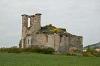
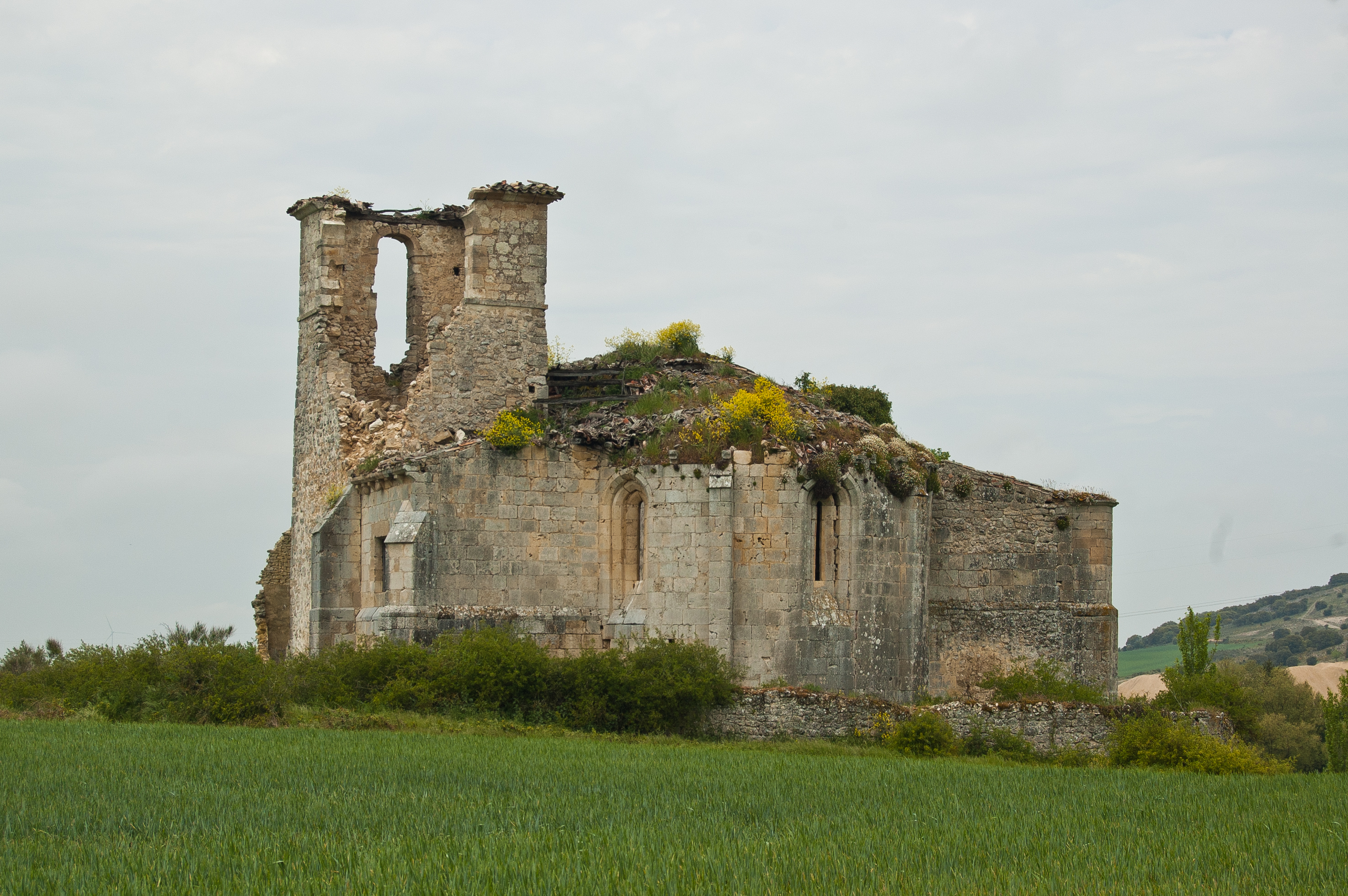
The ruins of the Gothic church of La Mota precede the old Villaverde Peñahorada stop, both to the left of the route. The rain-fed cereal crops and the plains take the limelight as road BU-V-5008 is crossed, with care being taken.
After passing kilometre point 16, a bridge crossing the River Ubierna is taken, with this being the prelude to the travellers’ entrance to Sotopalacios. The castle of Los Adelantados is particularly noteworthy in this town, as is, from a culinary perspective, the preparation of morcillas (black pudding).
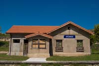
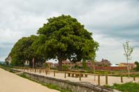
The old railway route is left momentarily upon reaching the town, advancing along the path parallel to road N-623 (from Burgos-Santander inside the urban nucleus). This road is crossed via the traffic light controlled pedestrian crossing. Shortly afterwards, a right turn is taken to get back onto the old railway route at the old Sotopalacios station, where two large horse chestnut trees (Aesculus hippocastanum) enable for strength to be regained at the Rest Area.
The town is left among cropland, leaving behind the trail that provides access to Quintanilla Vivar, located less than 1 km from the Nature Trail. Road A-73 is passed via an underground subway, and the old railway route is taken again, crossing the River Ubierna once again by means of the corresponding bridge. Without further ado, kilometre point 22 is reached, carefully crossing road BU-V-6279 that leads to Sotragero, and shortly afterwards finding the interpretation panel that puts an end to this double section of the Santander-Mediterranean Sea Nature Trail between Castellanos de Bureba-Quintanarruz and Quintanarruz-Quintanilla Vivar.
Map
Puntos de Interés
Geología
Hidrografía
Orografía
Profile
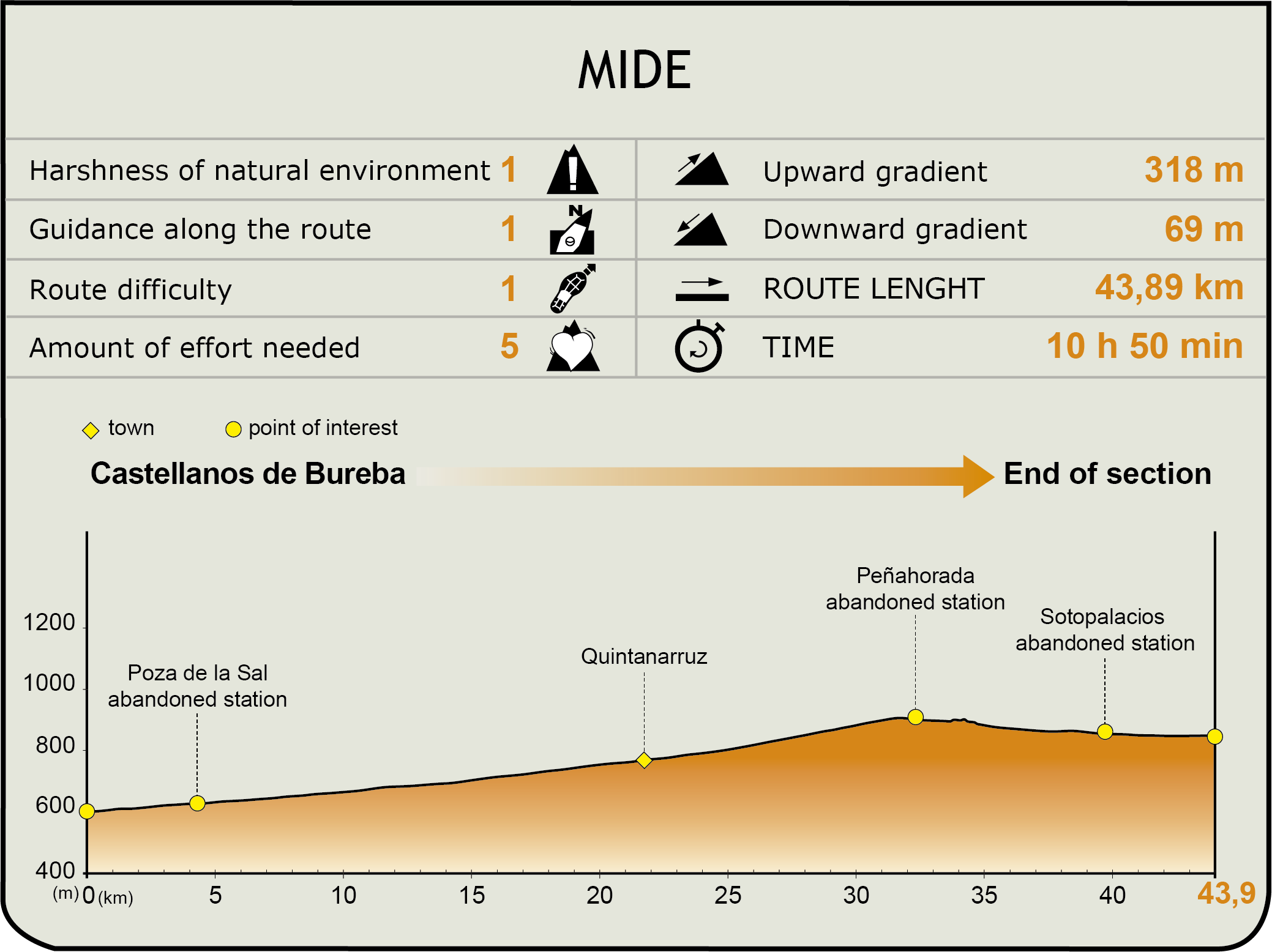
MIDE (Method for the Information of Excursions)
 Harshness of natural environment
- 1. The environment is not risk-free
- 2. There are more than one risk factors
- 3. There are various risk factors
- 4. There are quite a lot of risk factors
- 5. There are many risk factors
 Guidance along the route
- 1. Well defined trails and crossings
- 2. There is a clearly marked trail and signage
- 3. Requires the identification of geographic features and cardinal points
- 4. Requires off-path navigation
- 5. The trail is interrupted by obstacles that have to be gone around
 Route difficulty
- 1. Walking on a flat surface
- 2. Trails with different types of path
- 3. Walking on stepped paths or irregular terrain
- 4. The use of hands or jumping over the terrain is necessary
- 5. The use of hands is required to progress
 Amount of effort needed
- 1. Up to 1 hour of continuous walking
- 2. Between 1 and 3 hours of continuous walking
- 3. Between 3 and 6 hours of continuous walking
- 4. Between 6 and 10 hours of actual walking
- 5. More than 10 hours of continuous walking
Featured
Further information
Poza de la Sal
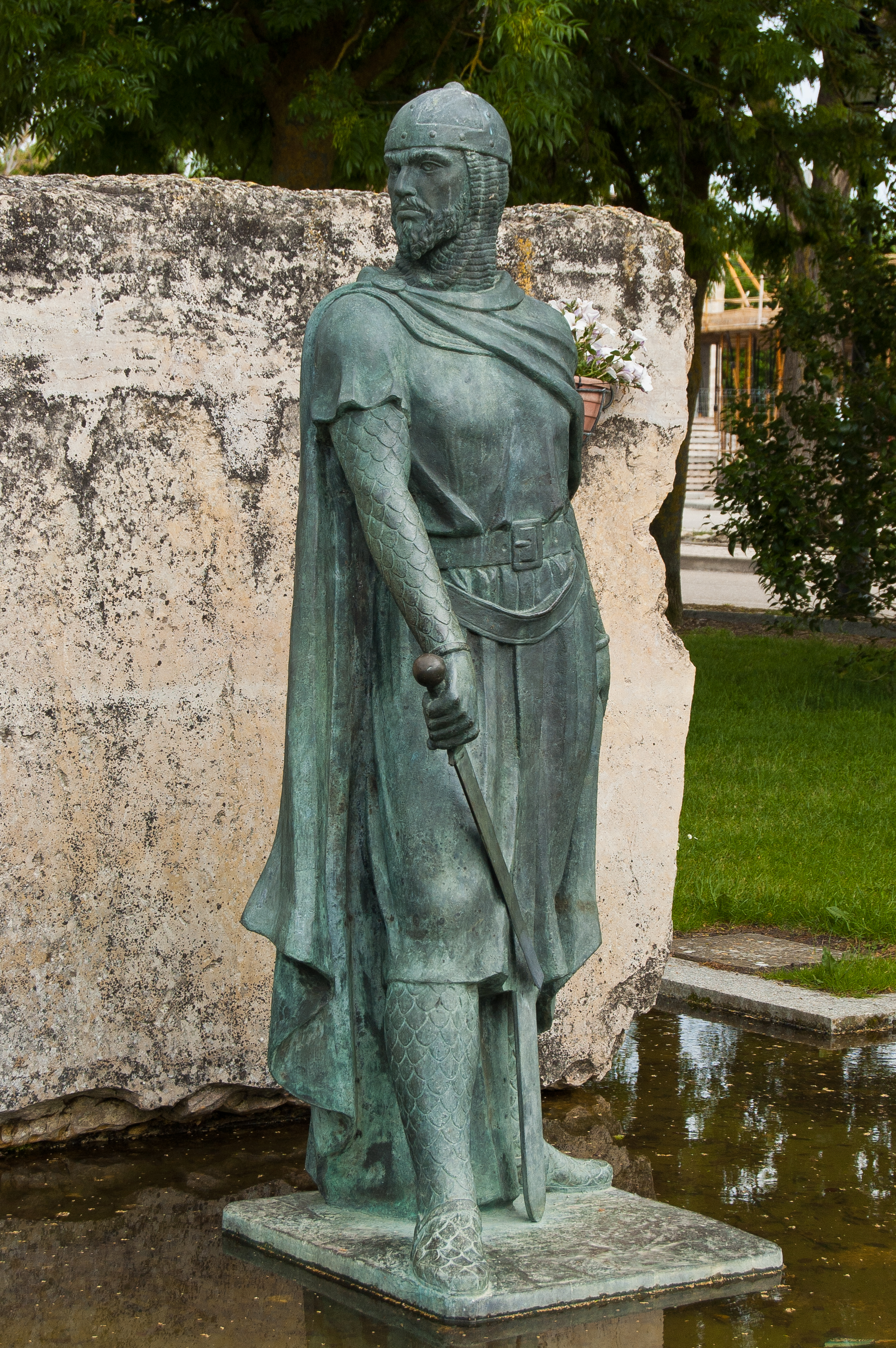
The English translation of this town in Burgos is “Salt Pond”, and as its name suggests, its history is linked to salt extraction activities. Traces of Neolithic settlements provide suspicion of rudimentary salt extraction activities. The Romans, Visigoths and Moors perfected the collecting of this valuable substance used for food conservation. The Casa de Administración de las Reales Salinas (Royal Saltworks Administrative House) and the La Magdalena and Trascastro warehouses date back to the splendour of the 18th century. There is a rich architectural heritage, declared as Site of Cultural Interest, with examples such as the El casco antiguo de la villa (old town), the Castle of Los Rojas, the salt mines and the church of San Cosme and San Damián, whose municipal festivities are held on 26 and 29 September. The most famous person from here is the unforgettable Félix Rodriguez de la Fuente.
Su vecino más ilustre es el inolvidable Félix Rodriguez de la Fuente.
Sotopalacios
A town in Burgos belonging to the municipality of Merindad de Río Ubierna, which is its capital. The first documentary records of this town date back to the 12th century, although its origin was probably prior to this. It has a rich architectural heritage made up of the Castle of Los Adelantados, the church of Nuestra Señora del Acorro, the church of San Martín (known as the shrine of the town) and the Casa de Los Tiros building, declared as a Site of Cultural Interest in 1992. It has its patron saint festivities on 8 September and on the second Sunday in November the fair takes place for the town’s most famous product, morcilla (black pudding).
Multimedia