
- Home
- Rural Development
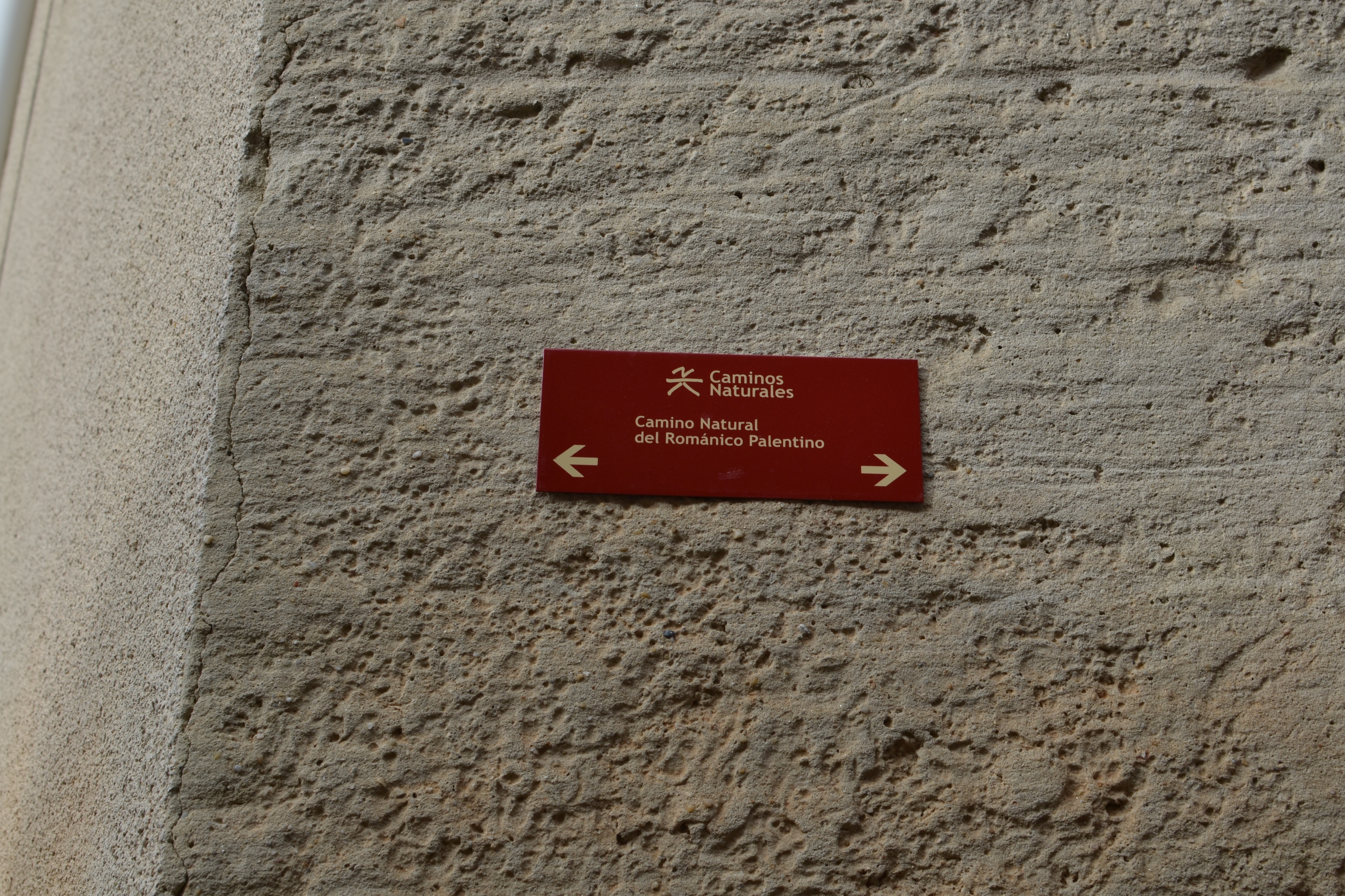
- Nature Trails
- Nature Trails
- Northwest Sector
- Románico palentino
Coke Coal Route. Stage 1. Alar del Rey - Cozuelos de Ojeda
Description
Leaving Canal de Castilla behind to move into La Ojeda
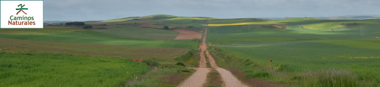
The main route of the Palentinian Romanesque Nature Trail uses an old road that linked the mining areas of the Orbó, Castillería and Vergaño Valleys and the Canal de Castilla, in Alar del Rey. This road was used to transport coal to Palencia and Valladolid. This first stage of the trail starts at Alar del Rey, winding through crop plains, gullies, pine forests and meadows. It goes through Prádanos de Ojeda, Santibáñez de Ecla and Villaescusa de Ecla, ending at Cozuelos de Ojeda.
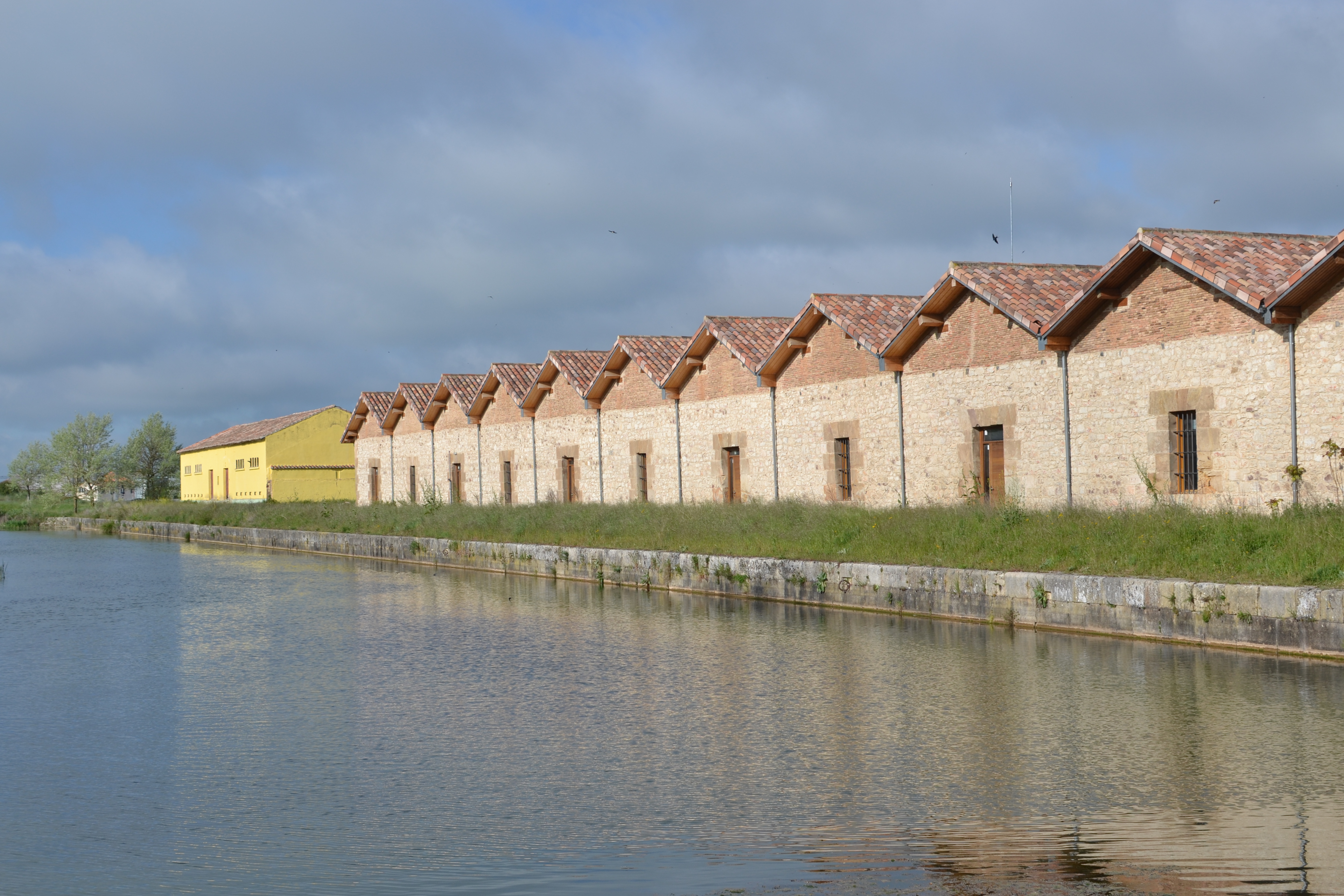
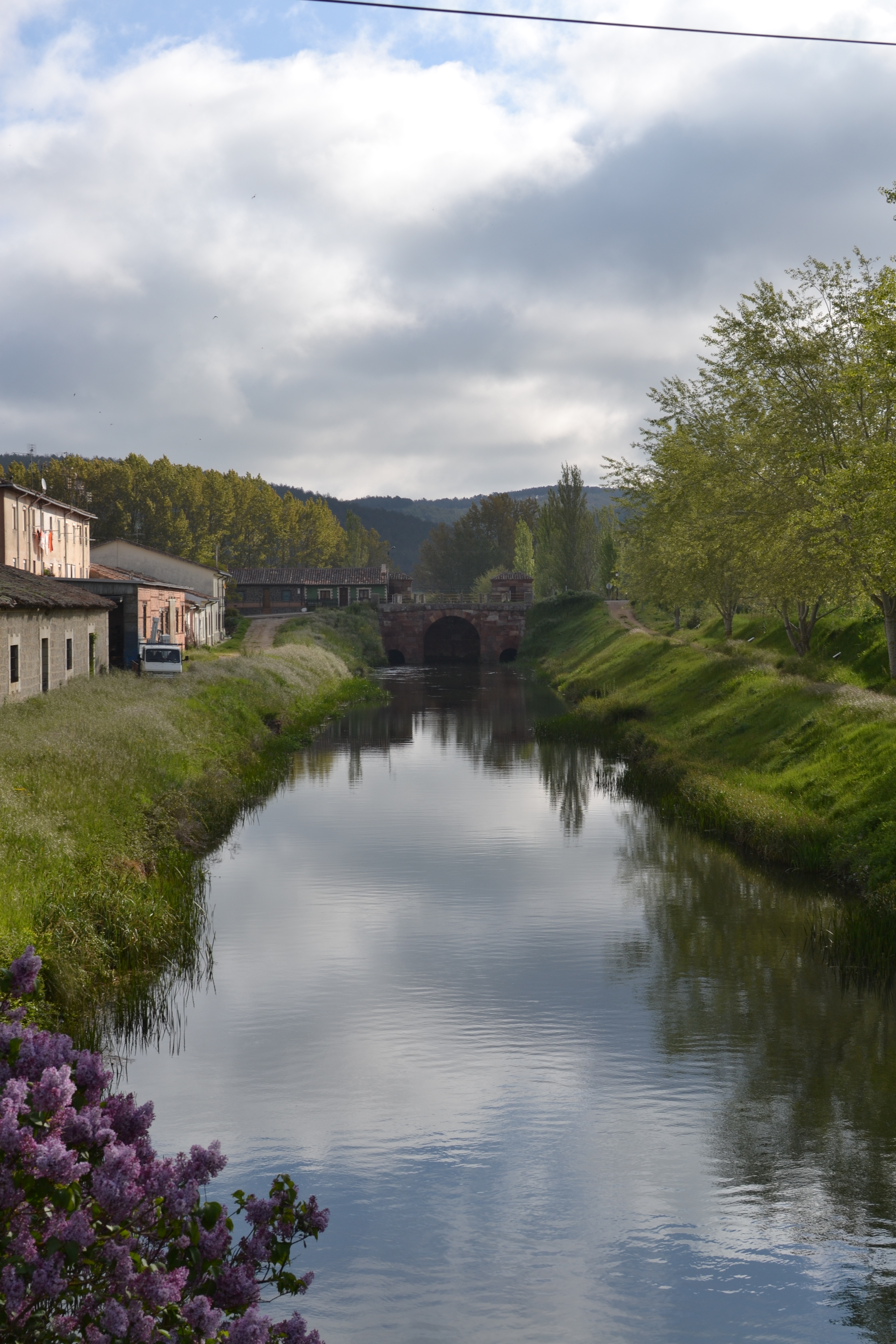
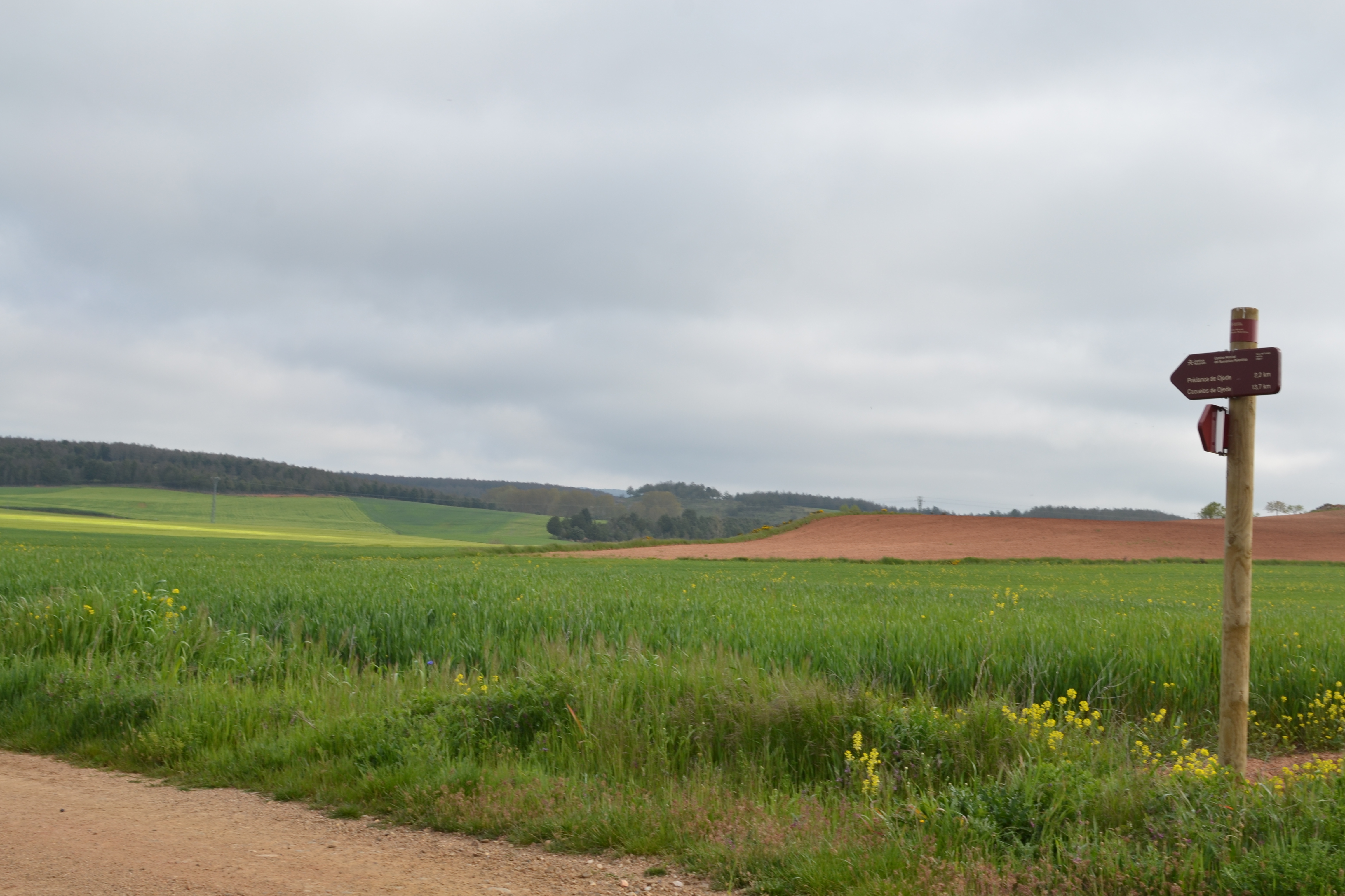
This first stage of the Coke Coal Route starts near the docks of the Canal de Castilla, where coal was once loaded in order to be carried to other regions. A few metres from the panel marking the beginning of the trail, there is a bridge allowing the traveller to stand straight over the canal and see the docks and, in the distance, the very beginning of the Canal de Castilla.
This nature trail goes north-west, leaving Alar del Rey behind, crossing the railway tracks and then leaving a branch that goes to the beginning of the Canal de Castilla on the right. It then crosses the Pisuerga river over the “Puente de las Monjas” and continues along the N-611 road for a few metres before crossing it near some farming buildings. Later on, the paved route is replaced by a dirt road, which is also used to access private properties. This kind of road will be the most frequent one along this route, except when the trail goes through towns and areas with gravel paths.
After a couple of well-indicated intersections, the route reaches the passage under the A-67 motorway among crop fields. It then goes through a similar landscape up to the P-223 road, which must be crossed in order to enter the town of Prádanos de Ojeda. Although the trail follows a clear route in Alar del Rey, there are other towns which are full of winding streets, so the traveller must pay special attention to the signals showing the direction of the nature trail.
The trail barely enters Prádanos de Ojeda, as it goes down Pozo Street and then leaves the town. However, the Corazón de Jesús Square and the parochial church of San Cristóbal are worth visiting, even though the trail must be left behind for a few metres. This Romanesque and Renaissance church, started in the 12th century and finished between the 15thand 17th centuries, is located on the highest place in the town.

When leaving the town, the landscape is still dominated by crops, but the path soon ventures into an area of gentle hills covered with a dense mass of black pine (Pinus nigra subsp. Salzmannii). Later on, the trail goes through a holm oak forest (Quercus ilex). Further ahead, crops appear again, announcing the proximity of Santibáñez de Ecla.
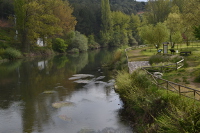
The Coke Coal Route briefly goes through Santibáñez, arriving through Camino Escuelas and leaving the town before reaching Calle Real. However, the church of San Juan is worth leaving the trail for a while in order to admire it. One of the other routes complementing the Palentinian Romanesque Nature Trail starts at this town: the route going from Santibáñez de Ecla to Payo de Ojeda. Having passed by Santibáñez, the path turns right and arrives at a gully in the heart of a holm oak forest. Later on, this landscape alternates with pastures and crops up to the point where the route crosses San Andrés stream, in the outskirts of Villaescusa de Ecla
From the moment the P-255 road is reached and up to the point this town is left behind (crossing the San Andrés stream again), this stretch of the trail is shared with vehicles, so the traveller must be cautious. If you want to continue discovering the Romanesque heritage of this area, you can visit the church of Santa Elena.
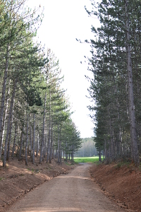
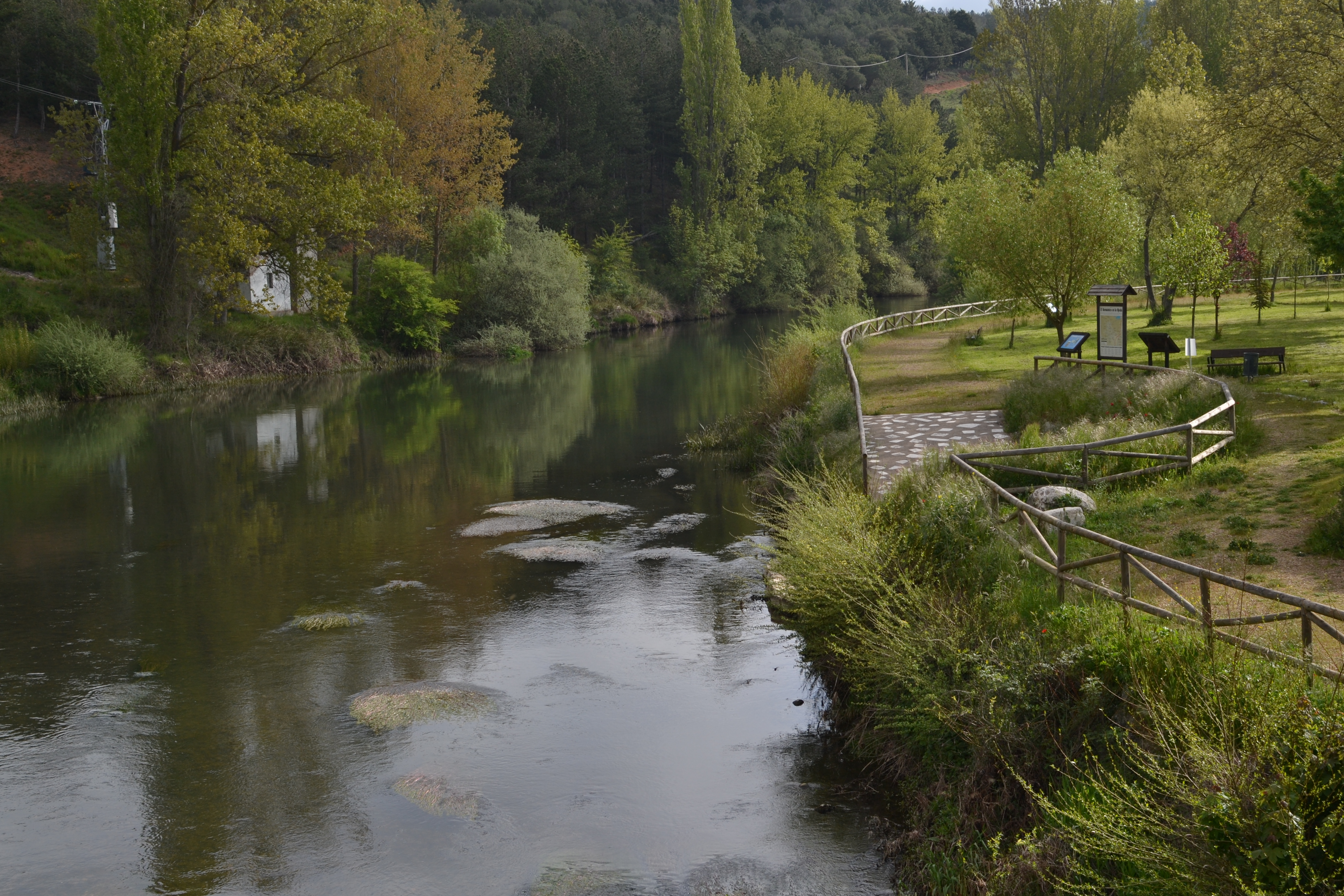
Villaescusa de Ecla is left behind, leaving the path that goes to the Desfiladero del Diablo and the Cascada de Cervigona aside. However, both of these places are worth visiting if you have extra time. The trail then continues running among pastures and bushes and goes up to enter a pine forest.
Later on, it goes downhill, and a cross on top of some rocks (Peñatorrecilla) announces that Cozuelos de Ojeda is near, just around the hill. This town will be end point of the first stage of the Coke Coal Route.
Although this stage ends after crossing the Cozuelos stream, a visit to the church of Nuestra Señora de la Asunción, on the outskirts of the town, is highly recommended. This is a Renaissance building with interesting heritage inside. There, the remains of a possible “conjuradero de nublos” are preserved - a peculiar and very interesting building from an ethnographic and historical perspective.
Profile
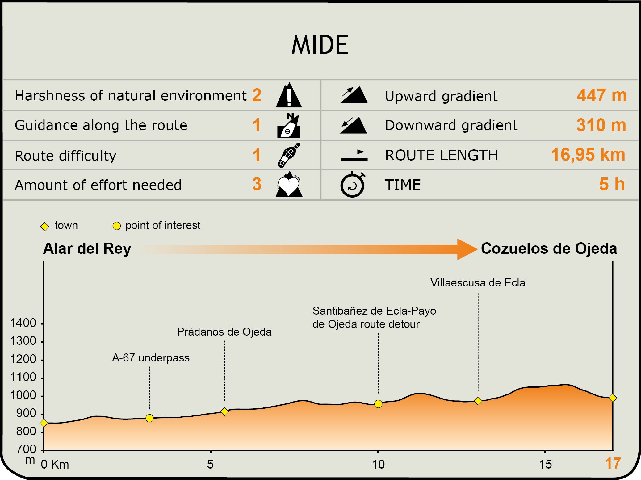
MIDE (Method for the Information of Excursions)
 Harshness of natural environment
- 1. The environment is not risk-free
- 2. There are more than one risk factors
- 3. There are various risk factors
- 4. There are quite a lot of risk factors
- 5. There are many risk factors
 Guidance along the route
- 1. Well defined trails and crossings
- 2. There is a clearly marked trail and signage
- 3. Requires the identification of geographic features and cardinal points
- 4. Requires off-path navigation
- 5. The trail is interrupted by obstacles that have to be gone around
 Route difficulty
- 1. Walking on a flat surface
- 2. Trails with different types of path
- 3. Walking on stepped paths or irregular terrain
- 4. The use of hands or jumping over the terrain is necessary
- 5. The use of hands is required to progress
 Amount of effort needed
- 1. Up to 1 hour of continuous walking
- 2. Between 1 and 3 hours of continuous walking
- 3. Between 3 and 6 hours of continuous walking
- 4. Between 6 and 10 hours of actual walking
- 5. More than 10 hours of continuous walking
Featured
Further information
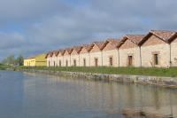
Canal de Castilla
The Canal de Castilla is one of the most important civil engineering projects from the 18th and 19th centuries in Spain. Its main purpose was to establish a river transport system and a communication channel solving the isolation of the Castile and Leon plateau, mainly due to a difficult terrain and a deficient and poorly maintained road network.
The Canal runs through the provinces of Burgos, Palencia and Valladolid, in the Autonomous Region of Castile and Leon. For years, one of its main functions was to enable the transportation of wheat from Castile to the northern ports, and from there to other markets.
At first, the Canal was conceived as a network of four channels that would link Segovia with Reinosa. Eventually, only three branches (Northern, Southern and Campos branches) were built. The branch going through the province of Palencia (the Northern branch) is the longest one.
Although it was soon replaced by the arrival of the railway, the Canal continued to prove itself very useful, since it was used as the driving force for the locks used in mills and for agricultural irrigation. Navigation stopped in 1959, and its main use is now agricultural irrigation. More recently, the important architectural heritage of the Canal de Castilla has meant that it has been promoted as a tourist landmark.
Multimedia

Downloads
GPS Downloads
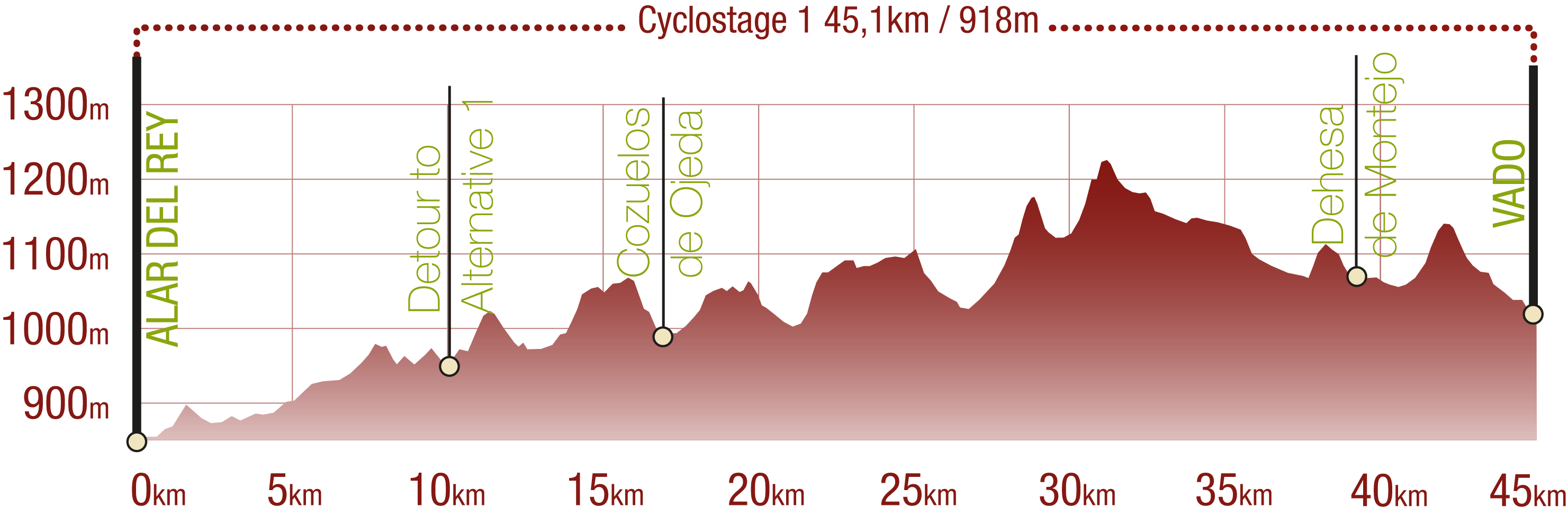
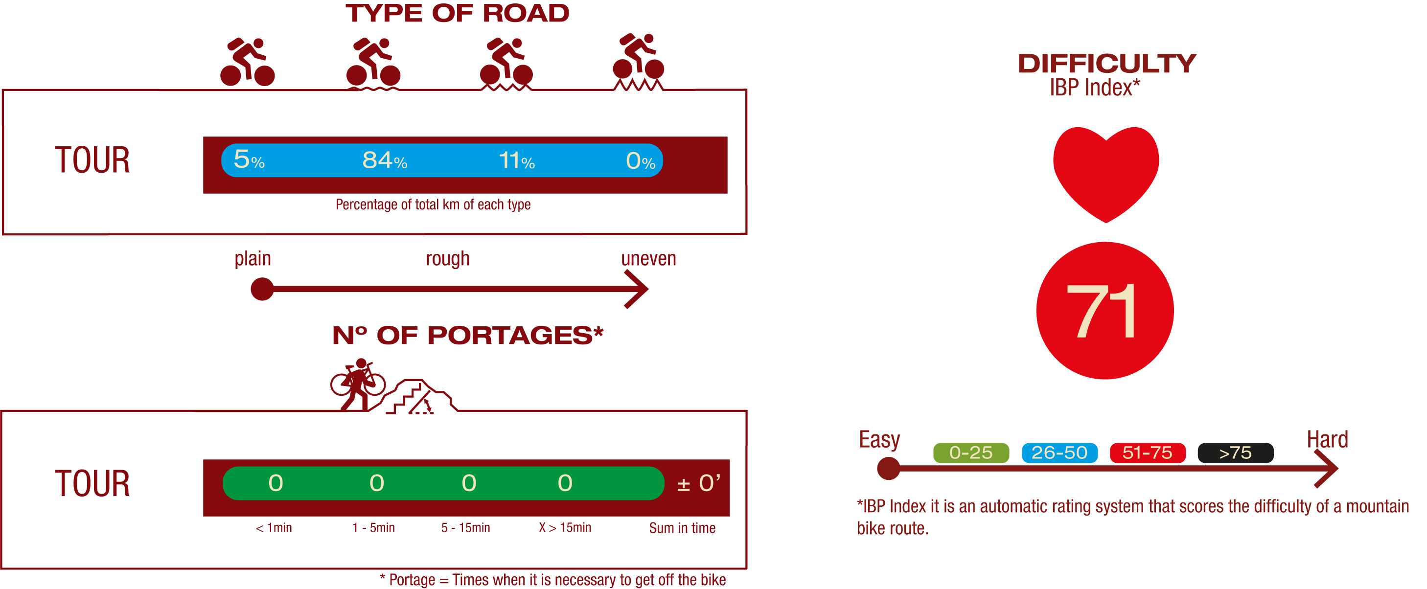
Cyclability
This Cyclostage corresponds to stages 1 & 2 of the Coke Coal Route of this Nature Trail
PROFILE
TYPE OF ROAD, PORTAGES & DIFFICULTY
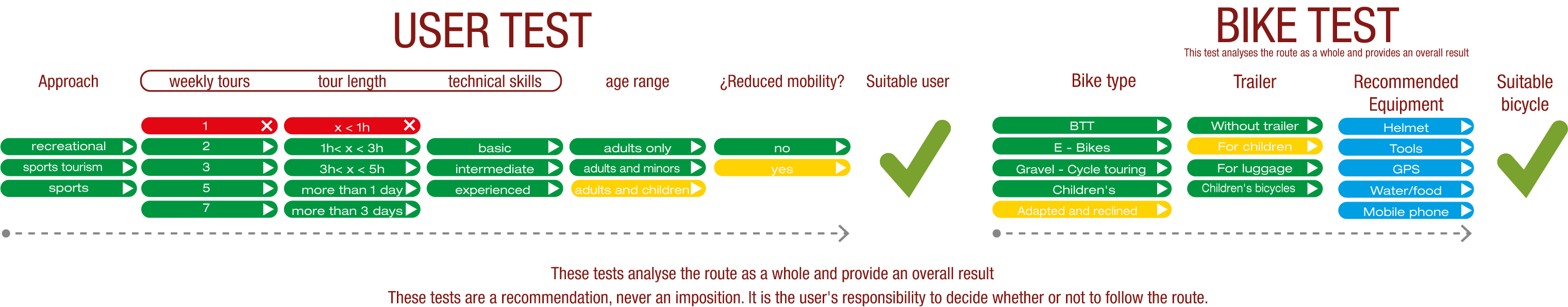
TEST
SAFETY RECOMMENDATIONS
- Sections shared with hikers.
- Transit through the centre of some population centres.
GENERAL RECOMMENDATIONS
- Find out about the technical aspects of the route and the weather on the day.
- Take care of the environment. Take care not to disturb animals or damage vegetation. Respect private areas.
- You must give priority to pedestrians and comply with general traffic rules.
- The environment in which you will be riding is open, free to move around and an area where many activities are carried out (sporting, forestry, livestock and agricultural activities). Always have an understanding, prudent, responsible and respectful attitude.