- Home
- Rural Development
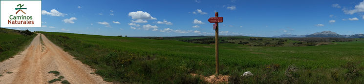
- Nature Trails
- Nature Trails
- Northwest Sector
- Románico palentino
Alternative 2: Perazancas de Ojeda to Dehesa de Montejo route
Description
The Romanesque heritage of the northern region of La Ojeda
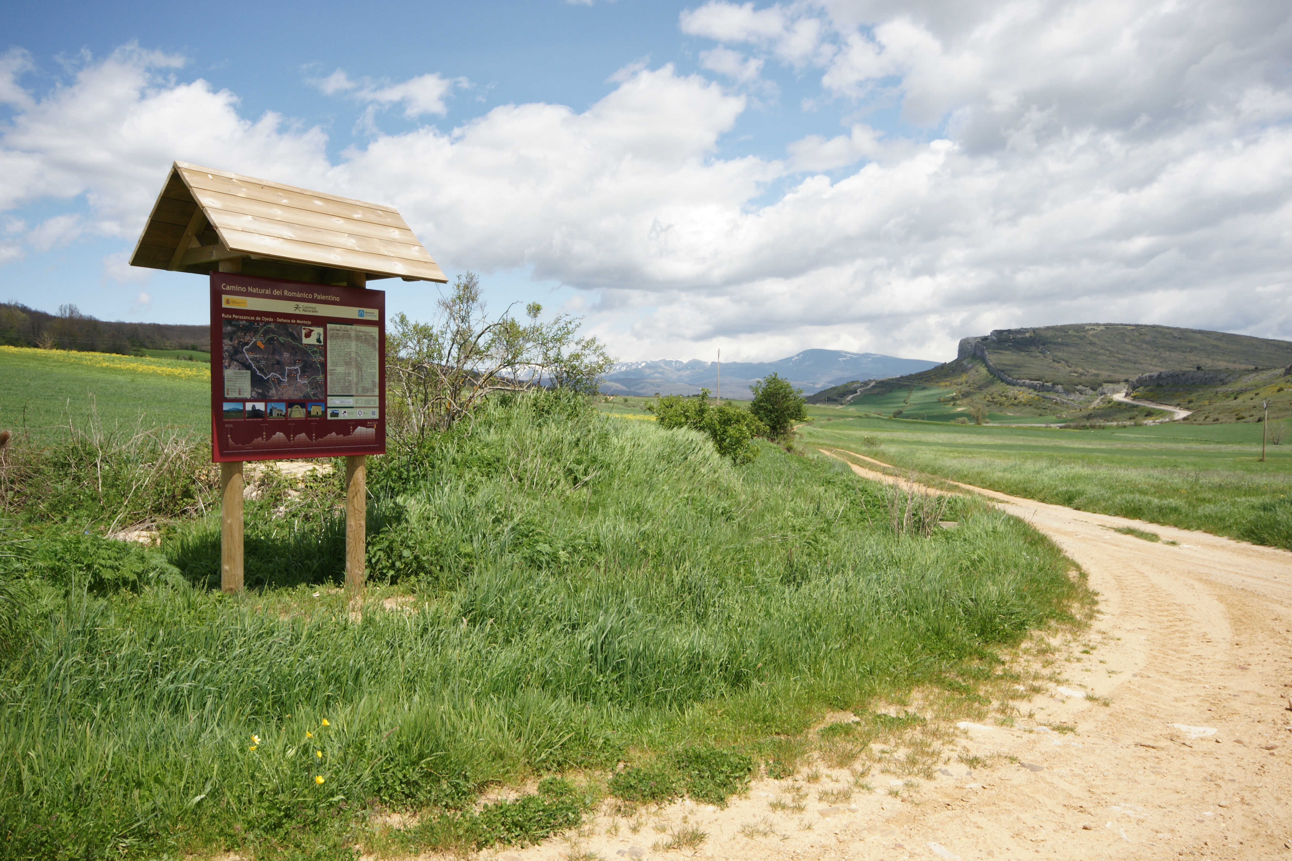
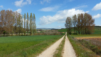
This 22.5-kilometre route is one of the two alternatives completing the Palentinian Romanesque Nature Trail. It departs from the Coke Coal Route, past Cozuelos de Ojeda, and goes through the north of La Ojeda region, between the plains of Tierra de Campos and the rocky wall formed by the first peaks of the Cantabrian Range. In Dehesa de Montejo, the path rejoins the main route.

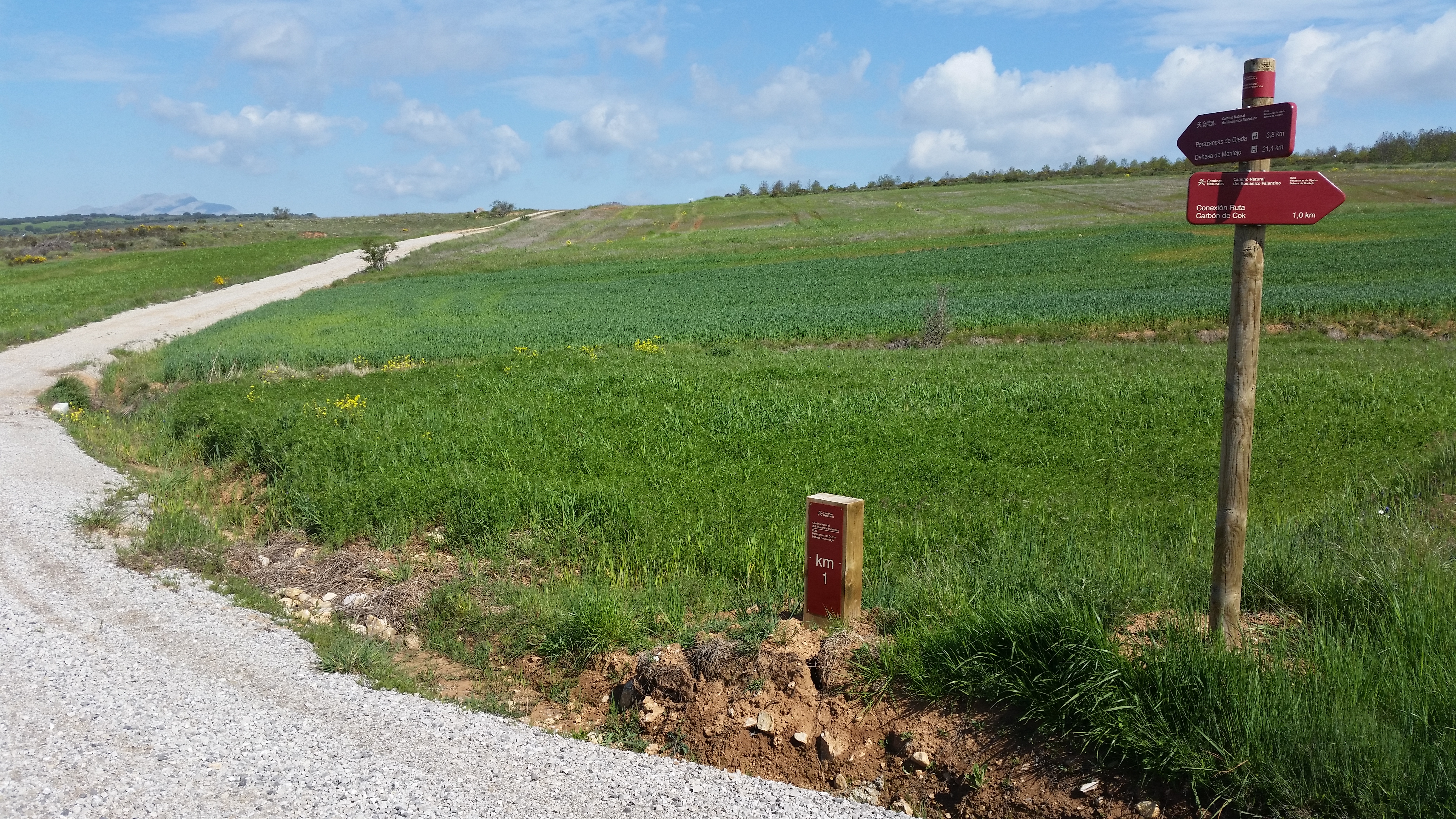
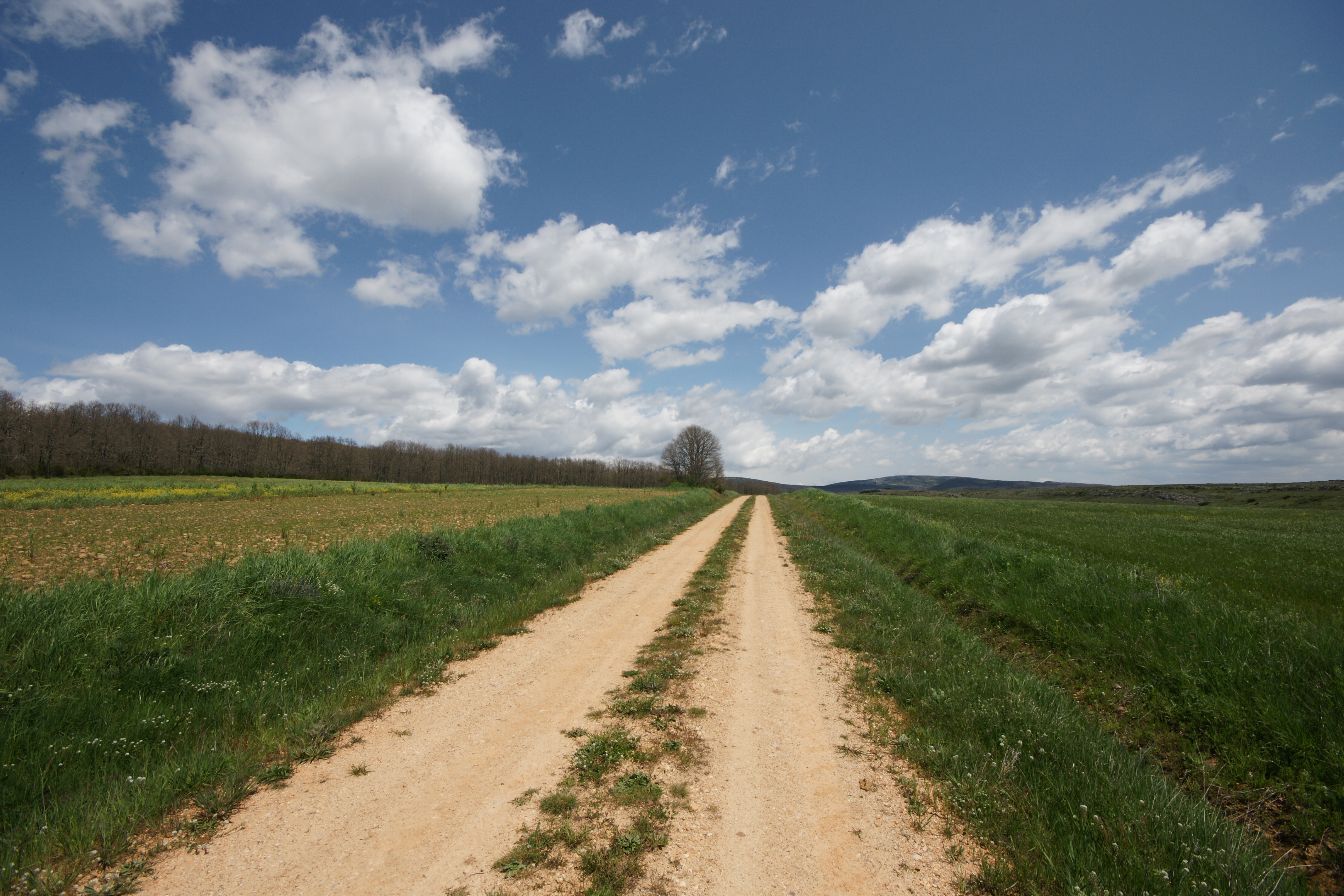
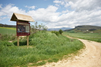
This alternative route starts at an intersection located at kilometre 18 of the Coke Coal Route, in its second stage, next to an information panel about the nature trail. The surface of this stretch of the trail alternates between dirt and gravel paths.
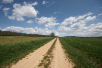
The route starts going down the Camino de la Lagunilla de la Vegauna to get into a wavy landscape, a mosaic of pastures and crop fields, mainly cereal, potato and garlic. At the end of the first descending slope, and coinciding with kilometre number 1 of this stretch, the route reaches a well-indicated fork, where the path continues to the right through a gravel road, passing over the little Valdizma stream.
The trail soon turns left, heading perpendicularly towards the P-227 road until it reaches a new intersection, before kilometre number 2. At this intersection, the route turns right and continues running along the road and among crop fields for approximately nine hundred metres, up to a new intersection appears soon after passing by the Agua stream.
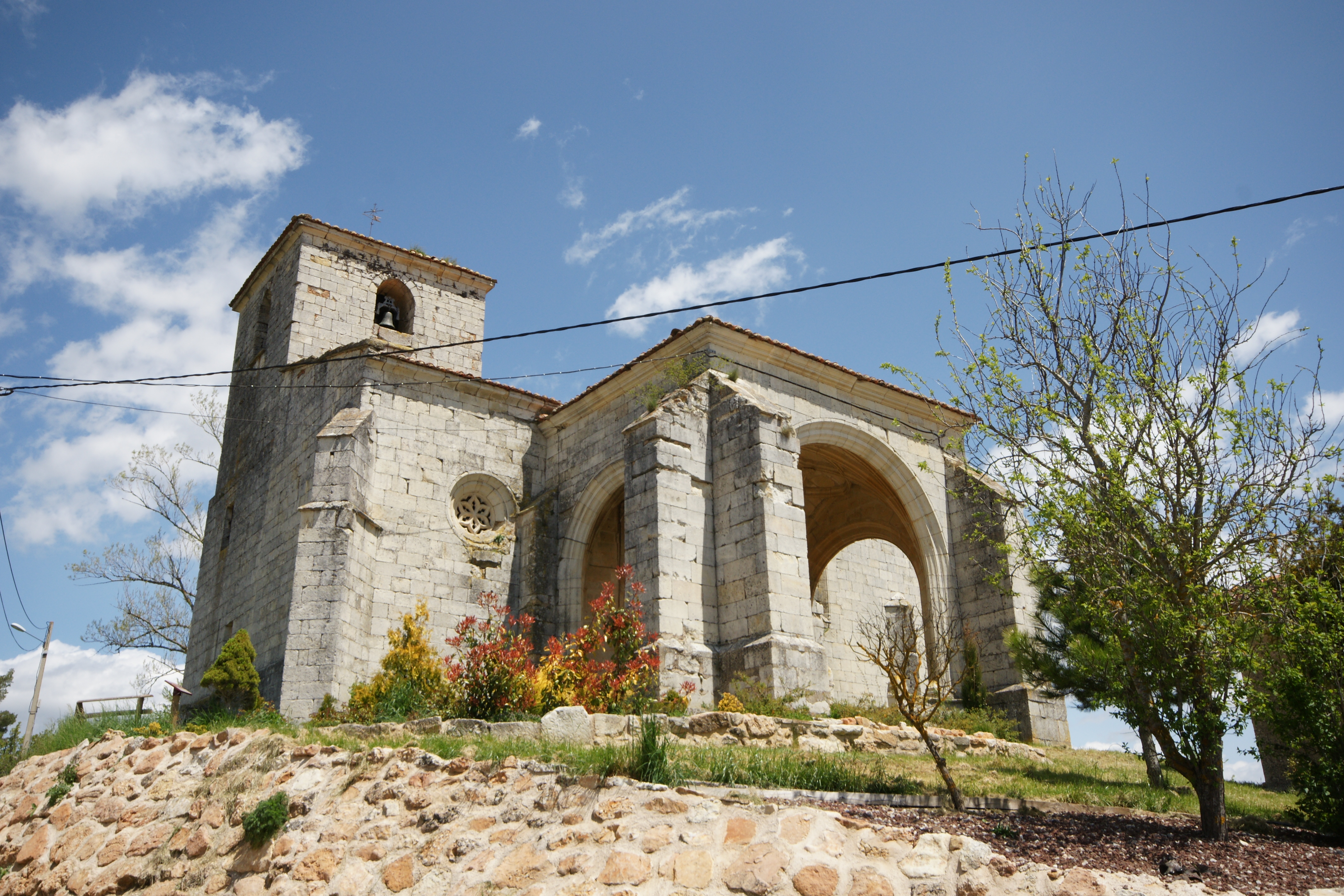
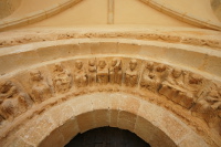
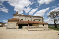
Even though the road continues to the right, travellers walk for 200 metres to the left in order to visit the striking hermitage of San Pelayo, next to the road. This is one of the oldest monuments of the Palentinian Romanesque and is really worth visiting. It holds the remains of the most remarkable Romanesque paintings in the province, where the apostles and the figures of the months of the year can be seen. The apse shows Lombard bands as decoration, something very unusual in Palencia. In the façade, capitals and shafts from a former Mozarab or Visigoth building were used.
Back to the intersection, the route continues towards Perazancas de Ojeda for two more kilometres, going around a hill on the right, near the town. The route continues through the meadow of Agua stream, following a wavy gravel road to the left, until the route of Perazancas de Ojeda is reached. From this point, the town area can already be seen, and the route turns left and starts going down in search of road P-227.
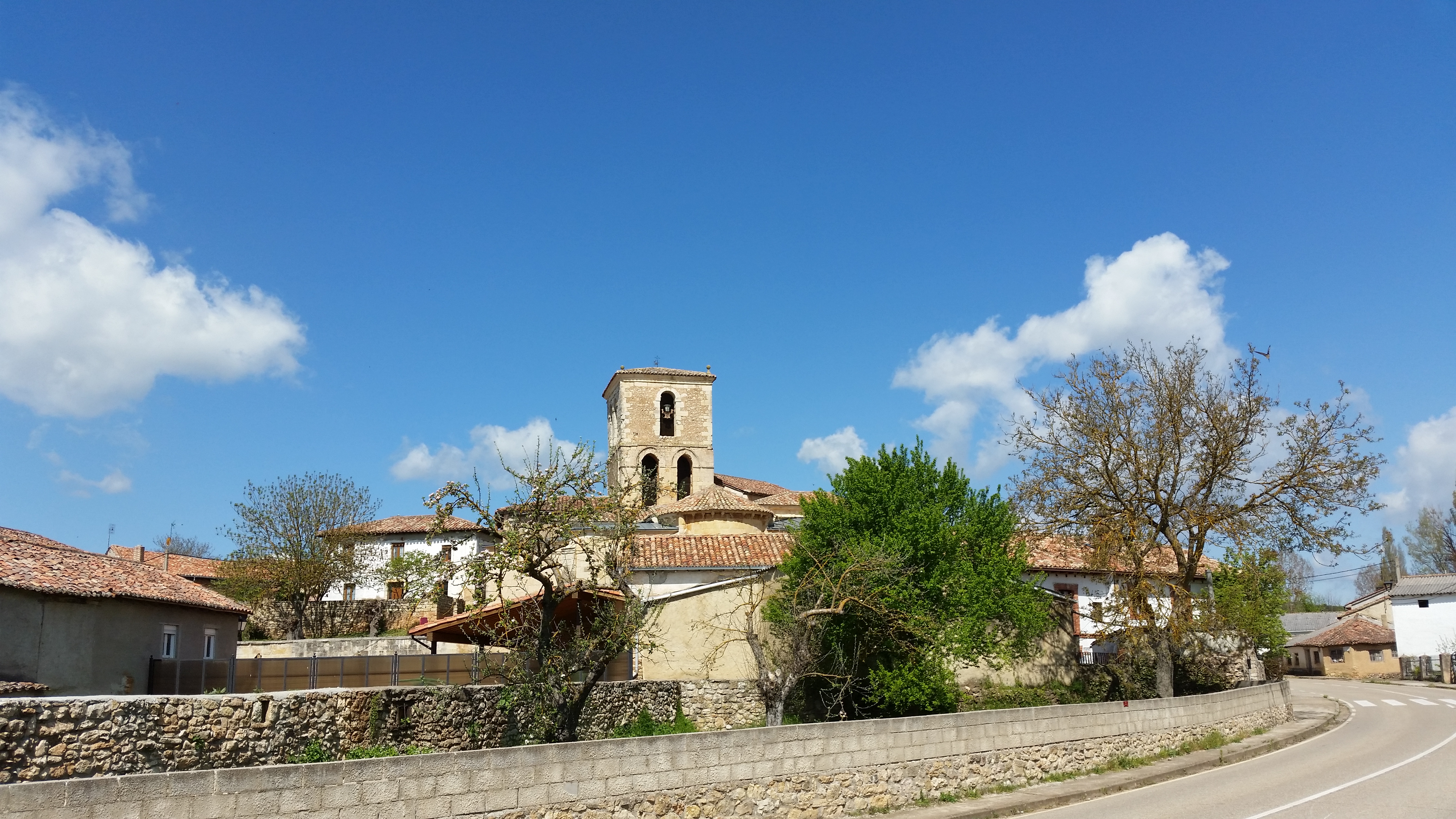
Before reaching the road, the route goes over the Tarabás River, next to the washing place of the Fuente de los Tres Caños. From here, the bell tower of the church of Asunción can be seen. In order to get to it, the route takes the road to the right up to the first intersection and then turns left through a cobbled street, where there is an information panel. The church of Asunción has the original façade of the Romanesque temple; a remarkable Romanesque work with figures of musicians decorating the central archivolt. On the inside, it holds an interesting Gothic Christ, as well as a Romanesque baptismal font.
The route continues through the same street up to an intersection, where it goes straight on through a concrete street, leaving a cereal plot to the right. The 5 kilometre point is placed on the border of this plot.
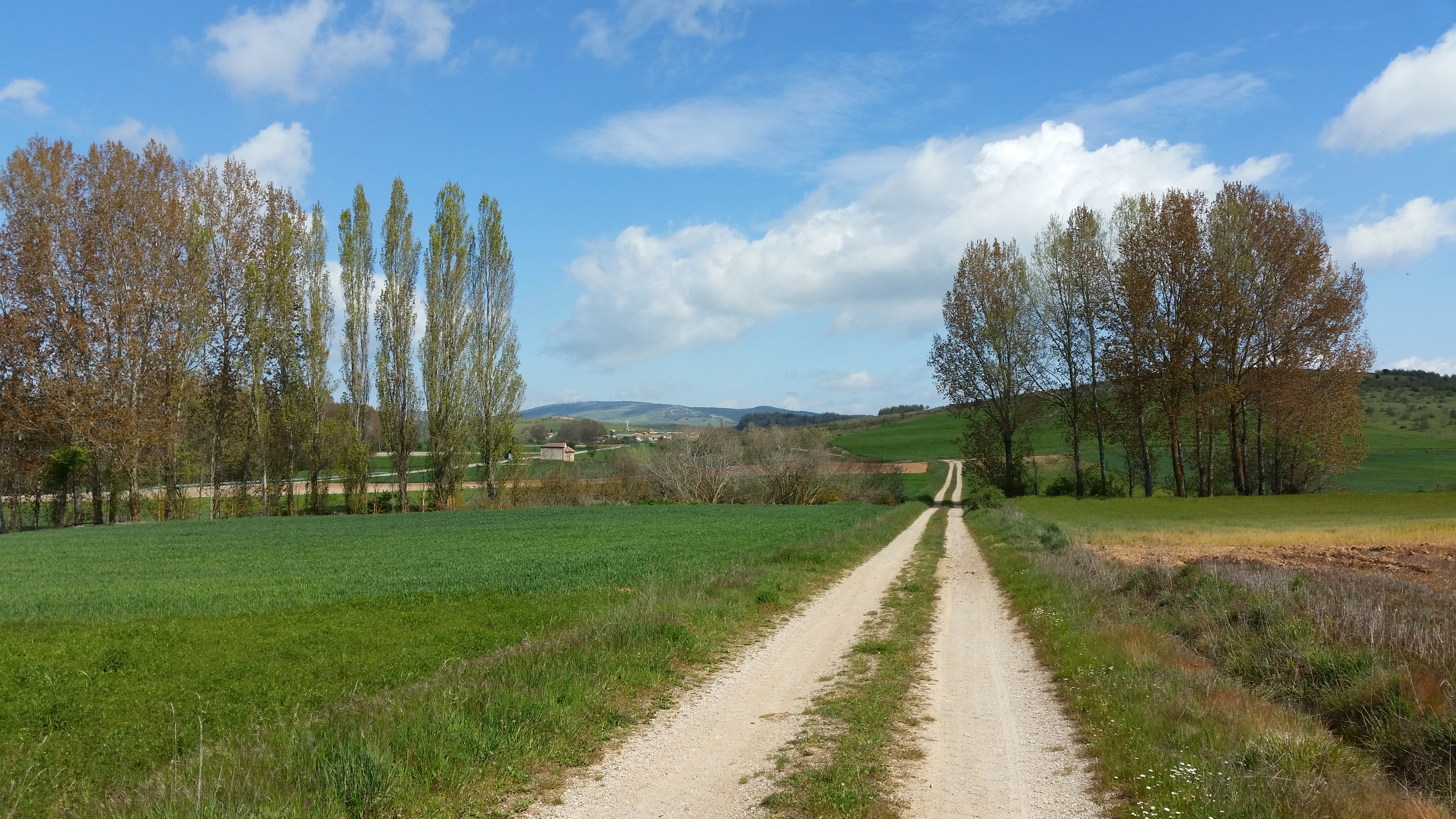
The route leaves the town through the west side, turning almost perpendicularly to the right, through Henares Pérez Street. On the outskirts of the town, the road surface is gravel again and the trail runs among wavy crop fields again, towards Montoto de Ojeda.
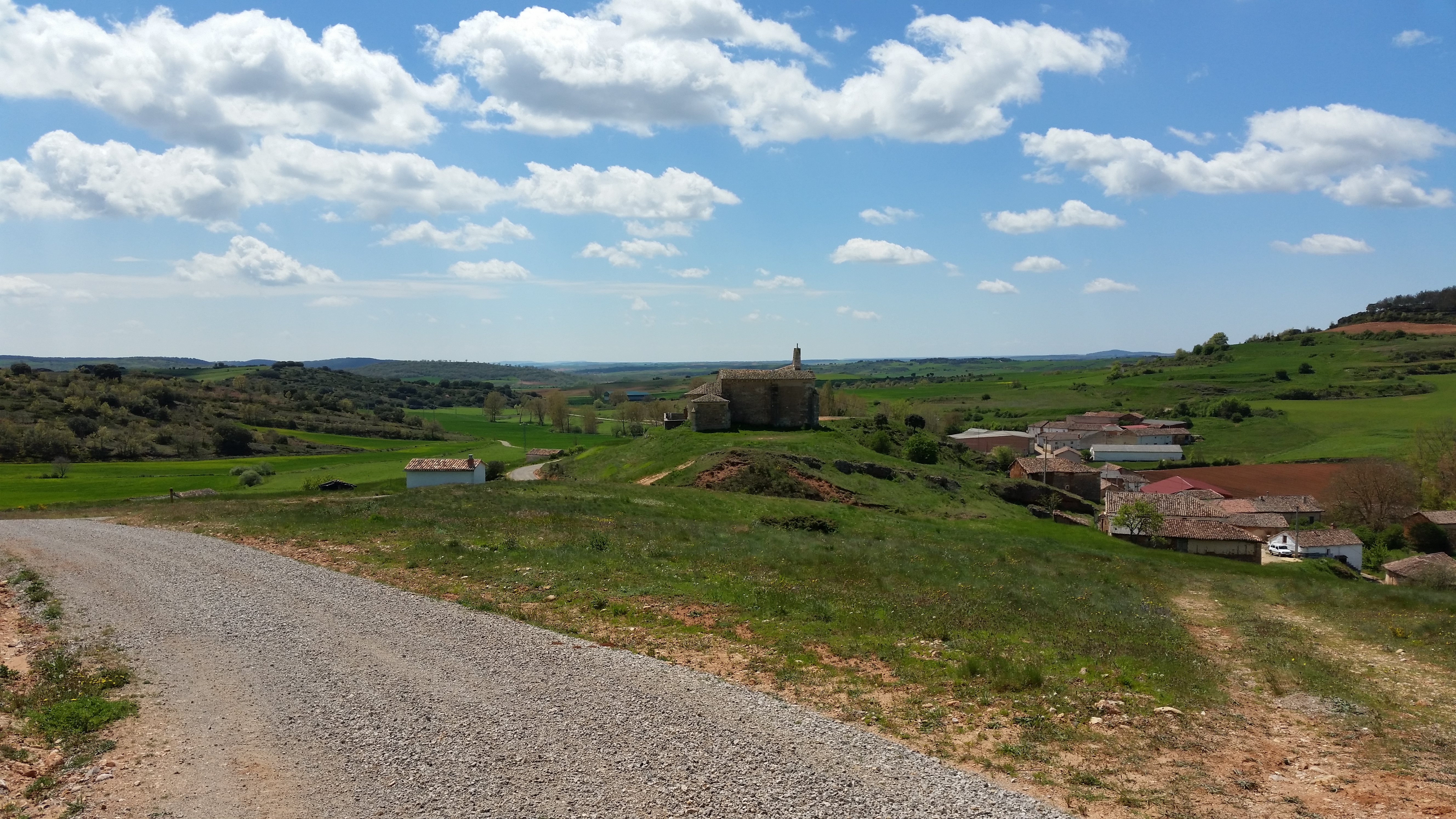
Two kilometres from Perazancas, there is a well-indicated fork, from where the trail continues to the left in a slight ascending slope for approximately two hundred metres, up to a new fork, where the road branches off and continues to the right. From this point on, a slight descent starts through a gravel road among pastures, crops and holm oak areas, down to the church of San Esteban, located on a small hill at the entrance of Montoto.

After visiting the church, a late 12th century temple which was substantially modified in subsequent centuries, the route turns right through the first intersection and goes to the town, which is by the riverside of the Montoto River. The trail then crosses the town through the bridge over the river and leaves it through the west side, going up through a dirt slope.
On the way towards Pisón de Ojeda, the landscape starts becoming steeper as the travellers get closer to the Palentinian Mountains, which can be seen on the background. For the rest of the route, the reforestation pine areas become more and more frequent, interspersed in the mosaic of crops and holm oak woods.
The route crosses the town of Pisón de Ojeda through Mayor Street. Before arriving at the Burejo River, which is crossed through a bridge, the travellers can make a stop and visit the church of San Pelayo, on top of a slope on the left. This is a simple temple from the early 12th century, but remodelled later, including its restoration during the 1980s.
After crossing the river, the route continues through Mayor Street until it ends at road PP-2223 towards Amayuelas de Ojeda. Later on, it continues through Camino de Pisón de Ojeda and then through Camino de la Pedrera, which follows the course of the Fuente el Moro stream. The route abandons the course of the stream by turning right, up to a fork a bit farther on. Here, the Camino de Pisón goes straight on and the route continues to the left through Camino del Nogal, among rural lands, heading northwest and parallel to road PP-2223. At this point, the Burejo River flows between the route and the road again.
When the Camino de El Nogal finishes, the route turns right, crossing over the Burejo River, to join an access path to rural lands that is adjacent to PP-2223, and continues through it until it ends up in the road entering Colmenares de Ojeda. It shares the path with said road for 200 metres, going through a bridge over the Valdeur stream, then turning and going into the town among several houses through the second street to the left.
In Colmenares, the path passes by the church of San Fructuoso, dating back to the 16th century. Its 12th century baptismal font is one of the most impressive in the province, and it is the main remain of the former Romanesque church, which was replaced by the building that can be seen today.
Leaving the church and Colmenares, the route heads northwest through a concrete road that soon becomes a dirt path. It continues up to an intersection of several roads, where it makes a right angle turn to the right and goes along the PP-2223 road.
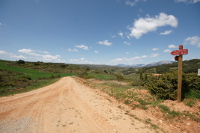
From there, it crosses the road and turns left going along the other side of it, until an intersection is reached at the entrance of Dehesa de Montejo. On the left-hand side, the church of San Pelayo can be seen, at the entrance of the town and next to the graveyard. This church was originally built in the 12th century, but completed between the 15th and the 17th. The possibility of visiting the protected natural space of Tejada de Tosande, 5 km away, is also indicated at this intersection. On the right, the travellers will see the panel marking the end of this route, where this stage rejoins the Coke Coal Route.
Sites of interest
Profile
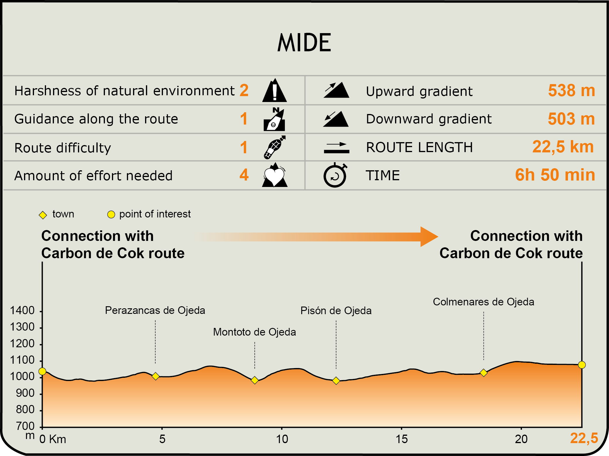
MIDE (Method for the Information of Excursions)
 Harshness of natural environment
- 1. The environment is not risk-free
- 2. There are more than one risk factors
- 3. There are various risk factors
- 4. There are quite a lot of risk factors
- 5. There are many risk factors
 Guidance along the route
- 1. Well defined trails and crossings
- 2. There is a clearly marked trail and signage
- 3. Requires the identification of geographic features and cardinal points
- 4. Requires off-path navigation
- 5. The trail is interrupted by obstacles that have to be gone around
 Route difficulty
- 1. Walking on a flat surface
- 2. Trails with different types of path
- 3. Walking on stepped paths or irregular terrain
- 4. The use of hands or jumping over the terrain is necessary
- 5. The use of hands is required to progress
 Amount of effort needed
- 1. Up to 1 hour of continuous walking
- 2. Between 1 and 3 hours of continuous walking
- 3. Between 3 and 6 hours of continuous walking
- 4. Between 6 and 10 hours of actual walking
- 5. More than 10 hours of continuous walking
Featured
Further information
La Tejada de Tosande
North-west of Dehesa de Montejo lies la Tejada de Tosande, a protected natural space which is included in the Fuentes Carrionas y Fuente Cobre-Montaña Palentina Natural Park, declared as such in the year 2000.
This small relict grove, integrated into a wide beech forest, is one of the most remarkable concentrations of yews in Spain. It is located in the northern slope of Peña Horacada, in heights between 1,300 and 1,500 metres.
La tejada de Tosande is one of the most important yew groves in the Iberian Peninsula, not only due to the number of trees (over seven hundred), but also due to the longevity of many of them. This can be seen in the perimeter of their trunks, some of which exceed three meters.
To discover this forest, you can walk the route PR-P 03 “Senda de la Tejeda de Tosande”, 11 kilometres long and with an average duration of 5 hours. This route can be accessed from a parking lot near the kilometre 2.2 of the regional road CL-626 from Cervera de Pisuerga to Guardo.
The Churra sheep breed
Along these routes of the Románico Palentino Nature Trail we can find flocks of churra sheep breed. It is an indigenous breed characterised by its very rustic nature currently increasing in number and present along the entire Castilian plateau. It specialises both in the production of milk (highly appreciated for the production of cheese) and meat (from which a high-quality young lamb meat is obtained). The breeding of these animals contributes to the maintenance of a traditional and extensive livestock model in our land.
Multimedia