
- Home
- Rural Development
- Nature Trails
- Nature Trails
- Northwest Sector
- Románico palentino
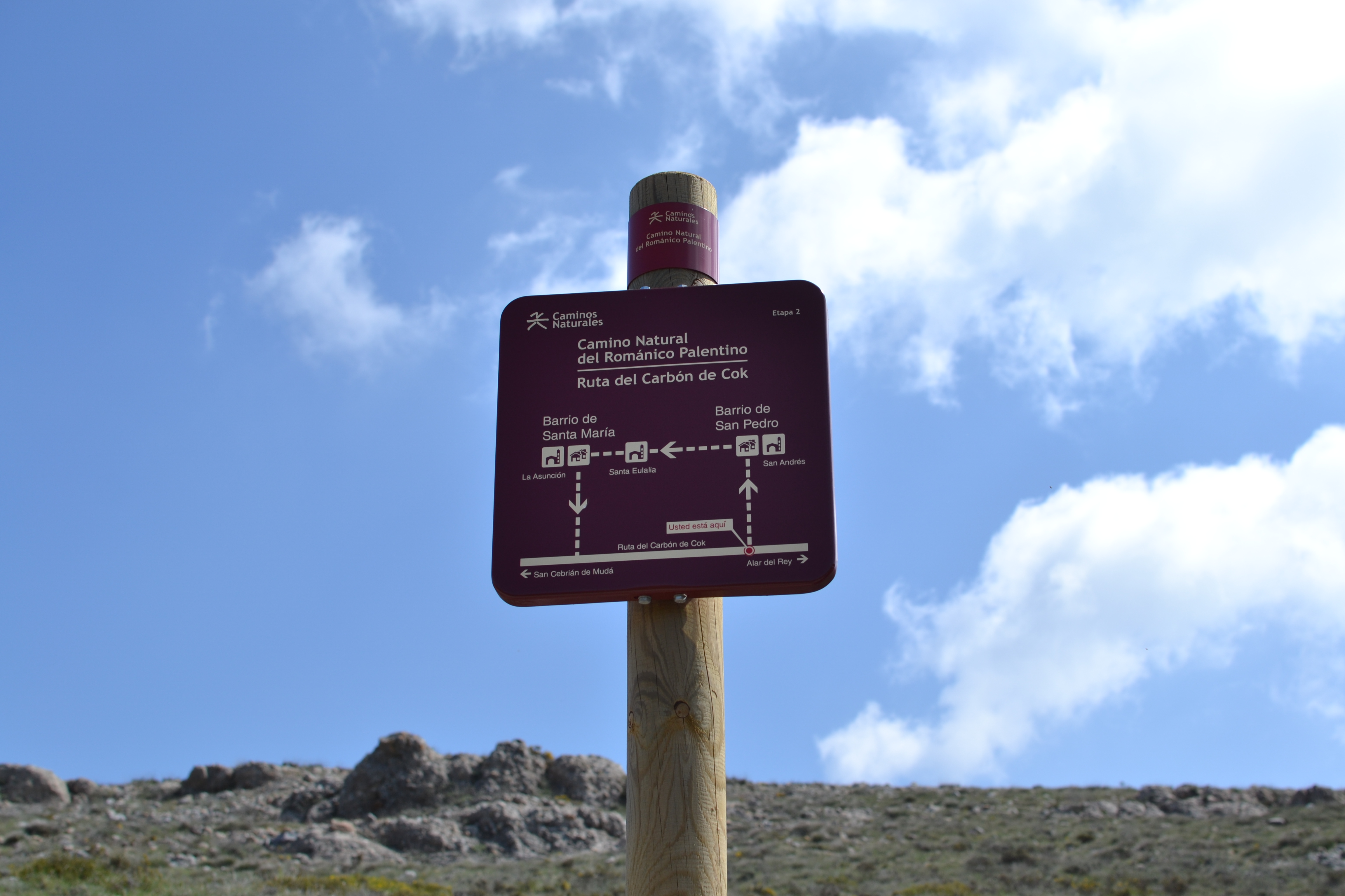
Coke Coal Route. Stage 2. Cozuelos de Ojeda-Vado
Description
The trail gets height in La Ojeda and Valdivia.
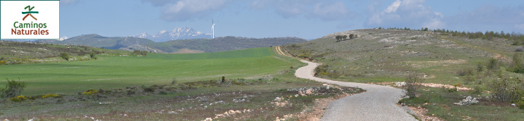
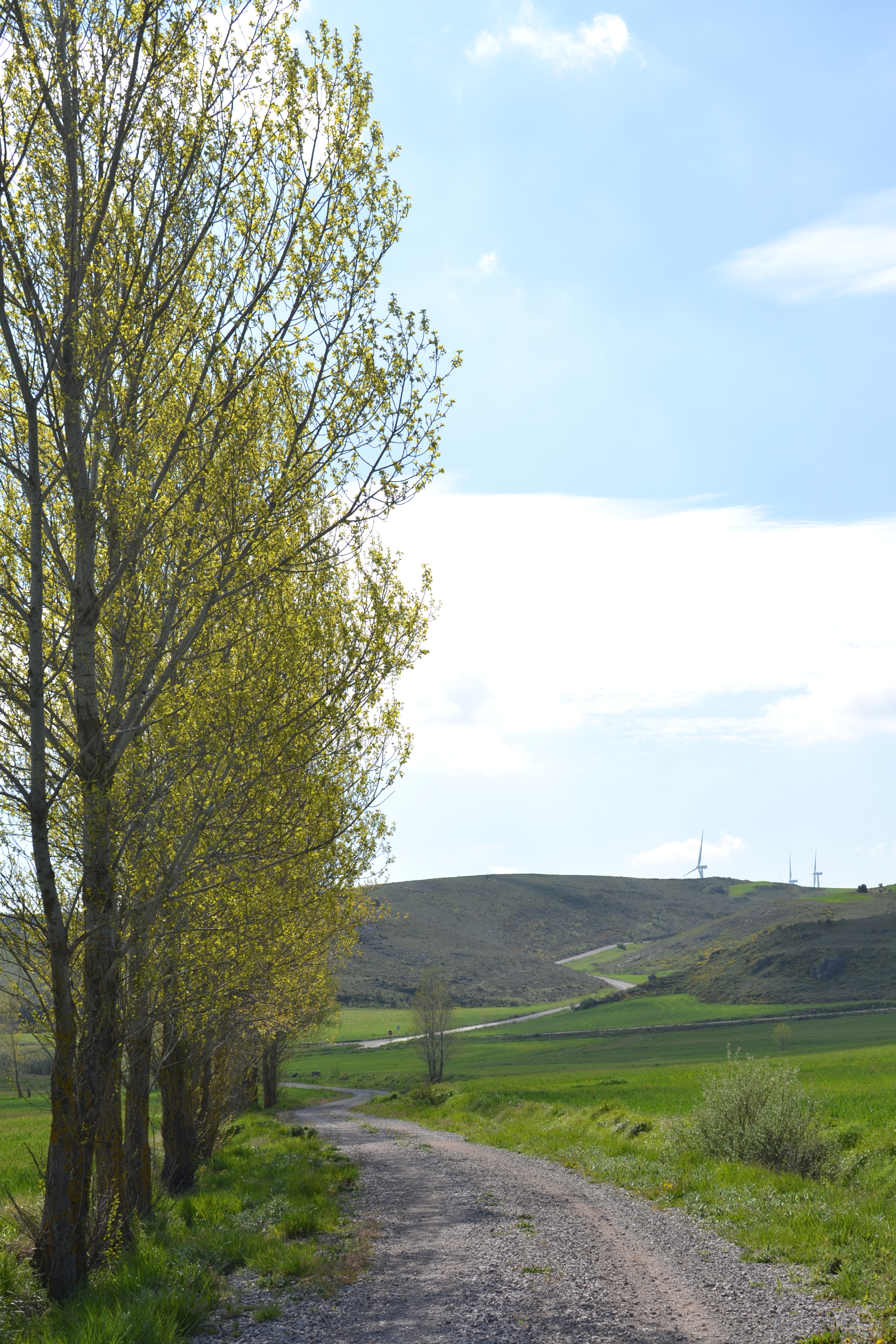
The longest of the three stages making up this trail goes through the north-eastern borders of La Ojeda region, allowing the traveller to enjoy some amazing panoramic views in the ascent (La Ruya, Peña Umoma). The trail goes across the towns of Cozuelos de Ojeda, Vallespinoso de Aguilar, Dehesa de Montejo and Vado. A branch of the trail also lets the traveller peek in the lands of Aguilar de Campoo and sight its reservoir, as well as visit Barrio de San Pedro and Barrio de Santa María. The route passes by different hermitages and churches, allowing the traveller to discover the rich Romanesque heritage of the province.
The second stage of the Coke Coal Route starts where the previous stage ended, next to an information panel right after crossing the Cozuelos stream. The route leaves this town behind among pastures and crops, going up a slope until it gets to a crossroads. The other route at this intersection is the Perazancas de Ojeda-Dehesa de Montejo Route, one of the additional routes completing the Palentinian Romanesque Nature Trail.
Leaving this fork behind, the trail runs through gentle hills, among pastures, cereal and forage crops, reaching the path linking the PP-2131 road with Vallespinoso de Aguilar. The route shares a few hundred metres with this road (caution, traffic shared with vehicles) and then enters the town, where there is a rest area.
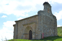
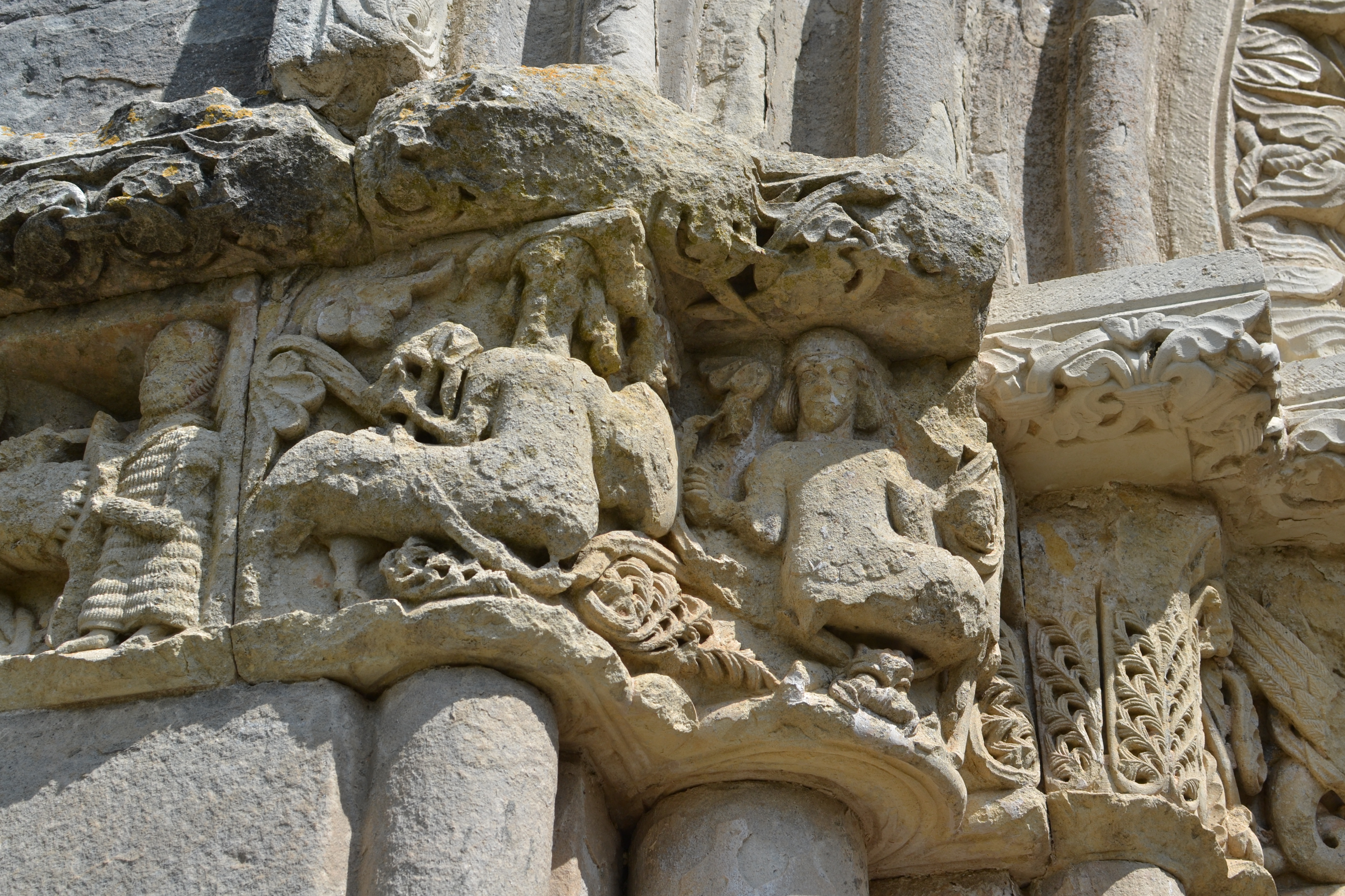
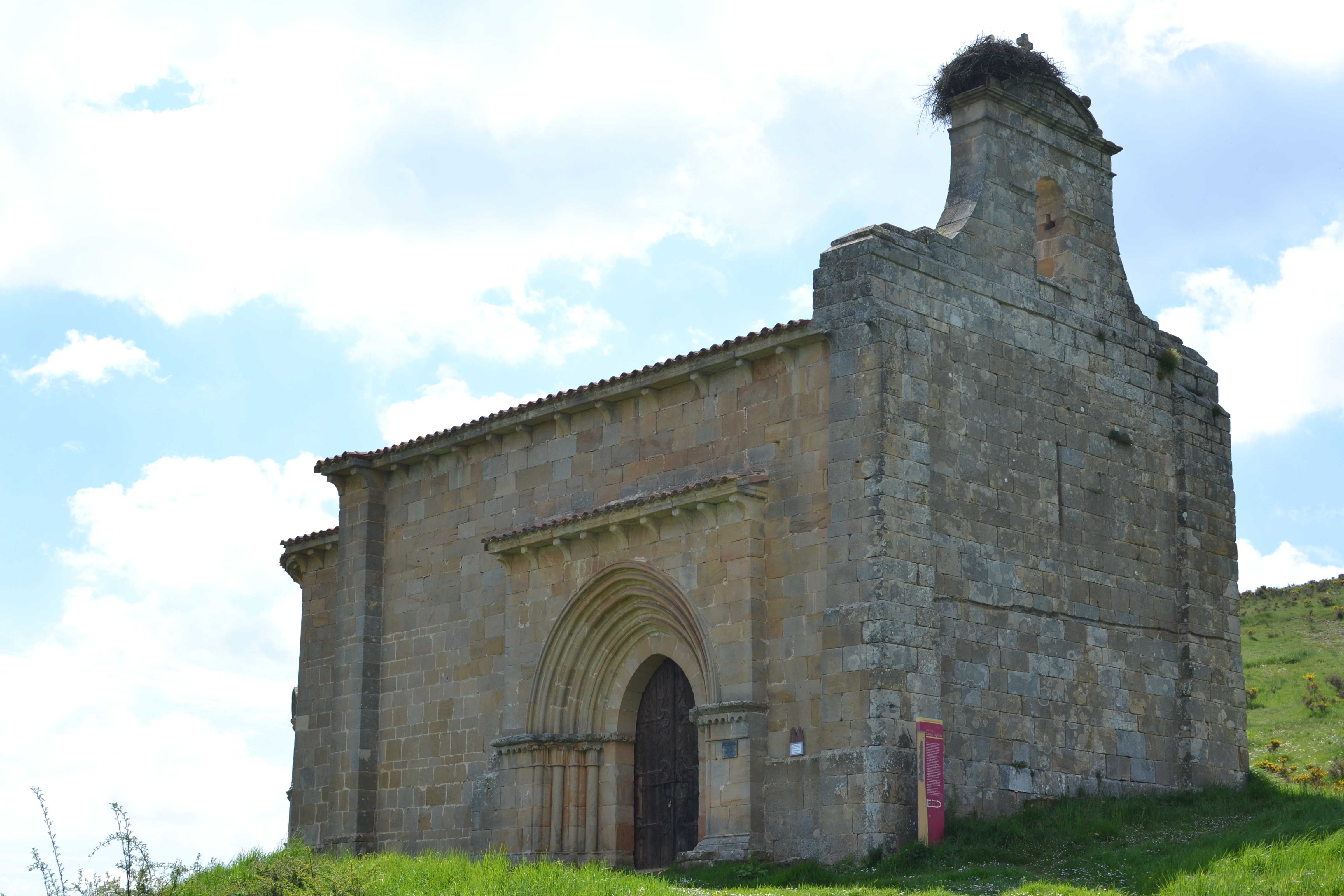
This trail will take the travellers to the hermitage of Santa Cecilia, which dates back to the 12th century. This hermitage was declared a historically relevant building in 1951 and restored in 1957, boasting an elaborate façade. Besides, the rocks where it was built will allow the traveller to enjoy stunning panoramic views over Vallespinoso and its valley. The trail then goes up the valley among pastures, bushes, and scattered trees and crop fields.
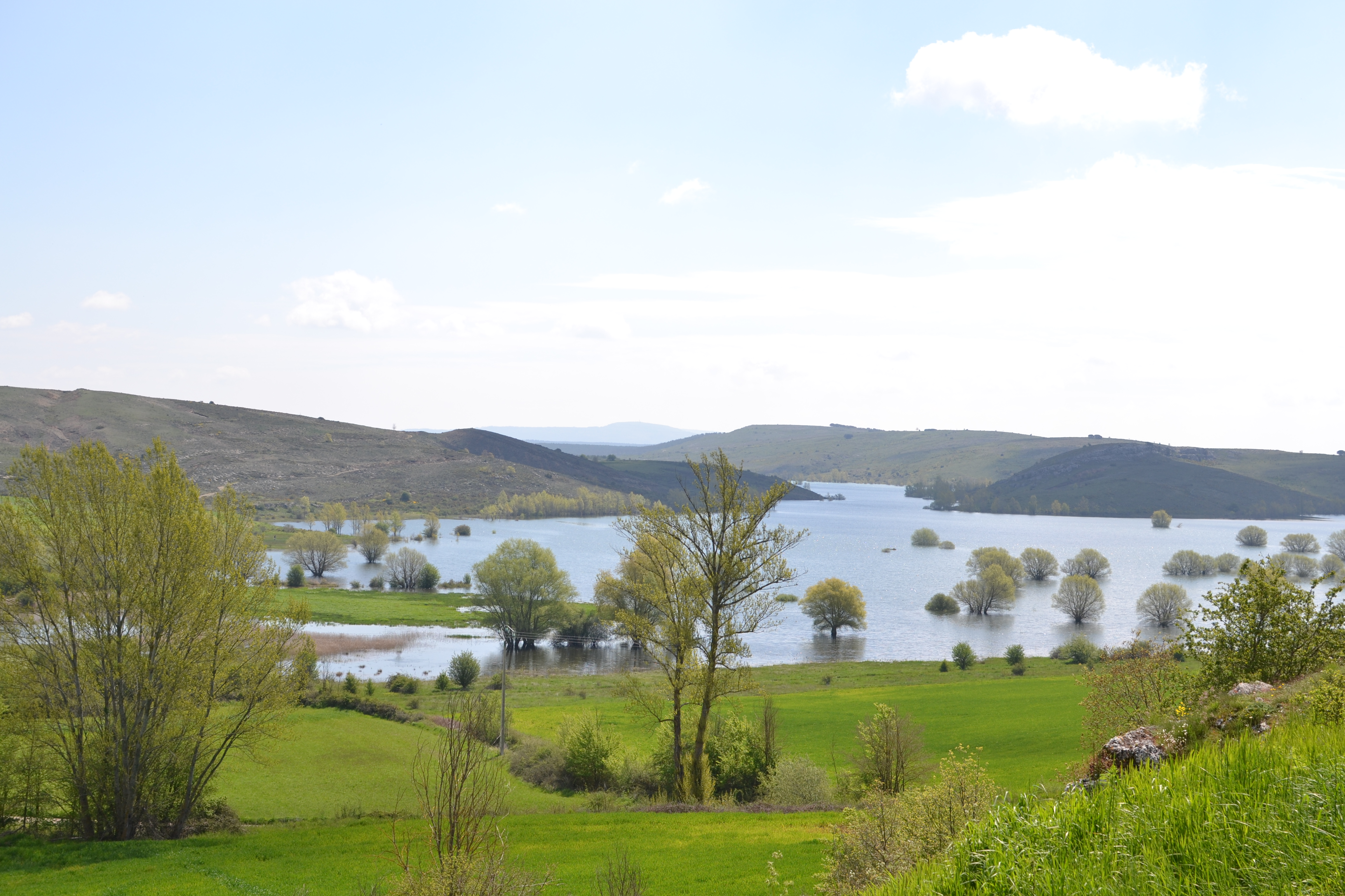
About four kilometres from Vallespinoso, a branch of the trail allows the traveller to go around the mountain and visit Barrio de San Pedro and Barrio de Santa María, two districts of Aguilar de Campoo. Almost one kilometre later, this branch goes back to the main trail.
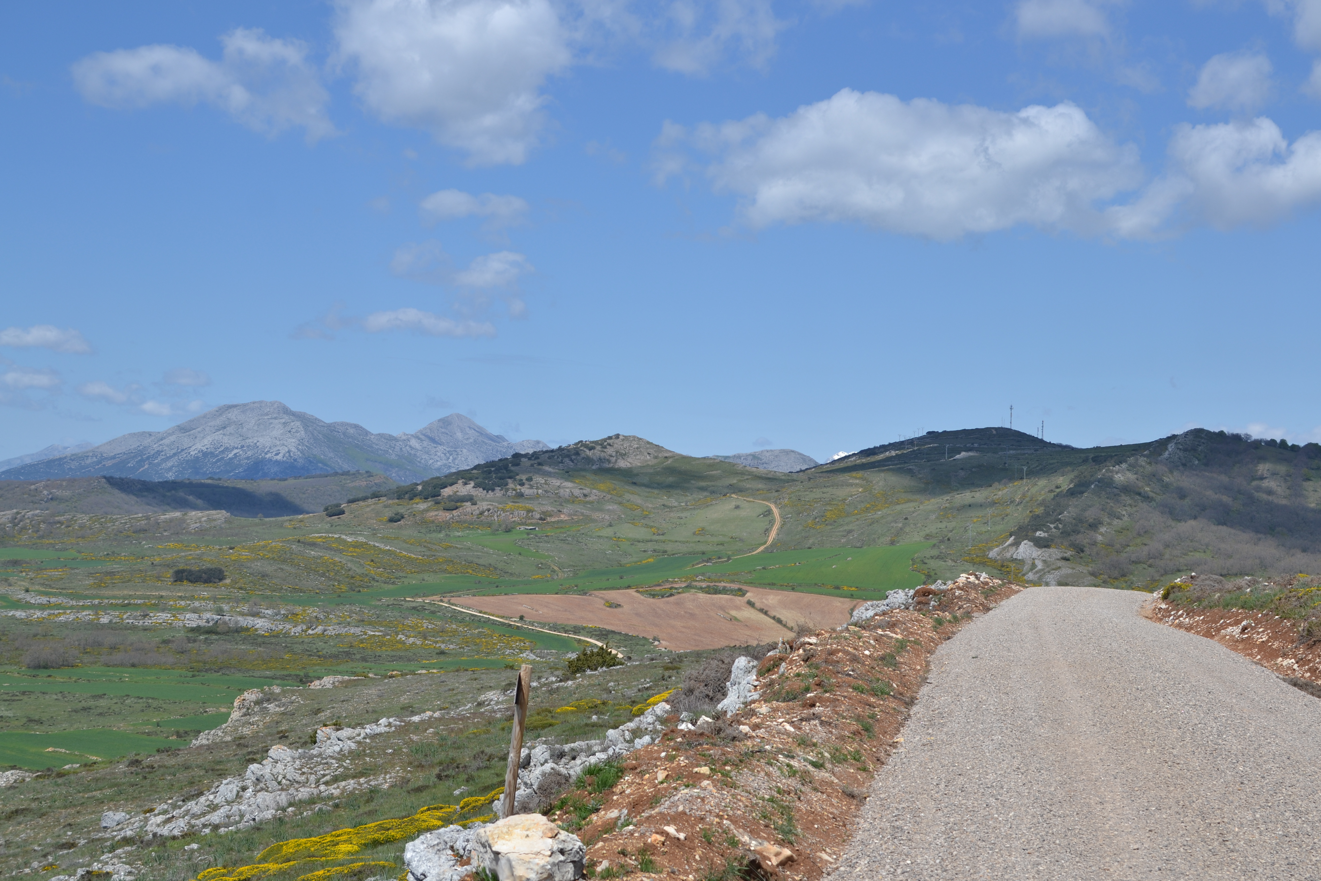
As the main route goes up the side of the mountain (La Ruya Mountain), trees become increasingly scarce and are replaced by scrub. At this point, an intersection is reached with a path leading to a photovoltaic power plant and to the windmill that the travellers could see in the ascent. This is a good place to make a stop and enjoy the great panoramic views over the region of La Ojeda, to the southwest, and over the peaks in the Fuentes Carrionas and Fuente Cobre-Montaña Palentina Natural Park, to the north.

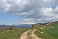
The path continues going up for a couple of kilometres before it starts going down to the P-227 road, which is reached after a sharp turn to the left. Having crossed this road, the route runs along the hillside among Pyrenean oaks (Quercus pyrenaica), pastures and crops. Leaving the Pyrenean oak forest behind and going only among pastures, the route descends to the town of Dehesa de Montejo. Before reaching the town, a path on the right must be taken, next to the panel that indicates where the Perazancas de Ojeda-Dehesa de Montejo Route joins this main route again.
After crossing the P-227 road once more, the path goes up to Peña Umoma and just above La Estación, where a sign tells the traveller more about the breath-taking views of the high mountains of the range of Fuentes Carrionas, in the Cantabrian Mountains.
The route then goes down to an intersection with a dirt path, where travellers must go left. After crossing a railway track (caution, this level crossing has no barriers), the trail leads directly to the town of Vado among pastures. This second stage of the trail ends at the entrance of the town, near a branch leading to Cervera de Pisuerga (2 km), a town worth visiting due to its interesting historical heritage.
Alternative route through Barrio de San Pedro and Barrio de Santa María.
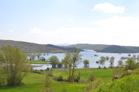
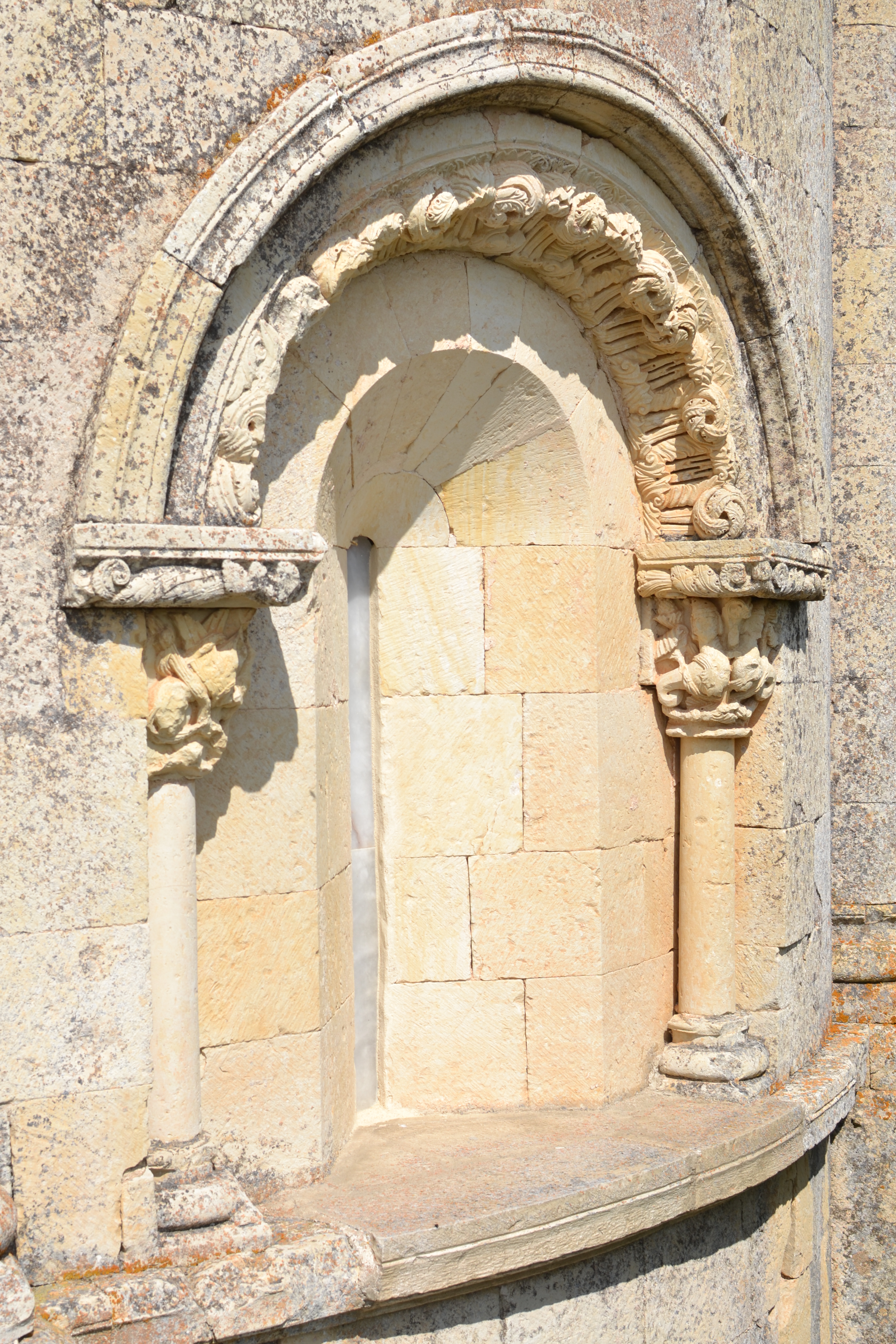
You will find the start of this branch of the trail about four kilometres after exiting Vallespinoso de Aguilar, in this second stage of the Coke Coal Route. This alternative route will allow you to discover these two districts of Aguilar de Campoo. After a gentle slope, the path starts to meander down among pine reforestation areas, with the reservoir of Aguilar at sight. First, the traveller enters Barrio de San Pedro, on the north-western side. The route then reaches a street leading directly to the Romanesque church of San Pedro. Although it is originally from the 13th century, different parts were added to this church throughout the 15th-18th centuries.
The aforementioned street goes out the town and crosses the PP-2132 road. The route then continues for almost another kilometre, up to a branch on the left leading to the hermitage of Santa Eulalia. This is a simple Romanesque temple from the late 12th century or early 13th century which was declared a Historical-Artistic Building in the 1960s.
This trail continues to Barrio de Santa María, linking with a street leading to a square where the travellers will find the next stop on their discovery of the Romanesque heritage: the church of La Asunción, dating from the 12th century, which was also modified in the following centuries and declared a Site of Cultural Interest in 1992.
After visiting the aforementioned church, which is a must, the route leaves this district through the street going left of the road where the traveller came. A path is reached that soon becomes a steep uphill path. Before entering the Vallejo de la Gorgoria gorge, travellers can look back in order to admire the reservoir of Aguilar again and to get a different view of the hermitage of Santa Eulalia, isolated among pastures. After walking through the gorge for over one kilometre, this alternative route joins the Coke Coal Route again, about one kilometre after the point where it started.
Profile
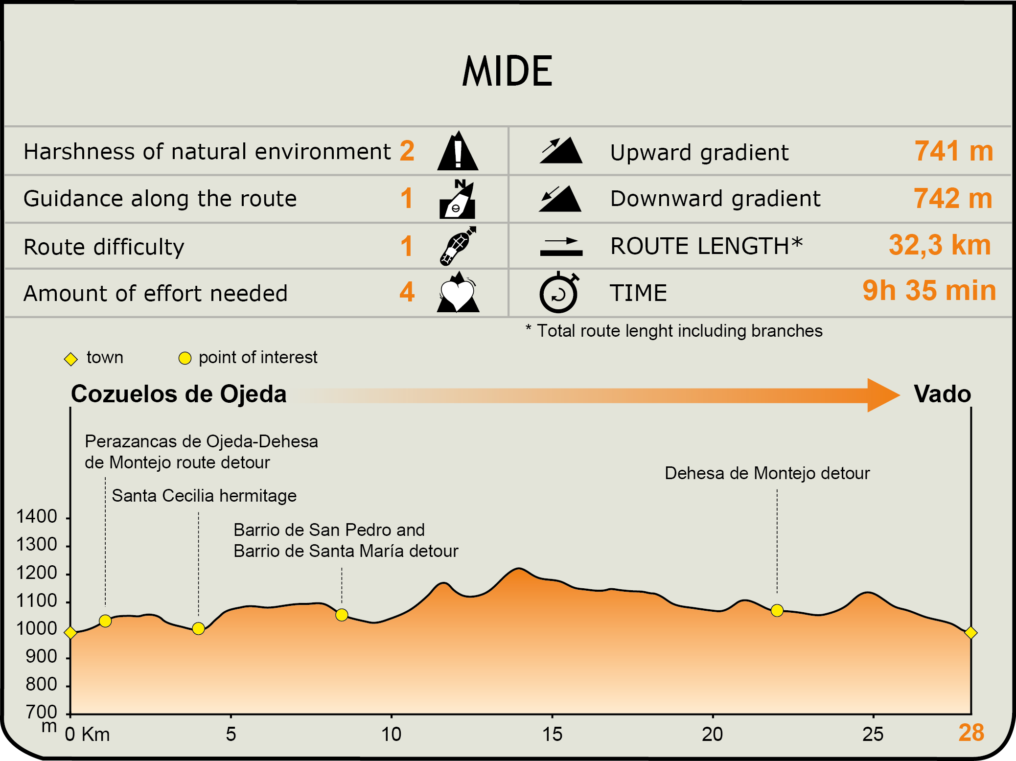
MIDE (Method for the Information of Excursions)
 Harshness of natural environment
- 1. The environment is not risk-free
- 2. There are more than one risk factors
- 3. There are various risk factors
- 4. There are quite a lot of risk factors
- 5. There are many risk factors
 Guidance along the route
- 1. Well defined trails and crossings
- 2. There is a clearly marked trail and signage
- 3. Requires the identification of geographic features and cardinal points
- 4. Requires off-path navigation
- 5. The trail is interrupted by obstacles that have to be gone around
 Route difficulty
- 1. Walking on a flat surface
- 2. Trails with different types of path
- 3. Walking on stepped paths or irregular terrain
- 4. The use of hands or jumping over the terrain is necessary
- 5. The use of hands is required to progress
 Amount of effort needed
- 1. Up to 1 hour of continuous walking
- 2. Between 1 and 3 hours of continuous walking
- 3. Between 3 and 6 hours of continuous walking
- 4. Between 6 and 10 hours of actual walking
- 5. More than 10 hours of continuous walking
Featured
Further information
Cervera de Pisuerga
Only two kilometres before the end of this stage, the traveller will find the town of Cervera de Pisuerga. This town is one of the main tourist and commercial centres in the Palentinian Mountains, as well as being the administrative centre of this vast region. Today, this town mainly focuses on tourism, since the reservoir of Ruesga and the Parador Nacional Fuentes Carrionas are near the town. However, it used to be it was also an important mining site, with anthracite and pyrite mines.
Among the historical heritage of Cervera de Pisuerga, the church of Santa María del Castillo must be remarked. This is a Gothic church holding valuable altarpieces, such as the one in the chapel of Santa Ana (with a painting by Juan de Flandes, The Adoration of the Magi), or the Renaissance altarpiece). Another remarkable landmarks are: the rock hermitage of San Vicente, surrounded by a necropolis (8th and 11th centuries) and located in the district of Vado, near the Pisuerga river; the Casa de los Leones, a nobleman palace with two ornate shields in the façade (now is the local library); the Cervera palace, which is now the Piedad Isla ethnographic museum; the arcaded square; and the palace used as the Cultural Centre today.
Multimedia


Downloads
GPS Downloads
Cyclability
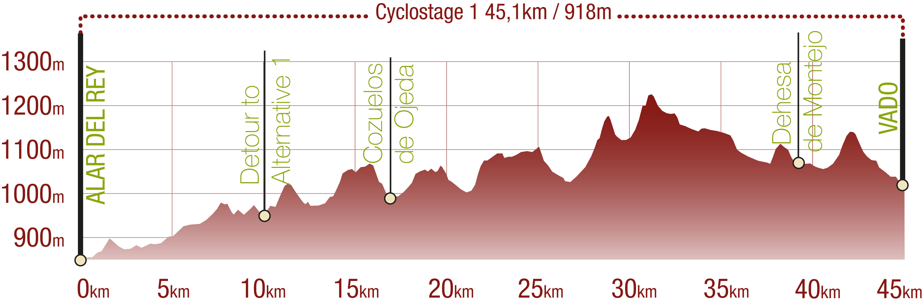
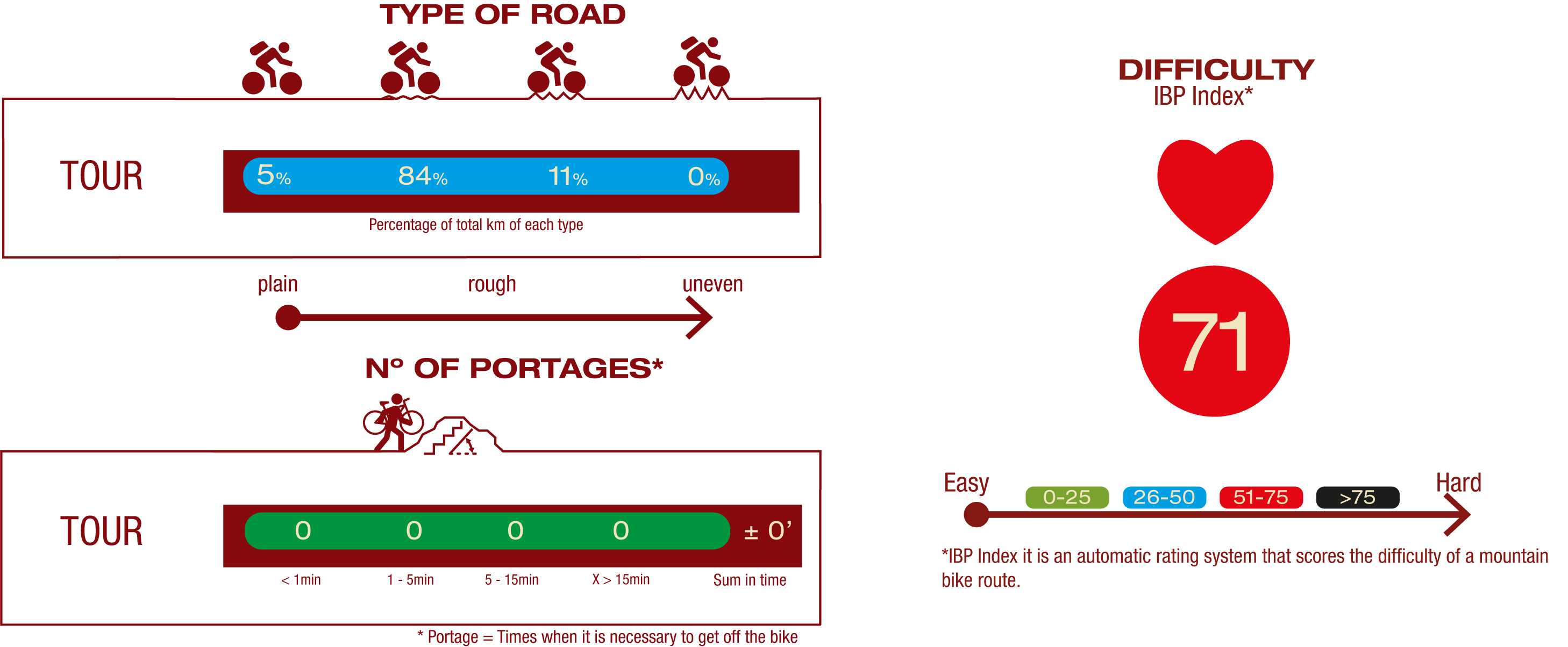
This Cyclostage corresponds to stages 1 & 2 of the Coke Coal Route of this Nature Trail
PROFILE
TYPE OF ROAD, PORTAGES & DIFFICULTY
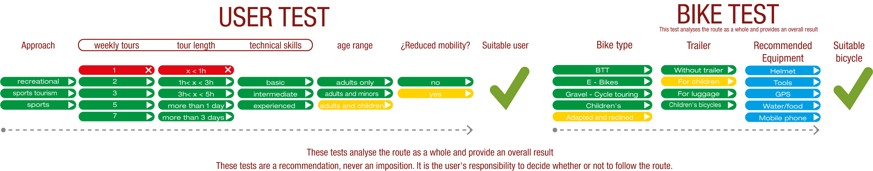
TEST
SAFETY RECOMMENDATIONS
- Sections shared with hikers.
- Transit through the centre of some population centres.
GENERAL RECOMMENDATIONS
- Find out about the technical aspects of the route and the weather on the day.
- Take care of the environment. Take care not to disturb animals or damage vegetation. Respect private areas.
- You must give priority to pedestrians and comply with general traffic rules.
- The environment in which you will be riding is open, free to move around and an area where many activities are carried out (sporting, forestry, livestock and agricultural activities). Always have an understanding, prudent, responsible and respectful attitude.