
Stage 21: Moral de Sayago - Villadepera
Description
Amidst holm oaks and granite outcrops
The walk along Arroyos Creek allows the traveller to enjoy the built heritage that dot the path, namely the old mills. The route traverses through holm oak dehesas bordered by stone walls. The constant presence of granite outcrops or "berrocales" adds great beauty and uniqueness to the landscape. The last part of the Stage runs at a higher altitude through more open terrain, with sweeping views of the area. The route leads here into Arribes del Duero Nature Park, through which the Trail runs until the end of the Duero Nature Trail.
The Stage begins next to the information panel located just outside Moral de Sayago, near Molino del Puerto, between the village and the road leading to Villalcampo.
The route heads north along Arroyos Creek. Shortly after, it reaches the recently restored Molino del Puerto, an example of the countless mills that dot the creeks in this area.
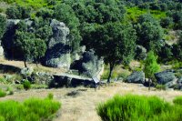
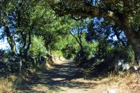
The path runs between stone walls, Portuguese oaks (Quercus faginea), holm oaks (Quercus ilex), a few blackthorns (Prunus spinosa) and granite outcrops. The route is very pleasant, amidst holm oak dehesas on grass and granite boulders. Ashes (Fraxinus angustifolia) and brambles (Rubus sp.) grow in the cooler spots.
Further on is another mill known as Molino de Mielgos, now in ruins. The mills of Luzvelina and Resbaladera, the largest in the area, stand out from the rest of the mills that line the banks of streams and creeks. At some point in time, this mill surpassed its artisan use, and became a small industry. The mill was first equipped with a small, coal-fired, steam engine. With the advent of electrical power, a small transformer was installed to ensure that it could continue operating in summer when the water level dropped. The mill was also rigged to power a saw mill.
The route continues through an unchanging landscape, at times between stone walls that border the farms, until it crosses a bridge on a creek. The Trail reaches a large landfill, a former gravel and rock pit used to build the nearby Villalcampo Dam, now populated with sizeable trees.
The signs lead to a bridge and the small Valcuevo Dam on Arroyos Creek, which the path crosses again. There is a recreational area nearby with a bathing jetty on the backwaters of the dam. The views show a more open landscape, dominated by oaks and granite outcrops. Past a short stretch near the ZA-324, the path climbs up a hill, and at the top, crosses a road.
This road marks the border of the Arribes del Duero Nature Park, through which the Nature Trail ventures until it reaches Vega Terrón.
After crossing the road with care, the route continues along a poorly marked path, with cattle grids on both sides to prevent livestock from wandering out of the farms. The path is sometimes just two vehicle tracks, amidst holm oaks and Scotch brooms (Cytisus scoparius), that gradually climbs to the top of a hill, from where one can enjoy wonderful sweeping views of the county.
The path joins a wider track known as Camino de la Dehesa, turns left and continues south. At the first crossroad, the route takes the path that emerges on the right known as Camino de Requejo, which, further on, joins another path and heads southwest. Next to the road are a few farms with vineyards, some abandoned.
In autumn and winter, one can enjoy the contrast between the evergreens, such as holm oak, and the deciduous species, such as ash, whose branches appear naked without leaves.
After crossing a stone pontoon, the route takes the path that emerges on the right between stone walls, and ventures through a beautiful holm oak forest with numerous, stunning rocky outcrops.
Several stone pontoons cross over various creeks. As the path climbs higher, the oak trees give way to brooms. The landscape is coloured with intense yellow in spring during the flowering season.
There are fewer granite and rocky outcrops as the path continues upwards, and a few farms dot the landscape. One can enjoy good views of the surrounding owing to the height and lack of trees and bushes.
Further on, the path takes the right fork that leads down to Villadepera. Stepping stones have been placed at a wide fork in the creek to cross without getting wet feet during the rainy season. Nearby is a watering trough for livestock.
The increasing number of farms enclosed by stone walls and the abundance of farm roads announce the proximity of Villadepera. Greater attention should be paid to the signs to continue on the route. Holm oaks, ashes and willows abound, especially along the stone walls.
The route heads amidst buildings to the town centre, where information panels describe cultural and ethnographic features of interest.
Sites of interest
Profile
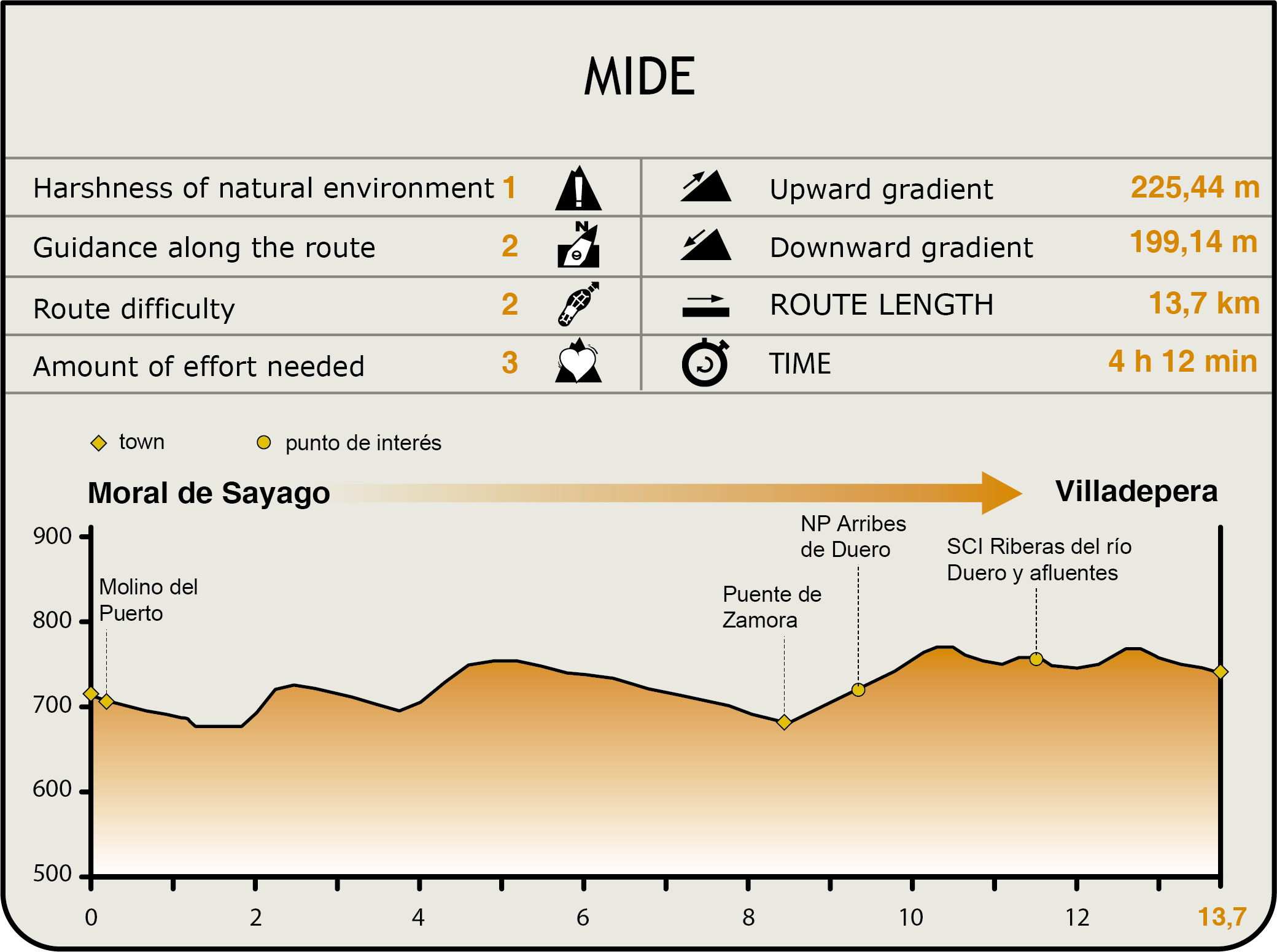
MIDE (Method for the Information of Excursions)
 Harshness of natural environment
- 1. The environment is not risk-free
- 2. There are more than one risk factors
- 3. There are various risk factors
- 4. There are quite a lot of risk factors
- 5. There are many risk factors
 Guidance along the route
- 1. Well defined trails and crossings
- 2. There is a clearly marked trail and signage
- 3. Requires the identification of geographic features and cardinal points
- 4. Requires off-path navigation
- 5. The trail is interrupted by obstacles that have to be gone around
 Route difficulty
- 1. Walking on a flat surface
- 2. Trails with different types of path
- 3. Walking on stepped paths or irregular terrain
- 4. The use of hands or jumping over the terrain is necessary
- 5. The use of hands is required to progress
 Amount of effort needed
- 1. Up to 1 hour of continuous walking
- 2. Between 1 and 3 hours of continuous walking
- 3. Between 3 and 6 hours of continuous walking
- 4. Between 6 and 10 hours of actual walking
- 5. More than 10 hours of continuous walking
Featured
Further information
Arribes del Duero Nature Park
Arribes del Duero, which straddles the provinces of Zamora and Salamanca, is part of a county traditionally known as "raya con Portugal" (line with Portugal).
The area is notable for its amazing landscape, wedged between the River Duero and its tributaries, in deep granite canyons carved out by the water.
After crossing the plains covered with fields of grain, the Duero flows into the western peneplain carved out of hard Palaeozoic materials, where deep canyons and cliffs, 400 metres high, confine the waterways. This deep, 100-kilometre long "gash" in the ground has created a Mediterranean microclimate in which species rarely seen at this latitude thrive. Olive, almond and fruit trees grow in terraces built on the steep slopes. There is also a rich community of riparian vegetation, including willow, ash and hackberry groves. The peneplain is dominated by a typical mosaic landscape of farmlands enclosed by stone walls, interspersed with grasslands and oak forests.
In addition to this rich and unique plant community, the area is also rich in fauna. Owing to this diverse and rich wildlife, the area was designated by the European Union as a Special Protection Area for Birds in 1990. These natural, scenic and wildlife values also led to its designation as a Nature Park in 2002.
Multimedia

