
Stage 10: Aranda de Duero - Roa
Description
Traversing through Burgalese Ribera del Duero
This Stage traverses not only through the most important wine-producing area in Burgalese Ribera del Duero, but also through a land in which spring lamb is considered the epitome of cuisine. These are just two reasons for which this region is famous nationwide.
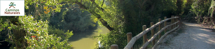
The Stage begins in the heart of Aranda de Duero, at the riverside park, and traverses through most of Burgalese Ribera de Duero. After crossing a footbridge on the river, the route follows the beautiful promenade along the calm waters.
The winding path, which also provides pedestrian access to Allende Duero Industrial Park, has many benches where one can rest. It is enclosed with railings to prevent people from falling into the river. They also serve as a wonderful viewpoint to contemplate the river, vegetation and fauna.
The Trail leaves behind the enclosed path near Aranda de Duero WWTP, where the waters are discharged back into the river after proper treatment.
EThe route continues along a straight and easy farm road parallel to the Duero. The factories and humanisation, typical of a city the size of Aranda de Duero, begin to fade gradually in the distance. Soon after, the landscape starts to be tinged with different colours in different seasons. The fields of grain glow green and gold, and vineyards add a touch of brown in the autumn.
At the junction with another farm road, the route turns left, then crosses the Valladolid-Ariza railroad, now in disuse, to continue towards Roa. Caution should be exercised owing to heavy traffic.
At the next interStage, the route turns right (west), then turns left at the next junction, heading towards Riaza Canal, a hydraulic work that supplies water for irrigation. This canal comes from Linares Reservoir. Although it was commissioned in 1945, it has been recently modernised to provide pressurised irrigation.
After crossing the canal, the route turns right, and then left to reach Castrillo de la Vega, where one can see numerous farm tools on threshing floors. A hill close to the town is riddled with cavities that are home to several wineries, a testimonial to the winemaking tradition of this land.
The route crosses Castrillo de la Vega downstream, and continues until the market gardens located in the western Stage of the town. As the route drifts away from the town, the landscape changes to fields of grain and orchards.
Gradually, the northwest bound route approaches again the river, passing next to poplars (Populus sp.) farmed for lumber, as well as native vegetation, including stone pine (Pinus pinea) and holm oak (Quercus ilex). Despite the numerous twists and turns and farm roads, the signs along the route clearly indicate which way to go.
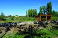
Starting from Km 13, the Stage ventures through areas in which lagoons have been created in former aggregate sites. The different stages of colonisation provide a great opportunity to observe water-related plant and animal species. These small ponds are used as resting places by a rich community of mostly migratory birds.
The route runs amidst tree stands and farmlands, mostly rain-fed, until it merges for a short stretch with the BU-120 road from Aranda de Duero to Roa that ends at Berlangas de Roa. At the edge of the town, on the right, is a rest area with shade. Further, on the left and inside the town, is a fountain.
The road traverses through the entire village and, on the opposite edge, takes the first track to the right, next to a winery and its vineyards. The landscape is tinged in different shades and textures according to the season: grey and brown in winter, with bare vineyards and ground; dark and light greens in spring and summer; and, gold and red in autumn.
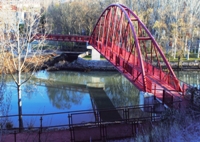
Leaving the vineyards behind, the route reaches the banks of the River Riaza, covered by dense vegetation. A barely visible stone bridge, covered with climbing plants, can be glimpsed.
Traversing through the natural vegetation of the flood plains and market gardens, which thrive in the cool climate and alluvial soil, the route reaches a road and a bridge on the River Duero, from where one can see the town of Roa, nestled high up the slope.
This short, steep climb offers the reward of reaching Roa, the endpoint of this Stage.
Profile
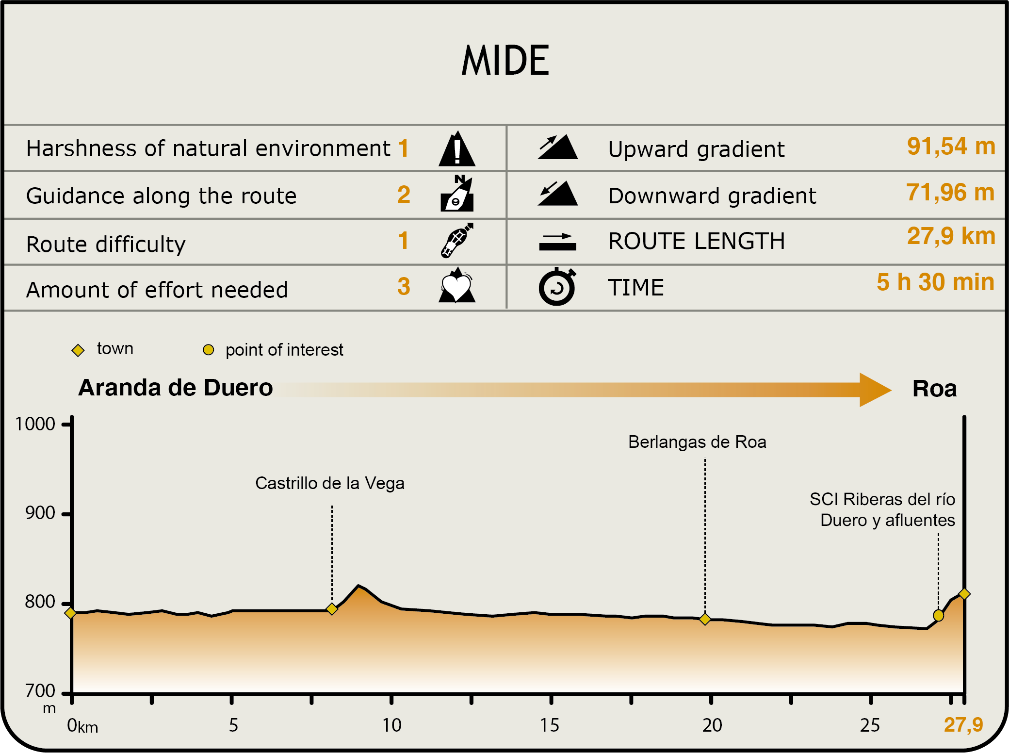
MIDE (Method for the Information of Excursions)
 Harshness of natural environment
- 1. The environment is not risk-free
- 2. There are more than one risk factors
- 3. There are various risk factors
- 4. There are quite a lot of risk factors
- 5. There are many risk factors
 Guidance along the route
- 1. Well defined trails and crossings
- 2. There is a clearly marked trail and signage
- 3. Requires the identification of geographic features and cardinal points
- 4. Requires off-path navigation
- 5. The trail is interrupted by obstacles that have to be gone around
 Route difficulty
- 1. Walking on a flat surface
- 2. Trails with different types of path
- 3. Walking on stepped paths or irregular terrain
- 4. The use of hands or jumping over the terrain is necessary
- 5. The use of hands is required to progress
 Amount of effort needed
- 1. Up to 1 hour of continuous walking
- 2. Between 1 and 3 hours of continuous walking
- 3. Between 3 and 6 hours of continuous walking
- 4. Between 6 and 10 hours of actual walking
- 5. More than 10 hours of continuous walking
Featured
Further information
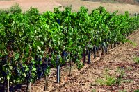
Growing vines on trellises
Traditionally, vines are pruned to form a V-shaped vinestock on the ground.
However, in recent times, growers are turning to the production of grapes on trellis systems. In this system, the "cordon" (woody horizontal growth) is positioned above the ground. Two vines are aligned along a groove and tied with a wire. The main advantages of this system are mechanization of work, faster ripening of the grapes, and lower risk of diseases due to increased aeration of the cordon.
Roa
The historic town of Roa, located in the Christian border during the Middle Ages, saw significant growth under the "Comunidad de Villa y Tierra" model, which conferred special rights and privileges (lands, grazing, and forests) to anyone who settled in Roa and its lands.
The king's will to set up a town and 33 neighbouring villages, including Calaforram (La Horra) Anguix, San Martín, La Cueva, Nava, Berlangas, Valcavado, Pedrosa, Mambrilla, Villaescusa and San Andrés was enshrined in the Fuero de Roa. As a result, these lands fell under the domain of the aristocracy. This law remained in force until the early 19th century, when all Comunidades were abolished.
In 1295, Doña Violante, widow of Alphonse X, ordered the construction of the fortress of Roa, a castle with an elegant tower, a royal palace and a robust wall with towers and six gates.
Multimedia


