- Home
- Rural Development
- Nature Trails
- Nature Trails
- Northwest Sector
- Cordillera Cantábrica. Asturias interior
Stage 5: Cangas de Onís - Villamayor
Description
Between the rivers Sella and Piloña
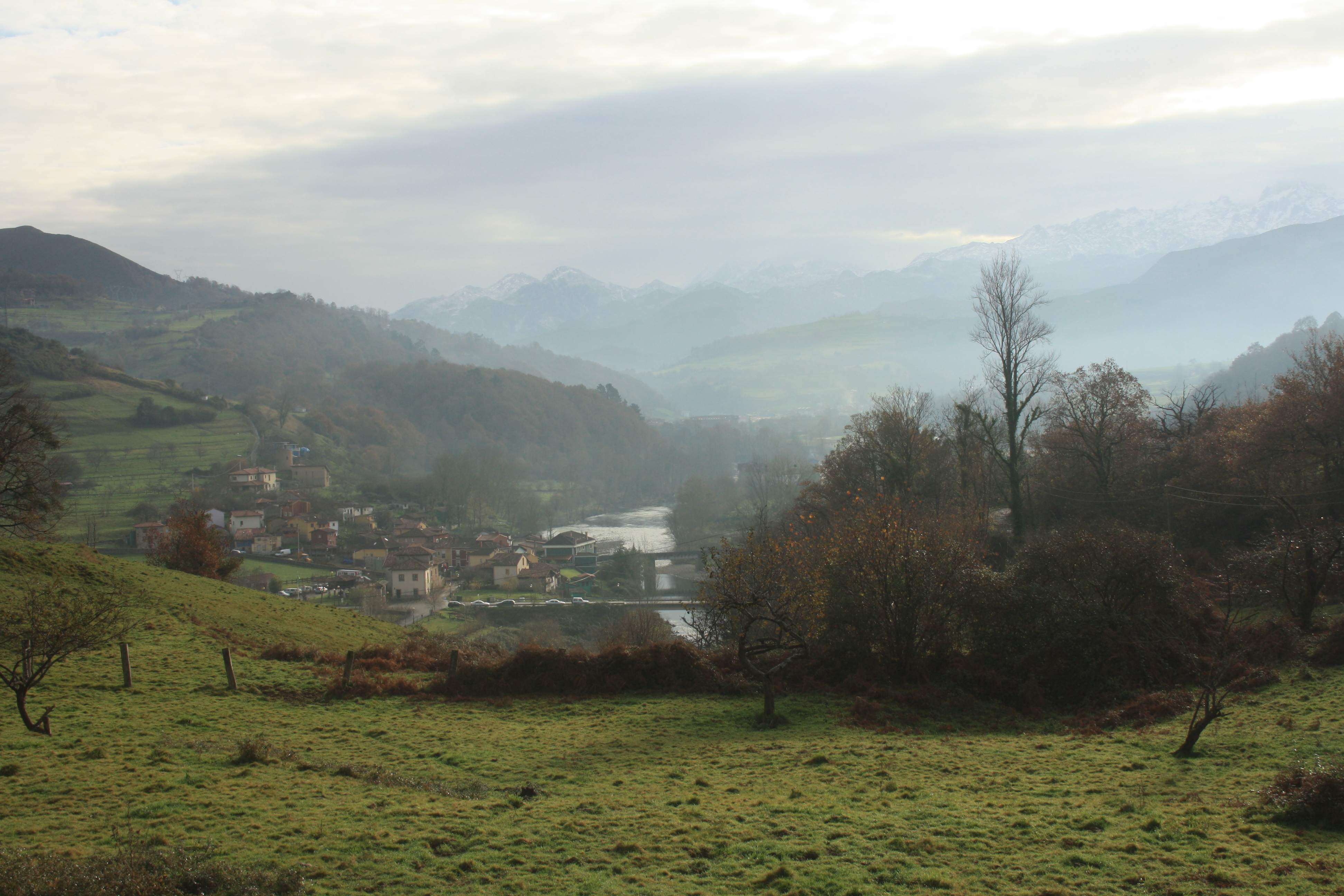
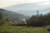
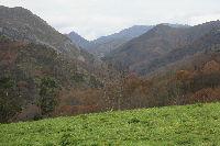
The Trail traverses the floodplains of the rivers Sella and Piloña, through meadows and chestnut groves, in counties Cangas de Onís, Parres and Piloña. The route, which starts in the historic town of Cangas de Onís, offers fantastic views of the rivers and valleys that shape the area, with the Picos de Europa National Park as a backdrop.
The fifth section of the Nature Trail starts in the town of Cangas de Onís, capital of the namesake county, traverses through County Parres and ends in in the town of Villamayor, in County Piloña. It runs along the different roads that connect the various towns in the three counties.
The route crosses first the floodplain of the river Sella, then the river Piloña, through meadows, chestnut groves and a variety of riparian vegetation, with fantastic views of the rivers and valleys, and the impressive peaks of the Picos de Europa National Park.
In Cangas de Onís, several monuments chronicle the past of this town that was the former capital of the Kingdom of Asturias until 774. It was here that one of the most important chapters in the history of the Iberian Peninsula started: the "Reconquista" by the army of Don Pelayo, who established his capital in this town. The legendary battle of Covadonga, and defeat of the Moors, took place in this municipality in 722.
The town of Cangas de Onís is located at the confluence of the rivers Sella and Güeña. The Chapel of Santa Cruz, built by order of King Favila in 737 over a megalithic cairn and underground dolmen, can be found in the valley between the two rivers. In 1936, the temple was destroyed during the Civil War, and rebuilt later. The archaeological remains of a medieval necropolis were also found in the area.
The dolmen of Santa Cruz may be accessed from the chapel through an oval opening. It is situated in a two metre high, poligonal chamber with a side opening. It has five large and two smaller stone slabs. Nothing is known about its covering. Four of the seven orthostats (stone blocks or slabs set upright to form the walls of the monument) are decorated with carvings and paintings on the inside, while the head slab was polished smoothed before it was painted red.
This section begins at the edge of Cangas de Onís, on the road to the village of Llueves. It continues along the road to Cangas de Onís, following the directional signs painted on lampposts and columns, then turns right onto Juan Carlos I Street, shortly before reaching the Municipal Sports Centre. At the end of the street, the route heads down a dirt track that runs parallel to the River Sella, declared a Site of Community Importance (SCI). The riparian vegetation here is dominated by ashes (Fraxinus angustifolia), birches (Betula pendula), poplars (Populus sp.) and oaks (Quercus robur).
The track reaches the town of Villanueva, where there is an information panel about the route. Following the directional sign and panels, the route leaves Villanueva behind through a bridge and veers right along the national road N-621 for about a hundred meters. Therefore, caution should be exercised until the Posada del Monasterio, where the path turns left, next to the car park sign.
The route now begins a moderate climb along a gravel track, whence there are views of the Parador Nacional de Cangas de Onís and the town of Villanueva. In this section, the track runs through farmland and woods dotted with hazels (Corylus avellana) and oaks.
Further on, there are two thematic tables that identify the different mountains of the Picos de Europa National Park that can be viewed along the route.
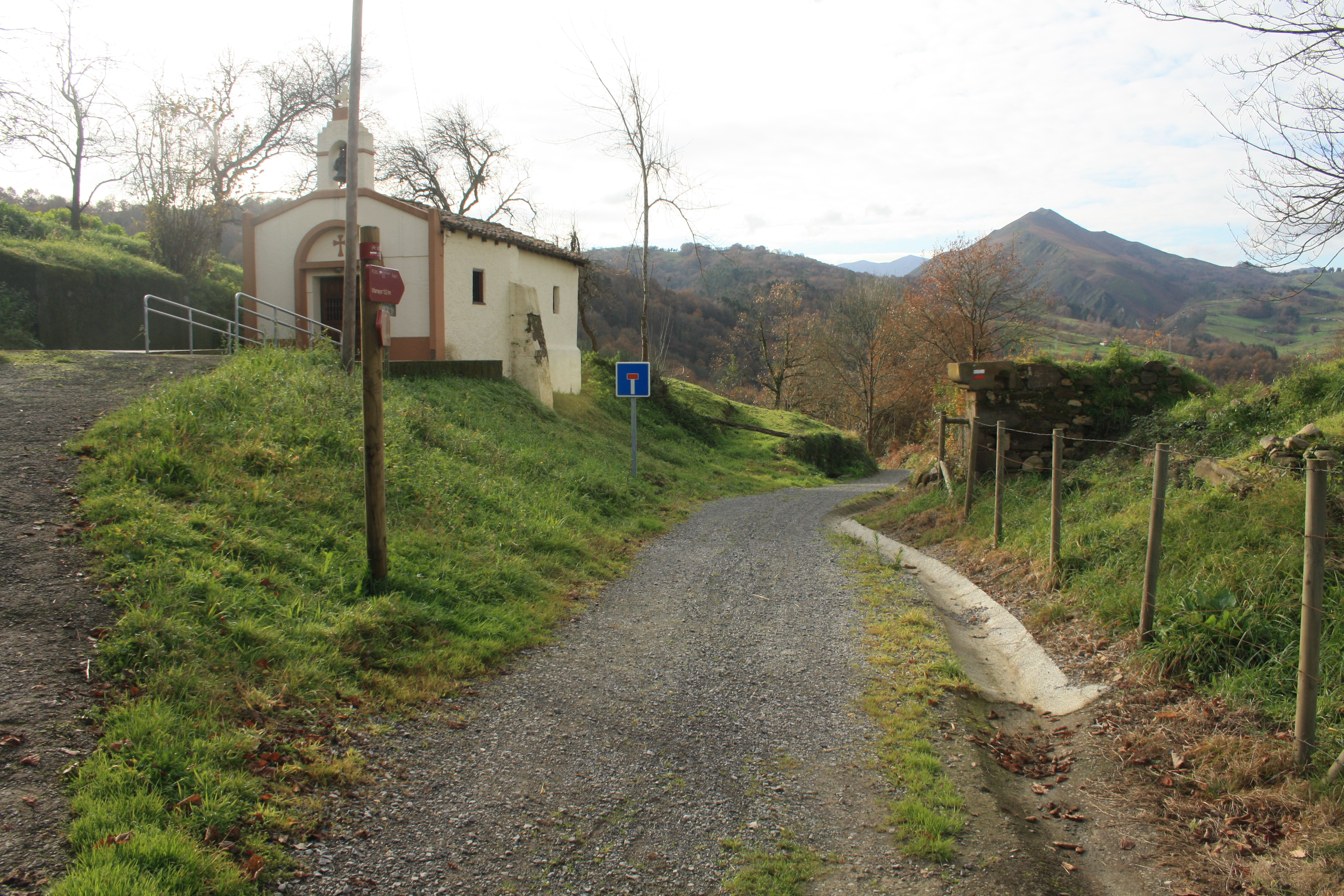
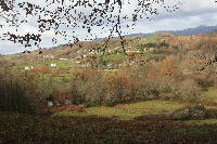
A little further on, the route ventures into a small forest of willows, chestnuts, oaks and pines, until the rural village of San Jose, where, skirting the chapel, the path descends to the right along a paved road, only to turn again immediately to the right. The route continues to descend slightly by road through meadows, chestnuts and oaks, leaving the village of La Cabaña to the right.
Immediately after, as indicated in the signs, the road turns to the right, towards the village of Romillín, via a dirt track lined on the right by limestone “murias” (stacks of pebbles). Once in Romillín, the path continues along a paved road to Romillo (Romillu).
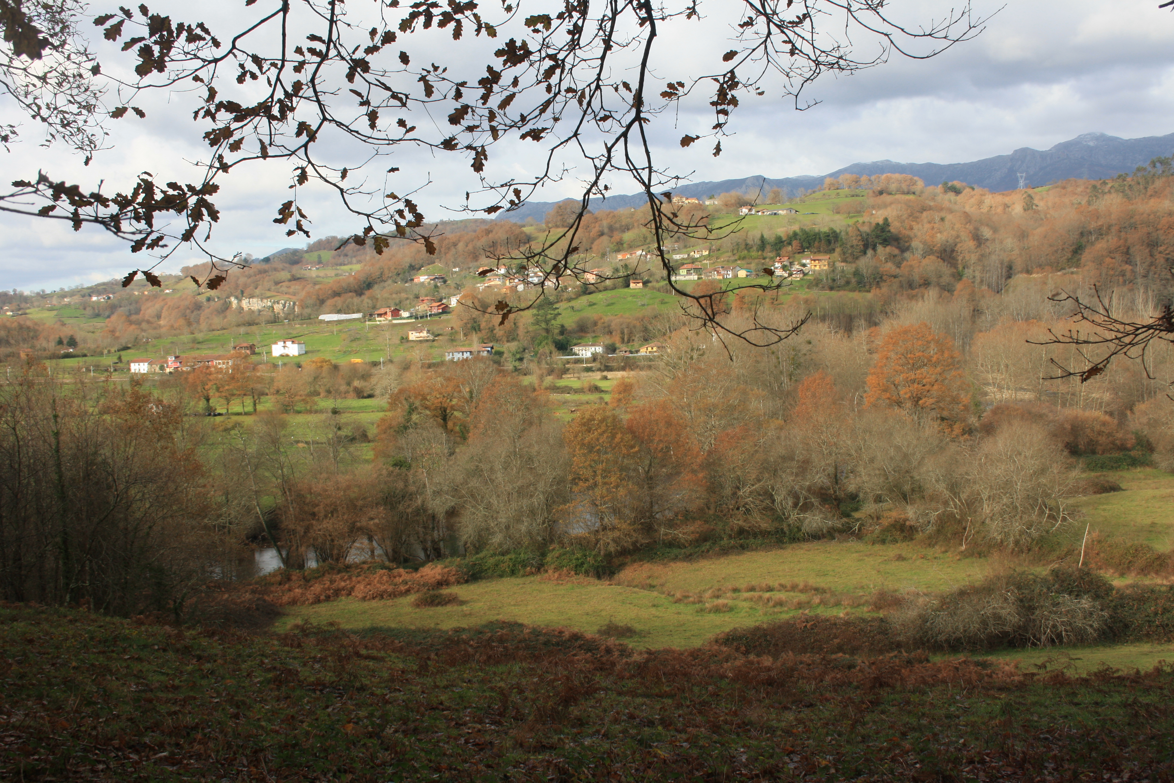
The route traverses Romillo along a gentle downhill cobbled path, leaving a small church to the left. This narrow path runs parallel to the River Piloña, through meadows and pastures lined by small chestnut and oak groves. Near the village of Vibañu, the route joins the road again to the right.
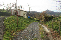
The route leaves Vibañu, past the church of Santa Maria to the right, and continues by road through El Collau, past the 12th century Chapel of San Martín de Escoto, situated in a meadow, with a table and several wooden benches to rest. From here, the route heads across pastures and grazing land, venturing into another chestnut and oak forest.
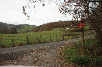
Near Soto de Dueñas, the path crosses the road and continues straight ahead to Villar de Guergo (County Piloña) along a track that climbs parallel to the left bank of the river, with great views of the floodplain. In Villar de Guergo, where the GR-109 meets the Camino a Covadonga, the route continues by road through the villages of Sevares and La Piñera, descends to Moñes and reaches El Caleru.
From El Caleru, the route skirts a house and begins a steep descent by a dirt road, with the Pico La Xiera always to the left. Shortly after leaving El Caleru, the route turns onto a narrow dirt road that descends moderately until shortly before Carua. Leaving this village behind, the route continues along the road to the village of Villamayor, where this section ends.
Sites of interest
Profile
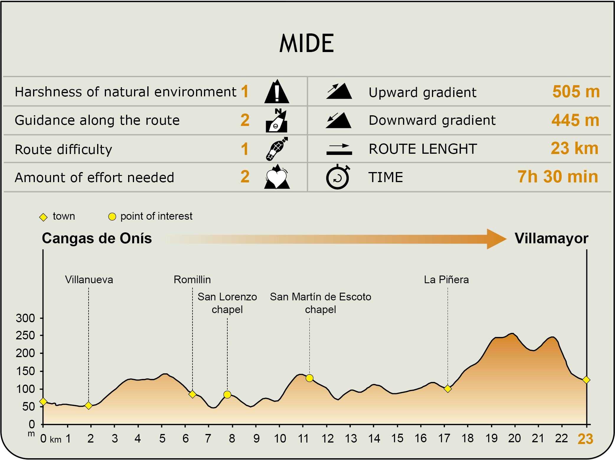
MIDE (Method for the Information of Excursions)
 Harshness of natural environment
- 1. The environment is not risk-free
- 2. There are more than one risk factors
- 3. There are various risk factors
- 4. There are quite a lot of risk factors
- 5. There are many risk factors
 Guidance along the route
- 1. Well defined trails and crossings
- 2. There is a clearly marked trail and signage
- 3. Requires the identification of geographic features and cardinal points
- 4. Requires off-path navigation
- 5. The trail is interrupted by obstacles that have to be gone around
 Route difficulty
- 1. Walking on a flat surface
- 2. Trails with different types of path
- 3. Walking on stepped paths or irregular terrain
- 4. The use of hands or jumping over the terrain is necessary
- 5. The use of hands is required to progress
 Amount of effort needed
- 1. Up to 1 hour of continuous walking
- 2. Between 1 and 3 hours of continuous walking
- 3. Between 3 and 6 hours of continuous walking
- 4. Between 6 and 10 hours of actual walking
- 5. More than 10 hours of continuous walking
Featured
Further information
The bridge and the Cruz de la Victoria
An iron cross hangs from the "Roman bridge" of Cangas de Onís, over the River Sella, to commemorate the ancient past of this town. It is a replica of the legendary Cruz de la Victoria, now in the Sacred Chamber of the Cathedral of Oviedo, which King Pelayo raised at the Battle of Covadonga.
The Cruz de la Victoria, the heraldic emblem of the Principality of Asturias, was donated to the church of San Salvador de Oviedo by King Alphonse III the Great in 908. It consists of two pieces of wood, 920 mm high and 720 mm wide, overlaid with gold, stones and enamels. On the back are several inscriptions in Latin. It has a hollow centre for relics.
Two unequal arches flank both sides of the central, canted-arch. In fact, this bridge was built over a Roman road in the Middle Ages, between the fourteenth and fifteenth centuries, during the reign of King Alphonse XI. The "pontoon", which divides the counties of Cangas de Onís and Parres, has been designated a Historic Artistic Monument.
Monastery of San Pedro de Villanueva
The Monastery of San Pedro de Villanueva (12th - 18th century) was restored and transformed into a Parador in 1998. Located on the banks of the River Sella, the Parador Nacional de Cangas de Onís is one of the Romanesque jewels of Asturias.
Declared a National Monument in 1907, the building is pre-Roman, although there is little material evidence available, only a few walls inside the Parador. The church of this former Benedictine monastery preserves the original Romanesque floor plan, as well as the circular apses and various decorative elements. It also has baroque elements, such as the tower and cloister.
The artists who decorated the church were considered the best in Asturias in their time (12th -13th centuries), their skill and technique on a par with the artists who created the "Apostolado" in the Sacred Chamber in Oviedo, a masterpiece of Romanesque Spanish sculpture. The preserved doorways are unsurpassed in beauty. The capitals depict scenes of chivalry, like the farewell between the falconer and Lady, as well as high quality animal and plants motifs.
Multimedia