- Home
- Rural Development
- Nature Trails
- Nature Trails
- Northwest Sector
- Cordillera Cantábrica. Asturias interior
Stage 3: Carreña - Benia de Onís
Description
Crossroads and mountain markets
This stage runs through various rural villages in counties Cabrales and Onís. It crosses over old bridges, and past emblazoned houses and crossroads like Cruz de Raos, an ancient meeting point on the mountain, between counties Cabrales, Onís and Llanes, where a market was held.
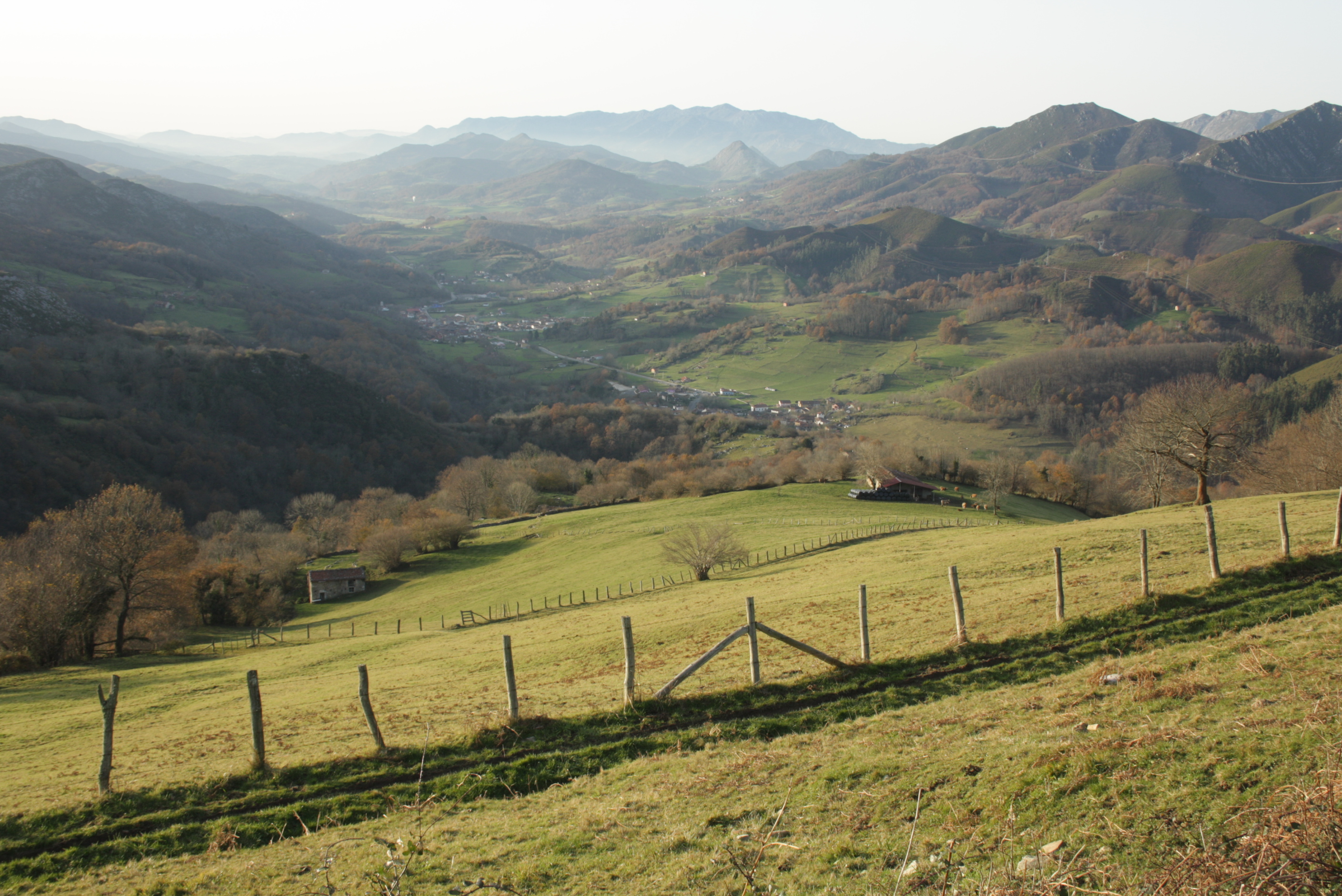
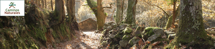
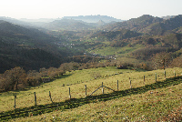
This third section of the Nature Trail, which begins in Carreña, in County Cabrales, is accessed via the AS-114. The route heads north towards Sierra del Cuera, then continues west for the rest of the way, until Benia de Onís, in County Onís. The route crosses several rural villages, like Asiego (Asiegu) and Puertas, where the remains of various flour mills can be found. It also traverses through vast arable lands in Puertas and Pandiello.
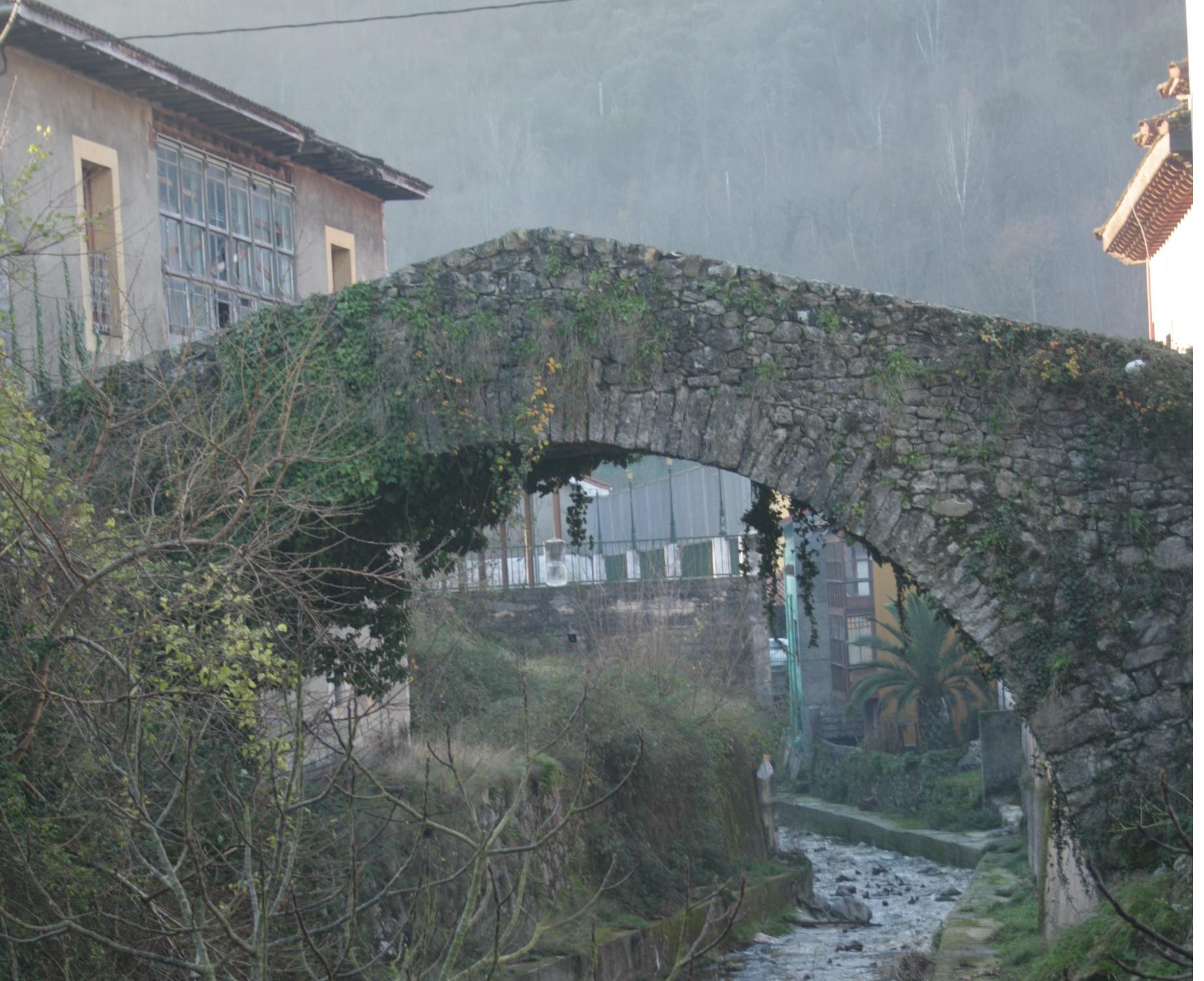
Near the entrance to Carreña, close to the town hall, is a start-end information panel. The directional signs painted on walls and lampposts lead to the opposite edge of the town, towards a track with a moderate slope that runs parallel to La Ría Brook.
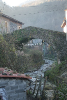
Flowing down from the River Cuera, La Ría crosses Carreña from north to south, into the River Casaño, a tributary of the River Cares. The brook is crossed by the Puente Antiguo or Puente Conceyu, a tall, single-arch, medieval bridge in good repair. Over the bridge runs an old road, the Camino Real, which winds its way from Peñalmellera to Onís, through Casaño Valley, connecting eastern and central Asturias. It joins here the Camino Real de Liébana, which from Sotres crosses County Cabrales from south to north, to end at Meré and Posada de Llanes.
Carreña is home to the Casa de los Bárcena, a 17th century former palazzo, initially owned by the Bárcena family, and later used as barracks. The building, rectangular in shape, has an asymmetrical façade with the left side built in folk style, with an open wooden solarium, and the right ornamented with the coat-of-arms of the Bárcena and Inguanzo families. Opposite the house, attached to the church of San Andrés, is the chapel and pantheon of the Bárcena family.
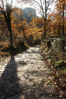
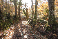
In the first part of this section, the route climbs north towards Sierra del Cuera, always parallel to the River La Riega. The gravel track, which at times becomes a dirt road, continues upstream through meadows, sometimes wedged between old stone walls, and others through chestnut (Castanea sativa) and oak (Quercus robur) forests, leaving Picos de Europa behind.
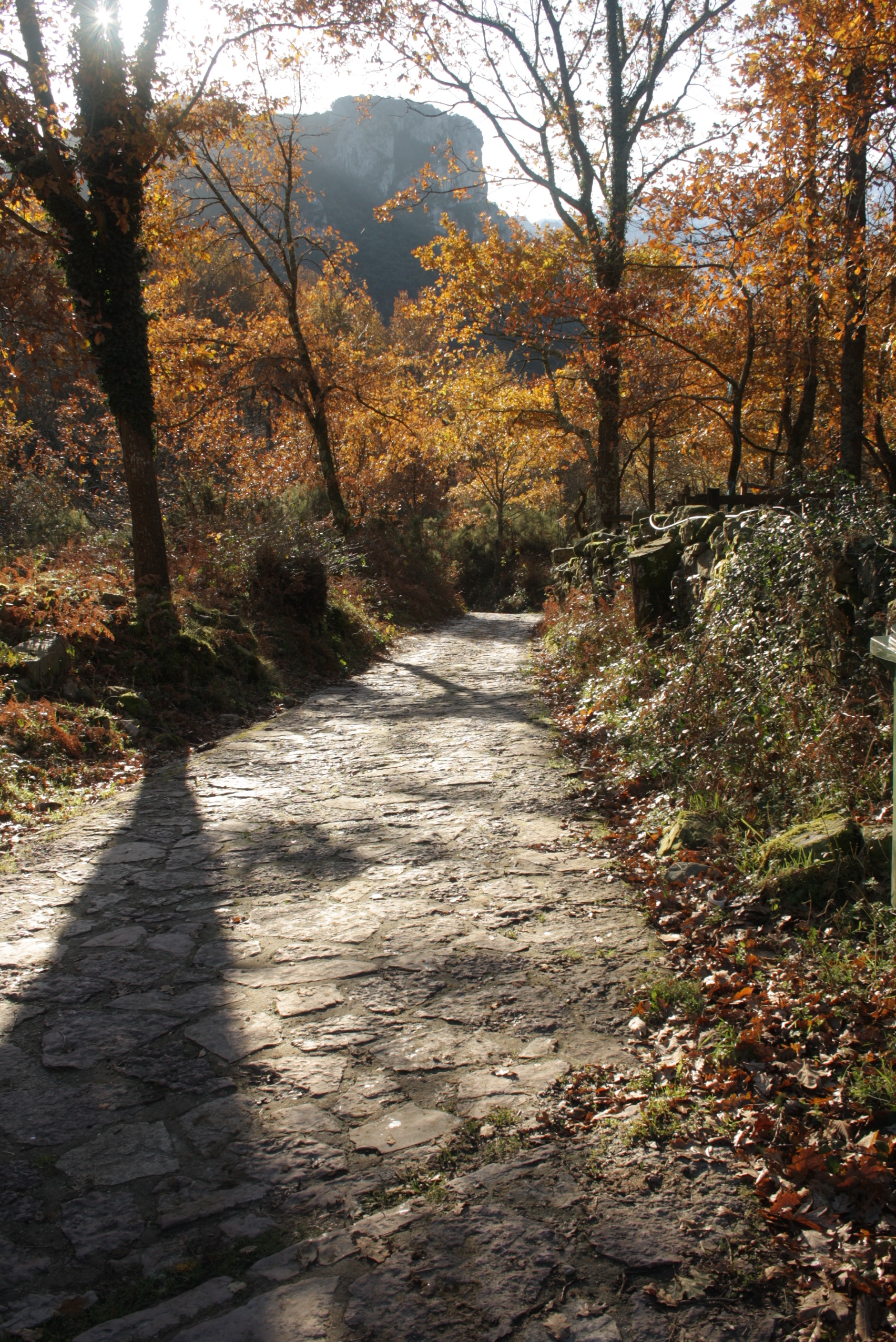
After crossing a small valley, past several cabins, the dirt road veers and begins a moderate climb up the slope of Picu Canciello, dotted with Pyrenean oaks (Quercus pyrenaica) and chestnuts, towards Asiego.
In Asiego, the route crosses the upper reaches of the town to continue along a narrow track in moderate descent towards the River Ricáu. From here, the track begins to climb along a concrete path, amongst chestnut groves and meadows dotted with cabins.
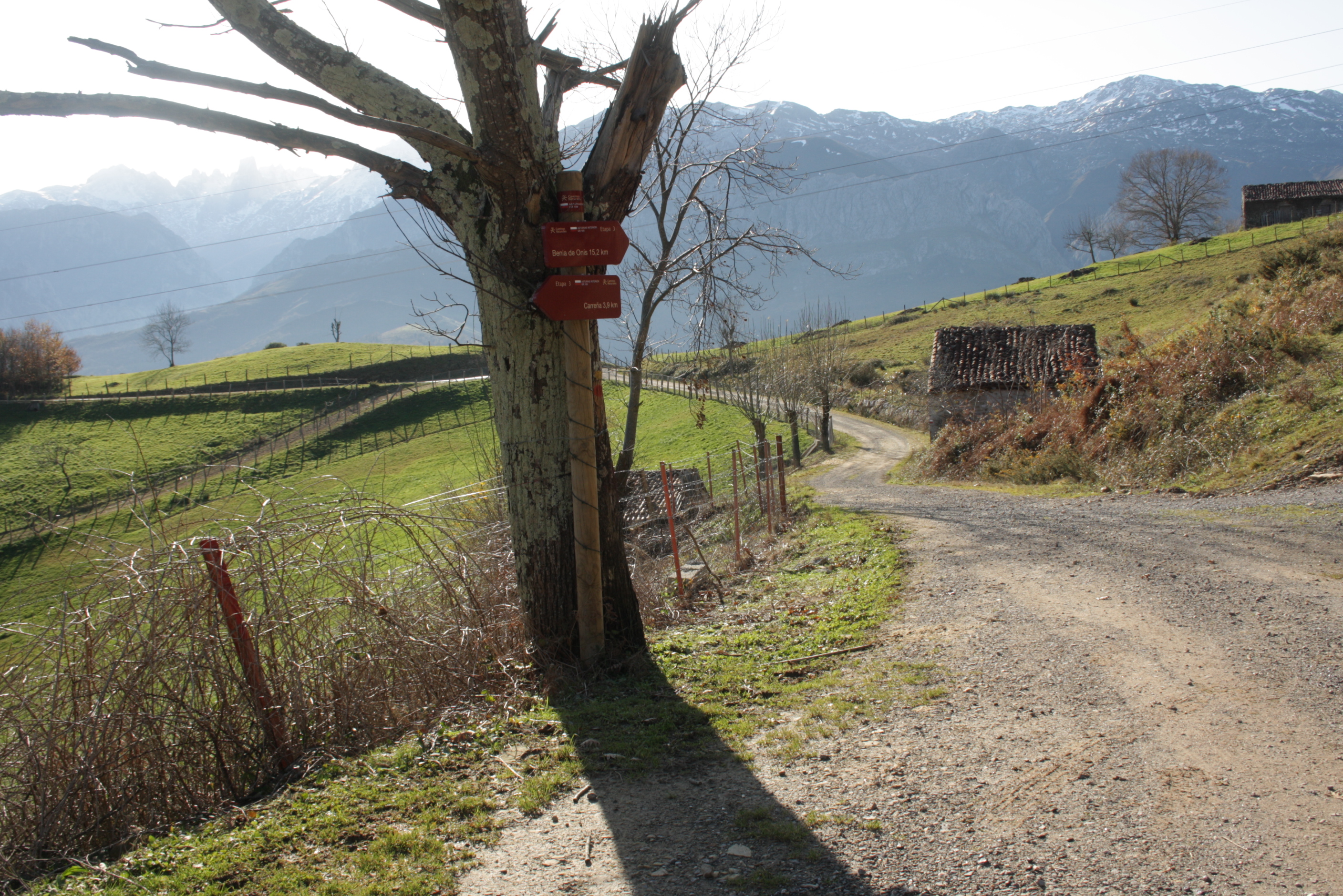
The climb continues until the route reaches the Cruz de Raos pastures, an ancient crossroads that linked counties Cabrales, Onís and Llanes. This may also have been a medieval meeting place in Roman times.
The Cruz de Raos, or Errados, which belongs to the parish of Puertas, is named after the old cross that stood watch here, and was subsequently moved near Pandiello. The place name Puertas derives from the term Portam, which means “place of passage”. This term was used in the Romance language to designate different land or territory partition systems and penetration or access areas.
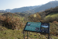
From Cruz de Raos, the route begins a slight descent along a dirt track to the road to Ortiguero (Ortigueru). Special attention should be paid to the directional signs, as the route will turn off the dirt track to continue along a narrow path. This path runs a few metres above and parallel to the road towards Ortiguero quarry, until it reaches the village of Salce. The next stretch of this section starts here, climbing through limestone walls, and leaving behind a cave used to age Cabrales cheese, towards the neighbouring County Onís.
>The last stretch of the route runs along a downhill track towards Avín, in County Onís. Fantastic views of the Güeña River Valley can be enjoyed along this stretch. At the edge of Avín, the road crosses the river, past the campsite, and traverses the village.
The town of Avín is divided in two by the AS-114. In the upper reaches, there is a small square where the walls of the chapel of San José, its belfry and a small sundial on the façade can be found. Opposite the chapel is the former Rectory, a fine example of a typical eastern Asturian building, now transformed into a house.
The track, sometimes wedged between old stone walls, ventures into chestnut and oak forests. In the village centre, there are several houses with a firebreak on their side walls. The remains of Puente Campu, a one-arch bridge with carved limestone ornaments that spans a now covered stream, can also be found.
The Cuevona de Avín is also an amazing place of interest. It is a natural cavity, similar to a widely open tunnel, with several side entrances that resemble columns. This unique feature, combined with the hole in the ceiling, allows natural light into the cave, enabling the growth of small trees within. The Avín Glacial Wildlife Interpretation Centre is located in Avín. A replica of a cave rhinoceros (Stephanorhinus sp.) fossil, found in the neighbouring cave of La Peruyal in 1974, can be seen at the Centre.
Leaving Avín behind, the path continues along the AS-114, towards Benia de Onís, the capital of County Onís, where the route ends. The start-end panel is located at the edge of Benia de Onís, next to the road.
Sites of interest
Profile

MIDE (Method for the Information of Excursions)
 Harshness of natural environment
- 1. The environment is not risk-free
- 2. There are more than one risk factors
- 3. There are various risk factors
- 4. There are quite a lot of risk factors
- 5. There are many risk factors
 Guidance along the route
- 1. Well defined trails and crossings
- 2. There is a clearly marked trail and signage
- 3. Requires the identification of geographic features and cardinal points
- 4. Requires off-path navigation
- 5. The trail is interrupted by obstacles that have to be gone around
 Route difficulty
- 1. Walking on a flat surface
- 2. Trails with different types of path
- 3. Walking on stepped paths or irregular terrain
- 4. The use of hands or jumping over the terrain is necessary
- 5. The use of hands is required to progress
 Amount of effort needed
- 1. Up to 1 hour of continuous walking
- 2. Between 1 and 3 hours of continuous walking
- 3. Between 3 and 6 hours of continuous walking
- 4. Between 6 and 10 hours of actual walking
- 5. More than 10 hours of continuous walking
Featured
Further information
Mountain markets
The mountain markets or fairs have a long-standing tradition in Asturias. They are located at crossroads to facilitate the influx of sellers and buyers from different counties. A large blackened sandstone marks the spot where the market was held. According to tradition, a weekly market was held every Wednesday at the Cruz de Raos. The inhabitants of the three neighbouring counties -Cabrales, Onís and Llanes- would attend this market.
A Royal Provision enacted in 1670 by Mariana de Austria, regent during the minority of King Charles II, exempted the inhabitants of Cabrales from tax on livestock sales within and outside the county, and granted them the privilege of holding a trade fair at Cruz de Errados on September 2nd. Not only was livestock traded at these fairs, but also agricultural products and Spanish and foreign textiles. Over time, the Cruz de Raos market was replaced by the farmer's market that takes place today in the town of Benia in County Onís.
Cabrales cheese
County Cabrales is famous for its cheese, made from cow milk, and, sometimes, a blend of cow, sheep and goat milk, from animals grazed in mountain pastures. The method used to manufacture Cabrales cheese, with Protected Designation of Origin since 1981, has remained unchanged since ancient times. The cheese continues to be aged in local mountain caves during a long period.
Since 1968, the Cabrales Cheese Contest, held on the last Sunday of August, attracts the best cheeses of the region, which are tasted by the attendees. The event also includes a cultural week on Cabrales cheese, with exhibitions, guided tasting and seminars.
Arenas de Cabrales is home to the museum of this popular Asturian cheese. It is situated in a gallery of a natural cave, with guided tours on the manufacturing process and the traditional customs of the shepherds.
Multimedia