- Home
- Rural Development
- Nature Trails
- Nature Trails
- Northwest Sector
- Cordillera Cantábrica. Asturias interior
Stage 24: Besullo - Berducedo
Description
In search of the Oro River
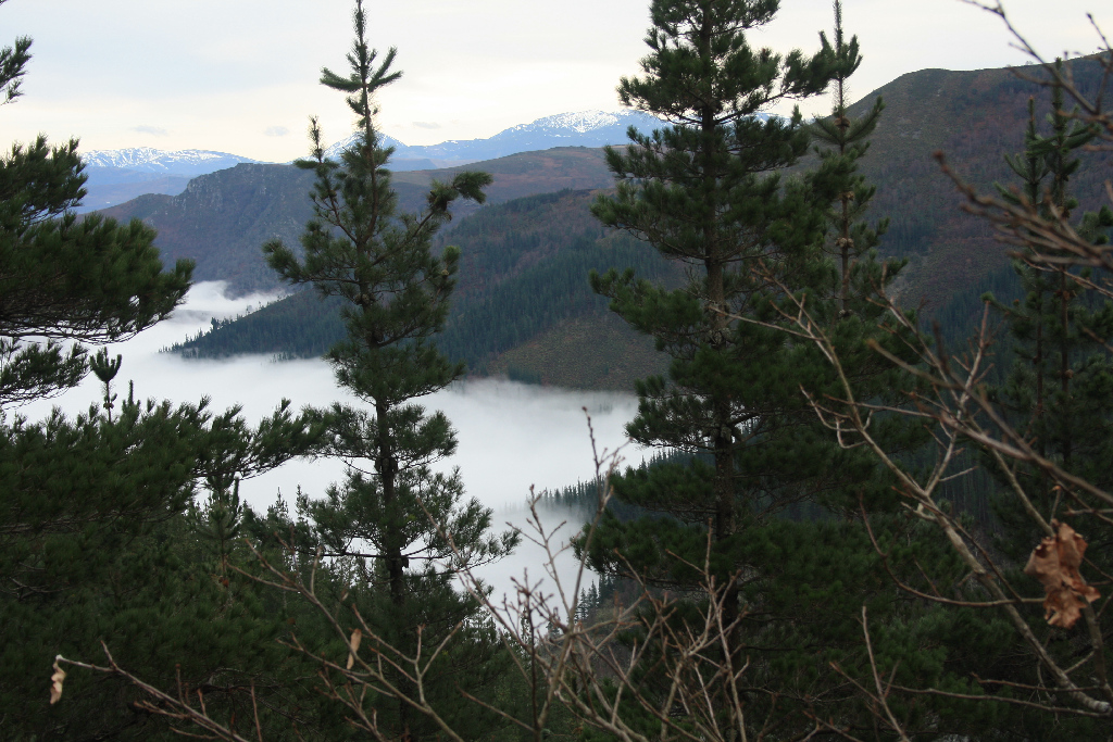
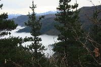
This stage begins in Besullo, in the municipality of Cangas del Narcea. The route heads north up the River Pomar Valley and Sierra de los Lagos, and then descends to County Allande to arrive at Berducedo. The route crosses County Montañas, where there are still vestiges of Roman gold mining operations. Further on, it descends to the towns that dot the Oro River Valley.
There are two alternative routes from Besullo. Both the main route and the alternative route head to Cocháu de Los Chagos, where both routes come together to continue along the same path until Berducedo.
The main route, located at the edge of Besullo, is a dirt track that leads to Pomar de las Montañas. Once in this rural town, the track climbs up through reforestation radiata pine (Pinus radiata) forests, with fantastic views over the Pomar River Valley. Further on, the route passes next to Sierra de los Lagos wind farm to arrive at Cocháu de los Chagos.
To reach Cocháu de Los Chagos, the alternative route runs from Besullo along a forest track that climbs upstream along the right bank of the River Pomar.
Shortly after taking this alternative route, the rural village of Pomar de las Montañas can be seen on the opposite bank of the river. This forest track continues to climb through pine forests, along steep slopes, to arrive at Cocháu de Los Chagos, where it joins the main route. Attention should therefore be paid to take the correct track to Berducedo.
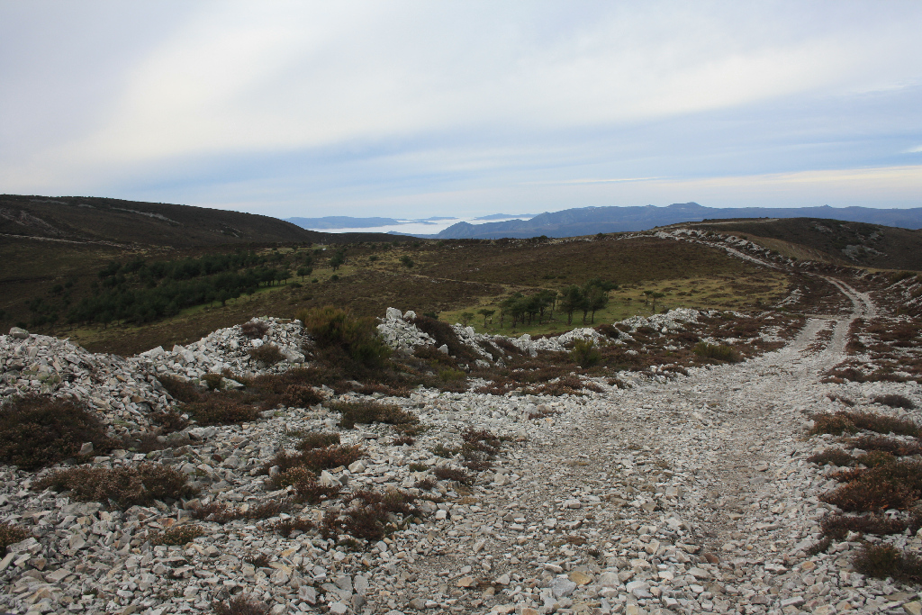
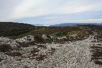
The final part of this section leaves Cocháu de Los Chagos behind, and heads north, through heath and gorse, with the wind farm to the right on Sierra de Los Lagos. To the left, in neighbouring County Allande, is Oro River valley and Berducedo Ridge. Special attention should be paid to the directional signals so as not to stray off course.
Finally, the last part of the Nature Trail descends to Villardejusto and, soon after, reaches the Oro River by a gravel track. After crossing the river, the route climbs up a road, passing near Armenande, Carcedo de Lago and Lago, towards the AS-14, where it turns left.
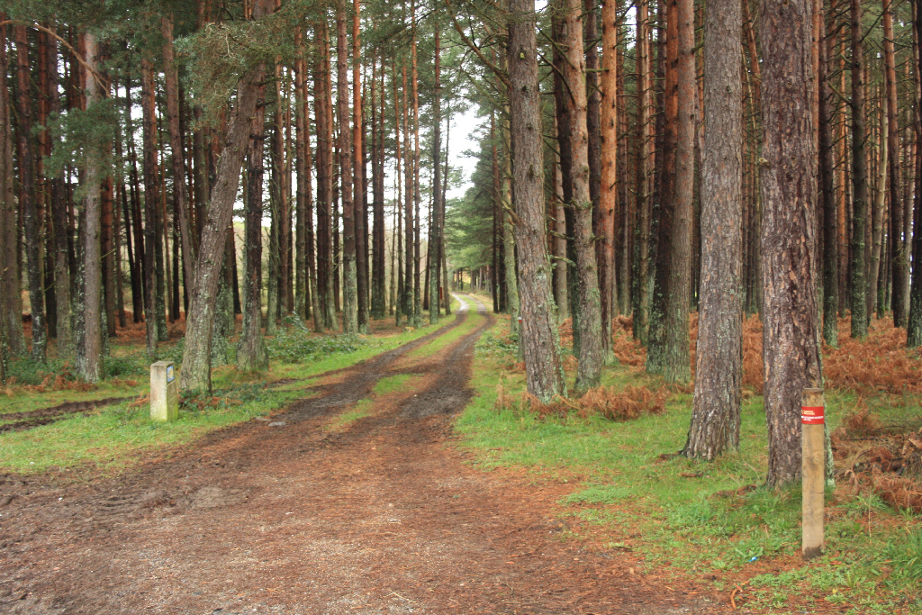
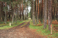
Further on, the route continues along the road, through a Scots pine (Pinus sylvestris) forest, then turns again to the left along a dirt road, through meadows, to arrive at Berducedo, and the end of this section.
Sites of interest
Profile
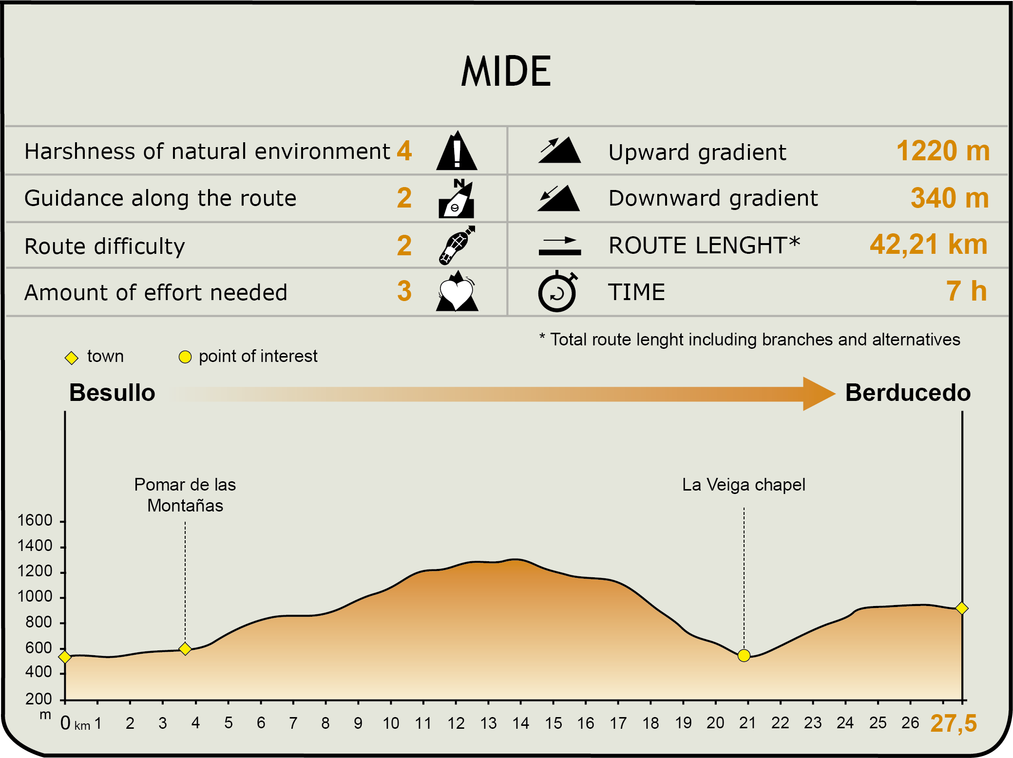
MIDE (Method for the Information of Excursions)
 Harshness of natural environment
- 1. The environment is not risk-free
- 2. There are more than one risk factors
- 3. There are various risk factors
- 4. There are quite a lot of risk factors
- 5. There are many risk factors
 Guidance along the route
- 1. Well defined trails and crossings
- 2. There is a clearly marked trail and signage
- 3. Requires the identification of geographic features and cardinal points
- 4. Requires off-path navigation
- 5. The trail is interrupted by obstacles that have to be gone around
 Route difficulty
- 1. Walking on a flat surface
- 2. Trails with different types of path
- 3. Walking on stepped paths or irregular terrain
- 4. The use of hands or jumping over the terrain is necessary
- 5. The use of hands is required to progress
 Amount of effort needed
- 1. Up to 1 hour of continuous walking
- 2. Between 1 and 3 hours of continuous walking
- 3. Between 3 and 6 hours of continuous walking
- 4. Between 6 and 10 hours of actual walking
- 5. More than 10 hours of continuous walking
Featured
Further information
Sierra de Los Lagos SCI
Sierra de Los Lagos, designated a Site of Community Importance (SCI), covers an area of 10,787 hectares in Cangas del Narcea County. This protected area is populated with various species like the Pyrenean desman (Galemys pyrenaicus), otter (Lutra lutra) and brown bear (Ursus arctos). It includes 7,333 hectares of habitats of Community interest, including priority habitats of "Raised bogs with Sphagnum and heather. Blanket bogs" and "residual floodplain forests (Alnion glutinoso-incanae)”.
Gold mining in County Montañas
There are several remnants of Roman gold-mining sites in Cangas de Narcea, in County Montañas. Towns like Pomar, San Félix and San Pedro de las Montañas are proof of this. A signposted trail provides easy access to these sites.
The most striking evidence of gold mining operations in the area is undoubtedly Carcavón de San Félix, located above San Félix de las Montañas, a village near Pomar. A dirt path opposite the village of San Félix leads to El Carcavón, a former Roman gold mining site that literally "swallowed up" part of the mountain.
The entrance to the exploratory gallery drilled by the Romans is located some 500 m from El Carcavón. This gallery runs about one hundred metres into the mountain. From the gallery, a path leads to the summit of El Carcavón, with views of the massive gaping hole in the mountain side.
Once on the summit, and further up the mountain, are the remains of the water deposits (natural hollows now covered with vegetation). Back on the path, the route heads to El Pozo, where the scars of the Roman mining operations can be seen on the landscape above the town of San Pedro.
River Oro
The River Oro rises near the mountain pass of Palo, at the foot of Sierra de Los Lagos (County Allande). The river was named Oro (gold) for the auriferous wealth of the basin, mined already in pre-Roman days.
The River Oro is formed by the confluence of the rivers Cereza and Forno. In the first stretch, the river flows south, along Sierra del Valledor, to Tremado and Collada, where it turns east to join the River Navia, from the right, at Salime Reservoir, near Villarpedre.
Way of St. James: the French Route
In Asturias starts the first pilgrimage route to Santiago de Compostela, known as "Camino Primitivo". This route was established when King Alphonse II the Chaste (791-842) went on a pilgrimage to the Holy Site, shortly after the tomb of the Apostle was found.
Thus, it became the oldest pilgrimage route to Santiago, linking Oviedo and Santiago de Compostela, through the hinterland of western Asturias (Oviedo, Las Regueras, Candamo, Grado, Salas, Tineo, Allande, and Grandas de Salime). To a large extent, it runs over the Roman road of Lucus Asturum-Lucus Augusti.
The "Camino", or French Route as it is also called in this region, climbs down from the mountain pass of Palo, across channels and Roman gold mines, and past Montefurado, where a former hospital for pilgrims stood. It then coasts along the summit of Collado del Couso, running parallel to the road, past the church of Lago, and onwards to Berducedo, through a densely populated pine forest.
Multimedia