- Home
- Rural Development
- Nature Trails
- Nature Trails
- Northwest Sector
- Cordillera Cantábrica. Asturias interior
Stage 2: Alles - Carreña
Description
The south side of Sierra del Cuera
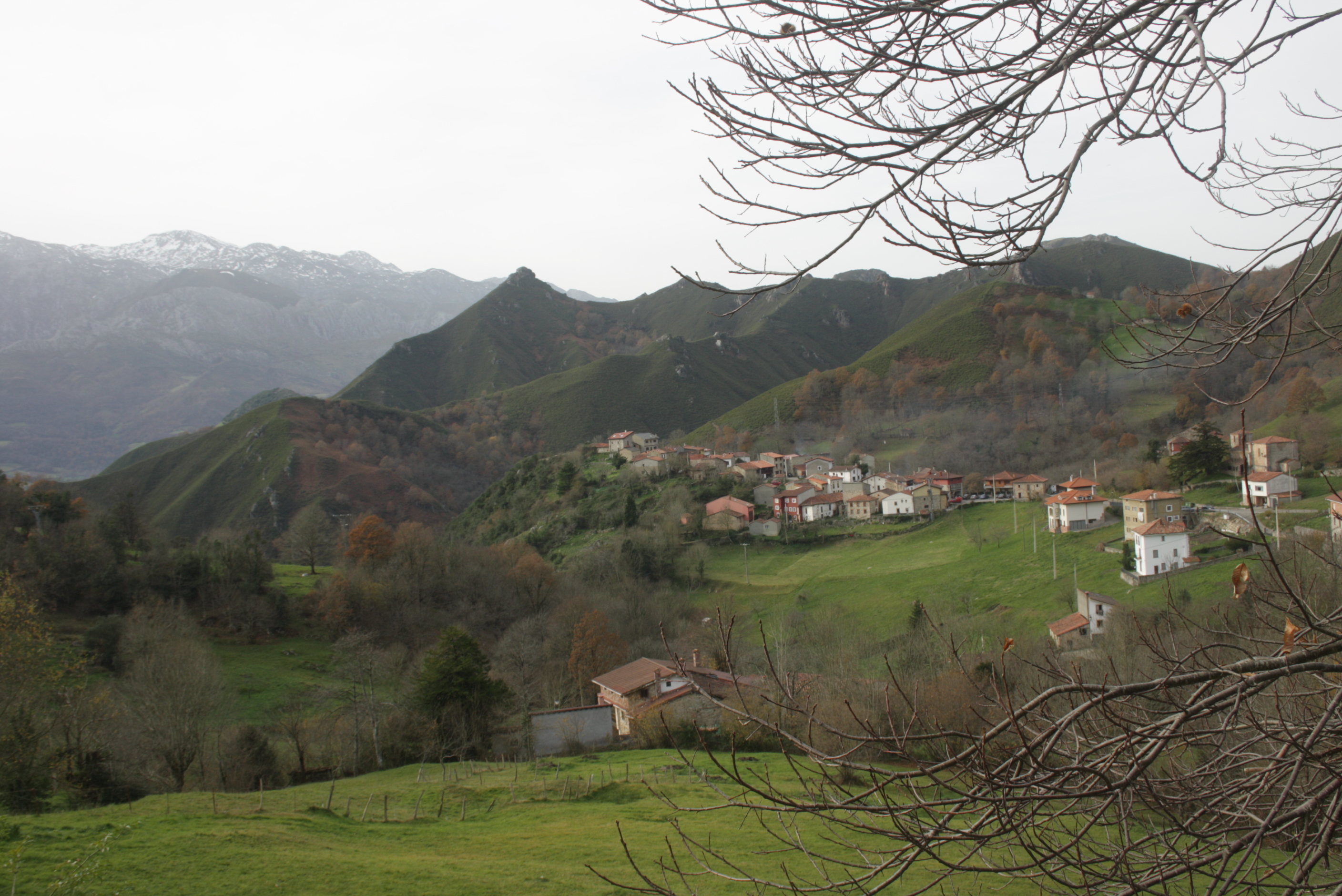
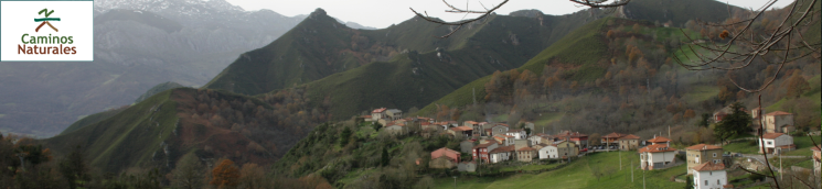
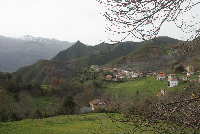
From Alles, the route runs east to west along the south side of Sierra del Cuera, a massif designated Protected Landscape. Situated just four kilometres from the coast, between the sea and the highest peaks, it demarcates the geographical boundary between the two sides, La Marina Llanisca and El Trascuera.
The second section of the Nature Trail begins at Alles, capital city of Peñamellera Alta, located at the foot of Sierra del Cuera. It continues west across the south side of the massif, and then descends to Carreño in County Cabrales.
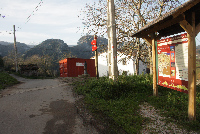
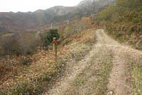
The route starts near Alles' health centre, where the information panel is located. Several directional signs point the way.
Just outside Alles are the remains of the late Romanesque church of San Pedro de Plecín, a beautiful temple that dates from the 11th to the 13th centuries. It was built over another pre-Romanesque church. Archaeological remains of a large medieval necropolis have been found below the church. The church of San Pedro de Plecín remained standing until the eighteenth century, under the patronage of the Mier family, and was converted into a cemetery when the nearby church of San Pedro was opened.
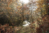
In this first stretch, the route descends steeply into the valley of the River Janu, a tributary of the River Cares, through holm oak (Quercus ilex) and holly oak (Quercus rotundifolia) forests, protected by regional legislation as vegetation of special interest. There are also other species typical to the area, such as common oaks (Quercus robur), hazels (Corylus avellana) and chestnuts (Castanea sativa). Special attention should be paid to the signs in this section, in particular, after crossing the River Sedo.
Further on, the Trail reaches a paved road, along which it continues to climb gently, parallel to the Janu, through slopes carpeted with heath (Erica sp.) and gorse (Ulex europaeus).
After crossing the bridge over the River Rumor, the route turns left and continues along a gravel track. Immediately after, the route crosses the River Janu. However, there is no bridge to cross the river; therefore, extreme care should be exercised when doing so. Attention should also be paid to the directional signs. Further on, the route crosses again the river, this time over a stone bridge. It then continues on a moderate climb to Rozagás, where views of the calcareous grassland and Sierra del Cuera can be seen behind the path.
From Rozagás, the route heads up the AS-345 to a summer pasture that demarcates the boundary between counties Peñamellera Alta and Cabrales. At this point, the road descends gently to Arangas, passing though the town. A short distance away, and after leaving behind the valley, the route continues up along a track to the right of the road, through pastures and chestnut and oak forests.
The Trail continues to climb steeply until Pandellamas, in some parts on concrete tracks. After reaching the mountain pass, attention should be paid to the signs, as the track veers to the left just before reaching some cabins. It then turns left again to descend steeply along a stone wall toward the confluence of two brooks. After crossing the brooks, the Trail continues uphill along a steep slope, skirting around a stone-walled pasture dotted with chestnut trees. Fantastic views of Sierra Panalba and, in the distance, the Picos de Europa, can be seen from here; in particular, Picu Urriellu is perfectly visible.
The climb ends at Collau of Pandejana, where a gravel track begins, with concrete surface in some places. The route continues descending until it reaches the end of this section at Carreña.
Sites of interest
Profile
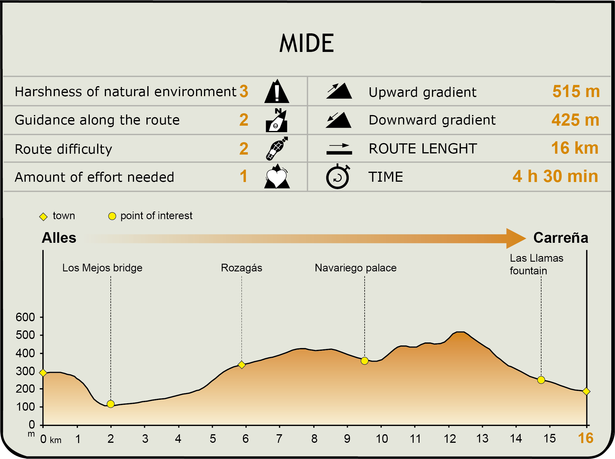
MIDE (Method for the Information of Excursions)
 Harshness of natural environment
- 1. The environment is not risk-free
- 2. There are more than one risk factors
- 3. There are various risk factors
- 4. There are quite a lot of risk factors
- 5. There are many risk factors
 Guidance along the route
- 1. Well defined trails and crossings
- 2. There is a clearly marked trail and signage
- 3. Requires the identification of geographic features and cardinal points
- 4. Requires off-path navigation
- 5. The trail is interrupted by obstacles that have to be gone around
 Route difficulty
- 1. Walking on a flat surface
- 2. Trails with different types of path
- 3. Walking on stepped paths or irregular terrain
- 4. The use of hands or jumping over the terrain is necessary
- 5. The use of hands is required to progress
 Amount of effort needed
- 1. Up to 1 hour of continuous walking
- 2. Between 1 and 3 hours of continuous walking
- 3. Between 3 and 6 hours of continuous walking
- 4. Between 6 and 10 hours of actual walking
- 5. More than 10 hours of continuous walking
Featured
Further information
Sierra de Cuera
Sierra del Cuera is a small limestone ridge, 40-kilometres long, located halfway between the sea and the highest mountains, near the rivers Sella and Deva. It is a mountain barrier very close to the coast, which demarcates two distinct geographical areas: La Marina Llanisca and El Trascuera, located on opposite slopes of the range.
The Sierra del Cuera Protected Landscape is situated in eastern Asturias, and spans the counties of Cabrales, Llanes, Peñamellera Baja, Peñamellera Alta and Ribadedeva. This coastal barrier is the boundary between counties Llanes and Ribadedeva, to the north, and Cabrales, Peñamellera Alta and Peñamellera Baja, to the south.
Prominent amongst the flora of this nature reserve are holm oaks (Quercus ilex), Asturian male ferns (Dryopteris corleyi), a species endemic to Cantabria, and tree ferns (Culcita macrocarpa). The most relevant wildlife in Sierra del Cuera includes different raptors such as the goshawk (Accipiter gentilis), peregrine falcon (Falco peregrinus), griffon vulture (Gyps fulvus), Egyptian vulture (Neophron percnopterus) and golden eagle (Aquila chrysaetos).
Alles and Casa de Mier
The village of Alles, capital city of Peñamellera Alta, is closely linked to the Mier lineage, ubiquitous throughout the district. The church of San Pedro, from late eighteenth century, was funded by Juan de Mier y Villar. This temple, overly baroque, has three oversized naves, bearing in mind the location, and a bell tower.
A series of traditional, sturdy, square, elegant and whitewashed highland-style manors can be found in the town centre. On the outskirts, atop a pointed, cylindrical limestone rock stand the remains of a medieval defensive tower, the Lombero tower, named after the neighbourhood in which it is located. Its medieval style was modified in 1646 by Domingo de Mier y Trespalacios, when it ceased to be useful as a defence.
In the square where the health centre is located, next to the 18th century chapel of Reina de los Ángeles, is Casona del Pedroso, now converted into dwellings. The façade has a large coat-of-arms flanked by two lions with the Mier family motto: “Adelante el de Mier por más valer”.
Multimedia