- Home
- Rural Development
- Nature Trails
- Nature Trails
- Northwest Sector
- Cordillera Cantábrica. Asturias interior
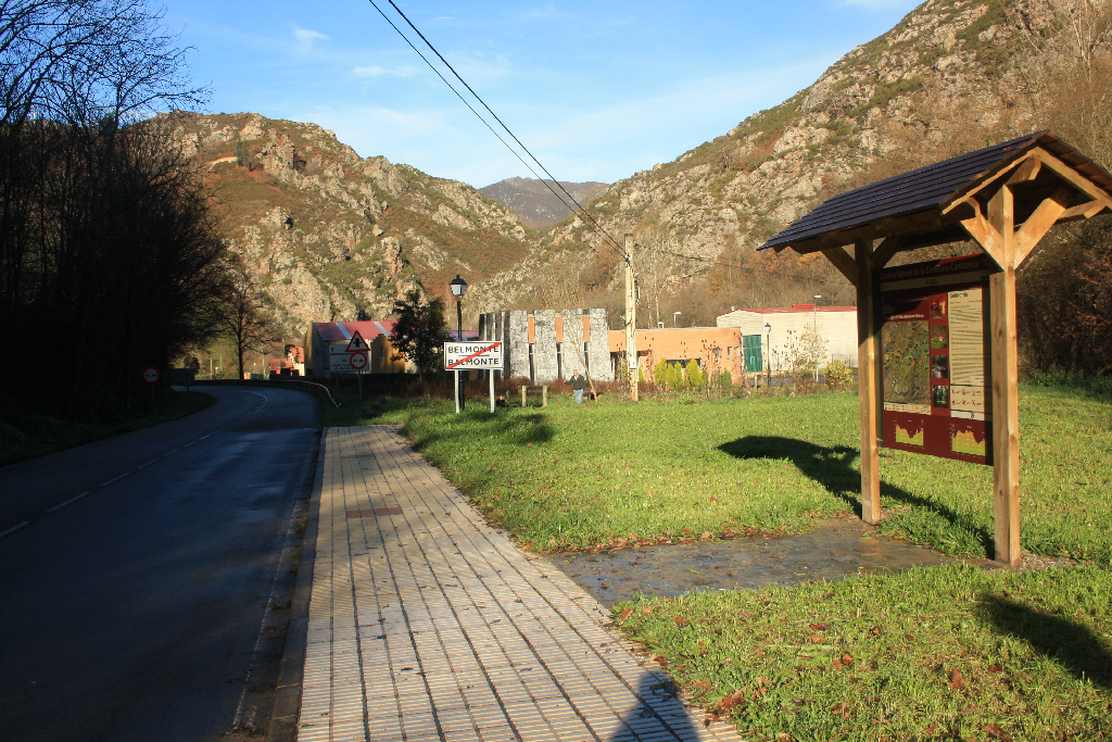
Stage 19: Belmonte - Boinás
Description
The Gold Route
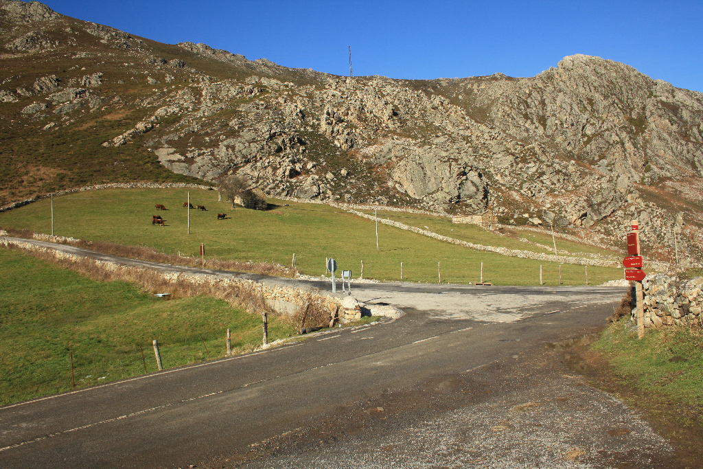
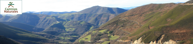
The Nature Trail is still linked to the historic roads that crossed Belmonte de Miranda County, in this case the Camín Francés (French Trail) used to transport gold in Roman times. Starting in Belmonte, the section traverses through Sierra de Arceyo, crosses the foothills of Sierra de Begega and ends in Boinás.
During the Roman Empire, gold mining in Belmonte de Miranda occurred in Sierra de Begega, near several purpose built mining towns. In this section, the Nature Trail follows the French Trail that links León and Asturias, and was used to transport gold.
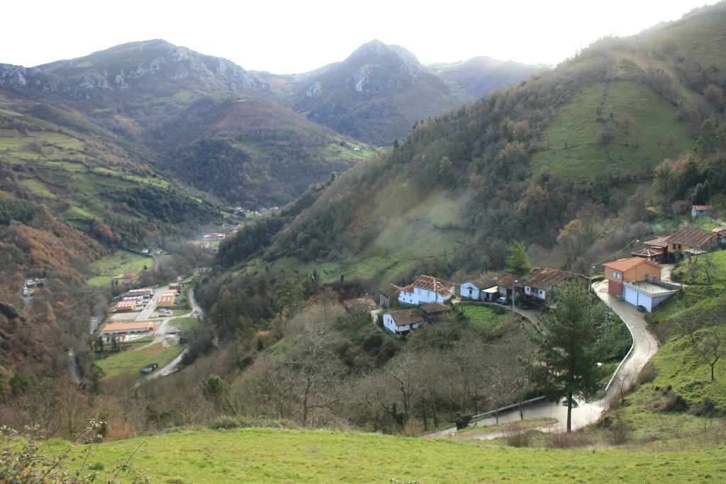
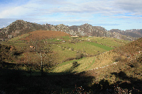
The French Trail crosses the municipality along the west ridge. This route was also used by nomadic herders (“vaqueiros de alzada”) in summer on their way to Somiedo. The route starts at Belmonte, capital city of the county, runs along Sierra de Arceyo, traverses the foothills of Sierra de Begega, and then climbs down to the Cauxa River Valley towards the village of Boinás, the final destination of this section.
Two alternative routes can be taken at the trail head panel at Belmonte. One option continues along the AS-227, in the opposite direction to the town, through an industrial estate, then turns left along a steep path towards Posadorio (El Pousadoriu). The road passes above this town, without crossing through it, and continues up towards the town of Cezana.
The second option begins at the start panel, continues along the AS-227, and traverses through Belmonte towards Cezana. In the latter case, the route is shorter. From Cezana, following the directional signs, the route runs along a narrow stone and dirt path, in a steep climb along Sierra de Arceyo, until it reaches the highland carpeted with meadows and grazing land.
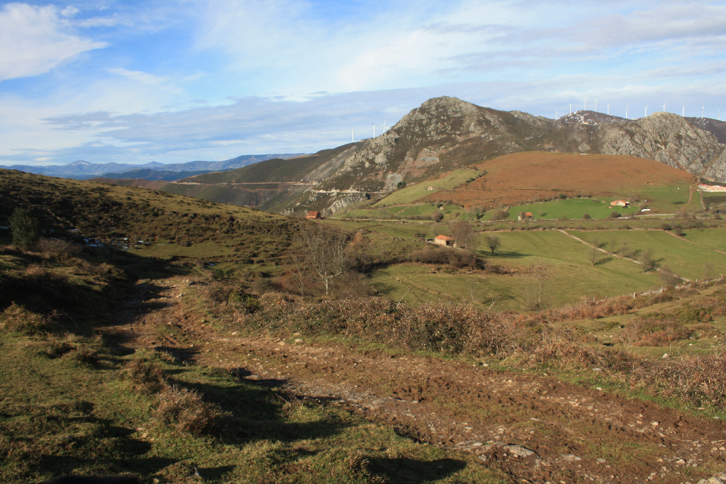
From here, the road begins to descend towards Braña Extremera, through pastures and livestock buildings, with beautiful views of Sierra de la Peña Begega and Peña El Castiellu (Carricedo), where the late medieval fortress of the lands of Miranda (9th-12th centuries) stood.
Between the eighth and twelfth centuries, the existing administrative structure divided the county into two districts separated by the river Pigüeña: Miranda, on the left bank, and Salcedo, on the right. Each had a fortress, from where they controlled the territory. A few remains of these buildings can still be found. Although the small summit of Peña El Castiellu can barely accommodate a small tower, its elevation (970 m) enabled control over the territory of Miranda.
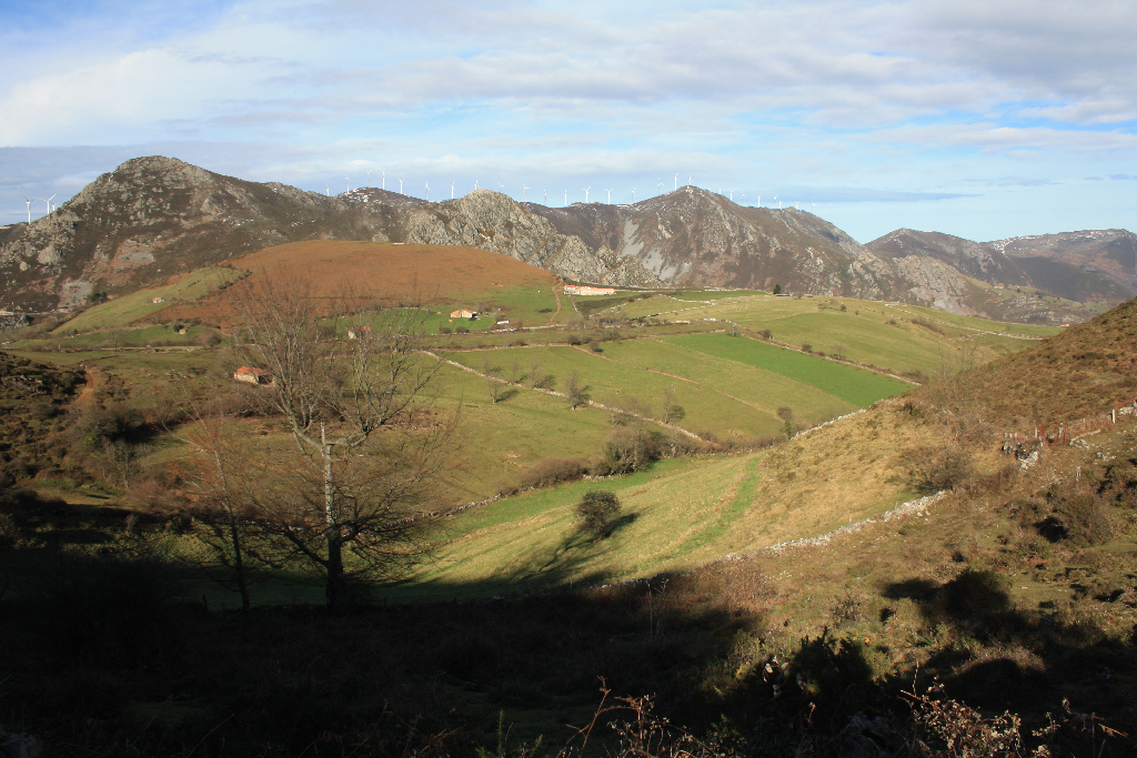
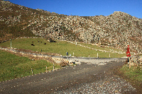
Leaving Las Brañas behind, and following the directional signs, the last stretch of this section descends through a narrow stone and dirt path to a crossroads, where the route continues straight ahead, climbing up a road in which extreme caution should be exercised.
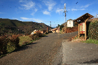
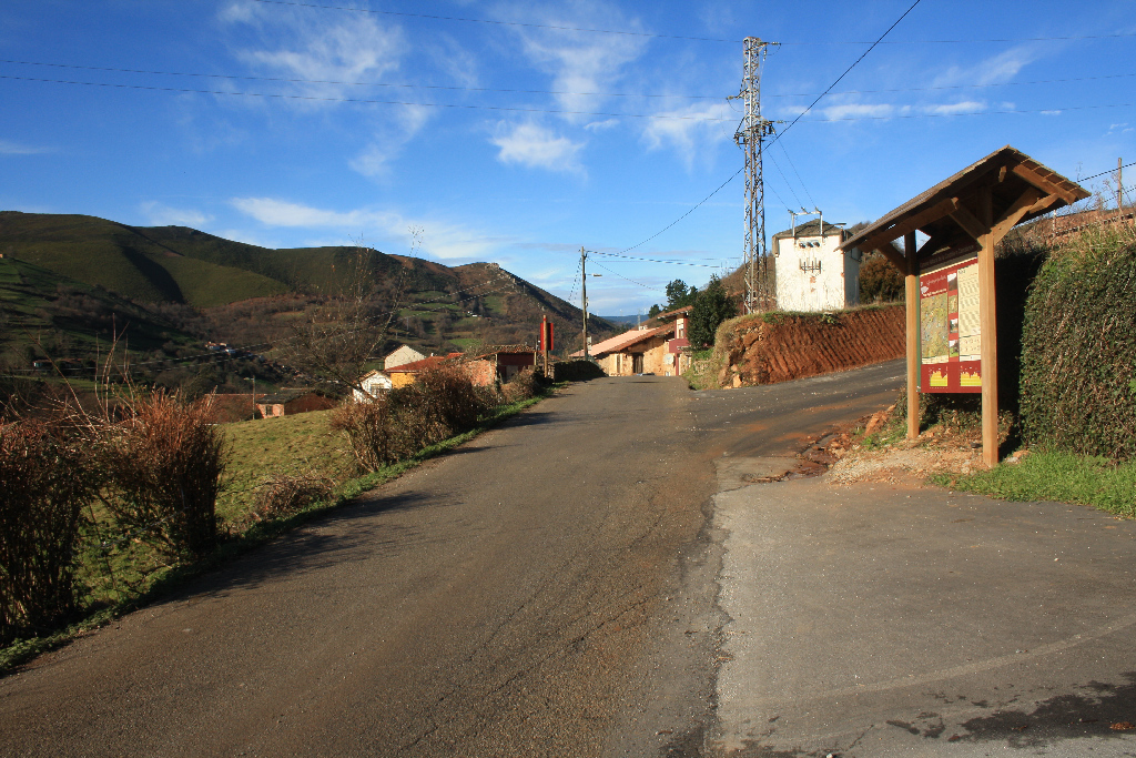
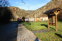
The landscape on this climb up the slope of Sierra de Begega is dominated by scrubland, heath and gorse, dotted with oak (Quercus robur) and chestnut (Castanea sativa) copses. Further down the road, the route starts a steep climb along the AS-310 (direction Tuña) to the village of Boinás, where this section ends.
Sites of interest
Profile
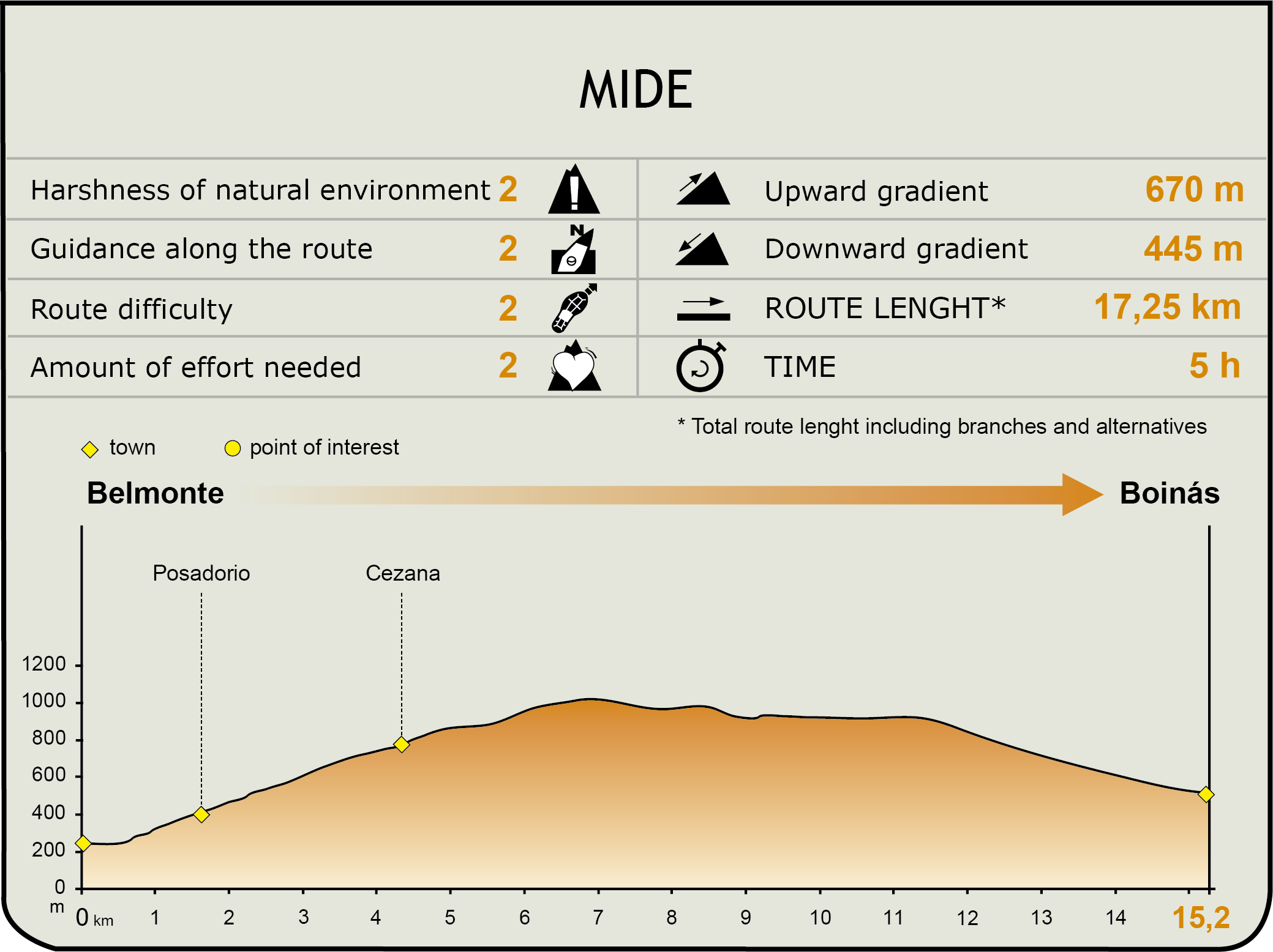
IDE (Method for the Information of Excursions)
 Harshness of natural environment
- 1. The environment is not risk-free
- 2. There are more than one risk factors
- 3. There are various risk factors
- 4. There are quite a lot of risk factors
- 5. There are many risk factors
 Guidance along the route
- 1. Well defined trails and crossings
- 2. There is a clearly marked trail and signage
- 3. Requires the identification of geographic features and cardinal points
- 4. Requires off-path navigation
- 5. The trail is interrupted by obstacles that have to be gone around
 Route difficulty
- 1. Walking on a flat surface
- 2. Trails with different types of path
- 3. Walking on stepped paths or irregular terrain
- 4. The use of hands or jumping over the terrain is necessary
- 5. The use of hands is required to progress
 Amount of effort needed
- 1. Up to 1 hour of continuous walking
- 2. Between 1 and 3 hours of continuous walking
- 3. Between 3 and 6 hours of continuous walking
- 4. Between 6 and 10 hours of actual walking
- 5. More than 10 hours of continuous walking
Featured
Further information
Gold Classroom
The Gold Classroom, located in Belmonte’s former jail, bears witness to the traditional ties between Belmonte de Miranda County and this precious metal. The exhibition spans two rooms.
The first focuses on prehistoric mining, and explains with panels, the various gold, copper and black lignite mining operations in Europe.
The second room is devoted to Roman gold mining in Western Asturias, which during the 1st century and part of the 2nd was the main source of income of the Roman Empire. The central exhibit of the second room is a large 6-metre model of Las Médulas mining site in León, designated a World Heritage Site. It is one of the most spectacular recreations of the techniques used by Romans to mine gold, which they used as currency.
Roman gold mining. Sierra de Begega
Pliny the Elder, a Roman writer who lived in the 1st century A.D., estimated that some 6,500 kg of gold were mined each year in the northwest of the Iberian Peninsula using various means and techniques, both above and underground, though the former was preferred. Some of the most representative Roman mining sites, located in Asturias, can be found in Belmonte de Miranda County. Most are situated close to Sierra de Begega, between the rivers Narcea and Pigüeña.
One such Roman mine is Boinás, located south of Sierra de Begega. This mining site occupied an area of about one hundred hectares. It consisted of three mining sites, a small fortified settlement and an extensive water supply network, used to collect and channel water from the highest peaks of the mountains to the goldfields operated by the Romans. Boinás' water network consisted of canals and reservoirs, and its main operations centre was located at Alto de la Cueva.
The fortified settlement of Peña Aguda was situated atop the hill overlooking the Boinás mining site. It housed both workers and soldiers stationed in these mines during the first century A.D., when the mine at Boinás was operating at full capacity.
Las Estacas and Carricedo
Halfway between Belmonte and Boinás, close to the AS-310, are the towns of Las Estacas and Carricedo, nestled in the land cleared for the Roman mines, at an altitude of 620 and 680 m, respectively. In winter, both towns were home to nomadic herders, a social group whose origin can be traced to the serf-herders who managed the large herds of cattle owned by lay and ecclesiastical lords since the Middle Ages. Both towns are mentioned in medieval documents from the 12th century.
These nomadic herders practiced transhumance, taking their livestock to the highland pastures in summer and, in autumn, they gathered the herds and their belongings to spend the winter in towns like Carricedo and Las Estacas, situated at lower altitudes. There still remain some families that continue to take their livestock in summer to Somiedo. The village of Las Estacas, together with Vigaña, was part of the territory of Arceu. A manor called El Palacio or Casa Don Paca can still be found there.
Multimedia