- Home
- Rural Development
- Nature Trails
- Nature Trails
- Northwest Sector
- Cordillera Cantábrica. Asturias interior
Stage 17: Villamayor - Dolia
Description
Caldoveiro Peak and Las Ubiñas-La Mesa Nature Park
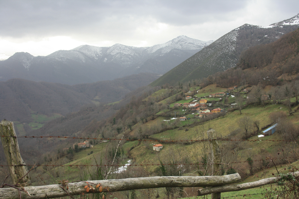
The Nature Trail begins at Villamayor, in Teverga County, and heads north to the rural town of Dolia in Belmonte de Miranda County. The route runs through protected nature areas, including Las Ubiñas-La Mesa Nature Park and Pico Caldoveiro Protected Landscape. For the most part, it overlaps with Camino Real de la Mesa, the ancient Roman road.
The route through this section is mostly flat and runs largely along the contour line. The Trail leads through protected nature areas of high environmental value, including Las Ubiñas-La Mesa Nature Park and the Montovo-La Mesa and Caldoveiro Sites of Community Importance (SCI) that form part of the Park. The latter site is, in turn, included in Pico Caldoveiro Protected Landscape.
The route begins in the rural town of Villamayor. It climbs up a track, through meadows and small hardwood forests, to Alto de El Cumalón, where, following the directional signs, the route veers onto a track to the left. The track has first a concrete surface, and then turns into gravel.
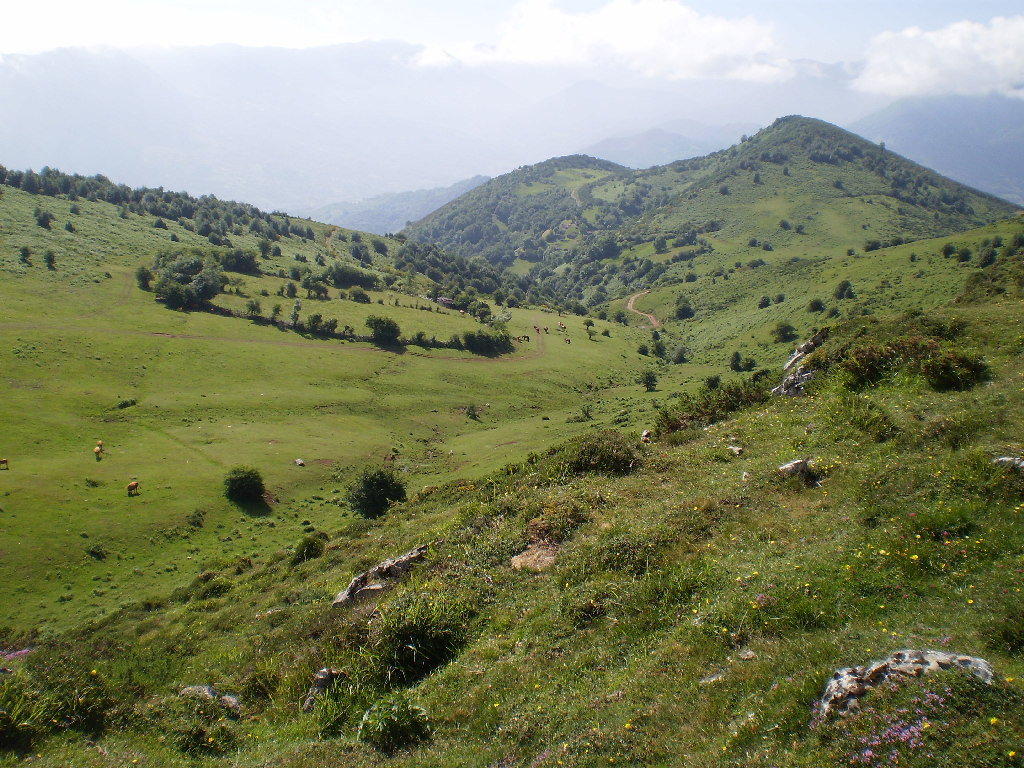
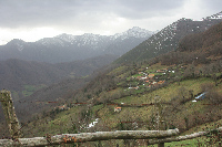
The route continues along the contour line, through meadows, grazing land and shrubs, leaving Brañas Santa Cristina to the right, toward Llanu'l Vicenturu. Further on, the route crosses Vega de Cueiro with beautiful views of Peña Sobia, Las Ubiñas Massif, Peña Rueda and Peña Manteca.
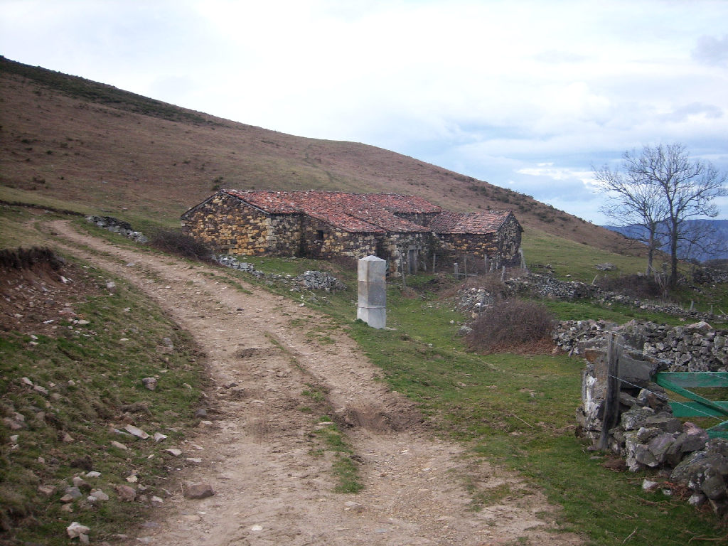
The Nature Trail then heads along the foothills of Sierra de Conto, in a moderate climb on a narrow, stone path, intuitively feeling the old Roman road of Camino Real de La Mesa. The route passes to the left of the only stone-walled estate, and continues ahead skirting Collado de Piedras Negras, until it reaches Venta de Porcabezas, where one can rest. Fuente de Porcabezas is only 30 metres from the inn, on the right side of the trail.
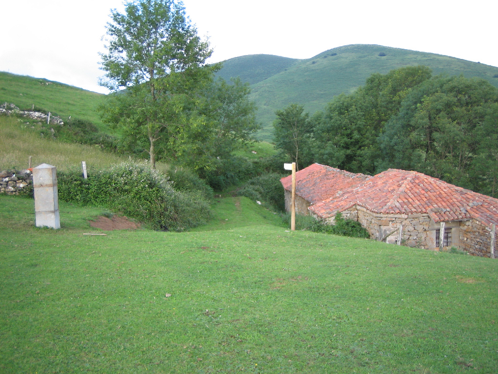
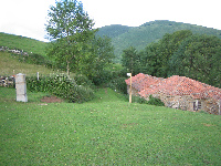
About three kilometres further on, past Llano de Mouro to the right, is the Venta de La Corredoria, with an information panel about its history. Venta de La Corredoria has a small chapel, which adds to the charm. Both abandoned inns were used as shelter-cum-stable for livestock and herders.
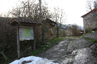
The end of this section is very close to Venta de La Corredoria. About one and half kilometre further on, the trail continues along a narrow road at the foot of Sierra Matiecha, to the village of Dolia, the final destination of the route, which has a start-end information panel.
Sites of interest
Profile
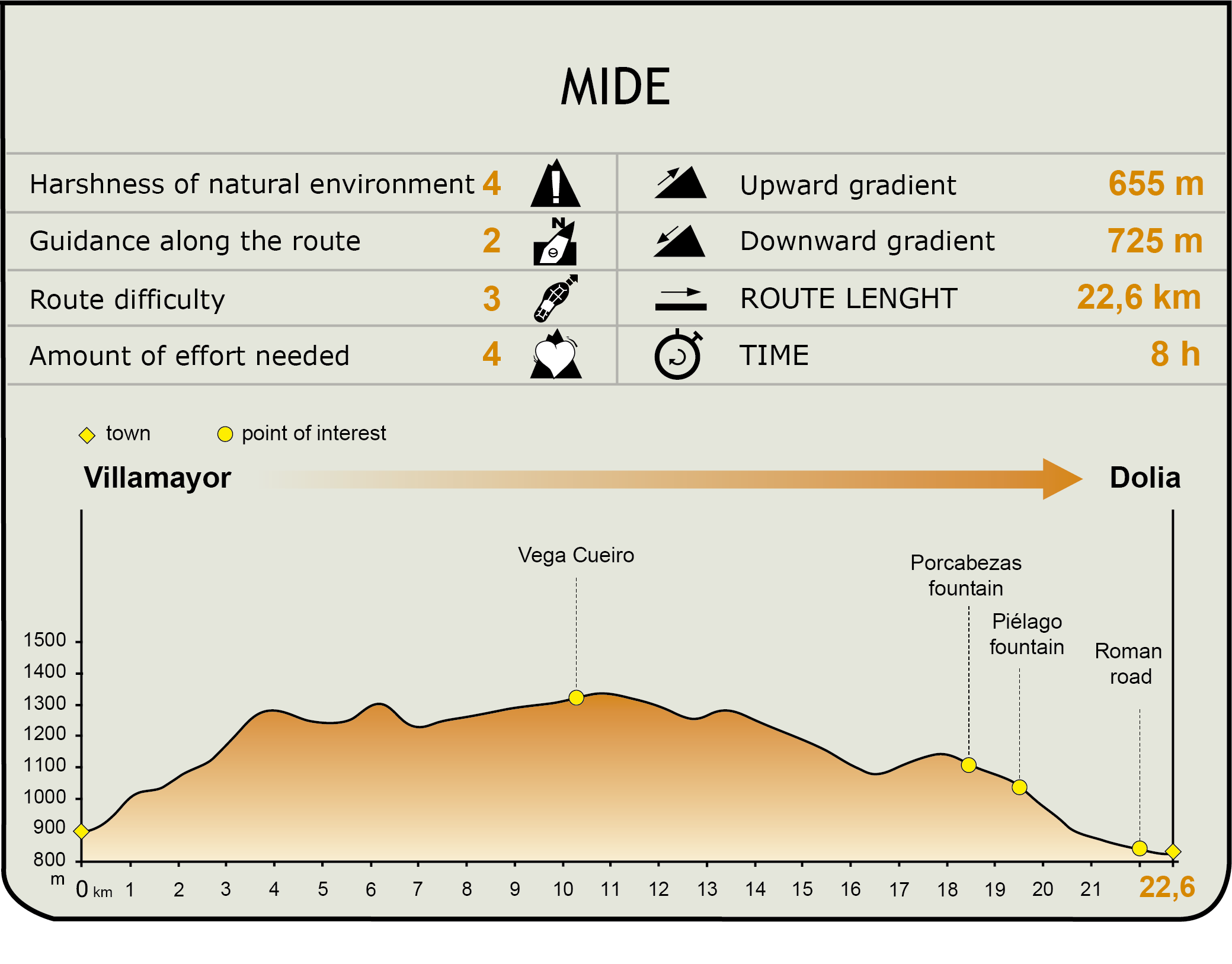
MIDE (Method for the Information of Excursions)
 Harshness of natural environment
- 1. The environment is not risk-free
- 2. There are more than one risk factors
- 3. There are various risk factors
- 4. There are quite a lot of risk factors
- 5. There are many risk factors
 Guidance along the route
- 1. Well defined trails and crossings
- 2. There is a clearly marked trail and signage
- 3. Requires the identification of geographic features and cardinal points
- 4. Requires off-path navigation
- 5. The trail is interrupted by obstacles that have to be gone around
 Route difficulty
- 1. Walking on a flat surface
- 2. Trails with different types of path
- 3. Walking on stepped paths or irregular terrain
- 4. The use of hands or jumping over the terrain is necessary
- 5. The use of hands is required to progress
 Amount of effort needed
- 1. Up to 1 hour of continuous walking
- 2. Between 1 and 3 hours of continuous walking
- 3. Between 3 and 6 hours of continuous walking
- 4. Between 6 and 10 hours of actual walking
- 5. More than 10 hours of continuous walking
Featured
Further information
Pico Caldoveiro Protected Landscape
Pico Caldoveiro Protected Landscape is a transition area between the valley and the central Asturian mountain. It encompasses part of Proaza, the Teverga area of Puertos de Marabio Natural Monument, Tameza parish (Yernes y Tameza) and the southern section of Tolinas (Grado). It is included in the Caldoveiro Site of Community Importance (SCI).
This natural area has a very interesting karst system, where mountain limestone prevails in the central area around Pico Caldoveiro. Trees account for only ten percent of the vegetation, owing to intense farming. Tree cover has been replaced by meadows and summer pastures for cattle. There are still beeches (Fagus sylvatica), especially in La Cavadura Valley (Grado), and oaks (Quercus robur) in the Cubia River basin. There are also holm oaks (Quercus ilex) on the western slopes of Sierra de la Verde, east of the River Trubia (Proaza).
The Protected Landscape is near the bear habitat of Quirós, Somiedo and Teverga. The steep rocky slopes provide shelter to the bears, enabling the slow recolonisation of the bear habitat. In addition to the brown bear (Ursus arctos), there are other mammals including wolf (Canis lupus), wild boar (Sus scrofa), roe deer (Capreolus capreolus) and deer (Cervus elaphus). The clean waters attract otters (Lutra lutra) and various raptors, such as the Egyptian vulture (Neophron percnopterus), the griffon vulture (Gyps fulvus) and the golden eagle (Aquila chrysaetos).
Las Ubiñas-La Mesa Nature Park
Las Ubiñas-La Mesa Nature Park, located in the central Cantabrian Mountains, encompasses 45,000 hectares covering counties Teverga, Quirós and Lena. It borders on the south with the province of León, on the west with Somiedo Nature Park, on the north with Belmonte de Miranda, Grado, Yernes y Tameza and Proaza, and on the east with Aller.
Overall, it is a mountain territory with a terrain that exhibits strong contrasts and altitudes, as it stretches from north to south, with the highest point on the border with León. To the south lies Peña Ubiña Massif, the highest limestone mountain system in the Cantabrian range, second-only in altitude to the Picos de Europa, with elevations in excess of 2,400 m (Picos del Fontan and Peña Ubiña, 2,417 m). La Mesa Ridge, with altitudes above 1,800 m, (Alto de La Cugurza and Peña Negra) marks the border with Somiedo. To the north, between counties Quirós and Teverga, lies one end of Sierra de La Sobia, with peaks above 1,600 m (Barriscal and Vallina).
Las Ubiñas-La Mesa Nature Park is characterised by the variety and excellent conservation of its vegetation. More than one third of the park is covered by (mature) native forests. Beech forests, which make up 65 percent of the forest surface, are the largest and best preserved. They tend to populate shady slopes. Other tree species found in the forests are oligotrophic Pyrenean oaks (Quercus pyrenaica), sessile oaks (Quercus petraea), hybrid oaks (Quercus petraea x robur), common oaks (Quercus robur) and birches (Betula pendula).
A quarter of the surface of Las Ubiñas-La Mesa is covered by pastures and meadows, clearly illustrating the importance of livestock in the local economy. This diversity of habitats in such a large territory is conducive the presence of numerous animal species, including the most representative of the Cantabrian Mountains, such as the brown bear, the capercaillie (Tetrao urogallus) and the golden eagle, plus game species, such as wild boar, roe deer, deer or stag and chamois (Rupicapra pirenaica). There are also martens (Martes martes), ermines (Mustela erminea), genets (Genetta genetta), wild cats (Felis sylvestris) and foxes (Vulpes vulpes).
The Inns along the Camino Real de La Mesa
The original purpose of the various inns strewn along the Camino Real de La Mesa was to provide shelter to the traveller and hold the cattle and the horses used to herd the livestock. Many had a shrine for travellers and visitors, like the shrine to Santa Ana that still stands at the foot of La Corredoria.
Later, with the advent of modern roads in the nineteenth century, like the Camino de Castilla and the mountain pass through Pajares, the inns fell into disuse, and were modified to house livestock during the summer in the highland pastures that surround La Mesa Ridge. The rooms are now stables and pens for cattle and pigs, as well as sheep and goats.
The most important inns were Piedrajueves (Somiedo-Teverga) and Cueiro, both located above 1,300 m; Porcabezas and La Corredoria, below 1,000 m, and Cruces at 600 m.
Multimedia