- Home
- Rural Development
- Nature Trails
- Nature Trails
- Northwest Sector
- Cordillera Cantábrica. Asturias interior
Stage 16: Villanueva - Villamayor
Description
Puertos de Marabio
From the Roman bridge of Villanueva de Santo Adriano, the Nature Trail heads to Proaza, ventures into the small counties of Yernes and Tameza, and ends in Teverga, after crossing Puertos de Marabio, passing next to La Barrera and La Tambaina lakes, and skirting the Pico Caldoviro in the last stretch before arriving at Villamayor.
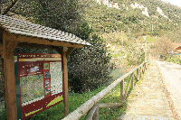
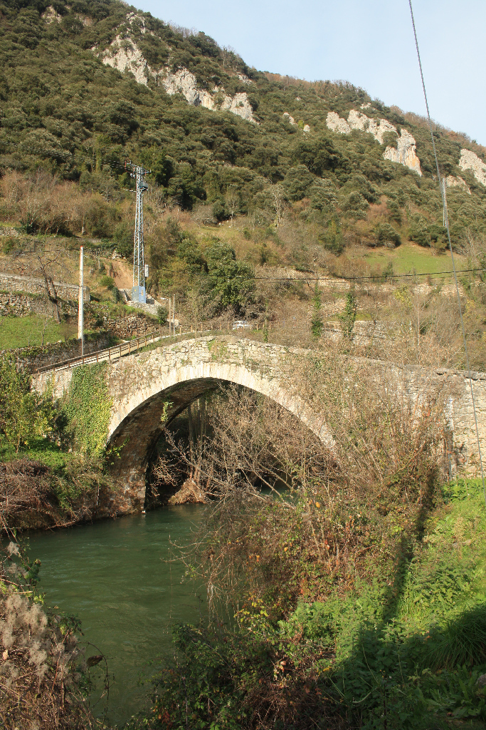
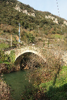
This stage starts at the centre of Villanueva de Santo Adriano, in the Ángel Fernández square, where the town hall is located, and next to which is the start panel and the chapel of Carmen. The town of Villanueva is divided by the River Trubia and the Bear Trail, which crosses the capital of Santo Adriano on a medieval, pointed bridge of a certain height. It has a single, very wide, semicircular arch, through which all travellers on the road from Ventana had to pass.
Villanueva not only has a medieval bridge, but also the Romanesque parish church of San Romano, with a single rectangular nave, semicircular east end and a vaulted cul-de-four apse, depicting images of Santa Catalina, Asunción de la Virgen and San Sebastián.
Near the River Trubia is also the church of Santo Adriano de Tuñón, an Asturian Romanesque building (ninth century).
On the way to the bridge over the River Trubia is Villanueva's basin and public fountain, both in stone. The fountain, which receives water from the Xanas Brook, was built in 1928. It was funded with 8,000 pesetas donated by Jose Antonio Fernández, a Spaniard who made good in America.
The route starts at the Roman bridge that crosses the River Trubia, and continues in a steep climb to Castañedo del Monte (Castañéu'l Monte), where it overlaps with most of the GR-101.1 route. Another option is not to cross the bridge and follow the signs along the river towards San Andrés, where the route continues to climb along a road to Castañedo del Monte.
From Castañedo del Monte, the route continues to climb up to the rural village of Linares, from where it takes the road to the left. Shortly after leaving behind a few booster aerials, the route veers to the right, up a concrete track, which soon after becomes a dirt road. The climb continues steadily for a while through meadows and huts, near the Braña de San Bartolomé and its namesake chapel.
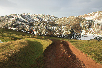
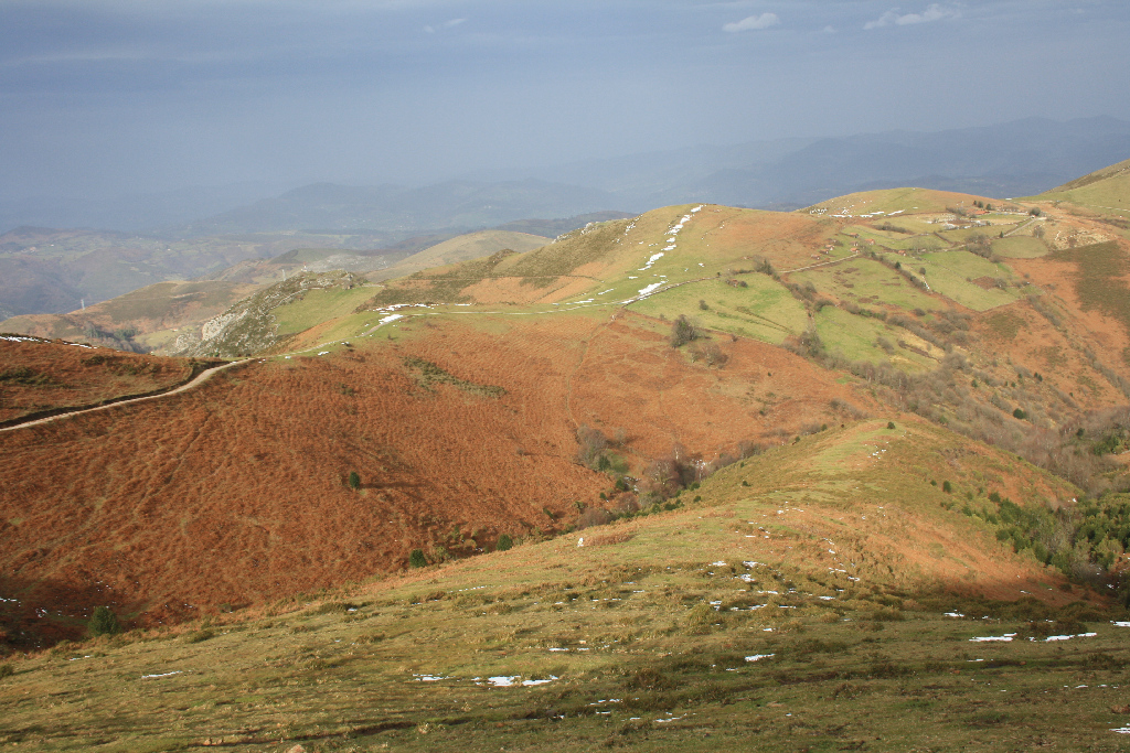
The dirt road finally arrives at a mountain pass with an information panel on GR-101.1 and the vertical sign of GR-109 Nature Trail. It is possible to take an alternative route from here: the right road down towards Cuevallagar, then the dirt track towards Yernes and Aula Vital. From the mountain pass, the main route continues towards Villamayor (Villamaore), climbing through Las Forcadas and El Llanu meadows, and next to two grazing lands. It then turns right onto a path through the limestone slopes of Puertos de Marabio, and an area of great hydrogeological interest.
The climb continues during the next stretch, winding through slopes along a well-signposted path that passes near La Barrera and La Tambaina lakes, through beech (Fagus sylvatica), holly (Ilex aquifolium) and hawthorn forests. Throughout this section, special attention should be paid to the signs, in particular when attempting the route in winter.

The last stretch of the route skirts Pico Caldoveiro and starts to descend among holly trees, with views of Sierra de Peña Gradura, to the left, and Sierra de La Llomba, to the right. The route climbs down to the south, past a few huts, until it reaches the road. Here, the Nature Trail veers right, down a paved road to the rural town of Villamayor, where the end panel stands next to a fountain.
Sites of interest
Profile
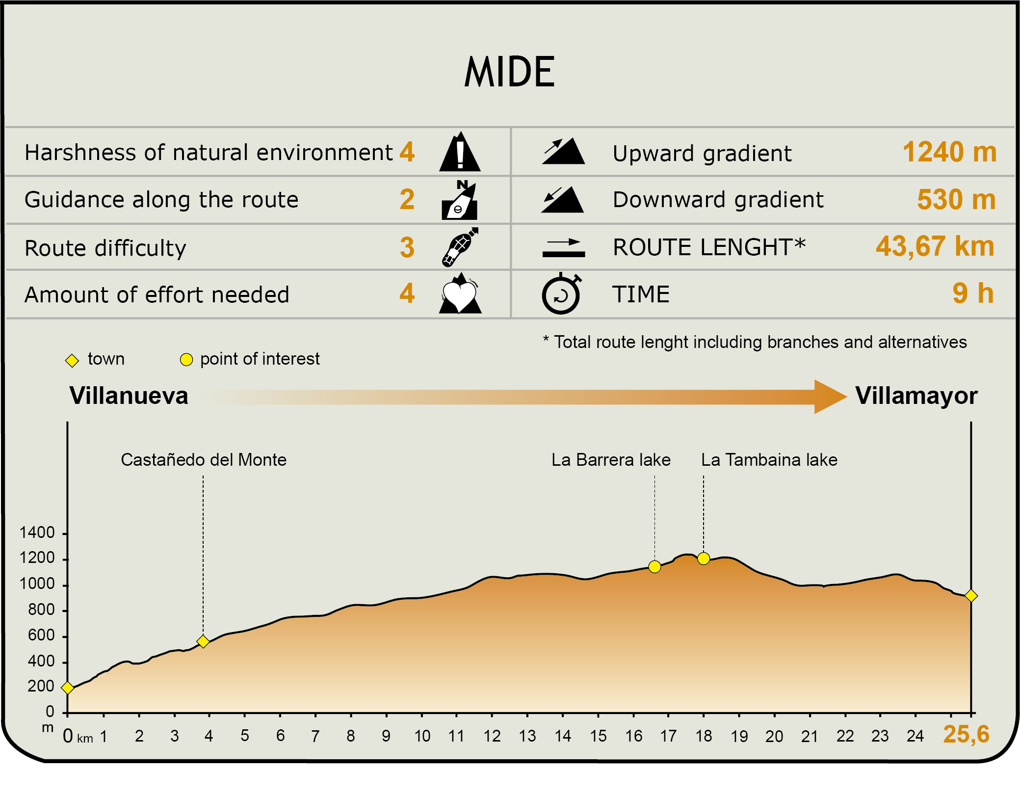
MIDE (Method for the Information of Excursions)
 Harshness of natural environment
- 1. The environment is not risk-free
- 2. There are more than one risk factors
- 3. There are various risk factors
- 4. There are quite a lot of risk factors
- 5. There are many risk factors
 Guidance along the route
- 1. Well defined trails and crossings
- 2. There is a clearly marked trail and signage
- 3. Requires the identification of geographic features and cardinal points
- 4. Requires off-path navigation
- 5. The trail is interrupted by obstacles that have to be gone around
 Route difficulty
- 1. Walking on a flat surface
- 2. Trails with different types of path
- 3. Walking on stepped paths or irregular terrain
- 4. The use of hands or jumping over the terrain is necessary
- 5. The use of hands is required to progress
 Amount of effort needed
- 1. Up to 1 hour of continuous walking
- 2. Between 1 and 3 hours of continuous walking
- 3. Between 3 and 6 hours of continuous walking
- 4. Between 6 and 10 hours of actual walking
- 5. More than 10 hours of continuous walking
Featured
Further information
Santo Adriano de Tuñón
The Church of Santo Adriano de Tuñón, whose construction was ordered by King Alphonse III (866-910), was founded in 891 as a Benedictine monastery built over a more humble church. It underwent a major reconstruction in the twelfth century. In 1100, the monastery and its possessions were donated by King Alphonse VI to the church of San Salvador in Oviedo.
Declared a Monument of Cultural Interest in 1931, the frescoes of this pre-Roman church are the only Mozarabic paintings of Asturian origin. These interesting paintings in the chapel represent plants, red and yellow flowers, semicircles and battlements. The diorama of the sun and the moon are examples of Eastern influences brought in by Mozarabic artists from Córdoba.
A basilica-type three nave church, divided by pillars, the temple retains some of the original Roman-style capitals, as well as a fragment of marble lattice. Invisible to the eyes, the monastery is surrounded by a necropolis with tombs from the tenth century, when the church was built, to the modern age.
Yernes
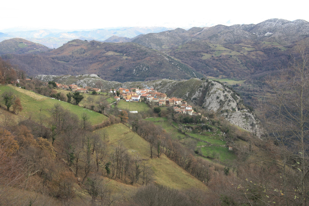
Yernes lies on a small limestone plateau, at an altitude of about 700 m, guarded by the foothills and elevation of Sierra de Tameza, with the Pico Caldoveiro ever present. It is the largest town in the small county of Yernes y Tameza, locked between Grado, Proaza and Teverga, and far from major regional roads.
Yernes is divided into several districts, including Palacio, Portal and Villarriba. All 21 dwellings remain inhabited throughout the year by its 70 inhabitants. The houses speak to its rural origin. Most are traditional farmhouses grouped together, with many granaries and cribs, interspersed between the houses and various auxiliary buildings, such as storehouses, wells and folds, which shape its charming streets and squares.
The limestone masonry walls of most of the buildings provide striking uniformity, occasionally interrupted by balconies and corridors carved in wood. Some of these houses are whitewashed and others are of exposed stone, like the derelict former Rectory, of which only its thick and lofty walls still stand like a skeleton.
At one end of the town stands what remains of the large manor of the López del Vallado family, in Casona district. After the removal of the coat-of-arms, it no longer has any external symbol of its noble origin. Today, the old manor has been divided into several private dwellings.
The upper reaches of the mountain are dominated by the silhouette of the church of Santa Cruz, a small, single nave temple, elegant and sober, with a square east end, side sacristy, portico and triple arch belfry. The church of Santa Cruz, built in traditional Asturian style, has an inscription that dates it to 1919. Its bell tower holds a bell from 1799, decorated with the cross of Calvary. Near the route is a walled cemetery. Opposite the church, an open square dominates the village.
Puertos de Marabio
The Puertos de Marabio Natural Monument is a vast mountain meadow, located halfway between the counties of Yernes y Tameza, Teverga and Proaza. It is included in Pico Caldoveiro Protected Landscape, and partially also in Las Ubiñas-La Mesa Nature Park.
The Puertos de Marabio karst system is characterized by a series of sinkholes and short blind valleys whose runoff drains into interconnected sinkholes. Owing to this, there are many underground cavities in the area, in many cases interconnected, which form a complex network.
The decline of livestock farming becomes increasingly evident by the large number of abandoned huts. The meadows are studded with small but numerous holly (Ilex aquifolium), hawthorn (Crataegus monogyna) and blackthorn (Prunus spinosa) patches, which have been preserved so shepherds can use them as shelter for their livestock from rain or summer heat.
Multimedia