- Home
- Rural Development
- Nature Trails
- Nature Trails
- Northwest Sector
- Cordillera Cantábrica. Asturias interior
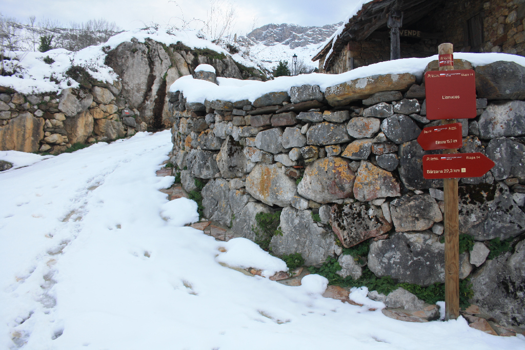
Stage 14: Llanuces - Bárzana
Description
Between protected areas
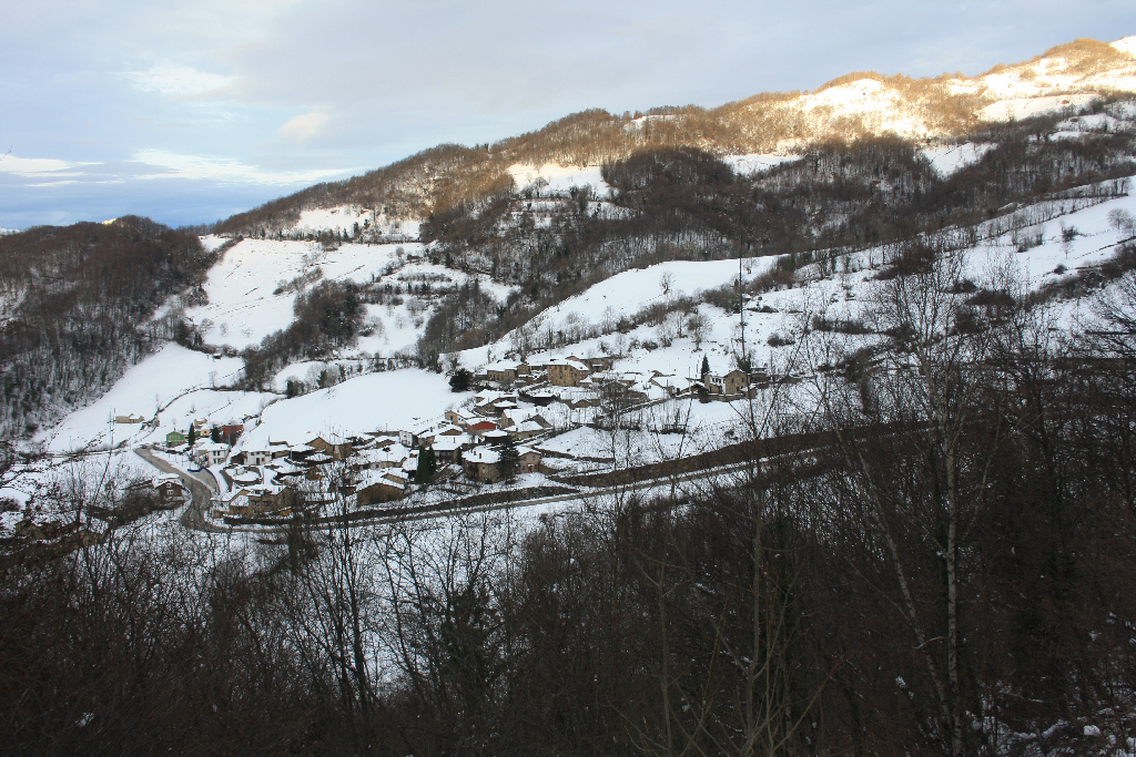
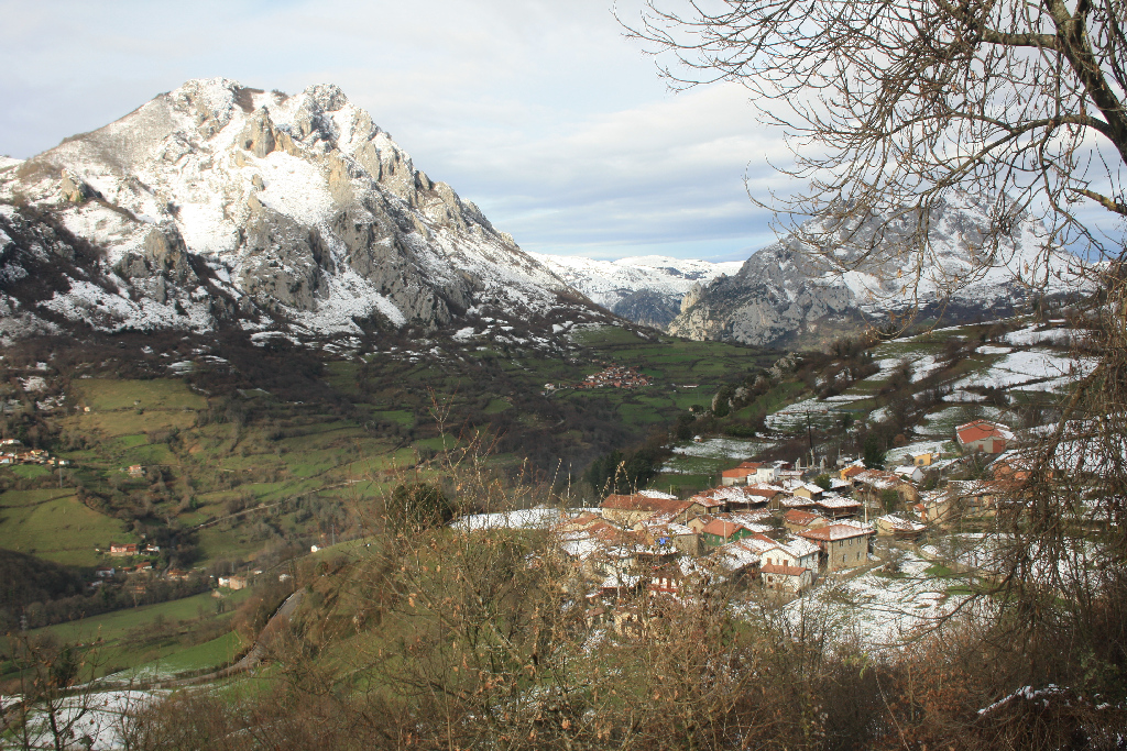
The Nature Trail first heads north, to Sierra de Aramo Protected Landscape and the foothills of El Gamoniteiro Peak, then continues southwest, to Las Ubiñas-La Mesa Nature Park, through an area that contains a diversity of landscapes and vegetation, including pastures that have endured centuries of intense livestock farming, forests and villages with former stately manors.
Starting from the rural town of Llanuces in Quirós County, the Nature Trail offers two alternatives: the main route, which heads northwest, and an alternative route, to the southeast, that leads to the endpoint of Section 13.
The main route first heads north towards the Sierra de Aramo Protected Landscape site, then continues southwest towards the Las Ubiñas-La Mesa Nature Park, ending at the village of Bárzana in Trubia River valley.
The first stretch begins next to a panel marking the trail head of the Llanuces section. It winds up through the streets of the town, between houses and “hórreos” (granaries), and continues along a narrow stone and dirt path with a moderate climb up to a wider path.
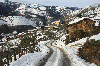
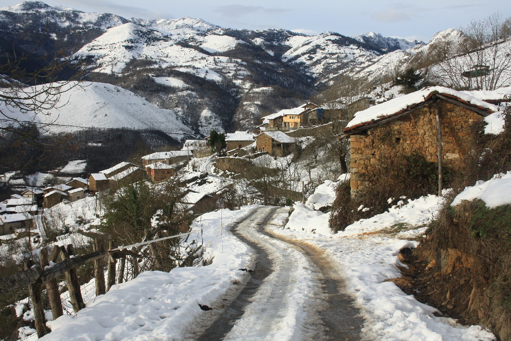
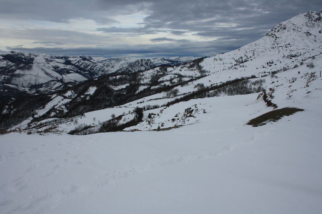
The route continues in moderate climb along this second path, although at times it does get quite steep, through meadows, heath and gorse areas until Cantu Les Quintes, in the southwest corner of Sierra del Aramo. From here, the route begins to descend along a paved road between harvested meadows and stone huts, leaving Pico Cuervo to the right, until it reaches the village of Las Vallinas.
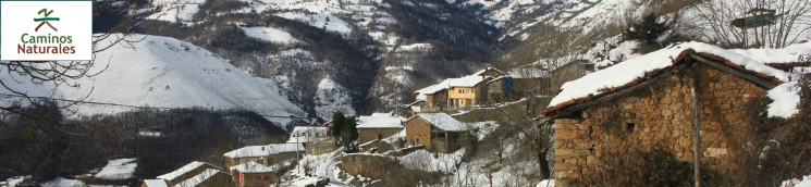
In the last stretch of the main route, the course traverses the village of Las Vallinas and passes above the village of Salcedo or La Villa, where there is an information panel at the shrine of Virgen del Alba, as well as directional signs to El Quinte y Alba recreation areas.
Further on, the path continues to descend, through pastures and small groves of chestnuts (Castanea sativa) and oaks (Quercus robur), to Villar de Salcedo, wherein section 14 overlaps with the GR-207 path. Leaving the village of San Pedro, the route converges immediately with the AS-229 and heads to the left towards Bárzana.
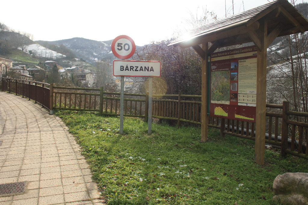
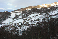
The route heads down the first side-track to the left, and crosses through the town of La Fábrica, which sits parallel to the AS-229, along which it will continue taking a turn to the left. Past the village of San Salvador, the route arrives at Bárzana, the capital of Quirós County, where a panel at the entrance of the town marks the start-end point of this section.
This section offers an alternative route to the main route described above, which also starts at the end point of section 13, in the town of Llanuces. It begins to the right of the church of Santa María (14th-15th centuries) and the Palace of Miranda. This route climbs up the AS-230 to Collau de la Cobertoria, where there is an information panel with the toponyms of the peaks that can be seen from here. About 400 ahead are the burial mounds of La Cobertoria necropolis.
Leaving Collau de La Cobertoria behind, the route descends into Lena County. Immediately after, the route leaves the AS-230, turning off to the left along a narrow road to Alto El Gamoniteiro. The road continues in moderate climb through pastures and small hardwood groves to Collá El Fresnu, where the trail begins to descend to meet the path described above that starts at Llanuces, and is part of the main route. Here, the alternative route converges with the main route.
Sites of interest
Profile
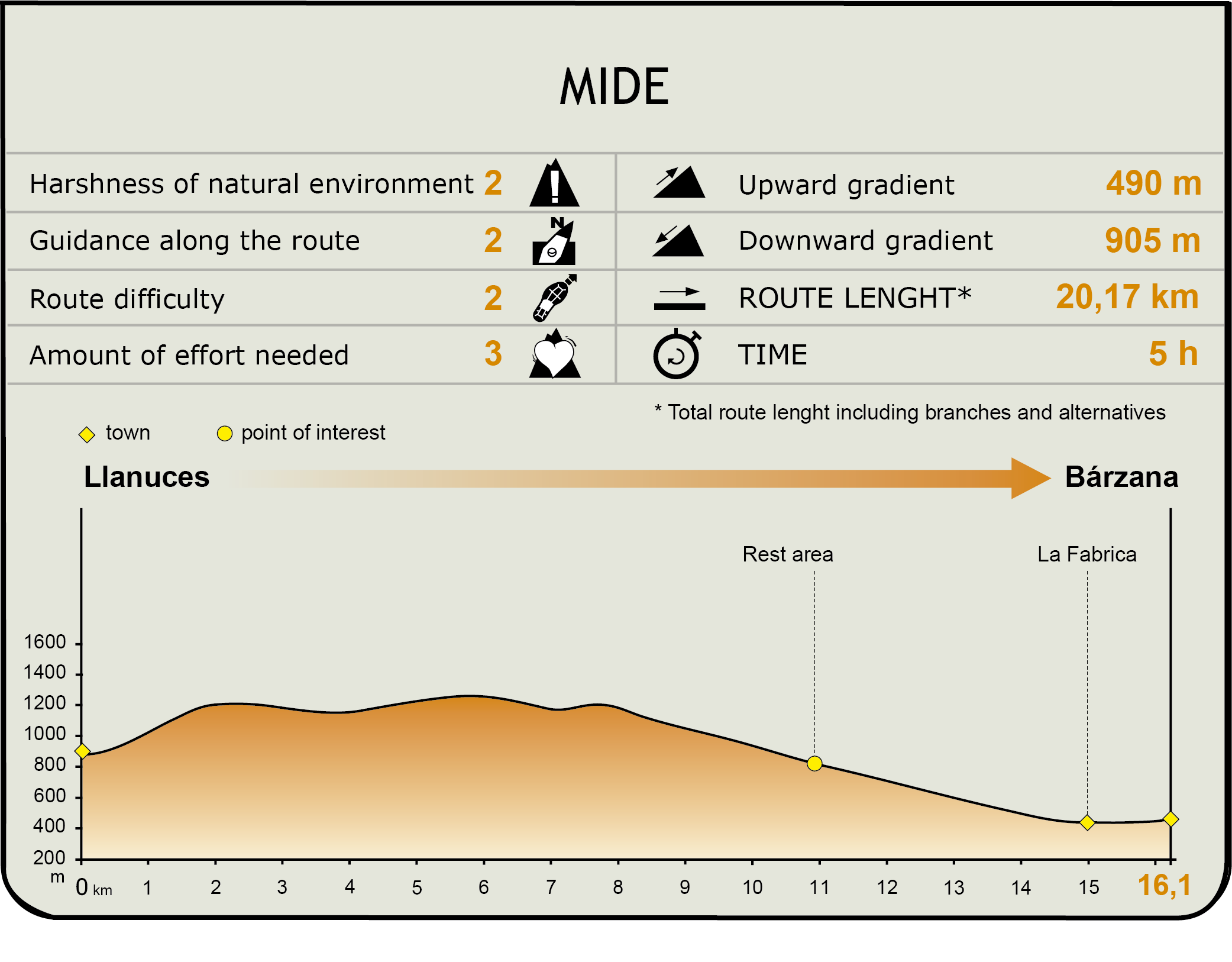
MIDE (Method for the Information of Excursions)
 Harshness of natural environment
- 1. The environment is not risk-free
- 2. There are more than one risk factors
- 3. There are various risk factors
- 4. There are quite a lot of risk factors
- 5. There are many risk factors
 Guidance along the route
- 1. Well defined trails and crossings
- 2. There is a clearly marked trail and signage
- 3. Requires the identification of geographic features and cardinal points
- 4. Requires off-path navigation
- 5. The trail is interrupted by obstacles that have to be gone around
 Route difficulty
- 1. Walking on a flat surface
- 2. Trails with different types of path
- 3. Walking on stepped paths or irregular terrain
- 4. The use of hands or jumping over the terrain is necessary
- 5. The use of hands is required to progress
 Amount of effort needed
- 1. Up to 1 hour of continuous walking
- 2. Between 1 and 3 hours of continuous walking
- 3. Between 3 and 6 hours of continuous walking
- 4. Between 6 and 10 hours of actual walking
- 5. More than 10 hours of continuous walking
Featured
Further information
Sierra del Aramo Protected Landscape
The Sierra de Aramo Protected Landscape is a 20 km limestone ridge located between the counties of Quirós, Riosa and Morcín in central Asturias. Its territory, which spans 53.99 km2 extends north from the foothills of the Cantabrian Mountains, west to the Trubia River basin, and east to the River Caudal.
The Aramo is composed of the peaks of La Gamonal, El Barriscal and El Gamoniteiro, all standing above 1,700 metres. Raptors like buzzards (Buteo buteo), kestrels (Falco tinnunculus), vultures (Gyps fulvus) and owls (Neophron percnopterus) overfly these mountains. The core section of this mountain range is formed by a calcareous platform located at 1,400 to 1,500 m above sea level, with frequent depressions and craters, caused by erosion of limestone by rainwater.
The vegetation in Sierra de Aramo consists of meadows and pastures for livestock farming, where cattle coexist with wolves (Canis lupus), broom hares (Lepus castroviejoi), stoats (Mustela erminea), wild boars (Sus scrofa) and roe deer (Capreolus capreolus). Due to its steep slopes, forests are scarce and far between. Nonetheless, beeches (Fagus sylvatica) and holly copses (Ilex aquifolium) can be found, while the upper karst platform has rich grazing areas and summer pastures.
Ermita del Alba
Overlooking the village of Salcedo, nestled in Sierra del Aramo, is the shrine of Virgen del Alba, patroness of Quirós County, a place of extraordinary beauty which can only be reached after a steep climb. The shrine is located on the southern slope of Peña del Alba, at an altitude of about 1,090 m, with the three crosses of Alba standing nearby, overlooking a large part of the county.
The Feast of Alba, designated Regional Feast of Tourism Interest, takes place every August 15th in the vicinity of the shrine. A throng of faithful from the villages in the area camp near the sanctuary to venerate the Virgin Mary. The procession to the sound of bagpipes and drums is followed by a chanted mass in “Quirosano”, a variant of the central Asturian language. After the picnic, various activities, such as a horseback ring race, “escanda” bread-making contest, and dressage shows take place.
The shrine is elongated with a notable central belfry. It was built in the seventeenth century after a fire. Inside is a large baptismal font donated by a “Quirosano” who brought it from the Philippines.
Multimedia