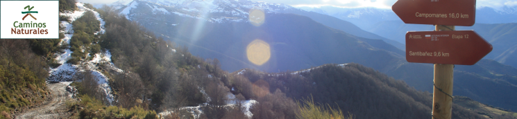
- Home
- Rural Development
- Nature Trails
- Nature Trails
- Northwest Sector
- Cordillera Cantábrica. Asturias interior
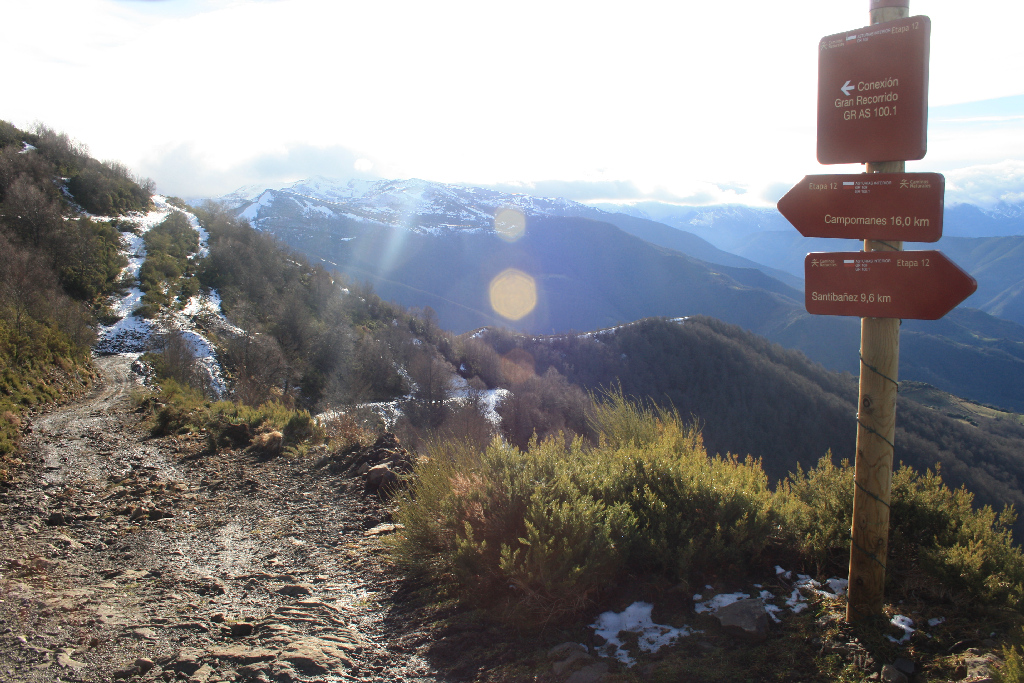
Stage 12: Santibáñez - Campomanes
Description
El Rasón and La Carisa Roman road
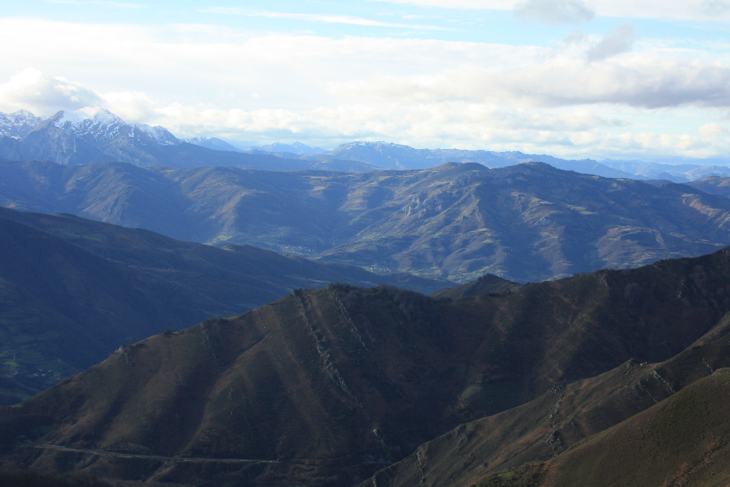
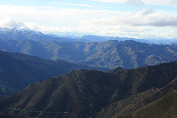
From Aller County, the road crosses the meadows of Puertos de El Rasón to the southwest, and reaches Alto de El Tunelón, where it heads down to Lena County, along a stretch of the Roman road of La Carisa. After skirting around the mountains, the road reaches the town of Campomanes, a crossroads that is witness to the pilgrimages to Santiago de Compostela.
Starting from the town of Santibáñez de Murias, the route runs along a concrete path that first passes through part of the town, then heads towards El Beyo Bridge over Fresnosa Brook. The route crosses the bridge and climbs up a gravel path following the directional signs, through meadows and woodlands, to Puertos de El Rasón.
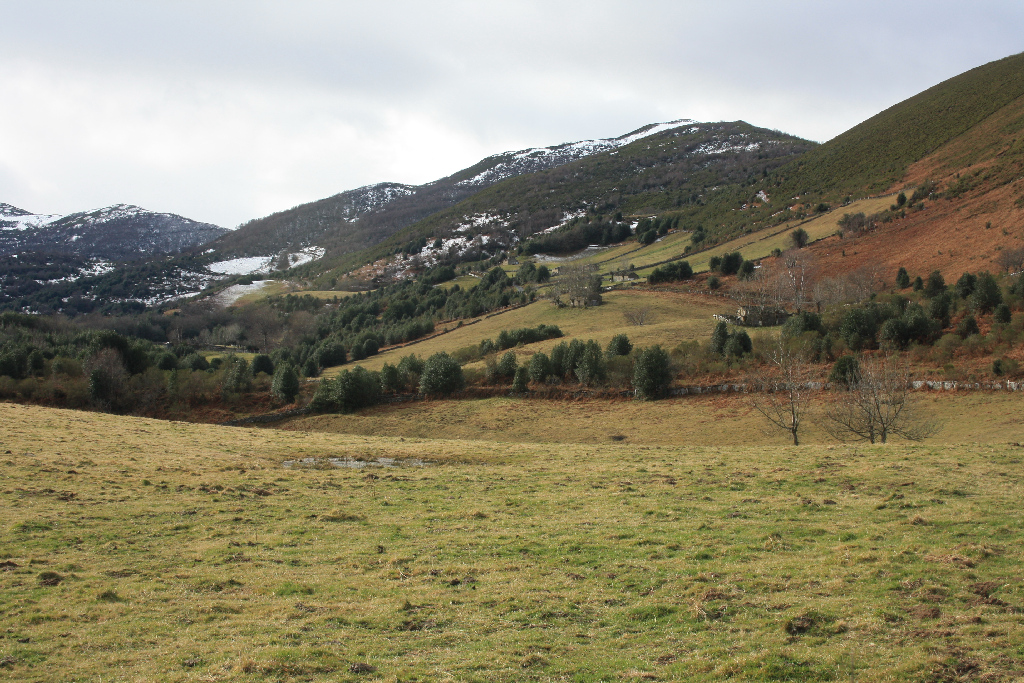
Habitat of cattle and herders, the unique harmonious beauty of the landscape is dominated by harvested meadows bound by wooden fences, dotted with stone huts, used by shepherds and animals as shelter, and small holly patches (Ilex aquifolium).
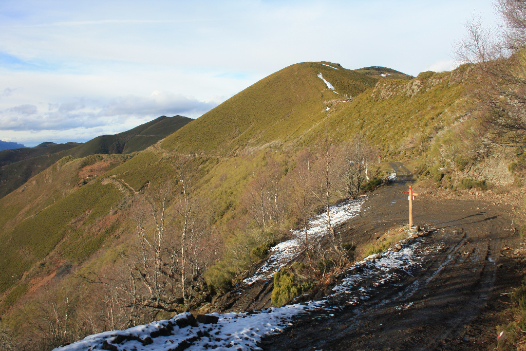
From El Rasón, the route leaves a lagoon to the right, and heads up a gentle slope towards Alto de El Tunelón, with magnificent panoramic views. Several routes intersect at Alto de El Tunelón, including the GR AS 100.1 to Pendilla or to Carabanzo. Thus, attention should be paid to the directional signs.
About one kilometre before Alto de El Tunelón (1,728 m) is the Roman camp of Mount Curriechos or La Boya Peak. The route runs along La Carisa Roman road for about 3 km.
Once in El Tunelón, the road continues downhill, then turns right towards a thematic table that explains the panoramic views of the area (Las Ubiñas, Peña Rueda, La Cubilla Mountain Passes and Los Fontanes).
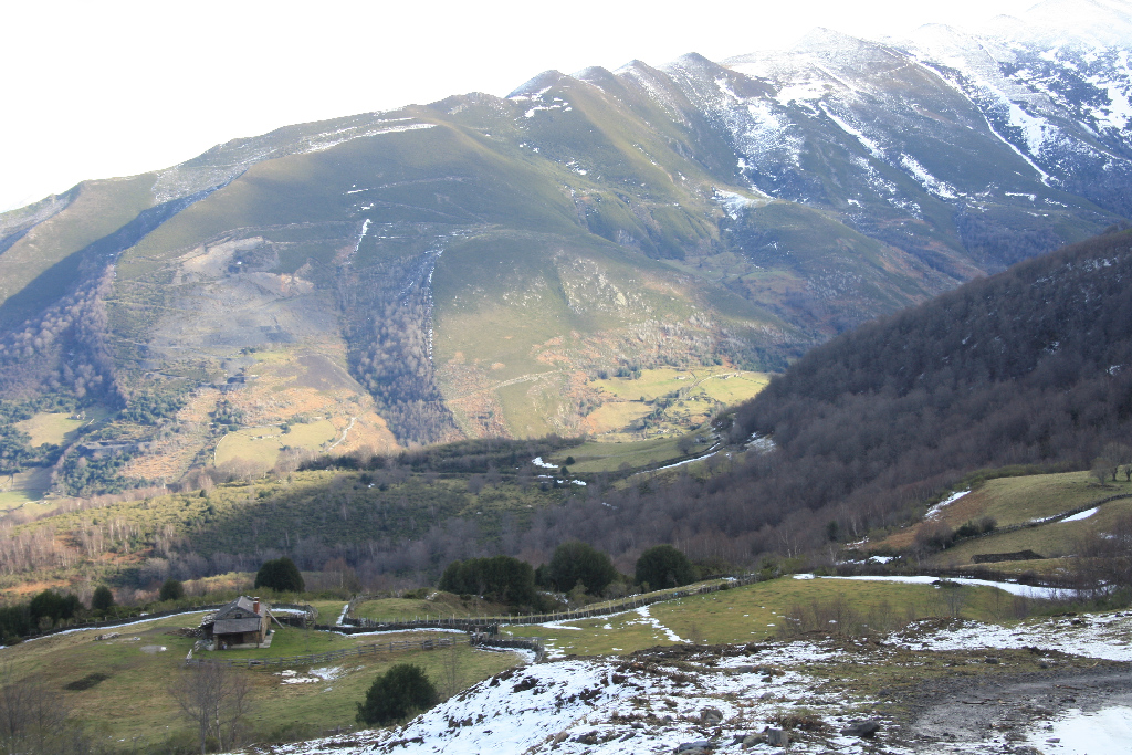
The route then skirts the mountains until it reaches the rural village of Linares de Abajo, in Lena County.
After leaving Linares behind, the Nature Trail continues along a dirt road that runs over the railroad tracks until it reaches the rural town of Casorvia.
From Casorvia, the Nature Trail makes a moderate descent down a paved road, with the town of Malveo to the right, and crosses the River Pajares. Shortly after, it veers right again, until it reaches the town of Campomanes, the final destination the route, where a start-end information panel can be found.
Sites of interest
Profile
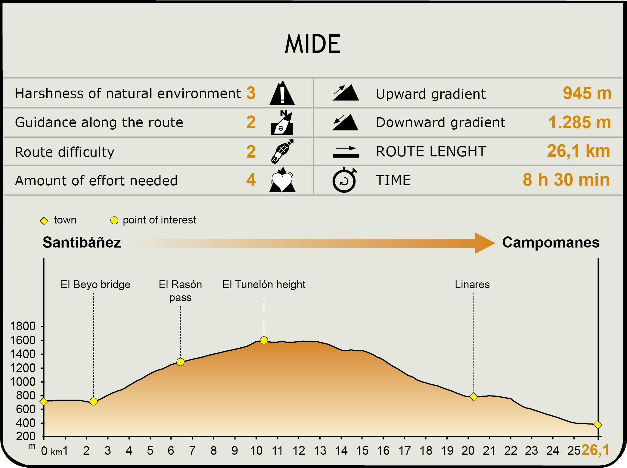
MIDE (Method for the Information of Excursions)
 Harshness of natural environment
- 1. The environment is not risk-free
- 2. There are more than one risk factors
- 3. There are various risk factors
- 4. There are quite a lot of risk factors
- 5. There are many risk factors
 Guidance along the route
- 1. Well defined trails and crossings
- 2. There is a clearly marked trail and signage
- 3. Requires the identification of geographic features and cardinal points
- 4. Requires off-path navigation
- 5. The trail is interrupted by obstacles that have to be gone around
 Route difficulty
- 1. Walking on a flat surface
- 2. Trails with different types of path
- 3. Walking on stepped paths or irregular terrain
- 4. The use of hands or jumping over the terrain is necessary
- 5. The use of hands is required to progress
 Amount of effort needed
- 1. Up to 1 hour of continuous walking
- 2. Between 1 and 3 hours of continuous walking
- 3. Between 3 and 6 hours of continuous walking
- 4. Between 6 and 10 hours of actual walking
- 5. More than 10 hours of continuous walking
Featured
Further information
Puertos de El Rasón
El Rasón mountain passes are located at 1,200 to 1,400 m in altitude, to the northeast of the ridge that demarcates the boundary between Aller and Lena counties near Tres Concejos Peak.
Humans have colonised these cool and humid highland pastures, where large herds of livestock graze in free range from spring to autumn. The "brañas" -areas in the Cantabrian mountain range where cattle graze in the summer- are among the best kept in Asturias, and are used by livestock farmers in Aller and Lena. High pastures (mayaes) like those found in Pendu, Balbona, Fuentes, Escosura or Les Llanes keep alive seasonal livestock farming in these mountains.
El Rasón has a highly diversified and rich flora, with over 200 species, including the holly tree (Ilex aquifolium). The three dominant types of vegetation are grasslands found between 750 and 1,150 m in altitude and harvested meadows, at 1,400 metres; brushwood groves consisting of predominantly two species of Genista, found between 1,300 and 1,650 m, which replace beeches (Fagus sylvatica) and birches at lower and upper levels, respectively; and forests mainly composed of beeches and sessile oaks (Quercus petraea), on the northeast slope over Santibáñez de Murias, below 1,200 m.
The mammal fauna is highly diverse, including roe deer (Capreolus capreolus), wild boar (Sus scrofa), and fox (Vulpes vulpes), as well as a host of small animals such as weasels (Mustelidae), squirrels (Sciurus vulgaris), hedgehogs (Erinaceus europaeus) and mustelids like otters (Lutra lutra). Wolves (Canis lupus) can be seen occasionally in these mountain passes when they crossover to León.
The Carisa Road
La Carisa Roman road, whose place name is taken from the Roman general Publius Carisius, crossed the Cantabrian Mountains, linking the plains of León and the land of the Asturs, which were conquered by Rome between 20 and 14 B.C. The course, which is over 40 km long and about 3 m wide, ran along the top of the mountain range like a long corridor, on a platform without a curb, which made easier the relocation of Roman troops to most strategic military outposts.
This Roman road linked Lugo de Llanera (Lucus Asturum) and Astorga (Asturica Augusta), passing through Leon (Legio VII). It was merely the Asturian section of the "Vía de la Plata". The original road climbed up from León through Bernesga Valley, across Sierra de los Pasos de Arbás through Pendilla. It continued through Fornillos, Collá Propinde, where it forked into Camín Vieyu and Camín Nuevu, and the western slope of Tres Concejos Peak. It then headed down the slopes of Carraceo Ridge to arrive at Carabanzo and Ujo (Mieres) where it joined a secondary route that came from San Isidro.
As testament to this historical past, various archaeological sites may be visited along the Via Carisa, including the tubular Espines necropolis in Mayéu Espines; Padrún necropolis at Padrún Peak; La Reigá burial mound at La Robliga Peak (Sierra del Ranero); La Carisa Castichu at La Boya Peak; the Asturian fortification at Homón de Faro; and the Roman camp of Mount Curriechos.
The town of Campomanes, located at the end of Huerna and Pajares valleys, and at the head of Caudal Valley, is a true crossroads on whose course converge the Way of St. James, the Camino Real and road to Castille.
Opposite Hospital street stands the chapel dedicated to Santa Eugenia and the Sacred Heart. The "Diaries of Jovellanos" mentions a hostel in this same area, which was probably related to the former Way of St. James and San Salvador, that came down from Pajares into Asturias, reaching Oviedo, the abode of San Salvador, and continued southwest to Galicia.
Physical remains of these historical routes can still be found, including the bridge over the River Huerna, called Ponte de Briendes, which appears for the first time in the town charter in 1247. It is located on a lower step between the Camino Real, the current road and Revillagigedo palace.
On the banks of the River Huerna, overlooking Campomanes, is the Revillagigedo Palace, built between the 17th and 18th centuries. The building has a side tower and a central section, called El Mirador, with a doorway in the centre and a balcony with a wrought iron balustrade. The palace had a now-defunct second tower, which was lost to a fire in the 1930s.
Multimedia