- Home
- Rural Development
- Nature Trails
- Nature Trails
- Northwest Sector
- Cordillera Cantábrica. Asturias interior
Stage 10: Entralgo - Bello
Description
The coalfield landscape
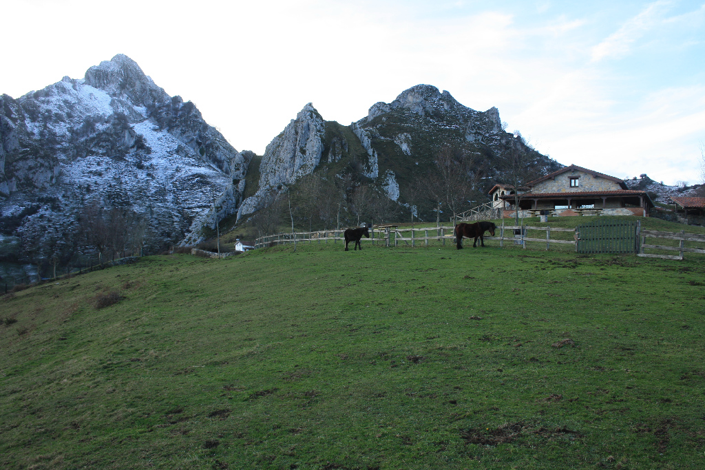
From Laviana County, in the Nalón River Valley, the Nature Trail moves on to the neighbouring County Aller to the southwest. Here it ventures into the Peña Mea massif, the highest point in the Protected Coalfield Landscape, an area characterised by traditional agricultural and forestry uses and extractive activities.
The first stretch of this stage starts in Entralgo, in the Nalón River Valley, from where it climbs up to Collada de Pelúgano, the boundary between the municipalities of Laviana and Aller. The parish church and cemetery, located in the upper reaches of Entralgo, next to a fairly tall yew (Taxus baccata) can be visited before leaving the town. The church, dedicated to San Juan Bautista, is built in the style that was popular in Asturias in the eighteenth century with one nave and a tall belfry. Splendid views of the valley can be seen from this place known as La Texera. The Armando Palacio Valdés Interpretation Centre, dedicated to this author and his work, is also located in Entralgo.
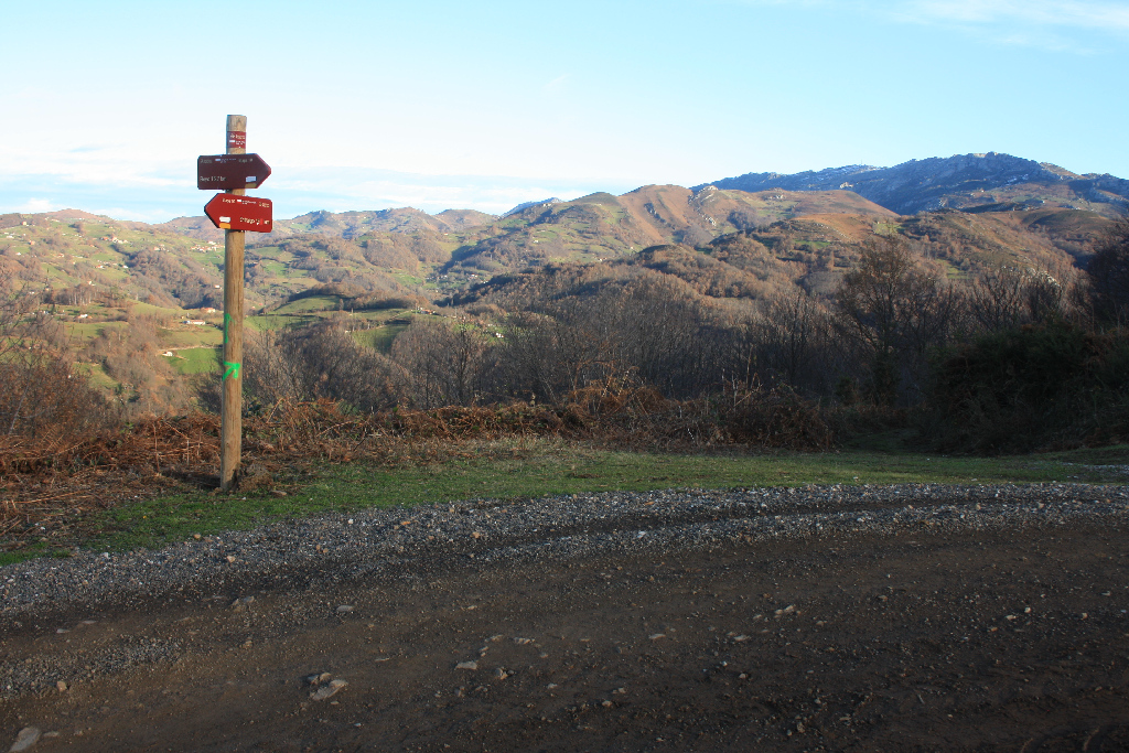
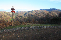
The route starts in Entralgo, which overlaps with the path PR AS-165 that links Puente de Arco with Tolivia. The information panel on this route is located on the access road to Entralgo, from where the route heads up the road into the town.
Further on, the Nature Trail heads down a gravel track through chestnut groves (Castanea sativa) and meadows to Sierra l'Cielo, with upstream views of the Nalón River Valley. It is possible to see Peña Mea from here, the highest peak of the Protected Coalfields Landscape at 1,560 m.
The route crosses the rural village of La Pomarada (La Pumará) and reaches a road along which it continues. Immediately after, the path veers onto a paved road to the right the leads to Campa Felguera recreation area, situated at an altitude of about 800, and surrounded by mountains to the north, with good views to the south.
From here, a concrete track to the right begins a relentless climb up the Villoria River Valley, through meadows and huts. Once at the recreation area, a narrow dirt path to the left heads into the Peña Mea Massif. Extreme caution should be exercised in this section.
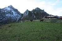
The last stretch crosses Peña Mea to arrive at Collada de Doñango, from where the route descends along a dirt track. In this stretch, the dirt track head down first through beech (Fagus sylvatica), chestnut, hazel (Corylus avellana), hawthorn (Crataegus monogyna) and holly (Ilex aquifolium) forests, then climbs up to Collado de Pelúgano. Just before reaching this mountain pass, there is a holly forest, a species protected by regional legislation, and listed as species of special interest.
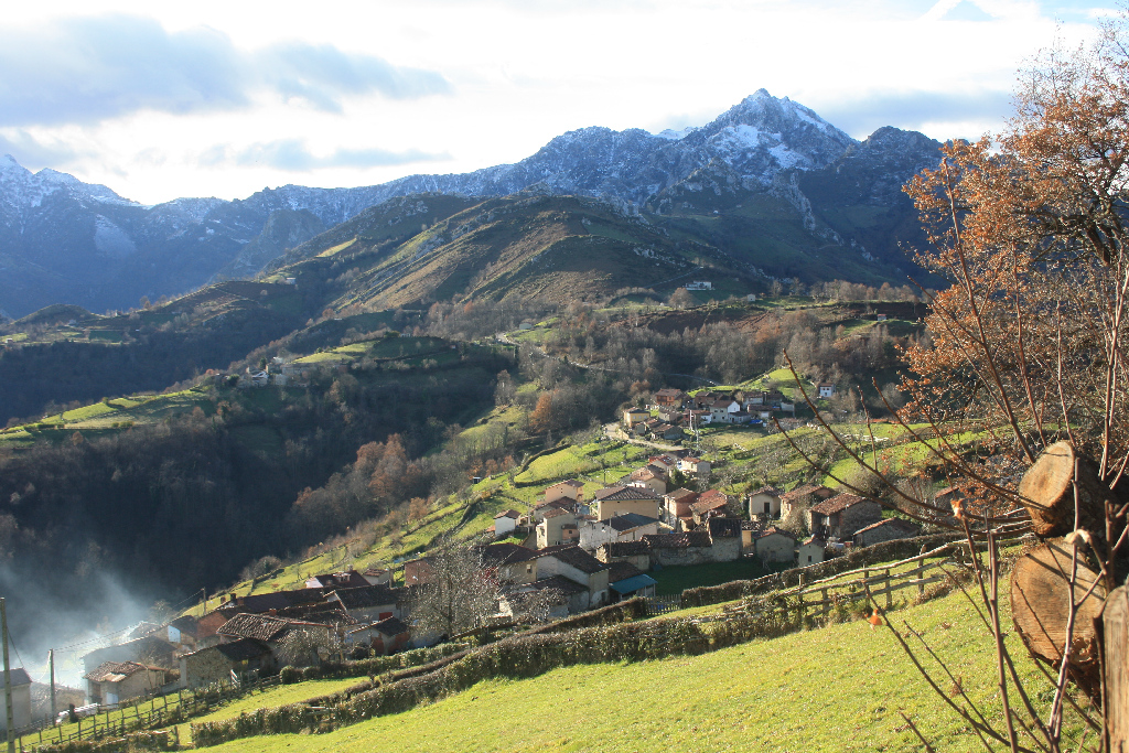
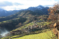
From Collada de Pelúgano, the dirt track heads down to the Aller River Valley. The first rural town along the route is Pelúgano. Here stands Torre de Pelúgano, the remains of an Asturian stately tower built in the coalfields in the late Middle Ages.
Tradition holds that Lady Gontrodo became pregnant with Doña Urraca, the future queen of Navarre, after a tryst with King Alphonse VII in the now-defunct fortress of Pelúgano, near Levinco. There are multiple legends about treasures hidden on this site, including one about a gold key that appeared in the fountain of the castle that was first owned by the Solis family and later by the Ronzón. Barely anything remains of the original tower except for the walls that now form part of a chicken coop and farm.
From Pelúgano, the route heads down to Levinco. From here, it continues to the AS-253 and, crosses a bridge to the opposite side of the River Aller. The last stretch of the Nature Trail climbs to Bello (Beyo), where, an information panel can be found in a small playground.
Sites of interest
Profile
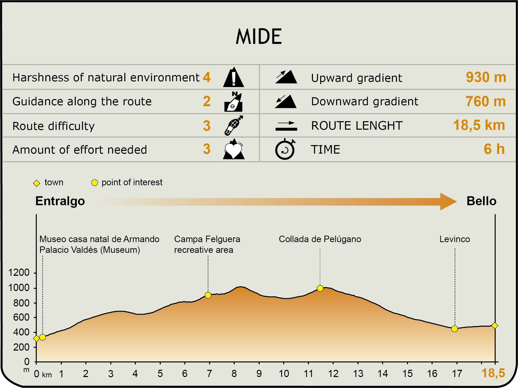
MIDE (Method for the Information of Excursions)
 Harshness of natural environment
- 1. The environment is not risk-free
- 2. There are more than one risk factors
- 3. There are various risk factors
- 4. There are quite a lot of risk factors
- 5. There are many risk factors
 Guidance along the route
- 1. Well defined trails and crossings
- 2. There is a clearly marked trail and signage
- 3. Requires the identification of geographic features and cardinal points
- 4. Requires off-path navigation
- 5. The trail is interrupted by obstacles that have to be gone around
 Route difficulty
- 1. Walking on a flat surface
- 2. Trails with different types of path
- 3. Walking on stepped paths or irregular terrain
- 4. The use of hands or jumping over the terrain is necessary
- 5. The use of hands is required to progress
 Amount of effort needed
- 1. Up to 1 hour of continuous walking
- 2. Between 1 and 3 hours of continuous walking
- 3. Between 3 and 6 hours of continuous walking
- 4. Between 6 and 10 hours of actual walking
- 5. More than 10 hours of continuous walking
Featured
Further information
Armando Palacio Valdés Birthplace Museum
Born in Entralgo in 1853, the writer Armando Palacio Valdés always drew a portrait of the Nalón River Valley in all his works. He painted a realistic picture of the economic and social changes brought about by mining and the gradual abandonment of traditional Asturian agricultural practices. This was best reflected in his famous novel, "La Aldea Perdida" (1903), rural and mining drama that takes place during the first industrial revolution in Asturias.
The Armando Palacio Valdés Interpretation Centre, housed in the birthplace of the writer, shows the evolution of the landscape and people of Laviana County through his literary works, infused with his personal childhood experiences in Entralgo and the long spells he subsequently spent as an adult.
The Casa de los Palacio, built in the eighteenth century, is a two-storey rural house with various extensions. The corridor on the first floor of this three-unit building is noteworthy. In 1983, the town council of Laviana purchased the nearly dilapidated building for rehabilitation. The Armando Palacio Valdés Interpretation Centre was opened in 2003 to raise awareness about the life and work of the writer.
Protected Coalfield Landscape
With an extension of about 100 square kilometres, the Protected Coalfield Landscape, designated in 2002, is located in the central Asturias, between the counties of Oviedo, Laviana, Mieres and San Martín del Rey Aurelio. It preserves the typical landscape of a land managed according to traditional agriculture, livestock and forestry practices, as well as industrial and mining activities.
Located within the Cuenca Carbonífera Central, this protected area combines limestone, shale and sandstone beds with quartzite, coal and conglomerates. The impact of the industrial and mining activity on the surrounding urban areas has been significant, resulting in overall degradation of the landscape.
From the orographic perspective, there is a mid-mountain area, combined with steep and deep hill ranges and narrow valleys, steep slopes and altitudes below 1,500 m, except for Peña Mea (1,560 m), the highest peak in the Protected Landscape. This territory consists of Navaliego, Rubies and Longalendo (Mieres) mountain ranges, the basin of the upper Samuño River Valley (Langreo), the upper Santa Bárbara Valley (San Martín del Rey Aurelio), and the highlands of Villoria, Tolivia and Llorio in Laviana.
Multimedia