- Home
- Rural Development
- Nature Trails
- Nature Trails
- Northwest Sector
- Carballeda de Avia
Carballeda de Avia Nature Trail
Description
A trail through Sierra de Pena Corneira
Carballeda Nature Trail runs through Pena Corneira mountain range in Ourense, the largest protected nature area in Galicia, scattered with large granite boulders and restored mills. A countryside of extraordinary beauty, located in O Ribeiro County, where the vineyards that fill the fertile valleys create a distinctive landscape.
The 18-kilometre Carballeda Nature Trail winds through the municipality of Carballeda de Avia in O Ribeiro County, a major wine-growing Galician district located in northwest Ourense. This county is characterised by its fertile valleys, historically known for the famous Ribeiro wine produced from its vineyards.
The River Miño, which flows north to south across the county, is fed by its tributaries, Avia and Arnoia, that bathe these lands. In Ribadavia, the Miño receives the waters of the Avia, which flow down the Suido Mountains, the natural boundary between the provinces of Ourense and Pontevedra. It feeds into the Albarellos Reservoir in the municipalities of Avión and Leiro. A little further south, the River Arnoia, the longest in the province, with almost 85 kilometres, flows into the Miño along the left bank.
Carballeda Nature Trail provides the opportunity to experience the natural beauty of this almost mystical rural area – the mills at A Veronza to Serra do Faro Mountains. A side-track leads to Serra de Pena Corneira Natural Monument, where humans have learned to adapt their way of life and modes of production to the forces of nature.
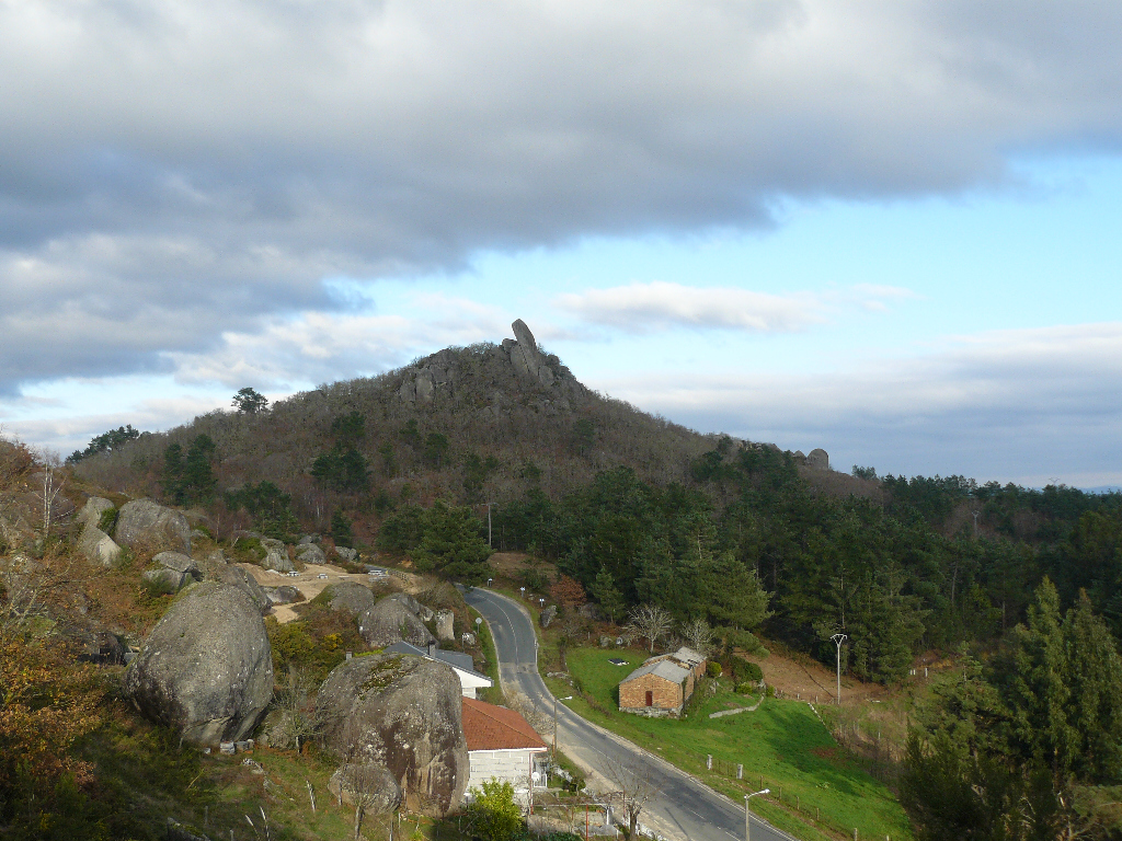
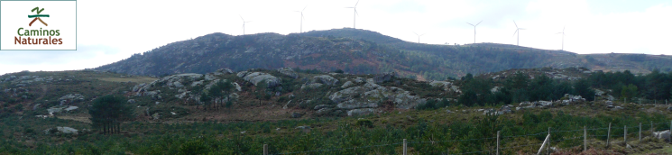
Serra de Pena Corneira, declared a Natural Monument in 2007, with its towering granite boulders, is the main attraction of this route. This mountain (998 hectares), which straddles the municipalities of Carballeda de Avia, Leiro and Avión, is one of the largest nature protected areas in Galicia. Pena Corneira, the great stone horn, rises vertically 10 metres atop other large rocks. It is the visual reference throughout the Avia Valley.
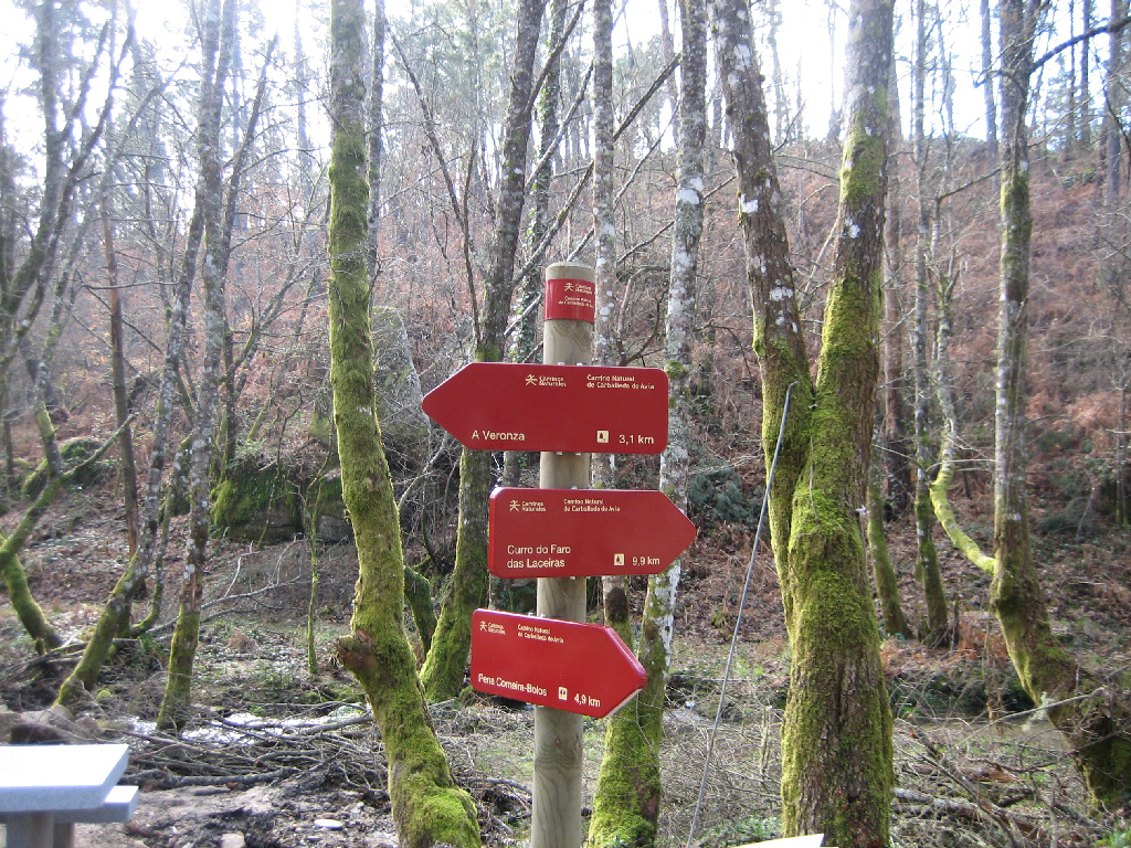
Most of Carballeda Nature Trail, which consists of a main section and a branch, runs along forest trails dotted with numerous restored mills. The main section stretches from A Veronza to Curro del Faro das Laceiras. Shortly before arriving at Abelenda rest area, the route branches off to Pena Corneira-Bolos.
A Veronza to A Portela

The main trail, nearly 13 km long, runs between the rest areas at A Veronza mills and Curro del Faro das Laceiras in A Portela do Pau.
The historical evolution of Carballeda is closely tied to the history of O Ribeiro County - pre-Roman, Roman and Swabian settlements, feuding between medieval lords, revolts against feudal rule and the power of monasteries (Celanova, Oseira or Melón) over these lands.
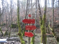
The church of San Miguel, the most impressive religious building in this municipality, and the chapel of San Lorenzo can be seen on the way from Carballeda de Avia to A Veronza rest area, where the route begins.
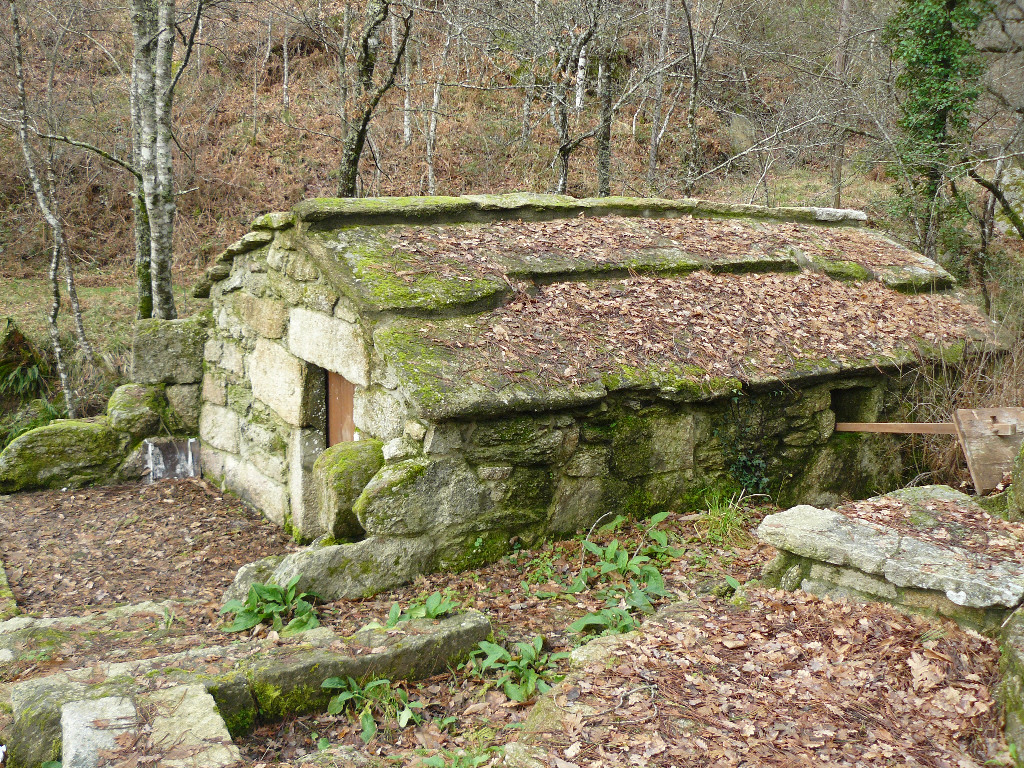
Several restored mills, testament to the importance of water in Galicia's daily life, can be found in A Veronza rest area. These buildings were not only used by their owners, but also by the local community, who paid with flour “a quenda” the fee established for the use of the mill.

The main route from A Veronza starts on the banks of Gateira Brook. It winds through riparian forests, alternating with fields of crop, vineyards and native pine forests, and continues along the brook until it meets a road. Here, a side-track to the left leads to the town of Muimenta where a Romanesque church can be seen.
The area closest to the river is covered with an extensive riparian forest of willows (Salix atrocinerea) and alders (Alnus glutinosa), and an occasional oak (Quercus suber) or strawberry tree (Arbutus unedo). The forests are mostly composed of common oak (Quercus robur) and Pyrenean oak (Quercus pyrenaica), and a few chestnuts (Castanea sativa). It is gradually replaced by high altitude mountain vegetation, characterised by large patches of scrub and a few pines (Pinus sylvestris), gnarled by the harsh climate.
Further along the main route towards Curro del Faro das Laceiras with the river to the left, there is a mill that is probably the oldest in the county. It is smaller than other mills in the area, but famous for its "lousa do pais" roof, a clear example of the use of natural resources by our ancestors.
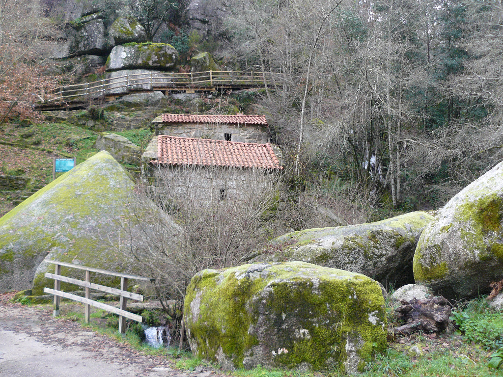
The use of granite as a building material for mills is common throughout the itinerary. Imposing elevations formed by granite boulders, typical of the Sierra de Pena Corneira, will appear along this stretch. These rocks were formed 300 million years ago when magma solidified deep in the Earth's crust. The complex geological formations found in this range raise great interest amongst geologists worldwide.
The route arrives at Abelenda rest area, where there are several restored mills and the road forks. Behind one of the mills is the branch that leads to Pena Corneira.
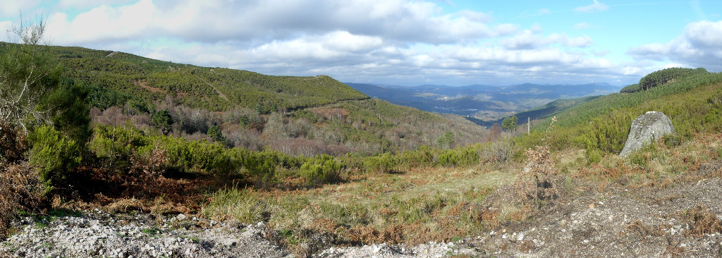
The main route crosses a bridge over Gateira Brook, towards the ruins of Sarinas. The phenomenon of rural depopulation and abandonment, so frequent today, becomes evident along this stretch of the Trail. Further on, the route passes through the village of As Fermosas. The mountain ridge along which the path runs provides magnificent views of both sides of the Trail, where horses and cows quietly graze in semi-freedom.
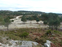
Near Curro, the path begins to climb along wide forest trails, between scrub and wild pines, whose size and height provide insight on the harsh climatic conditions. The route arrives at Curro del Faro das Laceiras, situated at over 1000 metres, where the distinctive “bolos” can be found. Scrub and rocks of curious shapes dominate the landscape of this natural environment.
From Abelenda to Pena Corneira

In addition to the main route, there is a 5-kilometre branch that runs north from Abelenda rest area to Pena Corneira. After a short climb, the path arrives at the town of Abelenda das Penas, where the church of San Andrés stands. This temple has been associated with the Order of the Templars. Nearby are a beautiful, 17th century stone cross and a Roman site.
The road continues further north through dense forests, passes above the town of Faramontaos, and reaches a rest area located in a natural environment of rock formations rounded by the forces of nature. The route arrives finally at Pena Corneira, a huge, 10-metre granite block shaped like a horn that gave name to this mountain and sits atop the Nature Monument.
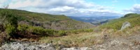
On the way down from Pena Corneira, the road to the right, off the route, heads to A Lama recreation area in the municipality of Leiro, where a namesake Romanesque church may be visited. A pedestrian path climbs to Outerial viewpoint with superb views of the county and the protected area. Leiro and Carballeda de Avia are the two major population centres near the Nature Trail. The riverside walk along the River Avia is another nice place to visit.
Sites of interest
Profile
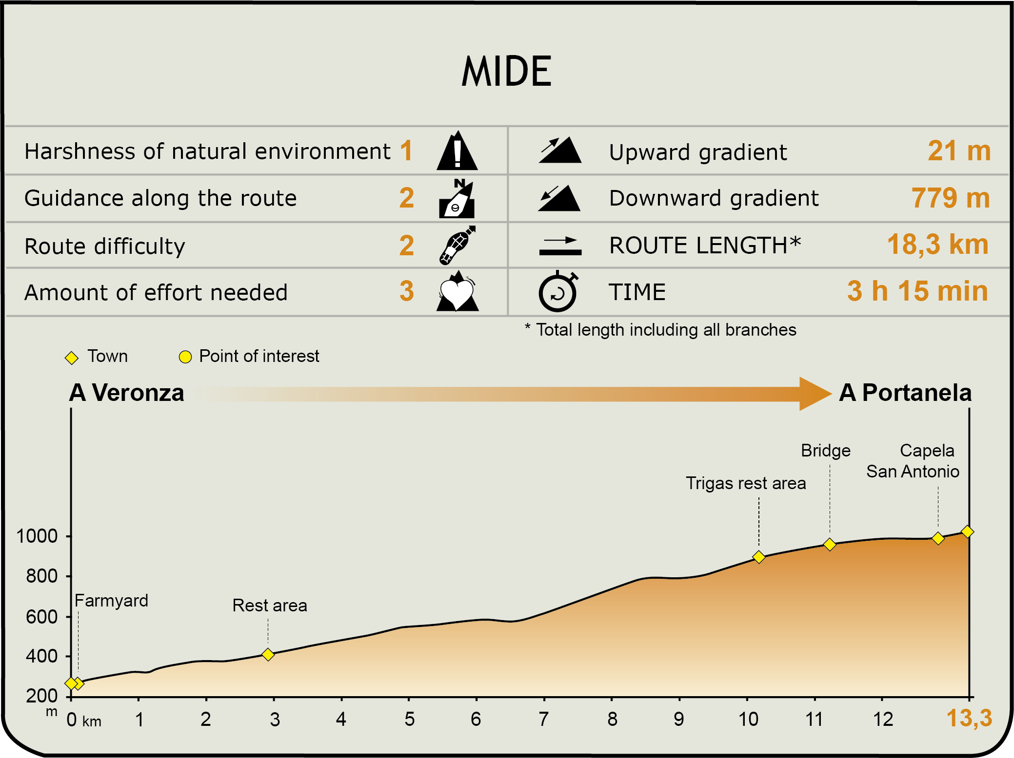
MIDE (Method for the Information of Excursions)
 Harshness of natural environment
- 1. The environment is not risk-free
- 2. There are more than one risk factors
- 3. There are various risk factors
- 4. There are quite a lot of risk factors
- 5. There are many risk factors
 Guidance along the route
- 1. Well defined trails and crossings
- 2. There is a clearly marked trail and signage
- 3. Requires the identification of geographic features and cardinal points
- 4. Requires off-path navigation
- 5. The trail is interrupted by obstacles that have to be gone around
 Route difficulty
- 1. Walking on a flat surface
- 2. Trails with different types of path
- 3. Walking on stepped paths or irregular terrain
- 4. The use of hands or jumping over the terrain is necessary
- 5. The use of hands is required to progress
 Amount of effort needed
- 1. Up to 1 hour of continuous walking
- 2. Between 1 and 3 hours of continuous walking
- 3. Between 3 and 6 hours of continuous walking
- 4. Between 6 and 10 hours of actual walking
- 5. More than 10 hours of continuous walking
Featured
Further information
The vineyards
County Ribeiro in Ourense, on the boundary with the province of Pontevedra, has been historically associated with wine production, owing to the excellent climatic conditions for wine making. Its geographical configuration protects the vineyards from extreme temperatures and high wind, preventing the deterioration of grapes.
Since ancient times, vineyards have been the main source of wealth of the county. It has defined the landscape of the various municipalities across which it spreads, including Arnoia, Castrelo do Miño, Leiro and Cenlle, and the capital Ribadavia.
In the second century B.C., the Greek historian Strabo wrote about the cultivation of vineyards in O Ribeiro, but it was not until the Middle Ages when wine production took off. Although kings and lords owned vineyards and wineries in the ninth century, it was only in the twelfth century when the cultivation of vineyards became the mainstay of the economy of the county. The vineyards owned by the monasteries were instrumental in this process, in particular those of the Cistercian Order, whose monks lovingly cultivated the grapes and studied native varieties.
Vineyard cultivation reached its heyday during the fifteenth and sixteenth centuries, spreading throughout Spain and Europe, especially due to the wine exported to Flanders, Brittany and, above all, England. During this first period of splendour, Ribeiro wines were bartered for gold and textiles. The navigability of the River Miño was instrumental for its transport.
It was not until the beginning of the eighteenth century that trade in Ribeiro began to decline owing to political disagreements with Europe. This, as well as transport difficulties, increasing prices, competition from cheaper wines from Castille and La Rioja, led to the loss of markets in northern Spain. In the nineteenth century, plant pests such as powdery mildew and phylloxera led to lack of interest in vineyards, pushing the inhabitants of the county to emigrate elsewhere.
Currently, vineyards have made a strong comeback, relying on the native varieties that once made its wines world-famous, including the treixadura white grape variety.
Multimedia