
- Home
- Rural Development
- Nature Trails
- Nature Trails
- Northwest Sector
- Ruta del Cantábrico
Stage 1. Ribadeo - Las Catedrales
Description
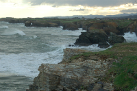
Running among beautiful fishing villages and cliffs carved away by the waves.
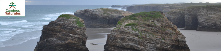
This stage of the Cantabrian Sea Nature Trail starts at the port of Ribadeo, and continues along the coastline, where the traveller can enjoy the view of breathtaking cliffs and beaches and observe the close relationship of the locals with the sea. The end of this stage is located at the Las Catedrales beach, which translates as beach of the Cathedrals and was declared a Natural Monument due to the astounding beauty of its rocky sculptures carved by the sea.
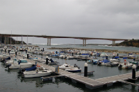
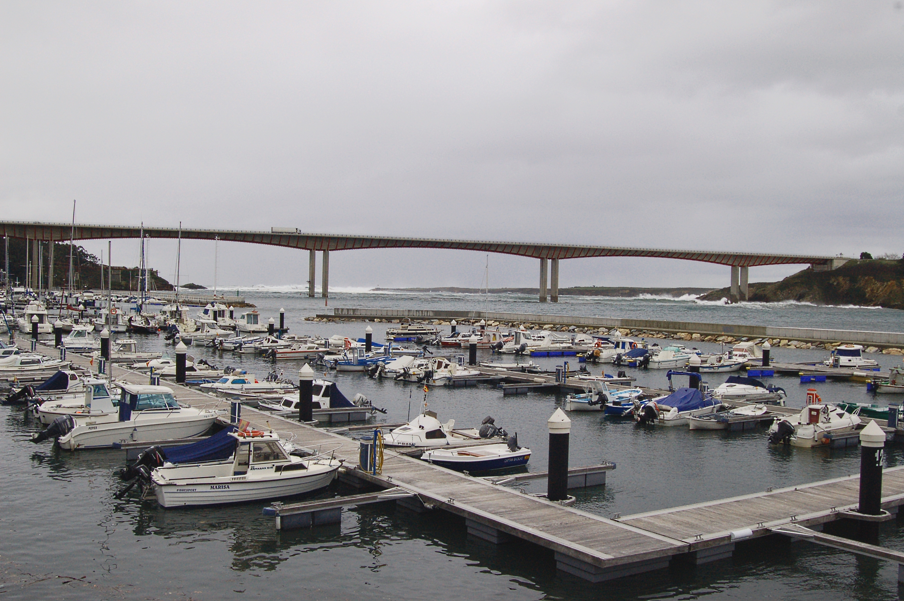
This stage begins in the Plaza de España in Ribadeo (just next to the local tourist information office). The trails goes down the paved Buenos Aires Street and along the Ribadeo port, first along the Mirasol commercial dock and afterwards the along Porcillán Marina.
Before hitting the first kilometre point, the traveller can choose between continuing by climbing a staircase or a ramp on the Leopoldo Calvo Sotelo Avenue; both paths converge in the Estrada do Faro. If you decide to climb the staircases, you will leave the San Miguel Chapel to your left, before turning right and descending along a small path which leads to a paved road that runs under the A-8 highway.
After crossing the Estrada do Faro, the traveller continues walking along the pavement for a few metres before crossing this street again to take the Nature Trail in the direction of the old cargo dock, which now is used as a viewpoint due to its splendid views over the Eo ría and the Cantabrian Sea.
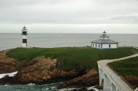
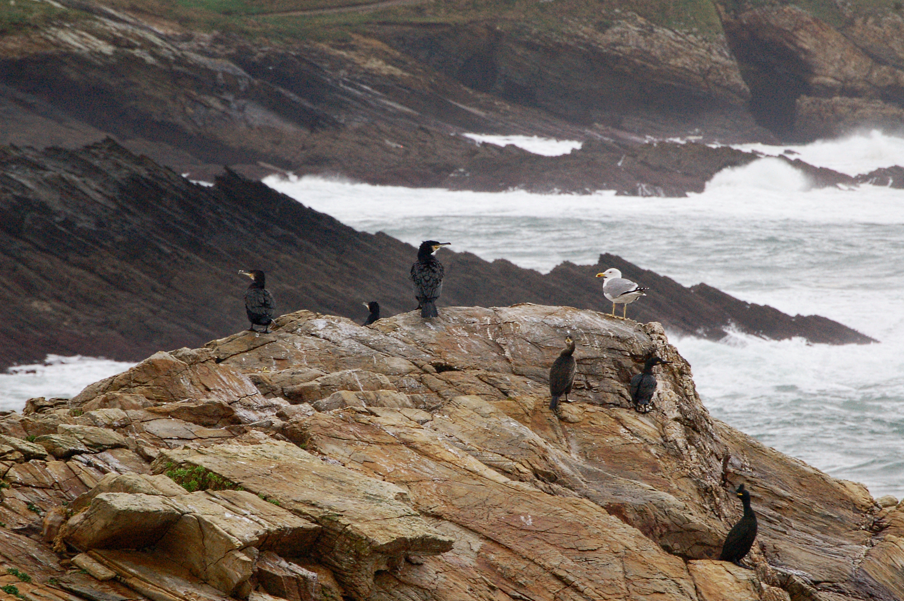
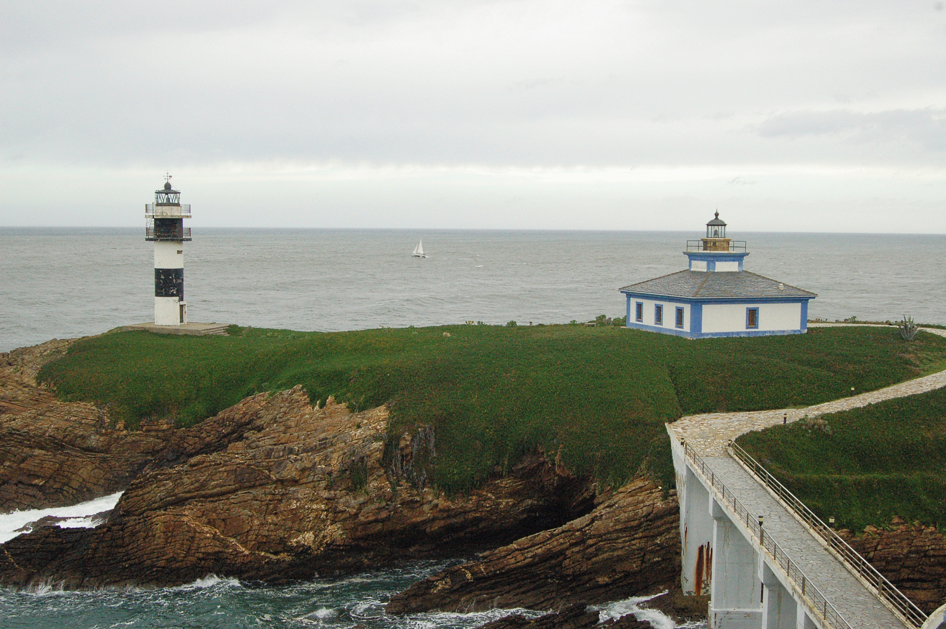
Just about 150 m away, the traveller finds the San Damián Fort, which is overpassed by this Nature Trail by means of a narrow path running under a canopy of eucalyptus trees. At the edge of this patch of woodland, the traveller takes the seafront promenade which runs parallel to the road and zigzags along the coastline. Well after the kilometre point 2, a section shared with motor traffic begins, where the traveller may admire, to their right, the view of Pancha Island and of its two lighthouses. The Nature Trail continues turning left by a section of the LU-140 road, so please be extremely cautious.
After leaving kilometre point 3 behind, the trail turns right in the direction of Rinlo and a little before kilometre point 4, the traveller has an opportunity to visit the Castro das Grobas. The shared section ends there, and the trail turns right along a wide dirt path, leaving behind a pine patch and leading again to the coastline. The trail follows the coastline until reaching the Areosa beach, after kilometre point 6. A few metres after leaving the beach, the trail turns right again and a new 500 m shared section starts, after which the trail turns right again by a dirt road.
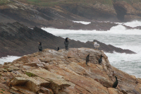
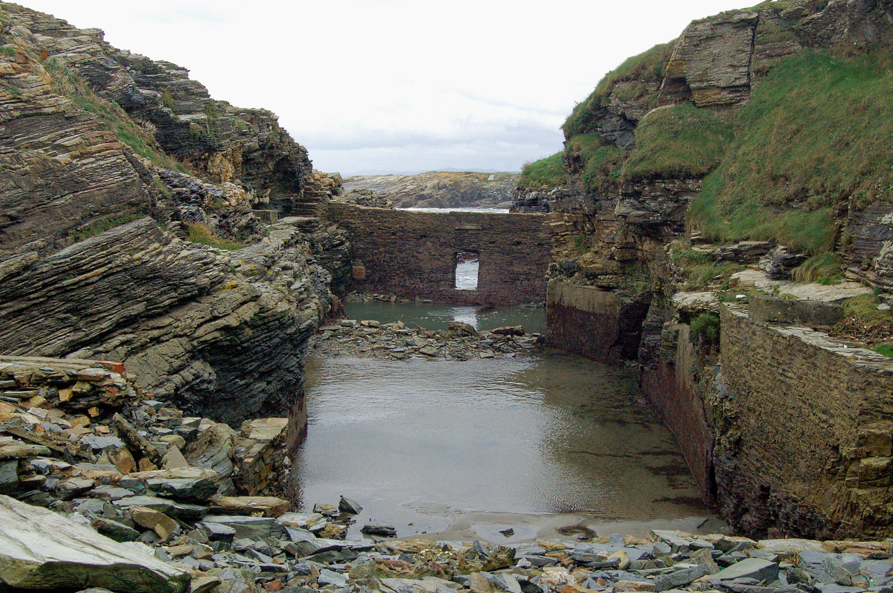
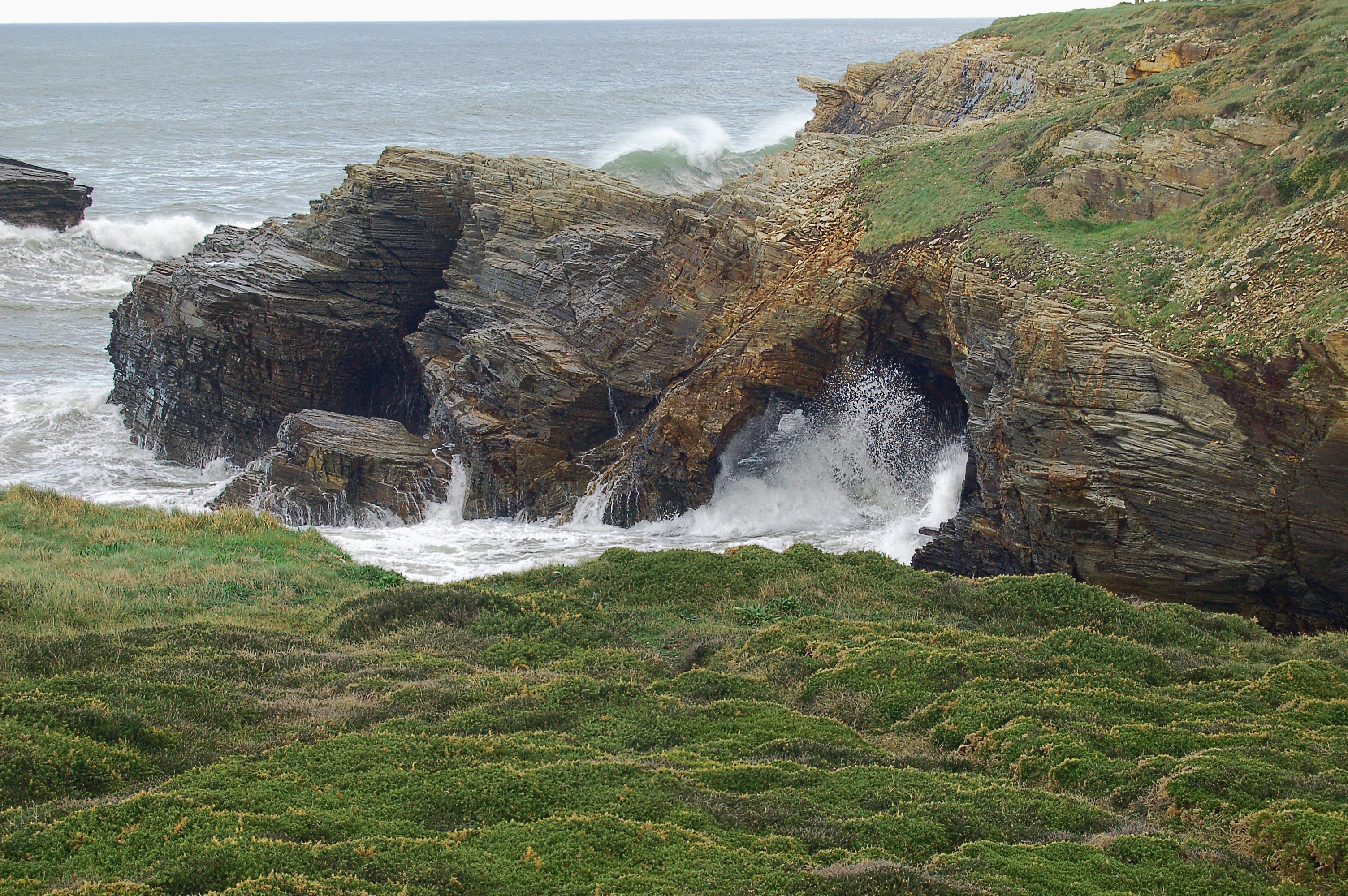
Again continuing along the coastline, after kilometre point 7 the traveller enters a dense gorse (Ulex europaeus) patch that, due to the climatological conditions of the area, is in bloom practically all year round. Afterwards, the trail leaves this wide road and turns right by a narrow lane which, shortly after kilometre point 8, allows the traveller to visit the Castro de Fornelos. This section of the trail is composed by intertwining sections of narrow and wide path until, a little before hitting kilometre point 10, the trail turns right and takes the road to for a while, passing near a furna (a sea cave) carved by the sea which is really worth a visit. Once the shared section is completed, the traveller has to walk less than 200 m before the trail reaches the Campo do Cristo recreational area, which leads them to Rinlo, a fishing village which is home to the second oldest Fishermen's Guild in Spain. The trail continues along Rinlo's seafront promenade until, leaving behind the town, reaching the Rinlo Port and then an old shellfish farm. Seawater is allowed into such farms so that farmed shellfish can feed on it. The trail continues along shellfish farms, with some sections along shared with motor traffic, until a little before kilometre point 14, where the traveller leaves the road shortly before reaching the Castro de Meirengos; a little further down the road they may enjoy the view of the village of Meirengos.

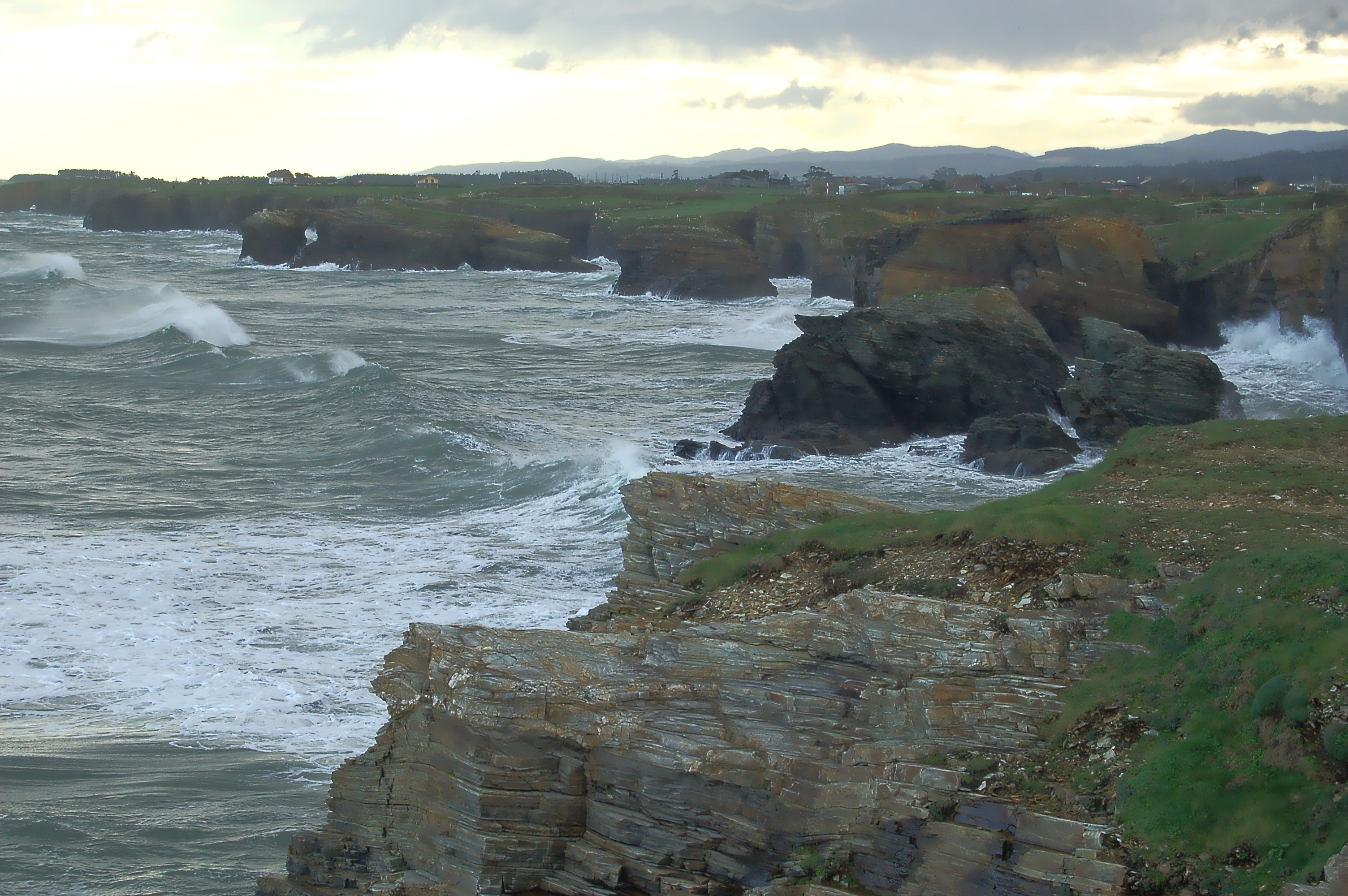
Once kilometre point 15 has been left behind, and walking among crop fields and cattle, the trail leaves behind a pretty rocky beach and reaches the stunning Castros beach, which has a large parking lot and several viewpoints. The stage continues by a wide lane which runs very close to the coastline, by which the trail reaches the Illas beach, where the traveller may enjoy the beauty of a landscape shaped by the many islets that stand close to the coast, and which give the beach its Galician name, Illas (Islands).
Afterwards, the trail leaves the beach and continues along the road that runs in front of it. Kilometre point 16 is reached. Afterwards, the trail turns right at a livestock farm and continues along this patch before turning left to take road LU-P-610 and continuing along this road until kilometre point 17, where the trail leaves the road at the Esteiro beach.
The final section of this stage is a path which, just before reaching the finishing point, runs parallel to the LU-P-610 road and enters the Las Catedrales beach parking lot. This stage could not have a better ending than a visit to this breathtakingly beautiful beach.
Branch Ribadeo-Mill As Aceas
This alternate path of the first stage starts at the Baixada de Mirasol, which is located in the commercial docks also called Mirasol.
The traveller walks along the pavement before leaving it at the end of the docks and descends by a paved path, which after a few metres turns a pavement of large slabs.
This alternate path runs close to the Eo ría, and it is a pleasant stroll that allows the traveller to enjoy the view of the towns of Figueras and Castropol in Asturias, at the opposite bank of the ría. The traveller reaches the Casa das Algas, which used to be a seaweed harvesting plant; it was operative until the 1990s, and nowadays is restored and houses the headquarters of the Ribadeo Rowing Club. Then, the road goes up a wooden footbridge which runs along the N-642 road and then enters a eucalyptus wood (Eucalyptus globulus). The trail climbs along intersecting dirt paths and wooden footbridges. Once the top is reached, the trail turns dirt path until this alternate section is finished.
This path goes up and down along an area where eucalyptus have been cut down and replaced with indigenous trees. Finally, this detour comes to an end at the Muiño das Aceas, a perfectly preserved tide mill.
Sites of interest
Map
Puntos de Interés
Geología
Vegetación
Profile

MIDE (Method for the Information of Excursions)
 Harshness of natural environment
- 1. The environment is not risk-free
- 2. There are more than one risk factors
- 3. There are various risk factors
- 4. There are quite a lot of risk factors
- 5. There are many risk factors
 Guidance along the route
- 1. Well defined trails and crossings
- 2. There is a clearly marked trail and signage
- 3. Requires the identification of geographic features and cardinal points
- 4. Requires off-path navigation
- 5. The trail is interrupted by obstacles that have to be gone around
 Route difficulty
- 1. Walking on a flat surface
- 2. Trails with different types of path
- 3. Walking on stepped paths or irregular terrain
- 4. The use of hands or jumping over the terrain is necessary
- 5. The use of hands is required to progress
 Amount of effort needed
- 1. Up to 1 hour of continuous walking
- 2. Between 1 and 3 hours of continuous walking
- 3. Between 3 and 6 hours of continuous walking
- 4. Between 6 and 10 hours of actual walking
- 5. More than 10 hours of continuous walking
Featured
Further information
Ribadeo
A town located in the province of Lugo, at the left bank of the Eo Ria. Since ancient times the village has been dependent on the sea; in fact, the village has grown inland from its original settlement by the port.
The parish church of Santa Maria do Campo and the casas de indianos (houses built in pseudo-colonial style by wealthy returning emigrants to America), especially the Torre de los Moreno, are noteworthy. The term indianos refers to those locals who, after having emigrated to America, returned rich to their hometown and built lavish houses for themselves.
The Parador de Ribadeo offers an excellent viewpoint over the ría. It occupies on a typical Galician Manor over the mouth of the Eo river, which is an area of maritime and tourist interest which serves as a border with the nearing Autonomous Community of Asturias. It offers the possibility of admiring an unique view over the ría and the small villages that dot the Asturian coast at the opposite bank.
Las Catedrales beach
Its breathtaking beauty earned this beach the status of Natural Monument and Biosphere Reserve, and it became part of the Natura 2000 Network as a Site of Community Interest. It must be visited at low tide to admire the row of aches carved away slowly by the sea waves over the centuries in all their glory.
Due to the large number of visitors which come to enjoy this unique beach makes, at certain times of the year it is necessary to ask for entrance permission.
Multimedia
Downloads
GPS Downloads
Maps
Cyclability
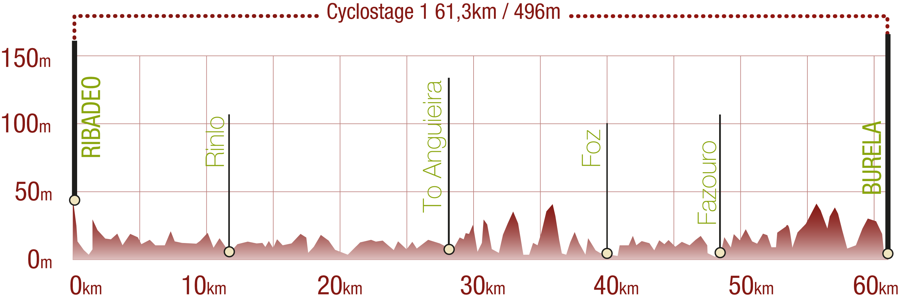
This Cyclostage corresponds to stages 1, 2 & 3 of the Nature Trail
PROFILE
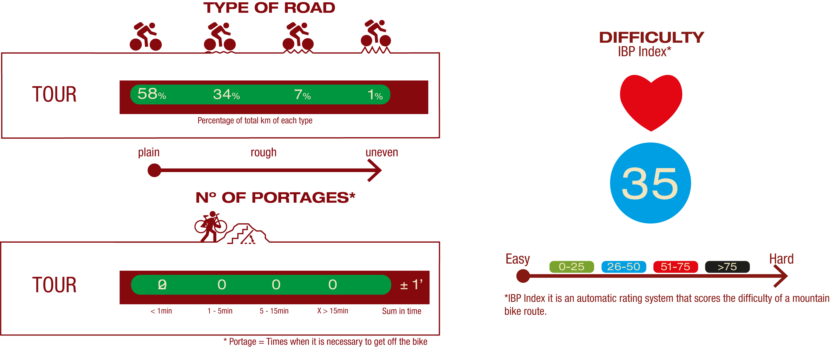
TYPE OF ROAD, PORTAGES & DIFFICULTY
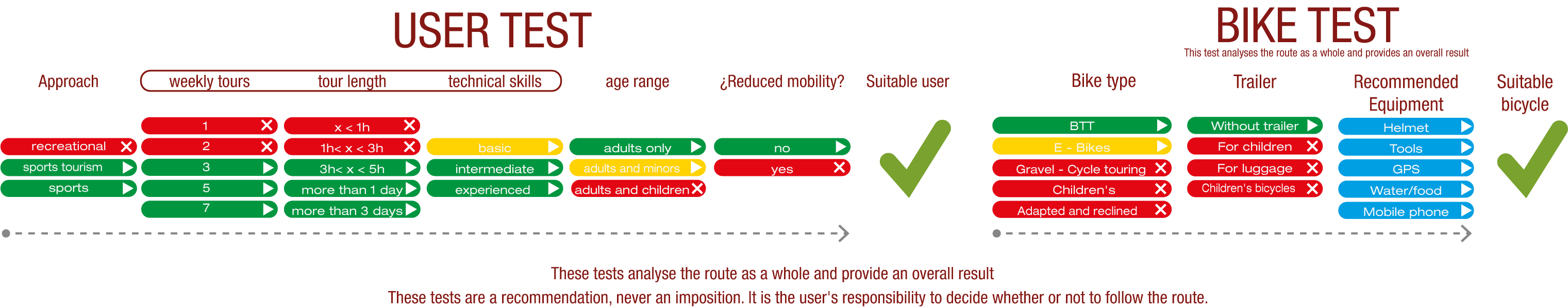
TEST
SAFETY RECOMMENDATIONS
- Sections shared with hikers.
- Transit through the centre of some population centres.
GENERAL RECOMMENDATIONS
- Find out about the technical aspects of the route and the weather on the day.
- Take care of the environment. Take care not to disturb animals or damage vegetation. Respect private areas.
- You must give priority to pedestrians and comply with general traffic rules.
- The environment in which you will be riding is open, free to move around and an area where many activities are carried out (sporting, forestry, livestock and agricultural activities). Always have an understanding, prudent, responsible and respectful attitude.