
- Home
- Rural Development
- Nature Trails
- Nature Trails
- Northwest Sector
- Ruta del Cantábrico
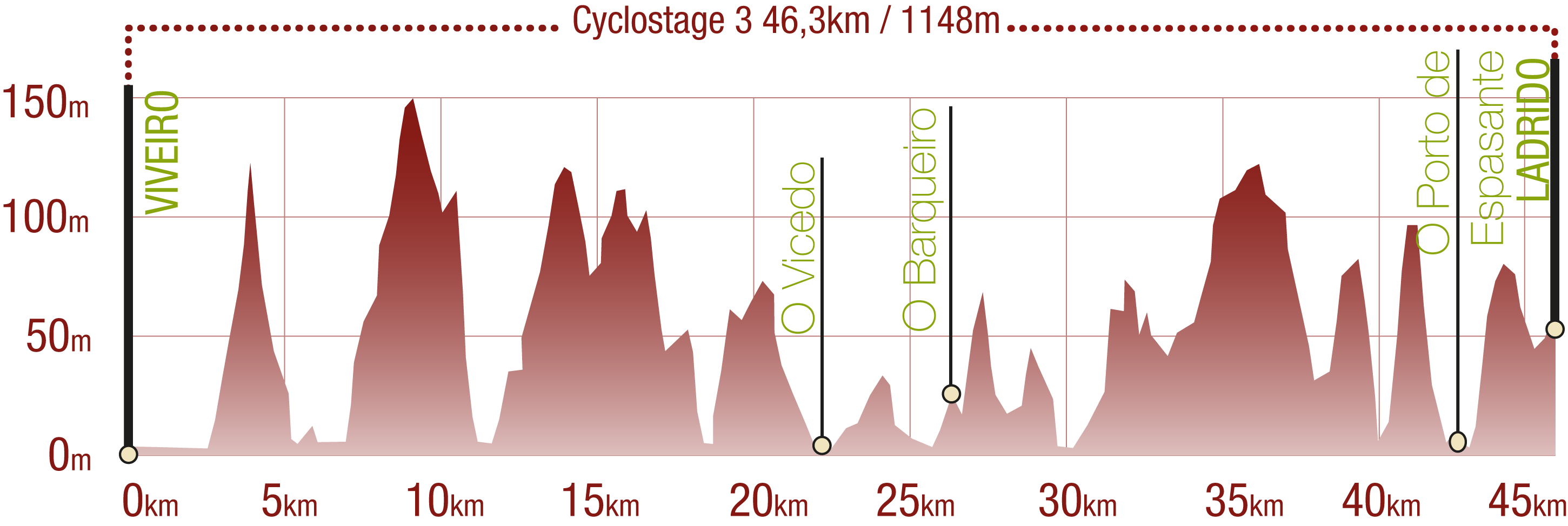
Stage 7. O Vicedo - Ladrido
Description
From O Vicedo to Ladrido, taking the O Barqueiro bridge to cross the Sor ría, the border between Lugo and A Coruña.
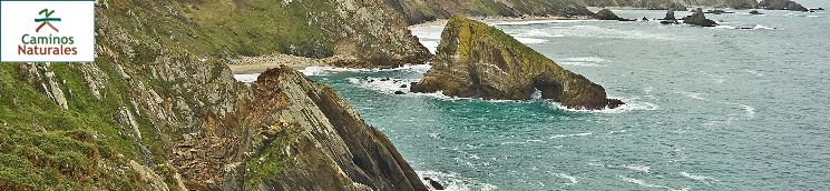
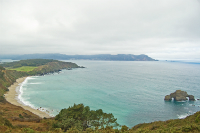
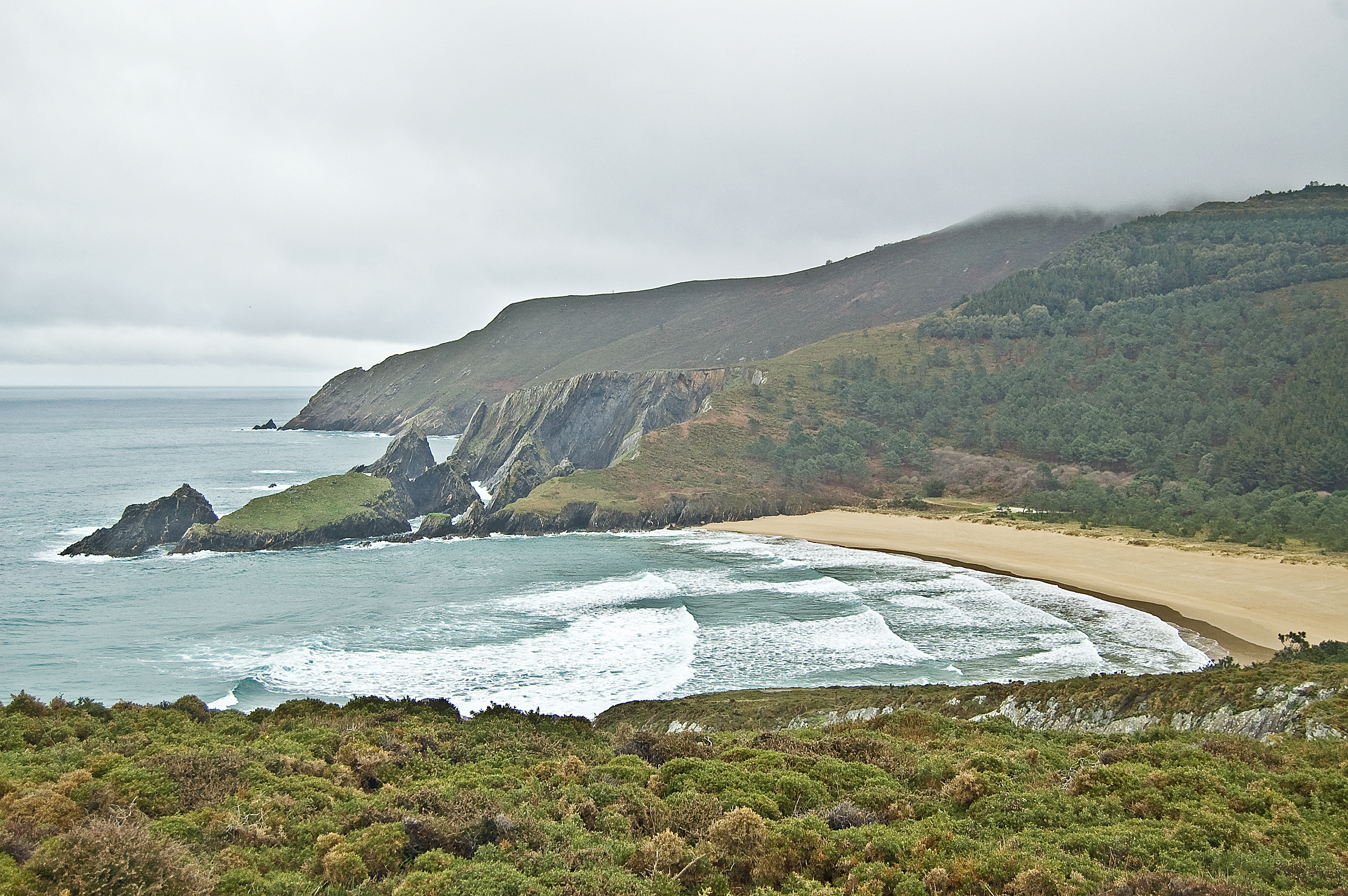
During this stage the sea takes the spotlight. A host of beautiful beaches line the trail, such as the beaches of Arealonga, Esteiro, Bimbiero and Concha. Breathtaking cliffs separate them all, and it can all be enjoyed from the Coitelo view point ("the best bench in the world"). This is an unbeatable environment, inhabited by people with strong ties to the sea, in towns such as O Vicedo, O Barqueiro and Porto de Espasante which have a taste of the sea.
An interpretation panel at the start of the path of Camiño a Praia Fomento marks the beginning of the seventh stage of the Cantabrian Route between O Vicedo and Ladrido.
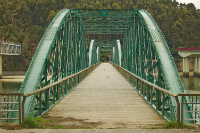
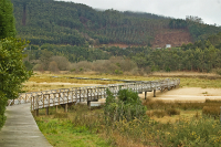
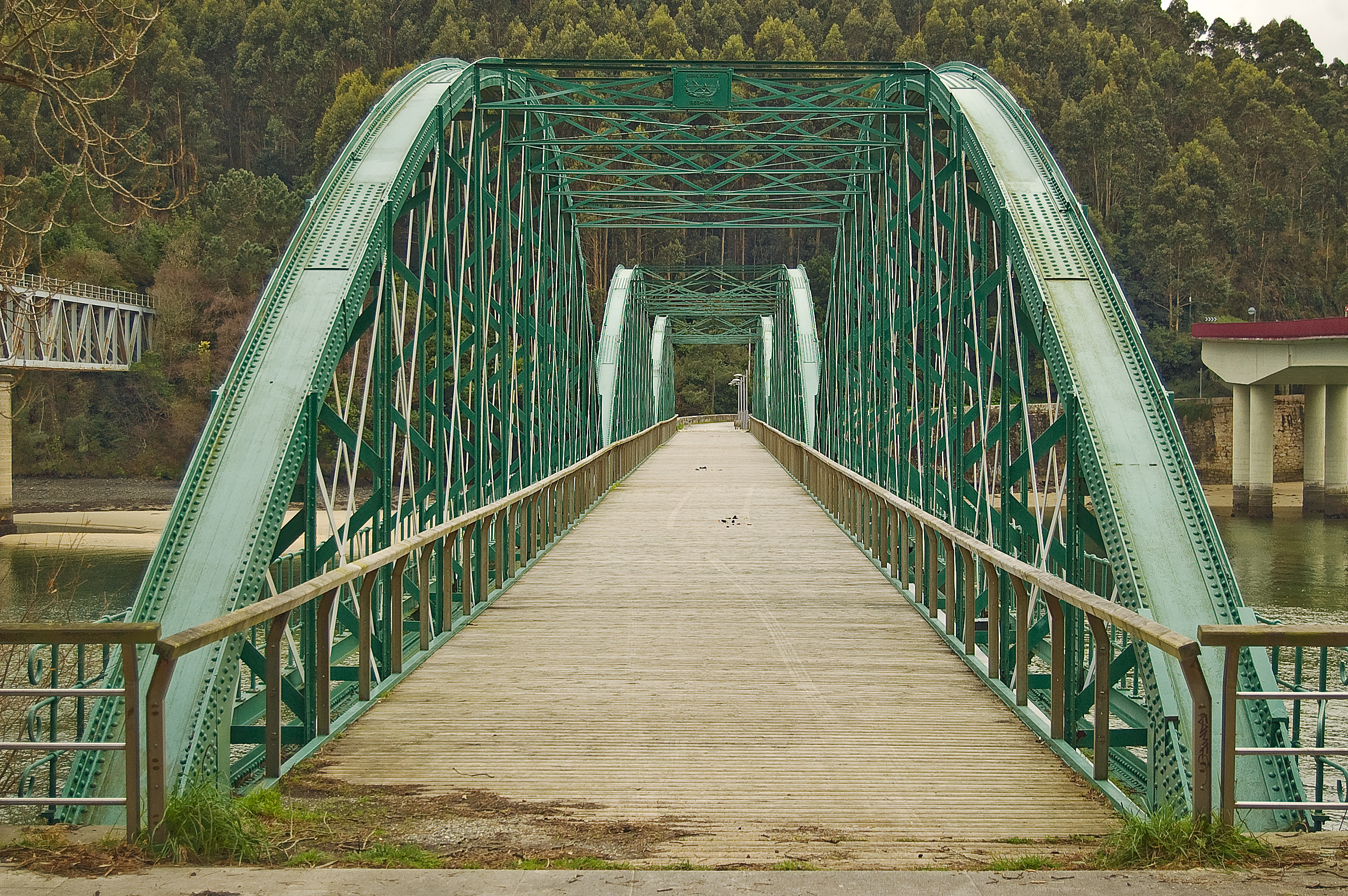
Stepping away from the beach, and after just a few meters the route turns to the left to ascend up Ciudad de Lugo street. Afterwards, it turns again, this time to the right, by the Rúa Vías e Obras Provinciais in order to take the deviation to the right by the Moledos cobblestone seafront promenade. All this is perfectly signalled. After a shared section by the Estrada Arealonga, where kilometre point 1 of the stage is found, this trail leads directly to the beach of the same name. Before reaching the beach, from the Estrada Arealonga, the traveller takes a signalled deviation to the right until reaching the LU-862 road (or Rúa Doutor Prado Villapol). The traveller takes a road that runs parallel to the road to a wooden paved section, at the end of which they take an asphalt road that leads again to the Arealonga beach, passing by kilometre point 2. From this access to the beach, the trail continues along a dirt path that runs parallel to the beach, and later on climbs a small hill and continues through a paved turnabout and a small parking lot. From this roundabout, the trail passes under the LU-862 road, going past kilometre point 3 and reaching the O Barqueiro Bridge, an architectural element whose centre marks the border between the Galician provinces of Lugo and A Coruña. From here, the Cantabrian Route Nature Trail enters the A Coruña Province. Not long after crossing the bridge, now on a dirt path and after going up and down various ramps, the Rego da Foca dike is reached. This is a construction from which boats with all kinds of goods, animals and people would set off towards the other shore of the ría.
The trail climbs up to the O Baqueiro narrow-gauge railway station (FEVE per its acronym in Spanish), going through eucalyptus trees. After overcoming the kilometre 4 milestone of this stage, the trail leads downhill and the O Barqueiro port can be seen. The trail moves away from the port and the traveller must take care when crossing the Station road. Leaving that section of the trail behind, it turns left at the Rúa Cruz and heads into the urban centre of O Barqueiro. The traveller should advance in parallel to the AC-862 road and, when reaching the tourist office, they should find an interpretative panel which gives information about the virtues of O Barqueiro. They should cross the AC-100 road (also known as D. Manuel Cora Rodriguez street), taking utmost care. Not long after, the trail turns right starting a decline until the Santa María de Mogor church. Meters before coming face to face with this religious building, when reaching the town's cemetery, the trail turns to the right and starts a section which is shared with road traffic.
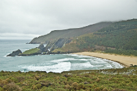
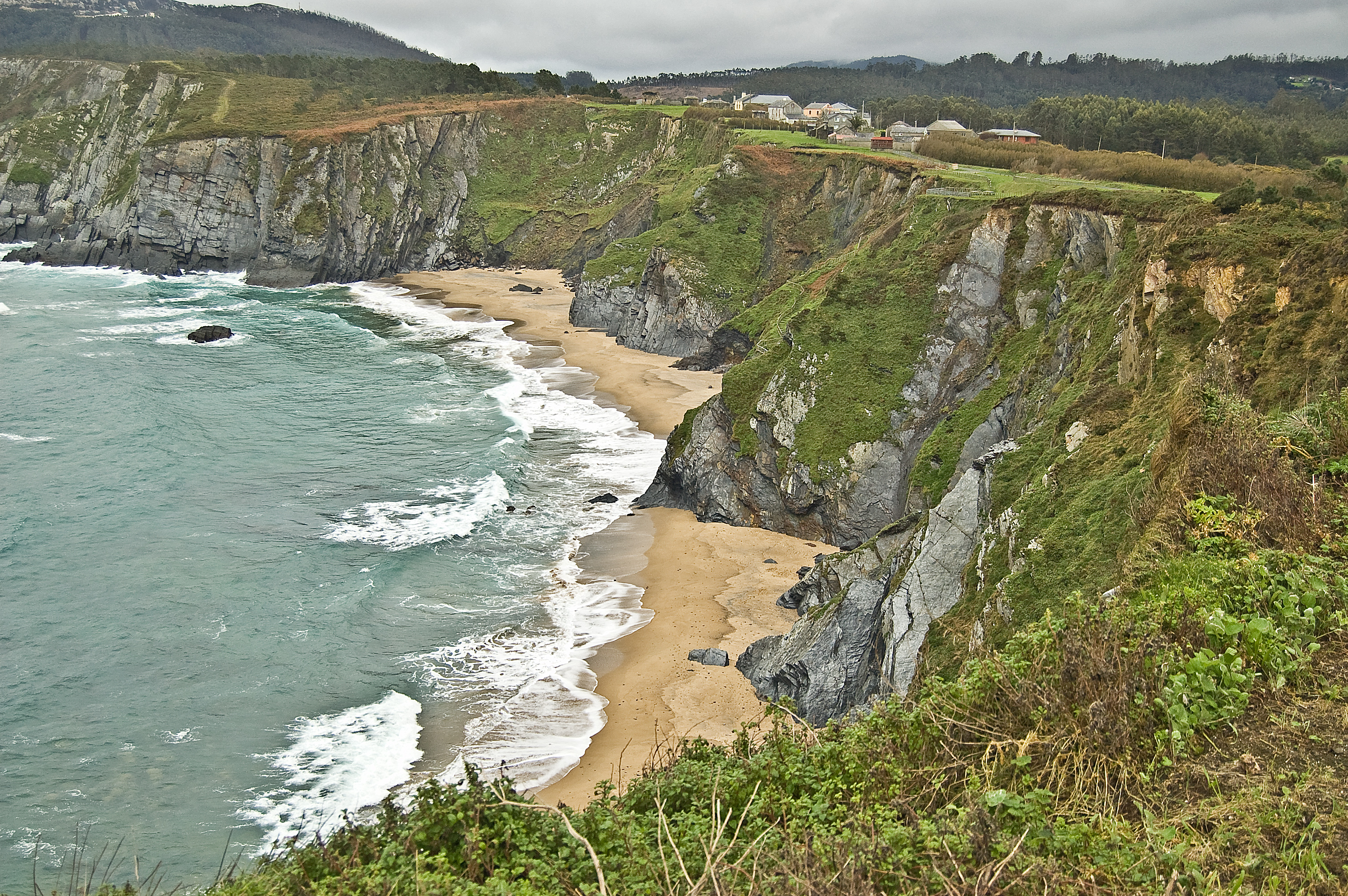
Advancing along an asphalt track parallel to the train track, kilometre 6 of this stage is reached. After continuing for a few metres, the asphalt is left behind and the train track is crossed via an overpass and then a short uphill section is started this time on a dirt track. When reaching the road with a pavement and lampposts, the traveller turns to the left and continues downhill until the beach of Esteiro where, half way along and on the right hand side, the shrine of Santa Rosa can be found.
The traveller enters this spectacular landscape made up of the beach and the Esteiro estuary, which are included in the Natura 2000 Network as a Specially Area of Conservation (SAC) under the name "Estaca de Bares". A long decked area allows for complete enjoyment of this environment brimming with biodiversity. Upon leaving this walkway, the traveller turns right onto a forest track full of eucalyptus trees which gradually increases in height. The track becomes a route, and whilst the traveller continues climbing, their efforts are rewarded with breathtaking views of the cliffs.
The track enters a pine forest which runs until the coastal edge. Little by little the track becomes wider and, after going past kilometre 9, the views of the beach of Esteiro are left behind once and for all.
Keeping faithfully to the coastline, kilometre 10 is reached, as is the parish church of Loiba, here a right turn is taken onto a asphalt track, leaving the beach of Picón on the right.
The solid track becomes a dirt one at kilometre 11 and, just beforehand, an interpretative panel offers information about the cliffs in the area. Following on from that, the O Coitelo viewpoint well deserves a short detour from the original track in order to get to the bench known as "the best bench in the world", because of the incredible views that can be enjoyed from sitting there.
Returning to the track, the route passes once again through a pine forest, and past the O Cadaval rest area. Another detour will surprise the traveller, taking them towards the area known as Pena Furada. Going back to the wide trail, there is a decline of just over 2 km amongst eucalyptus trees, turning right into the town of Mazorgán. A turn to the left at Paredes starts a decline towards some grassland where cattle graze.
Once again, the traveller climbs among pine and eucalyptus trees until reaching kilometre 16. A few metres later a decline begins towards the beach of Bimbieiro. The traveller says goodbye to this beach via a wooden decked section, after which they must face a steep climb, going through eucalyptus trees once again. The ascent comes to an end when the asphalt track is reached, this leads the traveller along a shared section until the town of Porto de Espasante.
In this town the traveller continues along Rúa do Areal and turns left on Rúa Barreira until reaching the seafront promenade (Rúa Miramar). They advance, enjoying the wide beach of Concha, leaving the children's play areas and sports facilities behind. After crossing the Ola River river mouth, a left turn is taken to start a shared section which passes through the area known as Os Castros which is filled with eucalyptus trees.
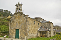
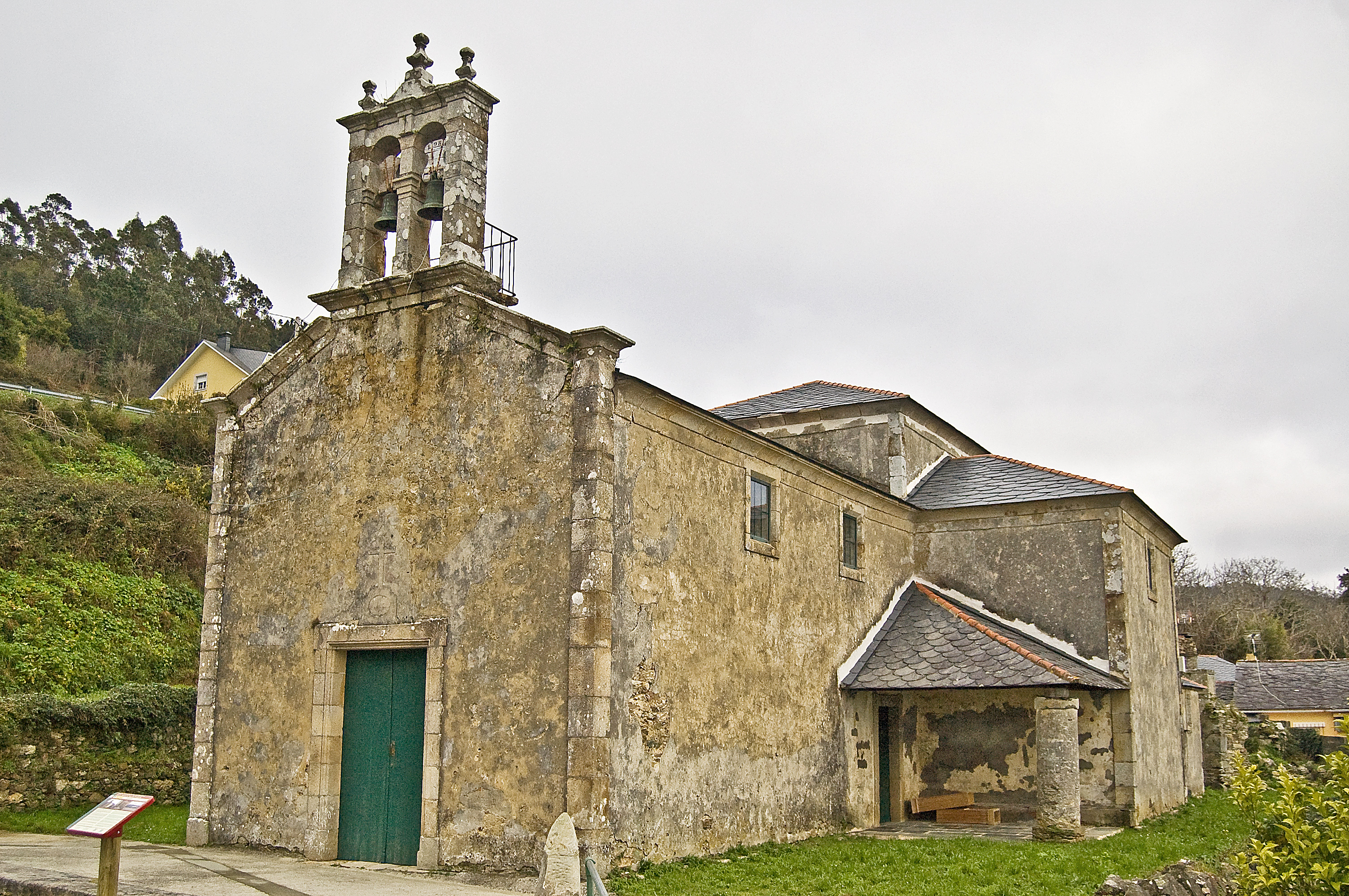
The traveller enters the town of Ladrido by the Cancelas street, turning left on road DP-6101 until the Torno street, which leads to the Santa Eulalia church, which marks the end of the seventh section of the Cantabrian Route Natural Trail between O Vicedo and Ladrido.
Detour to Casa da Vela
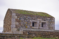
A detour which is less than a kilometre long which leaves from the Nature Trail's interpretation panel in the town of Porto de Espasante. A right turn is taken, going over the pedestrian crossing in the square of San Antonio, climbing alongside road DP-6103 until the chapel of San Antonio. At this building a right turn is made on the Estrada do Porto street on which a small climb will allow the traveller to enjoy beautiful views of the beaches of Bimbieiro and San Antón. With no more complications, the detour ends at the small defensive building of Casa da Vela.
Circular Ladrido Detour
The circular detour is less than two kilometres in length and takes the traveller through the area known as O Picoto. This starts a few meters after kilometre point 22 on the main route of stage 7 of the Cantabrian Route Natural Trail.
It goes through a forest of eucalyptus trees, leaving access to the beaches of Vidueiros and Santa Eulalia on the right. During its final section, panoramic views of the island of Sna Vicente and the Ortigueira-Ladrido ría can be enjoyed which are included in the Natura Network as a Specially Protected Areas for Birds (SPAB).
Map
Puntos de Interés
Hidrografía
Profile
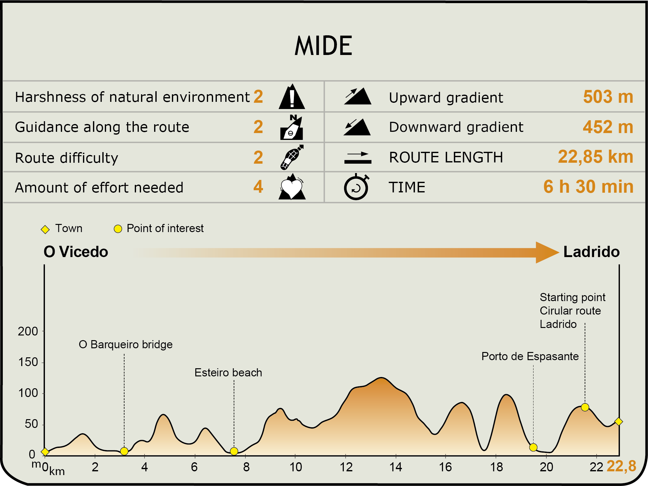
MIDE (Method for the Information of Excursions)
 Harshness of natural environment
- 1. The environment is not risk-free
- 2. There are more than one risk factors
- 3. There are various risk factors
- 4. There are quite a lot of risk factors
- 5. There are many risk factors
 Guidance along the route
- 1. Well defined trails and crossings
- 2. There is a clearly marked trail and signage
- 3. Requires the identification of geographic features and cardinal points
- 4. Requires off-path navigation
- 5. The trail is interrupted by obstacles that have to be gone around
 Route difficulty
- 1. Walking on a flat surface
- 2. Trails with different types of path
- 3. Walking on stepped paths or irregular terrain
- 4. The use of hands or jumping over the terrain is necessary
- 5. The use of hands is required to progress
 Amount of effort needed
- 1. Up to 1 hour of continuous walking
- 2. Between 1 and 3 hours of continuous walking
- 3. Between 3 and 6 hours of continuous walking
- 4. Between 6 and 10 hours of actual walking
- 5. More than 10 hours of continuous walking
Featured
Further information
O Barqueiro
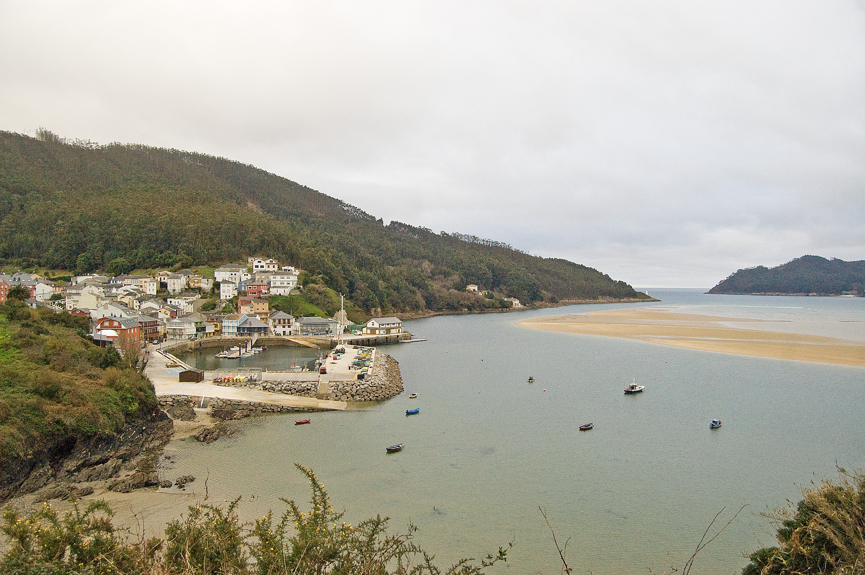
This town in A Coruña belongs to the municipality of Mañón and borders the Galician province of Lugo. It is found intimately linked to the sea, with the neighbourhood of the port standing out for its unique contructions and the activity around it. It has a narrow-gauge railway station (FEVE per its acronym in Spanish) and its most noteworthy civil construction is the bridge of O Barqueiro. This bridge, which was finished in 1901, allowed people and their goods to cross from one side of the ría to another. Before this point, this was done by a boatman, which is what the town and bridge are named after. Declared as a Galician Site of Cultural Interest, and restored in 2006, it is currently passed over by cycling tourists and hikers.
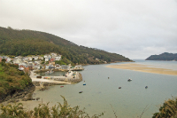
Porto de Espasante
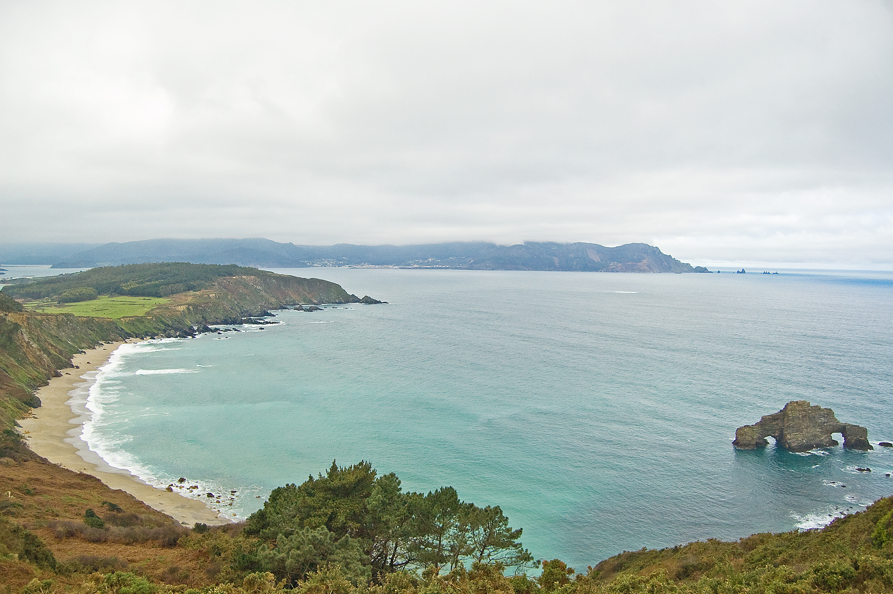
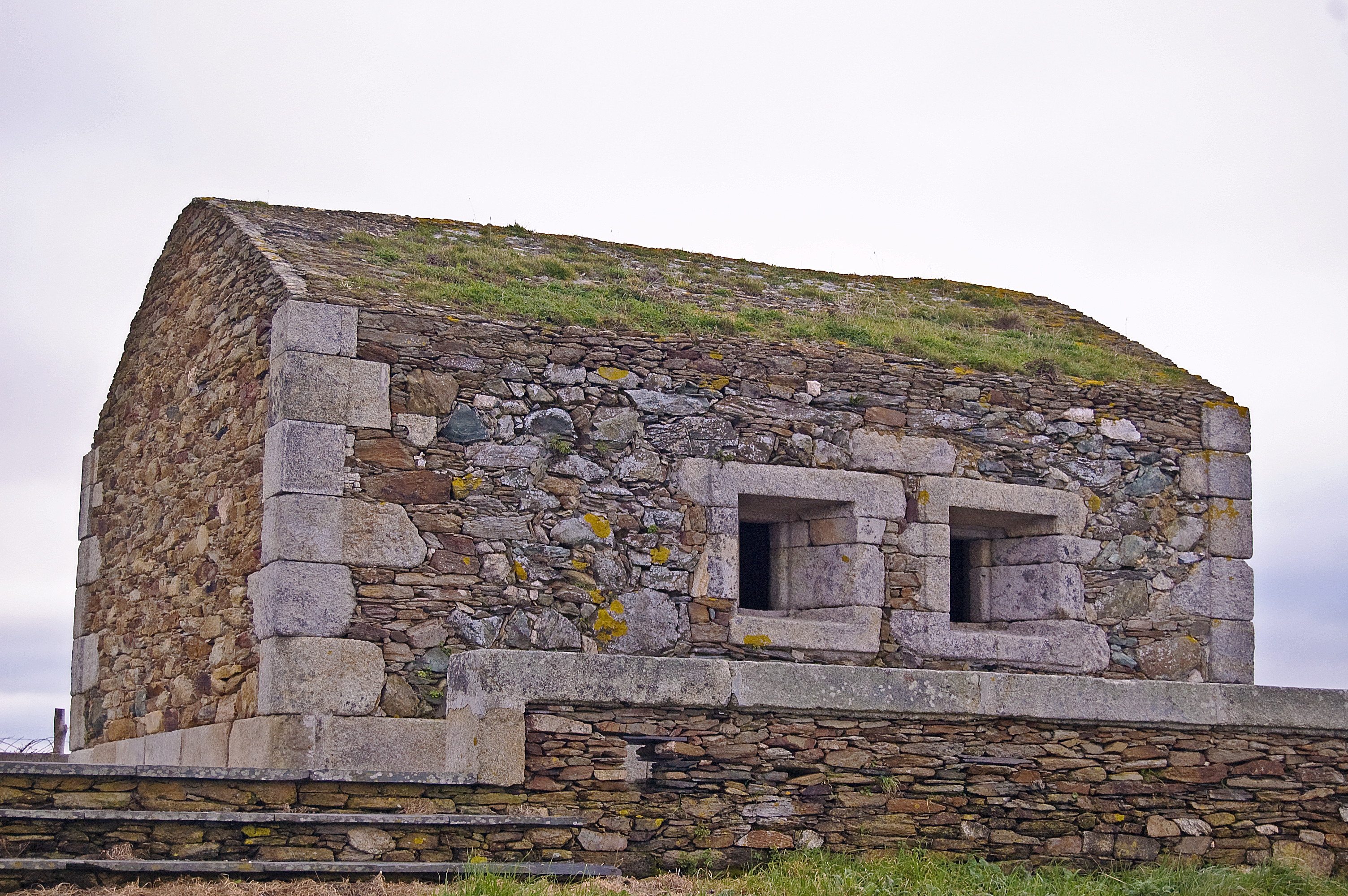
This is a seafaring town in the council of Ortigueira within the province of A Coruña. Its houses are spread out along the beach of Concha which has dunes of great avifaunan interest. The beach of San Antón is found on the west, and further along there is the beach of Bimbieiro. To the north of the beach of Concha, the area's fishing port can be found which is the centre of its economic activity. Near to the port, on mount Facho, a fort from the second Iron Age can be found, this was later used by the Romans and it is currently in a good condition. Near to the fort, on the same mount, there is a small, defensive, 18th century building called Casa da Vela, which provides the best views of the area.
Ladrido
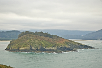
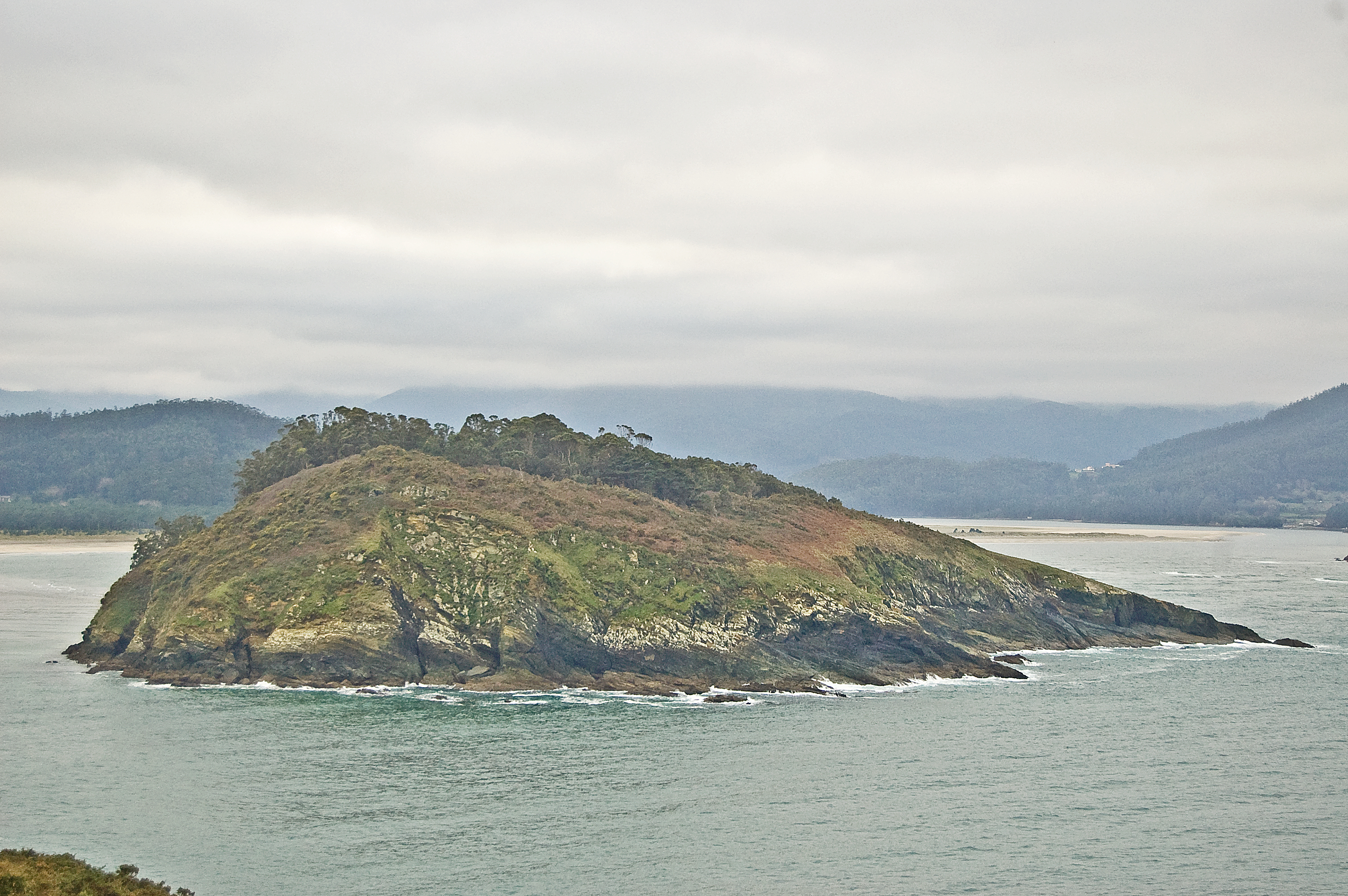
This town belongs to the council of Ortigueira. A traditionally marine town, one of its most noticeable architectural works is the church of Santa Eulalia, although the natural heritage outshines everything. The river mouth of the River Baleo forms the ría Ortigueira-Ladrido which is included in the Natura 2000 Network as a Specially Protected Area for Birds (SPABs). The richness of the flora and fauna of the ría is unarguable, and added to that is the island of San Vicente which also offers high quality scenery, especially from the mount of O Picoto.
Multimedia

Downloads
GPS Downloads
Maps
Cyclability
This Cyclostage corresponds to stages 6 & 7 of the Nature Trail
PROFILE
TYPE OF ROAD, PORTAGES & DIFFICULTY

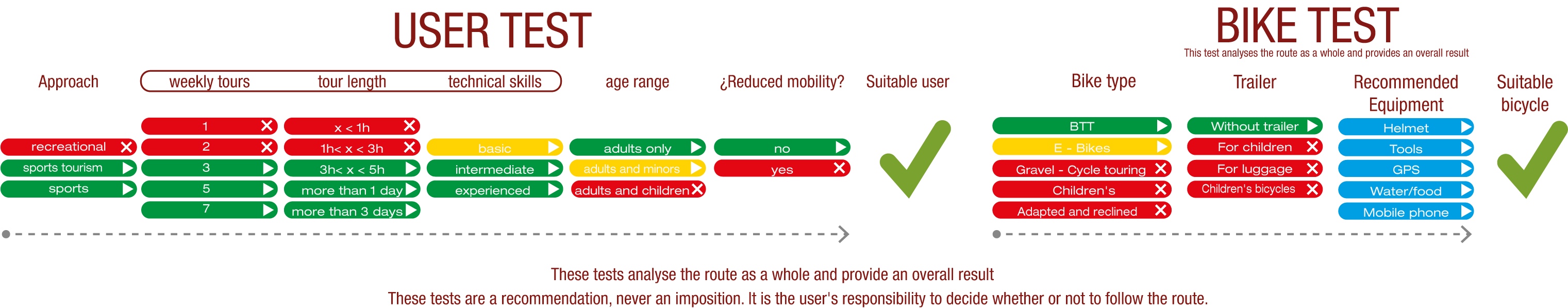
TEST
SAFETY RECOMMENDATIONS
- Sections shared with hikers.
- Transit through the centre of some population centres.
GENERAL RECOMMENDATIONS
- Find out about the technical aspects of the route and the weather on the day.
- Take care of the environment. Take care not to disturb animals or damage vegetation. Respect private areas.
- You must give priority to pedestrians and comply with general traffic rules.
- The environment in which you will be riding is open, free to move around and an area where many activities are carried out (sporting, forestry, livestock and agricultural activities). Always have an understanding, prudent, responsible and respectful attitude.